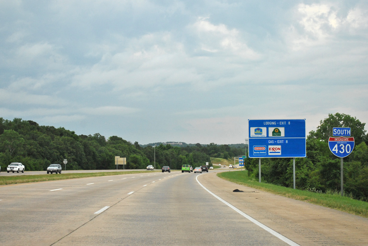
Joining I-30 and I-40 west of Little Rock, Interstate 430 serves as a western bypass of the Capital city. Planned from the 1950s, the 12.93 mile route opened in various stages between Winter 1974 and Fall 1975 at a cost of over $63 million.1 The freeway maintains six lanes of traffic for the majority of its length, widening to eight lanes between Exit 5 (Shackleford Road) and Exit 8 (Rodney Parham Road). I-430 is also linked with Downtown Little Rock via Interstate 630 east (Exit 6).
Construction at the Big Rock interchange with Interstate 630 (Exits 6A-B) upgraded the exchange with high speed flyovers and a grade separation at adjacent Financial Centre Parkway and Shackleford Road.
|
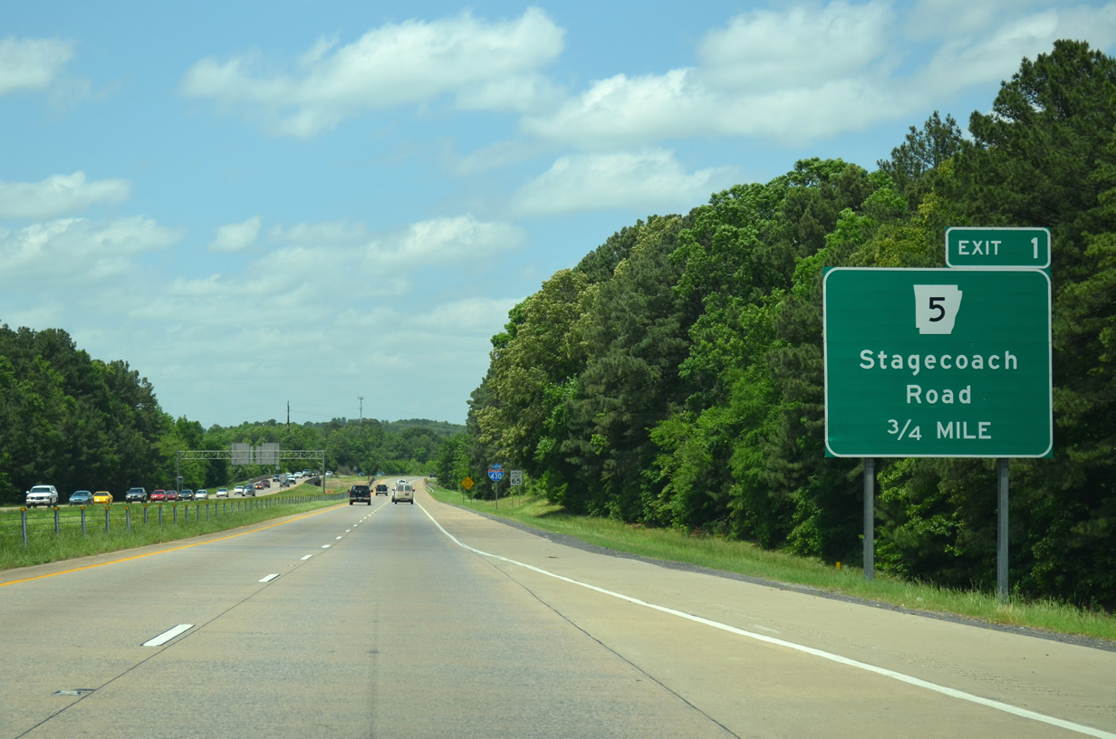
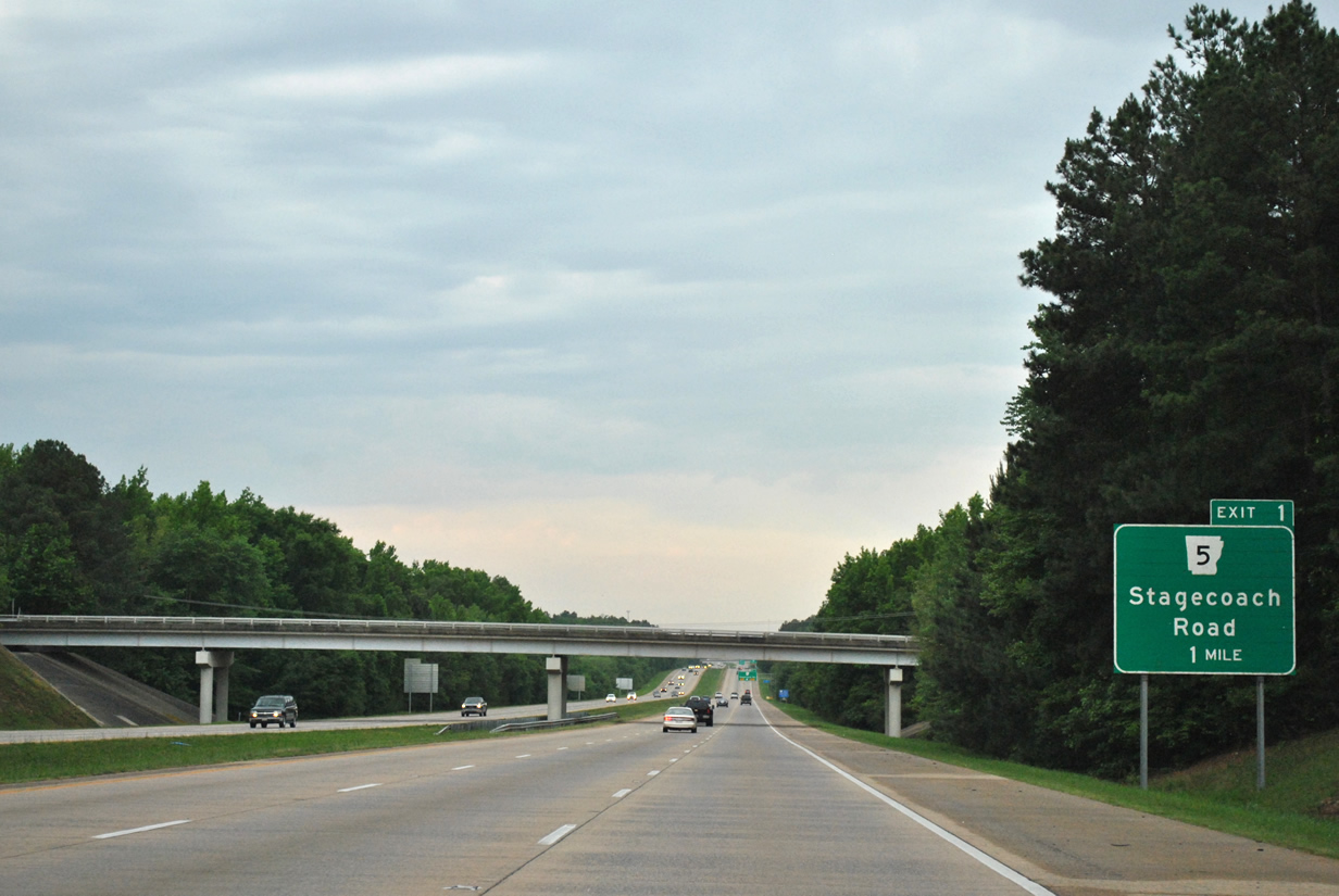
| Leaving I-30 near Mabelvale, Interstate 430 meets AR 5 (Stagecoach Road) in 0.75 miles. This segment of freeway was part of the final 3.6 miles of I-430 built. It opened on November 7, 1975.1 05/20/14 |
|
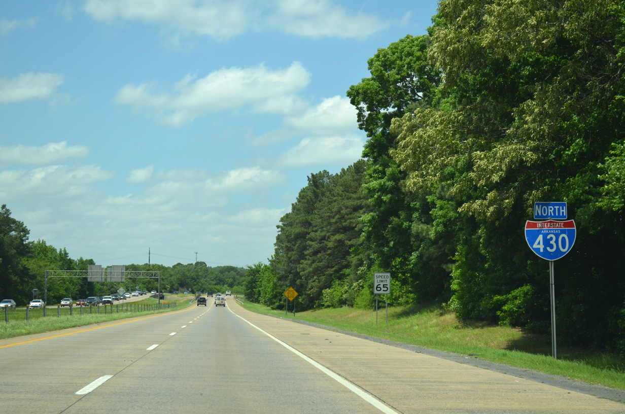
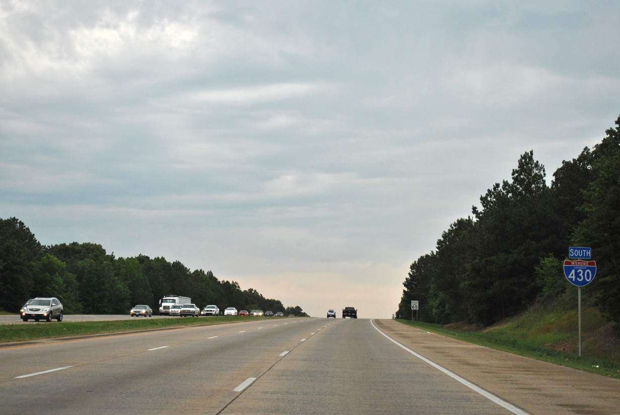
| Interstate 430 (Purple Heart Trail) maintains a 65 mph speed limit on its entire stretch to Interstate 40 (Exit 13) near North Little Rock. 05/20/14 |
|
| AR 5 follows Stagecoach Road northeast from I-430 to U.S. 70 Business (Asher Avenue) near the University of Arkansas Little Rock campus. Continuing southwest from Exit 1, AR 5 heads toward Benton and Hot Springs. Overall the state highway travels 192 miles on three different segments from Hot Springs to the Missouri state line. 05/20/14 |
|
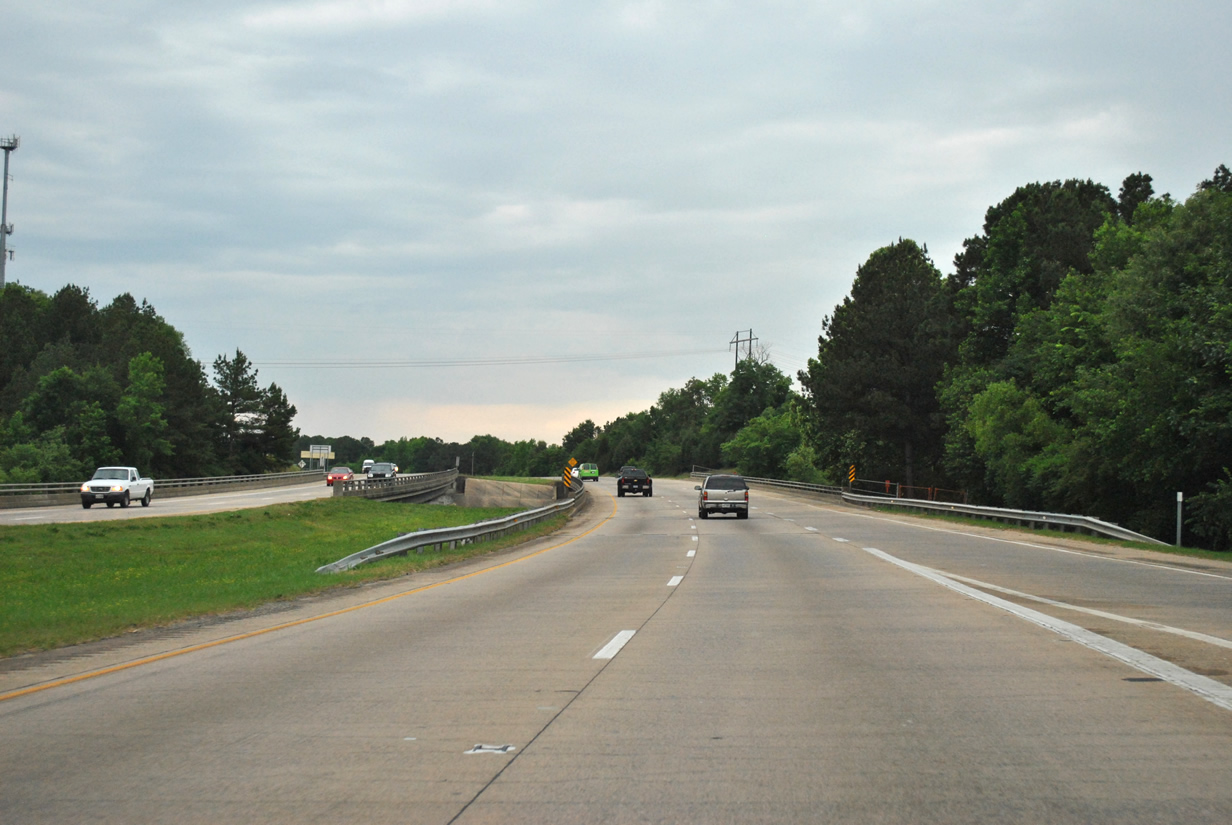
| Gaining a third lane from AR 5 (Exit 1) Interstate 430 continues north toward the western suburbs of Little Rock. 05/20/14 |
|
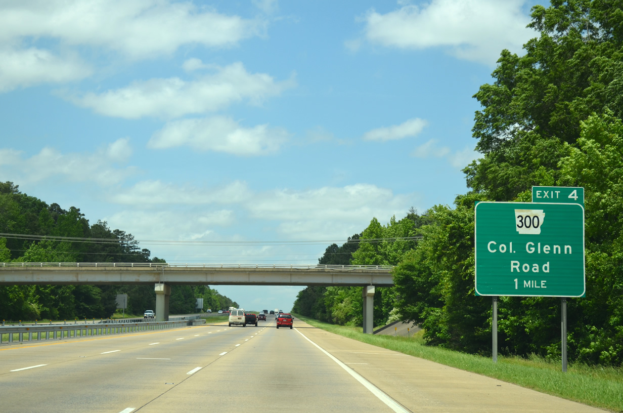
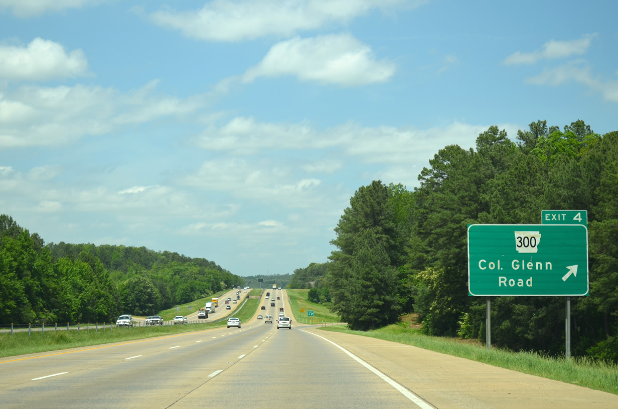
| Traveling under David O. Dodd Road the freeway advances ond mile to Exit 4 to AR 300. 05/20/14 |
|
| Interstate 430 north reaches the diamond interchange for Arkansas 300 (Colonel Glenn Road). Arkansas 300 follows Colonel Glenn Road to the east of Exit 4 to Arkansas 5 (Stagecoach Road). Colonel Glenn Road continues west of the freeway to serve the communities of Martinsdale and Twin Springs. 05/20/14 |
|
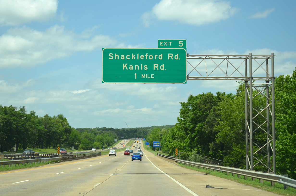
| Brodie Creek and West 36th Street pass under Interstate 430 on the one mile approach to Shacklefield Road (Exit 5). 05/20/14 |
|
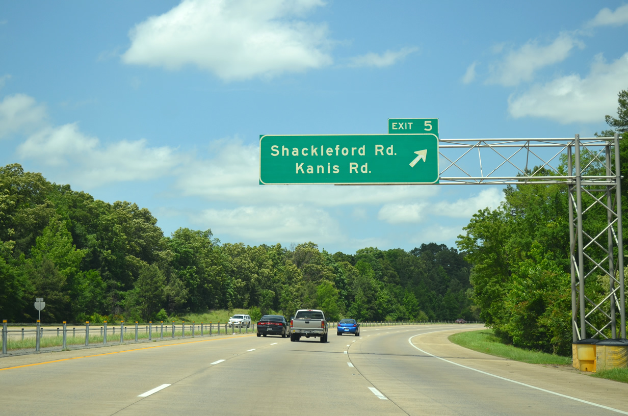
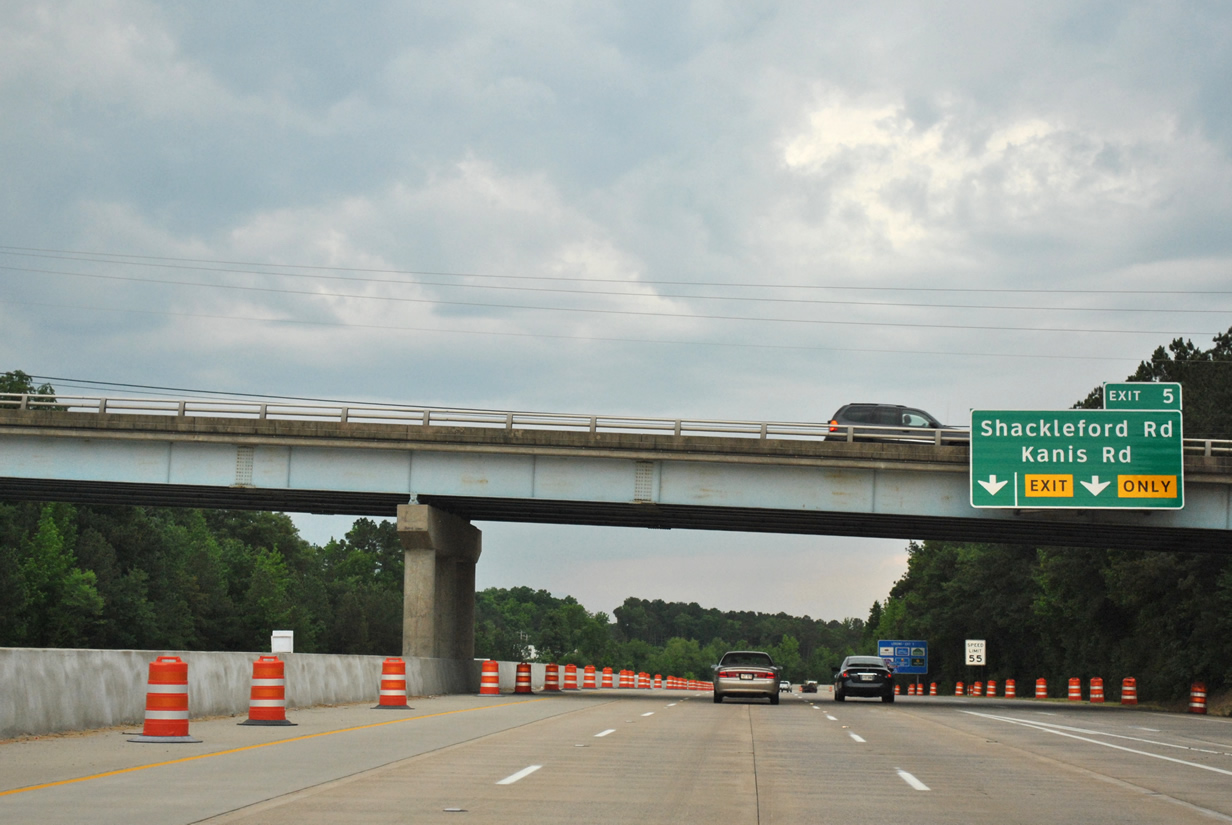
| Shacklefield Road was connected to the freeway in the early 1980s after growth in the immediate vicinity necessitated an additional interchange. Shackleford Road represents a busy arterial between Interstate 430 and Markham Street. Use Shackleford Road north to reach Kanis Road. 05/20/14 |
|
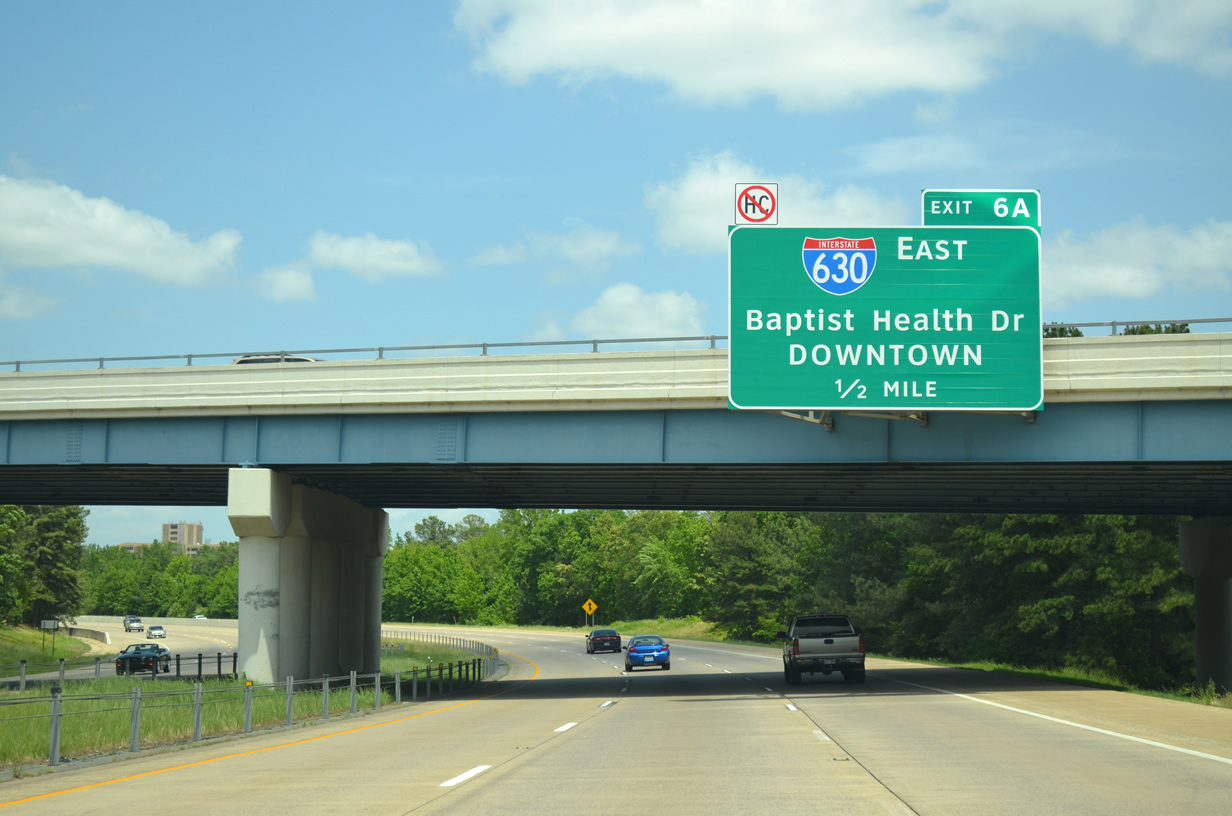
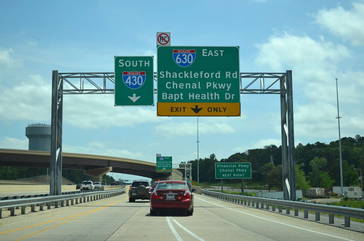
| Interstate 430 curves under Shackleford Road (Exit 5) one half mile out from the Interstate 630 east (Exit 6A) cloverleaf interchange to Downtown Little Rock. Locals often refer to the upcoming interchange as the Big Rock, named for the unique rock formation found at the southeast corner of the interchange. Any commercial trucks carrying hazardous materials are prohibited from using Interstate 630. 05/20/14 |
|
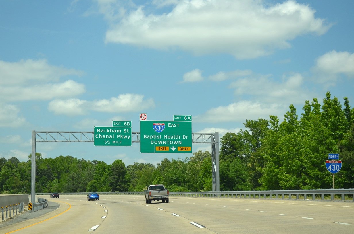
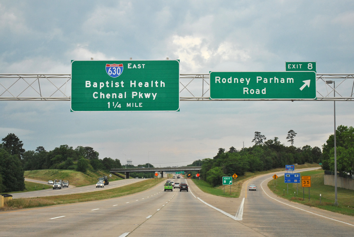
| One additional lane joins northbound Interstate 430 on the approach to Interstate 630 east and Chenal Parkway. Chenal Parkway (Exit 6B) continues west from I-430 and I-630 through the sprawl of west Little Rock. 05/20/14 |
|
| Traffic departs for Interstate 630 east (Exit 6A) to Baptist Health Drive and Downtown. I-630 east provides direct access to nearby Baptist Health Medical Center via Baptist Health Drive (Exit 7). One quarter mile remains for the ramp to Chenal Parkway to Markham Street (Exit 6B). 05/20/14 |
|
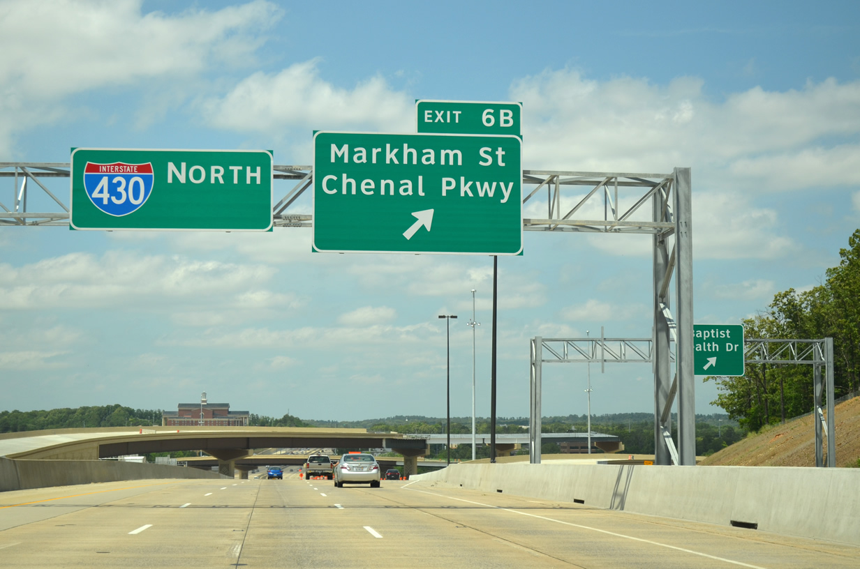
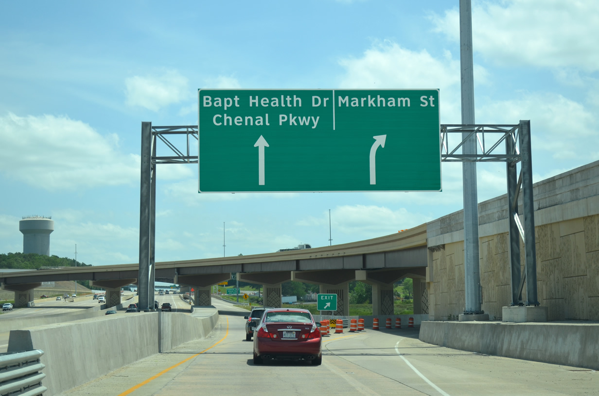
| Exit 6B leaves Interstate 430 for the collector distributor roadway to Chenal Parkway to Markham Street. Markham Street crosses the freeway north of the Big Rock interchange and serves as a main east-west arterial between the suburbs and Downtown. 05/20/14 |
|
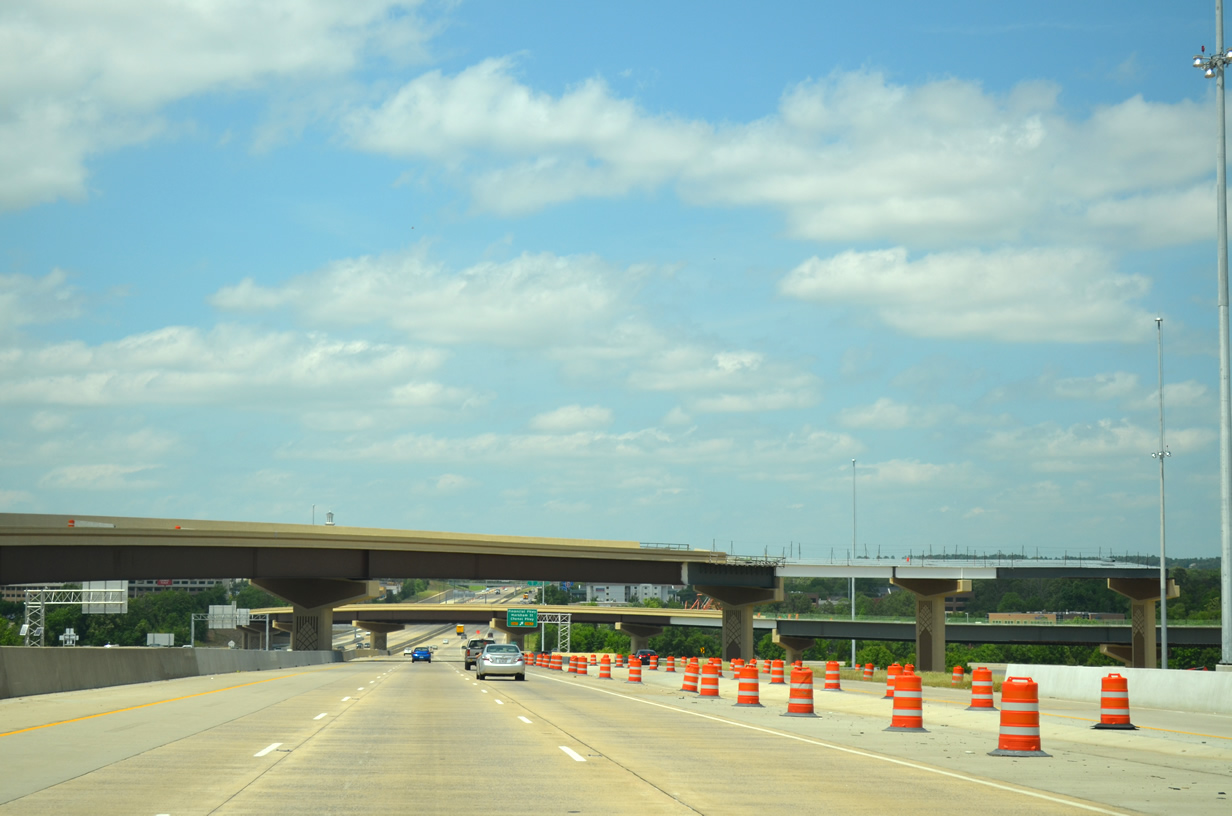
| The Big Rock interchange is currently undergoing modifications to improve access between Interstate 430 and Interstate 630. High speed flyover ramps between the two freeways are being constructed as well as converting the loop ramps to local use only. The entire project is slated for a Summer 2015 completion. 05/20/14 |
|
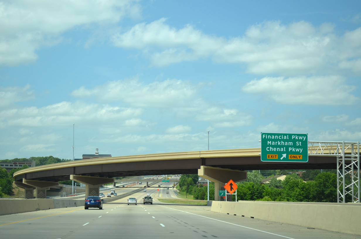
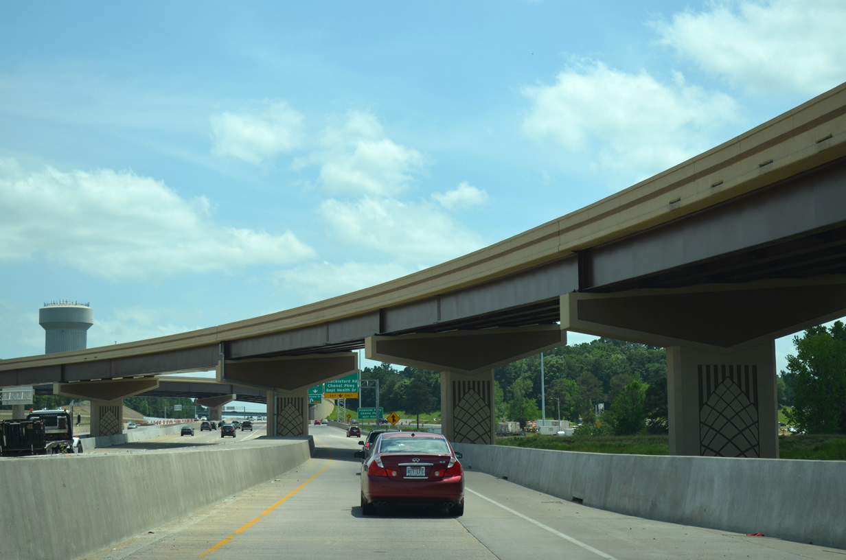
| One of the new flyovers span Interstate 430 as the freeway continues north toward the Arkansas River and Interstate 40 (Exit 13). A loop ramp leaves the collector distributor roadway for Financial (Centre) Parkway and Chenal Parkway. Financial Centre Parkway provides the needed connection to Chanal Parkway west. 05/20/14 |
|
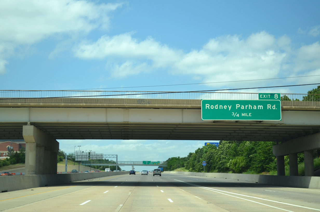
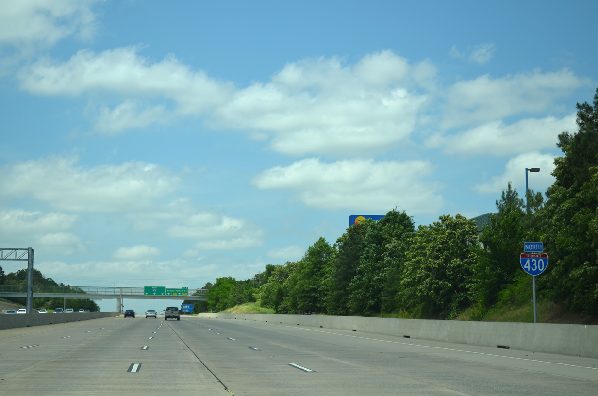
| Two lanes join the I-430 mainline from Interstate 630 as the freeway passes under Markham Road on the 0.75 mile approach to Rodney Parham Road (Exit 8). 05/20/14 |
|
| Interstate 430 north straddles both commercial and residential parcels en route to Rodney Parham Road as well as the C. Maurice Lewis Jr. Memorial Natural Resources Complex. 05/20/14 |
|
| Rodney Parham Road consists of a busy multilane arterial on either side of Interstate 430 as it cuts through Little Rock from northwest to southeast. The local arterial also meets Interstate 630 at Exit 6A. 05/20/14 |
|
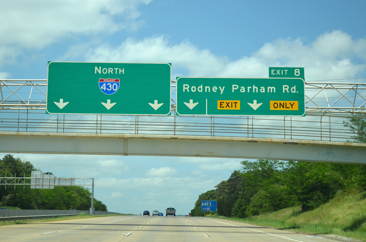
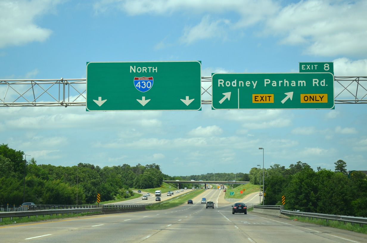
| Two lanes leave for the busy interchange with Rodney Parham Road (Exit 8). Provisions are in place to convert the current diamond interchange into a diverging diamond interchange (DDI), making it the first one in the state. 05/20/14 |
|
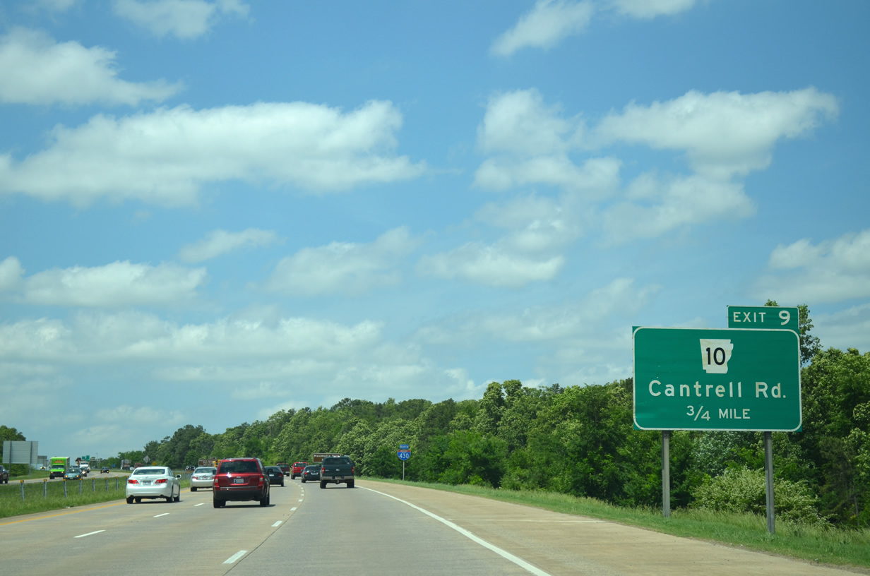
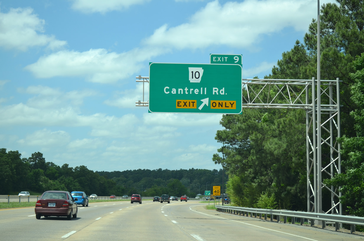
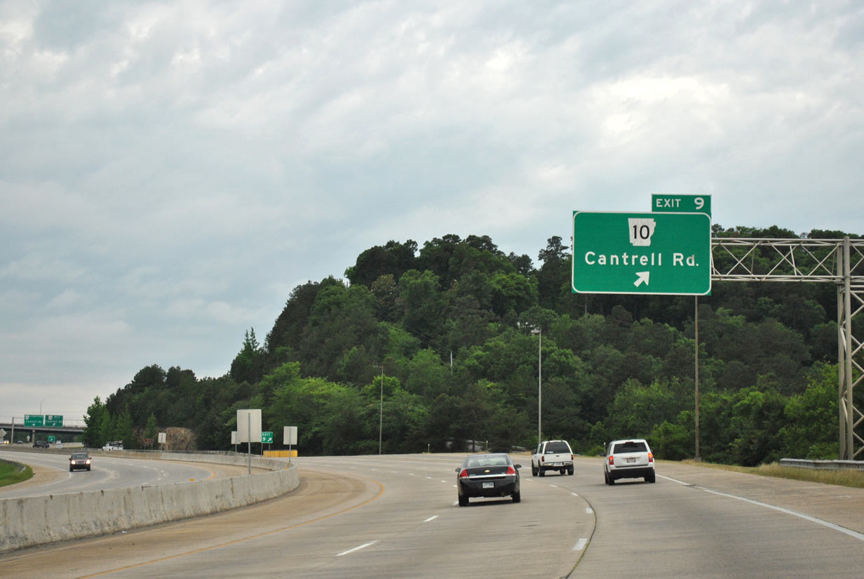
| Arkansas 10 (Cantrell Road) will meet Interstate 430 at Exit 9 in three quarters of a mile. The state highway provides one final connection to Downtown Little Rock south of the Arkansas River. 05/20/14 |
|
| Interstate 430 maintains three lanes of traffic to the approach to Interstate 40 (Exit 13). 05/20/14 |
|
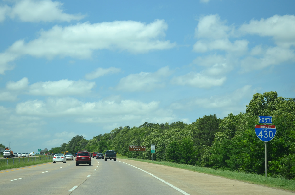
| A pair of guide signs precede the departure ramp for Arkansas 10 (Cantrell Road). Arkansas 10 extends 135.4 miles linking Little Rock with Perryville, Danville and Fort Smith. Use Exit 9 to Arkansas 10 west to reach Maumelle Park abutting the Arkansas River. The park offers boating, fishing and other recreational services. 05/20/14 |
|
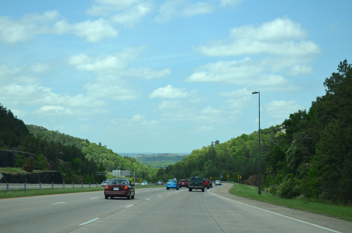
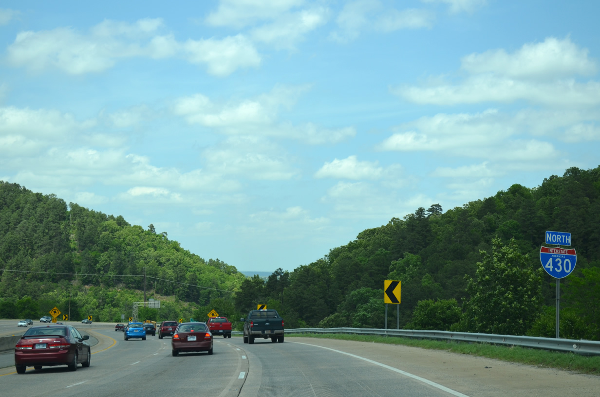
| Interstate 430 quickly descends 205 feet through terraced cuts between Arkansas 10 (Exit 9) and the approaching Arkansas River and Murray Lake crossing.2 05/20/14 |
|
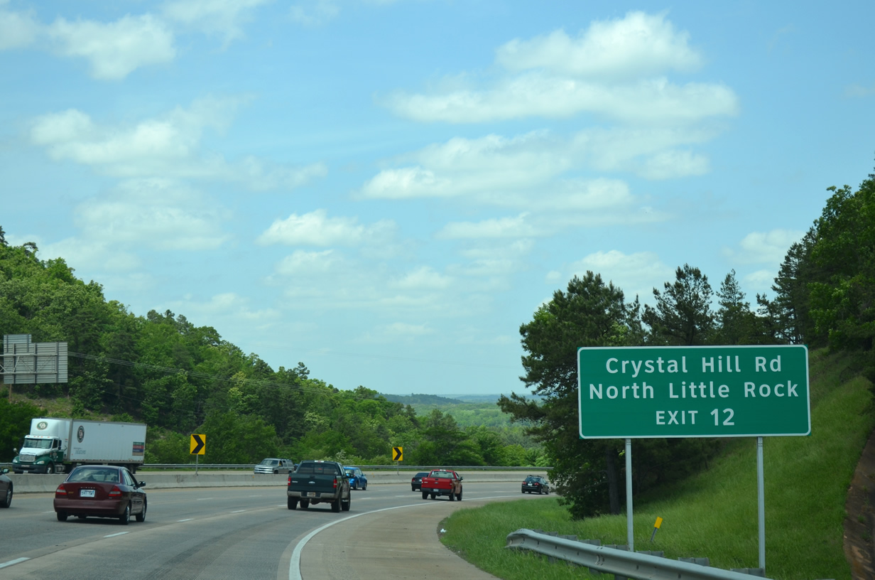
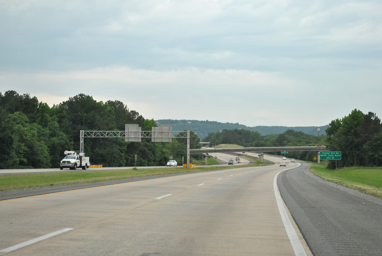
| An auxiliary guide sign advises motorists of the connection to North Little Rock via Crystal Hill Road (Exit 12) as the freeway further lowers toward the river. 05/20/14 |
|
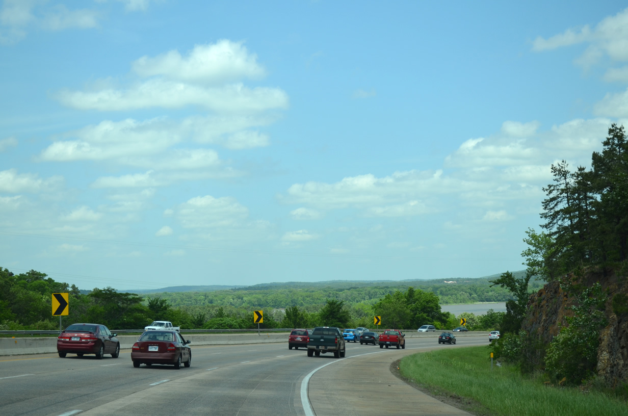
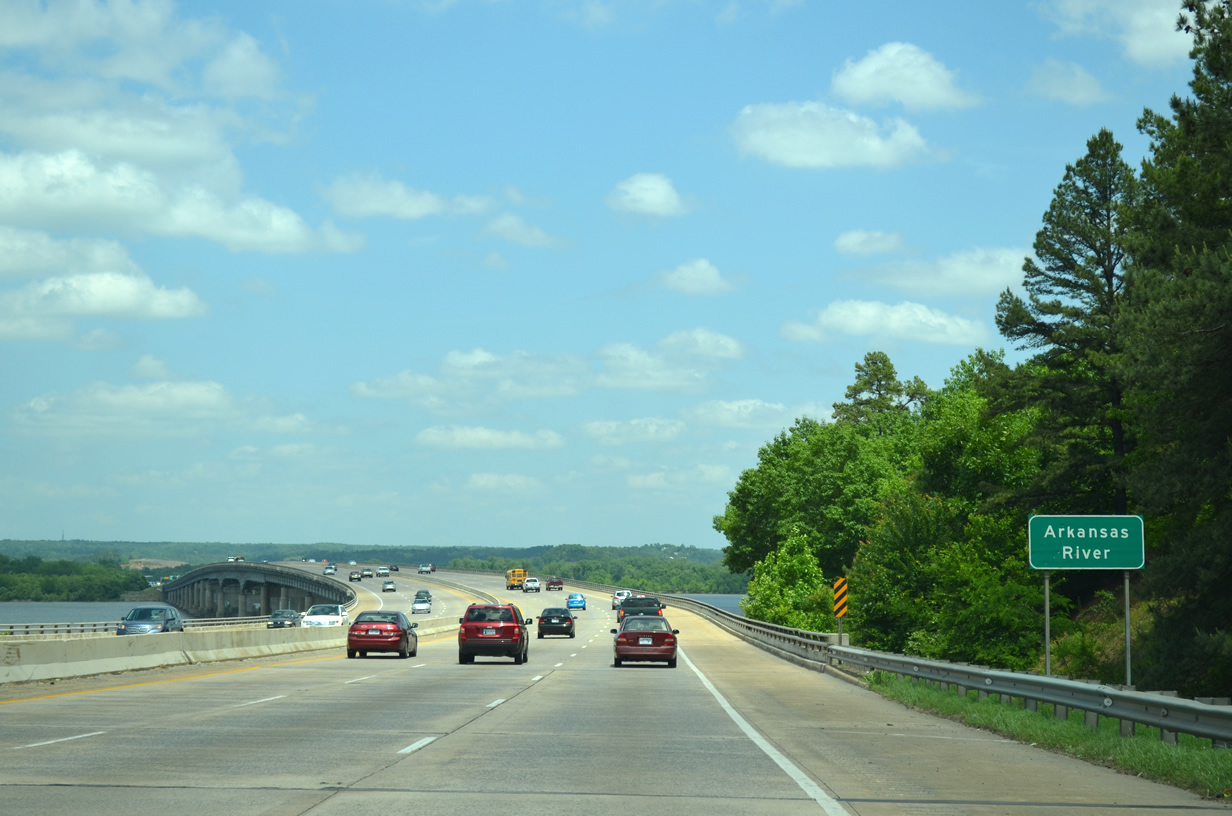
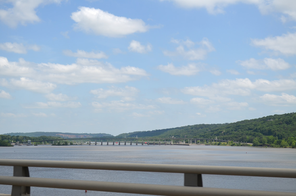
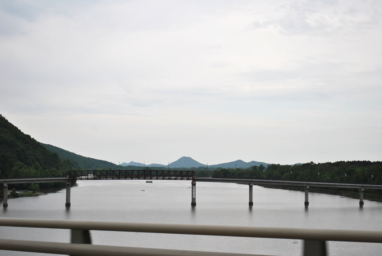
| Interstate 430 spans the Arkansas River and adjoining Murray Lake via a six lane mid-rise span. Constructed in tandem with a 5.2 mile section between Rodney Parham Road and Interstate 40, the bridge and adjoining freeway opened to drivers on December 16, 1974.1 05/20/14 |
|
| Murray Lock and Dam can be seen downstream from Interstate 430 north as it crosses the Arkansas River. The dam was built in the 1960s and forms Murray Lake between the locks and the I-430 span. A pedestrian and bicycle bridge (Big Dam Bridge) soars above the dam and river allowing for foot and pedal traffic to cross safely between Cooks Landing Park to the north and La Harpe View Park to the south. 05/20/14 |
|
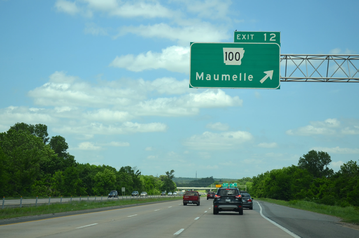
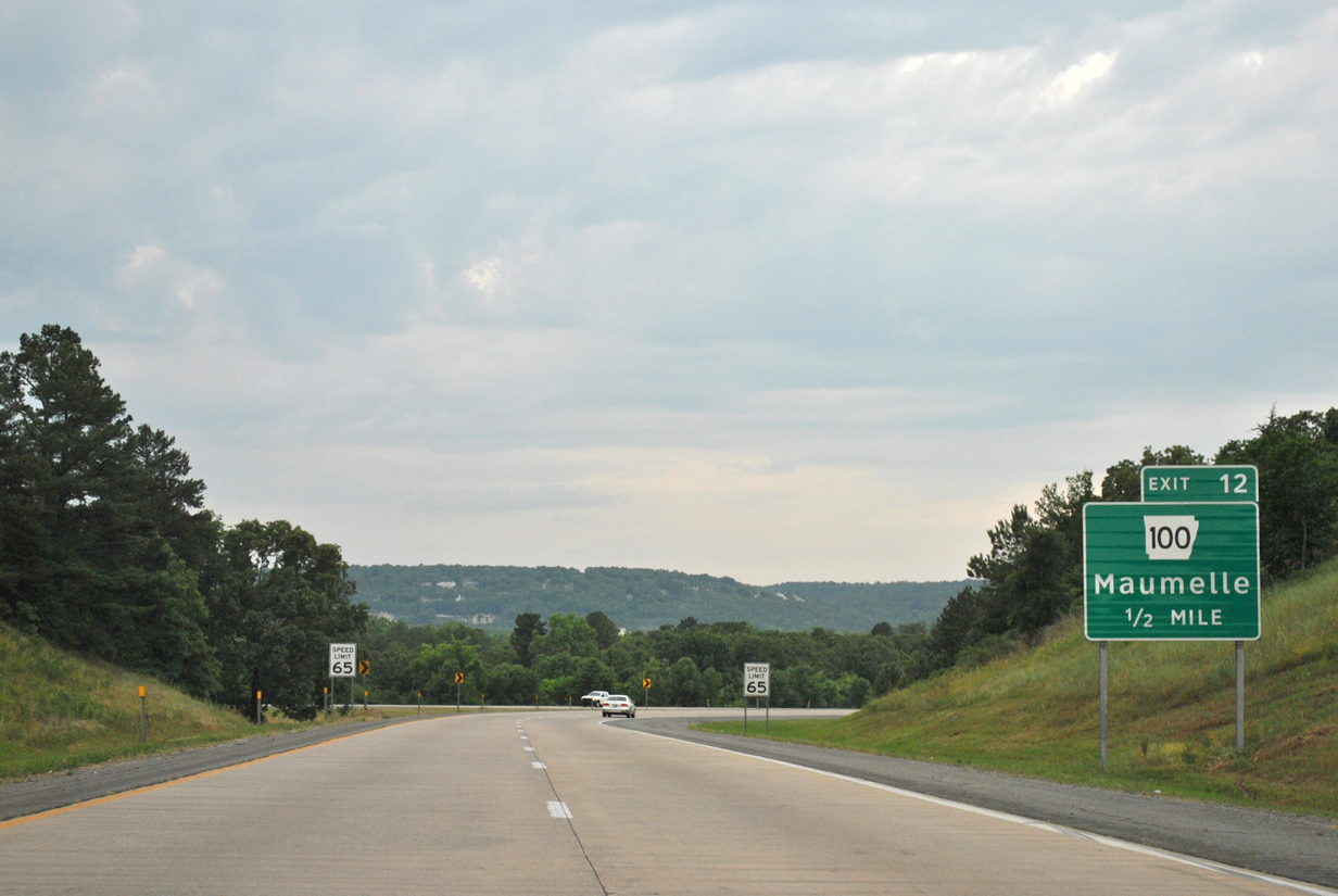
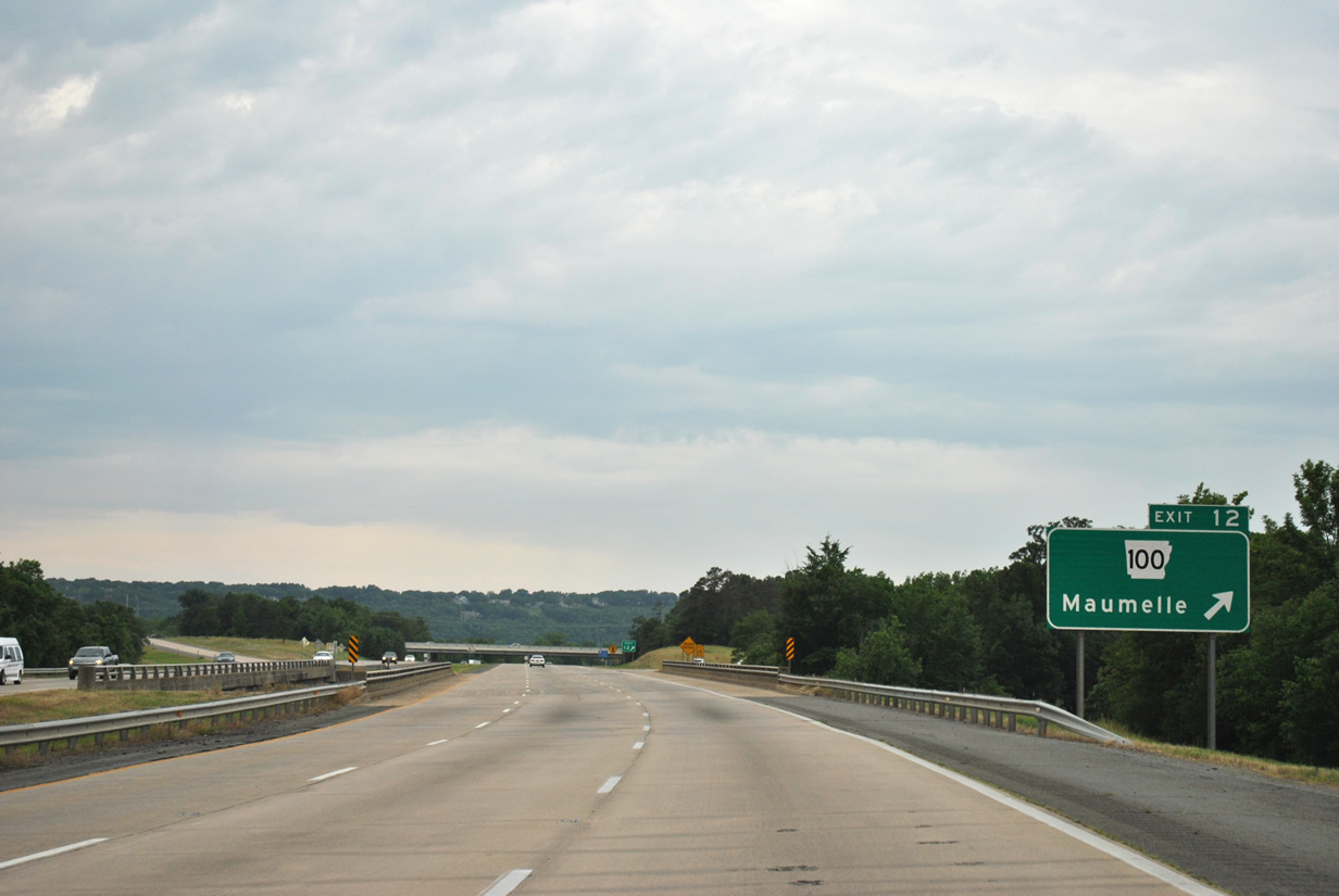
| North of the Arkansas River Interstate 430 comes to within one half mile of Arkansas 100 (Exit 12) to Maumelle. 05/20/14 |
|
| Arkansas 100 travels northwest from I-430 along Maumelle Boulevard to the city of Maumelle before turning north toward Arkansas 365. 05/20/14 |
|
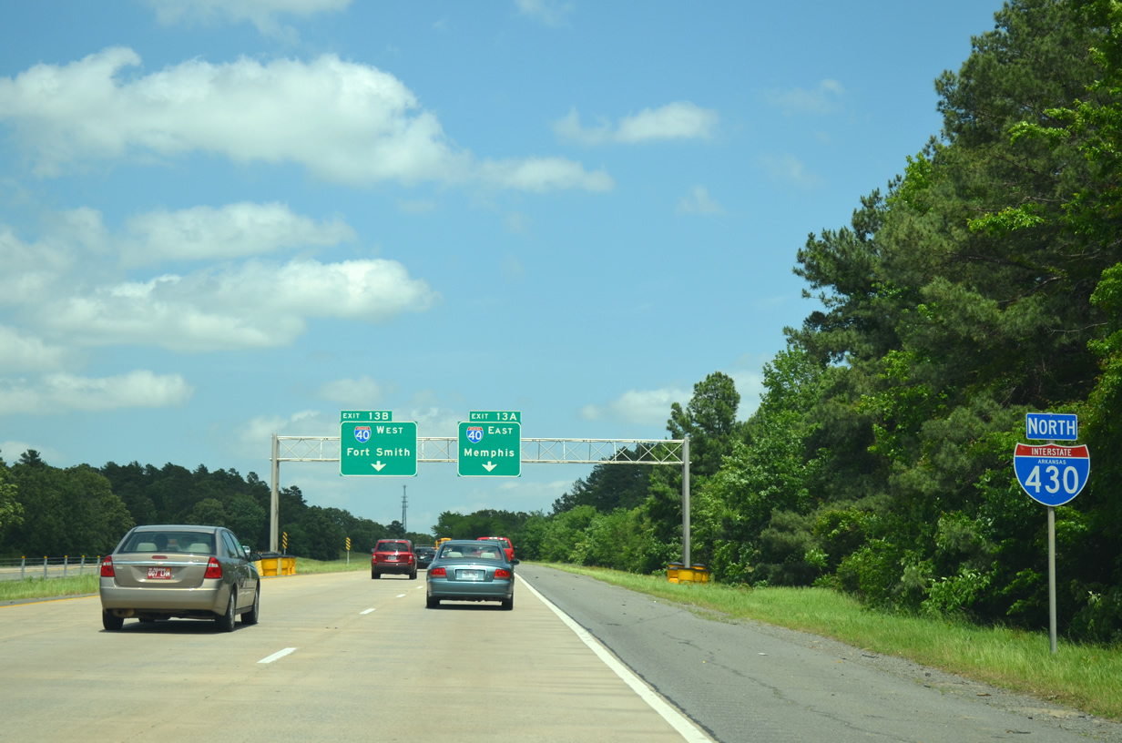
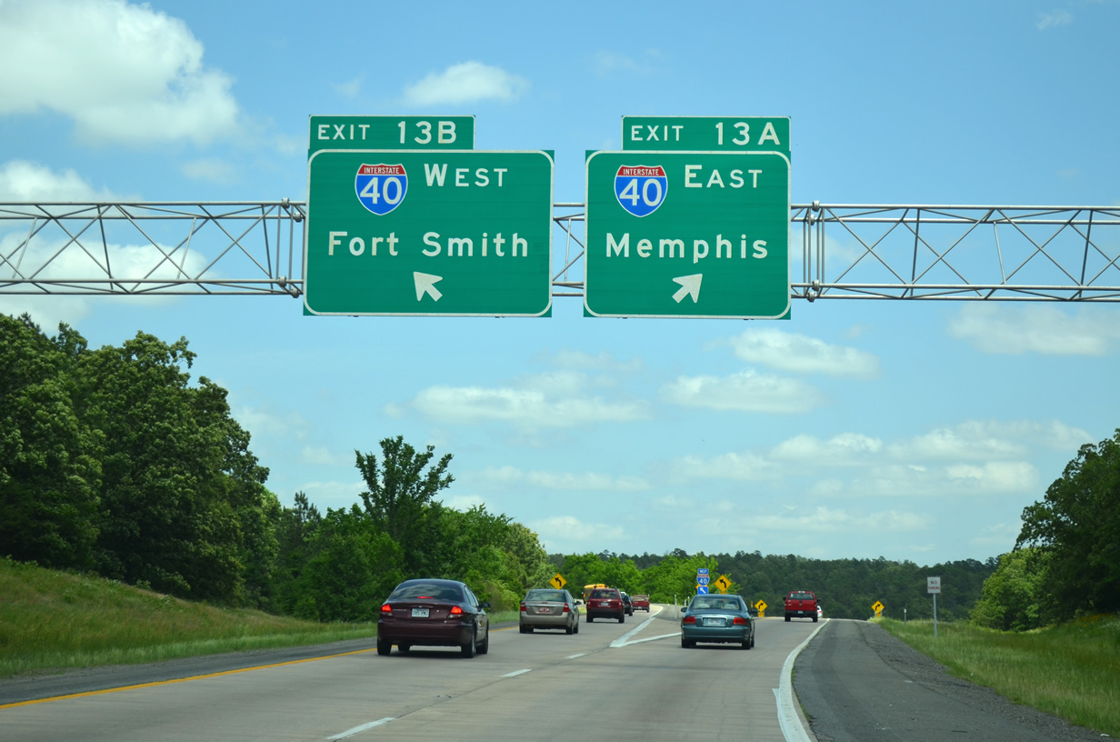
| The freeway reaches the egress point for Arkansas 100 (Exit 12). Crystal Hill Road continues east from Interstate 430 to Wild River Country water park and Interstate 40. Opened in 1985, Wild River Country is Arkansas's largest water park and is open between Memorial Day and Labor Day. I-430 will end 1.5 miles ahead when it meets Interstate 40 to Fort Smith and Memphis. 05/20/14 |
|
| Reducing to two overall lanes north of Arkansas 100 (Exit 12), I-430 makes its final approach to Interstate 40 east and west. 05/20/14 |
|
| Interstate 430 ends as it reaches the gore point for Interstate 40 east to Memphis (Exit 13A) and Interstate 40 west to Fort Smith (Exit 13B). Memphis lies 138 miles to the east along I-40 beyond the Mississippi River in Tennessee while Interstate 40 west takes motorists toward Fort Smith and Oklahoma. Conway in nearby Faulkner County is also reached via I-40 west. 05/20/14 |
|
| Interstate 430 south (Purple Heart Trail) leaves Interstate 40 for west Little Rock and Interstate 30 near Mabelvale. Exit 12 joins the freeway with Arkansas 100 to Maumelle in one half mile. 05/07/12 |
|
| The freeway begins a gradual decent as it approaches the Arkansas River to the south of the upcoming interchange with Arkansas 100. 05/07/12 |
|
| White Oak Bayou precedes the departure ramp for Arkansas 100 (Exit 12). The state highway stems northwest from I-430 to Maumelle and Arkansas 365. Crystal Hill Road continues east from the freeway toward Interstate 40 and North Little Rock. 05/07/12 |
|
| South of Arkansas 100 (Exit 12) Interstate 430 prepares to cross the Arkansas River. The Arkansas River is one of the Mississippi River's major tributaries, flowing 1,469 miles from near Leadville, Colorado to east Desha County in southeast Arkansas. 05/07/12 |
|
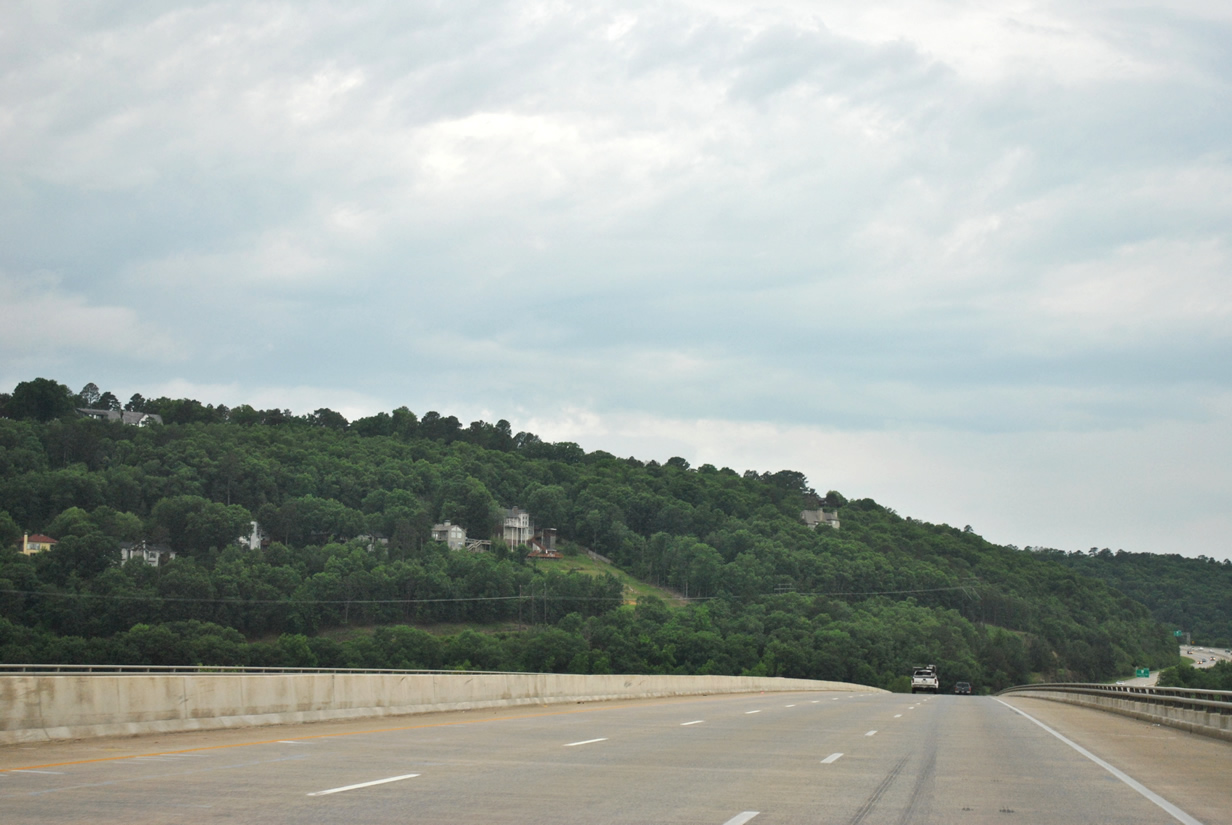
| The freeway spans the Arkansas River via a mid-rise bridge that opened to traffic December 1974. The crossing offers spectacular views of nearby mountains, including Pinnacle Mountain (Elev. 1,011 feet) and home sites tiered on nearby bluffs. Two Rivers pedestrian bridge is also seen from the span as it crosses the mouth of the Little Maumelle River. The pedestrian bridge is part of the Arkansas River Trail and connects to Two Rivers Park. 05/07/12 |
|
| Interstate 430 ascends just over 200 feet on its approach to Arkansas 10 (Exit 9). Cantrell Road carries the state highway east toward Downtown Little Rock. 05/07/12 |
|
| Overall Arkansas 10 stretches 135.4 miles between Little Rock and Fort Smith. The state highway leads west from Interstate 430 and Exit 9 to both Maumelle Park and Pinnacle Mountain State Park, offering visitors many recreational amenities. 05/07/12 |
|
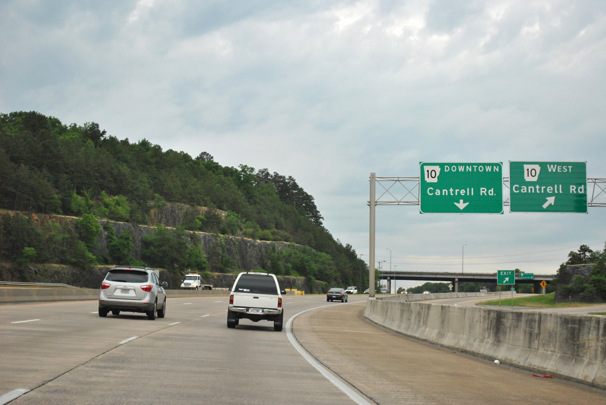
| A distributor ramp governs movements for Arkansas 10 west and east at Exit 9. Arkansas 10 (Cantrell Road) travels northwest from Interstate 430 toward Pinnacle Mountain State Park and Perryville. 05/07/12 |
|
| Arkansas 10 east (Cantrell Road) extends east another 8.6 miles through Downtown Little Rock with an end at Interstate 30 just south of the Arkansas River. 05/07/12 |
|
| Interstate 430 south will next encounter Rodney Parham Road at a diamond interchange (Exit 8) in one half mile. Rodney Parham Road crosses west Little Rock diagonally from west of I-430 to just south of Interstate 630. 05/07/12 |
|
| Rural in appearance, subdivisions line both sides of Interstate 430 between Cantrell Road (Exit 9) and forthcoming Rodney Parham Road. 05/07/12 |
|
| Motorists leave for Rodney Parham Road and Exit 8. Currently a diamond configuration, future plans are in place for the busy interchange to be converted into a diverging diamond interchange (DDI). While no construction time table is in place design plans will last approximately 18 months for the first DDI within Arkansas. Interstate 630 east to Baptist Health Medical Center and Downtown will meet I-430 in 1.25 miles at the Big Rock interchange. 05/07/12 |
|
| Interstate 630 east provides a 7.4 mile freeway connection between Interstate 430 and Interstate 30 near Downtown Little Rock. Vehicles carrying hazardous materials are prohibited from using Interstate 630. Chenal Parkway extends west from the upcoming cloverleaf interchange to the western suburbs of Little Rock. 05/20/14 |
|
| A pedestrian crossover spans the freeway on the quarter mile approach to the ramp to Interstate 630 east and Chenal Parkway. Modifications to the Big Rock interchange include a new high speed flyover ramp from Interstate 430 south to Interstate 630 east as well as two additional flyover ramps. Other improvements will allow the existing loop ramps to be used for local traffic. 05/20/14 |
|
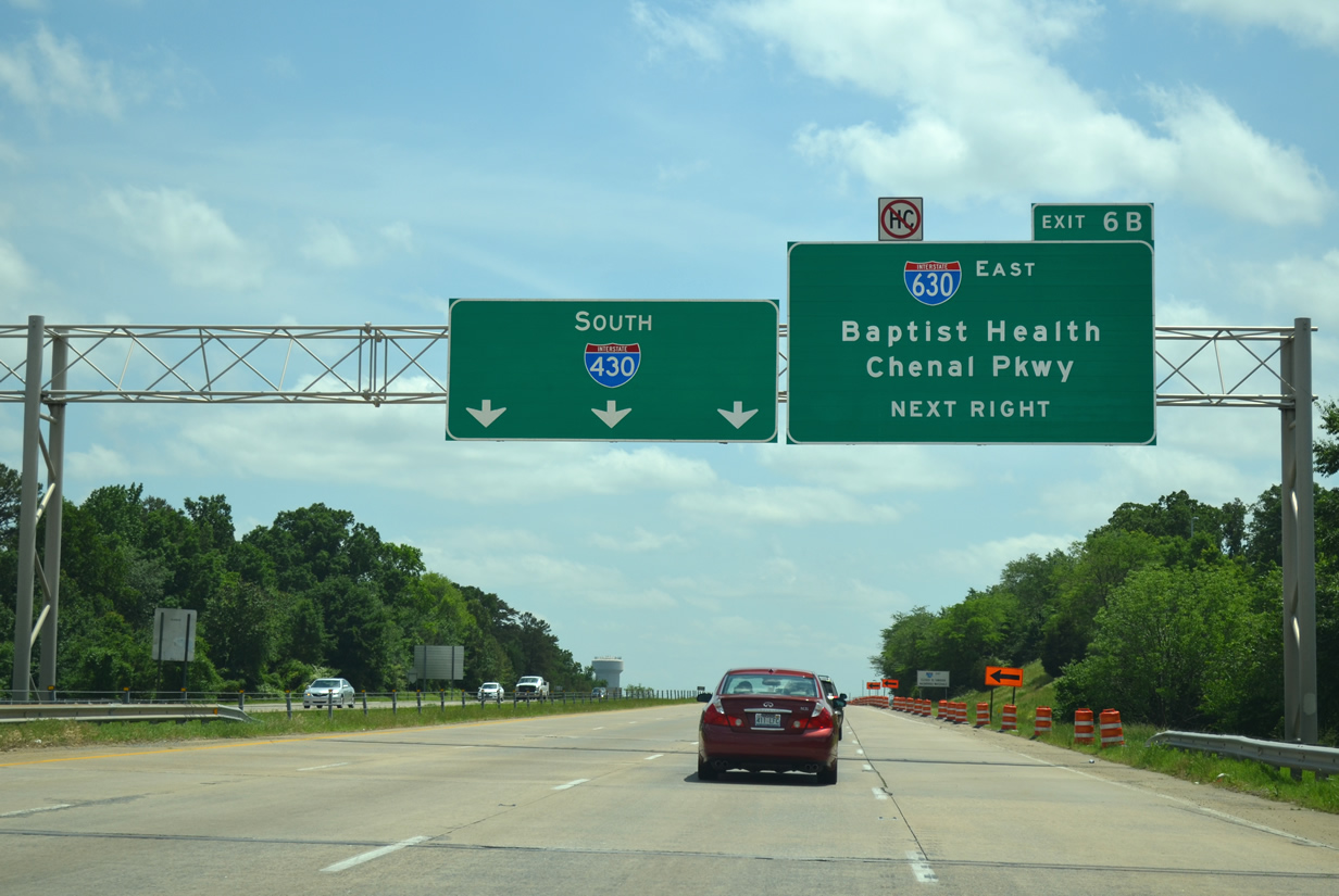
| Interstate 430 reaches the ramp to I-630 (Exit 6B) at the Markham Street overpass. Currently this ramp provides for all movements from Interstate 430 south to the local road network. Shackleford Road next encounters the freeway in one mile (Exit 5). 05/20/14 |
|
| The new high speed ramp to Interstate 630 soars over the distributor roadway as a ramp leaves for Markham Street (via Shackleford Road north). Continue along the distributor roadway to Baptist Health Drive and Chenal Parkway. 05/20/14 |
|
| While construction is ongoing the upcoming loop ramp still provides direct access to Interstate 630 east. Once the project is complete in Summer 2015 the ramp will only access the local road network as a new flyover will carry motorists from I-430 south to I-630 east. Traffic currently collected from Interstate 630 west continues along the collector distributor toward I-430 south. As part of the construction project a new grade separated interchange is being built for Financial Centre Parkway at Shackleford Road. Financial Centre Parkway makes the connection to Chenal Parkway west. 05/20/14 |
|
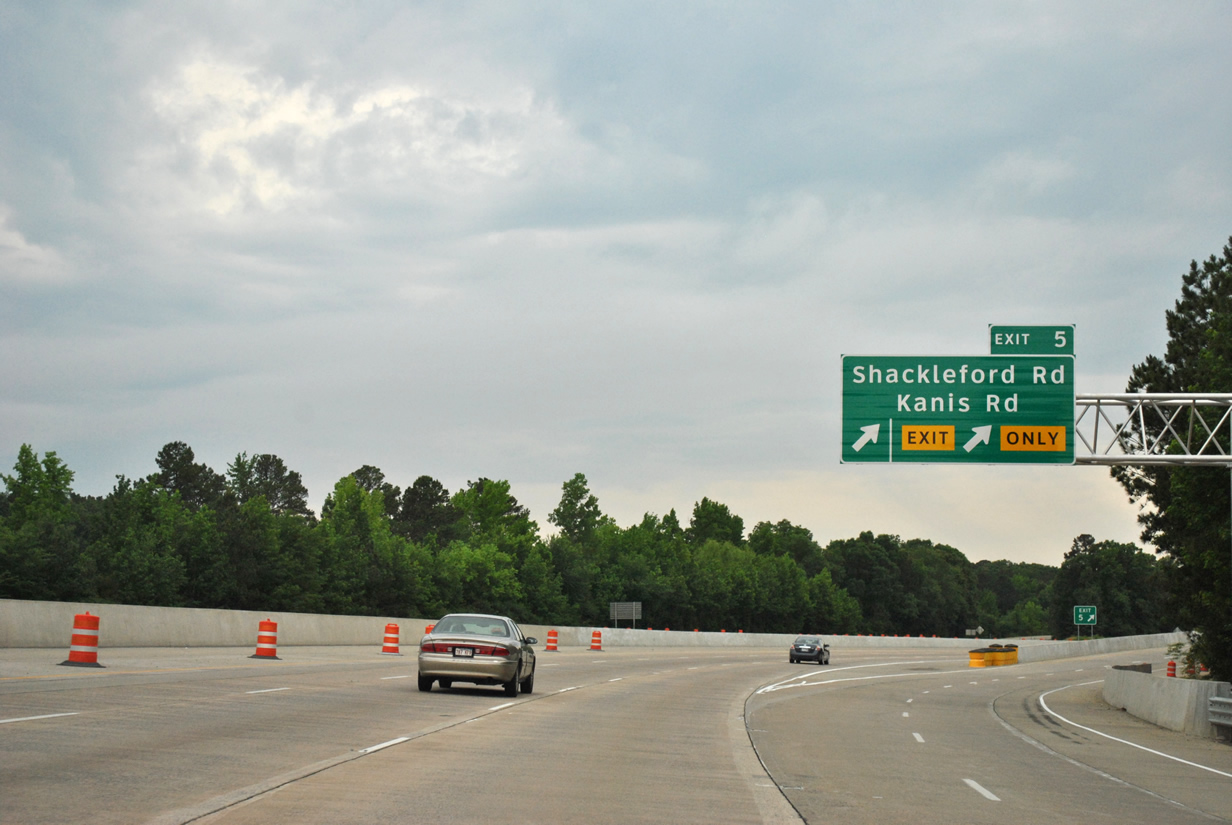
| Interstate 430 south passes under Kanis Road on the final leg to Shackleford Road (Exit 5). 05/07/12 |
|
| Shackleford Road was connected to the freeway in the early 1980s when commercial and residential growth in the area demanded an additional interchange. 05/07/12 |
|
| Two lanes depart for Shackleford Road (Exit 5) to Kanis Road. Shackleford Road represents a busy arterial between Interstate 430 and Markham Street. Kanis Road can be reached via Shackleford Road north. 05/07/12 |
|
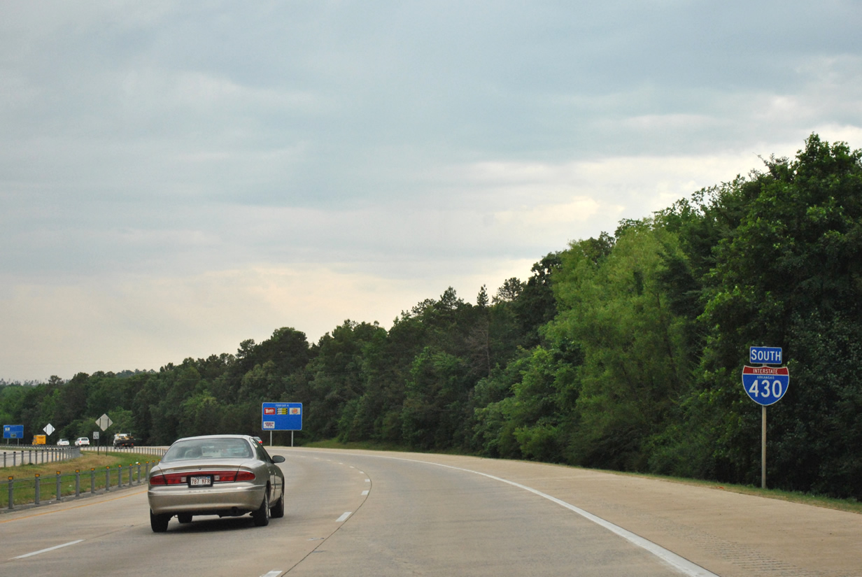
| Interstate 430 continues south from Shackleford Road toward Arkansas 300 (Exit 4) and Interstate 30 near Mabelvale. The freeway maintains three lanes of traffic to Arkansas 5 (Exit 1). 05/07/12 |
|
| Arkansas 300 (Colonel Glenn Road) represents a 1.45 mile connector to Arkansas 5 (Stagecoach Road). Colonel Glenn Road continues west from Interstate 430 and Exit 4 toward the communities of Martinsdale and Twin Springs. 05/07/12 |
|
| One exit remains along this stretch of Interstate 430 south before ending its nearly 13 mile journey to Interstate 30. 05/07/12 |
|
| David O. Dodd Road spans over Interstate 430 near the one mile approach to Arkansas 5 (Stagecoach Road). 05/07/12 |
|
| Arkansas 5 follows both Colonel Glenn and Stagecoach Roads southwest from U.S. 70 Business near the University of Arkansas Little Rock campus toward Benton and Hot Springs, meeting Interstate 430 at Exit 1. 05/07/12 |
|
| Interstate 430 reaches the ramp for Arkansas 5 (Exit 1) to Benton. The freeway will come to an end at Interstate 30 to Little Rock and Texarkana lies 1.25 miles ahead. 05/07/12 |
|
| Crossing over Haw Branch Creek, Interstate 430 curves southeast in advance of meeting Interstate 30. 05/07/12 |
|
| Arkansas 338 (Baseline Road) passes under I-430 on its 0.5 mile approach to its split for I-30 west and east. 05/07/12 |
|
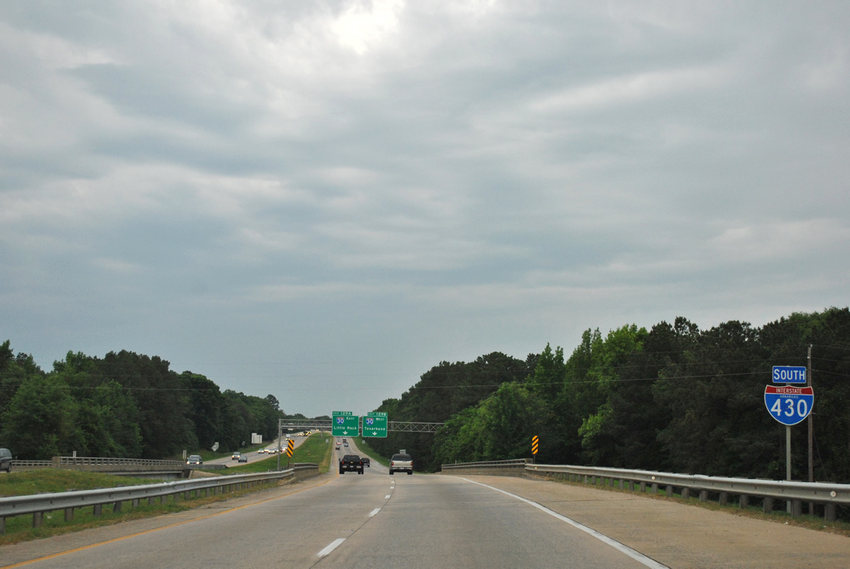
| Interstate 430 uses its parents exit number for the upcoming ramps to Interstate 30. Interstate 30 west (Exit 129B) will take motorists southwest toward Benton and Texarkana while Exit 129A will default motorists onto Interstate 30 bound for Little Rock. 05/07/12 |
|
| A frontage road for Interstate 30 passes over mainline Interstate 430 ahead of the split to I-30 west and east. Interstate 430 ends ahead as drivers depart toward Texarkana (Exit 129B) and Little Rock (Exit 129A). Overall Interstate 30 travels 366.8 miles between Interstate 40 in North Little Rock and Interstate 20 west of Fort Worth, Texas. 05/07/12 |
Page Updated 06-23-2014.

 North
North