|
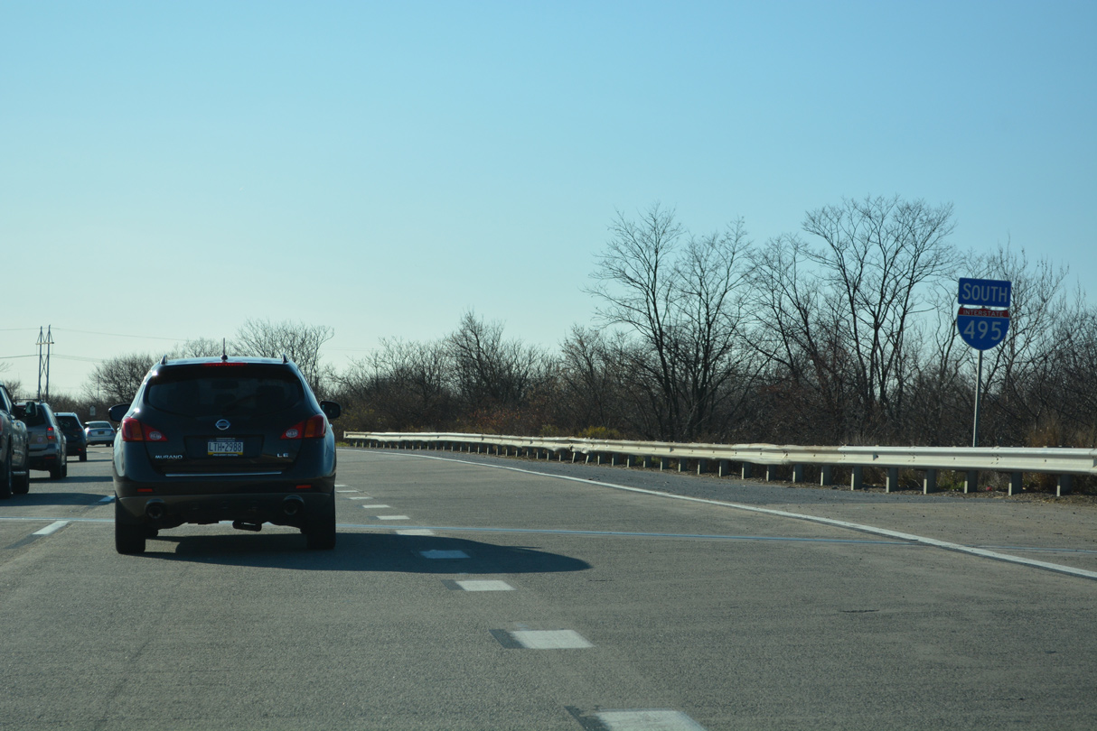
| Removed by 2019, the first confirming marker for I-495 south appeared at the Delaware state line with milepost 11.5 12/20/17 |
|
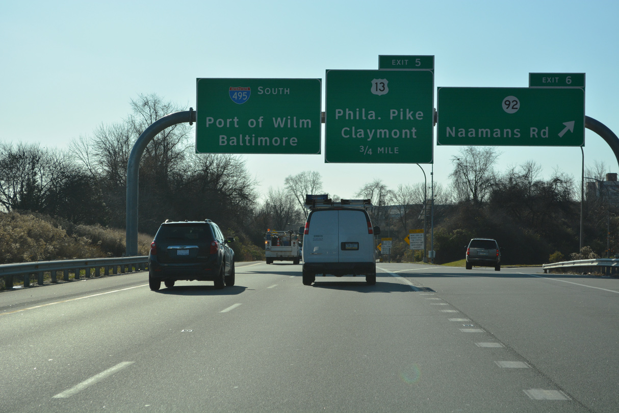
| The wye interchange for Interstate 495 south lies within the diamond interchange (Exit 6) joining I-95/495 and SR 92 (Naamans Road). 12/20/22 |
|
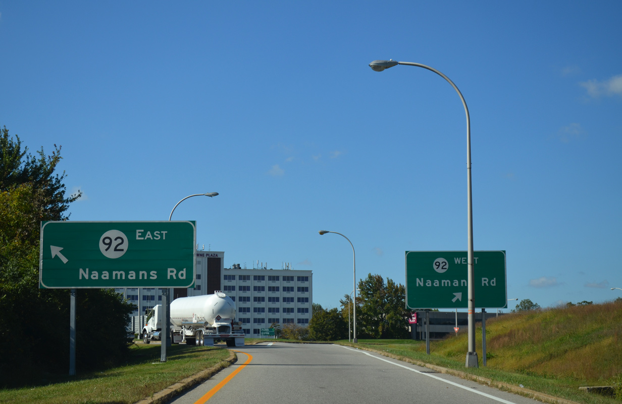
| SR 92 (Naamans Road) comprises a busy arterial between U.S. 202 (Concord Pike) and U.S. 13 (Philadelphia Pike). Heavy commercial and residential development lines the four to six lane route throughout the Brandywine Hundred and Claymont areas. 12/20/22 |
|
| SR 92 (Naamans Road) ends 0.82 miles to the east at U.S. 13 (Philadelphia Pike) by the First State Crossing development in Claymont. Naamans Road west intersects SR 3 (Marsh Road) in 1.76 miles. Widening of SR 92 commenced in 1985 and ran to 1999. 10/05/14 |
|
| Interstate 495 is the Vietnam Veterans Memorial Highway. Signs for the designation appear at both ends. 12/20/22 |
|
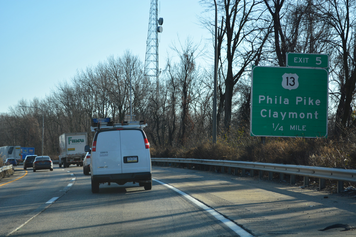
| A sign for Delaware Park precedes the bridge taking Interstate 495 southbound over the I-95 mainline a quarter mile north of a parclo interchange (Exit 5) with U.S. 13 (Philadelphia Pike). 12/20/22 |
|
| U.S. 13 (Philadelphia Pike) crosses the state line from Marcus Hook, Pennsylvania into Claymont from the north. One mile south of Exit 5, U.S. 13 splits with U.S. 13 Business for Governor Printz Boulevard. Both routes travel south to Wilmington. 12/20/22 |
|
| The guide sign for U.S. 13 (Philadelphia Pike) at Exit 5 was removed in 2017. Unincorporated Claymont falls within the area between Naamans Road, I-95, Harvey Road and I-495. The community is populated by several post World War II built subdivisions and industrial complexes north toward the Pennsylvania line. 12/25/12 |
|
| Myrtle Avenue spans I-495 between U.S. 13 and the SEPTA Claymont Station. The Amtrak Northeast Corridor and Norfolk Southern Railroad line run between the freeway and Delaware River. The Delaware Memorial Bridge appears far to the south. 12/20/22 |
|
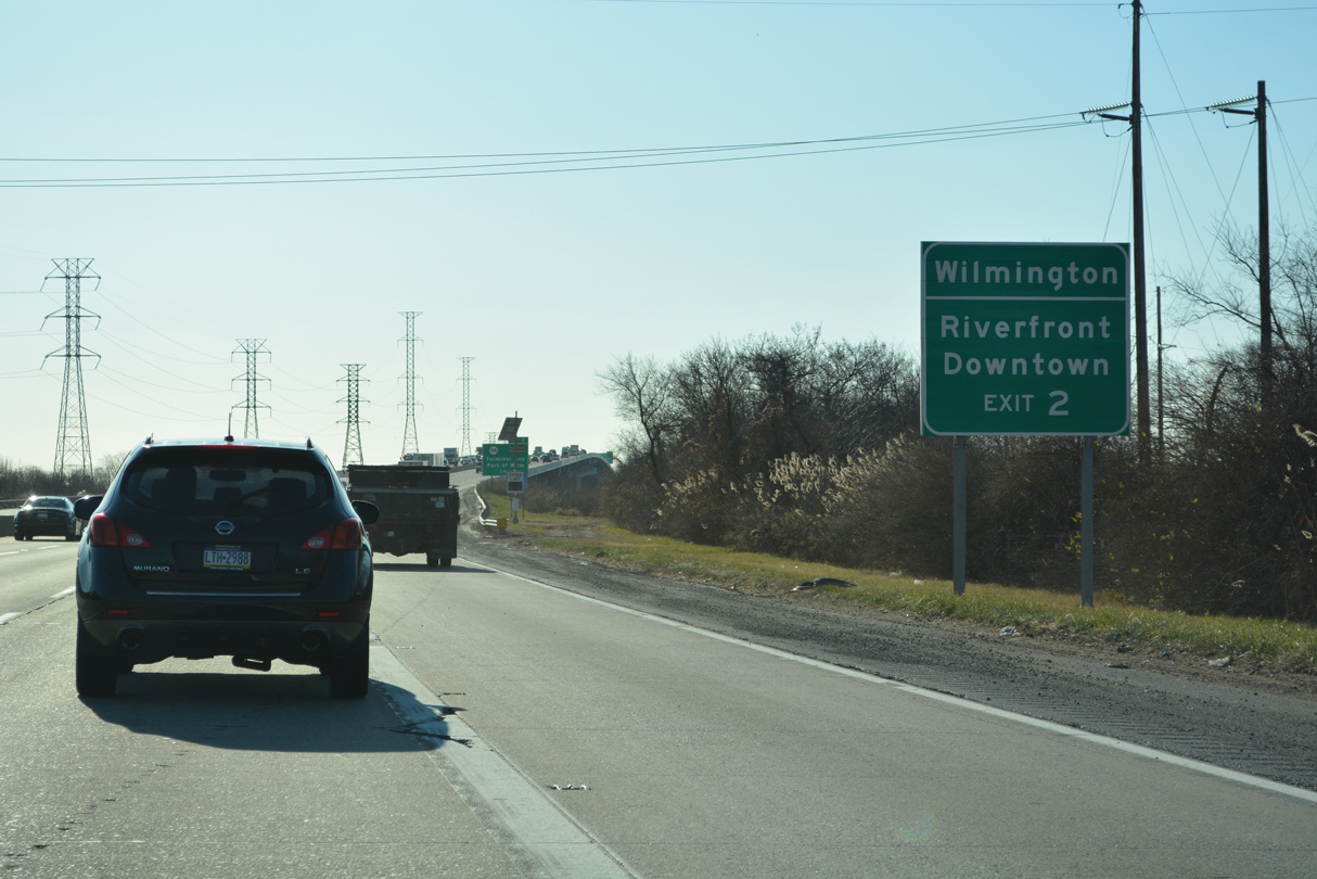
| Paralleling U.S. 13 (Governor Printz Boulevard), I-495 proceeds 4.2 miles south along an uninterrupted stretch to Fox Point State Park. The Port of Wilmington lies seven miles ahead at Exit 2, while motorists bound for the Delaware Memorial Bridge via I-495 south to I-295 north reach the span in 13 miles. 12/20/22 |
|
| I-495 runs along Fox Point State Park and the Delaware River to Exits 4 B/A with U.S. 13 (Governor Printz Boulevard) and SR 3 (Edgemoor Road). 12/20/22 |
|
| Industrial areas line the Delaware River along adjacent Lighthouse and Hay Roads at Exit 4 B. Serving northeast Wilmington and the town of Bellefonte, the exchange with SR 3 (Edgemoor Road) and U.S. 13 opened to traffic in 1989. 12/20/22 |
|
| Several guide signs for exits along I-495 were added for the Downtown Riverfront in Wilmington during the Rehabilitation of I-95 from I-495 to North of the Brandywine River Bridge project underway from Spring 2021 to Spring 2023. 12/20/22 |
|
| A reassurance marker for I-495 was added ahead of the wye interchange (Exit 4 B) with Governor Printz Boulevard in 2017. 12/20/22 |
|
| Exit 4 A links I-495 south with U.S. 13 at Stuyvesant Drive, just a tenth of a mile north of the intersection joining Governor Printz Boulevard with Edgemoor Road (SR 3). U.S. 13 enters the city limits of Wilmington along Northeast Boulevard one mile to the west. SR 3 travels northward to Marsh Road and Philadelphia Pike en route to Arden. 12/20/22 |
|
| A loop ramp (Exit 4 B) connects with the south end of SR 3 (Edgemoor Road) at Hay Road, Lighthouse Road and Edgemoor Industrial Park. Hay Road (Road 501) parallels I-495 southward to 12th Street Extension on Cherry Island. Lighthouse Road stems north from SR 3 to Fox Point State Park. 12/20/22 |
|
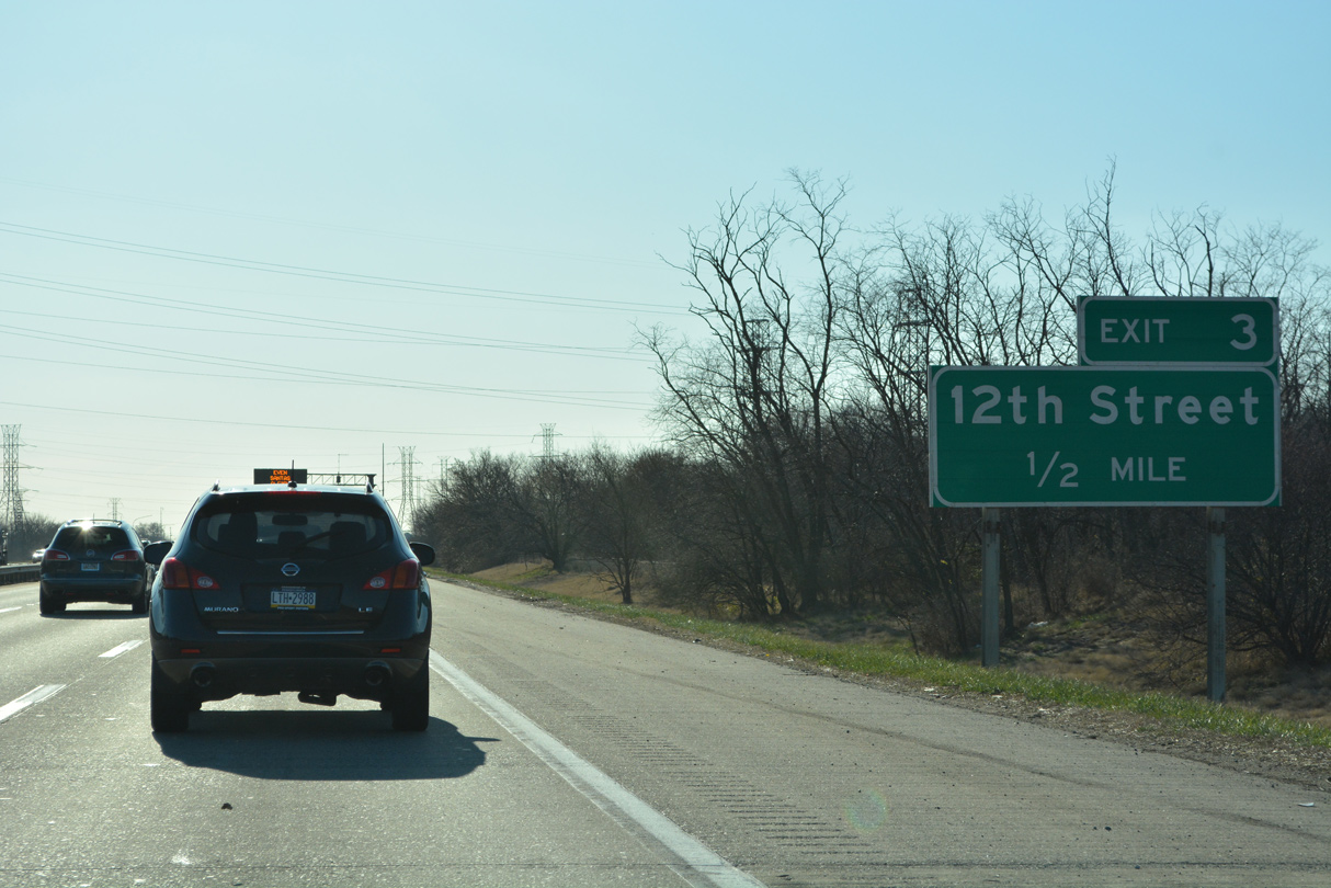
| The initial guide sign for Exit 3 to 12th Street precedes the entrance ramp from SR 3 (Edgemoor Road). 12/20/22 |
|
| I-495 crosses over Norfolk Southern Railroad spurs leading to a power plant ahead of the Wilmington city line at Shellpot Creek. 12/20/22 |
|
| I-495 spans Shellpot Creek a half mile north of the diamond interchange (Exit 3) with 12th Street. Twelfth Street (Road 9) links I-495 with Hay Road on Cherry Island to the east and U.S. 13 (Northeast Boulevard) at the 11th Street Bridge section of Wilmington to the west. 12/20/22 |
|
| 12th Street (Road 9) was envisioned as a potential expressway spur from I-495 into Downtown Wilmington. Some improvements were made to the corridor after the opening of I-495 in 1977, however opposition from Upper East Side residents and funding issues in 1982 ultimately led to its cancellation.1 12/20/22 |
|
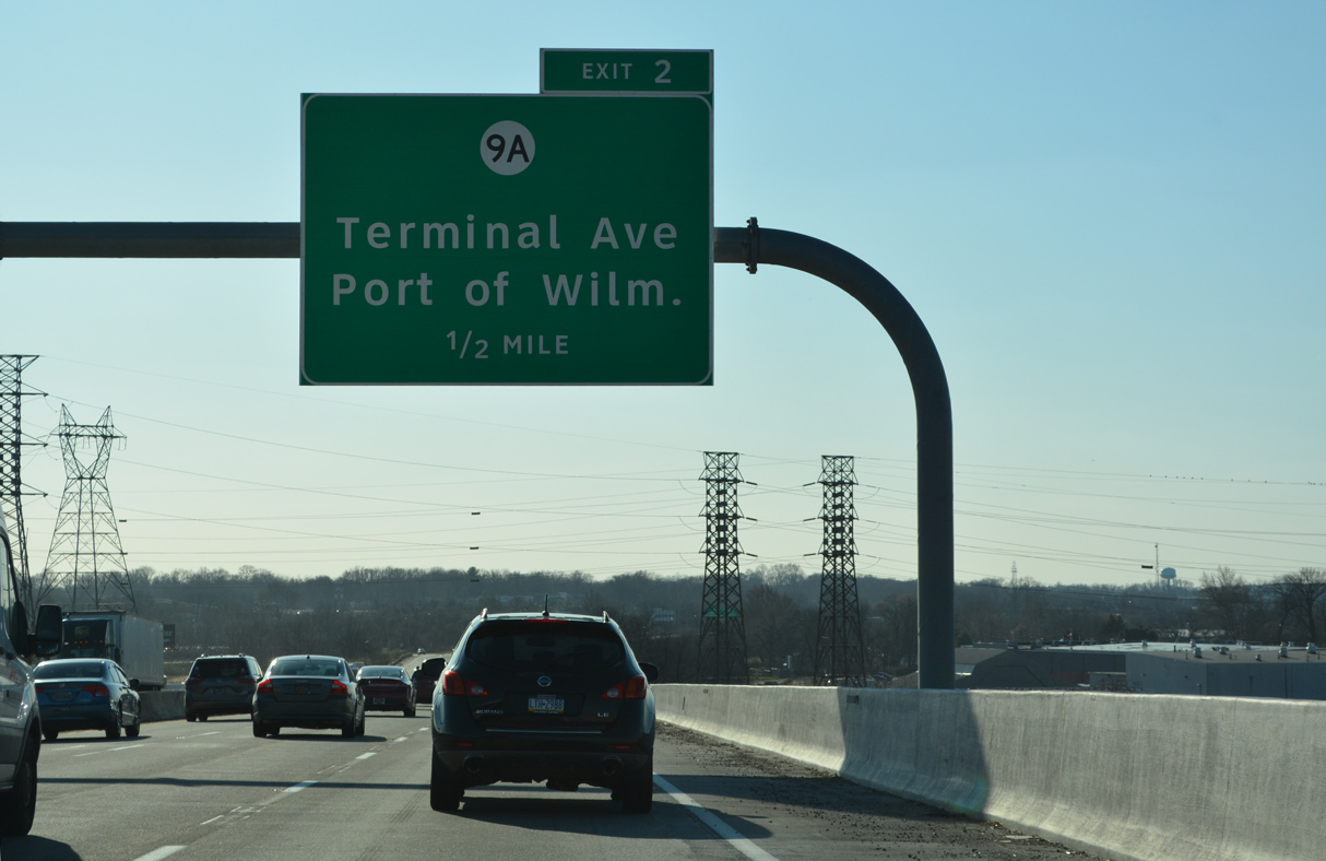
| Exit 2 joins Interstate 495 with SR 9A (Terminal Avenue) just south of the Christina River Bridge. 12/20/22 |
|
| SR 9A forms a 2.07 mile long loop east from SR 9 (New Castle Avenue) to the Port of Wilmington. 12/20/22 |
|
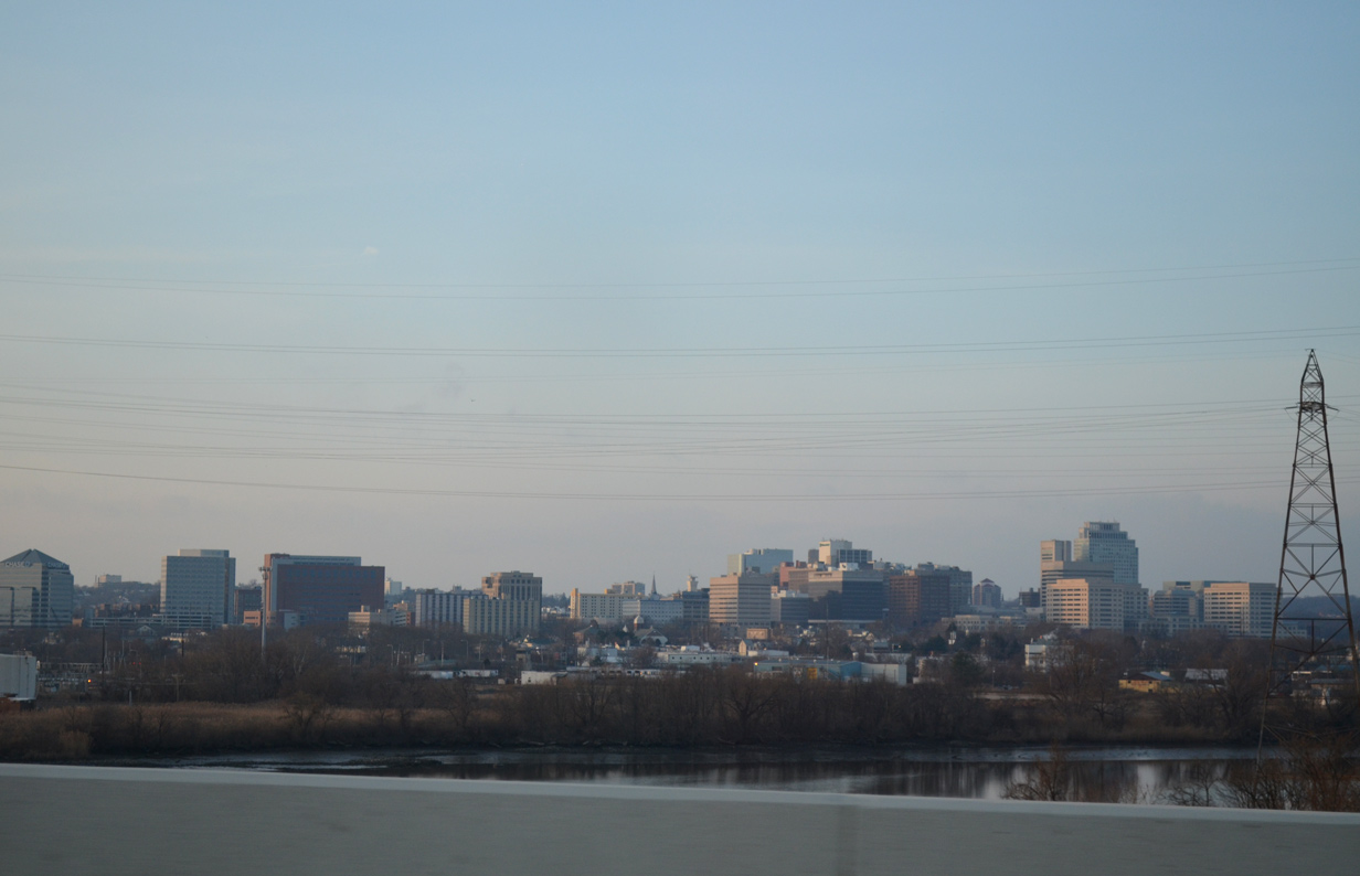
| The Wilmington skyline spreads upriver along the Christina from Interstate 495. Dubbed the Corporate Capital of the World due to the number of incorporated businesses calling the city home, the city is home to over 70,000. 12/20/22 |
|
| Appearing below the Christina River Bridge is the Shellpot Bridge of the Norfolk Southern (NS) Railroad system. Previously closed since 1994 due to structural deficiencies found in its foundation, the NS Railroad Company purchased the 116 year old span from Conrail in 1999. The opening of the bridge allowed NS to move freight trains from rails on the AMTRAK Northeast Corridor. The line also enhanced access to the Port of Wilmington. The swing bridge was renovated in 2004 during a $13.9 million project.2 12/25/12 |
|
| SR 9A follows Christina Avenue southeast from U.S. 13/SR 9 (Heald Street) to Old Ferry Road and the Port entrance, and Terminal Avenue west from there. 12/20/22 |
|
| Entering the parclo interchange (Exit 2) with SR 9A (Terminal Avenue) on I-495 south. Terminal Avenue links I-495 with SR 9 (New Castle Avenue) 0.27 miles to the west. SR 9 extends from Southbridge in Wilmington to I-295 and the historic town of New Castle. 12/20/22 |
|
| Interstate 495 curves west two miles ahead of the exchange with I-95 south and I-295 north. A directional cloverleaf interchange (Exit 1) joins the freeway with U.S. 13 (Dupont Highway) next. 12/20/22 |
|
| Leaving the Wilmington city limits, I-495 crosses over SR 9 (New Castle Avenue) and a former NS Railroad spur beyond this shield assembly. 12/20/22 |
|
| Forthcoming U.S. 13 north to U.S. 13 Business (S Market Street) provides a direct route to the Wilmington Trail Station, which includes AMTRAK and SEPTA Regional Rail service. 12/23/18 |
|
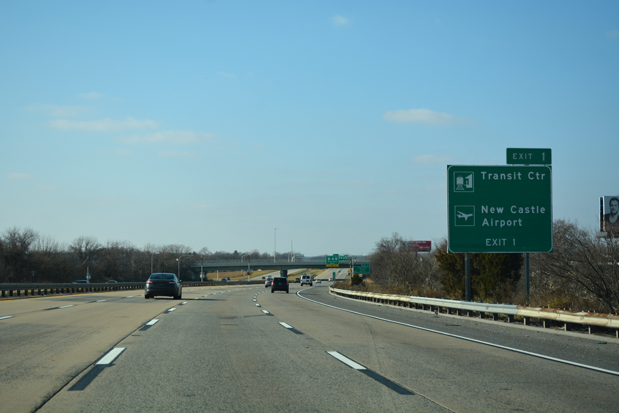
| U.S. 13 (Dupont Highway) south combines with U.S. 40 west at Interstate 295 in two miles at Farnhurst. The pair continue southwest from there to New Castle Airport (ILG) and State Road. 12/20/22 |
|
| Until 2000, Exit 1 connected Interstate 495 south with U.S. 13 (Dupont Highway) southbound only. A construction project at that time expanded the ramp to include access to U.S. 13 north. 12/20/22 |
|
| The auxiliary gained from the SR 9A entrance ramp departs for U.S. 13 (Dupont Highway) at Exit 1. 12/20/22 |
|
| Exit 1 partitions into ramps for U.S. 13 (Heald Street) north to its split with U.S. 13 Business (Market Street). The Market Street gateway to Wilmington provides the most direct access to Downtown from Interstate 495. 12/20/17 |
|
| U.S. 13 (Dupont Highway) travels south to Minquadale and Farnhurst. 08/07/04 |
|
| I-495 south parallels the south banks of the Christina River to a flyover (Exit 5) for SR 141. SR 141 arcs northward from U.S. 13/40 (Dupont Highway) by New Castle Airport (ILG) to Prices Corner, Greenville and U.S. 202 at Blue Ball. 12/20/22 |
|
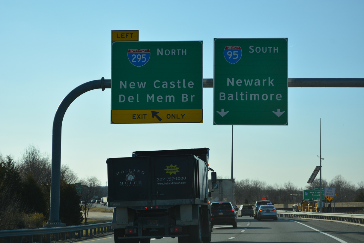
| The left lane defaults to Interstate 295 north (Exit 0) for the Delaware Memorial Bridge and South Jersey in one mile. 12/20/22 |
|
| The wye interchange with I-95 south was constructed at the same time Interstate 95 was north into Wilmington. An exit ramp to I-95 north was built into the exchange but removed when the flyover for SR 141 was added in 1981/82. 12/20/22 |
|
| Traffic along I-495 south joins the left side of I-95 within the directional T interchange at I-295. I-95 follows the John F. Kennedy Memorial Highway west to Newark and Baltimore, Maryland. I-295 initially heads east to the New Jersey Turnpike then north to Camden. 12/20/22 |
Page Updated 01-09-2023.

 South
South