
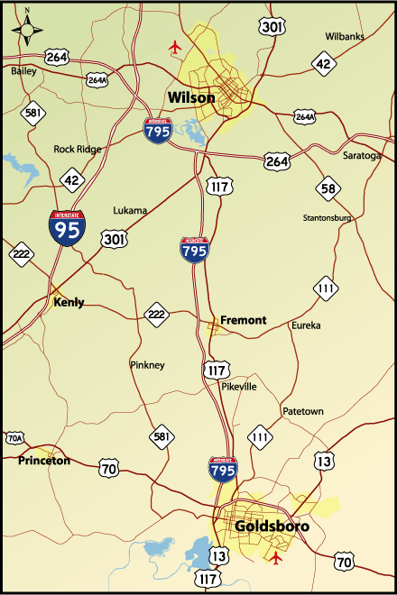
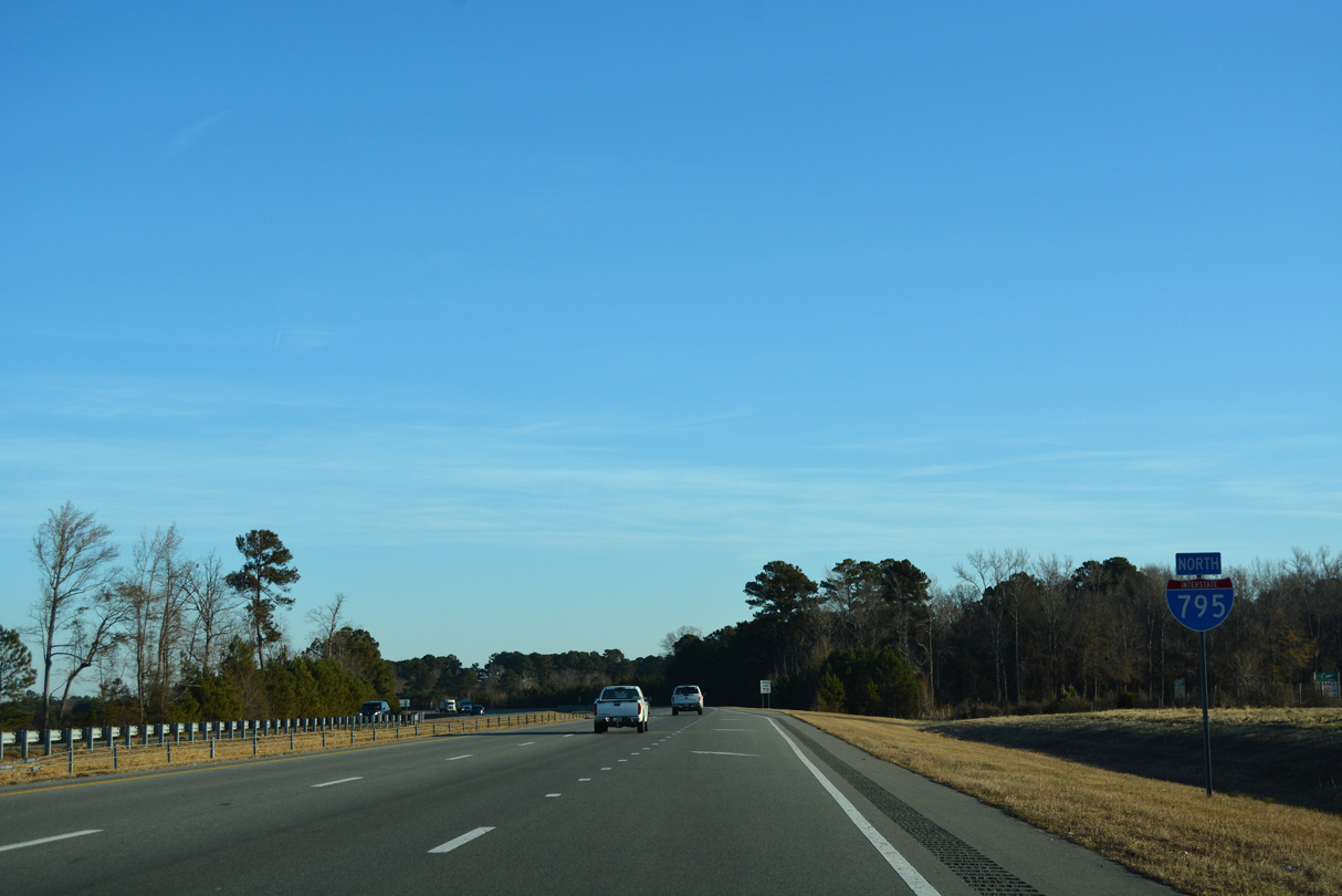
Interstate 795 is a 25.43 mile long freeway south from I-95 in Wilson County to U.S. 70 and NC 581 in the city of Goldsboro. I-795 initially runs east alongside U.S. 264 and I-587 around Wilson. Paralleling U.S. 117, I-795 turns south near Wiggins Mill Reservoir to Fremont, Pikeville and U.S. 70 Bypass / Future I-42 outside Goldsboro.
Interstate 795 was approved by the American Association of State Highway and Transportation Officials (AASHTO) during the September 28, 2007 meeting. Goldsboro and Wilson area officials sought the designation along the 2006-completed U.S. 117 freeway to promote economic development and allow the trucks exceeding 48 feet in length use of the freeway. Originally denied during the May 4, 2007 AASHTO meeting, officials successfully lobbied for its signing in Fall 2007. Shields went up along the route in November 2007.
With the signing of Interstate 795 along the U.S. 117 freeway between U.S. 70 at Goldsboro and U.S. 264 at Wilson, U.S. 117 was rerouted from the freeway back onto its own alignment (U.S. 117 Alternate). Most signs were updated to reflect Interstate 795 by Spring 2008.
Future work will upgrade around 24 miles of the U.S. 117 corridor south from I-795 in Wayne County to Interstate 40 in Sampson County. U.S. 117 is a Strategic Transportation Corridor serving regional, commuter and freight traffic between I-40 and I-795. The last of several feasibility studies for extending I-795 south to I-40 was completed in July 2015. Funding for construction between Country Club Road and NC 581 (W Ashe Street) was identified in the North Carolina Department of Transportation (NCDOT) 2018-27 State Transportation Improvement Program. Prior to the COVID19 pandemic, construction was anticipated to start on this section in 2027.
 North
North
NC 581 Connector extends 0.62 miles north from NC 581 (Ash Street) to the parclo interchange joining the south end of Interstate 795 with U.S. 70.
12/14/17

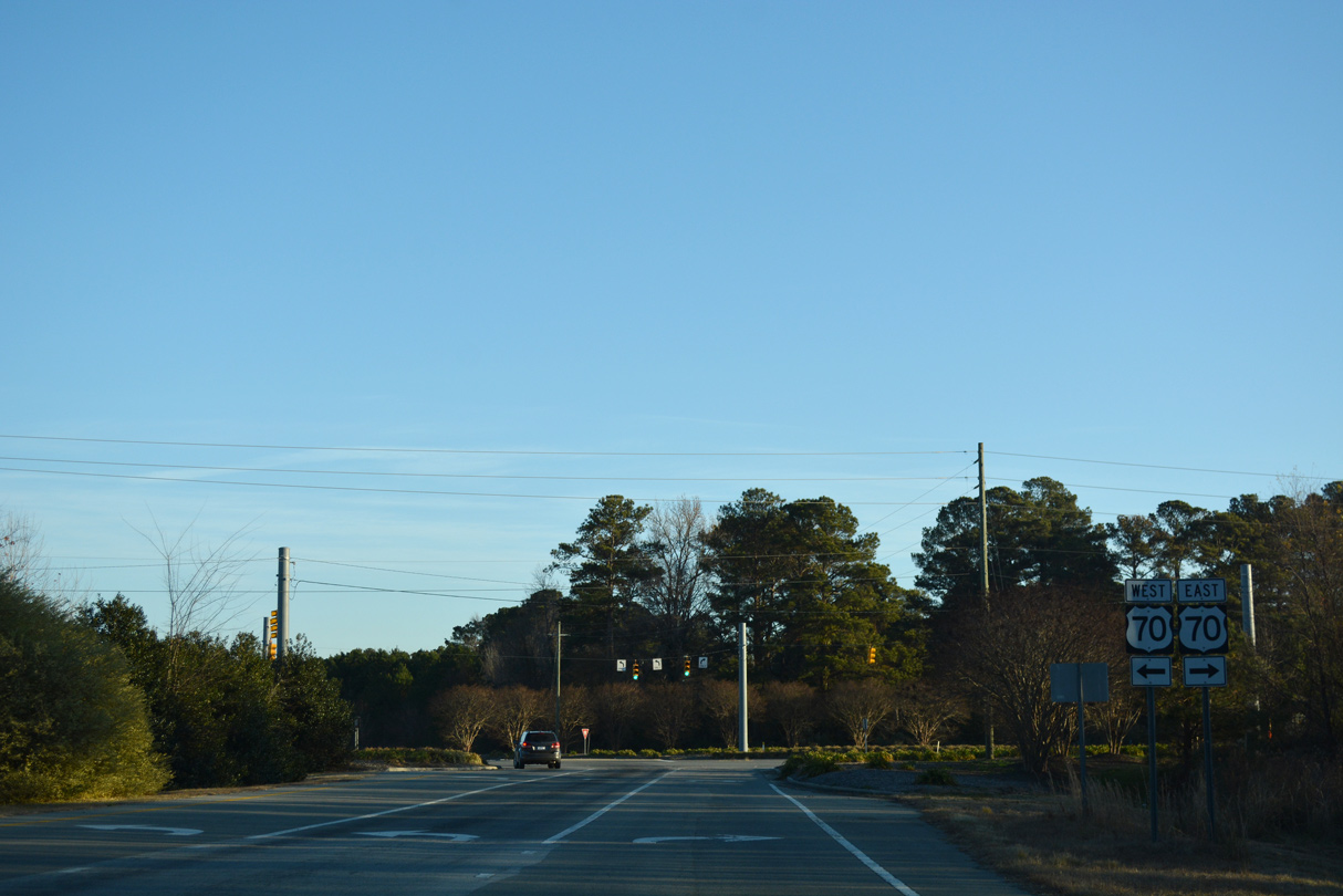
U.S. 70 (Grantham Street) constitutes an arterial route west from parallel U.S. 13/117 and the freeway bypass of Downtown Goldsboro.
12/14/17
U.S. 70 converges with the west end of U.S. 70 Bypass in 4.86 miles en route to Smithfield.
12/14/17

The first confirming marker for Interstate 795 north.
12/14/17
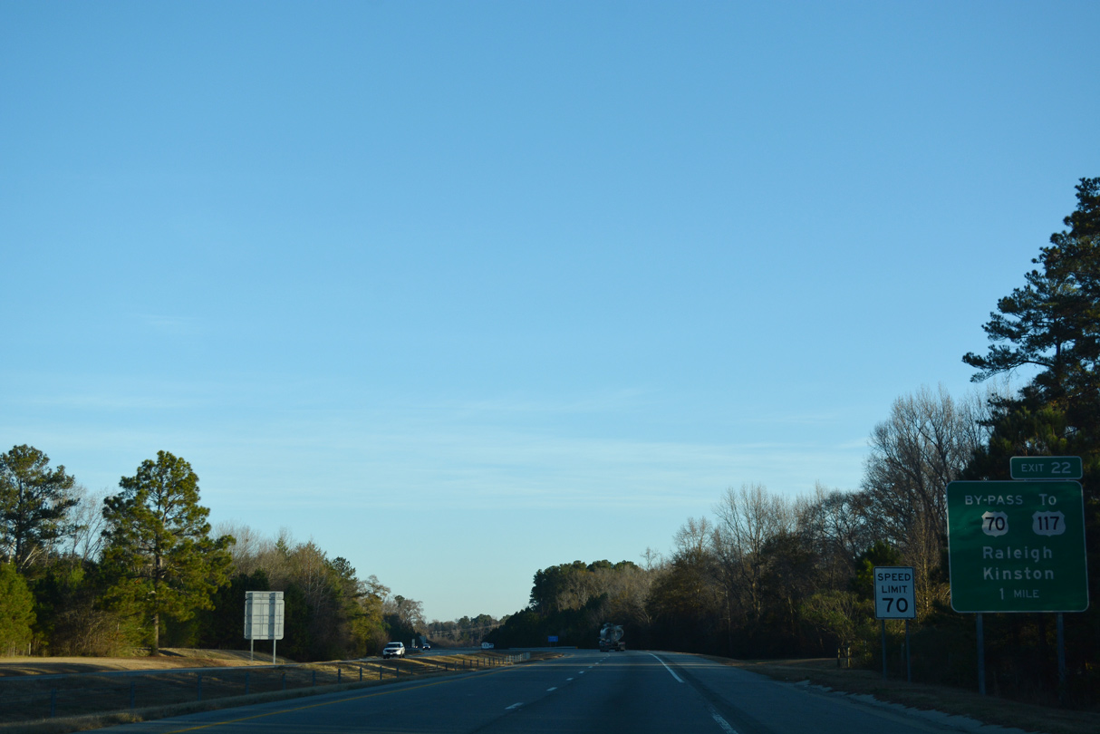
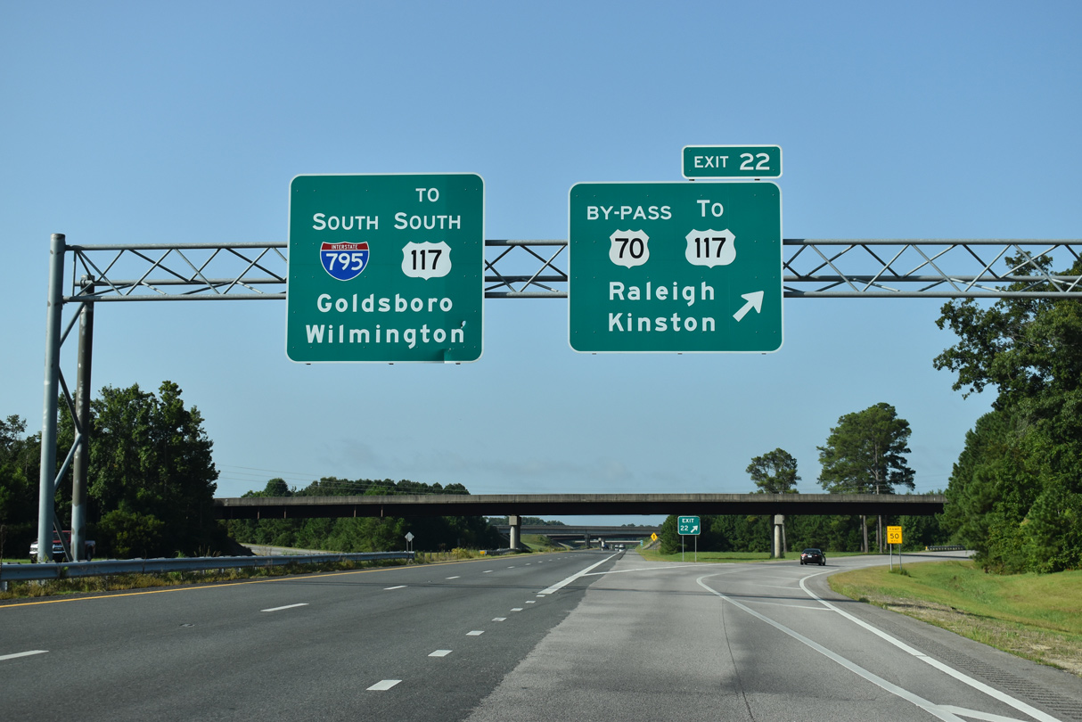
Interstate 795 parallels the Little River northward to U.S. 70 Bypass at Exit 22.
12/14/17

U.S. 70 Bypass is a freeway encircling the Goldsboro area east to La Grange.
12/14/17

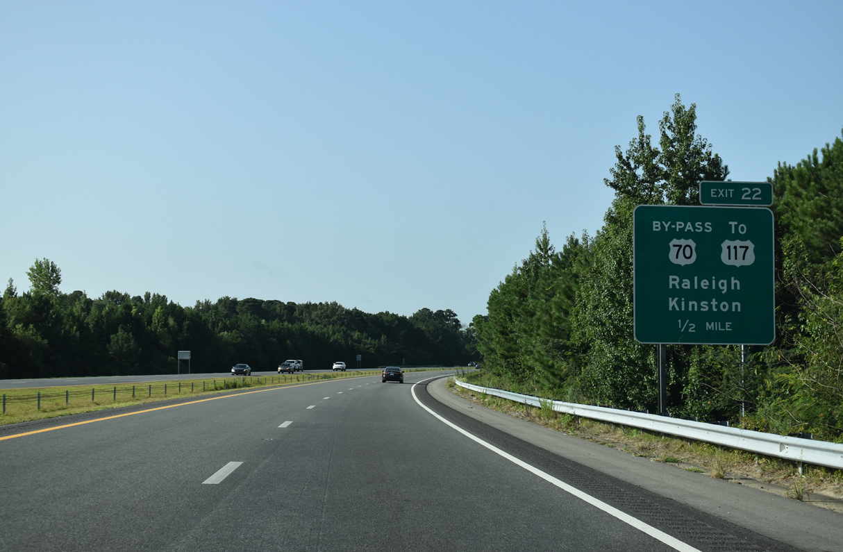
U.S. 70 Bypass links I-795 with U.S. 117 (N William Street) just east of the cloverstack interchange at Exit 22.
12/14/17

U.S. 70 Bypass is part of the Future Interstate 42 corridor that leads west to I-40 near Clayton and east to Kinston and New Bern.
12/14/17
12/14/17
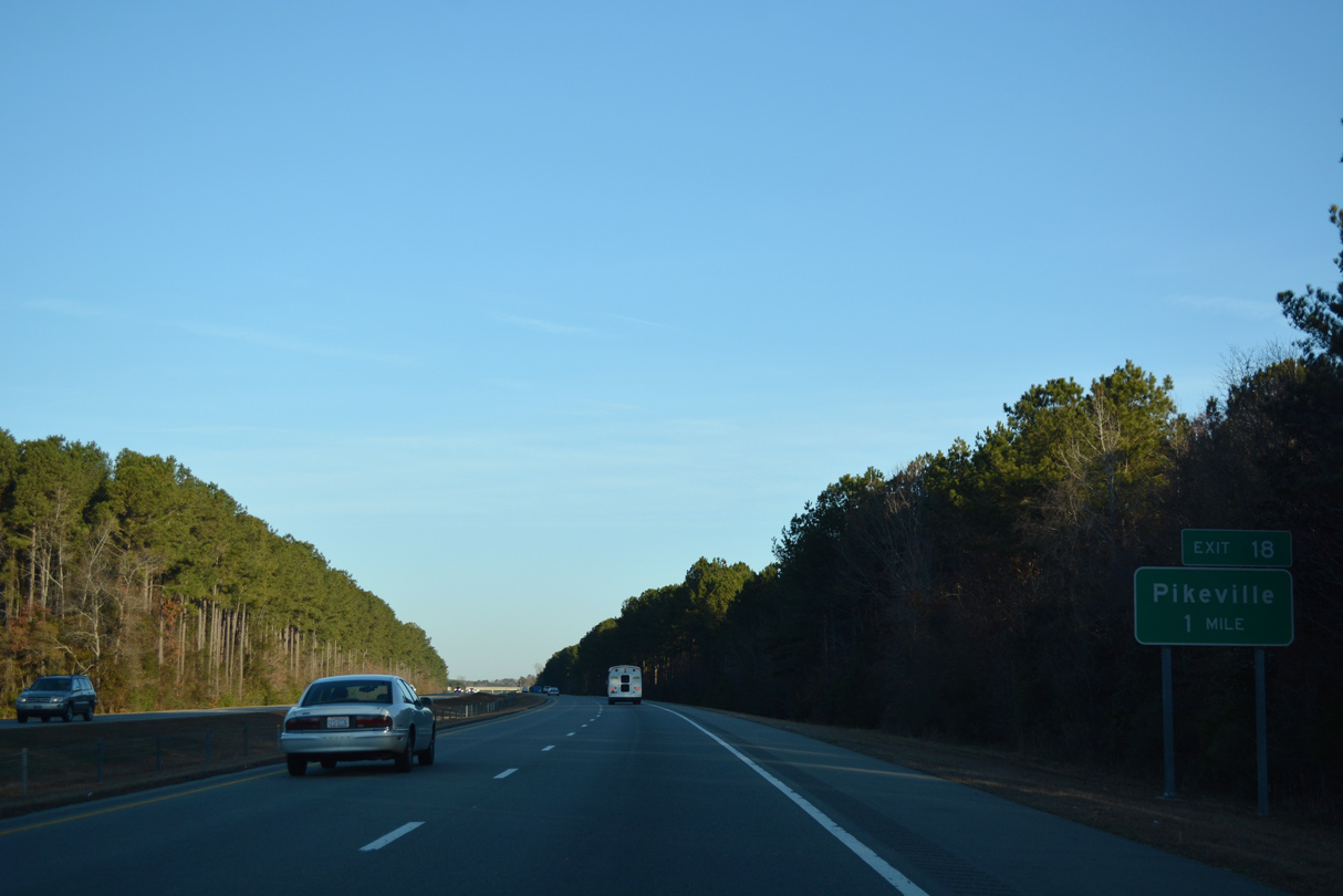
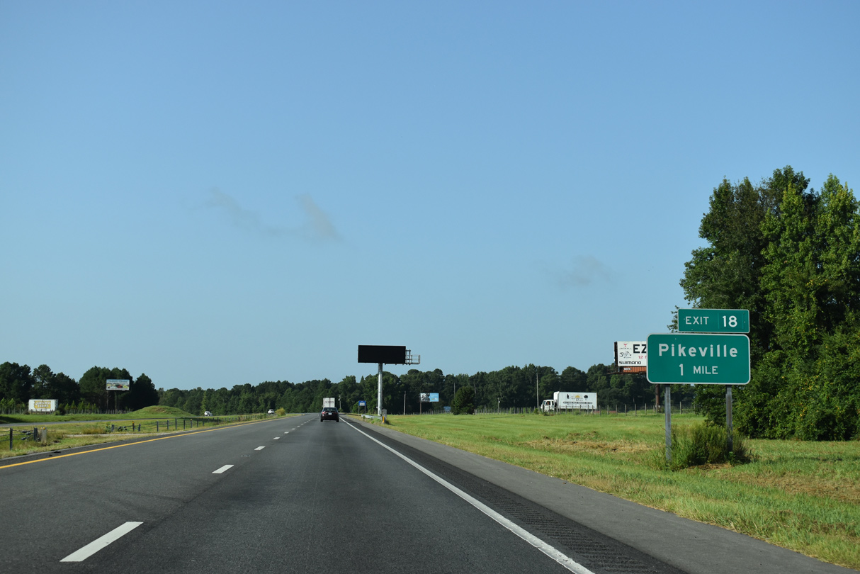
Exit 18 joins Interstate 795 with Pikeville Princeton Road (SR 1002) just outside Pikeville.
12/14/17
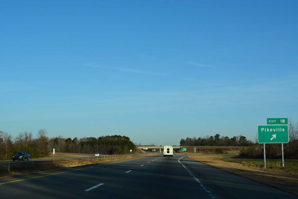
East into the town of Pikeville, SR 1002 follows Main Street to U.S. 117 (Goldsboro Street). Pikeville Princeton Road heads west from Exit 18 to NC 581 at Pike Crossroads.
12/14/17

12/14/17

Interstate 795 north at Nahunta Swamp.
12/14/17

A diamond interchange connects I-795 with NC 222 just outside the town of Fremont.
12/14/17

NC 222 travels west from I-795 four miles to NC 581 and nine miles to I-95 and U.S. 301 at Kenly. The Governor Charles B. Aycock Birthplace lies south of Fremont off U.S. 117.
12/14/17

12/14/17

Interstate 795 advances north from Fremont across Great Swamp.
12/14/17
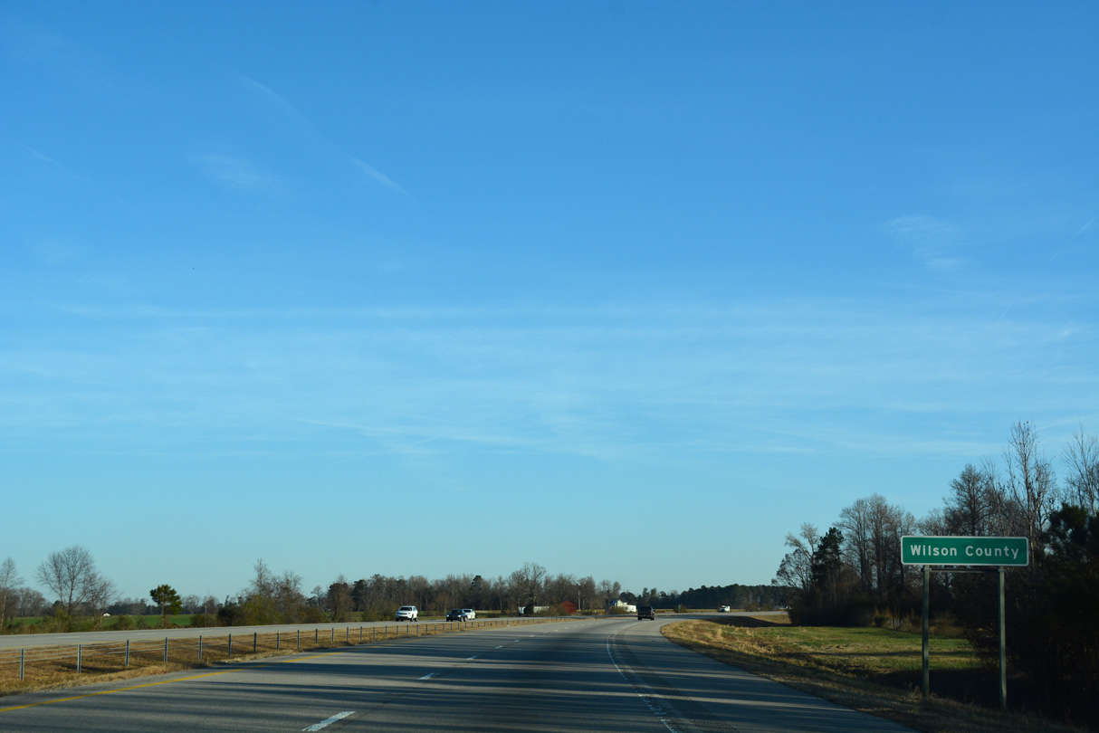
Interstate 795 crosses into Wilson County midway between Exit 14 and 9.
12/14/17

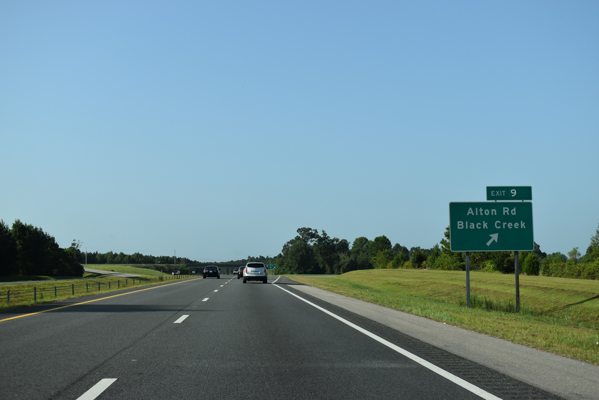
Gourd Branch Road (SR 1640) spans I-795 one mile south of the diamond interchange (Exit 103) with Alton Road (SR 1643).
12/14/17

Alton Road joins I-795 with U.S. 117 near the town of Black Creek. Alton Road continues 1.60 miles west from Exit 9 to Little Rock Church Road (SR 1649) south of Lucama.
12/14/17

Interstate 795 crosses Black Creek north of this confirming marker.
12/14/17

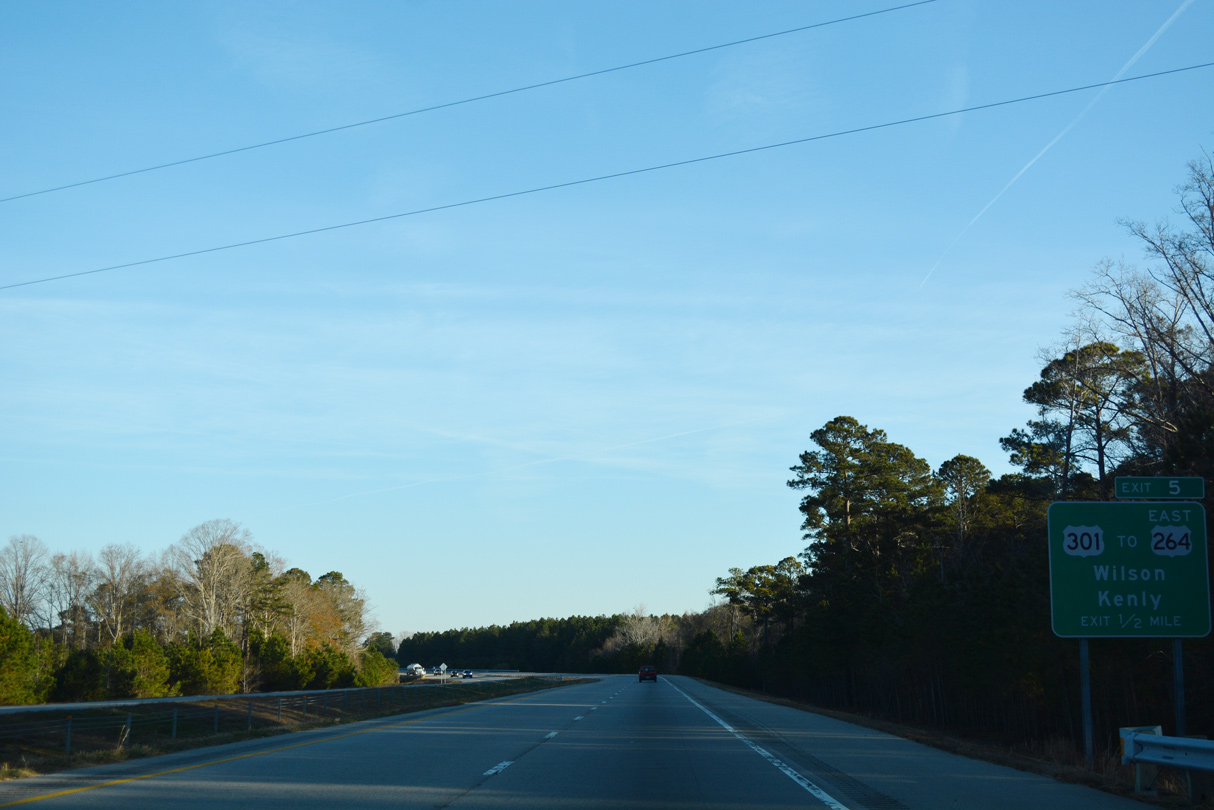
Meeting Interstate 795 at Exit 5, U.S. 301 travels northeast from Kenly and the I-95 corridor to Lucama and Wilson.
12/14/17

I-95 and U.S. 301 both lead southwest from Kenly to Selma and Smithfield. U.S. 301 north links I-795 with I-587/U.S. 264 east to Greenville.
12/14/17
U.S. 301 continues north from the nearby exchange with I-587/U.S. 264 into the city of Wilson.
12/14/17

The parclo A2 interchange with U.S. 301 was previously Exit 107 using U.S. 117 mileposts. I-587/U.S. 264 extend 32 miles east from Wilson to Greenville.
12/16/07

Interstate 795 defaults onto I-587/U.S. 264 westbound via a wye interchange just beyond Exit 5.
12/14/17

12/14/17

I-795 combines with I-587/U.S. 264 westbound 0.52 miles ahead of the folded diamond interchange (Exit 42) with Downing Street (SR 1163).
12/14/17

Until June 2022, Interstate 587 remained a future route along U.S. 264 partly due to slow moving farm equipment permitted along the freeway.
12/14/17
North 
 West
West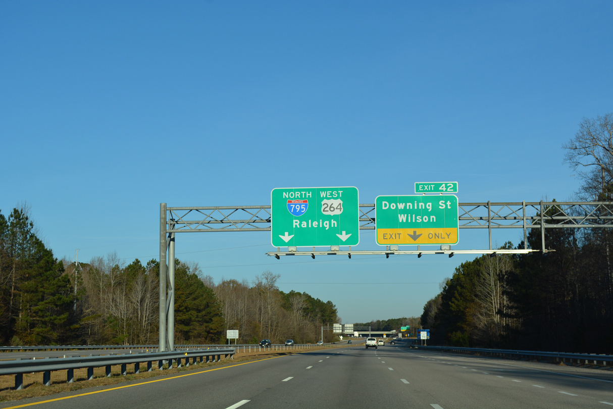
Succeeding lane drops precede Exit 42 for Downing Street (SR 1163) east into Wilson.
12/14/17

12/14/17

12/14/17

12/14/17

12/14/17

A folded diamond interchange (Exit 40) joins I-795/587-U.S. 264 west just beyond Contentnea Creek in one mile.
12/14/17

NC 42 follows Tarboro Street east into Wilson, meeting U.S. 264 Alternate (Ward Boulevard) in 4.06 miles. NC 42 encircles central Wilson along an arterial beltway.
12/14/17

NC 42 travels 27 miles west from Exit 40 to U.S. 70 Business outside Clayton.
12/14/17

I-795/587-U.S. 264 advance one mile north to a cloverleaf interchange (Exit 38) with Interstate 95.
12/14/17

12/14/17

Exit 38A connects with I-95 south 24 miles to Smithfield and 38 miles to Interstate 40 near Benson.
12/14/17

Interstate 95 heads 19 miles north from Exit 38B to U.S. 64/Future I-87 near Rocky Mount.
12/14/17

End Interstate 795 shield posted at the exchange with I-95. Future I-587 accompanies U.S. 264 west to U.S. 64/Future I-87 at Zebulon.
12/14/17

Exit 38B departs I-795/587-U.S. 264 for Interstate 95, 136 miles north to Richmond, Virginia.
12/14/17

Interstate 95 stays west of both Wilson and Rocky Mount along a rural route. The freeway primarily serves regional traffic southwest to Fayetteville, Savannah, Georgia and Florida.
12/14/17
South East
Exit 38A leaves I-795 south / U.S. 264 east for Interstate 95 north to Rocky Mount and Petersburg, Virginia. A cloverleaf interchange joins the two freeways just outside the Wilson city limits.
07/28/13

NC 42 meanders east from U.S. 70 in Clayton to meet I-587/795-U.S. 264 at a diamond interchange (Exit 40) in one mile.
07/28/13

The first shield for I-795 south appears beyond the Old Raleigh Road (SR 1136) overpass. U.S. 264 around Wilson is designated the Governor James B. Hunt, Jr. Highway.
07/28/13

A 226 mile route between I-73/74 at Asheboro and NC 45 at Colerain, NC 42 leads east from Exit 40 toward Downtown Wilson along Tarboro Street.
07/28/13

Exit 40 departs I-587/795-U.S. 264 east for NC 42. NC 42 circumvents Downtown Wilson along Ward Boulevard, an arterial beltway that is also part of U.S. 264 ALT and NC 58.
07/28/13

I-587/795-U.S. 264 east next span Contentnea Creek.
07/28/13

Forthcoming Downing Street (SR 1163) stems east from Quaker Road (SR 1162) to Goldsboro Street and Downtown Wilson.
07/28/13

A folded diamond interchange (Exit 42) connects I-587/795-U.S. 264 with Downing Street (SR 1163) in a half mile.
07/28/13

Exit 42 loops away from I-587/795 east for Downing Street. SR 1163 is rural east to Forest Hills Road (SR 1165). Connections with local roads lead west to Scotts and Lamms Crossroads along Wiggins Mill Road (SR 1103).
07/28/13
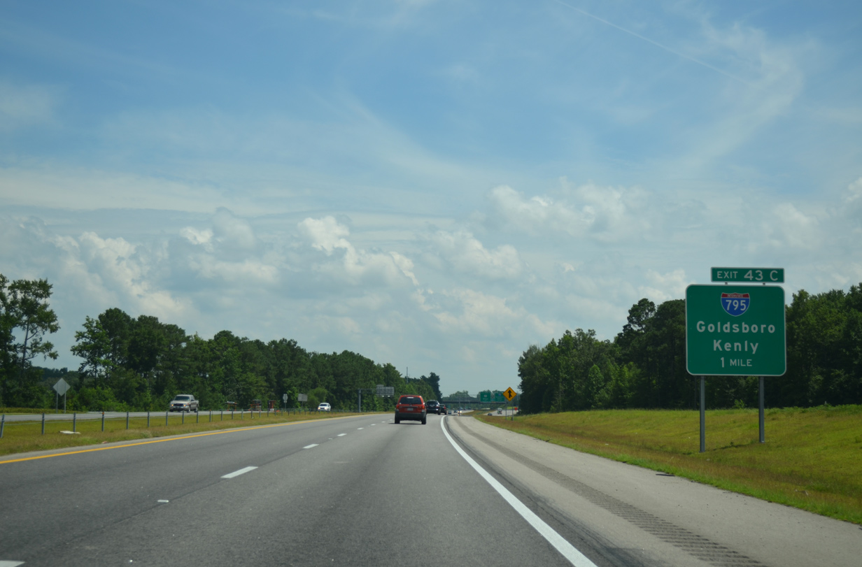
Interstate 795 south and I-587/U.S. 264 east part ways at a wye interchange (Exit 43 C) in one mile.
07/28/13

Interstate 795 overtakes the freeway formerly leading U.S. 117 south to Goldsboro. Exit 5 nearby joins I-795 with U.S. 301 leading southwest to Kenly, while I-587/U.S. 264 meet the route directly at Exits 43 B/A.
07/28/13

An extra trailblazer for I-795 appears near the Wiggins Mill Road (SR 1103) overpass. I-795 was established southward in 2007, with the route signed with shields only.
07/28/13

I-587/U.S. 264 continue east around the south side of Wilson en route to Greenville while I-795 turns southward paralleling U.S. 117 to Fremont, Pikeville and U.S. 70 at Goldsboro.
07/28/13
South
08/28/21

08/28/21
08/28/21

08/28/21

08/28/21

08/28/21

08/28/21
08/28/21

08/28/21

12/14/17

Part of Future Interstate 42, U.S. 70 Bypass is a 19.71 mile long freeway passing north of Goldsboro between Rosewood and La Grange
08/28/21
The cloverstack interchange (Exit 22) joining I-795 with U.S. 70 Bypass lies adjacent to an exchange with U.S. 117 at Belfast.
08/28/21

08/28/21
Interstate 42 will supersede U.S. 70 Bypass and U.S. 70 west to I-40 at Canton.
08/28/21

08/28/21
12/14/17

12/14/17
U.S. 70 remains to the south along Grantham Street leading east into Goldsboro.
12/14/17

U.S. 70 combines with U.S. 13/117 nearby along an older expressway bypass of Downtown Goldsboro.
12/14/17

U.S. 70 travels west from Goldsboro to I-95 at Smithfield and from there to Raleigh.
12/14/17

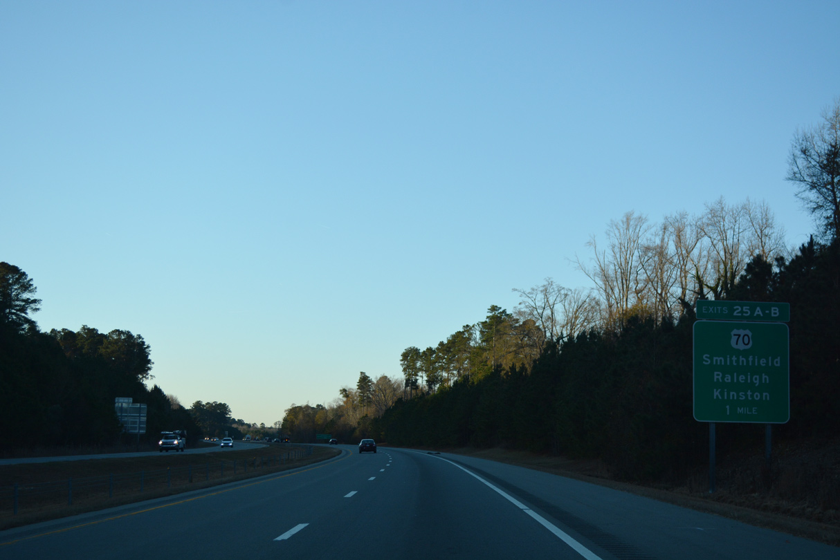
Exit 25B loops onto U.S. 70 east toward Downtown Goldsboro. Kinston is better served by U.S. 70 Bypass.
12/14/17

The freeway extends beyond the end shield for I-795 as NC 581 Connector for 0.62 miles to NC 581 (W Ash Street).
12/14/17

A Future I-795 sign was added along NC 581 CTR in late 2017. NC 581 leads direct onto U.S. 13/117, which parallel just to the east.
12/14/17

NC 581 ties into NC 581 Connector along Ash Street from Rosewood to the west.
12/14/17

Ash Street (SR 2075) continues east directly into Downtown Goldsboro.
12/14/17
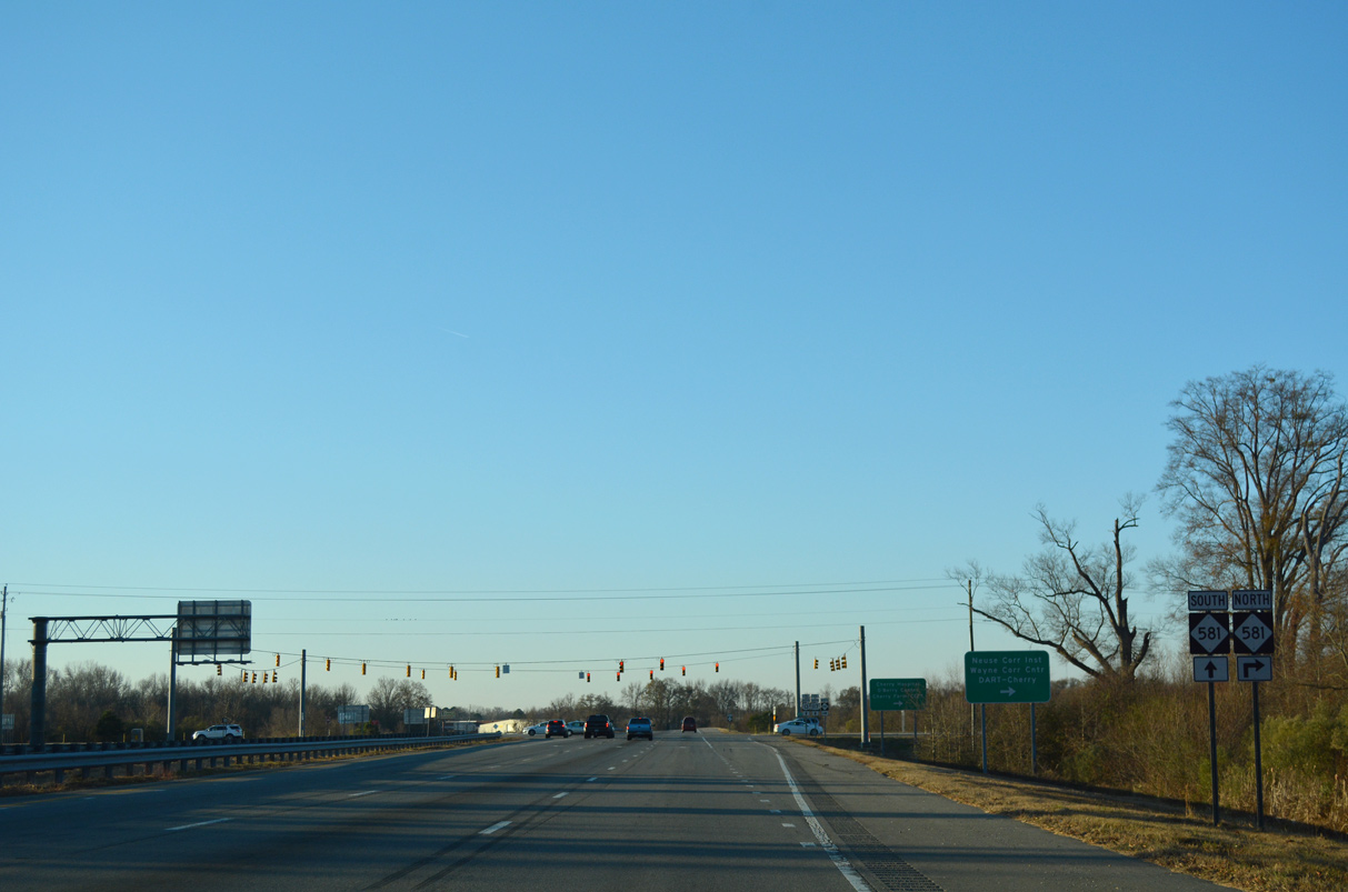
NC 581 turns south at the freeway end 0.45 miles to U.S. 13/117.
12/14/17

NC 581 overlaps with U.S. 13/117 south to Arrington Bridge Road as part of a bypass route of Goldsboro and Seymour Johnson Air Force Base.
12/14/17
Connect with:
Interstate 95
U.S. 70
U.S. 117
U.S. 264
U.S. 301
Page Updated 12-09-2022.