| Route Number |
Names |
West or South End |
East or North End |
Mileage |
| 61 |
Pali Hwy; Kalanianaole Hwy; Kailua Rd |
Route 98 (Vineyard Bl) at Pali Hwy (CR 7505) |
Kaulua
Hamakua Dr (CR 6010) at Kainehe St |
10.60 |
| 63 |
Kalihi St; Likelike Hwy |
Route 92 (Nimitz Hwy) at Kalihi St (CR 7430) |
Route 83 (Kahekili Hwy / LikeLike Hwy) |
8.28 |
| 64 |
Sand Island Pkwy; Sand Island Access Rd |
end of state maintenance on Sand Island Pkwy |
Route 92 (Nimitz Hwy) |
2.60 |
| 65 |
Kaneohe Bay Dr; Mokapu Saddle Rd; Mokapu Blvd |
Route 83 (LikeLike Hwy) at Kamehameha Hwy (Route 83 south / CR 6510)
|
Kalaheo Av (CR 6012) at Mokapu Rd (CR 6015) |
4.15 |
| 72 |
Kalanianaole Hwy |
end of Interstate H1 and Ainakoa Dr (CR 7941) |
Route 61 (Kalanianaole Hwy / Kailua Rd) |
18.44 |
| 76 |
Fort Weaver Rd; Kunia Rd |
end of state maintenance near Popoi Pl |
Exit 5 of Interstate H1 at Route 750 (Kunia Rd) |
6.64 |
| 78 |
Moanalua Fwy |
Route 99 (Kamehameha Hwy) |
I-H1 and I-H201 |
0.74 |
| 80 |
Kamehameha Hwy |
Interstate H2 at Exit 9 |
Route 99 (Kamanaui Rd) |
1.88 |
| 83 |
Joseph P. Leong Hwy; Kamehameha Hwy; Kahekili Hwy |
Route 99 (Kamehameha Hwy) at Route 930 (Kamananui Rd) |
Route 61 (Kalanianaole Hwy / Pali Hwy) at Auloa Rd (CR 60510) |
43.92 |
| 92 |
Ala Moana Blvd; Nimitz Hwy; Kamehameha-Nimitz Hwy |
Nimitz Hwy gate to Hickam Air Force Base |
Kalakaua Av (CR 7612) at Niu and Pau Streets |
9.26 |
| 93 |
Farrington Hwy |
Interstate H1 at Exit 1 and Route 95 (Kalaeola Bl) |
end of state maintenance on Farrington Hwy at Kaena Point State Park |
19.53 |
| 95 |
Kalaeloa Blvd; Malakole St |
end of state maintenance on Malakole St |
Interstate H1 at Exit 1 and Route 93 (Farrington Hwy) |
2.68 |
| 98 |
Olomea St; Halona St; Vineyard Blvd |
Interstate H1 at Exit 20 B |
Interstate H1 at Exit 22 |
1.79 |
| 99 |
Farrington Hwy; Kamananui Rd; Kamehameha Hwy; Wilikina Dr |
Interstate H1 at Exit 15 and Route 92 (Nimitz Hwy) |
Route 83 (Kaukonahua Rd) and Route 930 (Kamananui Rd) |
23.83 |
| 750 |
Kunia Rd |
Interstate H1 at Exit 5 and Route 76 (Fort Weaver Rd) |
Route 99 (Wilikina Dr) |
8.05 |
| 901 |
Fort Barrette Rd |
Interstate H1 at Exit 2 and Makakilo Dr (CR 8810) |
Route 8940 (Franklin D. Roosevelt Av) at Route 8945 (Enterprise Av) |
1.38 |
| 930 |
Farrington Hwy; Kaukonahua Rd |
transition to Route 93000 (Farrington Hwy) |
Route 83 (Joseph P. Leong Hwy) at Route 99 (Kamehameha Hwy) |
7.92 |
| 7012 |
Whitmore Ave |
Route 80 (Kamehameha Hwy) |
Naval Computer and Telecommunications Area Master Station Pacific |
1.87 |
| 7101 |
Farrington Hwy |
Route 76 (Fort Weaver Rd) at CR 7110 (Farrington Hwy) |
Route 99 (Kamehameha Hwy) |
3.00 |
| 7110 |
Farrington Hwy |
transition to CR 9107 (Farrington Hwy) west of Old Fort Weaver Rd (CR 7147) |
Route 76 (Fort Weaver Rd) at Route 7101 (Farrington Hwy) |
0.60 |
| 7141 |
Iroquois Rd |
Route 76 (Fort Weaver Rd) at Geiger Rd (CR 7140) |
Iroquois Rd Gate to Pearl Harbor Naval Station |
1.51 |
| 7210 |
Moanalua Rd |
transition to CR 7210 south of Puakala St |
Kaimakani St (CR 299005) |
0.115 |
| 7239 |
Ulune St; Halawa Valley Rd |
Route 7241 (Kahuapaani St) |
Halawa Valley St (CR 299010) at Iwaiwa St |
0.32 |
| 7241 |
Kahuapaani St; Halawa Heights Rd |
Salt Lake Bl (CR 7311) |
Camp HM Smith |
2.32 |
| 7310 |
Puuloa Rd |
Route 92 (Nimitz Hwy) at Lagoon Dr |
Interstate H201 at Route 7345 (Jarrett White Rd) |
1.03 |
| 7345 |
Jarrett White Rd |
Interstate H201 at Route 7310 (Puuloa Rd) |
Tripler Army Medical Center |
0.55 |
| 7350 |
Bougainville Dr |
Route 7351 (Radford Dr) |
CR 7311 (Salt Lake Bl) |
0.59 |
| 7351 |
Radford Dr |
Route 99 (Kamehameha Hwy) at gate to Makalapa Naval Res. |
Bougainville Dr (Route 7350 north / CR 211003 south) |
0.23 |
| 7401 |
Kamehameha Hwy |
Interstate H1 at Exit 18 B |
east of Kalihi Stream bridge
transition to CR 7401 |
0.10 |
| 7413 |
Liliha St |
Dillingham Bl (CR 7401) |
Interstate H1 overpass |
0.35 |
| 7415 |
Middle St |
Kamehameha Hwy (Route 7401) |
Kaua St (CR 7346) |
0.51 |
| 7526 |
Lunalilo St |
Ernest St |
Interstate H1 at Exit 23 |
0.60 |
| 7601 |
Old Waialae Rd; King St |
King St (CR 7402) |
Kapiolani Bl (CR 7503) at Waialae Av (CR 7801) |
0.41 |
| 7801 |
Waialae Av |
17th Av |
19th Av |
0.12 |
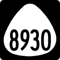
| 8930 |
Kualaka'i Pkwy |
Kapolei Parkway |
Interstate H1 at Exit 3 |
2.24 |
| 8940 |
Franklin D. Roosevelt Ave |
end of road west of Kamokila Bl (CR 8915) |
Essex Rd at Geiger Rd (CR 7140) |
3.44 |
| 8945 |
Enterprise Ave |
Midway St / Barbers Point NAS |
Route 901 (Fort Barrett Road) at Route 8940 (Franklin D. Roosevelt Av) |
0.98 |
| 8955 |
Coral Sea Rd |
Hamilton Rd / Barbers Point NAS |
Route 8940 (Franklin D. Roosevelt Av) |
2.69 |
| 9107 |
Farrington Hwy |
Kalaeloa Bl at Farrington Hwy north of I-H1's west end |
Kamokila Bl transition to Farrington Hwy south of Makakilo City |
0.67 |
| 93000 |
Farrington Hwy |
End of Farrington Hwy / transition to 4wd trail |
End of Route 930 (Farrington Hwy) |
1.554 |
| Interstate Route Mileage |
| H1 |
Lunalilo Freeway; Queen Liliuokalani Freeway |
Route 93 / near Makakilo City |
Route 72 / near Waialae |
27.16 |
| H2 |
Veterans Memorial Freeway |
Interstate H1 / near Pearl City |
Route 99 / Wahaiwa |
8.33 |
| H3 |
John A. Burns Freeway |
I-H1/201 / Halawa |
Kaneohe MCBH |
15.32 |
| H201 |
Moanalua Freeway |
I-H1/Route 78 / Aiea |
Interstate H1 |
4.38 |
| Source: GIS file, DOT Road Inventory (State Routes) for the main Hawaiian Islands, State of Hawaii Dept. of Transportation, August, 2011. |
Historical state route information provided by the 1970 Hawaii State Official Transportation Map and Larry Epstein.
|
| Route 930 carries Kamehameha Highway a short distance west from the shared end point of Route 83 (Joseph P. Leong Highway) and Route 99 (Kamehameha Highway) to Weed Circle. Kamehameha Highway turns north at Weed Circle to Hale'iwa. 07/29/10 |
|
| Route 930 leaves Weed Circle beyond Waialua Beach Road for Kaukonahua Road south to Kamo'oloa. 01/18/11 |
|
| Route 930 follows Kahukonahua Road south to Farrington Highway at Thomson Corner. 01/18/11 |
|
| Reassurance shield posted for Route 930 along Kahukonahua Road south at the Kamo'oloa community. 01/18/11 |
|
| Route 930 turns west onto Farrington Highway at County Route 803. Route 803 continues Kaukonahua Road southeast to Route 99 by Schofield Barracks. 01/18/11 |
|
| Route 930, signed erroneously here with a TO banner, follows Farrington Highway west from the stop sign with Route 803 (Kaukonahua Road) to Waialua and Dillingham Kawaihapai Air Field (HDH). 01/18/11 |
|
| Route 801 connects Route 803 (Wilikina Drive) with Route 99/80 north of Wahiawa. The county highway traverses low rolling pasture land. 01/17/11 |
|
| Kaukonahua Road turns southeast from Route 930 and Farrington Highway at Thomson Corner to Route 99 (Kamananui Road) and Route 80 (Kamehameha Highway). 01/17/11 |
|
| Route 99 (Kamananui Road) overtakes Kamehameha Highway north from Route 80 nearby en route to Haleiwa. Southward, Route 99 bypasses Wahiawa to Wilikina Drive and Schofield Barracks. Route 801 converges with Route 80 (Kamehameha Highway) south ahead of Wahiawa. 01/17/11 |
|
| County Route 803 is a rural highway continuing Wilikina Drive northwest from Route 99 (Kamananui Road) to Kaukonahua Road. Route 803 joins the Schofield Barracks area with Farrington Highway near Waialua. 01/17/11 |
|
| Heading southeast from Thomson Corner and Route 930 (Farrington Highway) along County Route 803. 01/18/11 |
|
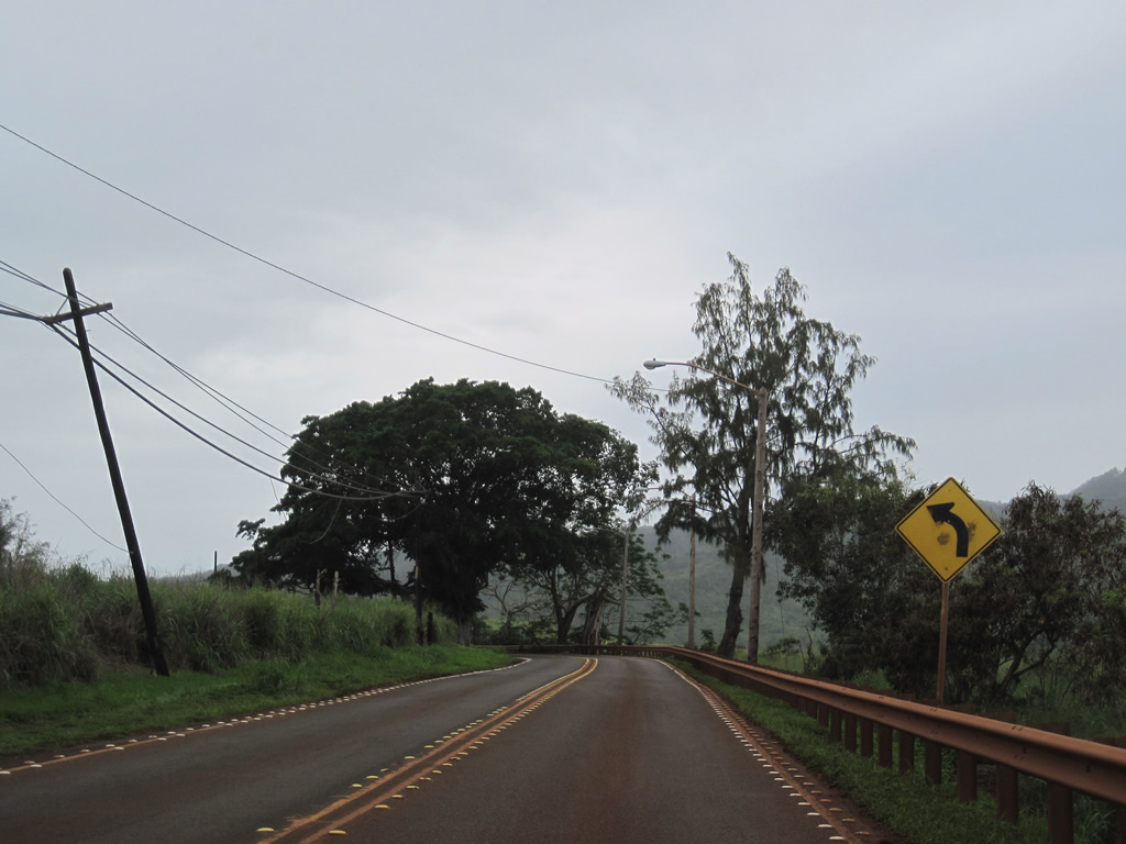
| Route 803 (Kaukonahua Road) makes a number of S-curves southeast along agricultural areas. 01/18/11 |
|
| 4,030 feet above sea level, Kaala peak rises to the west of the farm land along Kaukonahua Road. An FAA radar installation is visible on the summit. 01/18/11 |
|
| A straight stretch of Kaukonahua Road precedes the gated Poamoho Street. 01/18/11 |
|
| Foothills of Kaala peak rise to the west of Kaukonahua Road as Route 803 advances toward the Wahiawa area. 01/18/11 |
|
| Route 803 navigates through several additional curves as Route 803 diverges from parallel Kaukonhahua Stream into more farm land. 01/18/11 |
|
| Route 803 separate with Kaukonahua Road for Wilikina Drive, with Route 801 continuing Kaukonahua Road directly to Wahiawa and Wilikina Drive turning more south to Schofield Barracks. 01/18/11 |
|
| Route 803 (Wilikina Drive) converges with Route 99 (Kamananui Road) near the North Fork of Kaukonahua Stream. Route 99 overtakes Wilikina Drive southward to Schofield Barracks and Wheeler Army Airfield. 01/18/11 |
|
| Route 99 turns northeast from Wilikina Drive along Kamananui Road to Kamehameha Highway (Route 80). 01/18/11 |
|
| Kamehameha Highway through Hale'iwa crosses the Anahulu River over a concrete arch bridge constructed in 1921. Route 83 was relocated off this stretch of Kamehameha Highway to Joseph P. Leong Highway in 1993. 07/29/10 |
|
| Kamehameha Highway crosses the Anahulu River at Haleiwa along a concrete arch bridge constructed in 1921. 01/18/11 |
|
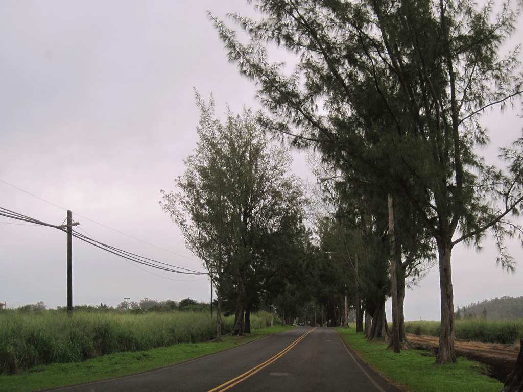
| Heading south from Haleiwa, Kamehameha Highway enters an agricultural area between Achiu Lane and Paalaa Road. A seasonally operated traffic light is located at a farm access road amid the fields. 01/18/11 |
|
| Succeeding bridges dating from 1928 take Kamehameha Highway across Opaeula and Helemano Streams ahead of Weed Circle. 01/18/11 |
|
| Mile 0 of Route 8300 on Kamehameha Highway stands at Weed Circle. Weed Circle joins Kamehameha Highway south with Waialua Beach Road (Route 9262) west Route 930 (Kaukonahua Road). 01/18/11 |
|
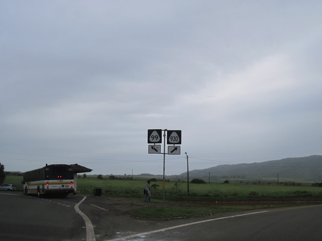
| A Route 99 shield appears at the partition of Kamehameha Highway into one way traffic for Weed Circle. Route 930 overlays the short section of Kamehameha Highway linking the segment on Route 8300 with the continuation southeast as Route 99. 01/18/11 |
|
| Motorists enter Weed Circle ahead of the turn onto Waialua Beach Road (Route 9262 / former Route 82) west to Mokuleia. A Route 83 shield is posted at the circle despite the relocation of the state route to bypass Haleiwa in 1993. 01/18/11 |
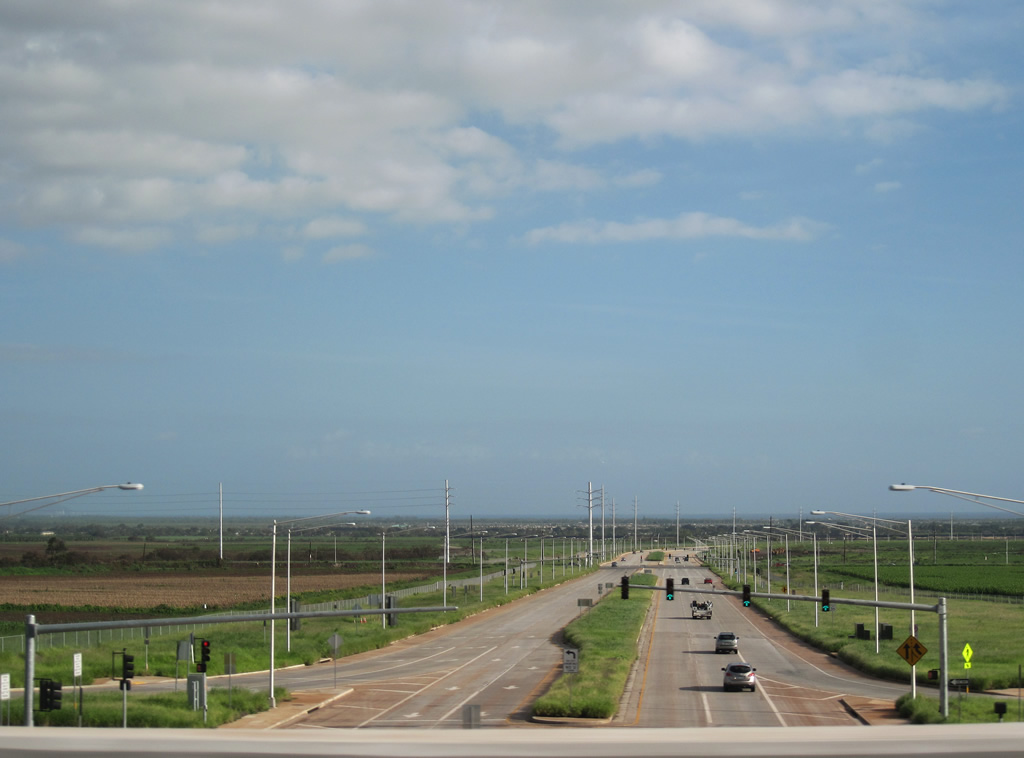
Southward view of Kulalakai Parkway from Interstate H1. Photo taken January 17, 2011.
Kulalakai Parkway is a new state route completed by February 2010 to join Interstate H1 (Exit 3) with Kapolei Parkway. The arterial was built for planned development in the area.
|
| Route 8930 northbound shield posted along Kulalakai Parkway after the signalized intersection with Farrington Highway. This stretch of roadway opened in February 2010. 01/18/11 |
|
| The diamond interchange (Exit 3) joining Kulalakai Parkway (Route 8930) north with Interstate H1 follows traffic lights for farm access. 01/18/11 |
|
| The exchange with I-H1 opened in February 2010 to open rural lands along new Kulalakai Parkway for development. The freeway stretches five miles east to Interstate H2 at Waipahu. 01/18/11 |
|
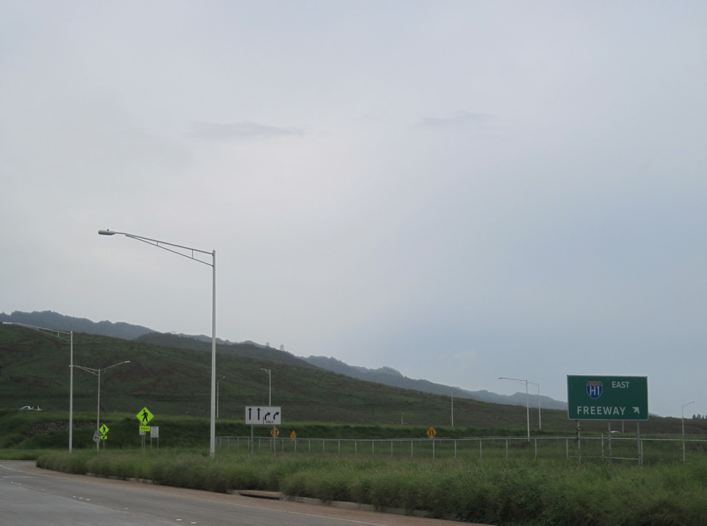
| Original guide signage for Interstate H1 east referenced freeway in place of Honolulu. 01/18/11 |
|
| Kulalakai Parkway passes under Interstate H1 ahead of the westbound entrance ramp to Kapolei, Barbers Point and Waianae. 01/18/11 |
|
| Interstate H1 westbound continues a mile to the Makakilo Interchange. A private road ties into the exchange with Kualakai Parkway from the north. 01/18/11 |
Page Updated 02-03-2012.