View of the Colorado Springs skyline to the east of Interstate 25 at Colorado Avenue. 11/11/03
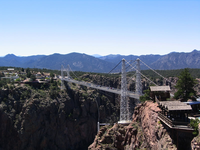
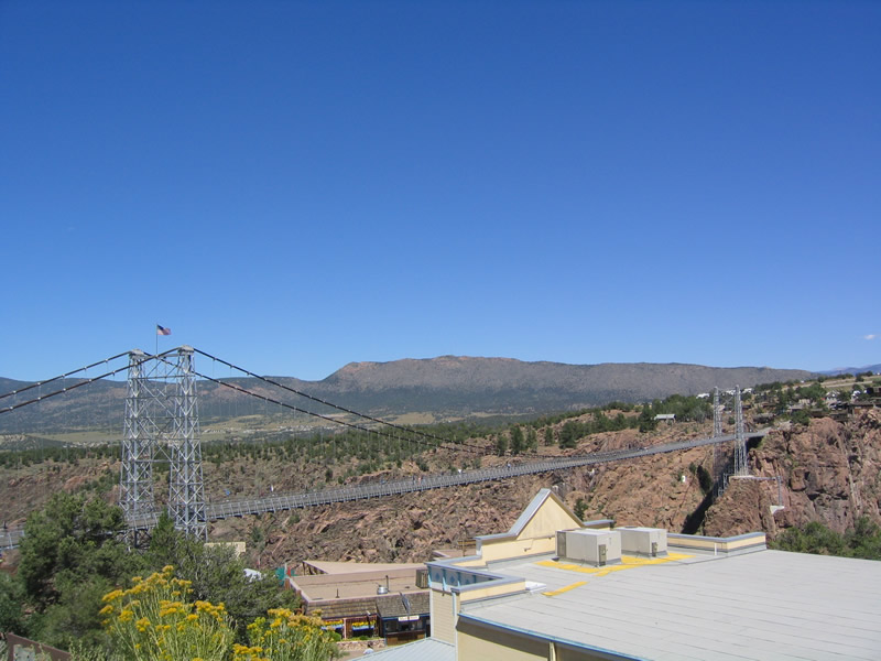
Built in 1929 and located in Fremont County, the Royal Gorge Bridge was constructed to span the narrow, yet deep chasm that funnels the Arkansas River through the Rocky Mountains.
|
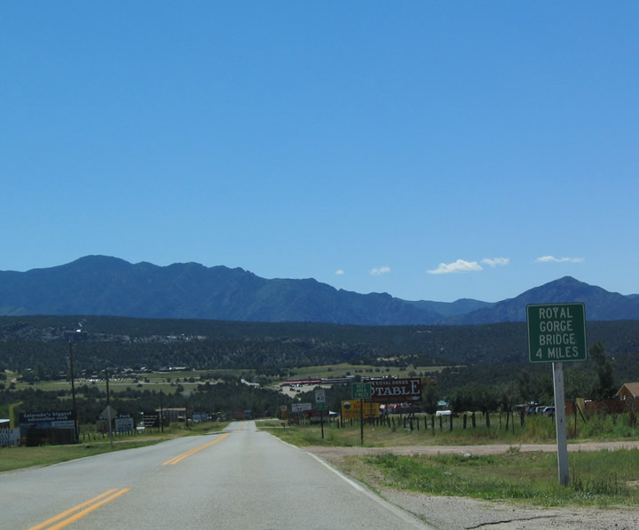
| Fremont County 3A spurs 4.3 miles south from U.S. 50 south to the Royal Gorge Bridge. While most motor vehicles are prohibited from using the suspension bridge, pedestrians and bicyclists are welcome on the bridge. A large parking area is located adjacent at the south end of County Route 3A. 08/28/04 |
|
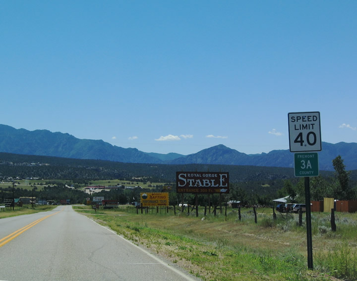
| Fremont County 3A reassurance shield posted south of U.S. 50. Unlike many other counties in Colorado that use the standard blue and yellow pentagon marker, Fremont County uses a green square shield for its signed county road network. 08/28/04 |
|
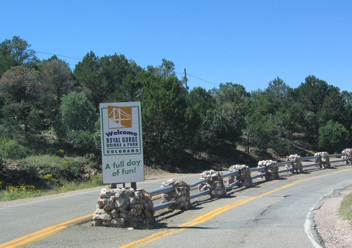
| CR 3-A ends at the north entrance into Royal Gorge Bridge and Park. 08/28/04 |
|
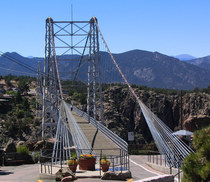
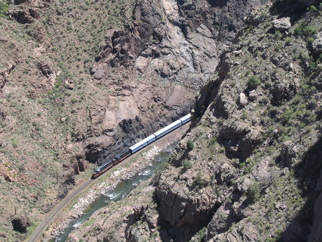
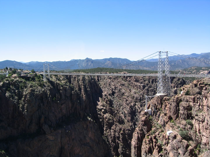
| This view looks south at the Royal Gorge Bridge. Known as the Grand Canyon of the Arkansas River, the Royal Gorge is notable for being extremely deep yet very narrow, as the canyon floor is only about 50 feet wide on average and several hundred feet wide on top. With a depth of over one thousand feet, the canyon is that much more impressive and beautiful. 08/28/04 |
|
| The Royal Gorge Bridge has a wood deck. When permitted cars, golf carts, and bicycles travel the bridge. According to the official web page, the walkway is made of 1,292 wooden planks on top of over 1,000 tons of steel that serve as the floor of the bridge. Even more striking is the superstructure of the bridge, which incorporates 2,100 strands of No.9 galvanized wire, weighing over 300 tons. 08/28/04 |
|
| The towers of the suspension bridge rise 150 feet, supporting what is generally regarded as the world's tallest suspension bridge. The main span between the two towers is 800 feet long, and the total length of the bridge including the approaches is 1,260 feet. 08/28/04 |
|
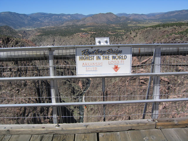
| Below the midpoint of the Royal Gorge Bridge, the Arkansas River churns 1,053 feet below the bridge deck, over one-fifth of a mile down! 08/28/04 |
|
| Visible at mid span, the bundled strands of wire that keep the bridge suspended above the Arkansas River. The theme of the bridge's design appears to incorporate the simplicity of the structure without covering the components that support the bridge. As a result, the bridge towers and cables are immediately visible and recognizable for their role in supporting the bridge. 08/28/04 |
|
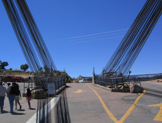
| Now at the south end of the bridge, the cables anchor into these two points. A roadway continues from this end, connecting to a continuation of County Road 3A and eventually County Road 3. This road continues to loop back to U.S. 50 near the confluence of the Arkansas and Currant Rivers. Since vehicular access to the bridge is limited, it is best to visit the bridge from either County Route 3A from the northeast or County Route 3 from the northwest. 08/28/04 |
|
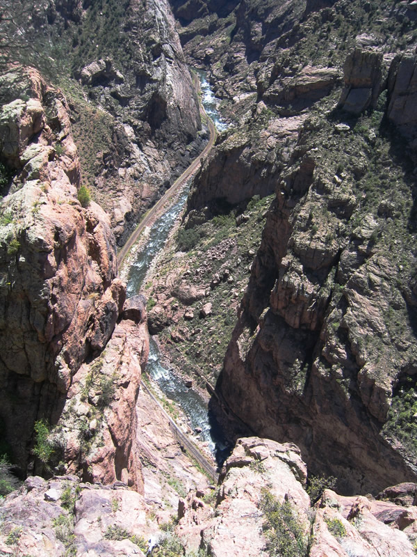
| Looking down from near the midpoint of the Royal Gorge Bridge are these views of the Royal Gorge. The river and railroad are squeezed into a very tight canyon. Royal Gorge Park offers an incline rail that takes visitors to the bottom of the gorge. The incline is very steep due to the limited room in the canyon. 08/28/04 |
|
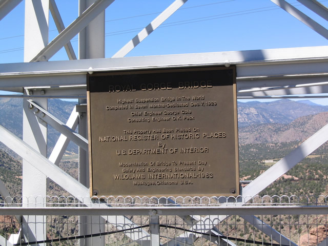
| A plaque on the bridge commemorates the registration of the Royal Gorge Bridge on the list of National Historic Places. Built in 1929 for $350,000, the bridge would cost over $20 million in 2000 dollars (based on the official web page). 08/28/04 |
|
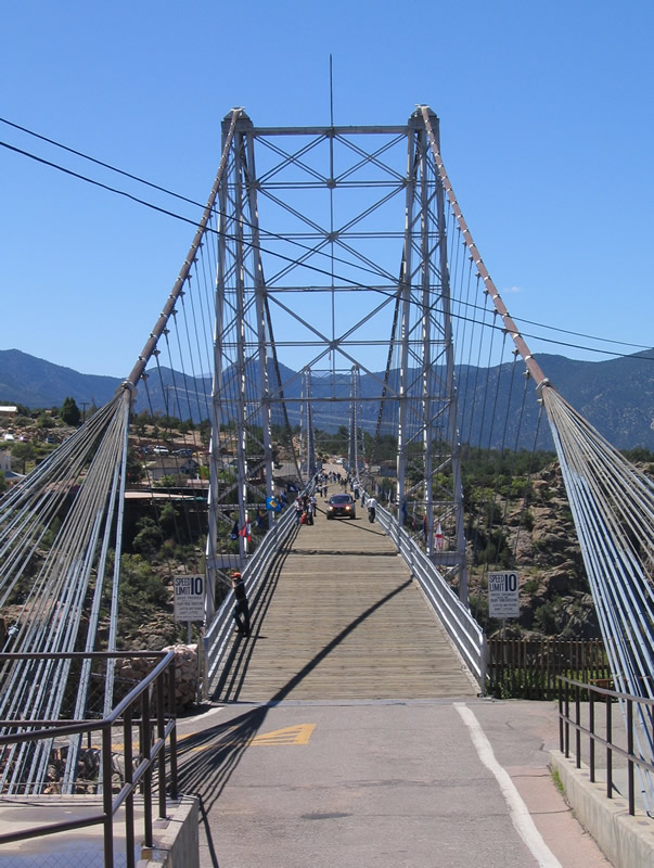
| Looking northward at the Royal Gorge Bridge, the towers are topped with an American flag. A flag from each of the 50 states is flown along both sides of the bridge. They are positioned in alphabetical order. 08/28/04 |
|
| Viewing the Royal Gorge Bridge from nearby overlooks. A cable car ferries passengers across the gorge to the east of the suspension bridge. 08/28/04 |
Page Updated 05-05-2017.