SR 7 stretches 72.99 miles across Northern Virginia from U.S. 11/522 (Cameron Street) in Winchester east to SR 400 (Washington Street) in Alexandria. The route constitutes a four lane highway east from Winchester across Clarke County with an expressway bypass of Berryville. A second stretch of limited access highway takes SR 7 from Purcellville to Leesburg in Loudon County.
SR 7 overlaps with U.S. 15 around Leesburg to a separate expressway along Market Street E. Continuing east past Ashburn, SR 7 (Harry Byrd Highway) remains with limited access to the north end of SR 28 at Sterling, and with controlled access to Potomac View Road (SR 637) by the Loudon Campus of Northern Virginia Community College.
Following Leesburg Pike, SR 7 is a suburban arterial leading southeast past Herndon, Reston and Great Falls to the commercial center at Tysons. SR 7 continues through Fairfax County to the independent city of Falls Church, Baileys Crossroads and Shirlington. Entering the independent city of Alexandria, SR 7 lines King Street to Downtown.
|
| SR 7 meets Interstate 81, 1.82 miles east from U.S. 11/522 (Cameron Street) in Winchester. I-81 runs along the east side of the city southward 15 miles to Interstate 66. 07/16/05 |
|
| SR 7 (Berryville Avenue) leaves the Winchester city limits at the folded diamond interchange (Exit 315) with Interstate 81. 07/16/05 |
|
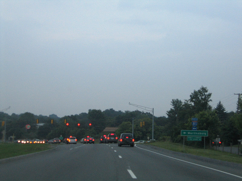
| Interstate 81 continues 8.63 miles north from the exchange with SR 7 (Berryville Pike) and Valley Mill Road (SR 659) to the West Virginia state line ahead of Martinsburg. 07/16/05 |
|
| SR 7 (Berryville Pike) advances eight miles east from I-81 to Berryville. Heavy development lines the ensuing stretch. Winchester Gateway was added after 2005, along with a traffic light between the two curves pictured here. 07/16/05 |
|
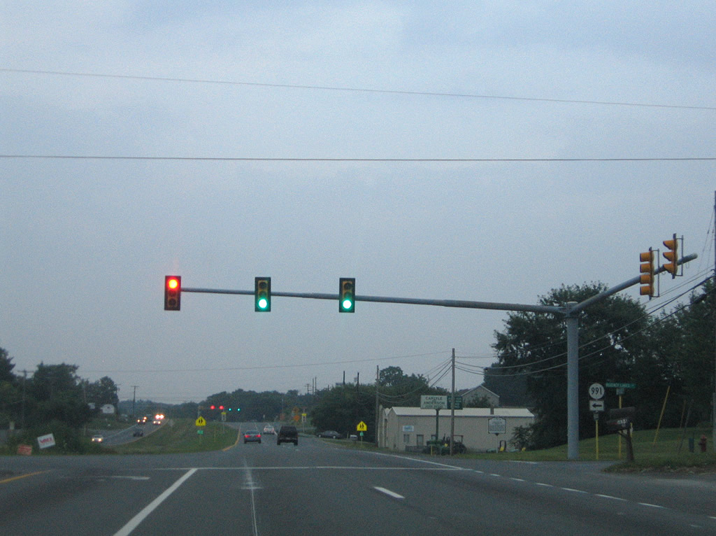
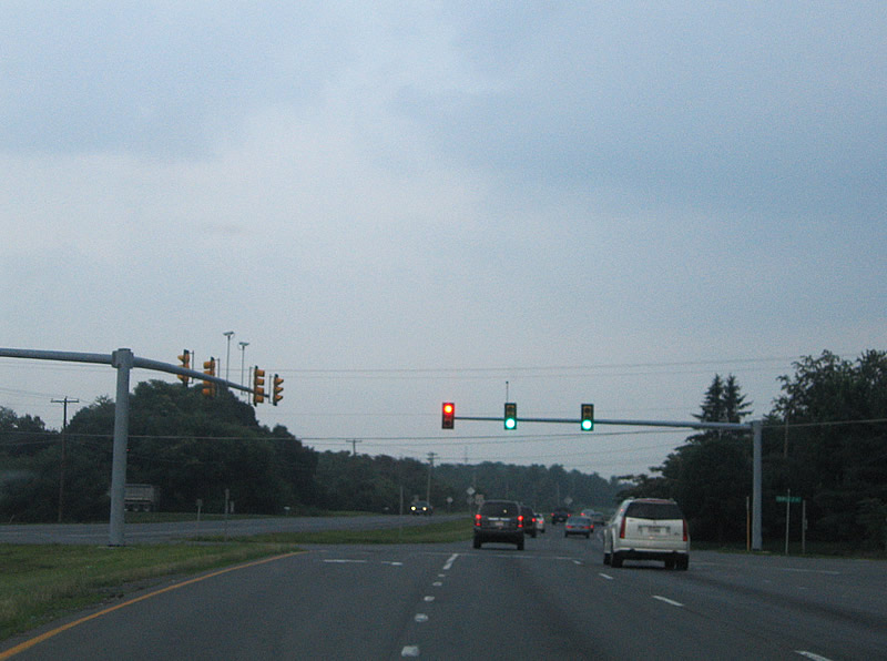
| SR 7 (Berryville Pike) passes through several signalized intersections through the eastern suburbs of Winchester. SR 991 (Regency Lakes Drive) spurs northward to form a loop serving a near subdivision. 07/16/05 |
|
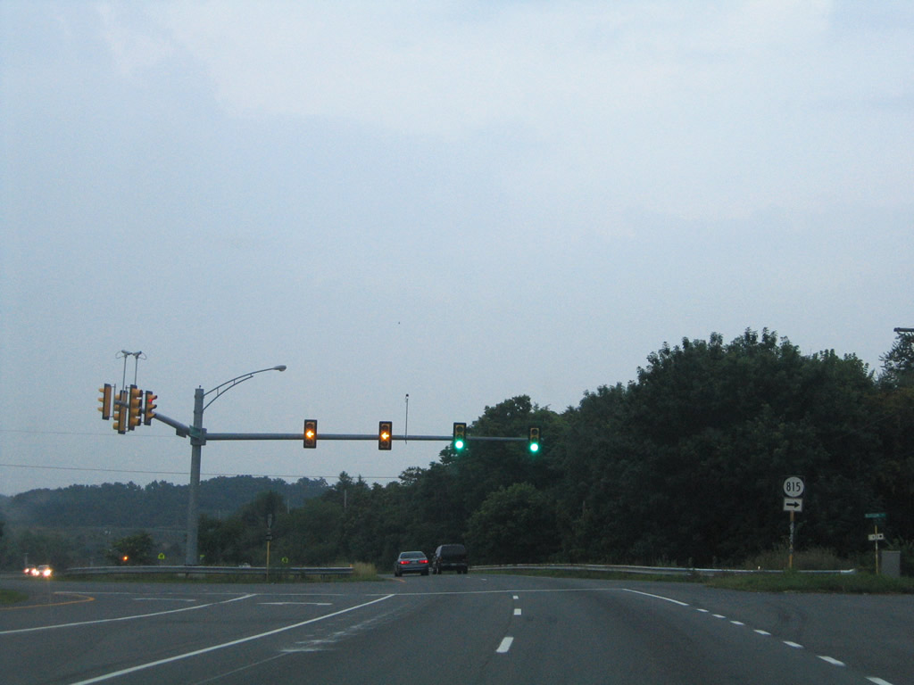
| Millbrook and Blossom Drives come together at the succeeding traffic light. Blossom Drive is SR 815, a residential street. 07/16/05 |
|
| Crossing Opequon Creek, SR 7 (Berryville Pike) leaves suburbanized Frederick for a rural stretch across Clarke County. 07/16/05 |
|
| Midway between SR 645 (Wrights Mill Road) and SR 635 (Moose Road south / Pierce Road) along SR 7 east, four miles from the Clarke County seat of Berryville. Charlestown (16 miles) and Leesburg (31 miles) follow. 07/16/05 |
|
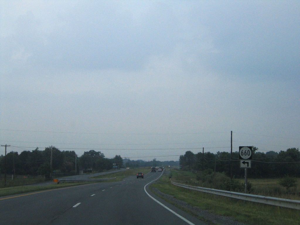
| Russell Road (SR 660) arcs northeast and then west from SR 7 (Berryville Pike) to SR 635 (Pierce Road) and SR 645 (Wrights Mill Road). 07/16/05 |
|
| SR 632 on Triple J Road south and Crums Church Road north intersect SR 7 (Berryville Pike) at the next traffic light. SR 632 heads north to SR 761 near Swimley the state line and southwest a short distance to SR 657. 07/16/05 |
|
| SR 7 splits between a business loop (Main Street) and an expressway bypass outside of Berryville. 07/16/05 |
|
| SR 7 Business (Main Street) loops 3.05 miles across the town of Berryville. The route was established in the early 1970s when SR 7 shifted to the four lane bypass to the north.1
07/16/05 |
|
| SR 7 Business (Main Street) passes through the suburban west side of Berryville before meeting U.S. 340 (Buckmarsh Street) in Downtown. US. 340 enters Berryville from White Post and Boyce to the southwest. 07/16/05 |
|
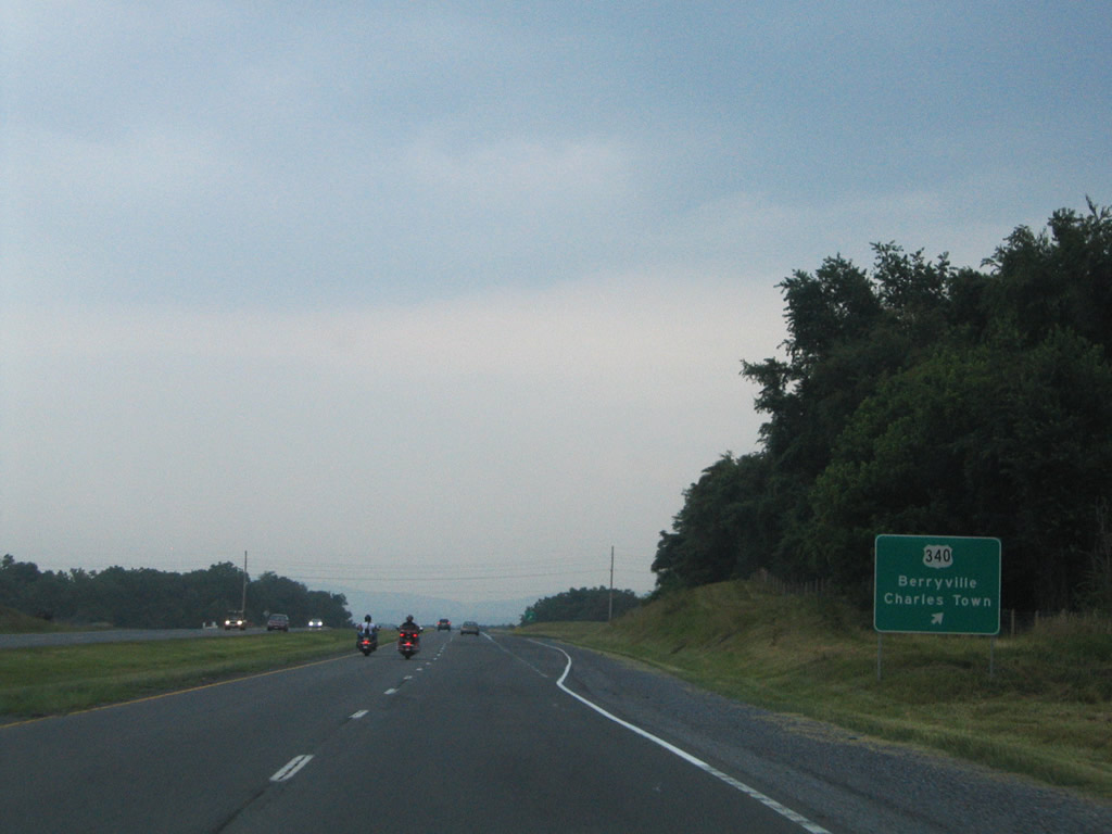
| The expressway bypass along SR 7 (Harry Byrd Highway) connects with U.S. 340 (Lord Fairfax Highway) at a diamond interchange. U.S. 340 heads 4.11 miles north into West Virginia, en route to Charles Town, Harpers Ferry and ultimately Frederick, Maryland. 07/16/05 |
|
| U.S. 340 follows Buckmarsh Street south through the town of Berryville. 07/16/05 |
|
| U.S. 340 originates west of Stuarts Draft in Virginia. The route measures 122.01 miles northeast to Jefferson County, West Virginia. 07/16/05 |
|
| SR 7 (King Street) meets U.S. 1 (Patrick Street) north 0.24 miles west of SR 400 (Washington Street) in Downtown Alexandria. 12/16/16 |
|
| SR 7 (King Street) proceeds west one block to Henry Street south. Patrick Street and Henry Street south form a 12 block couplet for U.S. 1 through Alexandria. 12/16/16 |
|
| SR 7 (King Street) continues west from U.S. 1 (Henry Street) south in Alexandria toward the George Washington Masonic National Memorial. 12/16/16 |
Sources:
- VA 7. Virginia Highways Page.
07/16/05, 12/16/16 by AARoads
Connect with:
Interstate 81
Interstate 395 - Henry G. Shirley Memorial Highway
Interstate 495 / Capital Beltway
U.S. 1
U.S. 340
Page Updated 05-06-2021.