Florida State Road 11 is a rural highway linking the Volusia County seat of DeLand with the Flagler County seat of Bunnell. The two lane route measures 14.32 miles from U.S. 17 north to the Flagler County line, and 15.48 miles from Volusia County to U.S. 1 (State Street) at SR 100 (Moody Boulevard). Historically SR 11 continued 8.2 miles east from Downtown Bunnell along Moody Boulevard to SR A1A at Flagler Beach. This segment was replaced with an extension of SR 100.
|
| SR 11 splits with U.S. 17 (Woodland Boulevard) north in north DeLand. The state road joins the Volusia County seat with Bunnell as U.S. 17 heads northwest to De Leon Springs and Palatka. 03/21/08 |
|
| SR 11 leaves the built up areas of DeLand 1.3 miles north of U.S. 17 (Woodland Boulevard) and advances 30 miles to Bunnell. 03/21/08 |
|
| Volusia County Road 15A (Spring Garden Avenue) provides a truck bypass route around central DeLand for U.S. 17/92. The county road becomes SR 15A south of U.S. 17 (Woodland Boulevard). 03/21/08 |
|
| SR 11's first reassurance marker stands along the road beyond the Volusia County Road 15A north end. CR 15A and SR 15A encircle DeLand southward toward Orange City. 03/21/08 |
|
| Another freeway style guide sign posted for Bunnell on SR 11 north. Bunnell is the Flagler County seat. 03/21/08 |
|
| SR 11 northbound at the east end of unsigned Volusia County Road 4030 (Arredondo Grant Road). Arredondo Grant Road becomes Spring Garden Ranch Road on the westward drive to U.S. 17 at DeLeon Springs. 03/21/08 |
|
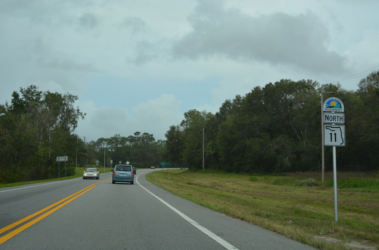
| SR 11 continues 18.2 miles north from SR 40 to U.S. 1/SR 100 at the Bunnell city center. 10/19/17 |
|
| SR 11 travels 15.48 miles within Flagler County, the majority of which either straddles or falls within the Bunnell city limits. 10/19/17 |
|
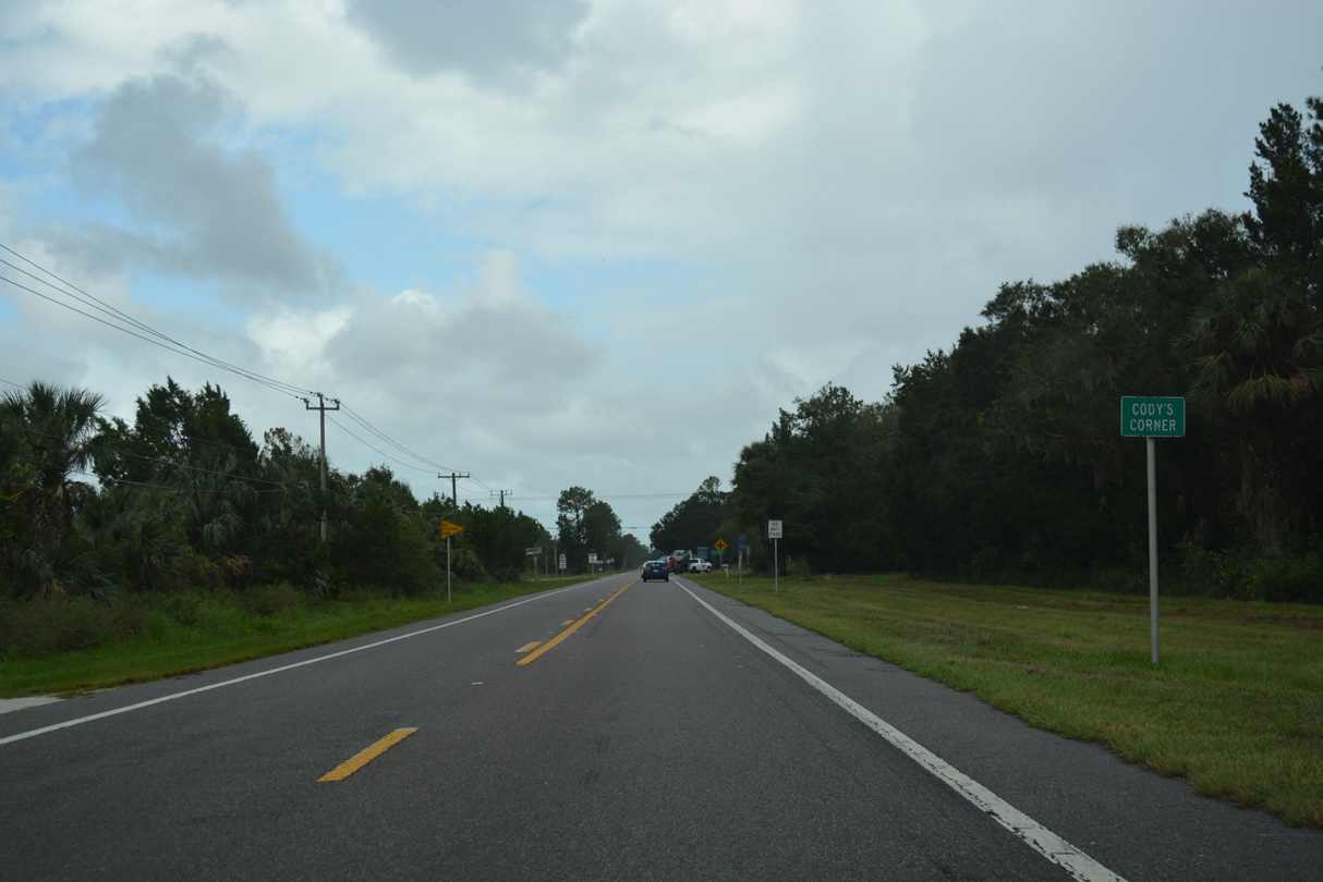
| SR 11 heads north from Relay State Wildlife Management Area to the settlement of Cody's Corner. 10/19/17 |
|
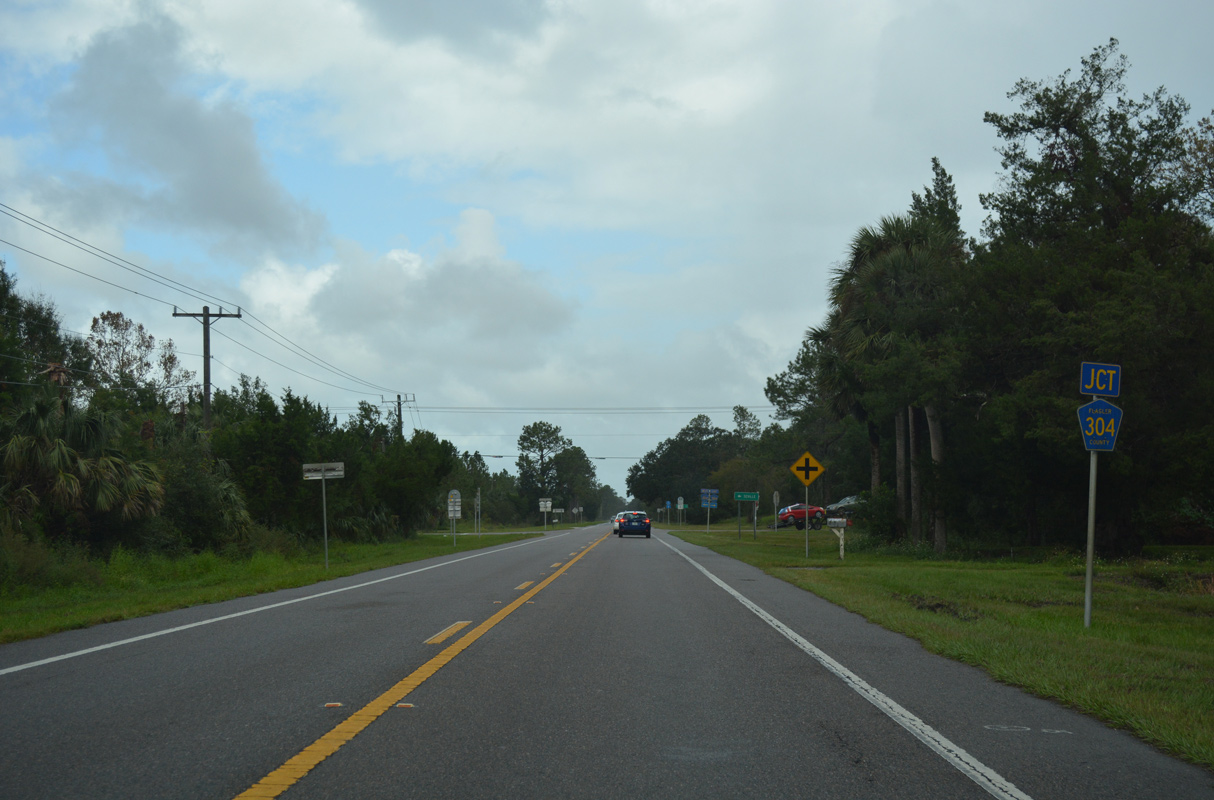
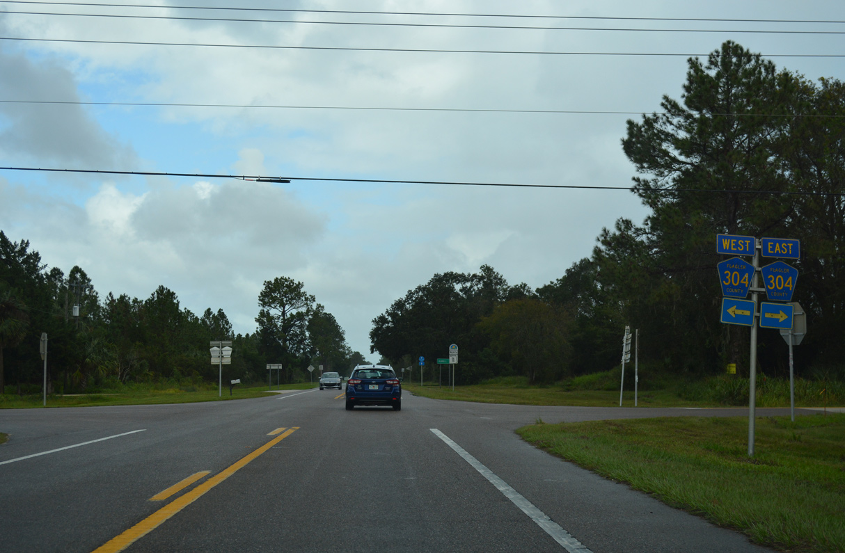
| CR 304 stems east from CR 305 at Deanville to meet SR 11 at Cody's Corner. 10/19/17 |
|
| CR 305 leads west from CR 304 to U.S. 17 at the unincorporated community of Seville. 10/19/17 |
|
| CR 304 travels 10.39 miles northeast from CR 305 to U.S. 1 at Dupont. 10/19/17 |
|
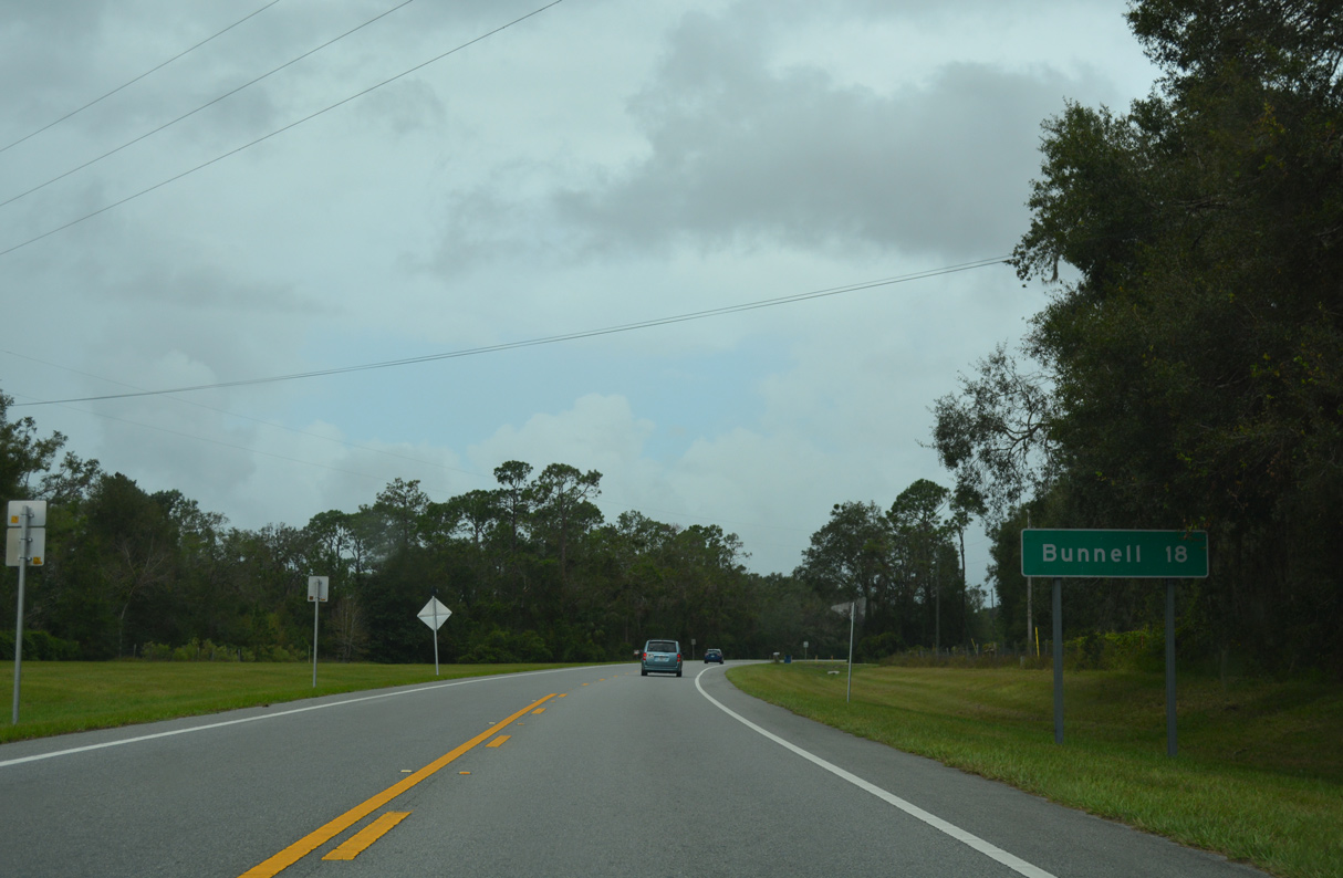
| Advancing north from Cody's Corner, SR 11 crosses Middle Haw Creek on the ten mile stretch leading into Bunnell. 10/19/17 |
|
| SR 11 curves northeast around Sweetwater Swamp midway between Codys's Corner and Bunnell. 10/19/17 |
|
| Crossing Black Branch 10/19/17 |
|
| SR 11 remains a Florida Scenic Highway north into Bunnell. 10/19/17 |
|
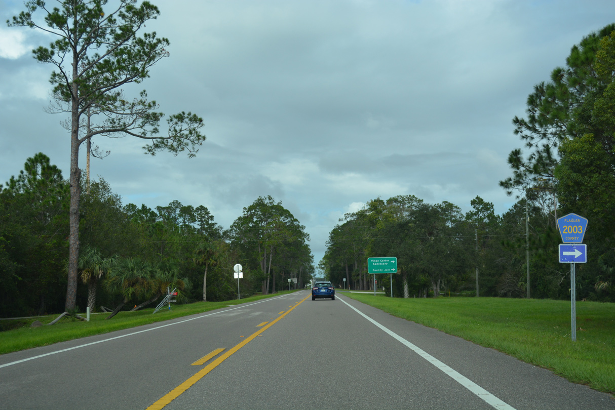
| CR 2003 (Old Haw Creek Road) stems 4.86 miles south from SR 11 to CR 304 within the Bunnell city limits. 10/19/17 |
|
| SR 11 meets U.S. 1 (State Street) and SR 100 (Moody Boulevard) two blocks north of Bunnell City Hall. 10/19/17 |
|
| SR 100 combines with U.S. 1 along State Street north for 0.42 miles. SR 100 east extends Moody Boulevard from SR 11 across Palm Coast to SR A1A at Flagler Beach. 10/19/17 |
|
| U.S. 1 angles southeast from SR 11/100 to Ormond Beach. Beyond their separation, U.S. 1 continues north into Palm Coast while SR 100 heads northwest to U.S. 17 and Palatka. 10/19/17 |
|
| The first confirming marker for SR 11 was previously posted along Moody Boulevard south beyond Forsyth Street. The assembly was removed when a driveway was added for an adjacent house by 2018. 06/14/08 |
|
| SR 11 comprises the first leg of the route leading southeast from Bunnell to Orlando. 06/14/08 |
|
| CR 2003 (Old Haw Creek Road) runs 4.86 miles south from SR 11 to CR 304 in rural areas of the Bunnell city limits. 06/14/08 |
|
| SR 11 spans Black Branch south of CR 2003. 06/14/08 |
|
| Traversing timberland, SR 11 curves southward around Sweetwater Swamp. 06/14/08 |
|
| SR 11 south next crosses Middle Haw Creek. 06/14/08 |
|
| SR 11 crosses paths with CR 304 at the rural settlement of Cody's Corner. 06/14/08 |
|
| CR 304 angles 10.39 miles southwest from U.S. 1 at Dupont and the Palm Coast city line to CR 305 at Deanville. 06/14/08 |
|
| SR 11 continues south from Flagler County Road 304 and Cody's Corner 20.4 miles to U.S. 17 at DeLand. 10/15/17 |
|
| SR 11 turns along a southwesterly course bordering Relay State Wildlife Management Area. 10/15/17 |
|
| State Road 11 remains very rural west of Relay State Wildlife Management Area and east of Lake Disston. 10/15/17 |
|
| Curving southeast, SR 11 crosses Little Haw Creek near the Volusia county line. 10/15/17 |
|
| SR 11 enters northern Volusia County through a vastly undeveloped area of woods and wetlands. 10/15/17 |
|
| The Florida Scenic Highway River of Lakes Heritage Corridor ends along SR 11 south at the Volusia County line. 10/15/17 |
|
| SR 11 parallels Little Haw Creek southward to the rural intersection with SR 40. 10/15/17 |
|
| SR 40 crosses the Florida Peninsula between U.S. 41 north of Dunnellon and SR A1A on Ormond Beach. Locally the route connects with U.S. 17 at Barberville west of Volusia Speedway Park. 10/15/17 |
|
| SR 40 links with Interstate 95 at Exit 268 within the city of Ormond Beach, 13 miles to the east. 10/15/17 |
|
| SR 40 travels west from SR 11 to Silver Springs, Ocala and U.S. 41 in Marion County. A county road branch of CR 40 continues to Yankeetown and Inglis in Levy County. 10/15/17 |
|
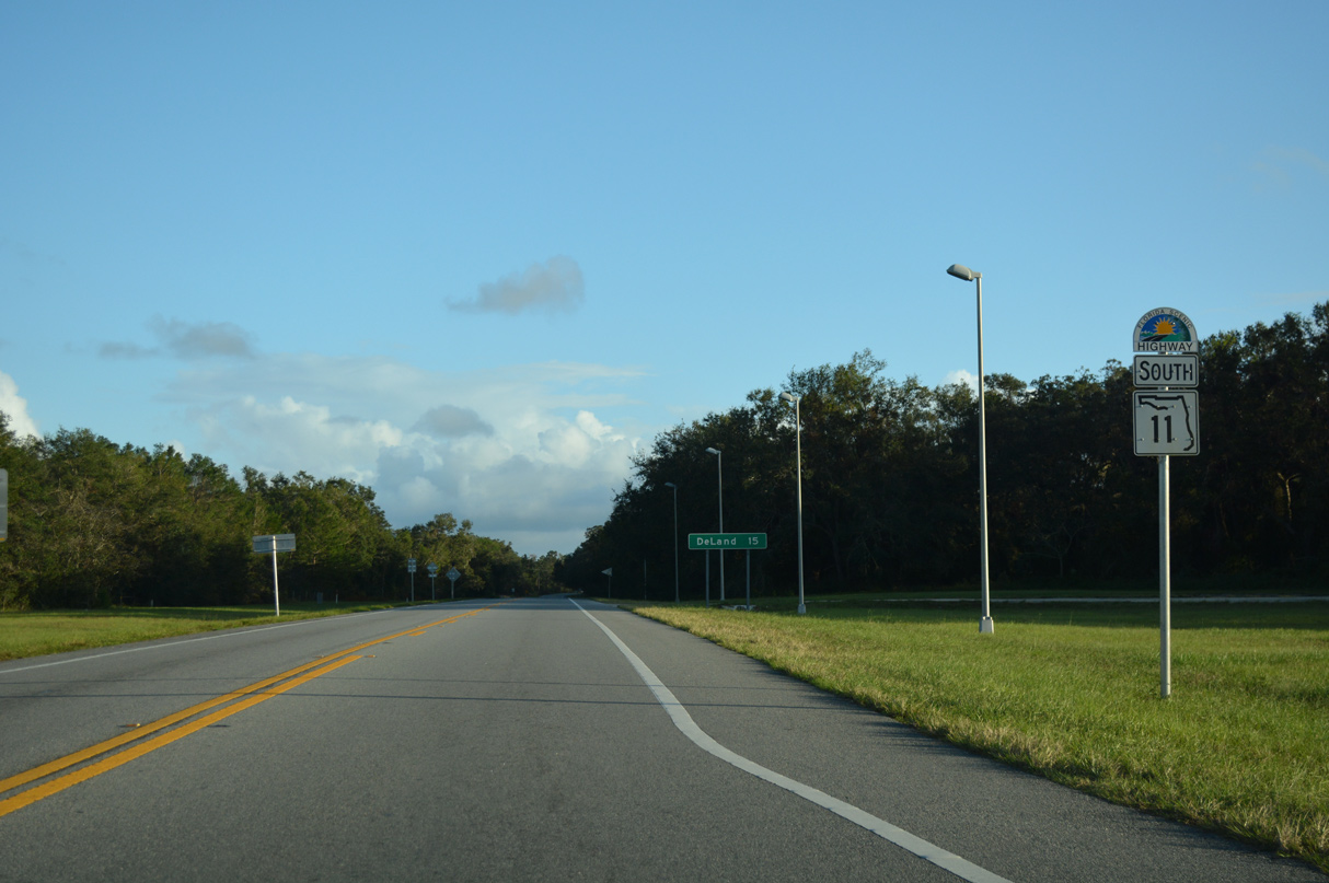
| SR 11 continues 11.5 miles south from SR 40 to U.S. 17 at the Volusia County seat of DeLand. 10/19/17 |
|
| Downtown DeLand lies 14.6 miles south of SR 40 via SR 11 and U.S. 17 (Woodland Boulevard). 10/19/17 |
|
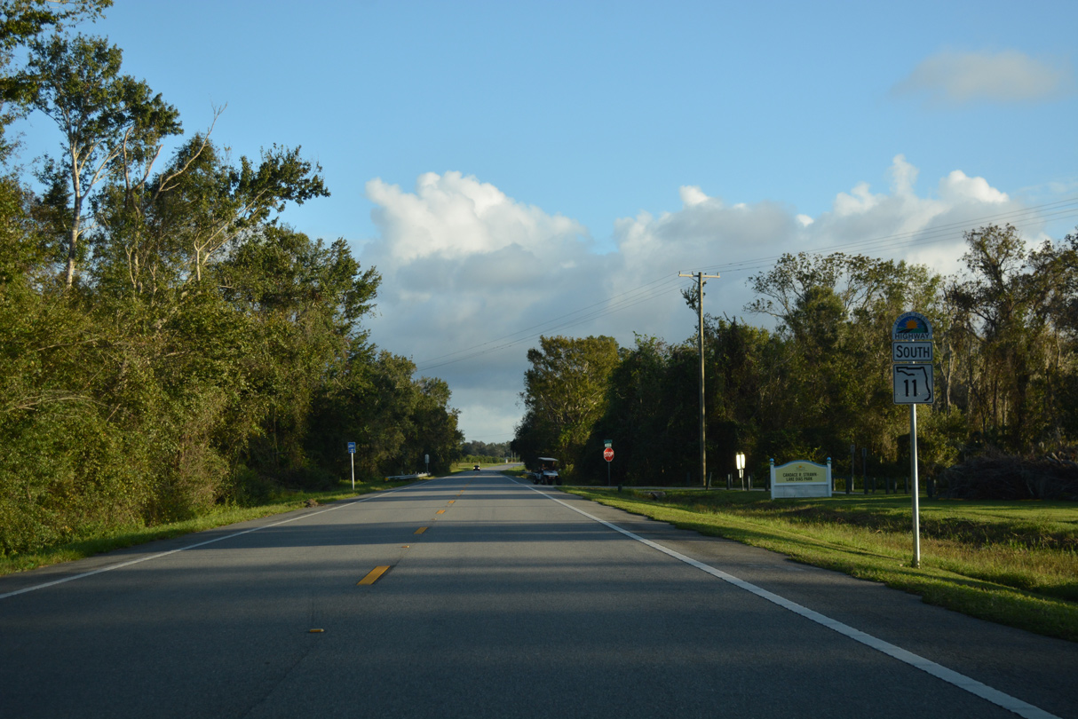
| Passing east of Dan George Lake, SR 11 maintains a rural setting as it progresses south through Volusia County. 10/19/17 |
|
| Reassurance marker posted ahead of Lake Park Road. Lake Park Road loops west to Candace R. Strawn-Lake Dias Park along Lake Dias. 10/19/17 |
|
| SR 11 south passes west of the Tomoka Woods subdivision en route to CR 15A and U.S. 17 to DeLand. 10/19/17 |
|
| Advancing into the DeLand area, truck traffic is diverted from the center of the city onto the Volusia County Road 15A / SR 15A bypass route. 10/19/17 |
|
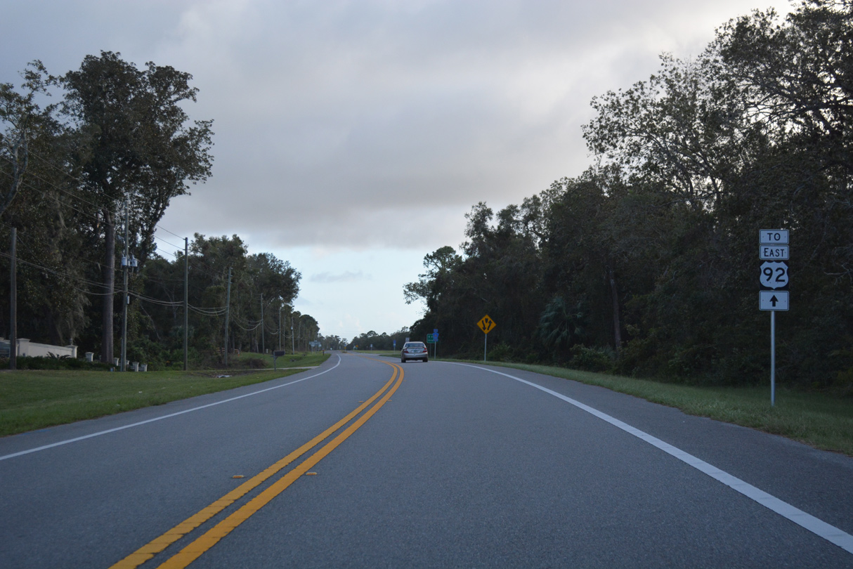
| U.S. 92 (International Speedway Boulevard) branches east from U.S. 17 (Woodland Boulevard), 1.2 miles beyond the south end of SR 11 (Perkins Highway). 10/19/17 |
|
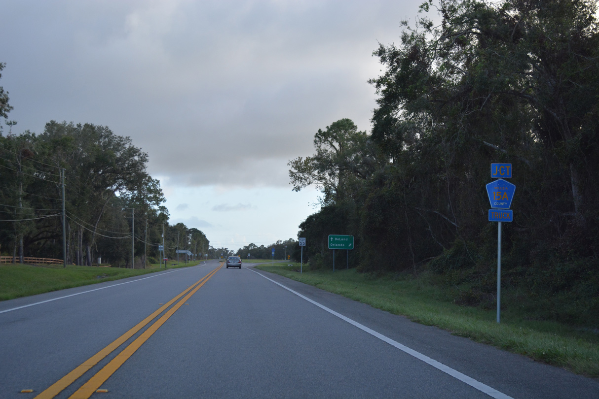
| Connecting SR 11 (Perkins Highway) with U.S. 17, 2.14 miles to the southwest, CR 15A (Spring Garden Avenue) constitutes the northern leg of the DeLand truck bypass. 10/19/17 |
|
| Guide sign directing traffic to Orlando via CR 15A south. The sign is mostly directed toward truckers, as SR 11 south to U.S. 17, and any number of routes, provide connectivity from DeLand to Interstate 4 west for Orlando. 10/19/17 |
|
| A free flowing ramp links SR 11 south with CR 15A (Spring Garden Avenue) by Lake Crystal. The county road portion of the truck bypass only is only two lanes wide while the remainder along SR 15A is a four lane arterial. 10/19/17 |
|
| SR 11 shifts southwest through an S-curve beyond CR 15A between Horseshoe Lake and Twin Lakes. 10/19/17 |
|
| A second reassurance marker for SR 11 stands south of CR 15A (Spring Garden Avenue). 10/19/17 |
|
| Downtown DeLand is five miles to the south along U.S. 17/92 (Woodland Boulevard). 10/19/17 |
|
| Following a series of residential streets, SR 11 converges with U.S. 17 south at Glenwood Road (CR 4088). 10/19/17 |
|
| SR 11 southbound turns west to conclude at U.S. 17 across from Glenwood Road. Glenwood Road (CR 4088) extends 2.74 miles to CR 4053 (Grand Avenue). 10/19/17 |
|
| Locally, U.S. 17 joins SR 11 with DeLand and Orange City to the south and with DeLeon Springs to the north. 10/19/17 |
Page Updated 09-05-2022.

 North
North