Wis 11 is a state trunk highway that travels 157.56 miles east across the extreme southern portion of Wisconsin. Beginning at an interchange with U.S. 61 and U.S. 151 in Grant County, the route makes its way east through the cities of Monroe and Janesville before ending at Wis 32 in the city of Racine, one half mile from the west shores of Lake Michigan.
|
| Reassurance marker for Wis 11 immediately east of its intersection with Wis 35. The state trunk highway shares a brief 0.3 mile alignment with Wis 35, beginning at an interchange with nearby U.S. 61 and U.S. 151. The interchange with the two U.S. Highways is also the western terminus of Wis 11. Wis 35 continues south from Wis 11 for another 0.9 miles to the Illinois state line, where the highway transitions into Illinois 35. Wis 11 continues east from this intersection toward the village of Hazel Green, 9 miles ahead. Janesville, where the trunk highway will share pavement for two miles with Interstates 39 and 90, is 92 miles away. 12/21/09 |
|
| Wis 11 traverses some hilly terrain as it makes its way eastward toward the village of Hazel Green and beyond. Cuts like this one had to be made into the hillside in order to allow the highway to navigate through the terrain. 12/21/09 |
|
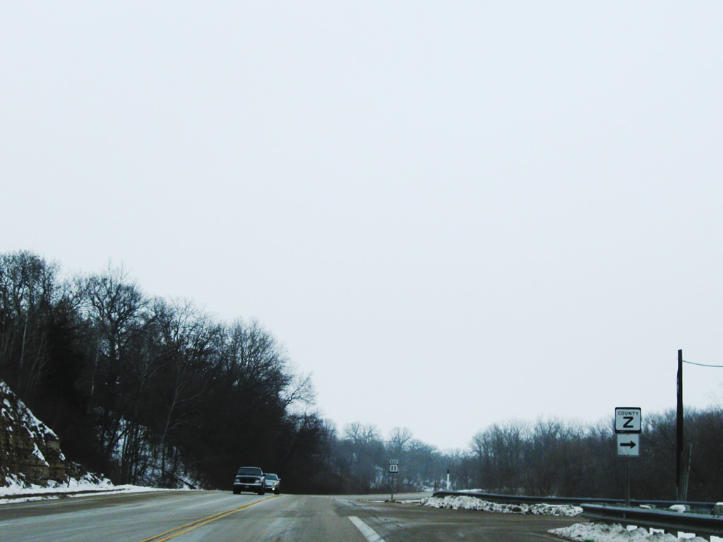
| Wis 11 approaches the first of two intersections with Grant County Z. The county route stems east from the state trunk highway to encounter the small community of Sinsinawa. 12/21/09 |
|
| Grant County Z departs Wis 11 for the community of Sinsinawa. The small unincorporated community lies 2.2 miles to the east of this intersection and is home to the cone-shaped hill of Sinsinawa Mound. 12/21/09 |
|
| Continuing eastward, Wis 11 meanders through the Wisconsin countryside. Grant County Z will intersect the state trunk highway once more 2.9 miles ahead. 12/21/09 |
|
| Wis 11 passes through the unincorporated community of Fair Play on its way eastward toward Hazel Green. Fair Play lies half-way between the two intersections with Grant County Z. 12/21/09 |
|
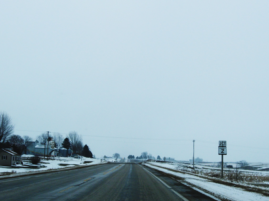
| The state highway approaches the second intersection with Grant County Z east of the small community of Fair Play. 12/21/09 |
|
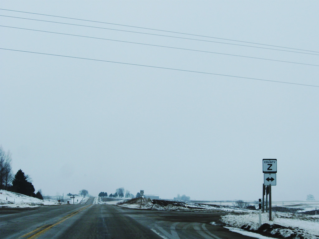
| Grant County Z changes direction at the community of Sinsinawa to become a north-south route. The county route crosses Wis 11 on its way north and ends at Grant County H 3.8 miles north of the intersection. 12/21/09 |
|
| The village of Hazel Green lies 5.2 miles ahead along the state trunk highway. Wis 11 will join Wis 80 north in downtown Hazel Green for a brief multiplex. 12/21/09 |
|
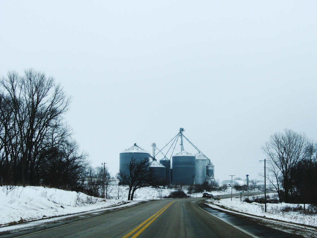
| Wisconsin State Trunk Highway 11 east passes by plants such as this one on its trek eastward through southern Wisconsin. The village of Hazel Green lies ahead. 12/21/09 |
|
| The state highway enters the village of Hazel Green (pop. 1,183). Lying along the county line of Grant and Lafayette Counties, the village touts itself as being the "point of beginning" of the ultimate small town experience in Wisconsin, since this was the place where all lands that became a part of Wisconsin were first land surveyed. Hazel Green was established in 1825 and was the first permanent settlement in Wisconsin. 12/21/09 |
|
| Wis 11 (Fairplay Street) east approaches downtown Hazel Green and the junction with Wis 80 (Percival Street). Wis 80 is a north-south state trunk highway that stretches 163 miles from the Illinois state line to Pittsville, located in Wood County. 12/21/09 |
|
| The state trunk highway prepares to join Wis 80 north for a 2.8 mile overlap. Wis 11 east departs the north-south route at North Hollow Road north of the village limits. 12/21/09 |
|
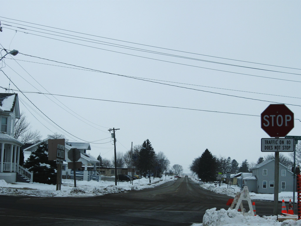
| Cross-traffic at the intersection of Wis 11 and Wis 80 does not stop. Heading south along Wis 80 will grant travelers entry into Illinois 1.8 miles south of the intersection, where the route becomes Illinois 84. Grant County W continues eastward crossing over to nearby Lafayette County. Main Street lies one block east of this intersection and was once the original routing of Wis 80 through the village. 12/21/09 |
|
| Wis 11 west departs Wis 80 in the downtown village of Hazel Green. The state trunk highway continues westward to end in 9 miles at an interchange with U.S. Highway 61 and 151 near the southwest corner of the state. 12/21/09 |
|
| Grant County Trunk Highway W begins at the intersection with Wis 11 and Wis 80 in downtown Hazel Green. The county route extends into Lafayette County, ending 22.6 miles east at Wis 78. 12/21/09 |
|
| Grant County W transitions into Lafayette County W 0.5 miles from the center of the village of Hazel Green. The county maintained route continues eastward through rural Lafayette County, ending at Wis 78 only 0.9 miles north of the Illinois state line. 12/21/09 |
|
| Grant County W transitions from Lafayette County W. The county route extends westward 0.5 miles to the village of Hazel Green where it ends at the intersection with Wis 11 and Wis 80. 12/21/09 |
|
| The county route enters the village of Hazel Green (pop. 1,183), which lies along the county line of Grant and Lafayette Counties. Hazel Green was established in 1825 and was the first permanent settlement in Wisconsin. 12/21/09 |
|
| Grant County W ends at the intersection with Wis 11 and Wis 80 one block west of downtown Hazel Green. The two state trunk highways share pavement from this intersection northward for 2.8 miles before departing for separate parts of the state. Motorists continuing ahead default onto Wis 11 west. 12/21/09 |
Page Updated 03-27-2011.