
Indiana State Road 37 travels a total of 234.04 miles throughout the Hoosier State along two discontinuous segments. The longer 220 mile extent of SR 37 joins Tell City with Bloomington, Indianapolis, and Marion, while the northernmost segment follows along a 14.04 mile course between Fort Wayne and the Ohio state line.
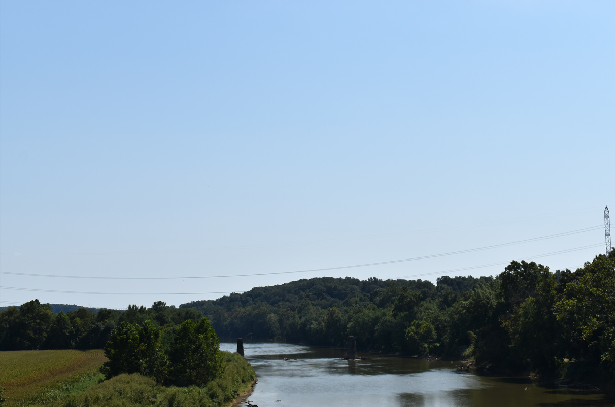
Located south of the Eugene B. Crowe bridge along U.S. 50/SR 37, bridge piers are all that remain for the original crossing of the White River East Fork near Bedford. 09/08/20.
State Road 37 begins in Tell City, located along the Ohio River in the southern reaches of Indiana. Exiting Tell City, the state road angles northeast to Gatchel where it enters the Hoosier National Forest. SR 37 continues along a rural course northerly to I-64 at St. Croix, and to Eckerty. SR 37 turns east with SR 64 at Eckerty, and the two overlap to the town of English. Turning north once more, SR 37 advances to Paoli, exiting the Hoosier National Forest ahead of the Orange County seat. North of U.S. 150, State Road 37 proceeds to Mitchell and Bedford, seat of Lawrence County. U.S. 50 briefly follows a four lane SR 37 near Bedford before the U.S. highway resumes east toward Brownstown and Cleveland, Ohio. The state road passes Lake Monroe, the largest body of water in Indiana, halfway between Bedford and Bloomington.
Interstate 69 joins State Road 37 from the southwest, and the two travel through western reaches of Bloomington northward to Martinsville in Morgan County. The remaining portion of SR 37 between Martinsville and I-465 in south Indianapolis is being upgraded, and will become a part of I-69 by 2024. The state road enters Indianapolis from the southwest, joining I-74/465 around the southern and eastern sections of the beltway around the capital city. SR 37 departs with I-69 near Castleton, traveling through the northeastern suburbs of Indianapolis to the city of Fisher in Hamilton County. SR 37 splits with I-69 at Fisher, extending north to Noblesville. Beyond Noblesville, State Road 37 reduces to two lanes, following a course northeast to Strawtown and Elwood. The southern portion of SR 37 concludes in south Marion at SR 9.
The second section of State Road 37 is contained within Allan County in the northeast part of Indiana, beginning at a diamond interchange with I-469 in eastern Fort Wayne. SR 37 beelines northeast along a rural course to Harlan and the Ohio state line. Crossing into the Buckeye State, the two lane route continues as SR 2 to the village of Hicksville.
Indiana State Road 37 Guides
- North - Paoli to Bedford
- North - Bedford to Bloomington
- North - Morgan, Johnson, Marion Counties
- North - Hamilton, Madison, Grant Counties
- South - Marion, Johnson, Morgan Counties
- South - Monroe / Lawrence Counties
Historically SR 37 followed one continuous route through the Hoosier State, but the portion between Marion and Fort Wayne was decommissioned as it generally overlapped with SR 9 and U.S. 24.
In addition to the build out of I-69 along SR 37 between Martinsville and south Indianapolis, construction is ongoing between Fisher and Noblesville in Hamilton County to modify the state road. In collaboration between the cities, county, and Indiana Department of Transportation (INDOT), the State Road 37 Improvement Project upgrades a 2.4 mile segment of SR 37 between I-69 in Fisher and 146th Street in south Noblesville to a freeway. Dumbbell interchanges will replace at-grade intersections at 126th, 131st, and 141st Streets while a right-in right-out (RIRO) will replace the intersection at 135th Street. A single point urban interchange will be constructed at 146th Street. As of November 2020, the interchange between SR 37 and 126th Street is complete. Overall construction is slated to be wrapped up by late Spring 2023.
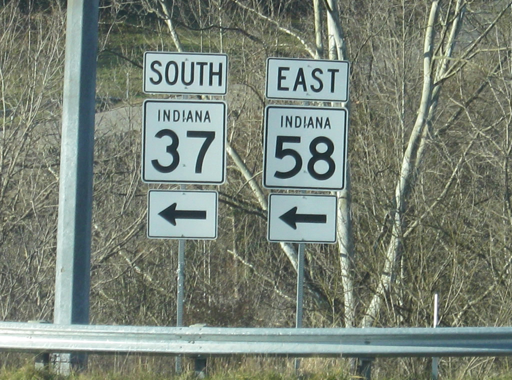 | The shields for southbound SR 37 and SR 58 at the Main Street/Patton Hill Road intersection outside of Oolitic. 12/18/11 |
 | Removed by 2020, a unique marker for SR 37 designed with the state outline was posted for Monroe Dam Road at the dam for Monroe Reservoir. 06/13/09 |
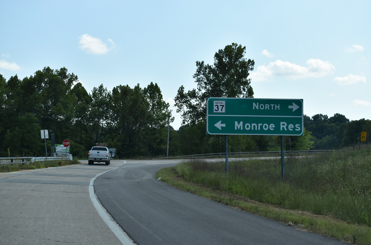 | Monroe Dam Road turns north ahead as a loop ramp joins the local road with SR 37 north to Bloomington. The Lake Monroe Reservoir follows in two miles. 09/08/20 |
 | Monroe Dam Road turns west at the folded diamond interchange with State Road 37. 09/08/20 |
 | A ramp leads to SR 37 south to Bedford ahead of the Old SR 37 Road overpass. Monroe Dam Road ties into the former alignment next. 09/08/20 |
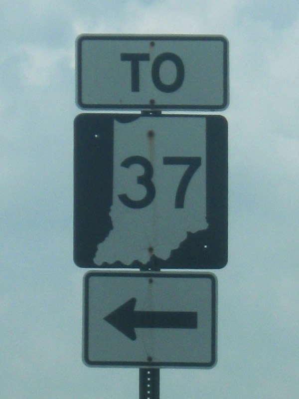
 | A Business SR 37 highway shield, located at the intersection of South Walnut Street and Church Lane in southern Bloomington. 06/13/09 |
 | Northbound on Bloomfield Road at the interchange with SR 45 and SR 37. SR 45 joins SR 37 north for a few miles as part of its overlap around Bloomington. 06/27/09 |
 | Guide sign at the SR 45 South (Second Street/Bloomfield Road) interchange with Bedford and Indianapolis as control cities. 06/27/09 |
 | SR 45/SR 46 westbound at the SR 37 interchange. Guide signs again indicated SR 37 North to Indianapolis and SR 37/SR 45 South to Bedford. SR 46 continues west along a four lane highway for a few miles to Ellettsville, a suburb of Bloomington in northwestern Monroe County. 06/27/09 |
Photo Credits:
- 06/13/09 by Thomas Decker.
- 06/27/09 by Thomas Decker.
- 12/18/11 by Thomas Decker.
- 09/08/20 by AARoads.
Connect with:
Interstate 64
Interstate 69
Interstate 465
Page Updated 11-20-2020.