|
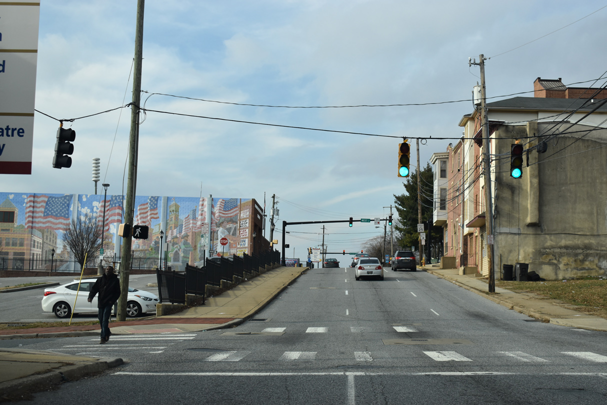
| SR 48 commences along E 2nd Street westbound from U.S. 13 Business (Walnut Street) north. Intersecting French Street south, the state route is unmarked along the initial stretch. 12/22/20 |
|
| The first confirming marker for SR 48 was posted between French Street and U.S. 13 Business (King Street) south in the LOMA district of Wilmington. The assembly was removed with the addition of a fence around the adjacent parking lot by Fall 2016. 03/30/04 |
|
| U.S. 13 Business follows King Street south to E 2nd Street, where it shifts one block west onto Market Street via Martin Luther King, Jr. Boulevard. 12/22/20 |
|
| U.S. 13 Business overtakes Market Street one block south of SR 48 (2nd Street) ahead of the Wilmington Train Station and bridge across the Christina River. 12/30/18 |
|
| SR 48 (W 2nd Street) proceeds one block westbound to Shipley Street. Street prefixes in Wilmington change from east to west at Market Street. 12/30/18 |
|
| SR 48 intersects Orange Street by the Delaware Technical Community College - Wilmington Campus. 12/30/18 |
|
| Tatnall Street flows south from Downtown Wilmington to intersect SR 48 (W 2nd Street) at the succeeding traffic light. 12/30/18 |
|
| West Street runs north from the Wilmington Waterfront to SR 48 by Wilmington Fire Station #1. 12/30/18 |
|
| Washington Street provides the last connection from SR 48 (W 2nd Street) onto adjacent MLK, Jr. Boulevard for the flyover ramps to Interstate 95. 12/30/18 |
|
| Lowering from the Quaker Hill area, 2nd Street intersects Madison Street at West Center City. Madison Street heads north from Frawley Stadium and the Riverfront to Justison Landing. SR 4 overlays the street for one block between Martin Luther King, Jr. Boulevard (SR 48 east) to end at SR 48 west. 12/30/18 |
|
| Westbound SR 4 begins at SR 48 (2nd Street) and Monroe Street. Monroe Street leads the route two blocks south to Maryland Avenue. SR 4 (Maryland Avenue) provides the gateway into Wilmington east from Newport and Richardson Park. 12/30/18 |
|
| A detour shield for I-95 north directed motorists onto forthcoming Adams Street by 2004. By 2007, the north assembly remained without an arrow. It was replaced in 2022. 12/20/17 |
|
| A flyover ramp joins Martin Luther King, Jr. Boulevard west with I-95 north above the intersection of 2nd and Adams Streets. Adams and Jackson Streets form frontage streets for both the Wilmington Viaduct and the below grade section of I-95 east to Happy Valley. 12/30/16 |
|
| The entrance ramp from 2nd Street joins the Wilmington Viaduct as Interstate 95 south leads toward I-295 and SR 141 near Newport. The ramp represented a temporary beginning of I-95 south from when the freeway initially opened between the Delaware Turnpike and Wilmington. 12/30/18 |
|
| The I-95 Rehabilitation project from I-495 to the Brandywine River Bridge underway through Summer 2023 reconfigured the entrance ramp from SR 48 to I-95 southbound with a extra receiving lane. An additional lane was also constructed along 2nd Street between Adams and the on-ramp. 12/20/17 |
|
| Jackson Street flows south from SR 48 (2nd Street) west through the Hedgeville community to SR 4 (Maryland Avenue). 12/30/16 |
|
| 2nd Street gains elevation through the Hilltop community. An array of street level signals operate at Van Buren Street north. 12/19/22 |
|
| A one way street south to Hedgeville and Browntown, Harrison Street represents the last of the Presidential street series along 2nd Street west. 12/30/16 |
|
| SR 48 (2nd Street) north at Franklin Street. Franklin Street runs north from Kosciuszko Park to Cool Spring. 12/30/16 |
|
| 2nd Street levels out at Broom Street. Broom Street heads south from SR 48 to the St. Elizabeth Area and SR 4 (Maryland Avenue) just outside the Wilmington city limits. 12/30/16 |
|
| Rodney Street carries two way traffic from Bayard Square and SR 48 (Lancaster Avenue) north to West Hill and Delaware Avenue. 12/30/16 |
|
| SR 48 (2nd Street) west at Clayton Street. Clayton Street travels one way north to Trolley Square and Brandywine Park. 12/30/16 |
|
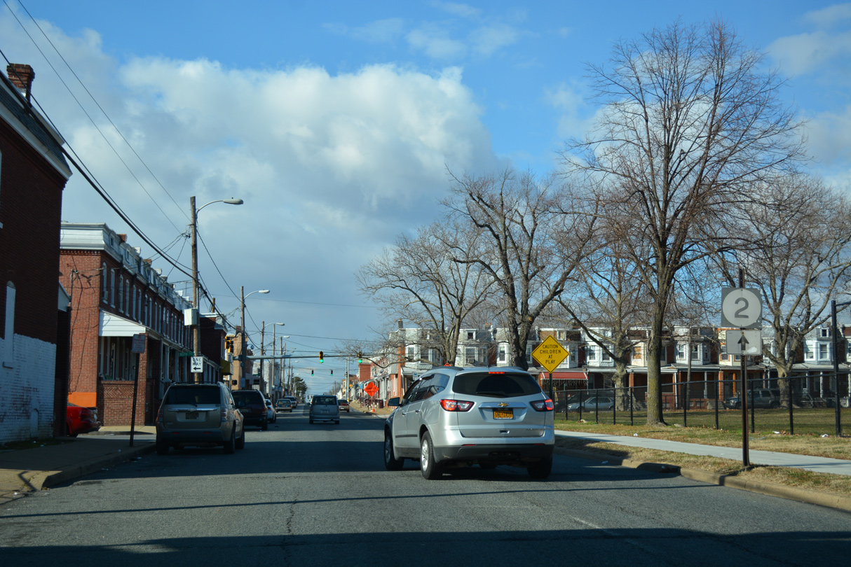
| A trailblazer for SR 2 appears along SR 48 (2nd Street) by Judy Johnson Park. SR 2 is located three blocks ahead. 12/30/16 |
|
| Dupont Street leads south from 2nd Street to Oak Street and Canby Park. 12/30/16 |
|
| Approaching the Flats neighborhood on 2nd Street (SR 48) west at Scott Street. 12/30/16 |
|
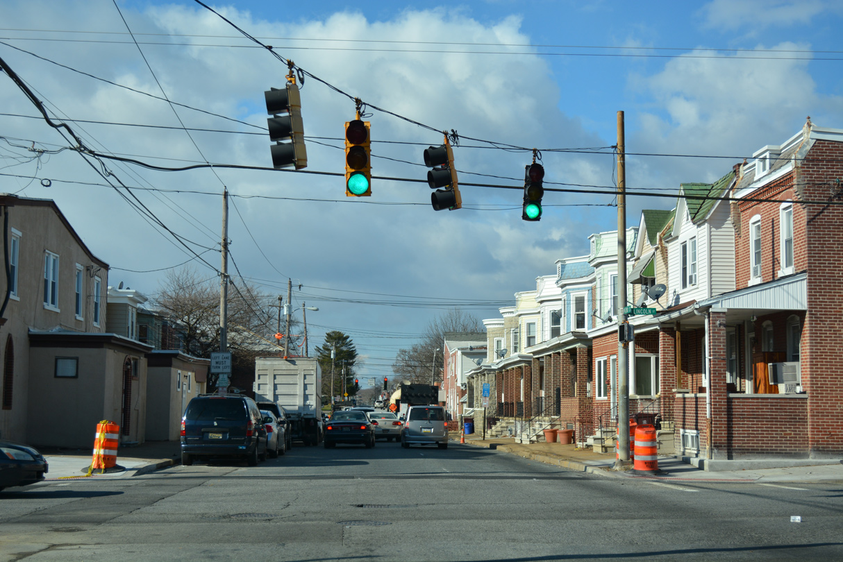
| A weather worn shield precedes the couplet of SR 2 along Lincoln Street east and Union Street west on SR 48 (2nd Street) west. 12/30/16 |
|
| Lincoln Street takes SR 2 east from Canby Park to Little Italy and SR 52 (Pennsylvania Avenue). 12/30/16 |
|
| SR 48 west dog legs alongside SR 2 (Union Street) west to connect with Lancaster Avenue north. 12/30/16 |
|
| SR 2 (Union Street) connects Wilmington with Elsmere and Kirkwood Highway west to Prices Corner and Newark. Lancaster Avenue carries two-way traffic along the remainder of SR 48 through northwest Wilmington. 12/20/17 |
|
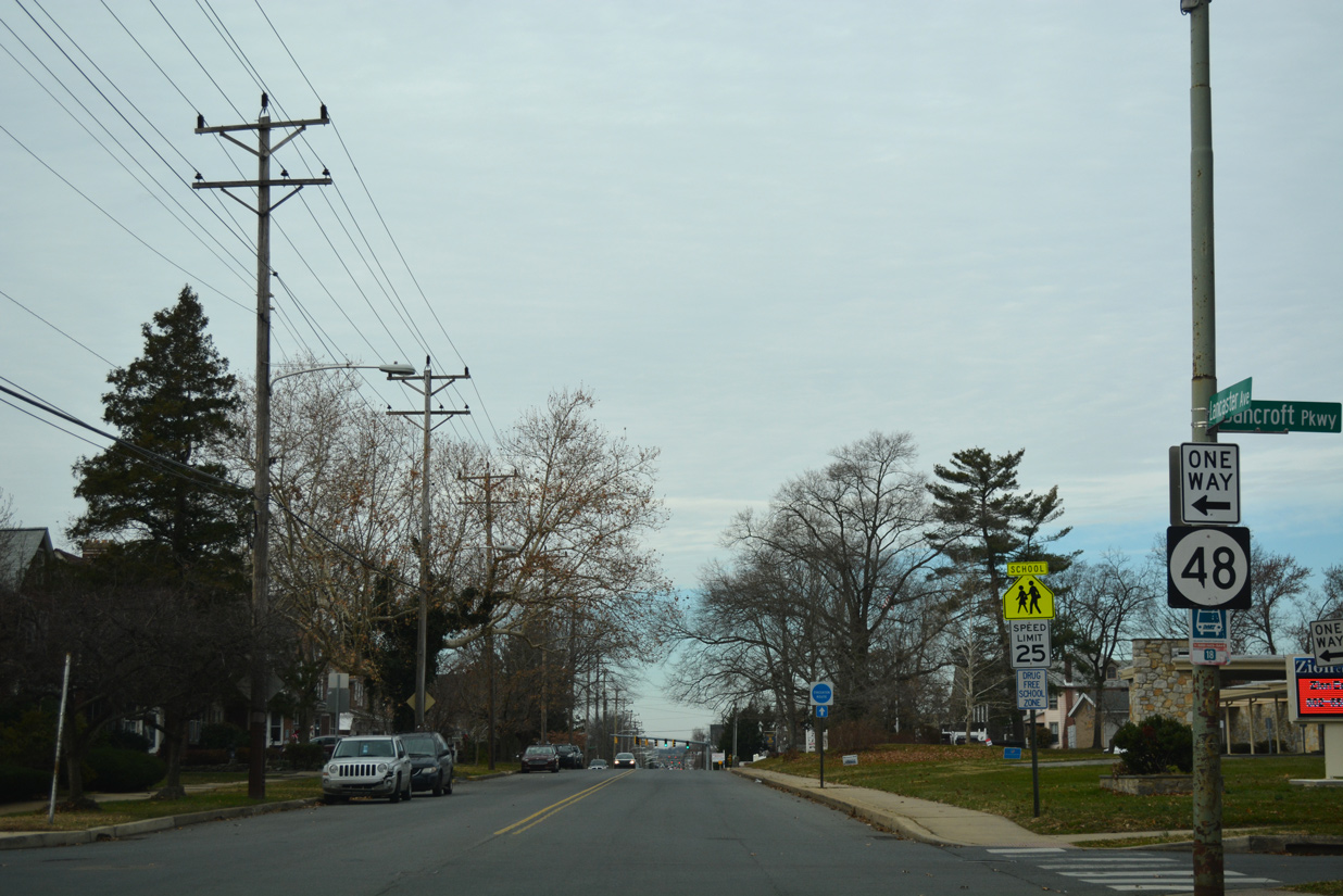
| Confirming marker for SR 48 west posted at Lancaster Avenue and Bancroft Parkway just beyond SR 2 (Union Street). Bancroft Parkway is a landscaped roadway connecting the Union Park Gardens and Flats neighborhoods. 12/20/17 |
|
| Lancaster Avenue west at Woodlawn Avenue, the Union Park Gardens community and Cathedral Cemetery. 12/20/17 |
|
| Spanning a CSX Railroad line, SR 48 (Lancaster Avenue) lowers into the intersection with Greenhill Avenue. Greenhill Avenue is an urban collector joining the Greenhill, Wawaset Heights and Highlands neighborhoods in northwest Wilmington. 12/20/17 |
|
| Lancaster Avenue expands to four lanes beyond Greenhill Avenue. A reassurance marker for SR 48 was formerly posted north of Greenhill Avenue until 2012. 03/29/04 |
|
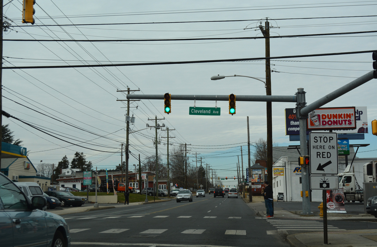
| Advancing through the Greenhill neighborhood, SR 48 (Lancaster Avenue) intersects Cleveland Avenue south to Colonial Park and north to Westmoreland and Mack Park. 12/20/17 |
|
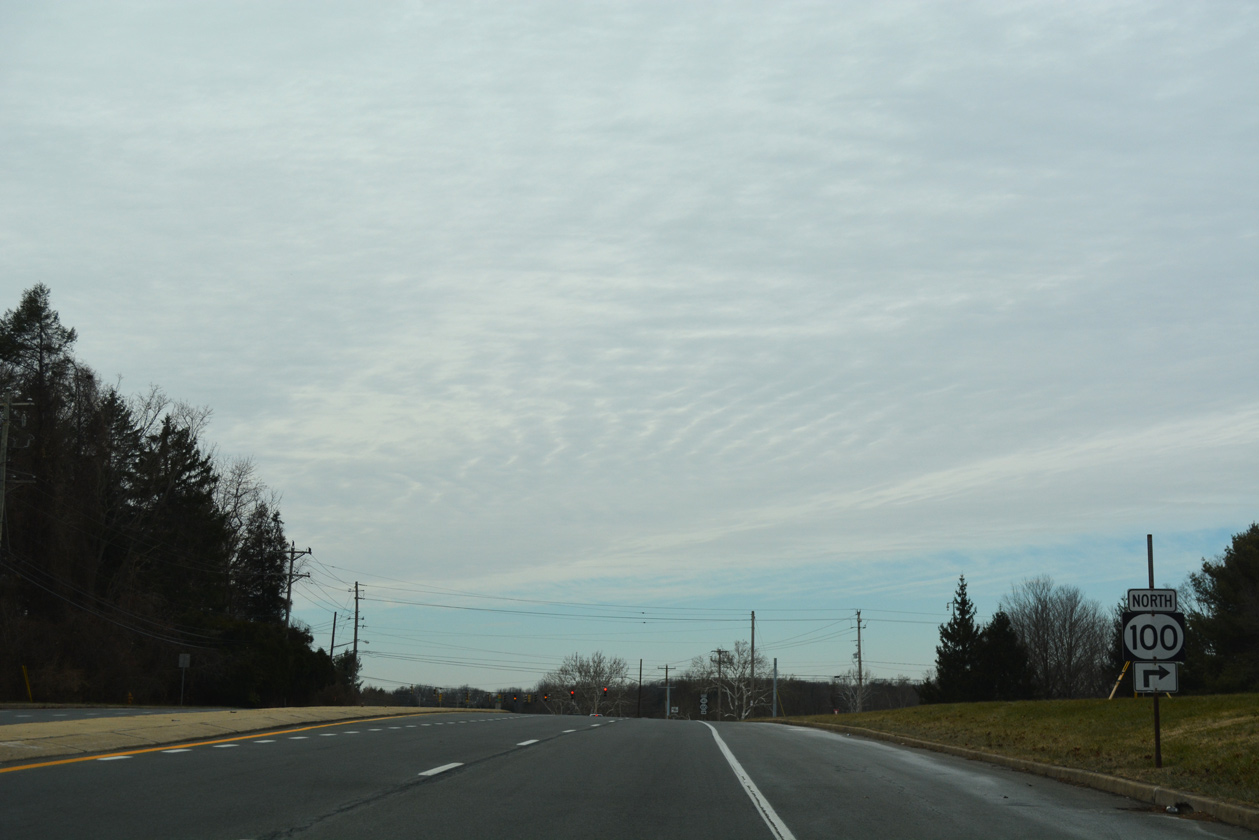
| Separate branches of Dupont Road tie into SR 48 (Lancaster Avenue) at the Wilmington city line. Unmarked on Lancaster Avenue westbound, Dupont Road south into Elsmere is a part of SR 100. 12/20/17 |
|
| SR 48/100 combine for 0.92 miles from the Wilmington city line to SR 141 at Barley Mill Plaza. Prior to 1989, SR 100 turned onto N Dupont Road through Westover Hills to SR 52. A truck restriction was enacted along Dupont Road at that time, resulting in the SR 100 overlaps with SR 48 and 141. 12/20/16 |
|
| Beyond the Wilmington city line and North Dupont Road (old SR 100), Lancaster Avenue becomes Lancaster Pike. SR 48/100 next cross the Delaware Valley Railroad at-grade. 12/20/17 |
|
| The succeeding traffic light along SR 48/100 (Lancaster Pike) operates at A Street, entrance to Lancaster Pike Market. 12/20/17 |
|
| Lancaster Pike intersects the entrance roads for Barley Mill Plaza and Delledonne Corporate Center at this traffic light. 12/20/17 |
|
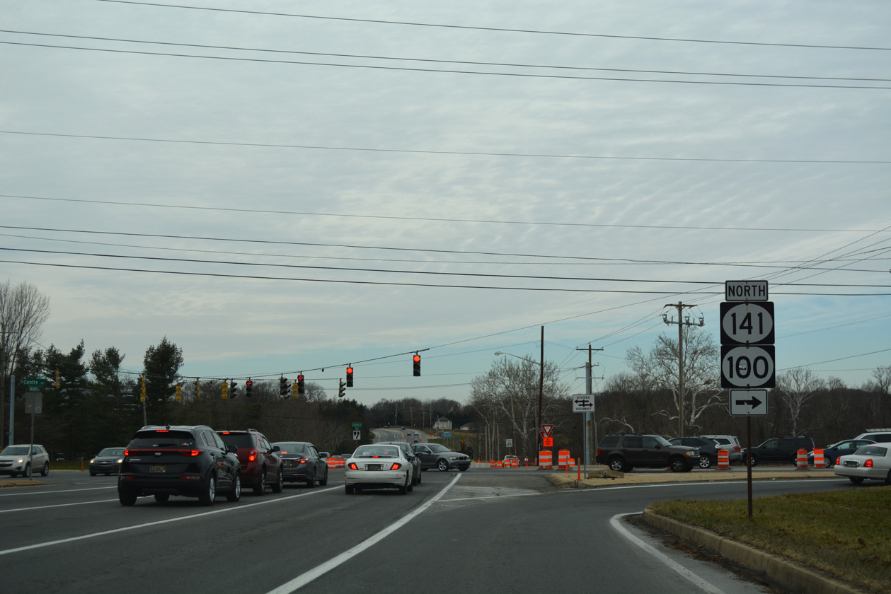
| SR 100 separates from SR 48 (Lancaster Pike) and combines with SR 141 (Centre Road) 1.4 miles northeast to Greenville. SR 48 continues west toward Hockessin. 12/20/17 |
|
| SR 141 (Centre Road) encircles Wilmington and Elsmere southwest to Newport and east across the Tyler McConnell Bridge to Fairfax. The state route crosses SR 48 as a controlled access arterial, with the wide right of way here originally reserved for a grade separation with Lancaster Pike. 12/20/17 |
|
| A confirming marker is missing for SR 48 (Lancaster Pike) west after SR 100/141 (Centre Road). 12/23/18 |
|
| SR 48 (Lancaster Pike) west at Centerville Road. Centerville Road heads south through Little Falls Centre business park to Prices Corner and north between the high end Stonewold and Sedgely Farms subdivisions to Hoopes Reservoir. 12/23/18 |
|
| Lancaster Pike continues with four lanes and a grassy median west from Centerville Road. 12/23/18 |
|
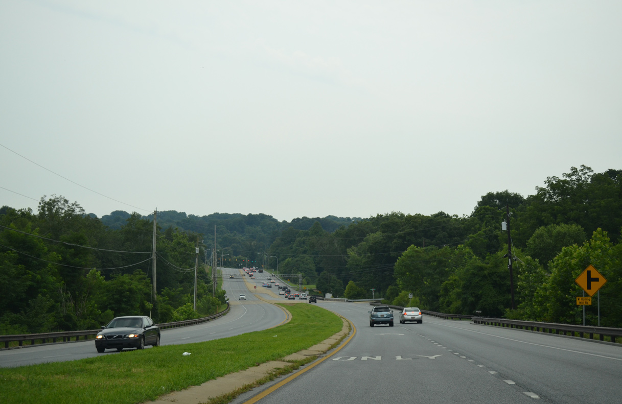
| SR 48 makes a sweeping curve west ahead of the Wilmington & Western Railroad grade crossing and a bridge across Red Clay Creek. 07/31/13 |
|
| Dual turn lanes coincide with a lane drop for Lancaster Pike westbound at Hercules Road. Named after the former Hercules Country Club, Hercules Road connects SR 48 with SR 41 (Newport Gap Pike) and Millcreek Road to the west. 12/23/18 |
|
| Loveville Road extends north from McKennans Church Road and SR 41 across SR 48 (Lancaster PIke) to Old Wilmington Road. 12/23/18 |
|
| Lancaster Pike merges with SR 41 (Newport Gap Pike) at a wye intersection built in the 1950s. 12/20/16 |
|
| SR 41 overtakes Lancaster Pike north from SR 48 and the Church Hill subdivision to Hockessin and the Pennsylvania state line. The multi state route leads northwest to Avondale, Cochranville, Christiana and U.S. 30 at Gap. 12/23/18 |
Page Updated 01-05-2023.

 West
West


 North
North