
Running 27.70 miles across Washington County, SR 56 leads east from State Line, Mississippi to the county seat of Chatom, where it meets SR 17. East from there, SR 56 concludes at U.S. 43 in Wagarville.
SR 56 was the original route for U.S. 84 between Chatom and U.S. 43 until in the 1950s.
 | Leading away from State Line, Mississippi, Alabama State Route 56 winds through pine forest and by a handful of houses to Chatom. 02/10/02 |
 | SR 56 combines with SR 17 for one block south in the Washington County seat of Chatom. SR 56 resumes an eastward course from SR 17 en route to Wagarville. 02/10/02 |
 | SR 56 east reaches U.S. 43 at the community of Wagarville. 02/10/02 |
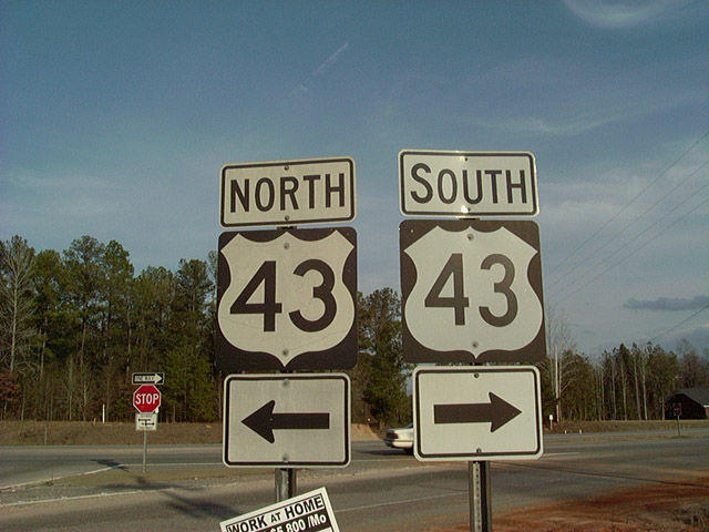 | A four lane divided highway, U.S. 43 travels through eastern Washington County, connecting industrial plants along the Tombigbee River with Grove Hill to the north and the Mobile area to the south. 02/10/02 |
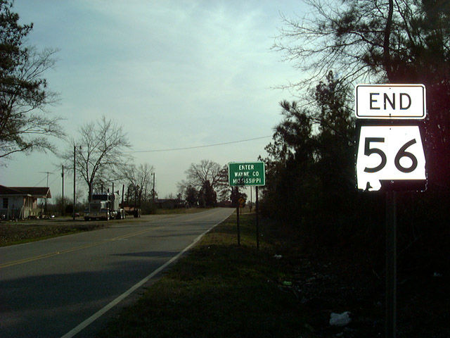 | An end shield for SR 56 west stands at the Mississippi state line. Continuing west, the road leads to U.S. 45 in State Line. 02/10/02 |
Photo Credits:
02/10/02 by AARoads
Connect with:
U.S. 43
State Route 17
Page Updated 11-21-2003.