Covering Oregon 58 eastbound between Interstate 5 and U.S. 97.
|
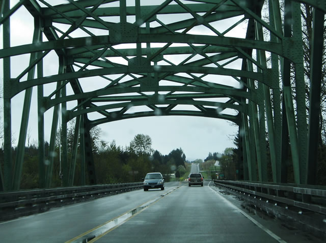
| OR 58 (Willamette Highway) departs its interchange with Interstate 5 & OR 99 at Goshen and quickly encounters a truss bridge over the Coast Fork of the Willamette River. 04/01/05 |
|
| OR 58 enters the community of Pleasant Hill east of the Willamette River. Parkway Road intersects the Willamette Highway 2.9 miles south of its end at Jasper Road in Jasper. Jasper Road travels northwest to the city of Springfield from Jasper. 04/01/05 |
|
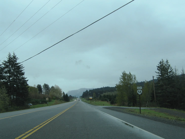
| Reassurance marker posted along OR 58 (Willamette Highway) after the intersection with Parkway Road in Pleasant Hill. The state highway next sees services in 31 miles at Oakridge. 04/01/05 |
|
| Old style guard rails date the OR 58 over crossing over the Southern Pacific Railroad line near Trent and the intersection with Rattlesnake Road. 04/01/05 |
|
| Wheeler Road intersects OR 58 east of Trent and south of Elijah Bristow State Park. Wheeler Road doubles back west to Rattlesnake Creek and Immigrant Roads in Trent. 04/01/05 |
|
| Dexter Road loops through the settlement of Dexter south of OR 58 (Willamette Highway) near Dexter Reservoir. The state highway stays north of the community through an undeveloped stretch. 04/01/05 |
|
| OR 58 skims the southern shores of Dexter Reservoir between Lost Creek Road and Pioneer Street. The body of water represents one of two lakes along OR 58 near the Lowell community. In the distance is Lookout Point Dam and the Lowell Covered Bridge. 04/01/05 |
|
| Pioneer Street crosses a causeway over the heart of Dexter Reservoir. The north-south road stems north from OR 58 to Main Street and Pengra Road within the town of Lowell. Founded in the 1850s by Amos D. Hyland, the first postmaster of the fledgling town. The area post office was named Cannon in 1880 after a local resident, A.D. Cannon. The town was later renamed Lowell after its founder's hometown in 1883. 04/01/05 |
|
| OR 58 (Willamette Highway) eastbound at the intersection with Pioneer Street adjacent to Dexter Reservoir. Pioneer Street provides connections to West Boundary Road along the northern shores of Dexter and Lookout Point Reservoirs and Jasper Lowell Road, a highway leading north to Unity and Fall Creek Reservoir. 04/01/05 |
|
| OR 58 continues east alongside the Lookout Point Reservoir into Willamette National Forest. The Southern Pacific Railroad line parallels the Willamette Highway closely from Lowell to McCredie Springs. 04/01/05 |
|
| The state highway crosses the Willamette River again ahead of the town of Oakridge. The river splits into the North Fork and Middle Fork at the Oakridge and Westfir communities. Hills Creek Reservoir lies to the south. Oakridge, originally called Big Prairie and later Hazeldell, lies above the fog line and below the snow line ahead of the Cascade Range. The town is home to 3,680. Traveler services including gas, food, and lodging are available in Oakridge. 04/01/05 |
|
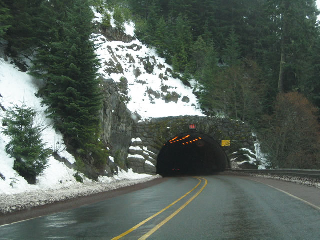
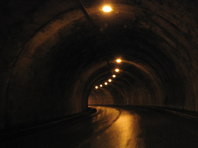
| The Salt Creek Tunnel lies along OR 58 east of Oakridge within the Cascade Range. The two lane tunnel lies at the top of a 6% grade along the Willamette Highway near Salt Creek Falls. The tunnel opened in the late 1930s. 04/01/05 |
|
| Two interior views of the Salt Creek Tunnel along OR 58 eastbound. The Oregon Department of Transportation replaced the lighting system of the tube in 2005. 04/01/05 |
|
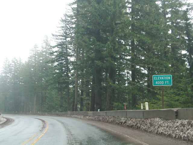
| Rising to 4,000 feet above sea level on OR 58 (Willamette Highway) eastbound. 04/01/05 |
|
| Eastbound at the Salt Creek Falls access road on OR 58. The 286 feet tall waterfall lies along the Salt Creek south of OR 58. Forest Service Road 5893 spurs south from the Willamette Highway to an observation area just east of the Salt Creek Tunnel and five miles west of Willamette Pass. 04/01/05 |
|
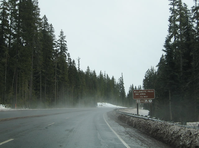
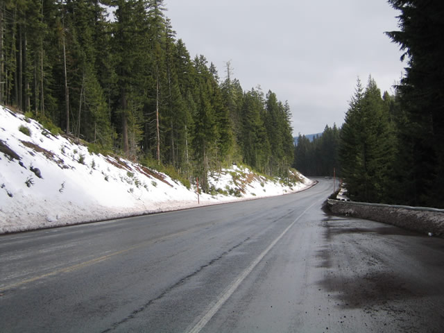
| Snow cover becomes more evident on the climb toward the Willamette Pass Ski Area along OR 58 eastbound. The Gold Lake Sno-Park lies along the stretch as well. 04/01/05 |
|
| OR 58 eastbound reaches Odell Lake, a popular fishing, camping, and boating destination. There are access points from the highway at both the north and south ends of the lake. 04/01/05 |
|
| Entering Deschutes National Forest and leaving Willamette National Forest along OR 58 (Willamette Highway) east. 04/01/05 |
|
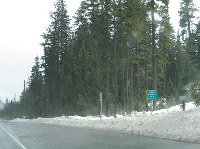
| OR 58 crests at Willamette Pass (elevation 5,128 feet). The pass area represents the Klamath County line. 04/01/05 |
|
| Leaving the Willamette Pass area along OR 58 (Willamette Highway) eastbound. A reassurance marker and distance sign list the distance to Crescent Lake and Klamath Falls (via U.S. 97 south). 04/01/05 |
|
| Although mostly hidden behind trees, OR 58 straddles the northern shores of Odell Lake upon crossing the Klamath County line. East access to the lake is provided by East Odell Lake Road. 04/01/05 |
|
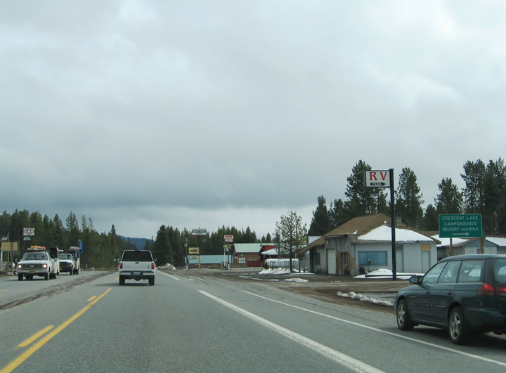
| OR 58 enters the settlement of Crescent Lake Junction two miles south of Odell Lake. Crescent Lake Highway intersects the state highway there northeast of both the Crescent Lake village and body of water. 04/01/05 |
|
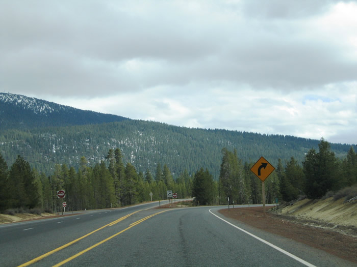
| Approaching the intersection with Crescent Cutoff Road on OR 58 (Willamette Highway) eastbound. The east-west road provides a more direct route to U.S. 97 northbound at Crescent. 04/01/05 |
|
| Distance sign posted at the OR 58 eastbound intersection with Crescent Cutoff Road. Crescent Cutoff Road meets National Forest Road 46, an Oregon Scenic Byway leading north to Davis Lake, in 3.4 miles. The highway otherwise ends 12.2 miles to the east at U.S. 97 (Dalles-California Highway) within the town of Crescent. 04/01/05 |
|
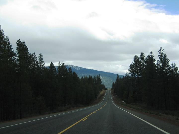
| OR 58 continues southeast 13.5 miles toward its end at U.S. 97 south. The transition from the snowy Cascades into its arid rain shadow becomes more apparent along the drive to U.S. 97. 04/01/05 |
|
| OR 58 (Willamette Highway) eastbound ends at a wye interchange with U.S. 97, eight miles north of Chemult. U.S. 97 continues the southward drive for motorists destined to Klamath Falls and northern California. 04/01/05 |
|
| All OR 58 traffic defaults onto U.S. 97 southbound at the state highway end. Access to U.S. 97 north for Crescent and Bend however is provided via a U-turn ramp just beyond the OR 58 merge. Klamath Falls lies 77 miles to the south. 04/01/05 |
Page Updated 11-21-2005.