Covering Oregon 58 westbound between U.S. 97 and Interstate 5.
|
| OR 58 westbound to Eugene and Oakridge is announced on this advance sign along US 97 northbound in Klamath County. 06/25/05 |
|
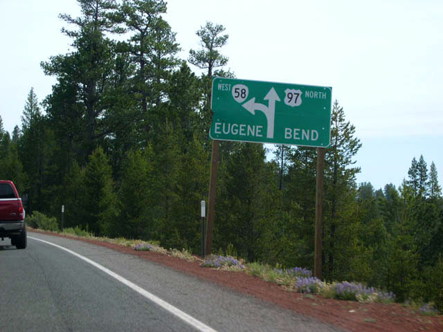
| Diagrammatic sign showing the junction of US 97 with OR 58. Continue north on US 97 to reach Bend. Follow OR 58 over the Cascade Range to Eugene. 06/25/05 |
|
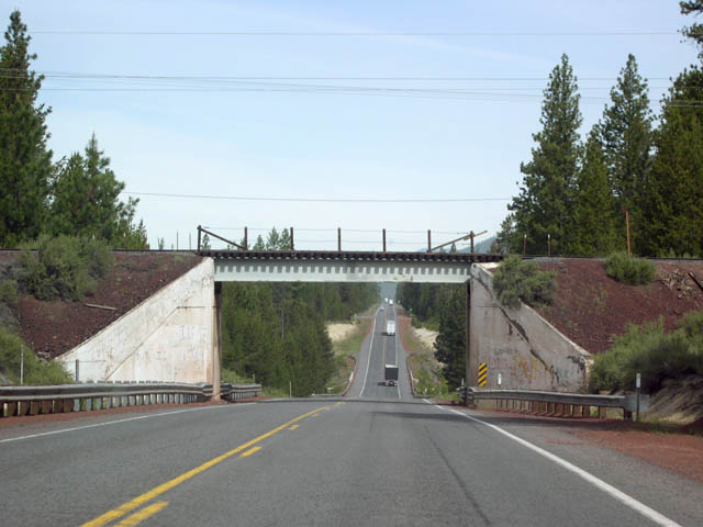
| US 97 is not a freeway here, but an interchange is provided for its junction with OR 58. A view of the gore point exit sign. 06/25/05 |
|
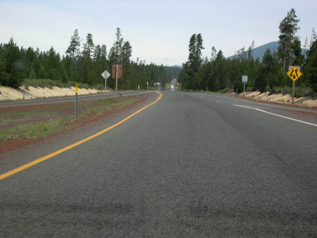
| After exiting from US 97, OR 58 begins to take shape. 06/25/05 |
|
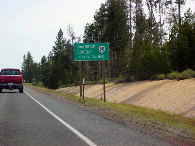
| The first distance sign encountered on westbound OR 58. Oakridge: 50; Eugene: 91. 06/25/05 |
|
| A spur line from the Southern Pacific mainline, the Klamath Northern Railroad crosses the highway. 06/25/05 |
|
| On the high pumice plateau east of the Cascade Crest, OR 58 heads through forests of mostly lodgepole pine. 06/25/05 |
|
| When OR 58 climbs a small grade, the lodgepole pines give way to ponderosa pine forests that inhabit the warmer, south-facing slopes. 06/25/05 |
|
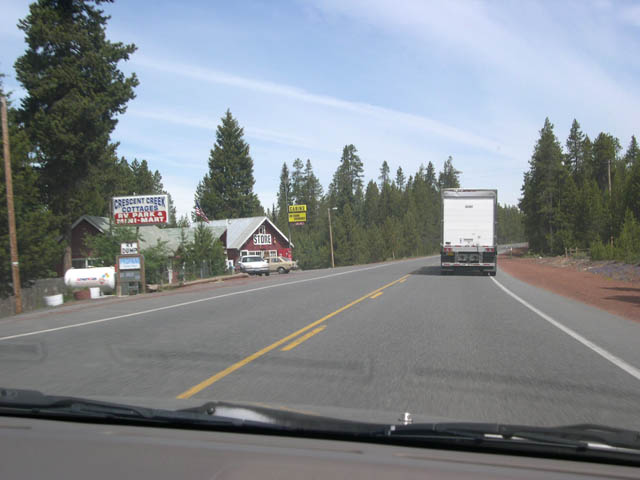
| The occasional store and lodging facilities are about the only signs of settlement along this stretch of highway 58. 06/25/05 |
|
| Trucks heading to and from California are frequently encountered on OR 58, as it is often a preferred route to Eugene instead of I-5 over the Siskiyou Summit. Trucks leave I-5 at Weed, California and head up US 97 to its junction with OR 58. 06/25/05 |
|
| OR 58 reaches Odell Lake, a popular fishing, camping, and boating destination. There are access points from the highway at both the north and south ends of the lake. 06/25/05 |
|
| Heading past the south entrance to the lake, the scenery along OR 58 will quickly change from the dry pine forests of the east slope of the Cascades to the lush fir and hemlock forests of the west slope. 06/25/05 |
|
| Odell Lake and Diamond Peak are visible in a few places along the western edge of the highway. 06/25/05 |
|
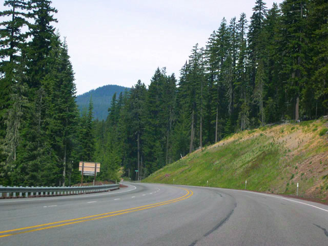
| Now closing in on the abundant rainfall zone of western Oregon, the trees are suddenly much larger. 06/25/05 |
|
| Past Odell Lake, OR 58 begins its final climb to Willamette Pass. 06/25/05 |
|
| Sign announcing the summit of Willamette Pass; elevation: 5,128 feet above sea level. 06/25/05 |
|
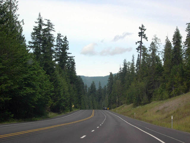
| The highway now begins its steep journey down the west slope of the Cascades. The trees are tall and the scenery gorgeous. Though now in Lane County, Eugene is still about 60 miles away. 06/25/05 |
|
| This sign near milepost 60 advises trucks of a steep 6% downgrade five miles ahead. 06/25/05 |
|
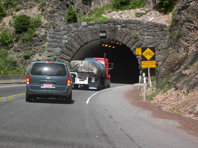
| The sole tunnel on OR 58 is the Salt Creek Tunnel near milepost 56. 06/25/05 |
|
| The 6% downgrade begins one mile past the tunnel. Motorists are also reminded to turn off their lights after exiting the tunnel. 06/25/05 |
|
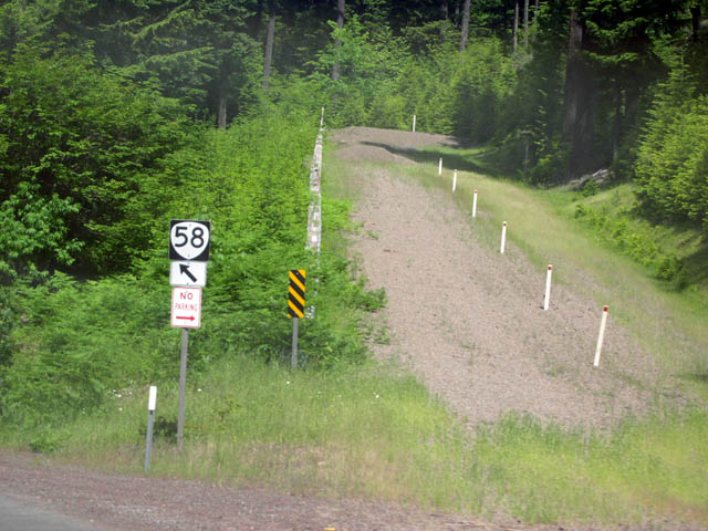
| Views of the first of two runaway truck ramps along westbound OR 58. Curiously, a directional sign for OR 58 is provided near the entrance of the ramp. It seems unlikely any motorist would mistake the gravel-surfaced ramps for the main highway! 06/25/05 |
|
| The steep downgrade continues between the first and second runaway truck ramps. 06/25/05 |
|
| The second runaway truck ramp. A directional sign for OR 58 is again posted. 06/25/05 |
|
| After the grade levels out, the Southern Pacific Railroad crosses the highway. This branch of the SPRR is known as the "Natron Cutoff" and it was constructed in the 1920s for rail traffic heading directly to and from California. This route provided a much better alternative to the endless switchbacks of the old line over the Siskiyou Mountains in southern Oregon and northern California. 06/25/05 |
|
| Approaching Oakridge, OR 58 levels out more. 06/25/05 |
|
| This speed zone sign heralds Highway 58's imminent arrival in Oakridge. 06/25/05 |
|
| With a little over 3,000 residents, Oakridge offers several gas stations, motels, grocery stores, and restaurants. It is a good stopping place for those traveling over the Cascades on this highway. There are no traffic lights. 06/25/05 |
|
| Just northwest of Oakridge is a junction with a road that leads to the tiny settlement of Westfir. The road loops through Westfir and returns to OR 58 several miles later. 06/25/05 |
|
| The Southern Pacific Railroad line parallels OR 58 as it begins its journey along the shores of Lookout Point Reservoir. The middle image is a view of the reservior across the SPRR tracks. Elevation here is a little under 1,000 feet. 06/25/05 |
|
| After passing Lookout Point Dam, OR 58 follows the shore of Dexter Reservoir.The Lowell Bridge, which spans the reservoir, may be crossed by turning right at this junction. The bridge leads to the town of Lowell. 06/25/05 |
|
| Looking across Dexter Reservoir, it is easy to spot Lookout Point Dam. The dam was built by the Army Corps of Engineers during the mid-1950s for flood control on the Middle Fork of the Willamette River. The cars visible in front of the dam are driving on the Lowell Bridge across Dexter Reservoir. 06/25/05 |
|
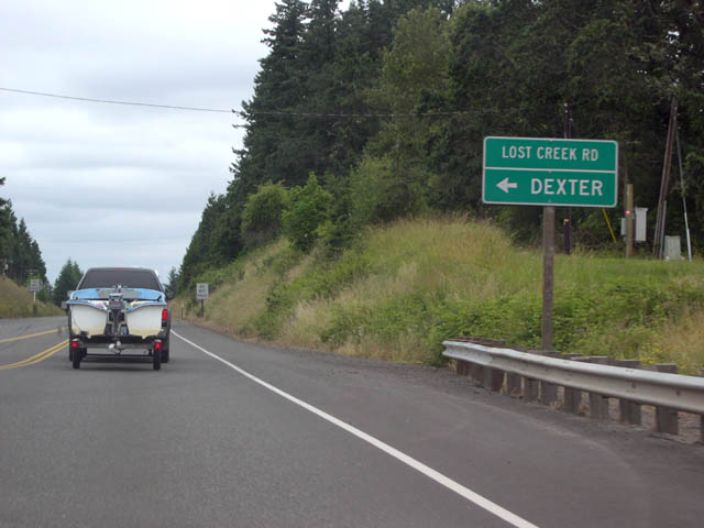
| Reaching the end of Dexter Reservoir, OR 58 junctions with Lost Creek Road. Turn left on Lost Creek Road to reach Dexter. 06/25/05 |
|
| OR 58 and Parkway Road. Though obscured in this view, the directional sign points the way to Jasper and Springfield. This is the "back door" route to Springfield, a large town across the Willamette River from Eugene. Turn right on Parkway Road to reach Jasper. At Jasper, turn left on Jasper Road to head into the eastern half of Springfield. Springfield may also be reached by simply staying on OR 58 and then following I-5 north to the Springfield exits. 06/25/05 |
|
| An OR 58 reassurance shield just past the Jasper/Springfield junction. 06/25/05 |
|
| Distance sign for the small town of Goshen and the much larger city of Eugene. The interchange with I-5 in Goshen is the actual western terminus of OR 58. 06/25/05 |
|
| Just prior to reaching Interstate 5, OR 58 travels through the unincorporated community of Pleasant Hill. 06/25/05 |
|
| OR 58 crosses the Willamette River at the west end of Pleasant Hill. Interstate 5 is about a mile away. 06/25/05 |
|
| OR 58 reaches its western terminus at Goshen just south of Eugene. Roseburg is about 64 miles south on I-5. Head north on I-5 to reach OR 99 and the Eugene/Springfield exits. 06/25/05 |
Page Updated 11-09-2005.