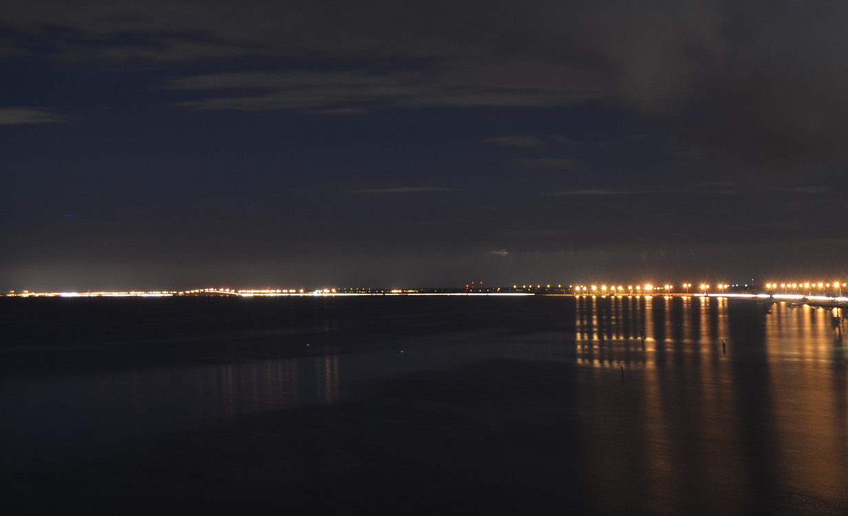
Looking west from Rocky Point at the ten mile long Courtney Campbell Causeway between Clearwater and Tampa. 10/19/13
SR 60 is a 160.82 mile long trans-peninsular route that connects Clearwater to the west with Vero Beach in the east. The state road is mostly four lanes, traveling across Old Tampa Bay via Courtney Campbell Causeway between urban Pinellas County and Hillsborough County, and Kennedy Boulevard through the city of Tampa. A short overlap with U.S. 41 Business takes the state road through Downtown Tampa to Adamo Drive, an industrial arterial parallel to the Selmon Expressway (SR 618) east to Brandon.
Through Brandon, SR 60 comprises a busy arterial with up to eight lanes of capacity. As the main route through the unincorporated suburb, the route is extremely busy. East from the county line, SR 60 drops southward to Mulberry and Bartow, where it utilizes a bypass alongside a portion of U.S. 98. Beyond the Polk County seat, SR 60 becomes more rural to Lake Wales.
Once at Lake Wales, SR 60 shifts southward to bypass the city center from a folded diamond interchange with U.S. 27 to the south of Lake Wales itself. The remainder of the highway southeast to Avon Park Bombing Range and Yeehaw Junction (where it meets both U.S. 441 and Florida's Turnpike) is rural.
It is not until Vero Beach and the interchange with I-95 that SR 60 again transitions to a commercial arterial. The state road bee lines east toward Downtown Vero Beach, where it separates into a one-way couplet before taking a dog leg north and east across the Indian River to end at SR A1A, 0.3 miles from the Atlantic Ocean beaches.
An unsigned branch of SR 60 lines West Kennedy Boulevard from Hoover Boulevard and Memorial Highway at Westshore in Tampa. The 0.311 mile segment connects the ramps with I-275 at the Howard Frankland Bridge approach with the SR 60 mainline transition from the Memorial Highway freeway to Kennedy Boulevard.
Florida State Road 60 Guides
Clearwater Memorial Causeway
The first bridge joining Clearwater Beach and Clearwater was constructed in 1916. The wooden structure utilized a hand-cranked boat opening at midspan. It was replaced in November 1927 with a higher bridge allowing smaller boats to pass unimpeded. A double-lift span situated along the bridge allowed larger vessels passage along the Intracoastal Waterway. Work followed in 1963 with a new bridge and upgrade of the causeway leading to it.1
A new high-level fixed span for Memorial Causeway was planned as the crossing built in 1963 reached the end of its lifespan. Construction, which was delayed by 18 months due to structural deficiencies in four of the main columns, ran from December 2002 to August 18, 2005. The new 74 foot high bridge cost $69.3 million.1,2
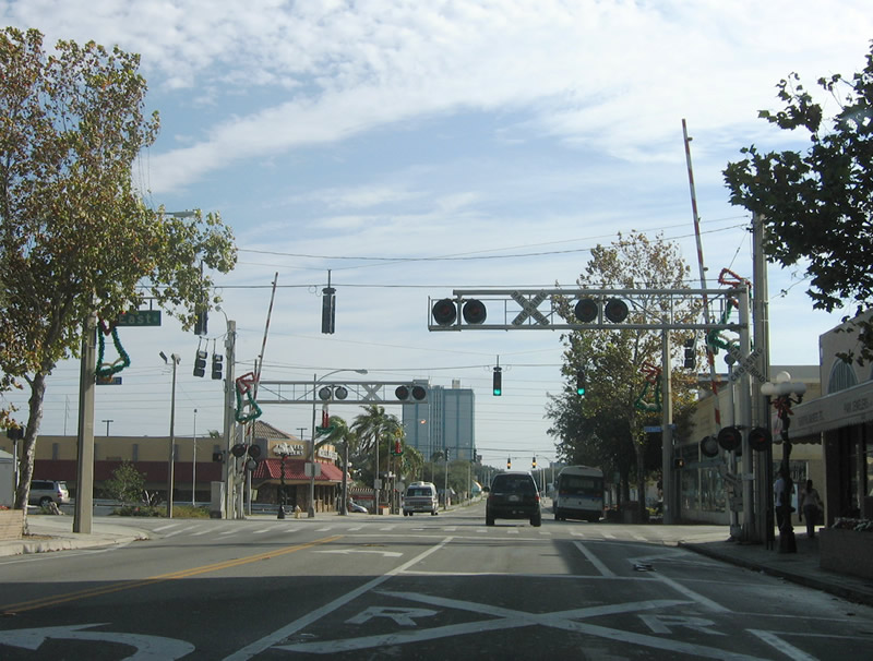
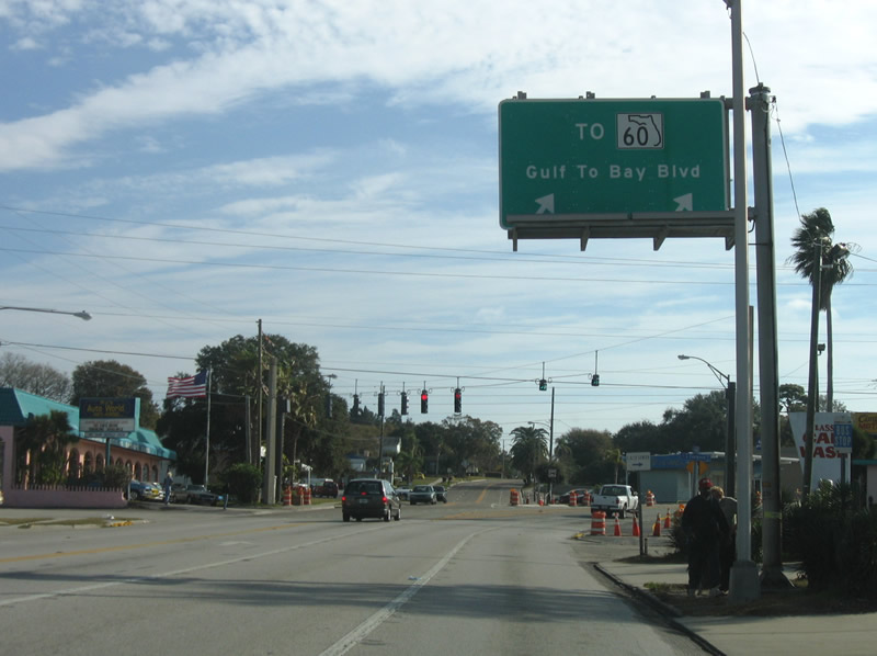
Heading east from Downtown Clearwater, SR 60 follows Gulf to Bay Boulevard to Courtney Campbell Causeway. A SPUI joins SR 60 with U.S. 19 along this stretch. A grade separated interchange between the two routes was proposed going back to at least June 1955, when blueprints for a cloverleaf interchange were prepared for construction of the exchange at SR 60 (Gulf to Bay Boulevard) and U.S. 19. Pinellas County and the City of Clearwater previously agreed to cooperate on the acquisition of the 24 acres of right of way needed for the project. The bulk of the area was vacant land populated by orange groves, though seven houses required relocation. The project was estimated to cost $500,000 with partial or full funding by Federal aid.3
Plans for the grade separation at U.S. 19 and SR 60 (Gulf to Bay Boulevard) advanced into 1956, when it was discussed at a meeting held on January 20 between municipal officials of Pinellas County, the County Commission and State Road Board member Al Rogero. Rogero urged the city of Clearwater and the county at the meeting to acquire the right of way needed for the "four quadrant cloverleaf traffic interchange". Rogero pledged that construction of the exchange would "definitely" be part of the State Road Department's five year program.4
Plans for the proposed interchange were presented at a public hearing in the Pinellas County Commission meeting room on July 9, 1969. Estimated to cost $1.7 million, plans for the project were included in the state's 1970-71 primary road building program. They called for elevating U.S. 19 from a point 1,000 feet north of SR 60 (Gulf to Bay Boulevard) to 1,200 feet south of SR 60. This included a 208 foot long span over Gulf to Bay Boulevard. Frontage roads would also be built along U.S. 19 to service adjacent motels and shopping centers. Nearly all construction was to take place within the existing right of way. Engineers estimated that project could be built in 15 miles, with the service roads built first and traffic temporarily shifting onto them while the overpass was constructed. Associated work would improve about 1,000 feet of SR 60 to accommodate future widening plans.5
Construction on the interchange commenced in September 1971. The four lane overpass taking U.S. 19 across SR 60 (Gulf to Bay Boulevard) eventually opened to traffic on August 20, 1973. Construction on the $3 million project was anticipated for completion in October 1973 with final work under the span along SR 60 and landscaping.6,7 Work however continued into November 1973.8
Courtney Campbell Causeway
Originally named Davis Causeway, the roadway spanning northern reaches of Old Tampa Bay opened on June 28, 1934. It was named for Ben T. Davis, proponent for the road. The causeway was tolled until 1944, when the federal government paid the bridge owners $1.1 million to remove them them in an effort to speed up wartime traffic. Courtney Campbell, a state road board member from Clearwater, lobbied for causeway improvements including a rebuild of its base and landscaping. His efforts led the renaming of the causeway in his name in 1948, despite objections from many including Campbell himself. The state road board named the parks and beaches lining the causeway after Ben Davis, who died in 1947.9
|
| Looking east at Rocky Point and the skyline of Downtown Tampa from Ben T. Davis Municipal Beach along the south side of Courtney Campbell Causeway. 01/02/06 |
|
| Narrow frontage roads line the north side of Courtney Campbell Causeway as it plies across Old Tampa Bay. These roads provide a place to pull off in addition to beach and fishing access. This view looks at the navigation channel bridge along SR 60. 01/02/06 |
|
| Looking southeast from Ben T. Davis Municipal Beach at the distant Howard Frankland Bridge carrying Interstate 275 between Westshore in Tampa and Feather Sound in St. Petersburg. 01/02/06 |
|
| Flamingo Drive ties into SR 60 just west of the Peace River in Bartow. This is the former east end of SR 60A. 03/20/20 |
|
| Kennedy Boulevard begins at the wye interchange (Exit 39) from Interstate 275 north. The four lane boulevard intersects Hoover Boulevard, a local road south to several condominium and office complexes, immediately beyond the freeway off-ramp. 01/18/14 |
|
| A short distance further, Kennedy Boulevard approaches SR 60 at the south end of the Memorial Highway freeway. 01/18/14 |
|
| SR 60 west passes under adjacent Interstate 275 en route to George J. Bean Parkway north to TPA International Airport and the Veterans Expressway (SR 589). 01/18/14 |
|
| SR 60 east overtakes Kennedy Boulevard from the entrance to Westshore Mall here to Downtown Tampa. 01/18/14 |
|
| Motorists taking Kennedy Boulevard (SR 60) west directly to I-275 south are alerted to the length of the Howard Frankland Bridge spanning Old Tampa Bay. 04/17/16 |
|
| A trailblazer for I-275 south stands along Kennedy Boulevard westbound between O'Brien Street and Hoover Boulevard by the Beach Park community. 04/17/16 |
|
| Hoover Boulevard links Kennedy Boulevard south with Cleveland and Azeele Streets in Beach Park. 04/17/16 |
|
| Kennedy Boulevard defaults onto Interstate 275 south at a wye interchange beyond Hoover Boulevard. 04/17/16 |
|
| Cleveland Street (former SR 60) eastbound at East Avenue and a CSX Railroad line in Downtown Clearwater. Cleveland Street carried SR 60 east from the original Memorial Causeway Bridge to Gulf to Bay Boulevard until 2005. 01/02/06 |
|
| Eastbound Cleveland Street at Myrtle Street (U.S. 19 Alternate) prior to a streetscaping project. U.S. 19 Alternate was relocated from Fort Harrison Avenue to Myrtle Street in 2007. The US highway travels south to a short overlap with SR 60 (Court / Chestnut Streets) east to Missouri Avenue. 01/02/06 |
|
| Cleveland Street at Martin Luther King, Jr. Avenue east of Downtown Clearwater. The transition from state to city maintenance resulted in a redesign of Cleveland Street from a four lane arterial to two lane, tree-lined boulevard. 01/02/06 |
|
| Missouri Avenue leads north to SR 590 (Drew Street) and south to the U.S. 19 Alternate and SR 60 split at Court Street. U.S. 19 Alternate follows Missouri Avenue (SR 651) south to SR 686.
Cleveland Street now expands to four lanes east of Missouri Avenue. 01/02/06 |
|
| Cleveland Street nears its split with Gulf to Bay Boulevard (former SR 60) at Evergreen Avenue. Cleveland Street continues east to Highland Avenue with four lanes. The connection provides an alternate to SR 590 (Drew Street), three blocks to the north. 01/02/06 |
|
| This overhead directed SR 60 southeast from Cleveland Street onto Gulf to Bay Boulevard. It was removed by 2007 as part of a signal upgrade project. 01/02/06 |
|
| Gulf to Bay Boulevard (former SR 60) angles southeast to become a part of SR 60 at Court Street and Highland Avenue. Court Street west to Missouri Avenue was formerly a part of SR 651, the hidden counterpart to U.S. 19 Alternate leading south to Seminole. This assembly was replaced by 2007 to reflect SR 60 instead of SR 651. 01/02/06 |
|
| A five way intersection joins Gulf to Bay Boulevard with Court Street west (former SR 651) and Highland Avenue north and south. SR 60 follows Gulf to Bay Boulevard east from Court Street between Highland Avenue and Courtney Campbell Causeway. 01/02/06 |
|
| Historical look at Cleveland Street west at Fort Harrison Avenue in Downtown Clearwater. Much has changed in this scene, with the shield assembly for U.S. 19 Alternate and SR 60 removed, a tree lined median added and a new high rise constructed along the horizon.
SR 60 formerly followed Cleveland Street, but now follows Court Street westbound to a new Memorial Causeway bridge over the Intracoastal Waterway, four blocks to the south. U.S. 19 Alternate was relocated in 2007 three blocks to the east, leading to the removal of this sign array. 01/02/06 |
Sources:
- "Pinellas Bridges and Causeways." Bayciti - Tampa Bay Urban Blog. Cozart, Justin, April 8, 2005. September 18, 2015.
- "Open at Last." St. Petersburg Times (FL), August 18, 2005.
- "Progress in Pinellas." St. Petersburg Times (FL), June 27, 1955.
- "Priorities Set on Highway Improvements." St. Petersburg Times (FL), January 21, 1956.
- "Interchange Plans Described." St. Petersburg Times (FL), July 10, 1969.
- "U.S. 19 Overpass Opens This Week." St. Petersburg Times (FL), August 14, 1973.
- "U.S. 19-Gulf-To-Bay Overpass Readied for Opening." St. Petersburg Times (FL), August 14, 1973.
- "U.S. 19 Overpass Adjacent to Mall." St. Petersburg Times (FL), November 8, 1973.
- "Bridges (Hillsborough)." Bayciti - Tampa Bay Urban Blog. Cozart, Justin, October 24, 2004. September 18, 2015.
01/02/06, 01/18/14, 04/17/16, 03/20/20 by AARoads
Connect with:
Interstate 75
Interstate 95
Interstate 275
Florida's Turnpike
U.S. 1
U.S. 17
U.S. 19
U.S. 27
U.S. 41
U.S. 92
U.S. 98
U.S. 441
U.S. 19 Alternate
State Road 39
Page Updated 12-02-2022.