|
| Distance sign to Mammoth (10 miles), SR 79 (32
miles) and Tucson (58 miles). 06/17/07 |
|
| SR 77 enters the town of Mammoth here. The town
was named after the nearby Mammoth Mine, named for the
'mammoth' vein of copper inside the mine. 06/17/07 |
|
| Advance signage for the San Manual exit
(former SR 76). 06/17/07 |
|
| San Manuel Redington Road departs from SR 77 here.
This is the interchange for former SR 76, which was
in existence from 1964 to 1987. The interchange itself
opened in 1957. 06/17/07 |
|
| This is a typical view of SR 77 south of the San
Manuel exit. 06/17/07 |
|
| Distance sign to Oracle (5 miles), SR 79 (17 miles)
and Tucson (42 miles). 06/17/07 |
|
| Turn left here for the town of Oracle (located along
an old alignment of SR 77, bypassed in 1974). 06/17/07 |
|
| Distance sign to SR 79 (9 miles) and Tucson (34
miles). 06/17/07 |
|
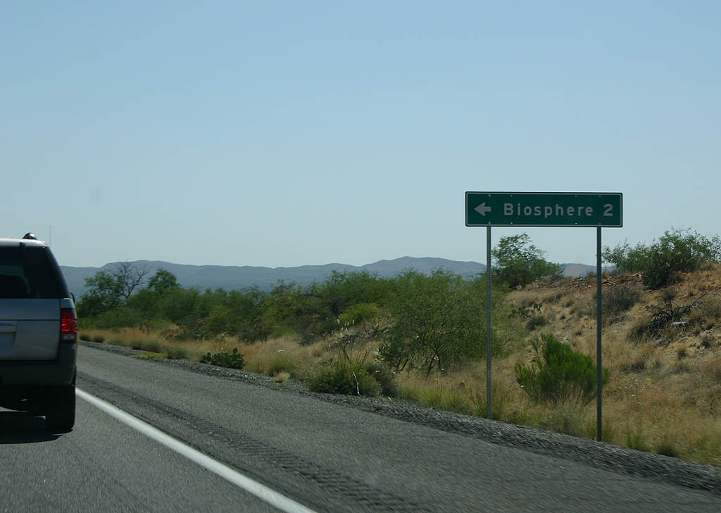
| Biosphere 2 is a research facility well documented over time for its numerous flaws. It is currently being run by the University of Arizona under a lease. 06/17/07 |
|
| Advance signage for SR 79, 1/2 mile. 06/17/07 |
|
| SR 77 meets SR 79 here. Turn right on Arizona
79 to reach Florence. This intersection marks the historic
end of SR 77 until 1992, when the road was extended
south into Tucson to replace former U.S. 80. 06/17/07 |
|
| Reassurance marker for SR 77 south of the Arizona
79 intersection. 06/17/07 |
|
| Distance sign to Catalina (4 miles), Oro Valley (11
miles) and Tucson (25 miles). 06/17/07 |
|
| The Catalina Mountains can be seen just to the east
of SR 77. As we approach the Pima county line, the
speed limit decreases. 06/17/07 |
|
| SR 77 enters the town of Catalina here. Catalina
is named after the Catalina mountains, and today is a
bedroom community for Tucson. 06/17/07 |
|
| SR 77 enters more developed areas as it gets closer
to Tucson. 06/17/07 |
|
| SR 77 enters Oro Valley here. Oro Valley is a suburb
of Tucson, incorporated in 1974. 06/17/07 |
|
| Turn left to enter Catalina State Park. 06/17/07 |
|
| The Catalina Mountains form an effective backdrop to
this panorama along SR 77 (former U.S. 80). 06/17/07 |
|
| Distance sign to downtown Tucson (14 miles). 11/10/07 |
|
| SR 77 turns right here. At this point, SR 77 (former U.S. 80) meets former SR 84. Turn right to continue on SR 77 to reach Interstate 10 at the Miracle Mile interchange. Continue south on former U.S. 80/former Business 10 to reach downtown Tucson. 11/10/07 |
Page Updated 05-03-2010.