NC 133 is a coastal route originating at Caswell Beach in Brunswick County. The state route crosses the Intracoastal Waterway north to Brunswick County Airport and NC 210 near Southport. Prior to 2016, the two highways combined east for 0.80 miles to Dosher Cutoff SE. Opening at that time was a 3.4 mile realignment along Long Beach Road Extension. The two-lane road bypassed Dosher Cutoff SE and shortened the overlap with NC 87 north out of Southport for NC 133. Work on the $22 million contract ran from May 2013 to May 2016.1
Additional work starting in 2019 will add a grade separation between NC 133 at NC 210. The new overpass will be built as part of an $85 million project to expand N.C. 211 east from Midway Road to N.C. 87 at Southport.2
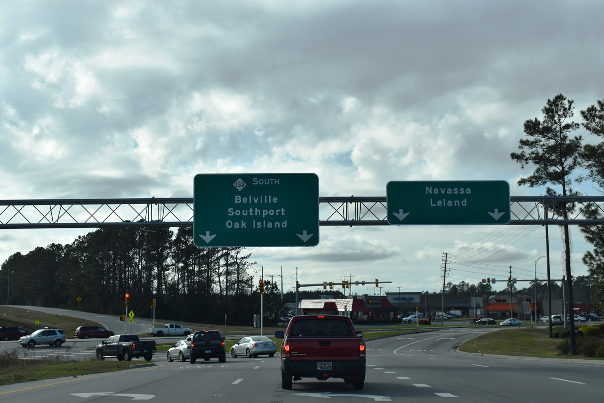
NC 133 combines with NC 87 for one mile north to River Road. NC 87 branches northwest to Boiling Spring Lakes while NC 133 shifts eastward alongside Sunny Point Military Ocean terminal and the Cape Fear River. The state route continues along River Road to Belville and a diverging diamond interchange (DDI) with U.S. 17/74/76 opposite Village Road and Leland. The exchange opened to traffic on April 15, 2016 and was built during the Causeway Bridge Project underway from January 27, 2014 to November 15, 2016.3
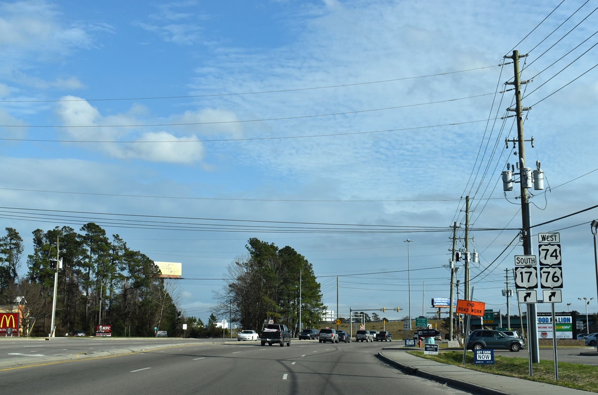
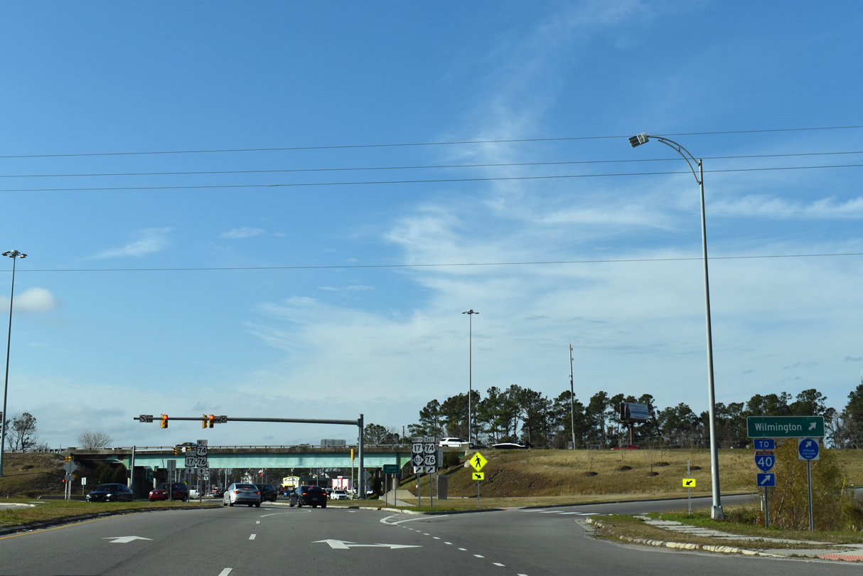
Heading east toward Wilmington, NC 133 navigates along a series of overlaps, starting with U.S. 17/74/76 across the Brunswick River. The state route accompanies U.S. 74/421 north from U.S. 17/76 over the Cape Fear River to Martin Luther King, Jr. Parkway, an expressway spanning the Northeast Cape Fear River into Wilmington. U.S. 74/NC 133 overlap east 1.8 miles to Hightsville, where NC 133 shifts onto Castle Hayne Road north.
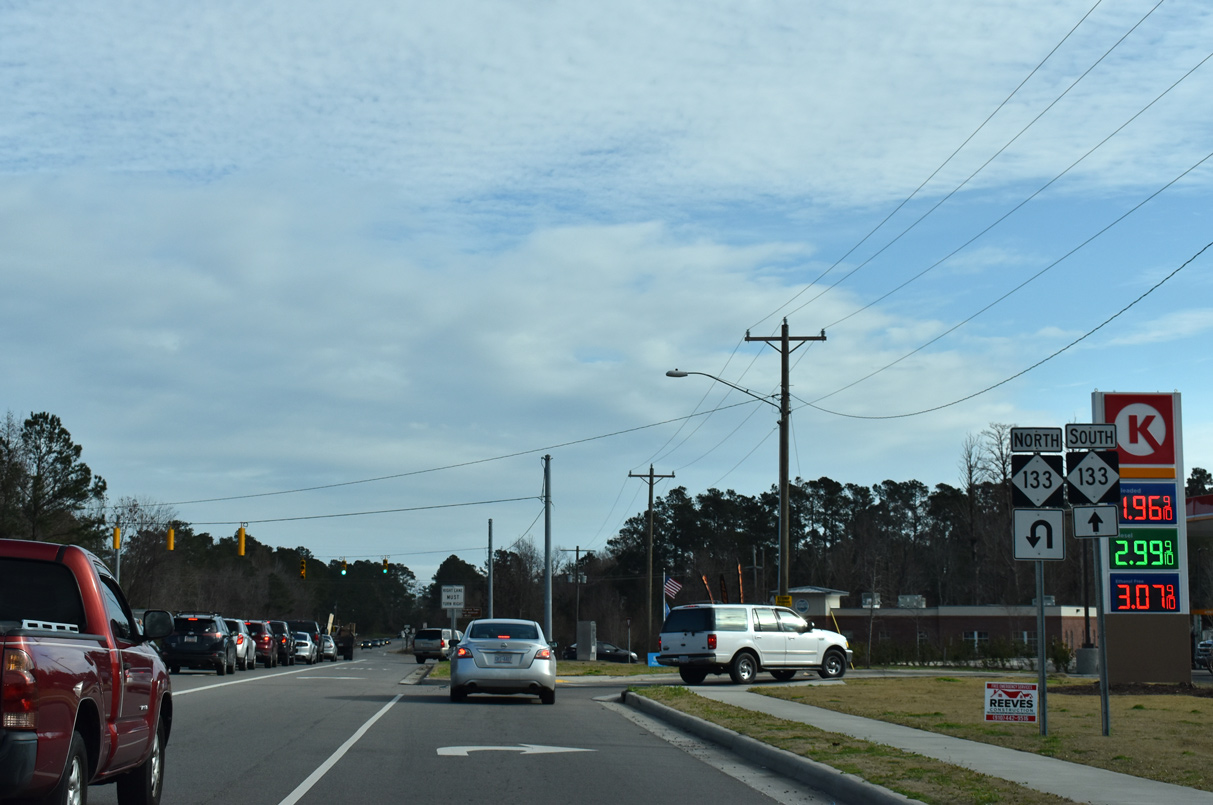
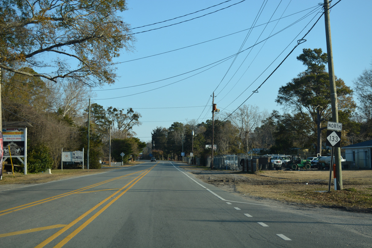
NC 133 combines with U.S. 117 from Castle Hayne northward across the Northeast Cape Fear River into Pender County. The two split 1.78 miles beyond the county line at Marlboro, with the final 3.90 miles of NC 133 extending west to NC 210 between Rocky Point and Long Creek.
|
| NC 133 (River Road) expands to four lanes leading into the diverging diamond interchange with U.S. 17-74-76 at Leland. 01/19/19 |
|
| U.S. 74 east from Leland to U.S. 117 north or to U.S. 421 north and I-140 east connects with Interstate 40 leading out of Wilmington. 01/19/19 |
|
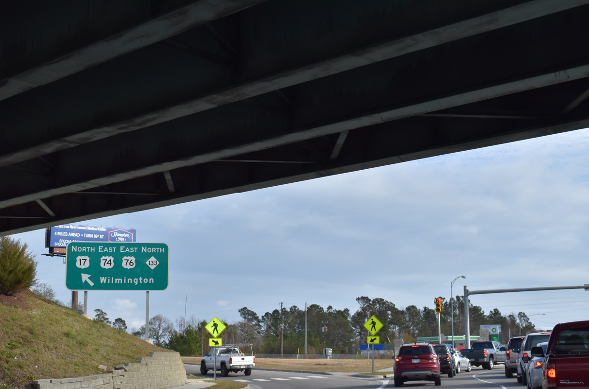
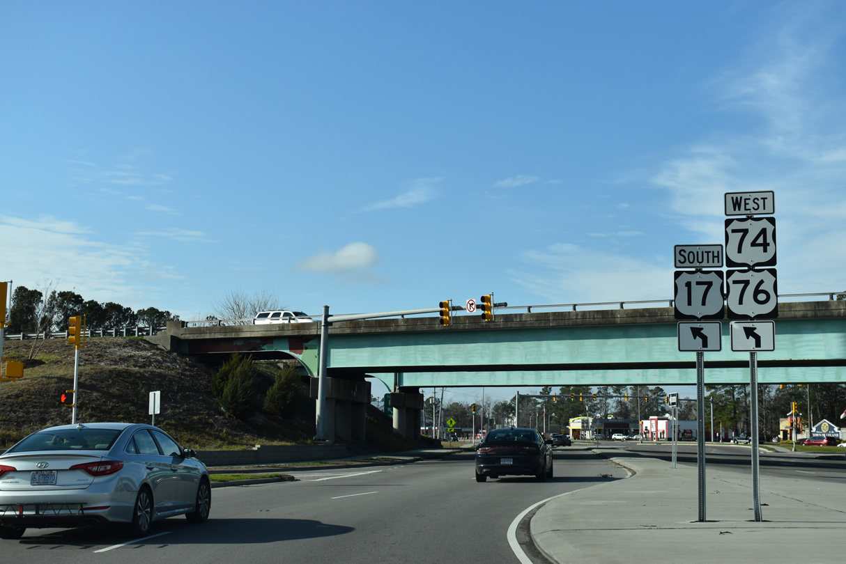
| NC 133 overlaps with U.S. 17-74-76 east onto Eagle Island, and with U.S. 74 to Wilmington and Hightsville. 01/19/19 |
|
| Navigating through the DDI to the westbound entrance ramp for U.S. 17-74-76 to Bolivia and Whiteville. 01/19/19 |
|
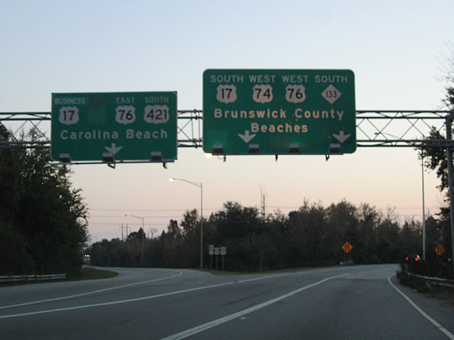
| U.S. 74 west to Lumberton, Laurinburg and Rockingham is part of the Future I-74 corridor. U.S. 76 travels west from coastal North Carolina to Florence, South Carolina. 01/19/19 |
|
| Village Road (SR 1472) extends northwest from NC 133 (River Road) and the DDI with U.S. 17-74-76 along a commercial strip into Leland. 01/19/19 |
|
| NC 133 separates from the U.S. 74 freeway and heads north into Hightsville. 12/31/17 |
|
| NC 133 overtakes Castle Hayne Road north from the ensuing traffic light after U.S. 74. 12/31/17 |
|
| Reassurance marker posted north of Gordon Road. 12/31/17 |
|
| North 23rd Street angles southeast from NC 133 (Castle Hayne Road) to Wilmington International Airport (ILM) and U.S. 74 (Martin Luther King, Jr. Parkway) east to North College Road (U.S. 117) and I-40. 12/31/17 |
|
| 23rd Street leads 2.5 miles south from Hightsville to U.S. 17 (Market Street) east of Downtown Wilmington. 12/31/17 |
|
| Castle Hayne Road and Kerr Avenue come together at a commercialized intersection in Wrightsboro. Kerr Avenue runs north of Wilmington International Airport (ILM) to U.S. 117/NC 132 and Murrayville. 12/31/17 |
|
| Castle Hayne Road remains a three-lane boulevard north from Kerr Avenue to North County Drive. 12/31/17 |
|
| NC 133 (Castle Hayne Road) advances two miles north from Wrightsboro to a folded diamond interchange with Interstate 140. 12/31/17 |
|
| Interstate 140 wraps around the north side of the Wilmington area along a 25 mile course between Bishop and Kirkland. 12/31/17 |
|
| U.S. 17 was previously cosigned with I-140 between U.S. 421 west of the Northeast Cape Fear River and I-40 near Murraysville. The route extended east of I-40 toward the Pender County line along unmarked NC 140. 12/31/17 |
|
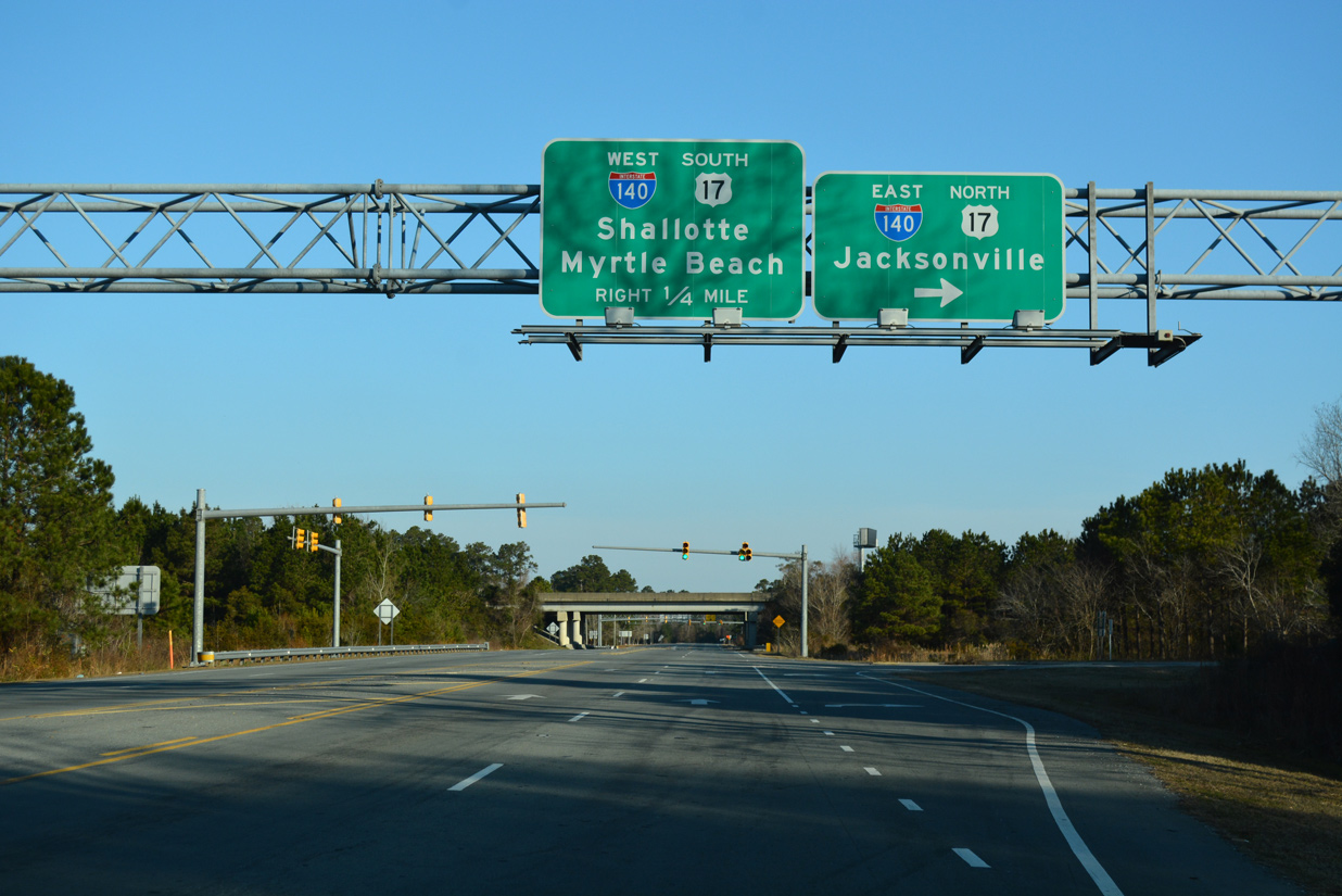
| I-140 provides a bypass of Wilmington for U.S. 17 north to Topsail Beach and Jacksonville. Encircling Leland to the southwest, I-140 connects with U.S. 17 ahead of Shalotte and Myrtle Beach, South Carolina. 12/31/17 |
|
| NC 133 shield posted along Castle Hayne Road southbound after Kerr Avenue in Hightsville. 11/11/06 |
|
| North 23rd Street branches southeast from NC 133 (Castle Hayne Road) to Wilmington International Airport (ILM) and U.S. 74 (Martin Luther King Jr. Parkway). U.S. 74 comprises an expressway link east to U.S. 117/NC 132 south of the I-40 eastbound beginning. 11/11/06 |
|
| Castle Hayne Road partitions with NC 133 to the southeast as the state route connects with U.S. 74 (Martin Luther King, Jr. Parkway). Prior to September 2005, NC 133 remained along Castle Hayne Road southwest toward the Parsley Street Bridge. The alignment changed when MLK, Jr. Parkway opened. 11/11/06 |
|
| A trumpet interchange joins NC 133 south with U.S. 74 (Martin Luther King, Jr. Parkway) at Hightsville. The parkway is a controlled access expressway west across the North East Cape Fear River to U.S. 421 and east to U.S. 17 (Market Street) at Eastwood Road. 11/11/06 |
|
| Heading south along U.S. 74-421 and NC 133 between Martin Luther King, Jr. Parkway and the Cape Fear River. 11/11/06 |
|
| U.S. 74 west / NC 133 south combine with U.S. 17-76 along a freeway to Belville and LeLand. A loop ramp joins U.S. 17-76-421 east across the Cape Fear River into Wilmington. Prior to 2005, U.S. 74 combined with the three routes east. 11/11/06 |
|
| U.S. 17-74-76/NC 133 combine ahead of Alligator Creek on Eagle Island. The Causeway Bridge Project underway between January 2014 and November 2016 included replacement of the bridges across Alligator Creek. 01/19/19 |
|
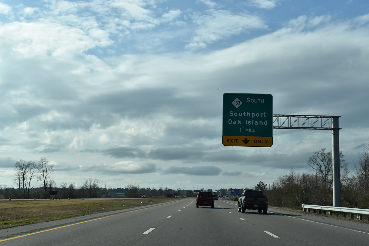
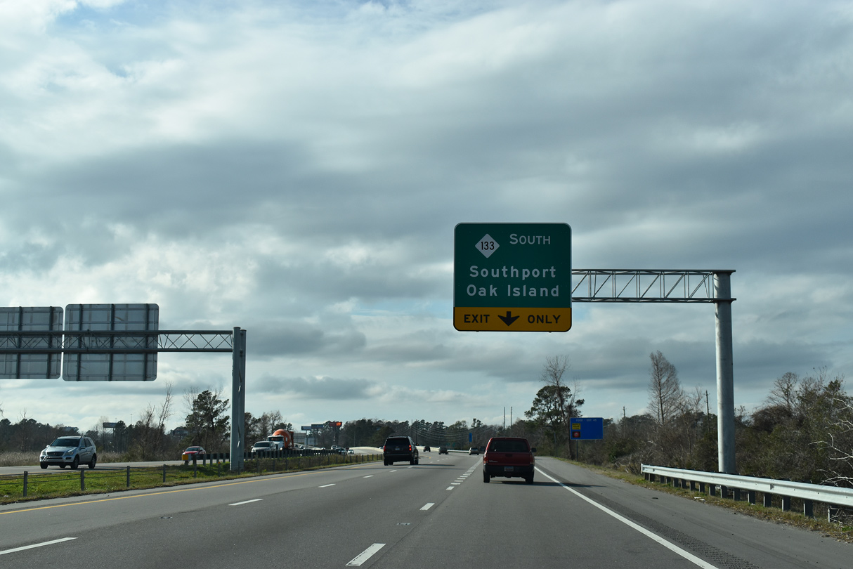
| NC 133 separates from U.S. 17-74-76 just across the eight lane span across the Brunswick River completed by mid-November 2016. Resuming a southerly course, NC 133 travels to Clarendon, Pinelevel and NC 87 by Sunny Point Military Ocean terminal. NC 87/133 combine toward Southport. 01/19/19 |
|
| The diamond interchange with River Road (NC 133) south and Village Road (SR 1472) west was reconfigured into a DDI. The new ramp system debuted to motorists on April 15, 2016. 01/19/19 |
|
| Village Road (SR 1472) heads southeast through a commercial strip to the diverging diamond interchange with U.S. 17-74-76 and NC 133. 01/19/19 |
|
| NC 133 (River Road) overtakes Village Road (SR 1472) south from the DDI with U.S. 17-74-76. 01/19/19 |
|
| Blackwell Road (SR 1551) was realigned to intersect NC 133 (River Road) south of Main Street as part of the project to build the DDI with U.S. 17-74-76. 01/19/19 |
Photo Credits:- 11/11/06 by AARoads and Justin Cozart.
- 12/31/17 by AARoads.
- 01/19/19 by AARoads.
Connect with:
Interstate 140
U.S. 17
U.S. 74
U.S. 76
U.S. 421
Page Updated 07-17-2020.


 West
West 
 South
South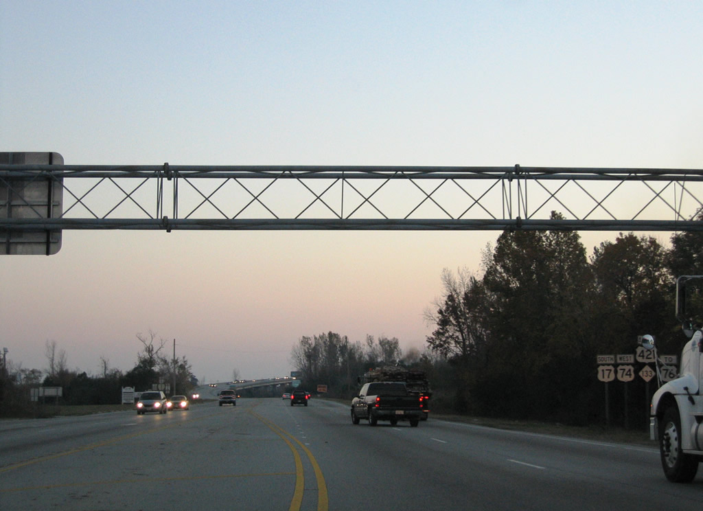

 West
West