|
| South of Northern Parkway, MD 139 (Charles Street) intersects Amberly Way west and St. Dunstans Road east into the Homeland community. 07/02/10 |
|
| Wyndhurst Avenue east and St. Albans Way west meet Charles Street at a staggered intersection. 07/02/10 |
|
| MD 139 (Charles Street) southbound at Homeland Avenue and the Notre Dame College of Maryland. 07/02/10 |
|
| A set of flashers hang above the entrance to Loyola University of Maryland at Charles Street. A pedestrian overpass join portions of the campus east and west of MD 139. 07/02/10 |
|
| Cold Spring Lane provides a through route west to Roland Park, Interstate 83 (Exit 9) and Park Heights and east to Morgan State University and Lauraville. 07/02/10 |
|
| St. Paul Street splits with Charles Street at the Guilford community of Baltimore. Charles Street flows south from St. Paul Street to Charlotte Road as an unsigned segment of MD 139. MD 139 also uses St. Paul Street as it encircles the area east of Johns Hopkins University. 07/02/10 |
|
| Charlotte Road provides northbound access from Charles Street onto St. Paul Street. 07/02/10 |
|
| The final southbound shield of MD 139 lies along St. Paul Street after Charlotte Road. 07/02/10 |
|
| St. Paul Street comprises a four lane divided parkway from Charles Street to University Parkway. Pictured here is the signalized intersection with East 39th Street. 39th Street links MD 139 with MD 45 (York Road) at Waverly. 07/02/10 |
|
| University Parkway meanders southeast from Roland Park and Cold Spring Lane to Johns Hopkins University and 33rd Street. MD 139 becomes more urban south of their intersection. 07/02/10 |
|
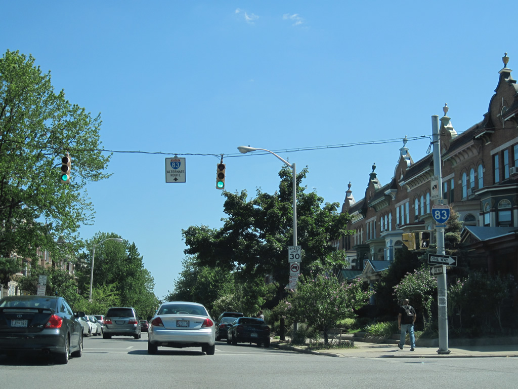
| East 33rd Street joins Johns Hopkins University with Waverly and the Lake Montebello area of Herring Run Park. Alternate route signs for Interstate 83 begin appearing for traffic interests between the university and the Jones Falls Expressway. 07/02/10 |
|
| Two segments of MD 139 continue south from St. Paul Street to U.S. 1 (North Avenue). Both Charles and St. Paul Streets carry two way traffic through their intersections with East 31st Street. 07/02/10 |
|
| Interstate 83 trailblazer posted along St. Paul Street southbound at East 30th Street. 07/02/10 |
|
| East 29th Street provides direct access to the Jones Falls Expressway at the Druid Hill Park interchange. 07/02/10 |
|
| East 28th Street returns traffic from Interstate 83 and Druid Park Lake drive to St. Paul Street and MD 45 (Greenmount Avenue). 07/02/10 |
|
| Continuing south through Charles Village to East 27th Street. 07/02/10 |
|
| 25th Street provides an alternate route between Harford Road (MD 147) and the 28th/29th Street couplet via Huntingdon Avenue. 07/02/10 |
|
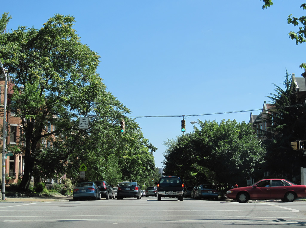
| Traffic lights govern the movements between the next four intersections of MD 139 (St. Paul Street) south. 07/02/10 |
|
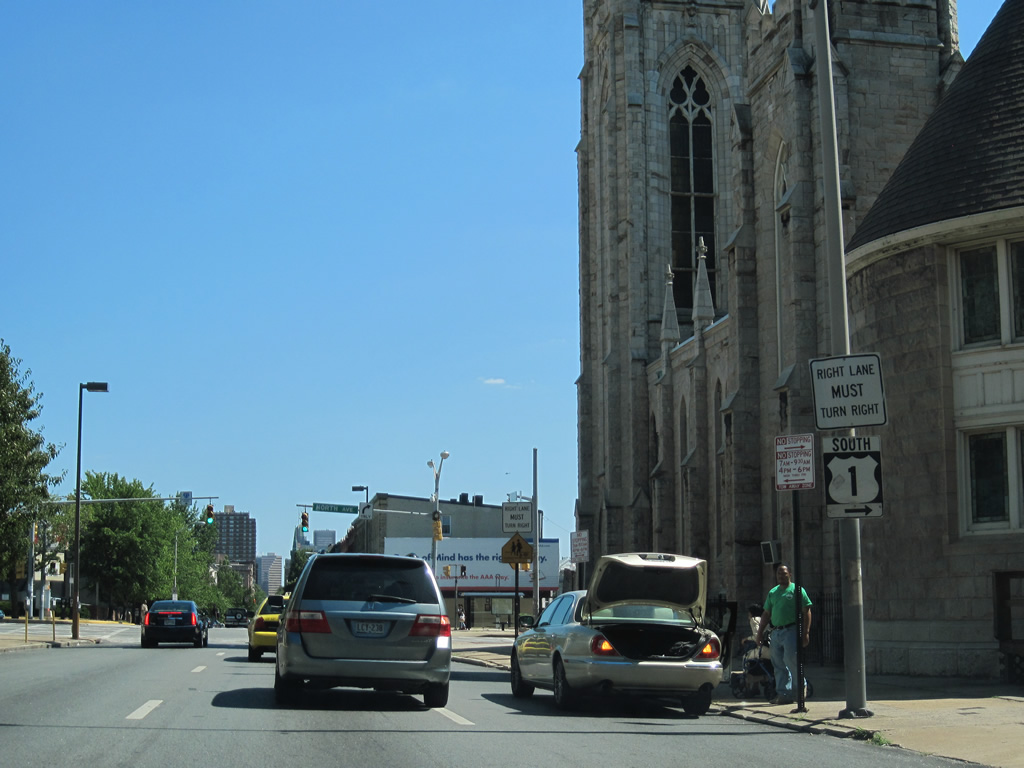
| MD 139 ends at U.S. 1 (North Avenue) and MD 2 (St. Paul Street) south. 07/02/10 |
|
| U.S. 1 travels west to Interstate 83 (Exit 6) and Monroe Street / Fulton Avenue and east to Bel Air Road. St. Paul Street continues as MD 2 to Mount Vernon and Downtown. 07/02/10 |
|
| Northern Parkway and MD 139 (Charles Street) cross paths at the Homeland neighborhood in north Baltimore. Charles Street exits the city en route to Lutherville and its end at Interstate 695. Southward, the state route continues on Charles Street to Notre Dame College of Maryland, Guilford, and Johns Hopkins University. 07/02/10 |
Page Updated 04-14-2011.