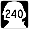
Washington State Route 240 runs 43.17 miles from SR 24 by the Hanford Department of Energy Site in Benton County to U.S. 395 by the Pioneer Memorial Bridge in Kennewick. The highway runs southeast through Cold Creek Valley along Hanford Reach National Monument to SR 225 by The Horn along the Yakima River.
Continuing southeast into north Richland, SR 240 passes by the Horn Rapids master planned golf course community ahead of Stevens Road and Jadwin Avenue (former SR 240 Business). SR 240 shifts onto Bypass Highway encircling residential areas of Richland south from Richland Airport (RLD) to Interstate 182 at Exit 4.
SR 240 overlaps with I-182 east 1.18 miles to George Washington Way (old SR 240 Business), where it turns southeast onto a freeway leading into Kennewick. Generally following Lake Wallula along the Columbia River, the freeway along SR 240 extends 7.12 miles to a roundabout interchange with U.S. 395 and W Columbia Drive.
|
| Reassurance shield for SR 240 east posted after the signalized intersection with Duportail Street along Bypass Highway southbound in Richland. 08/28/06 |
|
| The westbound entrance ramp for I-182/U.S. 12 west precedes the signalized intersection with Aaron Drive on SR 240 (Bypass Highway) east. 08/28/06 |
|
| Aaron Drive acts as a northbound side frontage road to the freeway east to Wellsian Way and George Washington Way. 08/28/06 |
|
| The right lane defaults onto I-182/U.S. 12 west to Interstate 82 at Goose Gap. 08/28/06 |
|
| SR 240 combines with I-182/U.S. 12 east at a trumpet interchange beyond Aaron Drive. 08/28/06 |
|
| Continuing south from I-182/U.S. 12, SR 240 crosses the Yakima River. A truss bridge parallels the freeway along the US Government Railroad line from Hanford. 08/28/06 |
|
| Replacing a four lane span built in the 1950s, the eight lane bridge crossing the Yakima River along SR 240 opened in 2005 as part of an expansion project along the state route. 08/28/06 |
|
| Major construction along SR 240 in the mid 2000s relocated the freeway mainline over Columbia Park Trail and redesigned the Richland Y Interchange. A roundabout was added along the eastbound ramps with Columbia Park Trail and Steptoe Street leading south to Gage Boulevard. Columbia Park Trail is the old alignment of U.S. 410 and U.S. 12 between Richland and Kennewick. 08/28/06 |
|
| SR 240 turns east from the Richland Y community alongside Columbia Canal. 08/28/06 |
|
| Columbia Center Boulevard meets SR 240 at a six-ramp parclo interchange in a half mile. 08/28/06 |
|
| Columbia Center Boulevard ties into Columbia Park Trail at Island View to the north. Columbia Park Trail continues east to Columbia Park. 08/28/06 |
|
| The first of three exits from SR 240 east in Kennewick departs for Columbia Center Boulevard. The arterial runs south to Columbia Center mall and Quinault Avenue east to the Toyota Center. 08/28/06 |
|
| SR 240 runs between Columbia Park and Columbia Canal on the ensuing stretch east. 08/28/06 |
|
| The next exit along SR 240 eastbound joins the freeway with Edison Street in one half mile. 08/28/06 |
|
| Edison Street leads south from Columbia Park to a diamond interchange with SR 240, the West Highlands neighborhood and 10th Avenue. 08/28/06 |
|
| The last eastbound shield for SR 240. A Union Pacific Railroad line parallels the final mile to U.S. 395. 08/28/06 |
|
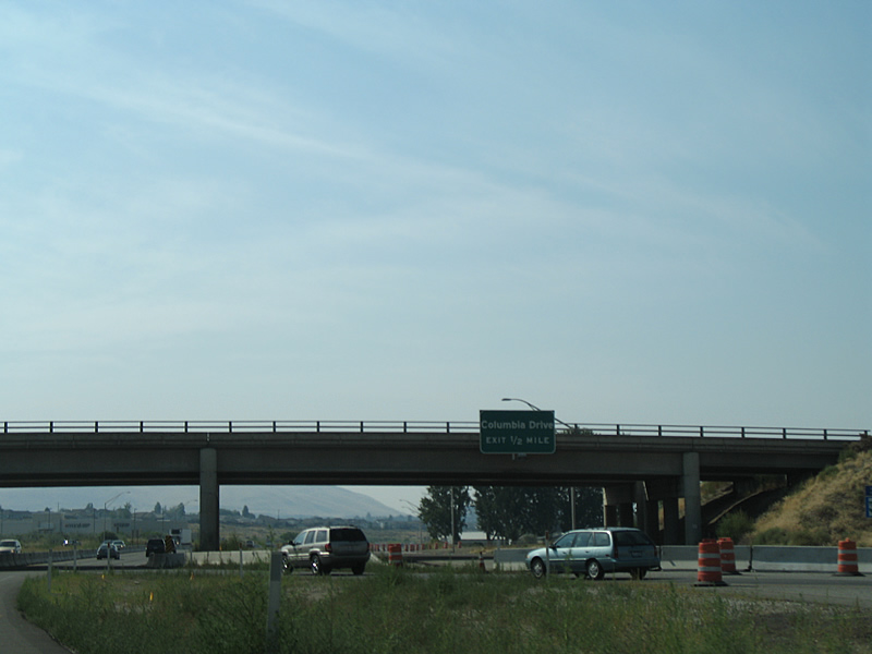
| SR 240 concludes at U.S. 395 and Columbia Drive east near the Blue Bridge. 08/28/06 |
|
| Columbia Drive extends east from the end of SR 240 to the Kennewick city center. The five lane boulevard follows the historic alignment of U.S. 410 to where the Green Bridge was once located. 08/28/06 |
|
| Traffic partitions from SR 240 for U.S. 395 north to Pasco, Columbia Drive east to SR 397 and the Cable Bridge and U.S. 395 southwest through Kennewick to I-82. Construction completed in October 2009 redesigned the exchange by replacing loop ramps with roundabouts and the overpass for U.S. 395 south over SR 240 east. 08/28/06 |
|
| Work completed in 2009 reconfigured the wye interchange joining U.S. 395 south from the Blue Bridge with SR 240 west to eliminate the left exit. 08/28/06 |
|
| Right in right out (RIRO) ramps link SR 240 westbound with Columbia Park Trail north at Columbia Park. 08/28/06 |
|
| Columbia Park Trail straddles Lake Wallula along the Columbia River west from Columbia Park to Richland. 08/28/06 |
|
| Edison Street meets SR 240 at a diamond interchange between a Union Pacific Railroad line and Columbia Park. 08/28/06 |
|
| Edison Street stems south from Columbia Park Trail to the West Highlands community and 10th Avenue in Kennewick. 08/28/06 |
|
| SR 240 parallels Columbia Canal west into the city of Richland. 08/28/06 |
|
| Columbia Center Boulevard converges with SR 240 at a six-ramp parclo interchange next to Island View and Richland Junction in a half mile. 08/28/06 |
|
| Columbia Center Boulevard leads south from SR 240 to Columbia Center mall and west of Toyota Center. 08/28/06 |
|
| Columbia Park Trail continues west from the Richland Y community to a parclo interchange with SR 240. The road leading west through Richland is the former alignment of U.S. 410 and U.S. 12. 08/28/06 |
|
| Work completed in 2007 realigned SR 240 at the Richland Y Interchange. Roadways were constructed east of the original freeway footprint to accommodate a new roundabout between Columbia Park Trail, ramps on SR 240 east and Steptoe Street south. 08/28/06 |
|
| SR 240 turns northward to cross the Yakima River and overlap with I-182/U.S. 12 west. Eight lanes cross the river on bridges built in 2005 as part of an overall SR 240 expansion project. 08/28/06 |
|
| George Washington Way commences northward to the Richland city center from the directional cloverleaf interchange joining Interstate 182, U.S. 12 and SR 240. 08/28/06 |
|
| Paralleling SR 240 across the Yakima River is a truss bridge along the Government Railroad. 08/28/06 |
|
| SR 240 combnes with I-182/U.S. 12 west to the succeeding exit from George Washington Way. I-182/U.S. 12 overlap for 15 miles from Interstate 82 at Goose Gap to Lewis Street in east Pasco. 08/28/06 |
|
| SR 240 branches northwest from I-182 at Exit 4 along Bypass Highway, a six lane controlled access arterial. 08/28/06 |
|
| Vantage is 68 miles north from Interstate 182. West Richland lies five miles to the west via SR 224. 08/28/06 |
|
| Duportail Street intersects SR 240 (Bypass Highway) at the first traffic light westbound. The residential through street connects with Thayer Drive to the east. 08/28/06 |
|
| SR 240 (Bypass Highway) westbound at Duportail Street. A separate section of Duportail Street is west of the Yakima River. 08/28/06 |
Page Updated 10-14-2011.

 East
East