|
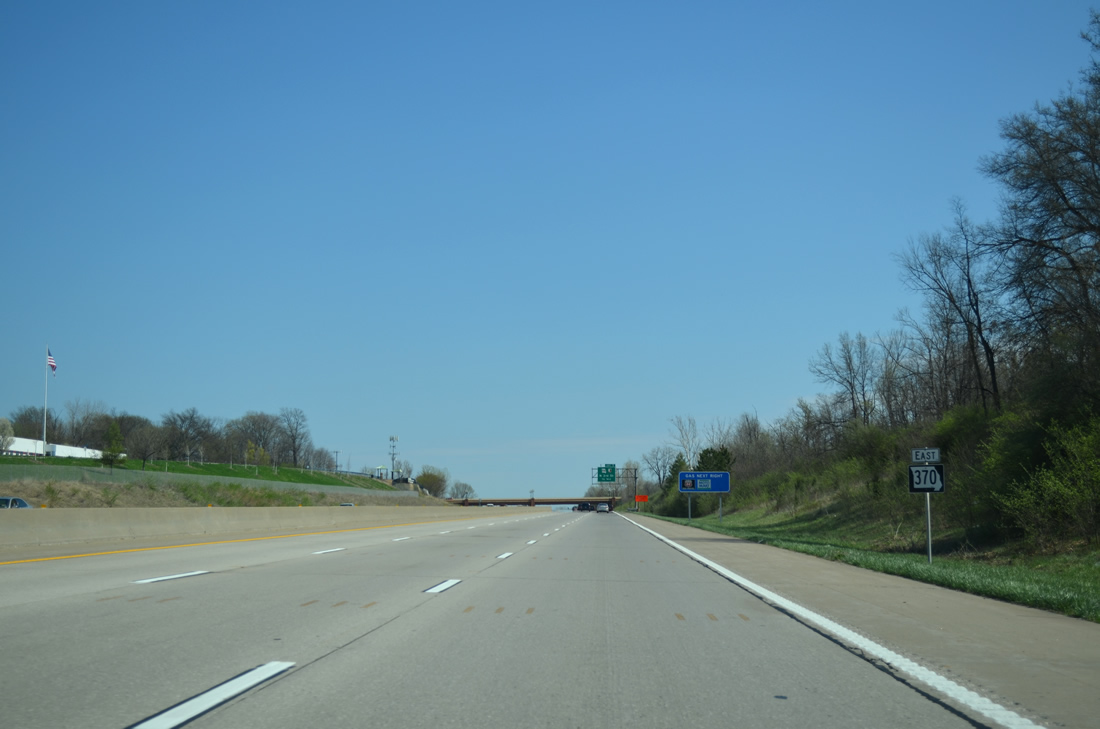
| The first reassurance marker for Missouri 370 east appears ahead of the Premier Parkway underpass. 04/13/13 |
|
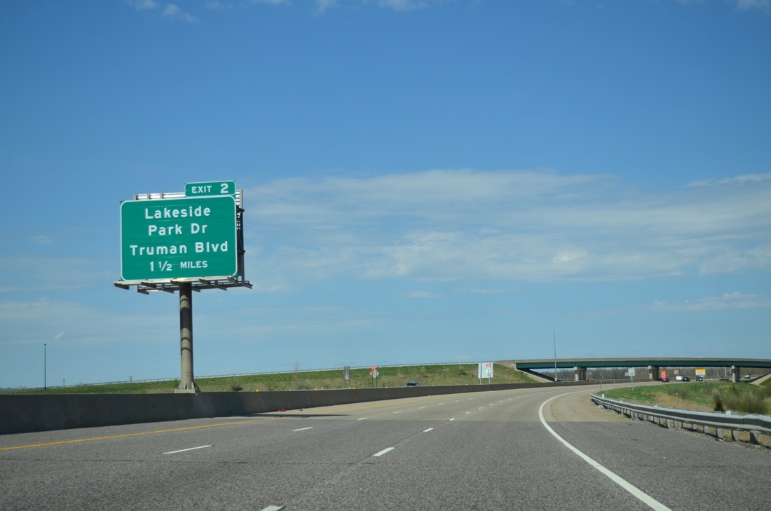
| Missouri 370 turns from north to east at the wye interchange (Exit 1B on westbound) with Salt River Road to meet Truman Boulevard south and Lakeside Park Drive north at Exit 2. 04/13/13 |
|
| All three exits in St. Charles County serve the city of St. Charles along Missouri 370 east to the Discovery Bridge. 04/13/13 |
|
| One quarter mile out from the diamond interchange (Exit 2) on Missouri 370 east. Lakeside Park Drive spurs north from the freeway to 370 Lakeside Park. The 300-acre park encircles a 140-acre lake formed along Dardenne Creek. It opened on May 19, 2011. 04/13/13 |
|
| Truman Boulevard winds south through western reaches of St. Charles from Exit 2 to Cave Springs Road at Interstate 70. 04/13/13 |
|
| Eastbound drivers along Missouri 370 formally enter the city of St. Charles at the ramp merge from Truman Boulevard. 04/13/13 |
|
| New Town Boulevard south and Elm Street north come together in one mile at a diamond interchange (Exit 5). The first St. Louis County exit is 5.25 miles away at the Earth City Levee District. 04/13/13 |
|
| Elm Street angles northwest from central St. Charles to become a commercial arterial leading to Missouri 370. 04/13/13 |
|
| Exit 5 leaves Missouri 370 east. New Town Boulevard extends north from Elm Street by the Fountain Lakes Commerce Center and east to St. Charles Airport (SET) and Highway B. 04/13/13 |
|
| Missouri 370 turns more southerly from Exit 5 to the Discovery Bridge. 04/13/13 |
|
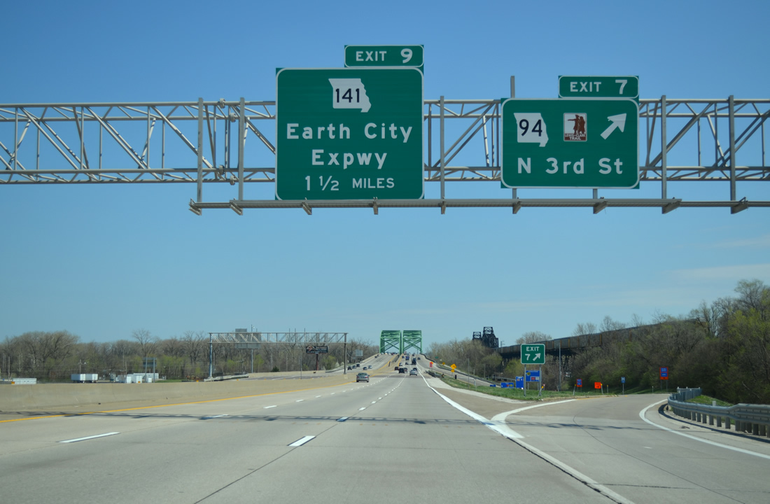
| Missouri 94, a 136.31 mile route from U.S. 54 & 63 at Jefferson City to U.S. 67 at West Alton, crosses paths with Missouri 370 in one mile. 04/13/13 |
|
| A second reassurance marker for Missouri 370 east remains from when temporary ramps connected the freeway end with Mueller Road. 04/13/13 |
|
| Missouri 94 takes North 3rd Street south from Exit 7 three blocks to Tecumseh Street and 2nd Street leading south to Downtown St. Charles. 04/13/13 |
|
| Mel Wetter Parkway stems north from 5th Street near Blanchette Park to pass over Missouri 370 ahead of parallel Little Hills Expressway. The Parkway opened on October 6, 2006 and is named after a former mayor of St. Charles. 04/13/13 |
|
| Entering the parclo interchange (Exit 7) with MO 94 ahead of the Discovery Bridge. MO 94 departs St. Charles for a rural trek to Boschertown and Orchard Farm through the northeastern arm of St. Charles County. 04/13/13 |
|
| Superstructure for both the Discovery Bridge and the parallel Wabash Bridge (Norfolk Southern Railroad) across the Missouri River appear as Missouri 370 spans Missouri 94 (North 3rd Street). 04/13/13 |
|
| The Missouri River flows eastward from St. Charles to the Mississippi River at Mobile Island and Columbia Bottom. The 2,341 mile waterway originates in western Montana. 04/13/13 |
|
| The Discovery Bridge doubles as the Mississippi River Trail bicycle route. Access to cyclists was prohibited however from November 2011 through 2013 during the I-70 Blanchette Bridge project as MO 370 was restriped for four lanes on each bridge. 04/13/13 |
|
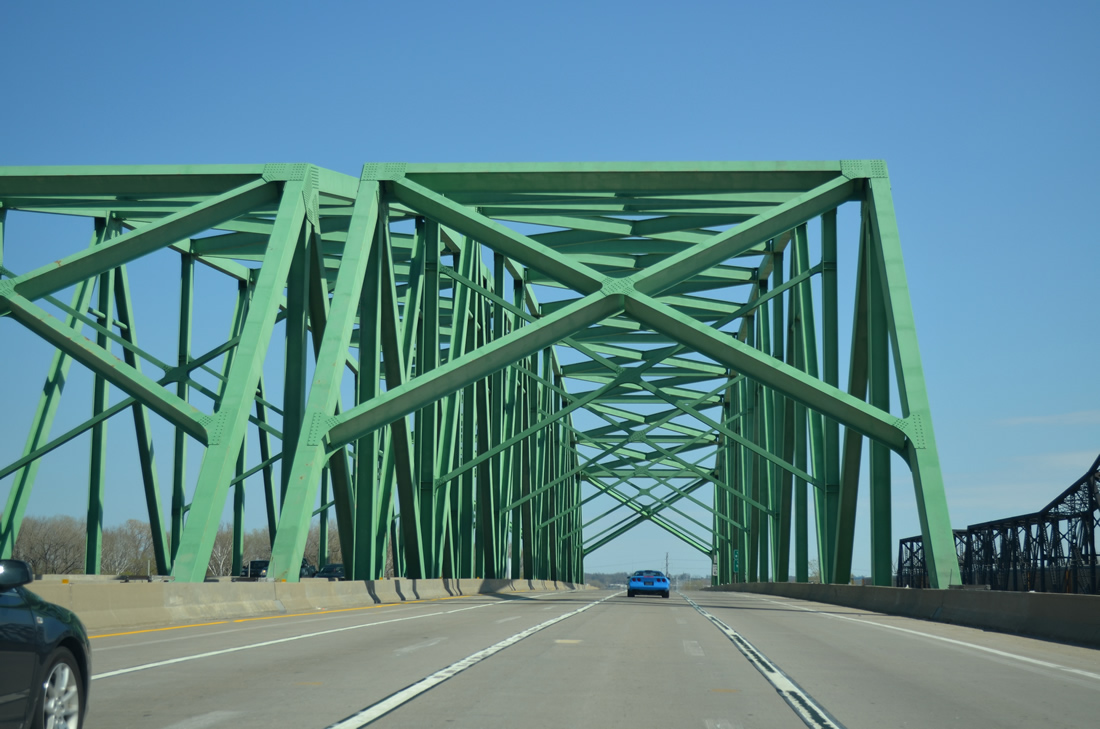
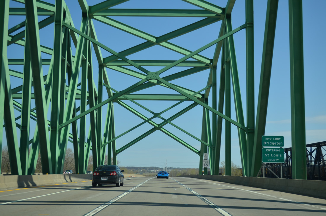
| A pair of truss bridges, the Discovery Bridge measures 3,455 feet in length. Two 55 foot decks accommodate three lanes with a full shoulder.1 04/13/13 |
|
| Midway across the Missouri River, travelers along Missouri 370 enter both St. Louis County and the city of Bridgeton. The Discovery Bridge opened to traffic on December 16, 1992 as a realignment for Missouri 115. 04/13/13 |
|
| Just beyond the Discovery Bridge is a parclo interchange joining MO 370 with the north end of MO 141 (Earth City Expressway). MO 141 was extended north along both Maryland Heights and Earth City Expressways, from MO 364 to Exit 9, in July 2012. 04/13/13 |
|
| Earth City Expressway leads south from Missouri 370 and Missouri Bottom Road through the Earth City Levee District, a 1,891 acre mixture of business and industrial parks bound by MO 370 to the north, I-270 to the east, and I-70 to the south. 04/13/13 |
|
| The final Missouri 370 eastbound reassurance assembly precedes the Ferguson Lane underpass. 04/13/13 |
|
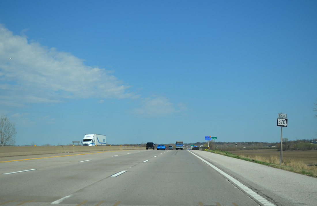
| Two miles out from the Missouri 370 directional T interchange with Interstate 270 and Missouri Bottom Road 04/13/13 |
|
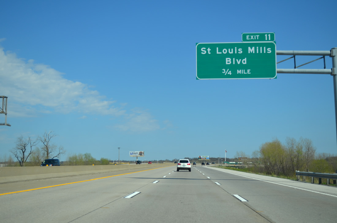
| St. Louis Mills Boulevard joins Missouri 370 with St. Louis Outlet Mall in adjacent Hazelwood and Taussig Avenue west into Bridgeton. 04/13/13 |
|
| A folded diamond interchange (Exit 11) connects MO 370 east with adjacent St. Louis Mills Boulevard. Taussig Avenue extends west from the boulevard to Bridgeton Municipal Athletic Complex and St. Charles Rock Road (Former MO 115) at Bonfils. 04/13/13 |
|
| Continuing southward, Missouri 370 east will meet Interstate 270 in one mile. The St. Louis beltway leads east to Florissant, Bellefontaine Neighbors and the Chain of Rocks Bridge into Granite City, Illinois. 04/13/13 |
|
| End signage posted for Missouri 370 east after the Taussig Avenue overpass. MoDOT typically uses this style of sign for the conclusion of a numbered freeway. 04/13/13 |
|
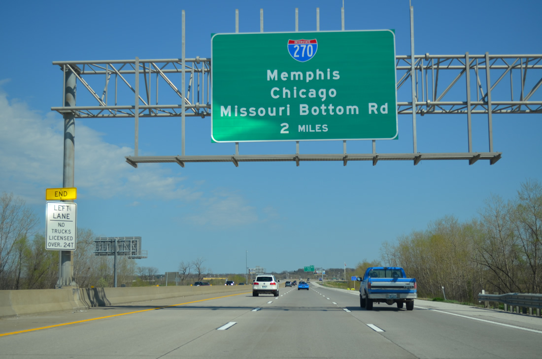
| Four eastbound lanes prepare to separate with two dedicated to Interstate 270 north to Chicago (via I-55 north), Exit 12B for the Missouri Bottom Road off-ramp of I-270 east, and Exit 12A for I-270 south to Maryland Heights, Creve Coeur and Kirkwood. 04/13/13 |
|
| Exit 12A departs for Interstate 270 south to Memphis (via I-55 south) ahead of the flyover onto both I-270 east and Missouri Bottom Road at Hazelwood. 04/13/13 |
|
| Exit 12B combines with the off-ramp (Exit 22A) from I-270 east to Missouri Bottom Road. Missouri Bottom Road winds southeast to U.S. 67 (Lindbergh Boulevard) on the north side of St. Louis Lambert International Airport (STL). 04/13/13 |
Page Updated 11-27-2013.