|
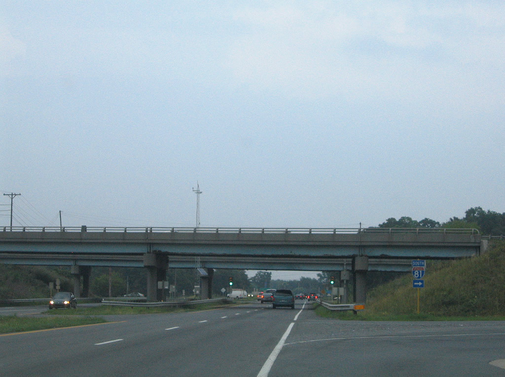
| U.S. 11 converges with I-64/81 north between Grassy Ridge and Mount Atlas at Exit 195. 07/16/05 |
|
| I-64/81 separate 3.4 miles southwest from U.S. 11 outside Lexington. 07/16/05 |
|
| I-81 continues beyond I-64 west to Roanoke and north from I-64 east near Staunton to Winchester. 07/16/05 |
|
| I-64/81 parallel U.S. 11 to the west from Exit 195 to Exit 213 north of Greenville. 07/16/05 |
|
| U.S. 11 (Lee Highway) runs along Timber Ridge from I-64/81 to Fairfield. 07/16/05 |
|
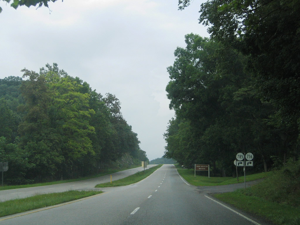
| SR 785 (Sam Houston Way) provides a cutoff to adjacent SR 716 (Timber Ridge Road) leading southeast across Timber Ridge to Crossroads Store and Cornwall. 07/16/05 |
|
| U.S. 11 (Lee Highway) continues with four lanes and light traffic northeast from SR 716 and Timber Ridge. 07/16/05 |
|
| SR 712 (Walucman Drive) stems southeast to SR 706 (Borden Grant Trail) near Round Hill. 07/16/05 |
|
| Entering the community of Fairfield, U.S. 11 (Lee Highway) reduces to two lanes. SR 711 (Sales Mill Road) joins U.S. 11 with parallel SR 706 near Buck Hill. 07/16/05 |
|
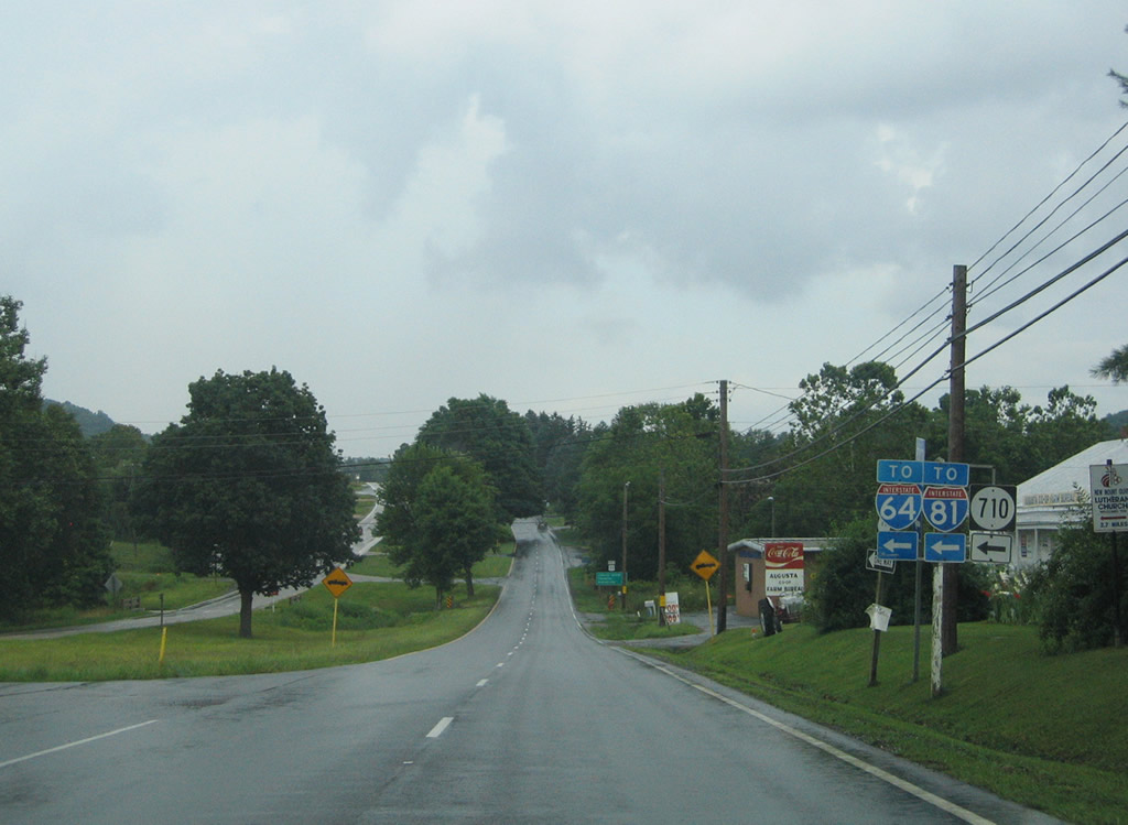
| SR 710 (Sterrett Road) links U.S. 11 (Lee Highway) with adjacent I-64/81 at a diamond interchange (Exit 200). 07/16/05 |
|
| SR 710 meanders 3.86 miles northwest from U.S. 11 (Lee Highway) and I-64/81 to SR 252 (Brownsburg Turnpike) south of Brownsburg. 07/16/05 |
|
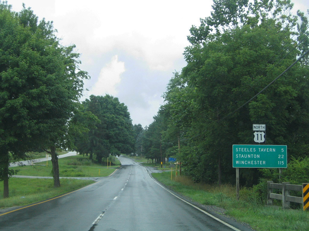
| Continuing north along Lee Highway, U.S. 11 advances to Jonestown and Steeles Tavern in five miles. 07/16/05 |
|
| Continuing north along the Lee Highway, U.S. 11 next meets Jonestown and Steeles Tavern in five miles. 07/16/05 |
|
| SR 606 (Raphine Road) connects U.S. 11 (Lee Highway) at Steeles Tavern with I-64/81 at Exit 205 near Raphine, 1.61 miles to the west. 07/16/05 |
|
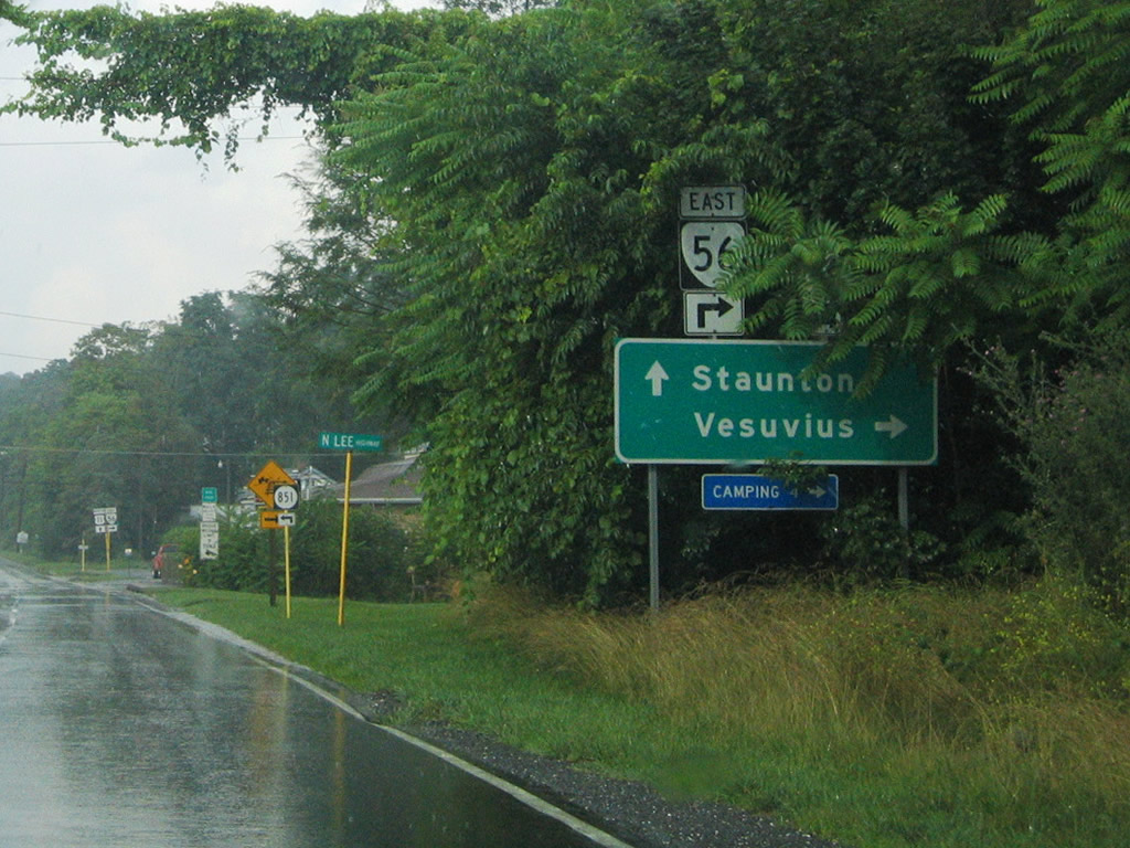
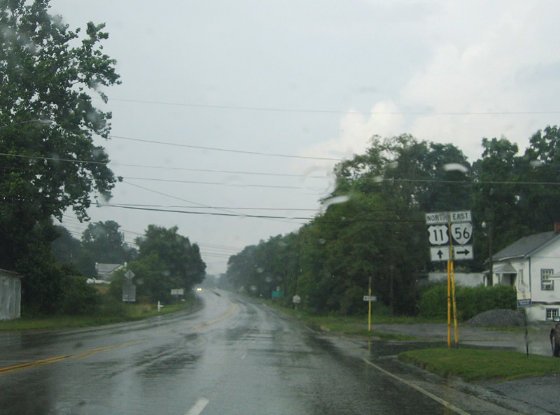
| Crossing Marl Creek and the Augusta County line, U.S. 11 (Lee Highway) proceeds north to meet the west end of SR 56 (Tye River Turnpike). 07/16/05 |
|
| SR 56 meanders southeast to Vesuvius and across the Blue Ridge Mountains at Tye River Gap to Montebello. SR 56 is a 60.87 mile long highway southeast to U.S. 60 (James Madison Highway) at Dentons Corner. 07/16/05 |
|
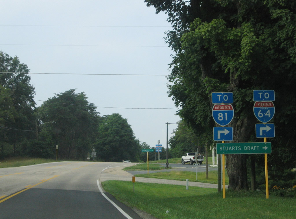
| U.S. 11 (Lee-Jackson Memorial Highway) heads north from Greenville to the south end of U.S. 340 (Stuarts Draft Highway). Traveling 156 miles overall, U.S. 340 straddles the Blue Ridge Mountains northeast to Front Royal and Charles Town, West Virginia en route to Frederick, Maryland. 06/17/05 |
|
| Within Augusta County, U.S. 340 (Stuarts Draft Highway) runs east to Stuarts Draft to the independent city of Waynesboro. 06/17/05 |
|
| U.S. 340 represents the lone remaining branch route of U.S. 40. U.S. 140 from Baltimore, Maryland to Gettysburg, Pennsylvania was decommissioned in 1977 and U.S. 240 from Washington, DC to Frederick in 1972. 06/17/05 |
|
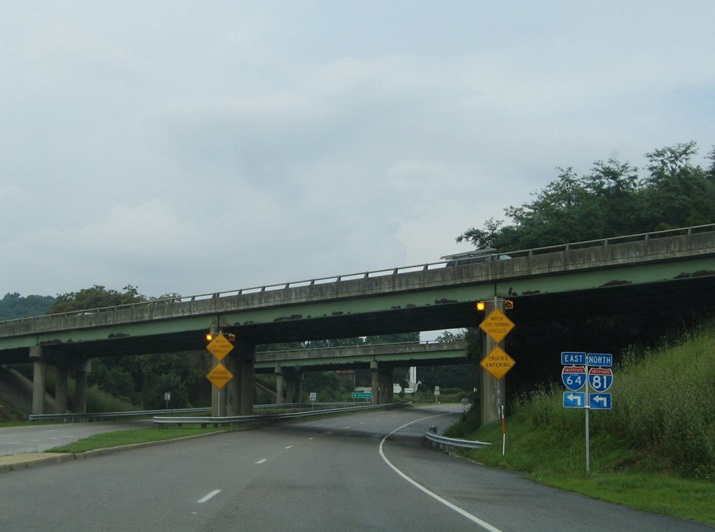
| U.S. 11 (Lee-Jackson Highway) converge with I-64/81 again at a parclo interchange (Exit 213) just north of U.S. 340. 06/17/05 |
|
| I-64 east and I-81 north continue another 8.2 miles to their separation outside the city of Staunton. 06/17/05 |
|
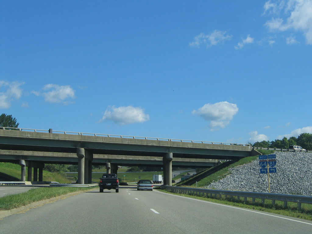
| I-64/81 overlap 21.6 miles southwest from U.S. 11 at Exit 213. Roanoke lies 70 miles away. 06/17/05 |
|
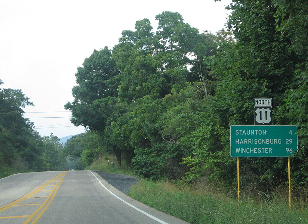
| U.S. 11 (Lee Jackson Memorial Highway) stays west of I-81 northward from Exit 213 to Exit 257 through Staunton and Harrisonburg. 07/16/05 |
|
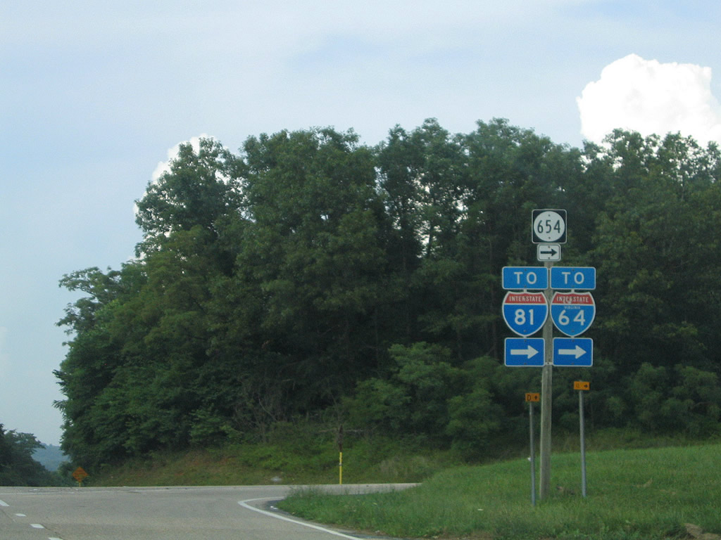
| U.S. 11 (Lee-Jackson Highway) advances 3.4 miles north from Kerry Lane to SR 654 (White Hill Road) east to I-64/81 at Exit 217. 07/16/05 |
|
| U.S. 11 north at Evans Lane (SR 815). Passing lanes open periodically along the two lane highway northward toward Staunton. 07/16/05 |
|
| U.S. 11 (Lee-Jackson Highway) reaches the community of Mint Spring north of SR 697 (White Oak Gap Road). This reassurance marker posted after SR 697 was replaced by 2012 and removed by 2019. 07/16/05 |
|
| SR 654 (White Hill Road) stems 0.83 miles east from U.S. 11 (Lee-Jackson Memorial Highway) at Mint Spring to I-64/81. SR 800 (Springfield Lane) loops east from U.S. 11 to SR 654. 07/16/05 |
|
| SR 654 (White Hill Road) arcs 4.72 miles southeast from Mint Hill to I-64/81 at Brookwood and U.S. 340 at Stuarts Draft. 07/16/05 |
|
| U.S. 11 progresses four miles north from Mint Spring to Staunton. 07/16/05 |
|
| Approaching the settlement of Folly Mills along U.S. 11 north at Markels Lane. 07/16/05 |
|
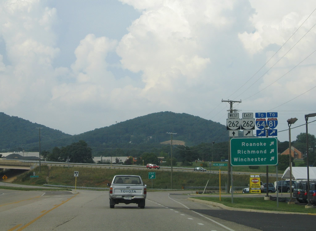
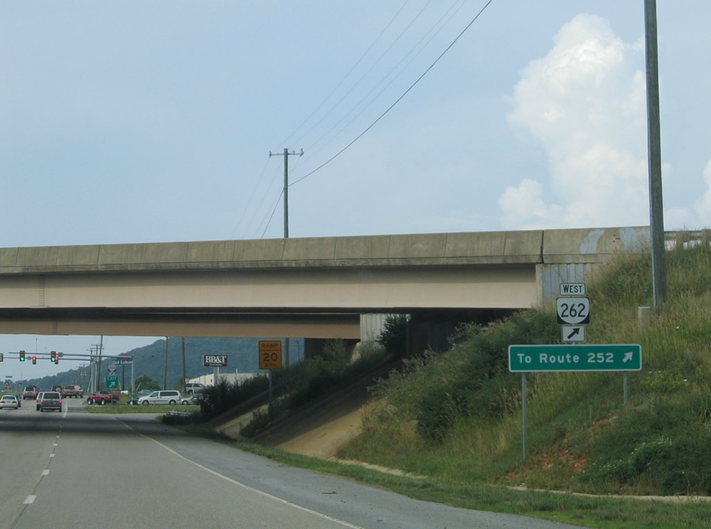
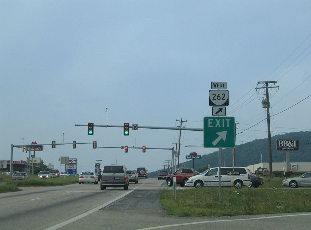
| Passing through a commercialized stretch at Jolivue, U.S. 11 (Lee-Jackson Highway) enters a cloverleaf interchange with SR 262 (Woodrow Wilson Parkway). 07/16/05 |
|
| SR 262 constitutes an expressway encircling Staunton west from I-64/81 at Exit 200, 13.32 miles north to I-81 at Exit 205. 07/16/05 |
|
| Prior to 2006, SR 262 (Woodrow Wilson Parkway) temporarily ended 1.8 miles northwest of U.S. 11 at SR 252 (Middlebrook Avenue). 07/16/05 |
|
| U.S. 11 continues north from the exchange with SR 262 (Woodrow Wilson Parkway) as a commercial arterial to SR 261 (Statler Boulevard) along Greenville Avenue in the city of Staunton. 07/16/05 |
|
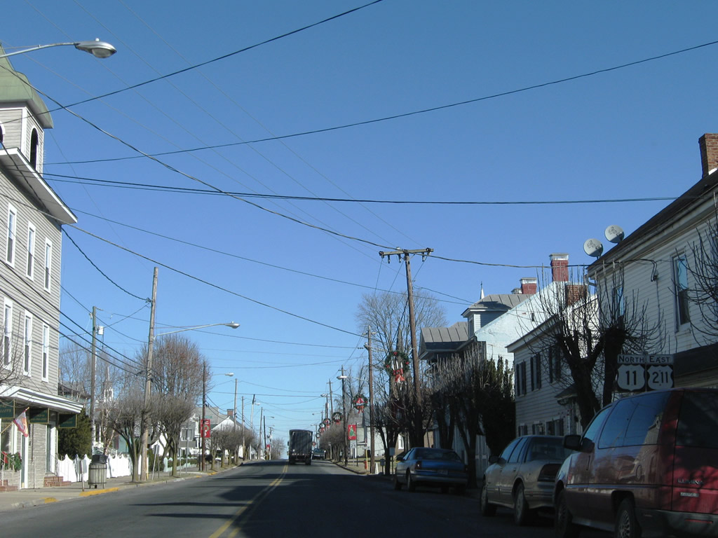
| U.S. 11/211 combine for three blocks along Congress Street in New Market. 12/30/08 |
|
| U.S. 211 turns east along Lee Highway from U.S. 11 (Congress Street) to traverse Massanutten Mountain en route to Luray. 12/30/08 |
|
| U.S. 11 continues north to Winchester via the towns of Mt. Jackson and Edinburg, while U.S. 211 travels east to Warrenton. 12/30/08 |
|
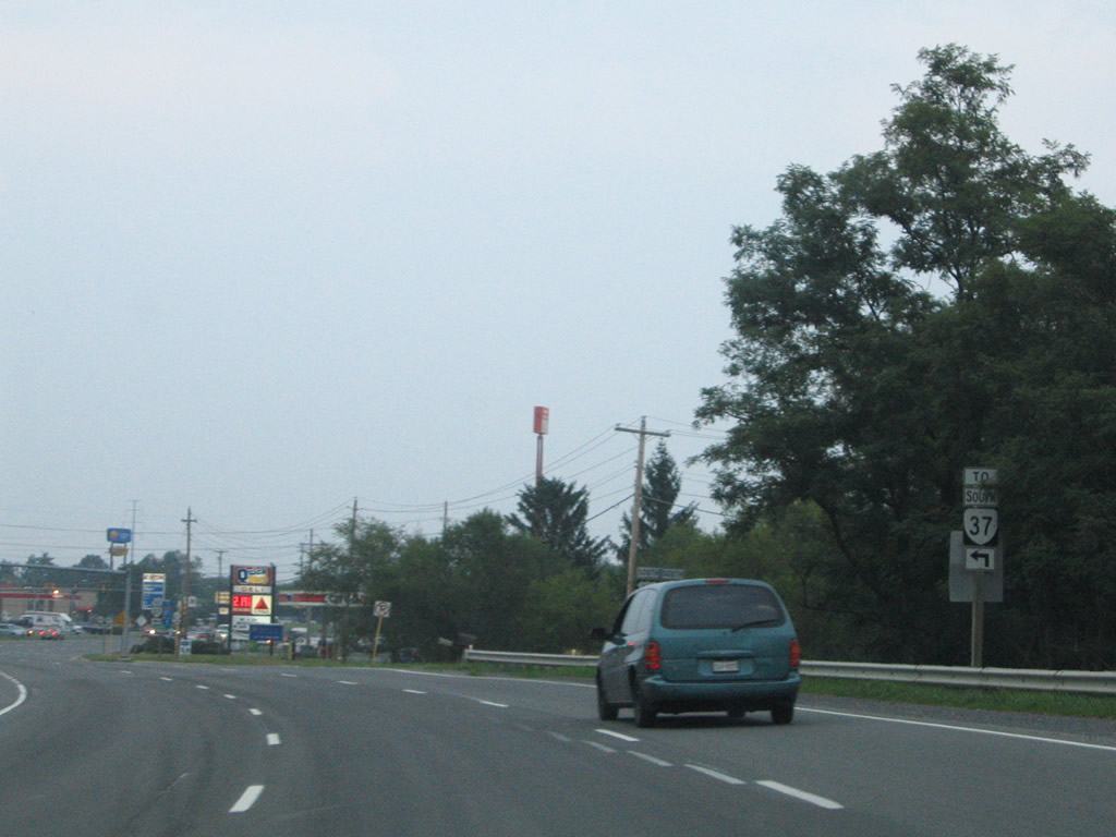
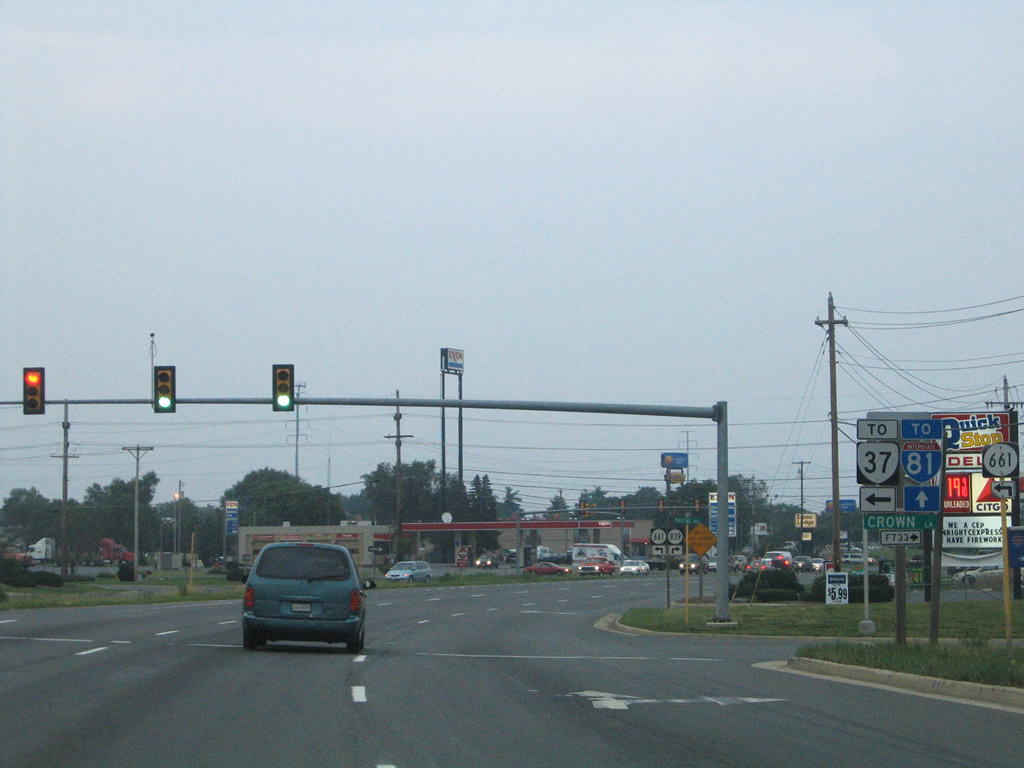
| U.S. 11 (Martinsburg Pike) converges with the north end of SR 37 at a wye interchange preceding Crown Lane. Crown Lane links U.S. 11 north with SR 37 south. 07/16/05 |
|
| Crown Lane north and Pactive Way south spur to an industrial business from U.S. 11 (Martinsburg Pike) between SR 37 and I-81. SR 37 comprises a 9.10 mile long expressway loop around the west side of Winchester. 07/16/05 |
|
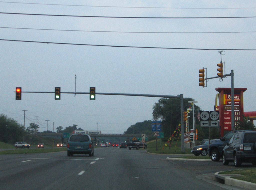
| SR 611 (Welltown Road) stems north from U.S. 11 (Martinsburg Pike) at SR 839 (Amoco Lane) to Welltown and Grimes. 07/16/05 |
|
| U.S. 11 (Martinsburg Pike) enters a diamond interchange with Interstate 81 at Exit 317. 07/16/05 |
|
| I-81 bypasses Winchester to the east south to Harrisonburg and Staunton. U.S. 11 (Martinsburg Pike) north continues east from I-81 to Stephenson and Clear Brook. 07/16/05 |
Page Updated 04-24-2021.


 North
North


 East
East