|
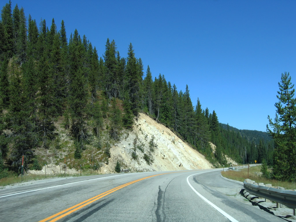
| U.S. 12 drops from an elevation of 5,235 feet above sea level at Lolo Pass to parallel the West Fork of Lolo Creek in a narrow valley west of Wagon Mountain. Truckers are advised to drive slow over the next four miles due to the curving nature of the two lane highway. 09/01/06 |
|
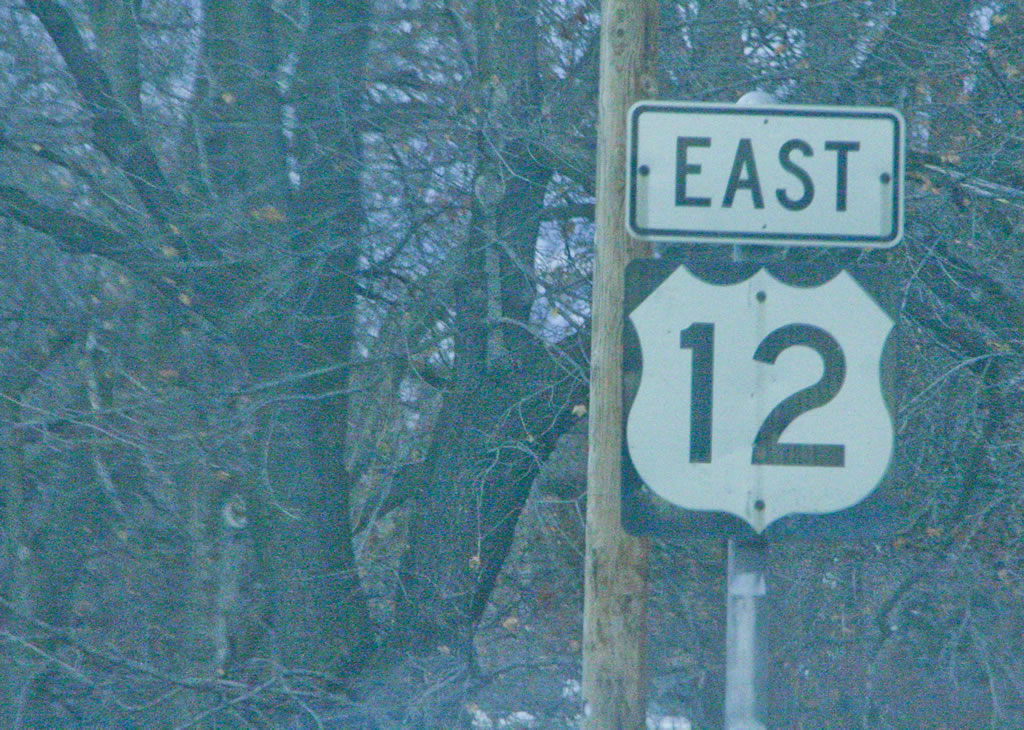
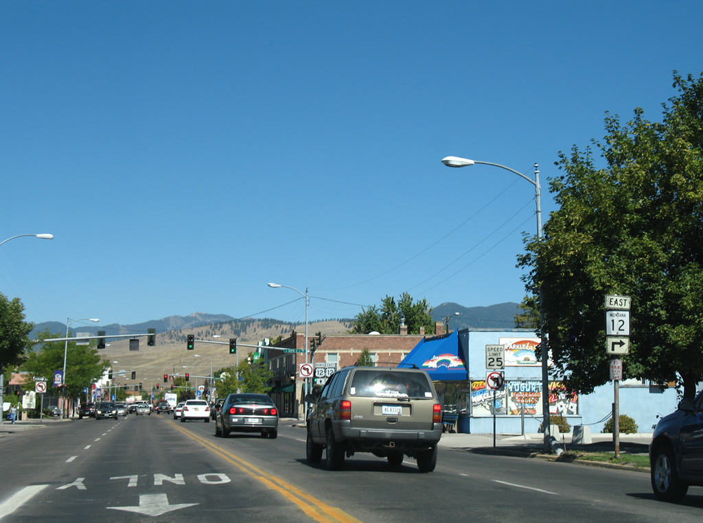
| Speed limits are set at 70 miles per hour for cars and 65 miles per hour for trucks along U.S. 12 east. Night speed limits drop to 65 and 55 MPH respectively. 09/01/06 |
|
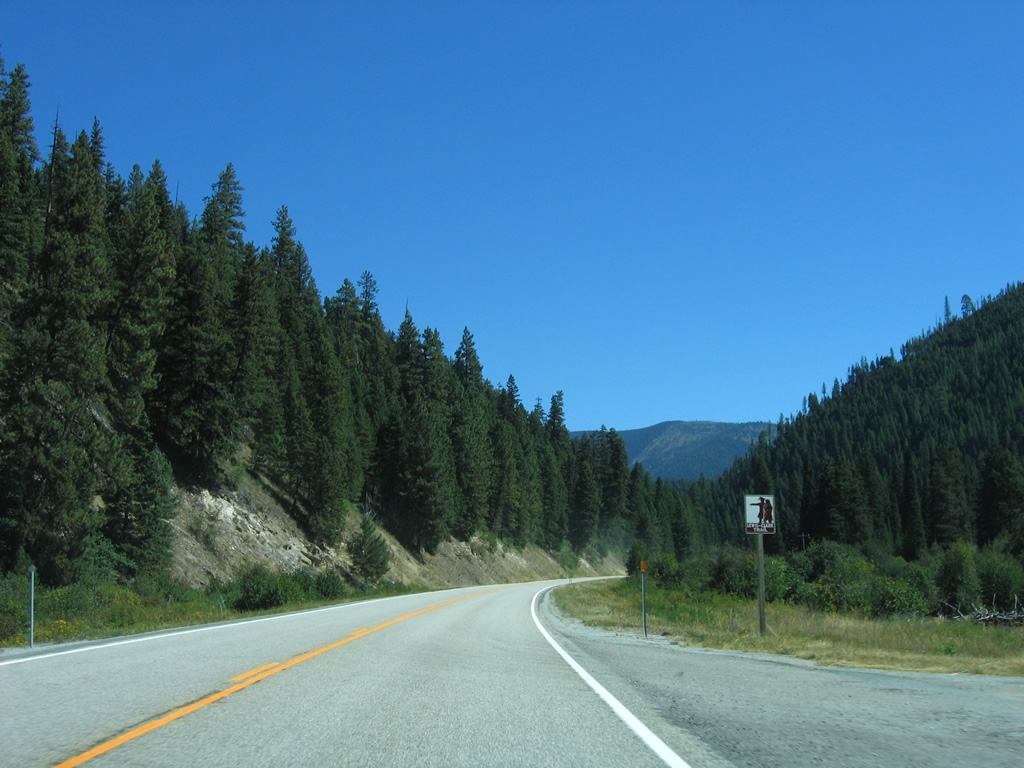
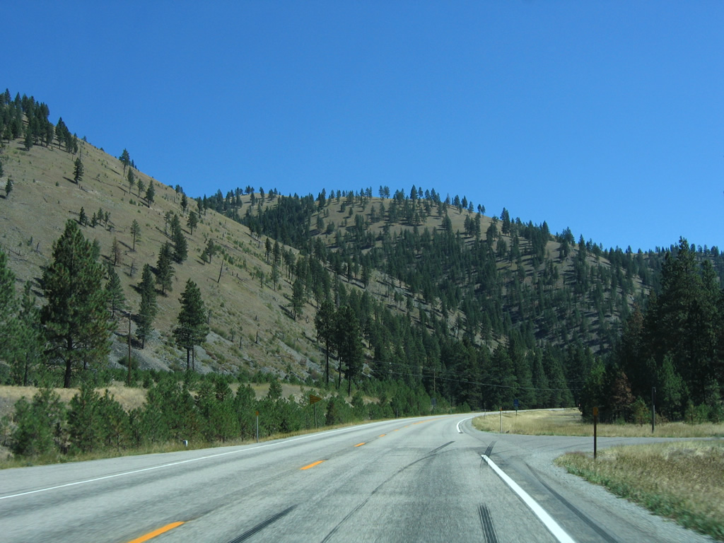
| Winding northward along U.S. 12 through a valley alongside the West Fork of Lolo Creek. Wagon Mountain (elevation 5,728 feet) rises to the east. 09/01/06 |
|
| U.S. 12 turns east briefly by Snowshoe Falls. 09/01/06 |
|
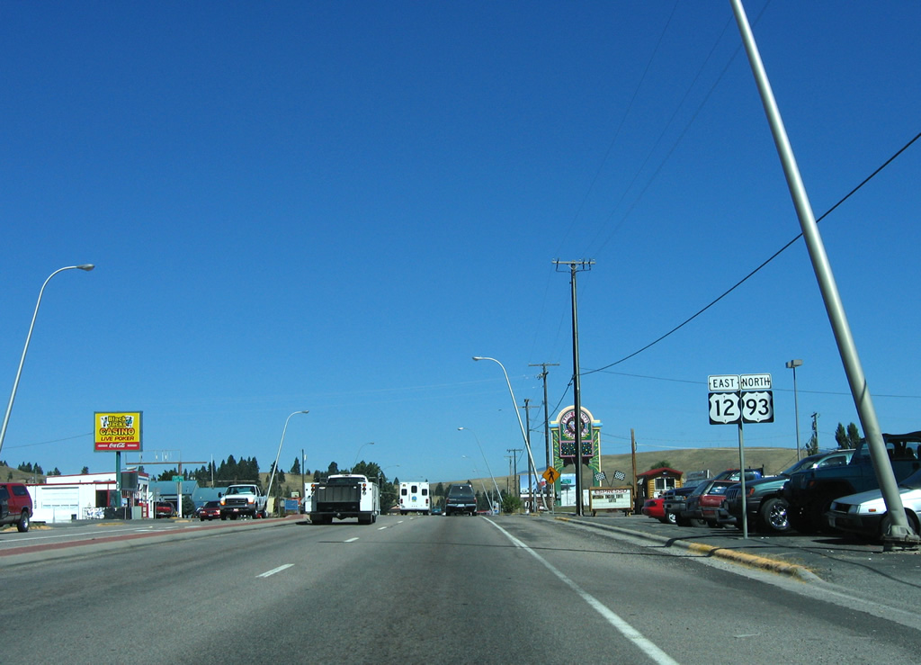
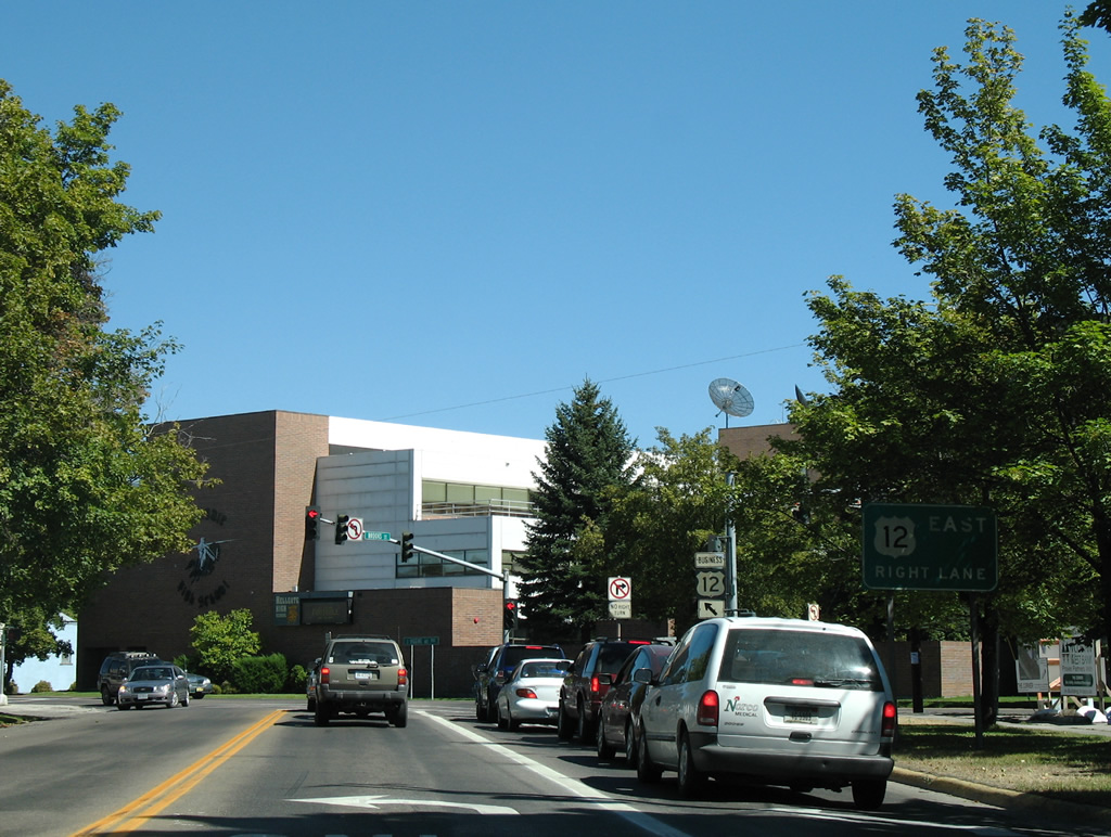
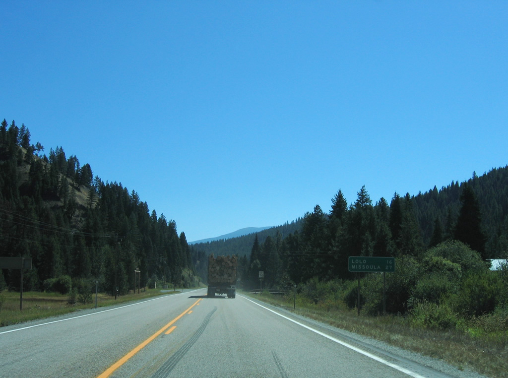
| A pair of pull offs line U.S. 12 beyond Snowshoe Falls ahead of this distance sign posted 27 miles from Lolo (U.S. 93) and 38 miles from Missoula. 09/01/06 |
|
| Lee Creek Road (National Forest Route 699) spurs south from U.S. 12 alongside Lee Creek to the Lee Creek Campground of Lolo National Forest. 09/01/06 |
|
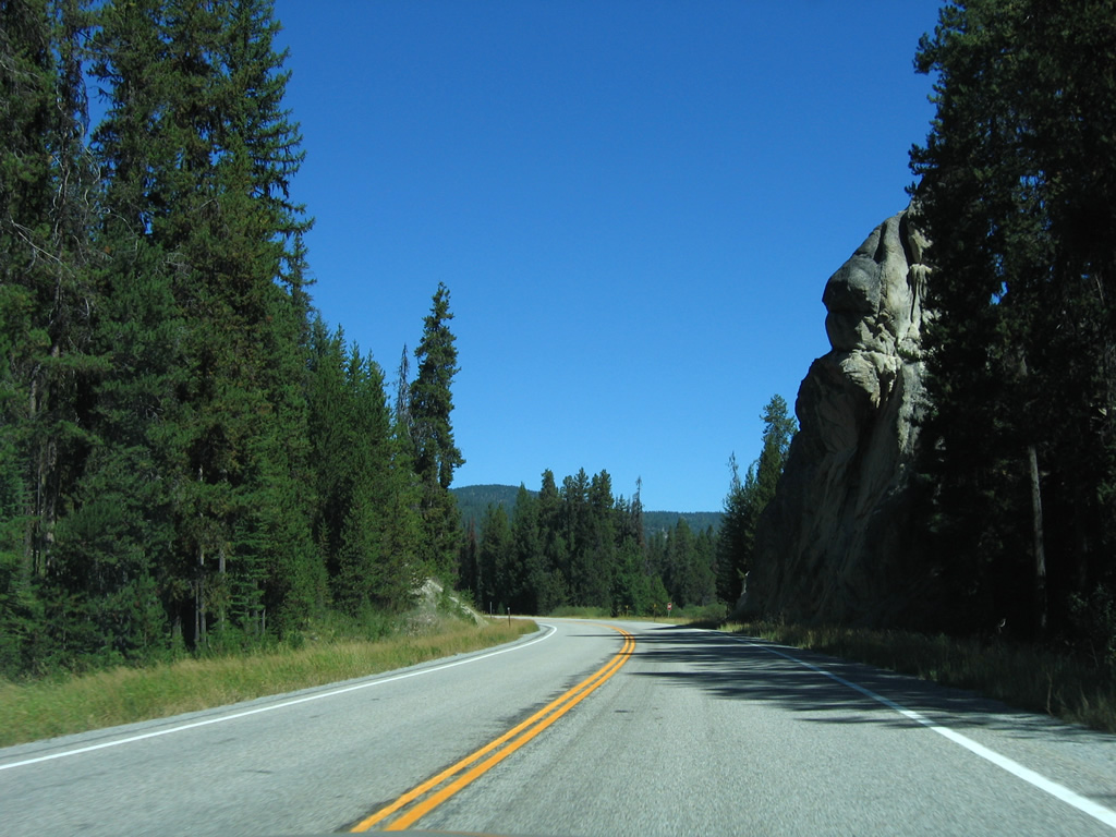
| A rock outcrop looms above U.S. 12 ahead of East Fork Lolo Creek Road (N.F. 461). 09/01/06 |
|
| Fish Creek Road (N.F. 343) follows and branches west and north from U.S. 12 into southeast Mineral County. 09/01/06 |
|
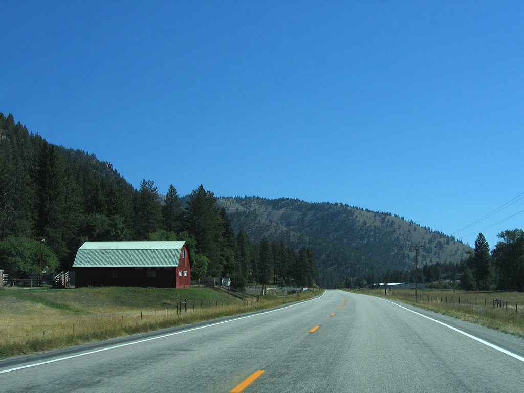
| U.S. 12 east next passes through the settlement of Lolo Hot Springs. 09/01/06 |
|
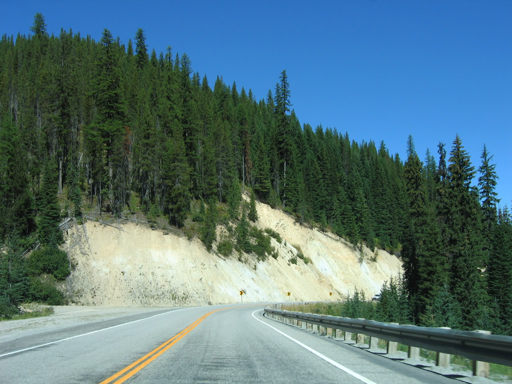
| Waters from the East and West Fork of Lolo Creek combine and flow northward alongside U.S. 12 as it leaves Lolo Hot Springs by an impressive rock wall. 09/01/06 |
|
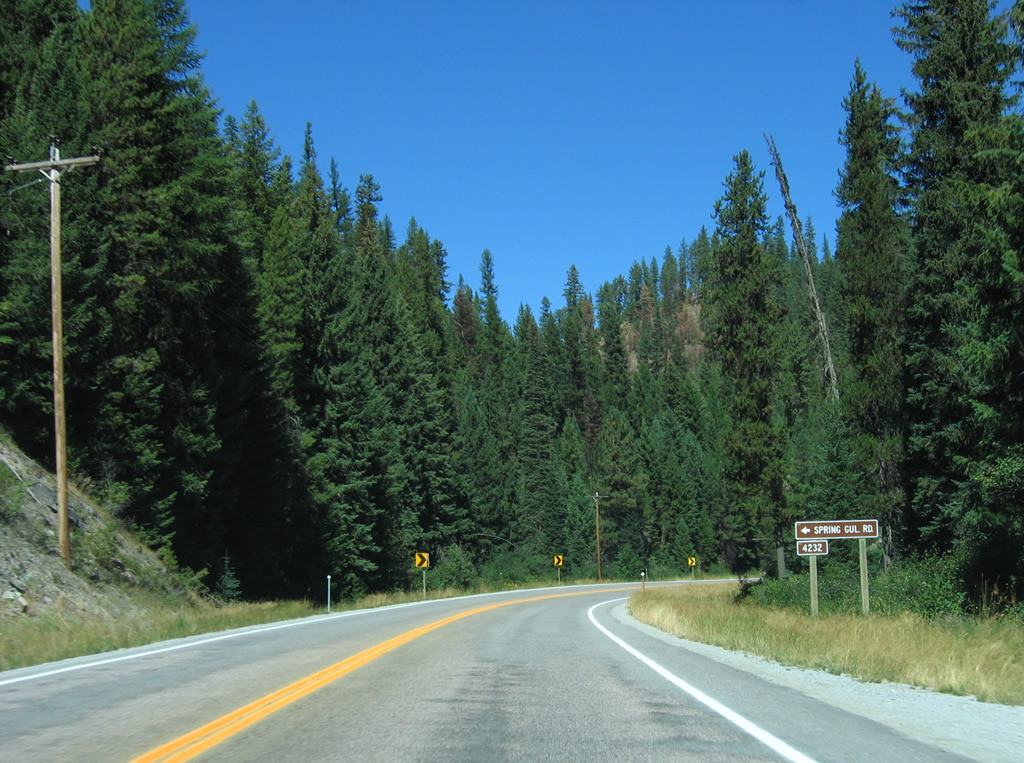
| Spring Gulch Road (N.F. 4232) winds west from U.S. 12 near milepost 8 into Spring Gulch. 09/01/06 |
|
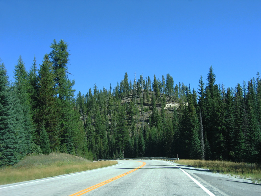
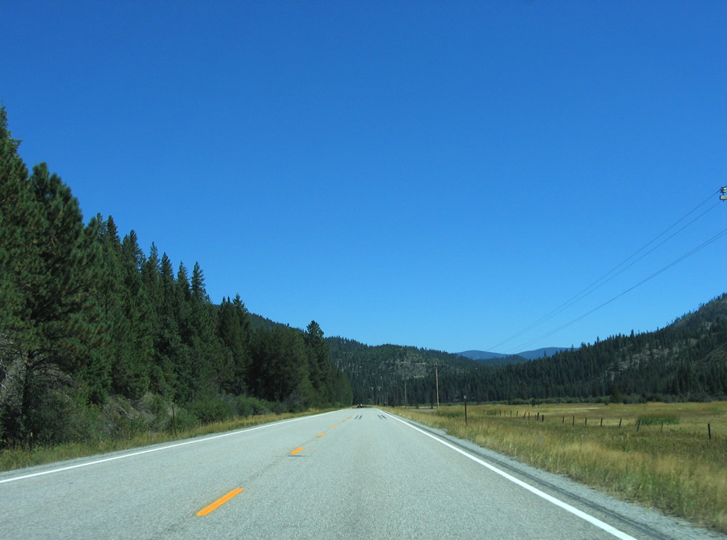
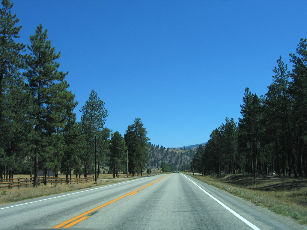
| U.S. 12 enters a grassy valley and a one mile straight away beyond Spring Gulch. 09/01/06 |
|
| Shallow waters of Lolo Creek come into view as U.S. 12 turns again east of the valley at Martin Creek. The roadway travels just over 4,000 feet above sea level along this stretch. 09/01/06 |
|
| U.S. 12 turns more easterly to make its approach to Lolo. 09/01/06 |
|
| Howard Creek Road (National Forest Route 238) ventures west from U.S. 12 to Lolo Trail at Howard Creek and Howard Creek Meadows. 09/01/06 |
|
| West Fork Butte Road (National Forest Route 37) stems south from U.S. 12 just east of N.F. 238 to West Fork Butte (elevation 6,145 feet) and the Earl Tennant Recreation Site. 09/01/06 |
|
| A Lewis and Clark Trail trailblazer resides at the U.S. 12 intersection with N.F. 37. 09/01/06 |
|
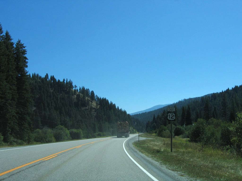
| The first reassurance marker for U.S. 12 east in Montana follows the intersection with Graves Creek Road (N.F. 489) north. 09/01/06 |
|
| U.S. 12 is now 16 miles from Lolo and 27 miles southwest of Missoula. 09/01/06 |
|
| Continuing east, U.S. 12 heads from Clark Creek to Bear Creek Road (N.F. 504) and a quarry. 09/01/06 |
|
| The Lolo Creek valley widens as U.S. 12 lowers from 3,623 feet east of Bear Creek to 3,189 feet at the community of Lolo. 09/01/06 |
|
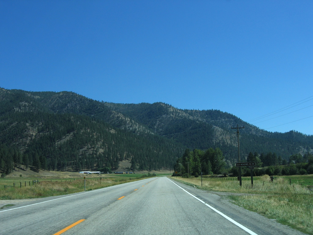
| Elk Meadows Road (N.F. 451) angles southwest from U.S. 12 into the adjacent hills along the West Fork Butte Creek. 09/01/06 |
|
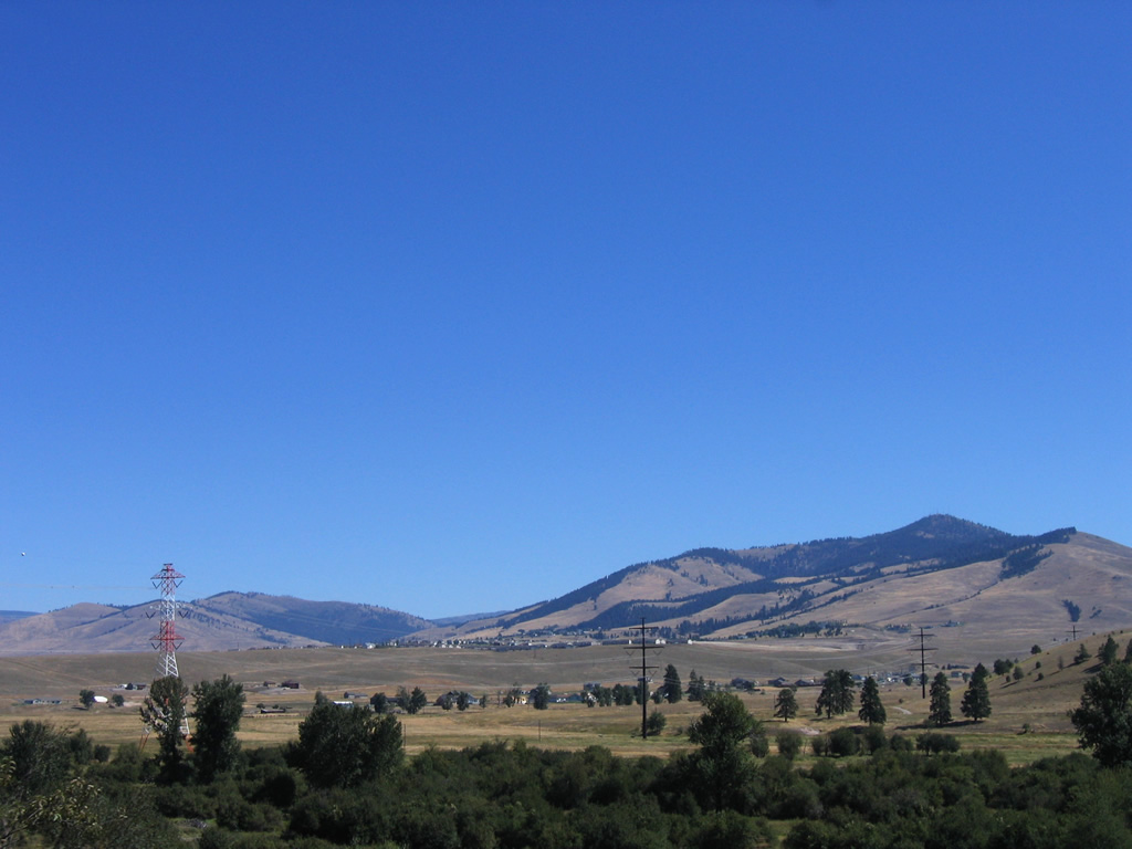
| U.S. 12 bisects agricultural lands east from Elk Meadows Road to the settlement of Woodman. Mormon Peak (6,047 feet) rises to the southeast. 09/01/06 |
|
| A number of residential roads tie into U.S. 12 east from Woodman to the Fort Fizzle Historic Site. 09/01/06 |
|
| A residential subdivision lines the north side of U.S. 12 as the highway enters the Lolo area, which acts as a bedroom community for Missoula. 09/01/06 |
|
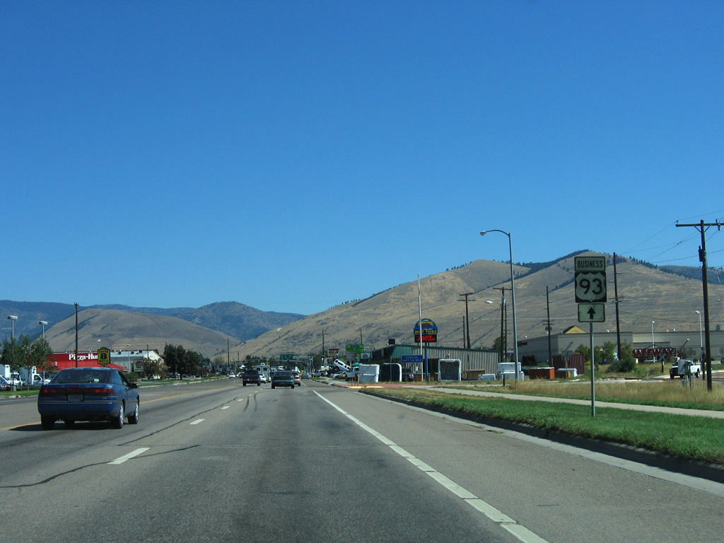
| U.S. 12 reaches the entrance to Travelers' Rest State Park before the junction with U.S. 93. 09/01/06 |
|
| U.S. 93 enters Lolo from Hamilton, 37 miles to the south. U.S. 12 combines with the route north 7.5 miles into Missoula. 09/01/06 |
|
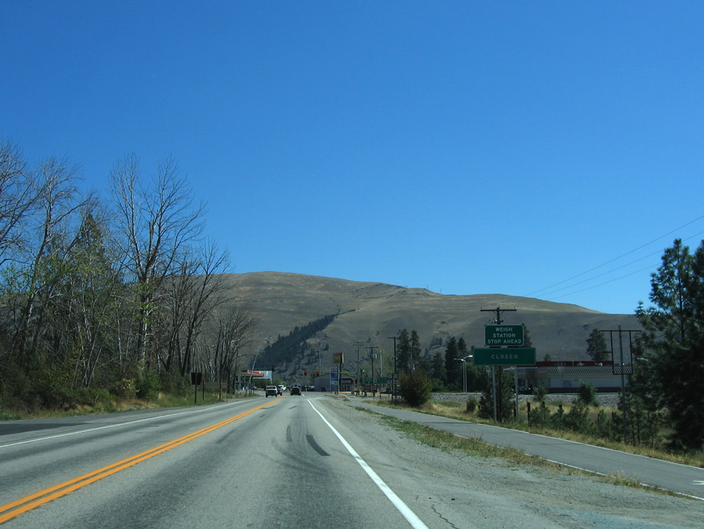
| A weigh station for commercial trucks lies east of the U.S. 12 and 93 intersection. 09/01/06 |
|
| U.S. 93 south exits Montana in 83.2 miles at Chief Joseph Pass to Salmon and Twin Falls, Idaho. 09/01/06 |
|
| U.S. 12/93 follow a four to five lane arterial northward from Lolo through a wide valley along the Bitteroot River. 09/01/06 |
|
| Angled overhead light fixtures line U.S. 12/93 within the vicinity of the merge at Lolo. Speed limits are set at 35 miles per hour along this stretch. 09/01/06 |
|
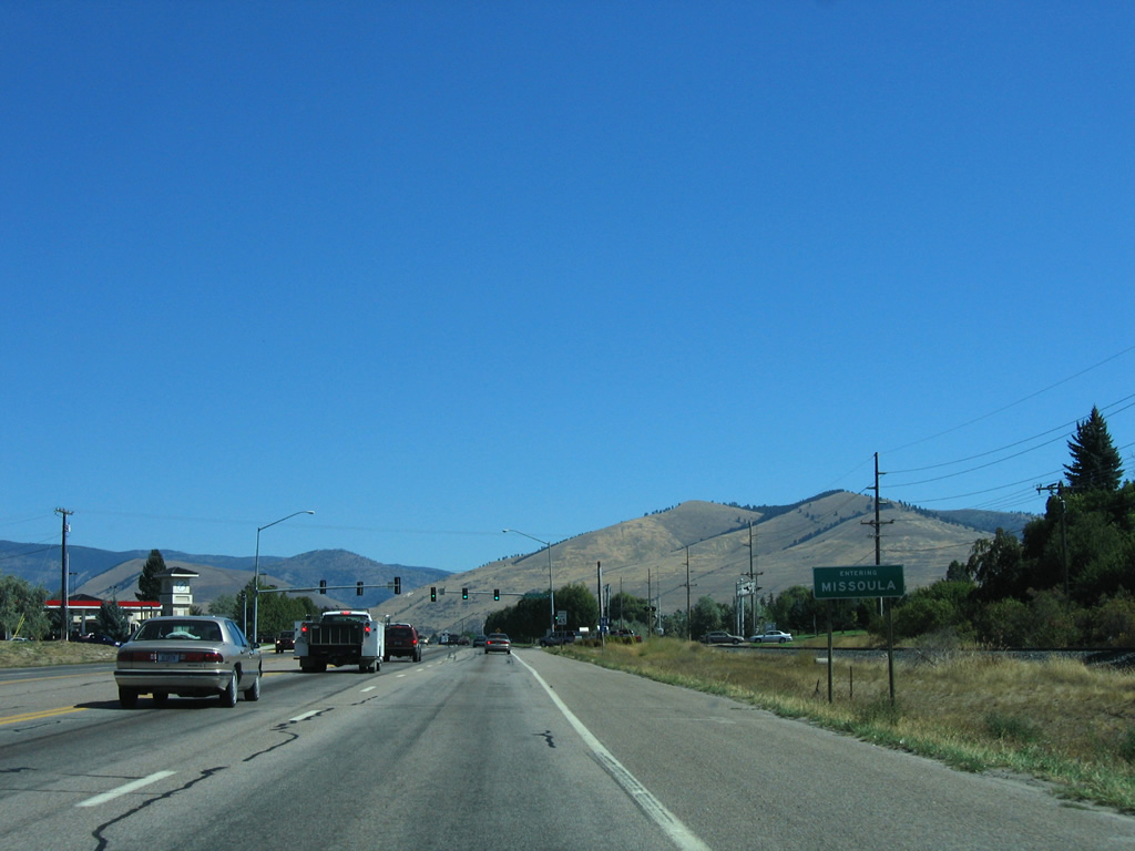
| Missoula is an eight mile drive north from Lolo along U.S. 12/93. 09/01/06 |
|
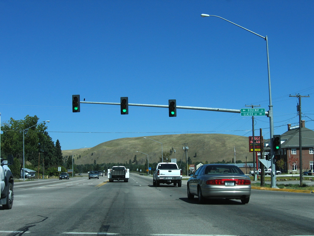
| Ridgeway Drive east and Glacier Drive west come together at this traffic light from subdivisions east and west of the commercial corridor along U.S. 12/93. 09/01/06 |
|
| U.S. 12/93 enter an agricultural area north of Lolo. The concrete median transitions into a center turn lane along this section of road. 09/01/06 |
|
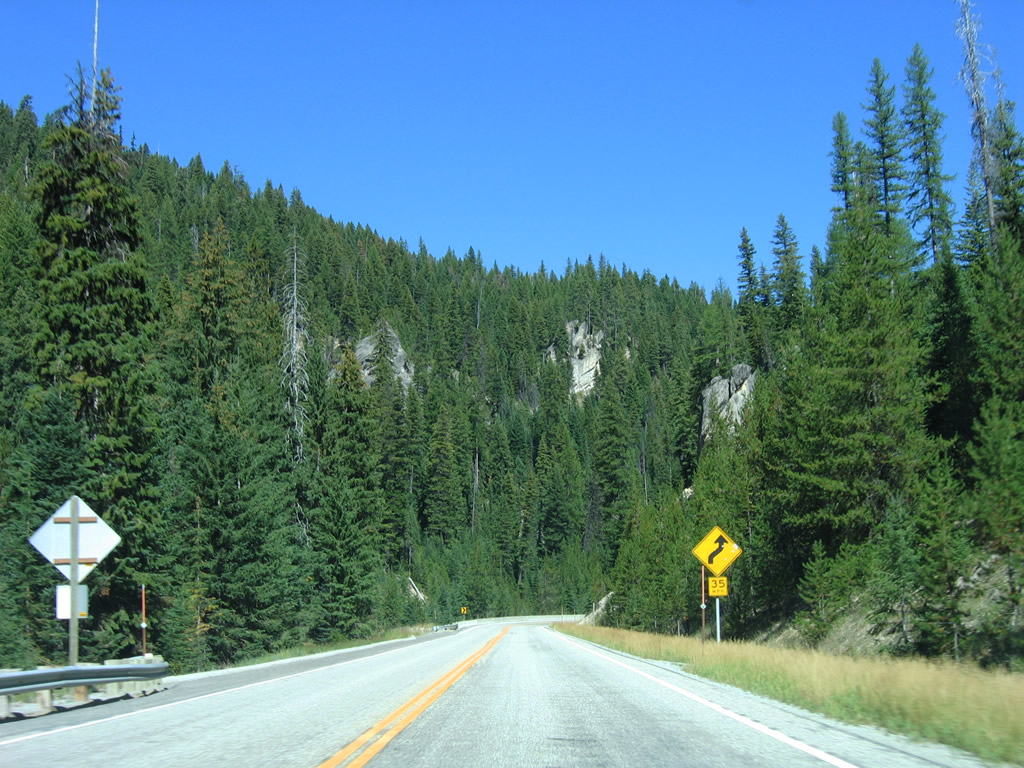
| U.S. 12 east & 93 north line a hillside above the Bitterroot River from milepost 86 northward to Deadman Gulch. 09/01/06 |
|
| U.S. 12/93 turn northeast from Deadman Gulch along the Bitterroot River to enter the greater Missoula area. 09/01/06 |
|
| Blue Mountain Road stems northwest from U.S. 12/93 to the Blue Mountain Recreation Area of Lolo National Forest. 09/01/06 |
|
| U.S. 12/93 north finally cross the Bitterroot River. A Montana Rail Link truss bridge parallels the 1968-built Buckhouse Bridge. 09/01/06 |
|
| Drivers formally enter the Missoula city limits just east of the Bitterroot River. Missoula was incorporated as a town on March 8, 1883 and was home to 66,788 at the time of the 2010 census. 09/01/06 |
|
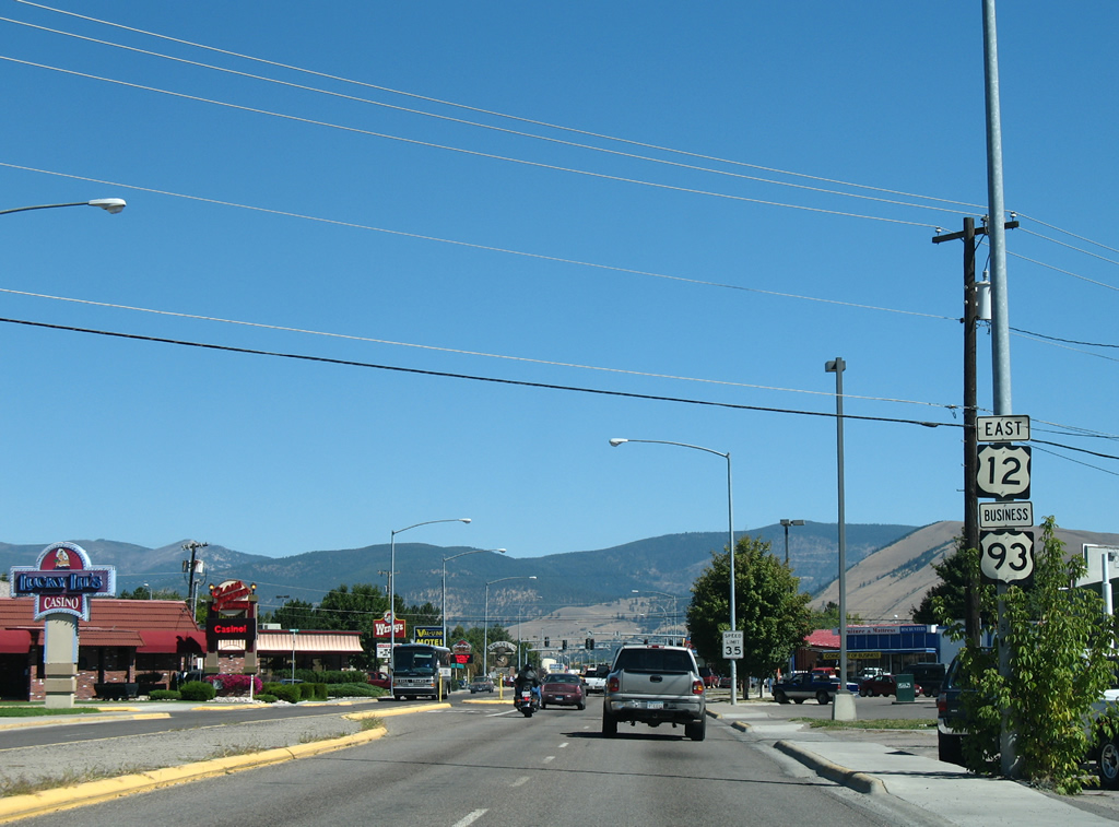
| Commercial frontage quickly encroaches upon U.S. 12/93 (Brooks Street) at Old US 93 and Miller Creek Road. Old US 93 lines the back side of an adjacent retail area to Clark Street to the north while Miller Creek Road connects Brooks Street with expanding suburban tracts to the south. 09/01/06 |
|
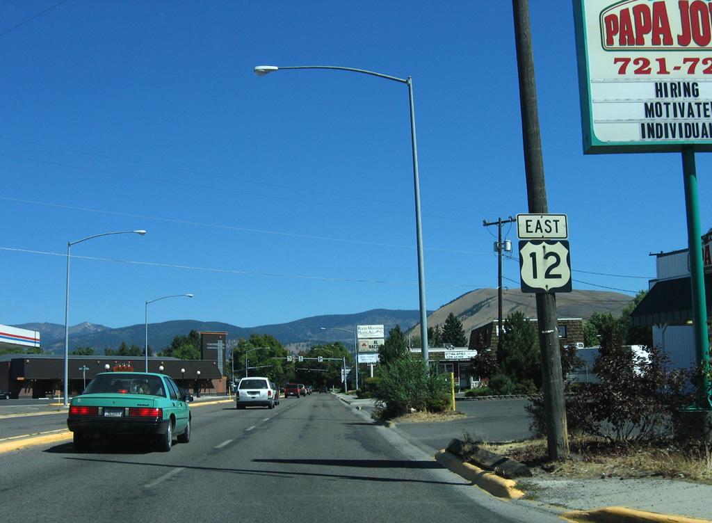
| U.S. 93 north prepares to split with U.S. 12 (Brooks Street) east at forthcoming Reserve Street. U.S. 93 Business begins here and follows U.S. 12 east to Stephens Avenue on the original route to Downtown Missoula. 09/01/06 |
|
| U.S. 93 follows Reserve Street, a commercialized bypass, north from the Fort Missoula and Orchard Homes area to merge with Interstate 90 west at Exit 101. 09/01/06 |
|
| U.S. 12 east/93 Business north combine 1.7 miles northeast along Brooks Street. U.S. 12 continues from Stephens Avenue to a split with its own business route into Downtown while the mainline stays east to the University of Montana. 09/01/06 |
|
| Reserve Street extends southward from the U.S. 12 and 93 split to 39th Street. 09/01/06 |
|
| Reassurance markers for U.S. 12 east & 93 Business north reside just beyond the intersection with Reserve Street and the at-grade crossing with the Montana Rail Link line. Mount Jumbo rises on the northern horizon. 09/01/06 |
|
| Milepost 91 remained between Reserve Street and Dore Lane along Brooks Street east from when U.S. 93 continued northeast to Stephens Avenue. 09/01/06 |
|
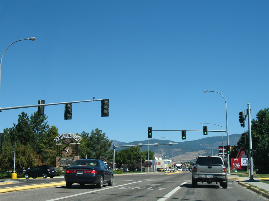
| Paxon Street crosses paths with U.S. 12 east & 93 Business north at the next traffic light on Brooks Street. The north-south street provides one of two access points to nearby Southgate Mall. 09/01/06 |
|
| Brooks Street gains a concrete divider from ahead of Paxon Street to Mount Avenue. Another set of shields for U.S. 12 east & 93 Business north follow the turn off onto Ernest Avenue. 09/01/06 |
|
| A set of Econolite signals govern the movements between U.S. 12/93 Business at the main entrance to Southgate Mall. 09/01/06 |
|
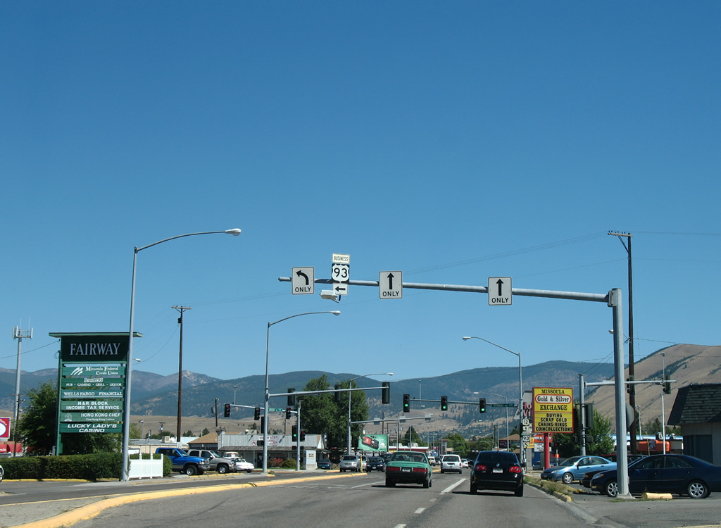
| Fairview Avenue links U.S. 12/93 Business with Russell Street at the Missoula County Fairgrounds to the east and Garfield Street by Southgate Mall to the west. Turns are prohibited at the forthcoming intersection with Russell Street, so motorists headed that way must use Fairview Avenue to make the connection. 09/01/06 |
|
| Continuing northeast from Fairview Avenue, motorists pass this set of shields for the U.S. 12 east & 93 Business north overlap. 09/01/06 |
|
| Russell Street continues Hillview Way north from suburban areas on the foothills of Mount Dean Stone to the Riverfront area ahead of the Clark Fork river. 09/01/06 |
|
| South Avenue ties into U.S. 12/93 Business (Brooks Street) at Russell Street ahead of the final set of shields for the 1.7 mile overlap. 09/01/06 |
|
| Sussex Avenue flows west from South Avenue to end at Oxford Street and U.S. 12/93 Business (Brooks Street) amid a number of shopping centers, restaurants and other businesses. 09/01/06 |
|
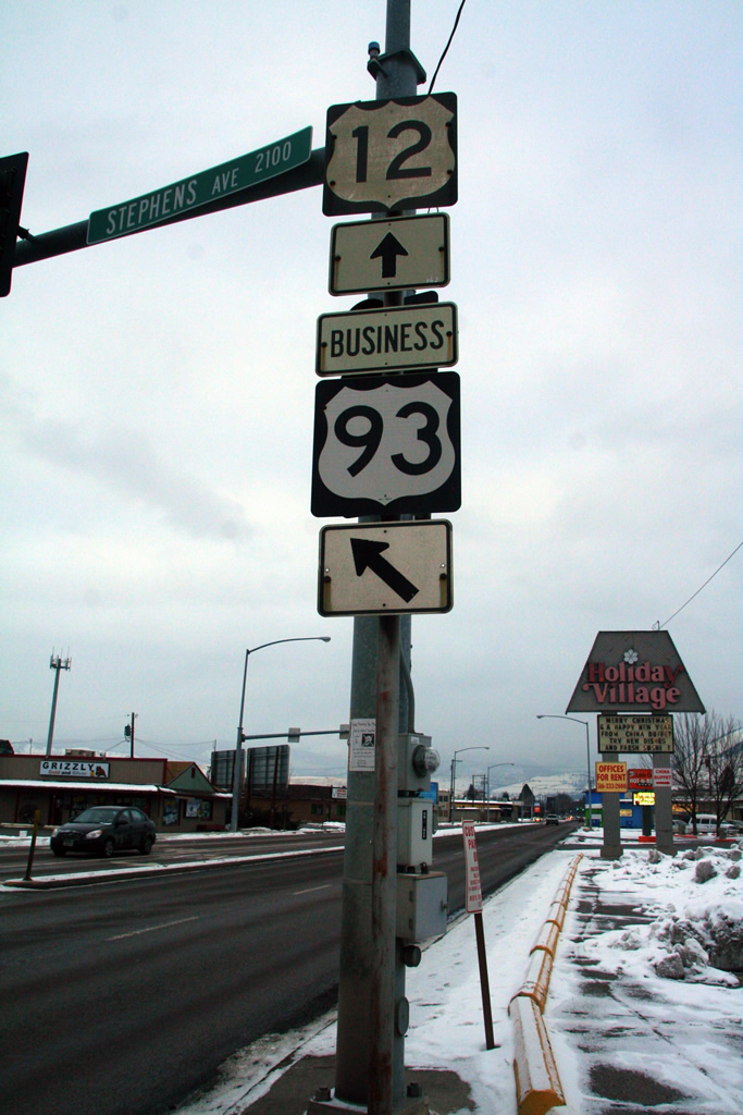
| Stephens Avenue heads north from the Missoula County Fairgrounds to carry the final 2.3 miles of U.S. 93 Business north from U.S. 12 (Brooks Street) east. 09/01/06, 12/30/12 |
|
| U.S. 12 remains northeast along Brooks Street to Higgins Avenue west of the University of Montana. U.S. 93 Business branches northward along Stephens Avenue to Orange Street and Interstate 90 (Exit 104). 09/01/06, 12/30/12 |
|
| U.S. 12 east passes by Holiday Village Shopping Center and leaves the commercialized stretch of Brooks Street in four blocks. 09/01/06 |
|
| Mount Avenue intersects U.S. 12 as Brooks Street transitions into a two lane residential street through the Rose Park neighborhood. 09/01/06 |
|
| The next reassurance shield precedes Franklin Street on Brooks Street east at the Missoula Memorial Rose Garden. 09/01/06, 11/19/13 |
|
| The Missoula street grid orientates in a 90 degree angle toward Brooks Street through the Rose Park community. Beckwith Street angles northwest from a roundabout with Higgins Avenue to become Walnut Street north to the Riverfront neighborhood. 09/01/06 |
|
| Entering the final block of Brooks Street, U.S. 12 turns northward briefly onto Higgins Avenue before splitting into a one way street couplet of 6th Street (east) and 5th Street (west). 09/01/06, 11/19/13 |
|
| North of 6th Street, Higgins Avenue doubles as U.S. 12 Business to Downtown Missoula and Broadway Street (Business Loop I-90). 09/01/06, 11/19/13 |
|
| An error MT 12 shield, since removed, directed traffic onto 6th Street east for the continuation of U.S. 12 to the University of Montana. 09/01/06 |
|
| U.S. 12 Business follows Higgins Avenue north three blocks to cross the Clark Fork river into the central business district. Once at Broadway Street, the 0.8 mile business loop turns east five blocks to U.S. 12 at Madison Street. 09/01/06 |
Page Updated 11-26-2013.

 East
East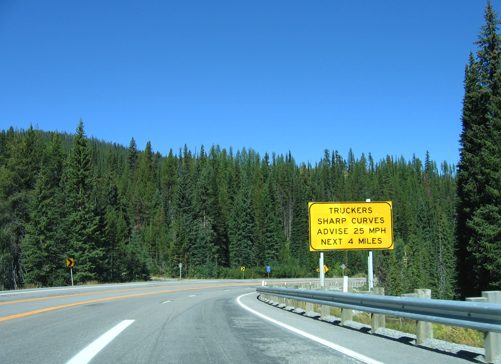


 North
North