|
| U.S. 29 southbound leaves the overlap with U.S. 80 and the Downtown square in Tuskegee. The highway advances eight miles south is Davisville and 22 miles to the Bullock County seat of Union Springs. 08/22/03 |
|
| U.S. 29 southbound at U.S. 84 (Martin Luther King, Jr. Expressway) at Andalusia. Old U.S. 29 (Three Notch Street) travels south into Downtown. Also traveling into Downtown is former SR 100, which used to connect U.S. 29 with U.S. 84 east of the city. 11/25/01 |
|
| U.S. 29 south and U.S. 84 west overlap for two miles along part of the four lane bypass encircling the north and west side of Andalusia. 11/25/01 |
|
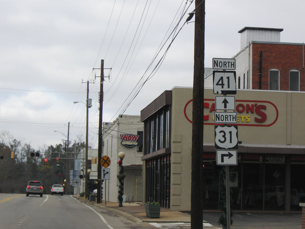
| U.S. 29 south joins SR 41 north for 1.2 miles between East Brewton and U.S. 31 (St. Joseph Avenue) in Downtown Brewton. 12/05/09, 02/12/10 |
|
| U.S. 29 south / SR 41 north span Murder Creek and enter the city limits of Brewton. 12/05/09 |
|
| SR 41 continues north from U.S. 29 along St. Nicholas Avenue to leave Bretwon. U.S. 31 enters the city from the Camp McMillan area in northern Escambia County, representing the main commercial route to the north of Downtown. 12/05/09 |
|
| Interests to Interstate 65 are directed onto SR 41 (St. Nicholas Avenue) north to the freeway in Conecuh County. U.S. 31 and CR 49 also radiate northward toward I-65 from the Escambia County seat. 12/05/09 |
|
| U.S. 29/31 travel 14.4 miles southwest from Downtown Brewton to Flomaton near the Florida state line. 12/05/09 |
|
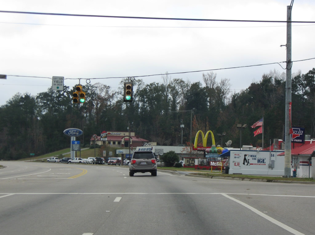
| Persimmon Street intersects U.S. 29/31 (South Boulevard) at the succeeding traffic light west of SR 41. The highway spans Burnt Corn Creek beyond this reassurance shield. 12/05/09 |
|
| Alco Drive winds west from U.S. 29/31 (South Boulevard) near Burnt Corn Creek as the original alignment of U.S. 29/31. 12/05/09 |
|
| U.S. 29/31 shifted from Alco Drive onto a four lane alignment (South Boulevard) by 1961. 12/05/09 |
|
| U.S. 29-31/SR 113 curve southwest along a five lane boulevard toward central Flomaton. 07/31/11 |
|
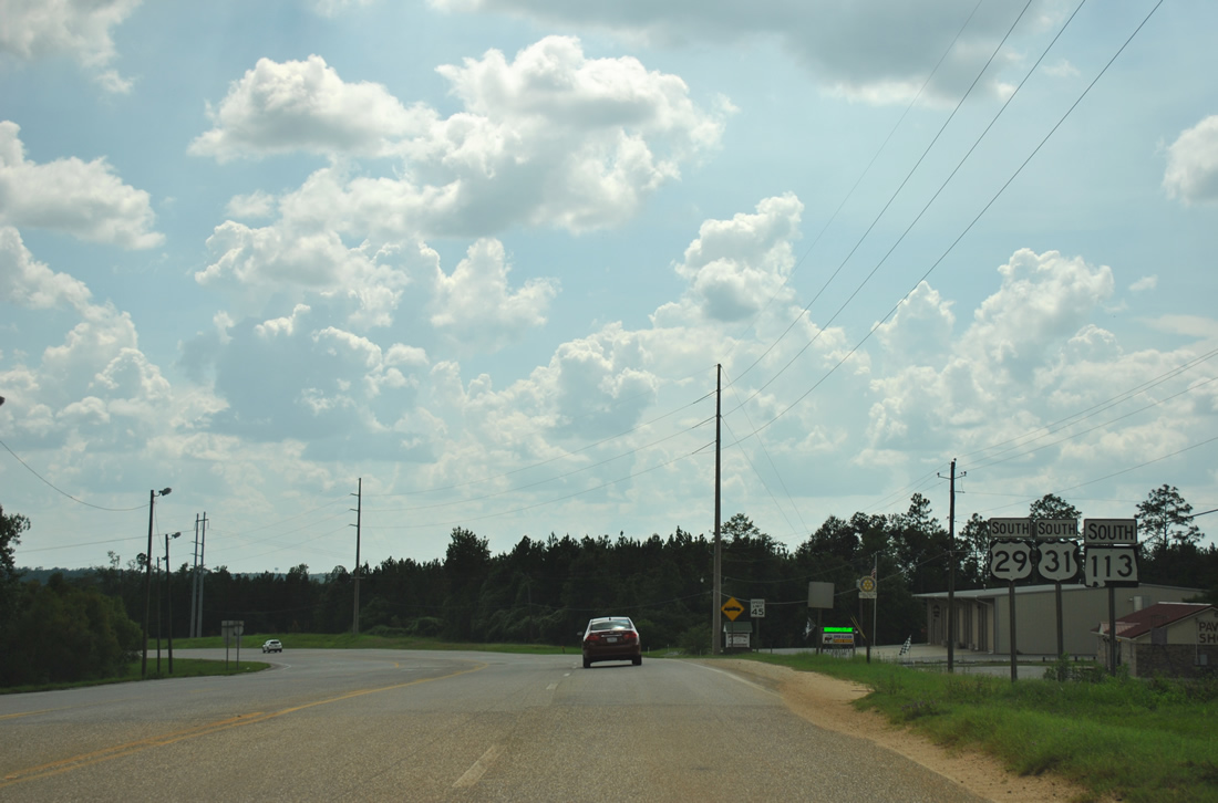
| CR 25 crosses paths with the three routes ahead of Big Escambia Creek. 07/31/11 |
|
| County Road 25 spurs southeast to Van Hoosen Road and Railroad Street west in Flomaton. Northward, CR 25 meanders along Upper Creek Road to Stanley Crossroads. 07/31/11 |
|
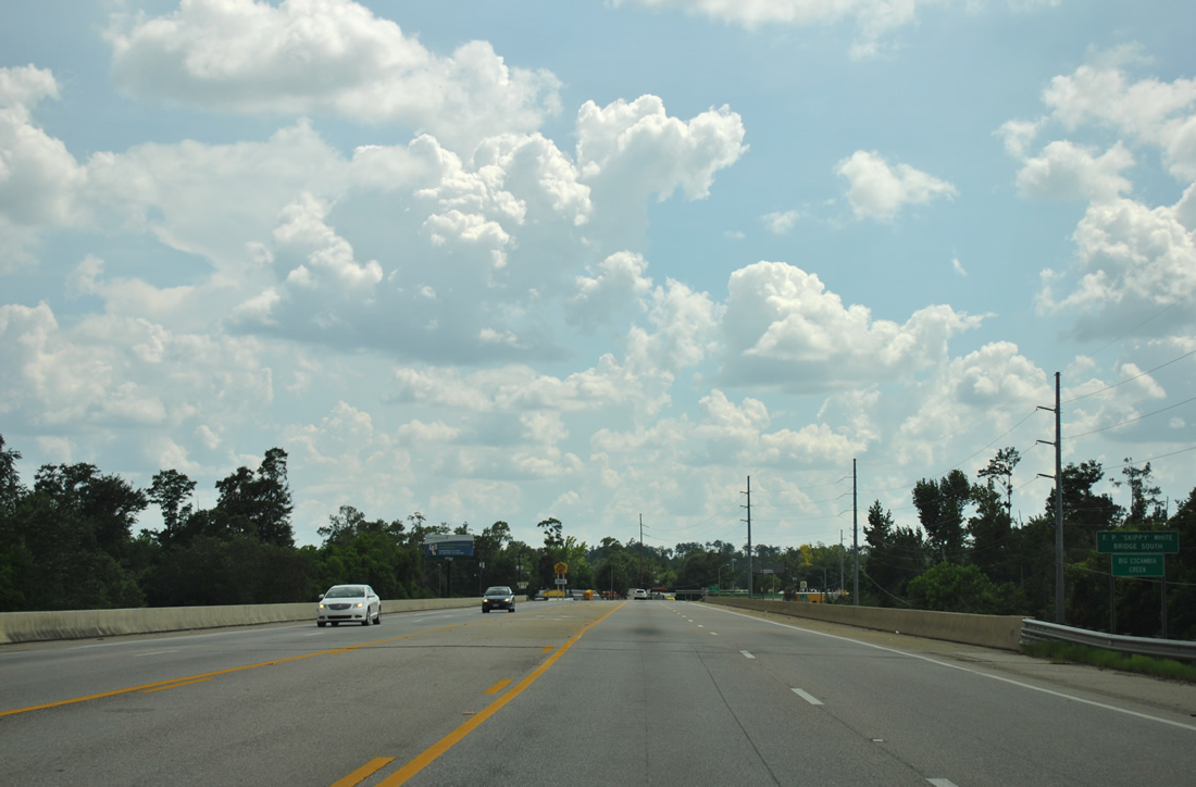
| Spanning Big Escambia Creek along the F.P. "Skippy" White Bridge South on U.S. 29-31/SR 113 south. This span opened in 2002 as part of a project to widen the three routes. 07/31/11 |
|
| U.S. 29/SR 113 turn southward onto Flomaton Boulevard from U.S. 31 toward the city center. 07/31/11 |
|
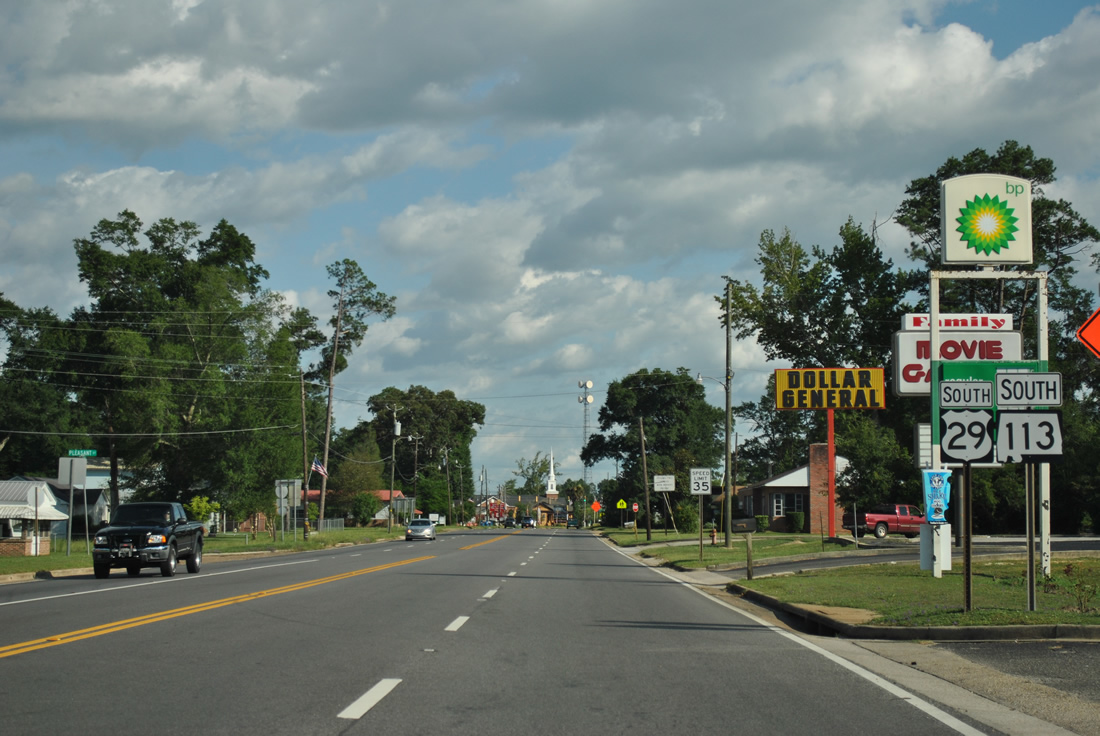
| SR 113 remains cosigned with U.S. 29 south to Century, Florida. U.S. 31 continues west to Wawbeek, Canoe, Malta and Downtown Atmore. 06/25/12 |
|
| U.S. 29/SR 113 follow Sidney E. Manning Boulevard south from U.S. 31 to the Florida state line. 06/25/12 |
|
| Three blocks south of U.S. 31, Sidney E. Manning Boulevard intersects Poplar Street at this traffic light. Poplar Street connects U.S. 29/SR 113 with Ringold Street to the west and Palafox Street to the east. 07/31/11 |
|
| College Street intersects U.S. 29/SR 113 (Sidney E. Manning Boulevard) near the town center. College Street stems west to become CR 2 en route to Old Atmore Road and U.S. 31 near Wawbeek. 09/27/08 |
|
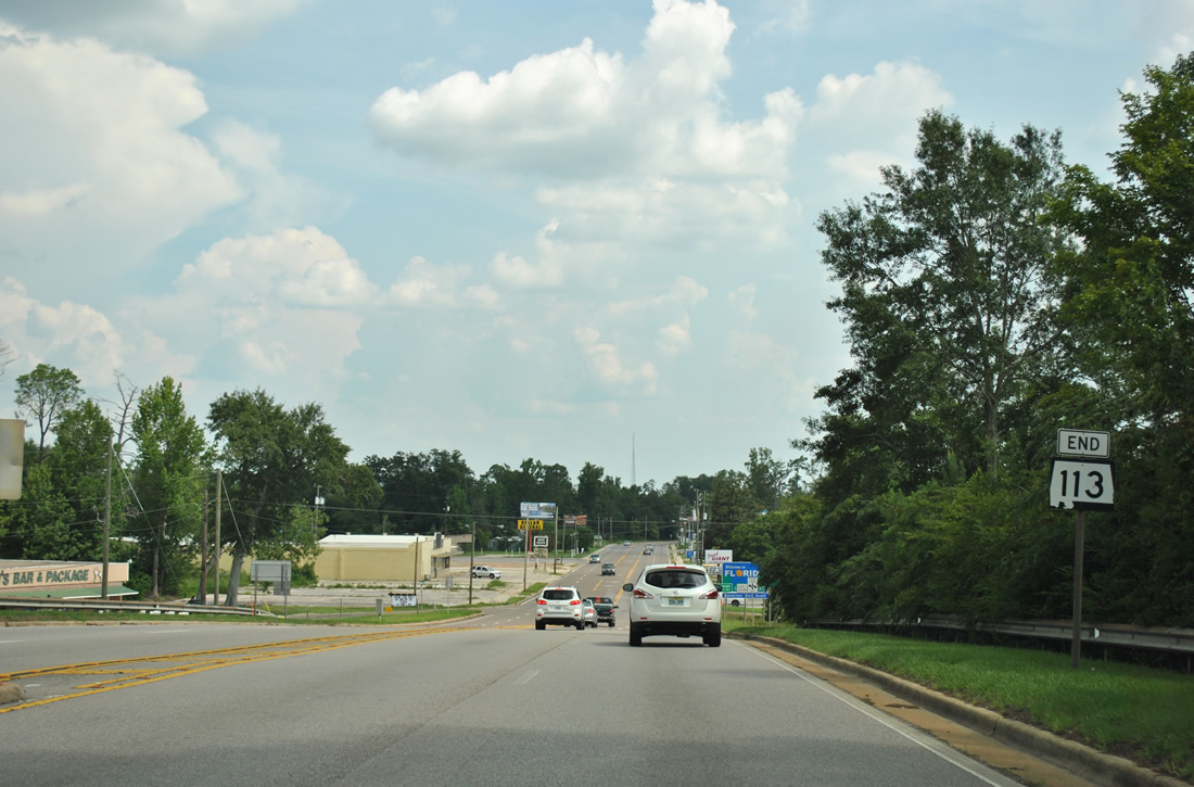
| SR 113 end shield posted after U.S. 29 spans the CSX Railroad ahead of the state line. 07/31/11 |
|
| U.S. 29 transitions to Century Boulevard, a five lane boulevard through the town of Century, Florida. 07/31/11 |
Page Updated 11-15-2011.

 South
South


 South
South