|
| U.S. 29 enters Caswell County, North Carolina within the exchange joining the Danville Expressway (U.S. 58) and U.S. 29 Business in Virginia. The succeeding exit lies 1.23 miles to the south with NC 700 near Pelham. 06/05/05 |
|
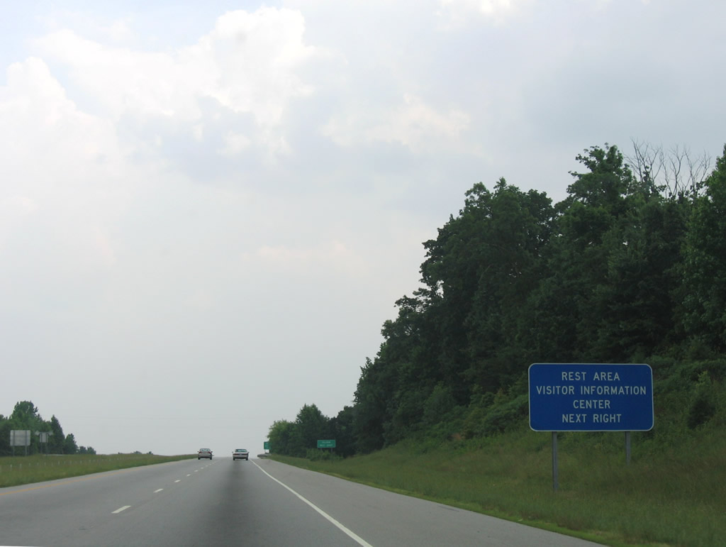
| The Piedmont Triad Visitor Center lies just west just of the diamond interchange (Exit 167) with NC 700. The welcome center doubles as a rest area. 06/05/05 |
|
| Reidsville is 19 miles to the southwest along U.S. 29. Greensboro follows in 43 miles. 06/05/05 |
|
| The rest area at the welcome center is the only along U.S. 29 between the Virginia state line and Greensboro. 06/05/05 |
|
| NC 700 travels 18.88 miles west from U.S. 29 to U.S. 311/NC 14-770 (Van Buren Road) in the city of Eden. Shady Grove Road (SR 1360) stems 0.47 miles southeast to Old U.S. 29 (SR 1353) at Pelham. Old U.S. 29 parallels a Norfolk Southern Railroad line from Virginia to Ruffin. 06/05/05 |
|
| Law Road (SR 1341) links U.S. 29 with Old US Highway 29 (SR 1353) at Blackwell and extends another 3.93 miles east to Park Springs Road (SR 1300) at Bethel. 06/05/05 |
|
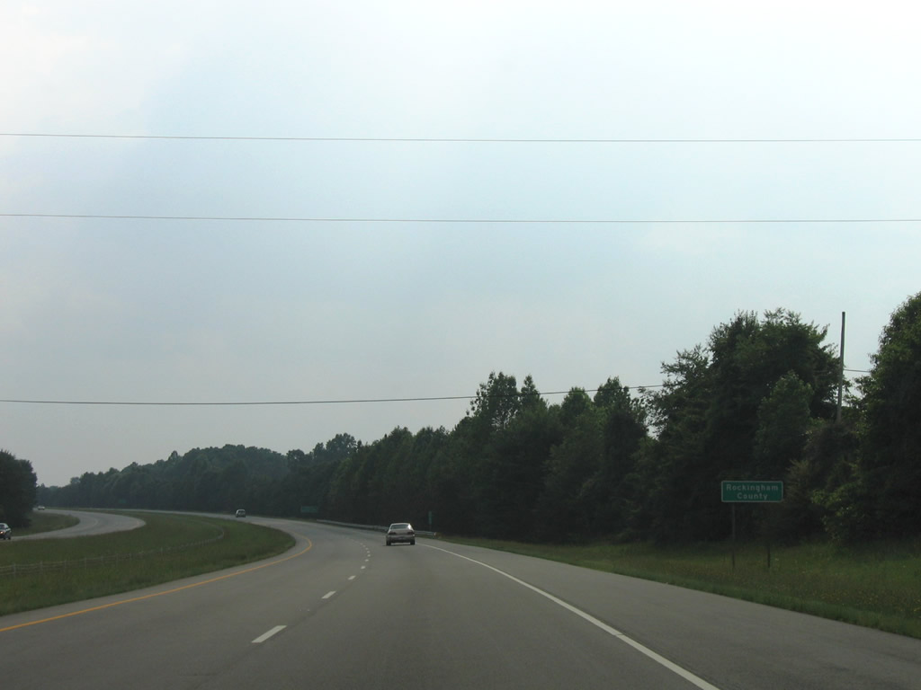
| Home of Reidsville and Eden, U.S. 29 enters Rockingham County 5.82 miles southwest of the Virginia state line. 06/05/05 |
|
| One mile northeast of the diamond interchange (Exit 161) with U.S. 29 Business south and Mayfield Road (SR 1767) north outside the community of Ruffin. 06/05/05 |
|
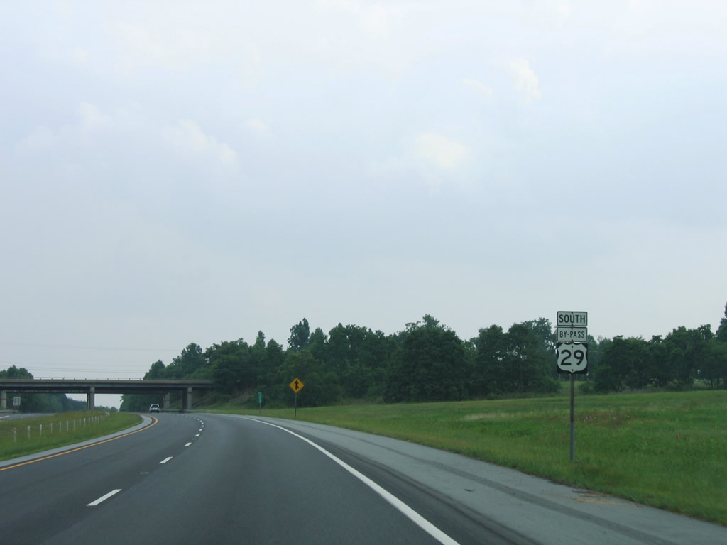
| U.S. 29 is part of the Future I-785 corridor from Danville south to I-840 (Greensboro Urban Loop). 06/05/05 |
|
| Overtaking Old U.S. 29, U.S. 29 Business loops 2.47 miles east into Ruffin. Mayfield Road heads north 4.21 miles to NC 700 at Mayfield. 06/05/05 |
|
| U.S. 29 Business converges with U.S. 29 west from Ruffin en route to Reidsville. Portions of the 18.73 mile long route represent the second alignment for U.S. 29, as U.S. 29 originally followed Scales Street through Reidsville. U.S. 29 Business was bypassed in the 1970s.1 06/05/05 |
|
| Previously marked as U.S. 29 Bypass, U.S. 29 continues south along a freeway through eastern reaches of Reidsville. 06/05/05 |
|
| Narrow Gauge Road (SR 2552) travels 2.54 miles west from U.S. 158 at Lawsonville to a parclo interchange (Exit 156) with U.S. 29. 06/05/05 |
|
| Narrow Gauge Road (SR 2552) heads 3.23 miles west from Exit 156 to U.S. 29 Business at an industrial park north of Reidsville. 06/05/05 |
|
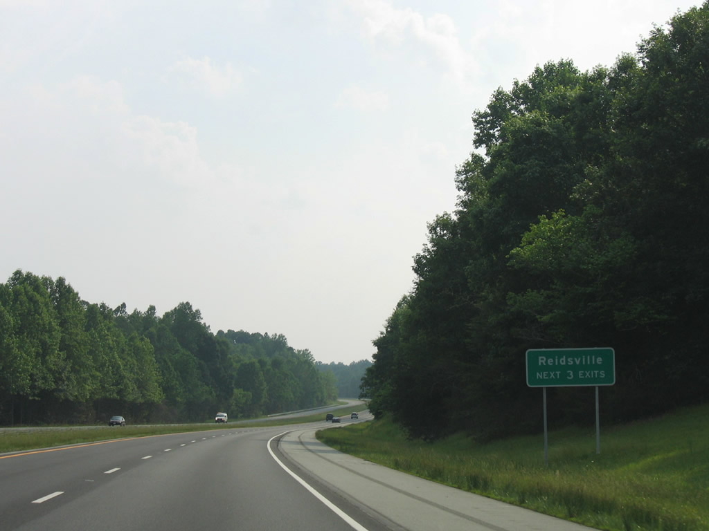
| Three interchanges directly serve the city of Reidsville over the next six miles from U.S. 29 south. 06/05/05 |
|
| U.S. 29 south meets U.S. 158 east and NC 14 west at Exit 153. NC 14 runs northwest past Reidsville 6.87 miles to U.S. 311/NC 87-770 outside the city of Eden. U.S. 158 was realigned to bypass Reidsville along U.S. 29 south and U.S. 29 Business north by 2018. 06/05/05 |
|
| Lawsonville Avenue (former U.S. 158) branches southwest toward Downtown Reidsville from NC 14, 0.32 miles to the west. East from U.S. 29, U.S. 158 travels 18 miles to the Caswell County seat of Yanceyville. NC 14 west to U.S. 29 Business south links with NC 65/87 (Harrison Street) to Wentworth, the Rockingham County seat. 06/05/05 |
|
| Meeting U.S. 29 at a diamond interchange (Exit 150), Barnes Street (SR 2817) serves industrial areas in south Reidsville. Barnes Street south to Freeway Drive and north to Harrison Street along NC 65 was a part of NC 87 until 2000. NC 87 was realigned then to overlap with U.S. 29 Business on Freeway Drive.2 06/05/05 |
|
| Exit 150 departs U.S. 29 south to Barnes Street (SR 2817) for Downtown Reidsville. Barnes Street angles 1.21 miles southeast to NC 87, which advances south from Freeway Drive to Williamsburg. 06/05/05 |
|
| U.S. 158 west and NC 87 encircle Reidsville to the south and west along Freeway Drive. NC 87 joins Reidsville with Burlington, 24 miles to the southeast. 06/05/05 |
|
| U.S. 158/NC 87 (Freeway Drive) overlap 3.38 miles west to Richardson Drive (SR 2686). NC 87 measures 237 miles in length from Virginia Route 87 north of Eden southeast to Southport on the Intracoastal Waterway. 06/05/05 |
|
| U.S. 29 Business from Reidsville returns to U.S. 29 at a trumpet interchange (Exit 145) south of the Haw River. 06/05/05 |
|
| Frontage roads (McWalker and Cornelius Roads) accompany the expressway along U.S. 29 south from the exchange with U.S. 29 Business. 06/05/05 |
|
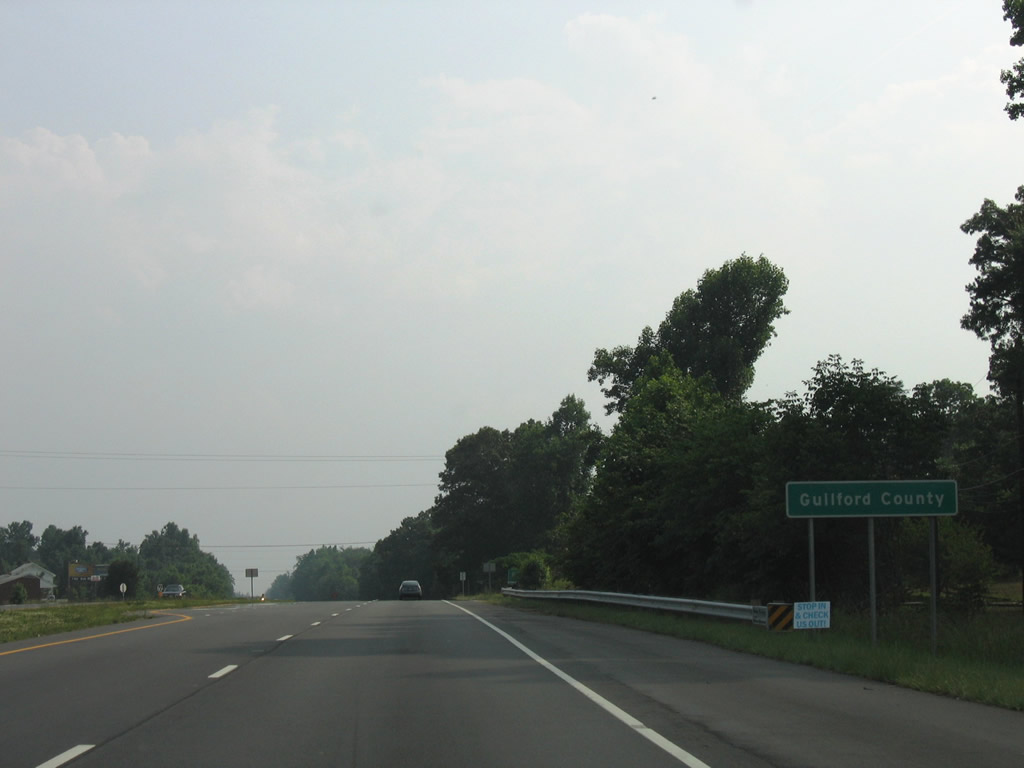
| McWalker Road (SR 2486) and Cornelius Road (SR 2665) come together at an at-grade intersection with U.S. 29 just north of the Guilford County line. 06/05/05 |
|
| Southbound U.S. 29 crosses into Guilford County between Benaja and Candy Creek. 06/05/05 |
Page Updated 11-29-2021.

 South
South


 West
West