|
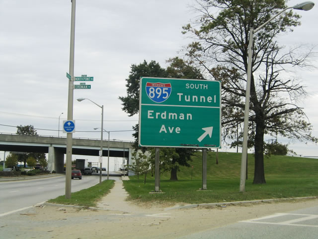
| U.S. 40 (Pulaski Highway) converges with MD 151/U.S. 40 Truck (Erdman Avenue) in east Baltimore at a cloverleaf interchange in Orangeville. 10/13/04 |
|
| The exchange joining U.S. 40 Pulaski Highway) and MD 151 (Erdman Avenue) includes an entrance ramp for Interstate 895 (Harbor Tunnel Thruway) south. MD 151 continues east from U.S. 40/U.S. 40 Truck to North Point Boulevard and the community of Edgemere. 10/13/04 |
|
| A button copy guide sign appeared at the ramp split between I-895 south and MD 151 east. I-895 northbound concludes at I-95 north in 1.5 miles. Moravia Road, 0.75 miles ahead, connects U.S. 40 east with I-95 north. 10/13/04 |
|
| U.S. 40 continues east from MD 43 (White Marsh Boulevard) to White Marsh Station. 06/30/10 |
|
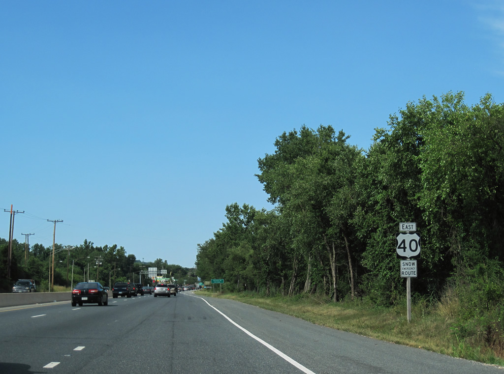
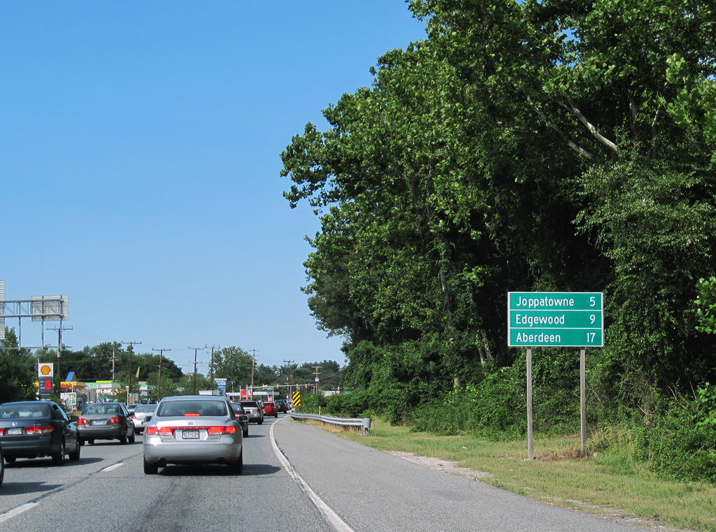
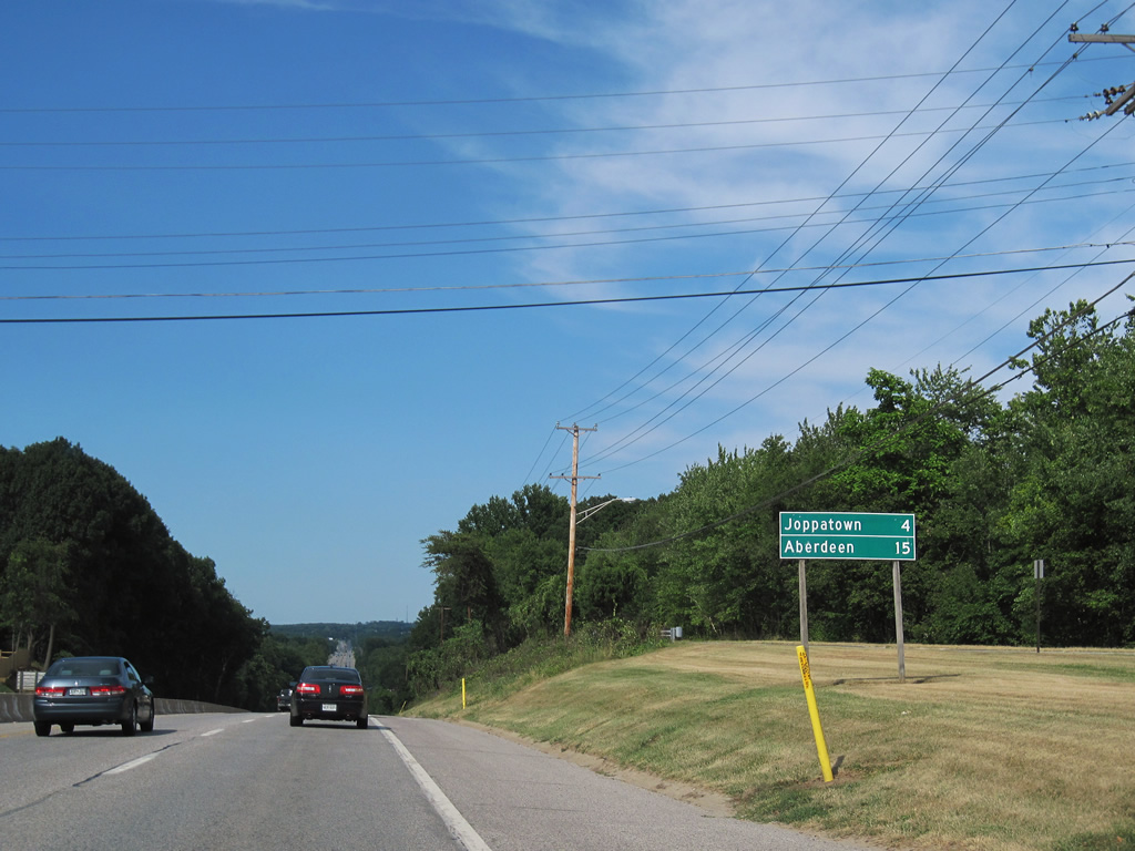
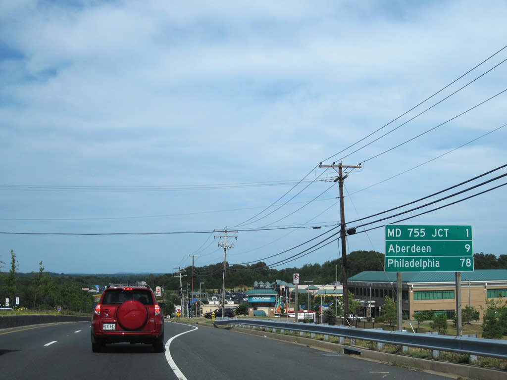
| Eastbound distance sign posted three miles ahead of Joppatowne. Edgewood, outside Aberdeen Proving Ground, follows in nine miles. 06/30/10 |
|
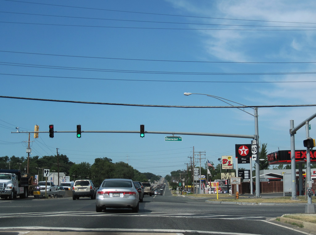
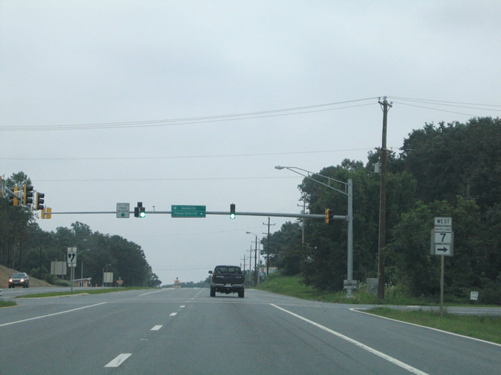
| Ebenezer Road intersects U.S. 40 at White Marsh Station. The road connects with MD 7 (Philadelphia Road) at White Marsh to the northwest and the community of Chase to the east. 06/30/10 |
|
| U.S. 40 (Pulaski Highway) continues northeast by the Bird River in eastern Baltimore County. 06/30/10 |
|
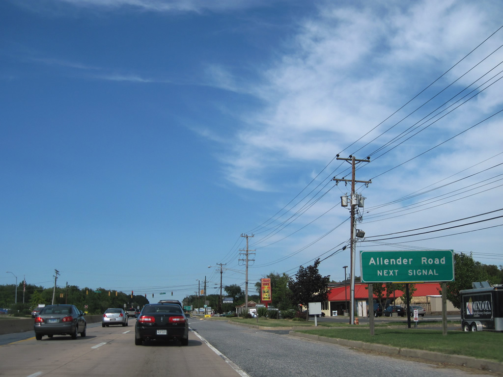
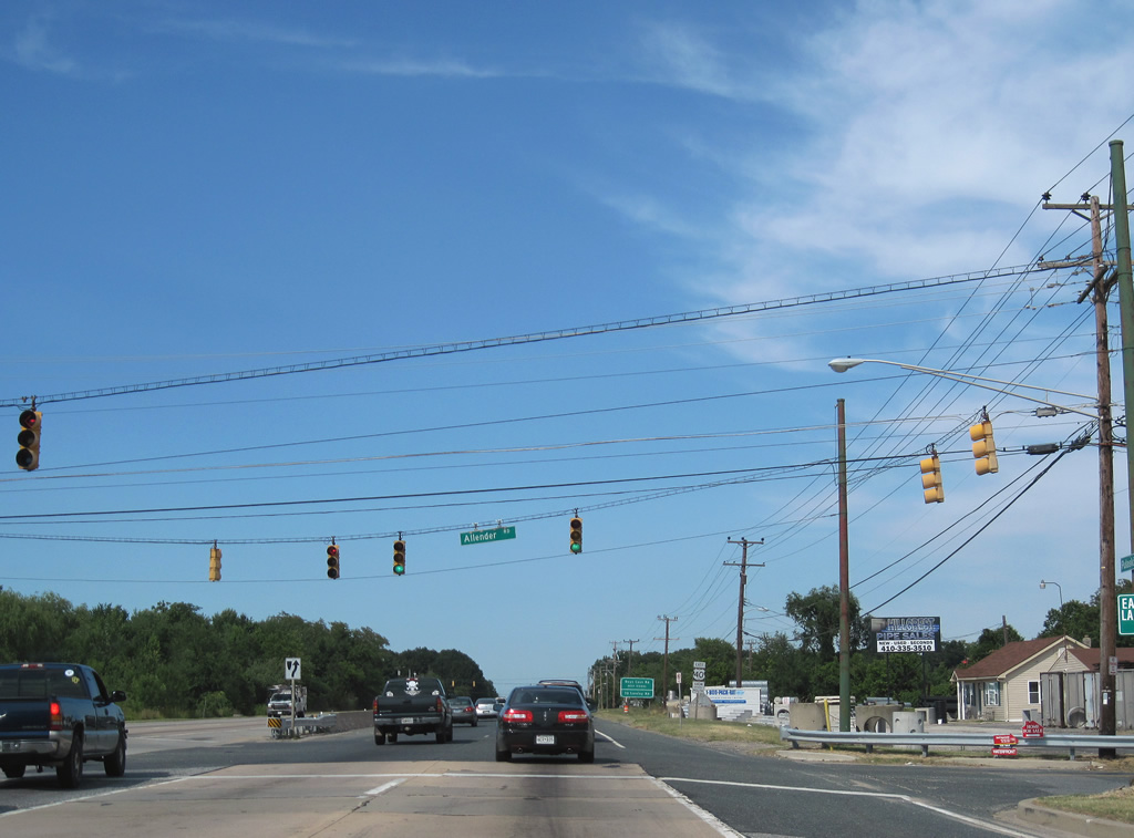
| Advancing to the signalized intersection with Allender Road on U.S. 40 east. 06/30/10 |
|
| Allender Road leads south from U.S. 40 to Loreley Beach Road and north to Loreley and MD 7 (Philadelphia Road). 06/30/10 |
|
| U.S. 40 passes by the Baltimore County Eastern Sanitary Landfill between Allender and Days Cove Roads. 06/30/10 |
|
| Days Cove Road spurs east to the landfill and the Environmental Education Center within Gunpowder Falls State Park. 06/30/10 |
|
| Lowering toward Gunpowder Falls, U.S. 40 enters the state park and next reaches Joppatown in four miles. 06/30/10 |
|
| U.S. 40 first crosses the Big Gunpowder River within the State Park. 2019-22 construction replaced the bridges built in 1935 across the waterway. 06/30/10 |
|
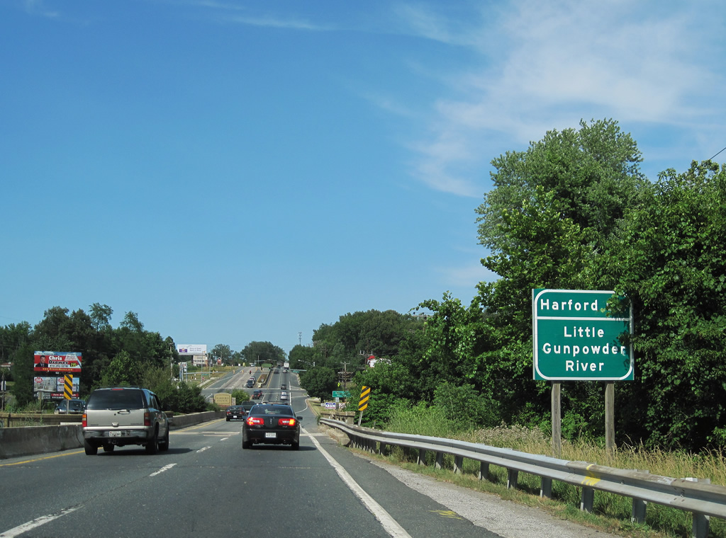
| Continuing alongside Gunpowder Falls State Park, U.S. 40 leaves Baltimore County at the Little Gunpowder River. 06/30/10 |
|
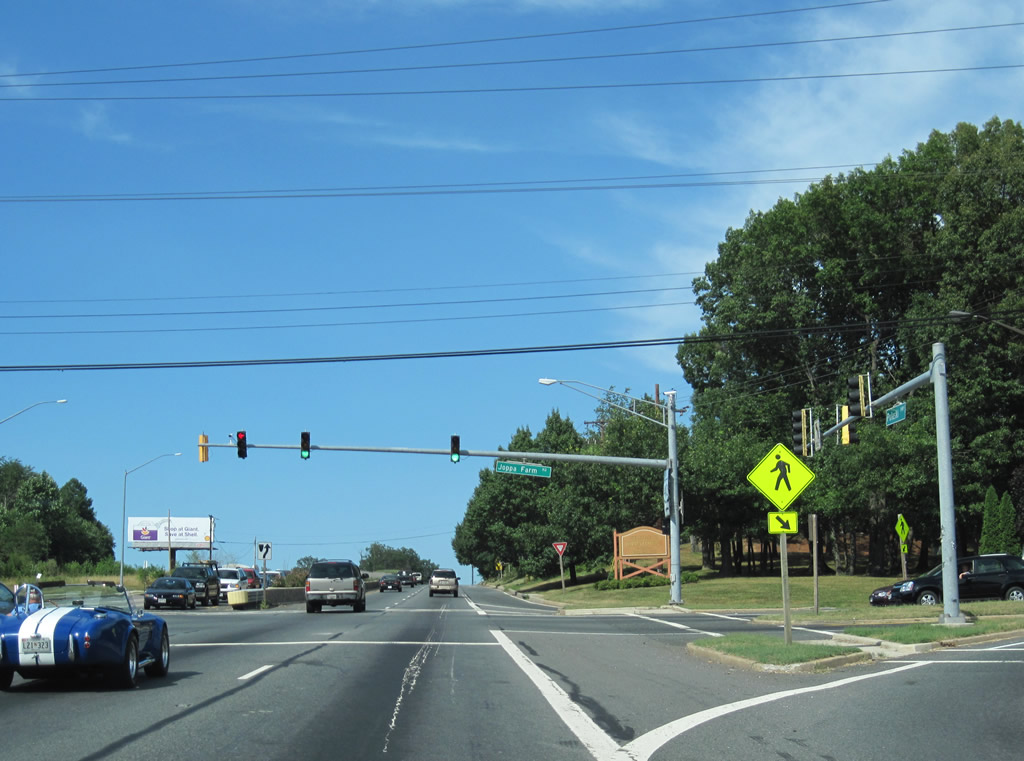
| U.S. 40 (Pulaski Highway) intersects Joppa Farm Road just east of Gunpowder Falls and the Baltimore County line. Joppa Farms Road provides one of two entrances to the Joppatowne community south of U.S. 40. 06/30/10 |
|
| Reassurance marker for U.S. 40 posted east of Joppa Farm Road. 06/30/10 |
|
| Joppa Road leads south from MD 7 (Philadelphia Road) from Joppa to Trimble Road at Joppatowne. 06/30/10 |
|
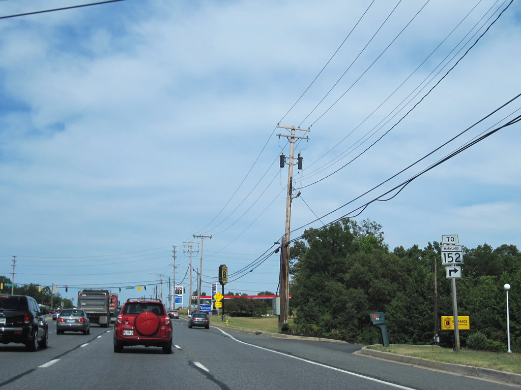
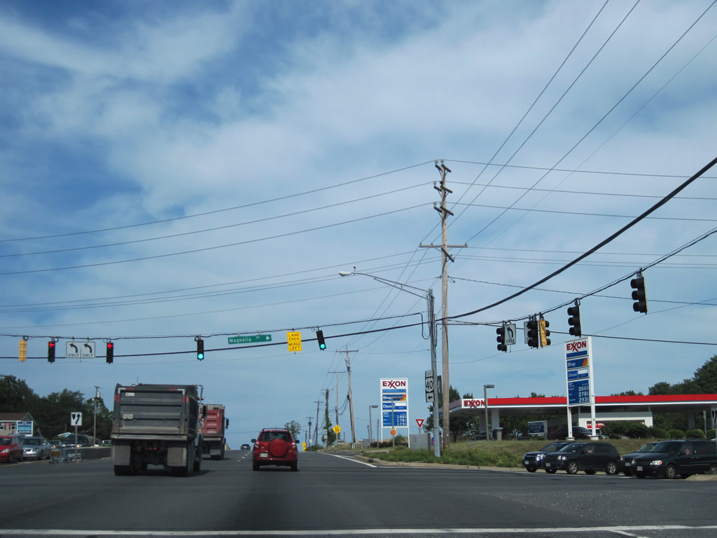
| The succeeding traffic light on U.S. 40 eastbound is at MD 152 (Mountain Road north / Magnolia Road south). 06/30/10 |
|
| MD 152 (Mountain Road) meets Interstate 95 at the first of five interchanges (Exit 74) in Harford County. 06/30/10 |
|
| MD 152 (Mountain Road) spurs 2.39 miles south from U.S. 40 to Aberdeen Proving Ground beyond Magnolia. 06/30/10 |
|
| Heading north, MD 152 (Mountain Road) travels to Mountain, Lynchs Corner (U.S. 1), Bagley and MD 146 south of Madonna. 06/30/10 |
|
| U.S. 40 becomes more commercialized between MD 152 and the community of McComas. Heavy development lines Woodbridge Center Way leading south from Pulaski Highway. 06/30/10 |
|
| A number of businesses serving interests to Aberdeen Proving Ground and the community of Edgewood line U.S. 40 east to MD 755 (Edgewood Road). 06/30/10 |
|
| Eastbound U.S. 40 at the intersection with Treetop Drive south and Paul Martin Drive north. Treetop Drive connects Pulaski Highway with Brookside Drive at the former Edgewood Army Chemical Center site. 06/30/10 |
|
| U.S. 40 shield posted after Treetop Drive. 06/30/10 |
|
| MD 755 continues Edgewood Road south from U.S. 40 (Pulaski Highway) to Edgewood Heights, Edgewood and the Aberdeen Proving Ground. 06/30/10 |
|
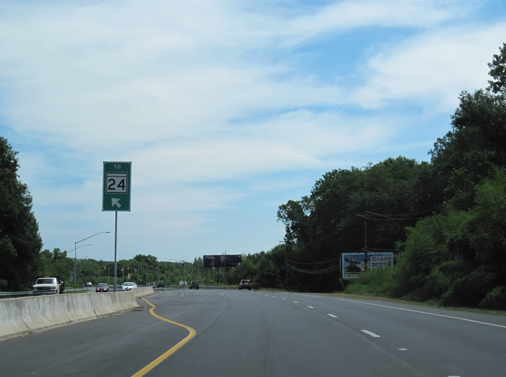
| MD 755 provides one of two connections to MD 24 (Emmorton Road) from U.S. 40. The state route travels just 1.79 miles from McComas to the Army base. 06/30/10 |
|
| Edgewood Road continues 1.25 miles north from U.S. 40 and MD 755 to Van Vibber and MD 24 (Emmorton Road) south of I-95 at Exit 77. 06/30/10 |
|
| MD 24 (Vietnam Veterans Memorial Highway) passes over U.S. 40 ahead of Otter Creek Road (MD 24 Segment D). Otter Creek Ramp links U.S. 40 (Pulaski Highway) with MD 24 (Emmorton Road) north to Bel Air. 06/30/10 |
|
| North from U.S. 40, MD 24 meets MD 7 (Philadelphia Road) at Van Bibber. The state route comprises a busy commuter corridor (Vietnam Veterans Memorial Highway) northward to Bel Air. 06/30/10 |
|
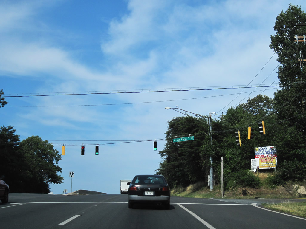
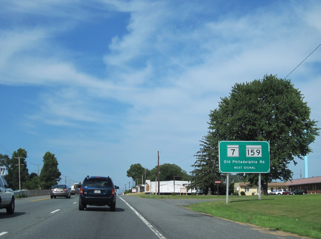
| U.S. 40 straddles marshy areas spreading north from Otter Point Creek on the six miles leading east to MD 7 (Old Philadelphia Road) west and MD 159 south. 06/30/10 |
|
| A traffic light operates at West Shore Road along U.S. 40 east near Otter Point Creek. 06/30/10 |
|
| Otter Point Road leads south from U.S. 40 at Abingdon to the Otter Point community. Abingdon Road angles northwest to MD 7 at Abingdon and Norris Corner north of Interstate 95. 06/30/10 |
|
| Long Bar Harbor Road stems east from U.S. 40 (Pulaski Highway) to Long Bar Harbor on the Bush River. 06/30/10 |
|
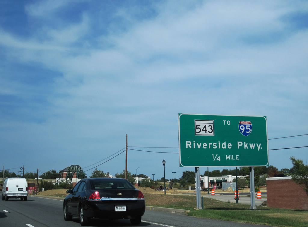
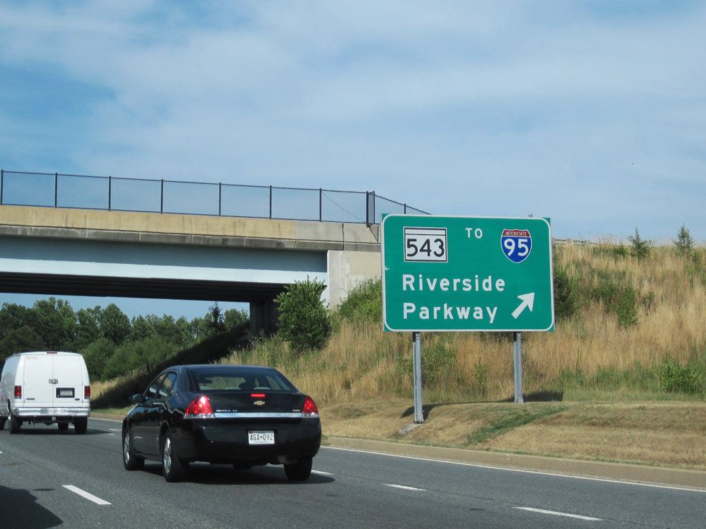
| Entering the Belcamp suburban community, U.S. 40 next meets the northbound beginning of MD 543 (Riverside Parkway). 06/30/10 |
|
| MD 543 shifted alignments in 1995 to Riverside Parkway east of its original course. A loop ramp connects U.S. 40 with the state route leading north to I-95. Larges areas of residential development spread along Riverside Parkway to MD 7 (Philadelphia Road). 06/30/10 |
|
| A 19.08 mile long route, MD 543 (Riverside Parkway) travels north to Fountain Green, Hickory and Ady. 06/30/10 |
|
| A large industrial park lies east of MD 543 and north of U.S. 40 and the parallel CSX Railroad. MD 543 provides one of two access points to that facility. 06/30/10 |
|
| U.S. 40 proceeds two miles east from MD 543 near Church Creek to MD 7/159. 06/30/10 |
|
| Spesutia Road connects U.S. 40 (Philadelphia Boulevard) with MD 159 (Perryman Road) at Perryman. 06/30/10 |
|
| MD 159 constitutes a 4.73 mile route northeast from Bush River to Old Philadelphia Road (MD 7) in west Aberdeen. MD 7 continues Old Philadelphia Road west back toward Belcamp. 06/30/10 |
|
| MD 159 shield posted for Old Philadelphia Road east to Perryman Road south. Old Philadelphia Road was formerly apart of MD 7 east of U.S. 40 into Aberdeen. 06/30/10 |
|
| The main segment of MD 7 heads west along Old Philadelphia Road to Philadelphia Road at Stepney Road. Traveling 22.83 miles, this stretch of MD 7 continues to Baltimore. 06/30/10 |
|
| U.S. 40 (Philadelphia Boulevard) enters the Aberdeen city limits after MD 7 west and MD 159 south. 06/30/10 |
|
| One half mile west of the trumpet interchange with MD 755 (Short Lane) east. 06/30/10 |
|
| MD 715 provides one of three routes into Aberdeen Proving Ground from the city of Aberdeen. All visitors and deliveries to the facility are directed to the Maryland Boulevard gate via MD 715. 06/30/10 |
|
| MD 715 (Short Lane) measures only 1.08 miles in length between U.S. 40 (Pulaski Highway) and the gate for Aberdeen Proving Ground (APG). 06/30/10 |
|
| East from MD 715, U.S. 40 (Philadelphia Boulevard) transitions into a commercial arterial through Aberdeen. 06/30/10 |
|
| Truck advisory signs posted along U.S. 40 east at Carol Avenue in Aberdeen. Trucks with four or more axles are prohibited from using the Hatem Bridge across the Susquehanna River between 6 am and 10 pm and instead are directed onto the Millard E. Tydings Bridge along I-95. 06/30/10 |
|
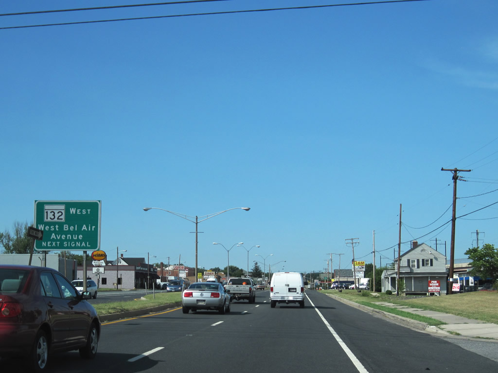
| MD 132 exists in multiple segments within the city of Bel Air. The main section follows Bel Air Avenue west from U.S. 40 (Philadelphia Boulevard) to Interstate 95 north at Exit 85. 06/30/10 |
|
| Bel Air Avenue mainly serves residential neighborhoods and Aberdeen High School north of U.S. 40. APG Road leads south as unsigned MD 132 across the AMTRAK Northeastern Corridor to serve the MARC Aberdeen commuter rail station and provide access to the Aberdeen Boulevard gate into APG. 06/30/10 |
|
| A short distance north of Bel Air Avenue is the parclo interchange with MD 22 (Aberdeen Throughway). MD 22 constitutes a mostly controlled access arterial northward from Aberdeen Proving Ground to Interstate 95. 06/30/10 |
|
| A direct ramp connects U.S. 40 (Philadelphia Boulevard) east with MD 22 (Aberdeen Throughway) south. The connection from U.S. 40 east to MD 22 north utilizes a ramp from Rogers Street opposite the southbound ramp. 06/30/10 |
|
| Vacating Aberdeen, U.S. 40 continues to MD 132 at Swan Creek and the city of Havre De Grace. 06/30/10 |
|
| Traffic lights were installed during the Spring of 2004 along U.S. 40 (Pulaski Highway) at MD 7 Segment B. MD 7 (Principio Furnace Road) ties into U.S. 40 across from Belvidere Road north. MD 7 Segment C begins in 0.40 miles. 07/25/04 |
|
| MD 7 Segment C branches east from U.S. 40 (Pulaski Highway) along Old Philadelphia Road, 1.25 miles southeastward to MD 267 (Baltimore Street) at Charlestown. 07/25/04 |
|
| U.S. 40 (Pulaski Highway) undulates over a series of hills eastward between MD 7 (Old Philadelphia Road) and Red Toad Road. 07/25/04 |
|
| Part of an effort to slow down traffic along U.S. 40, MDOT in early 2004 installed traffic lights along Pulaski Highway at forthcoming Red Toad Road and Mechanics Valley Road beyond North East. 07/25/04 |
|
| MD 272 (North East Road) meets U.S. 40 at a commercialized intersection by the town of North East. MD 272 travels 12.22 miles south to Downtown North East, Elk Neck State Park and Turkey Point along Chesapeake Bay by the Elk River. 07/25/04 |
|
| MD 7 (Old Philadelphia Road) returns to U.S. 40 (Pulaski Highway) at the south end of MD 279 (Elkton Road) outside the town of Elkton. MD 279 (Elkton Road) runs across Elkton northeast 4.95 miles to I-95 at Exit 109 and the Delaware state line at Newark. 03/23/04 |
|
| U.S. 40 (Pulaski Highway) crosses Little Elk Creek and the AMTRAK Northeast Corridor ahead of the traffic light with Landing Lane in Elkton. Landing Lane was formerly part of MD 7 Segment D, which included Main Street east from Jeffers Street to Downtown Elkton. 04/13/04 |
|
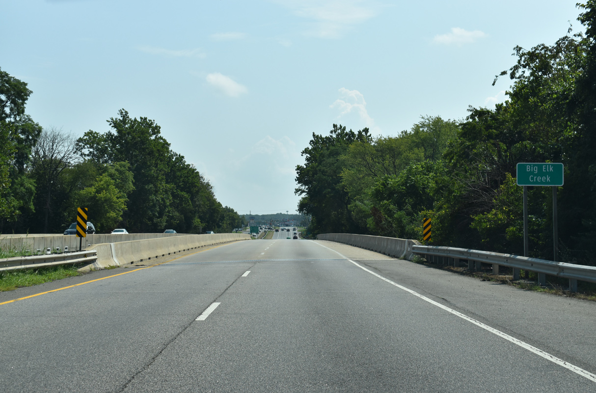
| U.S. 40 (Pulaski Highway) proceeds east from Landing Lane to cross Big Elk Creek south of Marina Park. 08/27/21 |
|
| MD 213 (S Bridge Street) links U.S. 40 (Pulaski Highway) with Downtown Elkton at the forthcoming intersection. 08/27/21 |
|
| MD 213 replaced U.S. 213 in 1971 along the route south from U.S. 40 in Elkton to Chesapeake City, Chestertown and Wye Mills. 08/27/21 |
|
| North from Elkton, MD 213 (Singerly Road) leads to MD 273 at Fair Hill and PA 841 at Lewisville, Pennsylvania. 08/27/21 |
|
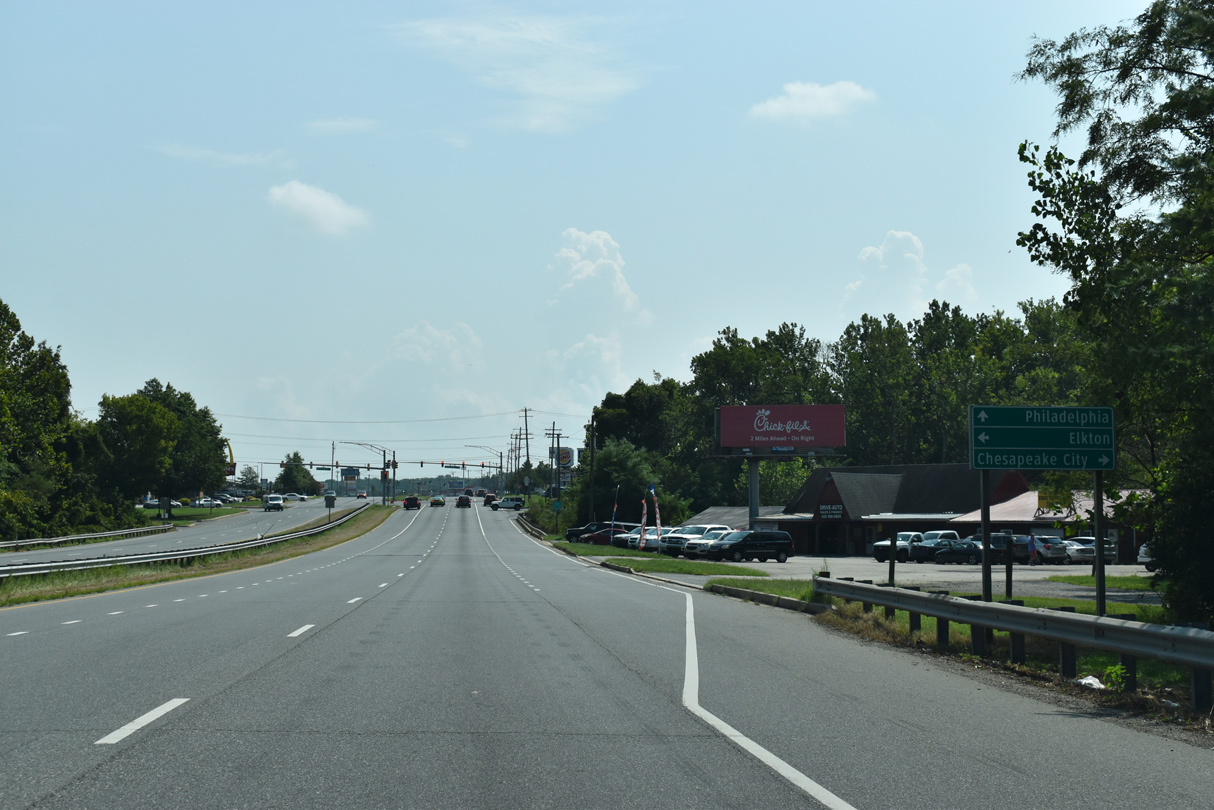
| South from Elkton, MD 213 crosses the Chesapeake and Delaware Canal across the Chesapeake City Bridge en route to Cecilton and Galena. 08/27/21 |
|
| The south end of MD 781 (Delancy Road) ties into U.S. 40 (Pulaski Highway) within a quarter mile of the state line. Delancy Road connects U.S. 40 with MD 281 (Red Hill Road) 1.01 miles to the north. MD 281 east becomes Old Baltimore Pike to Iron Hill in New Castle County, Delaware. 03/23/04 |
Page Updated 11-04-2022.

 East
East