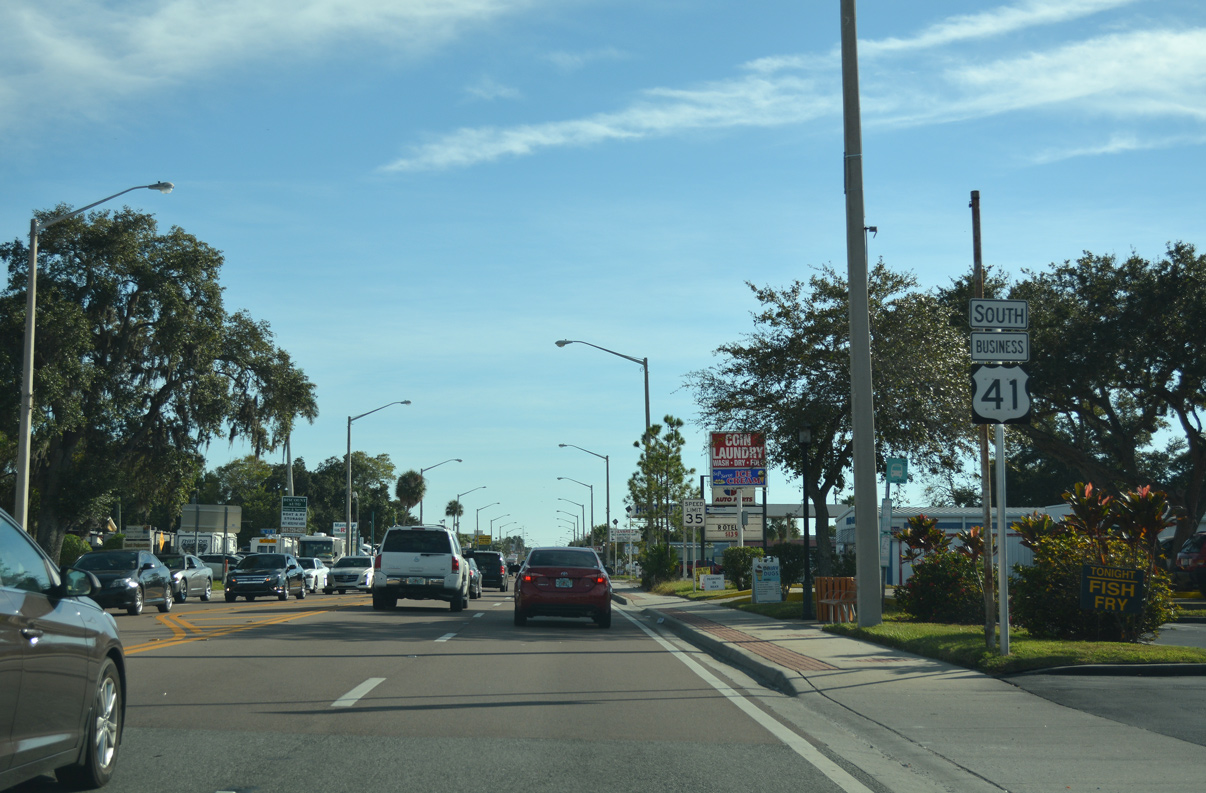
Designated in 1965 from a U.S. 41 realignment through east Bradenton and Palmetto, U.S. 41 Business runs 5.9 miles through both Downtown districts. The bannered route stems north from U.S. 41 and Florida State Road 684 (Cortez Road) through Bradenton into Palmetto via the Green Bridge over the Manatee River. U.S. 41 Business makes a return to U.S. 41 in Memphis at the southern end of the U.S. 19/U.S. 41 interchange complex.
|
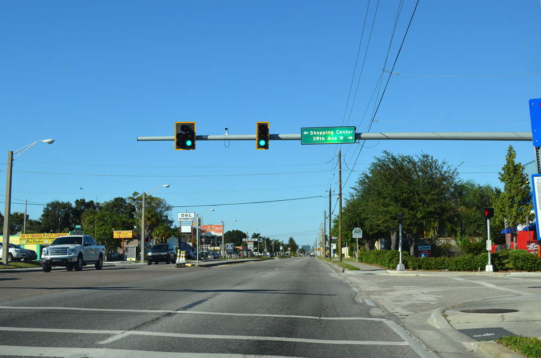
| U.S. 41 Business (14th Street W) north first intersects 39th Avenue W and the entrance to a retail center as it advances towsrd Downtown Bradenton. A traffic signal was added to the intersection sometime after July 2011. 11/03/13 |
|
| This portion of Tamiami Trail is part of a group of highways and roads that make up the Florida Scenic Highway state-wide program. These specific markers span the 70 mile length of the Trail from the Charlotte/Sarasota County line north to the Manatee/Hillsborough County line. 11/03/13 |
|
| 30th Avenue West extends west from the business route through residential neighborhoods to 26th Street West while east the local road crosses south Bradenton touching both U.S. 41 (1st Street) and U.S. 301 before ending at 27th Street East. 11/03/13 |
|
| U.S. 41 Business loses its center turn lane as it formally enters Bradenton at 26th Avenue West. Bradenton was created in 1943 from a merging of Manatee (incorporated 1888) and Bradentown (incorporated 1903). 11/03/13 |
|
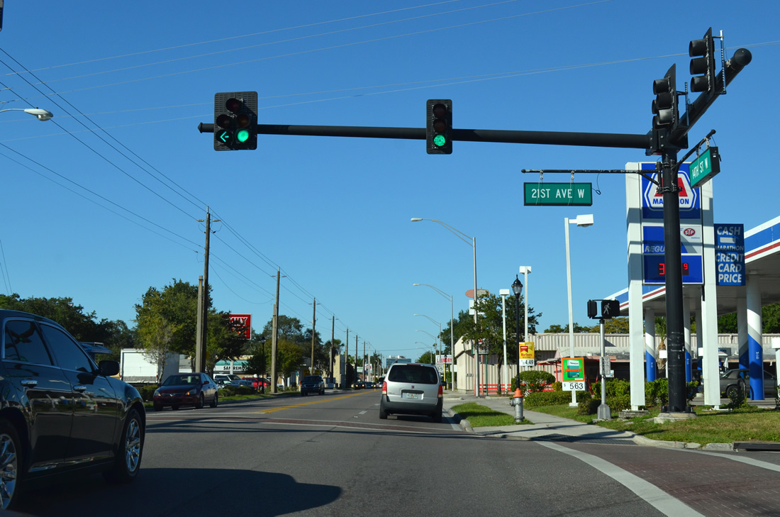
| The next signalized intersection for U.S. 41 Business (14th Street West) occurs at 21st Avenue West. 21st Avenue West stretches from 27th Street West to U.S. 41 (1st Street) at the base of the wye interchange with U.S. 301. 11/03/13 |
|
| 17th Avenue West connects the business route with both LECOM Park (former McKechnie Field) and U.S. 41/301 to the east and 43rd Street to the west. LECOM Park opened in 1923 and is the current spring training facility for the Pittsburgh Pirates MLB team. 11/03/13 |
|
| 14th Street West and U.S. 41 Business next meet 12th Avenue West at a signalized intersection as both continue toward Downtown. 11/03/13 |
|
| U.S. 41 Business north prepares to depart 14th Street West as it crosses 9th Avenue West (Martin Luther King Jr. Avenue West). 9th Avenue West doubles as Martin Luther King Jr. Avenue from this point east to 27th Street East near the Braden River. The local road also gains boulevard-type characteristics between 9th Street West and 9th Street East as it crosses through the city. 11/03/13 |
|
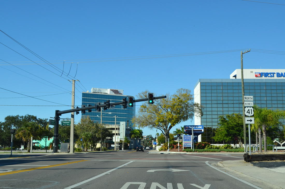
| Tamiami Trail and U.S. 41 Business both follow 8th Avenue east five blocks before turning north on 9th Street West toward SR 64 and Palmetto. 11/03/13 |
|
| Reassurance shield for U.S. 41 Business north along its stint with 8th Avenue West south of Downtown. 11/03/13 |
|
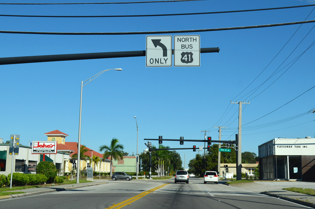
| A reversed colored guide sign alerts motorists of the upcoming turn north along 9th Street West. 9th Street West will carry the business route across the Manatee River via the Green Bridge into neighboring Palmetto. 11/03/13 |
|
| Another reassurance shield for U.S. 41 Business north (9th Street West) as it approaches SR 64 (6th Avenue West) near the central business district. 11/03/13 |
|
| SR 64 stretches 77.3 miles from Manatee County Road 789 in Holmes Beach near the Gulf of Mexico to U.S. 27/98 Avon Park in south central Florida. The majority of the state route is rural with the exception of the portion through the Bradenton area. 11/03/13 |
|
| 6th Avenue West carries SR 64 eastbound from 15th Street West to 14th Street East where the route rejoins its westbound component and Manatee Avenue. East of Bradenton, Zolfo Springs is the next destination for SR 64 east, lying 49 miles away. 11/03/13 |
|
| North of SR 64 west (Manatee Avenue) U.S. 41 Business meets 3rd Avenue West near the base of the Green Bridge. 3rd Avenue West parallels the Manatee River joining the business highway with U.S. 41 and 301 south (1st Street) to the east. 10/01/13 |
|
| Another Florida Scenic Highway marker stands along Tamiami Trail on the final approach to the Green Bridge spanning the Manatee River. 04/02/14 |
|
| The four lane Green Bridge carries U.S. 41 Business (Tamiami Trail) over the Manatee River into Palmetto. Completed in 1986 and named after E.P. Green, Sr., a former city councilman, the modern high-rise bridge replaced a drawbridge that connected Palmetto with 10th Street W near Downtown. 04/02/14 |
|
| The northern section of the former drawbridge at Palmetto was repurposed as a fishing pier. 04/02/14 |
|
| U.S. 41 Business enters the Palmetto street grid along 8th Avenue W. 04/02/14 |
|
| 5th Street stems west from U.S. 41 Business (8th Avenue West) into residential areas of Palmetto. To the east the local road continues to 5th Avenue West. 04/02/14 |
|
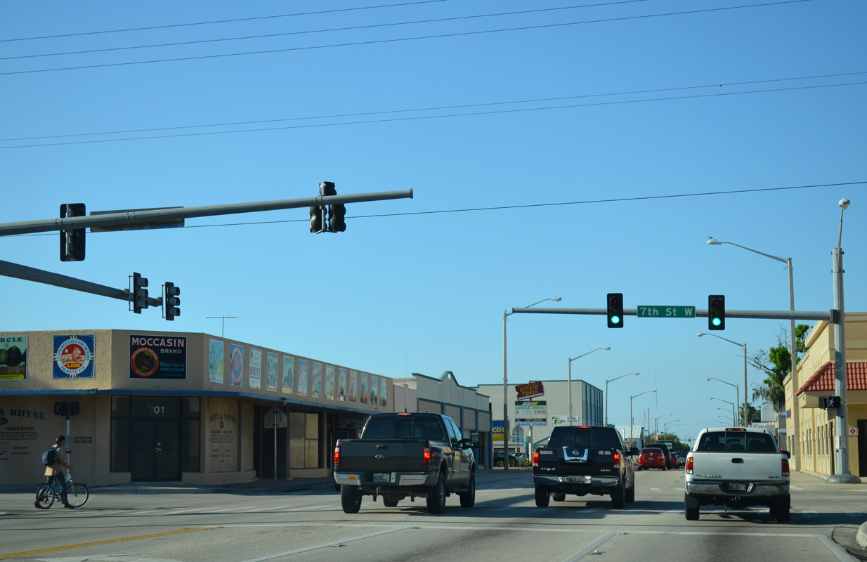
| U.S. 41 Business north reaches 7th Street W in the central business district of Palmetto. 7th Street W provides a direct connection to U.S. 41/301 south adjacent to the Palmetto Estuary Nature Preserve. U.S. 41 Business continues along 8th Avenue W and Valencia Drive another 2.1 miles to the northbound merge with U.S. 41 in Memphis. 04/02/14 |
|
| Motorists approach the unsigned west terminus of SR 43 (10th Street W) in Palmetto. The route follows U.S. 301 for most of its 41.5 mile alignment between Palmetto and Tampa. 10th Street W also provides a link between U.S. 41 Business and U.S. 41/301 east of Downtown Palmetto as well as serving Snead Island to the west along unsigned Manatee County Road 43. 05/06/14 |
|
| Moving north from 10th Street W, U.S. 41 Business (8th Avenue W) advances toward the return with U.S. 41. From a historical perspective, former U.S. 541 (1932-1951) commenced at this point, marching up Tamiami Trail to reach Memphis, Ruskin and eventually Tampa. U.S. 41 overtook the route of the former U.S. highway through Palmetto followed by the present U.S. 41 Business. 05/06/14 |
|
| 17th Street West stretches across north Palmetto from 24th Avenue West to U.S. 301 near its interchange with Interstate 75. The portion between 8th Avenue West and Bayshore Road formerly served U.S. 541, U.S. 41 and U.S. 41 Business prior to its current alignment. 05/06/14 |
|
| A trailblazer to U.S. 19 joins the reassurance shield for U.S. 41 Business north of 17th Street West. U.S. 19 travels nearly 262 miles in the Sunshine state. 05/06/14 |
|
| A set of flashers operate at U.S. 41 Business, Bayshore Road and 26th Street W. The bannered U.S. highway once followed Bayshore Road southwest into Palmetto from U.S. 41 near Memphis. 26th Street W (Church Road) goes to an extension of 8th Avenue W 0.4 miles from the intersection. 05/06/14 |
|
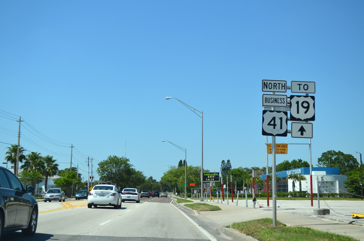
| U.S. 41 Business will come to an end as it curves underneath mainline U.S. 41 at a wye interchange. Merging traffic from U.S. 41 Business immediately meets U.S. 19 to St. Petersburg. A CSX rail line briefly follows U.S. 41 Business north prior to the merge. 05/06/14 |
|
| U.S. 41 Business commences from U.S. 41 at this wye interchange immediately south of U.S. 19 in Memphis. The bannered U.S. highway travels 5.9 miles through Palmetto and Bradenton, meeting U.S. 41 once more at an intersection with SR 684 (Cortez Road). 05/06/14 |
|
| Downtown Palmetto lies one mile ahead along U.S. 41 Business, followed by Downtown Bradenton in another two miles. 11/12/16 |
|
| The bannered route formerly enters Palmetto as it leaves the wye interchange with U.S. 41. The city was incorporated in 1897. 05/06/14 |
|
| The first reassurance shield for U.S. 41 Business appears as the four lane highway curves southwest toward Downtown Palmetto. A final turnabout allows motorists a return trip to U.S. 41 north. 05/06/14 |
|
| A set of flashers appear at Bayshore Road and 26th Street W (Church Road). U.S. 41 Business once followed Bayshore Road southward to 17th Street W prior to the current alignment into Downtown Palmetto. 26th Street shoots west from the intersection 0.4 miles to an extension of 8th Street W. 05/06/14 |
|
| Entering the central business district of Palmetto, U.S. 41 Business (8th Avenue W) crosses 17th Street W. 17th Street W runs west to 24th Avenue W and east to U.S. 41 (Tamiami Trail) and 16th Avenue E. The portion of 17th Street W between Bayshore Road and 8th Avenue W previously carried U.S. 41 Business, U.S. 41, and U.S. 541. 11/12/16 |
|
| Commercial businesses align both sides of U.S. 41 Business southward toward the succeeding traffic light at 10th Street W. 11/12/16 |
|
| 10th Street W (unsigned SR 43) leads east from Downtown Palmetto to U.S. 301 at the exchange with U.S. 41 (Tamiami Trail). SR 43 underlays U.S. 301 east 2.7 miles to Ellenton and 16.07 miles to the Hillsborough County line. 11/12/16 |
|
| The intersection with 10th Street W marks the historic south end of U.S. 541. West from U.S. 41 Business, 10th Street W is a part of unsigned Manatee County Road 43, 2.57 miles to Snead Island. 05/06/14 |
|
| Heading south from 10th Street West U.S. 41 Business (8th Avenue West) continues through the central business district of Palmetto. 10/01/13 |
|
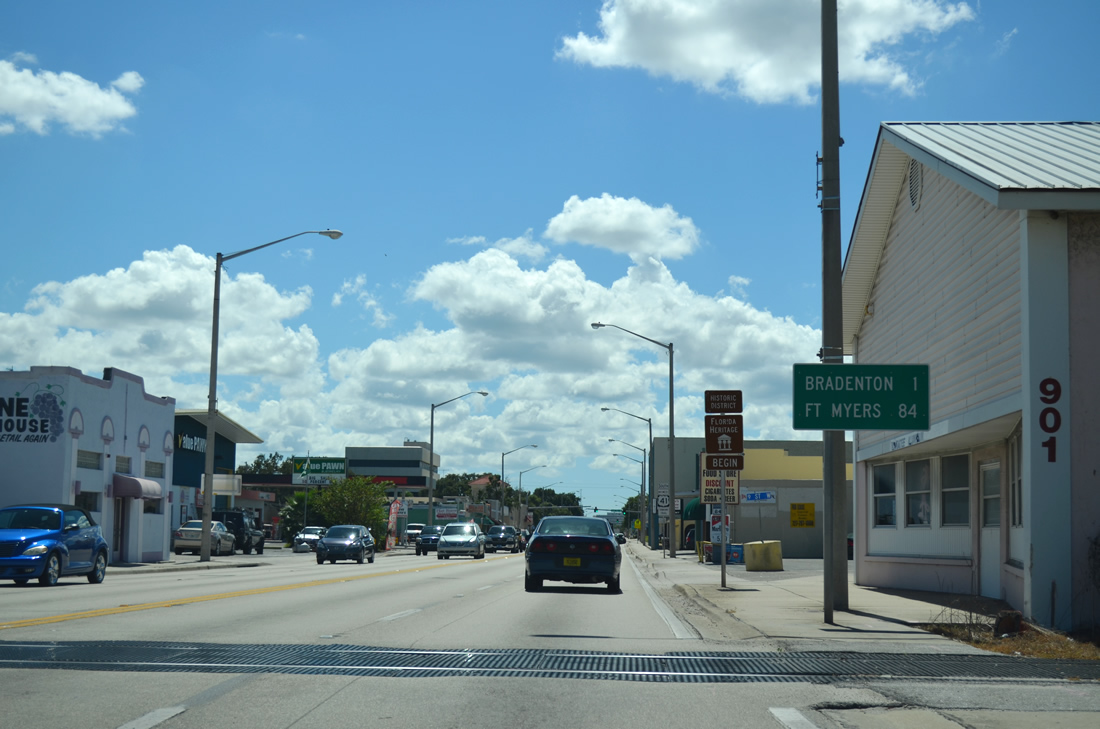
| Crossing over an abandoned rail line the business route comes to within one mile of Bradenton and 84 miles of Fort Myers. The mention of the City of Palms is remnant from when U.S. 41 followed this corridor through Palmetto and Bradenton. 10/01/13 |
|
| A second reassurance shield displays the Tamiami Trail moniker for U.S. 41 Business south on the approach to 7th Street West. The business highway follows the Trail through both Palmetto and Bradenton to U.S. 41 in South Bradenton. 10/01/13 |
|
| 7th Street stems east from 8th Avenue several blocks to reach U.S. 41/301 immediately south of the diamond interchange between the two U.S. highways. Going west, 7th Street reaches residential areas of Palmetto. 10/01/13 |
|
| The final signal preceding the Green Bridge and Downtown Bradenton along U.S. 41 Business operates at 5th Street W. 04/02/14 |
|
| Passing by Riverside Park, U.S. 41 Business (Tamiami Trail) south reaches the Green Bridge spanning the Manatee River. 04/02/14 |
|
| A fishing pier adjacent to the high-rise bridge across the Manatee River was formerly a part of a drawbridge linking Palmetto and Bradenton. 04/02/14 |
|
| Named for a former Bradenton city councilman, the Green Bridge opened to traffic in 1986. 04/02/14 |
|
| U.S. 41 Business formally enters the city of Bradenton at the apex of the Green Bridge. 04/02/14 |
|
| South of the Manatee River at Downtown Bradenton U.S. 41 Business (9th Street W) crosses 3rd Avenue W. 3rd Avenue provides access to the South Florida Museum and Twin Dolphin marina. 04/02/14 |
|
| SR 64 extends 77 miles between Holmes Beach and Avon Park, connecting the Gulf Coast with the south central region of Florida. 04/02/14 |
|
| Manatee Avenue carries SR 64 west through Downtown Bradenton en route to Holmes Beach and Anna Maria Island. 04/02/14 |
|
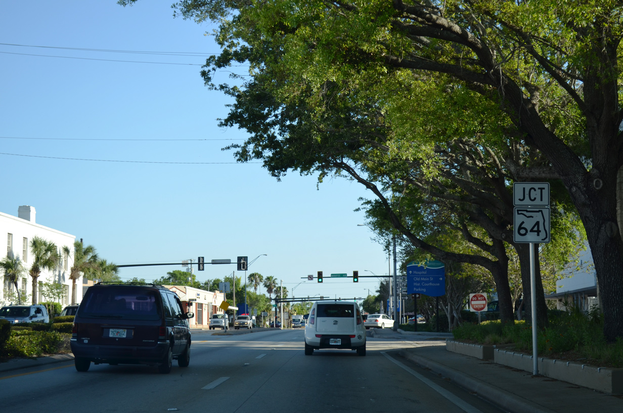
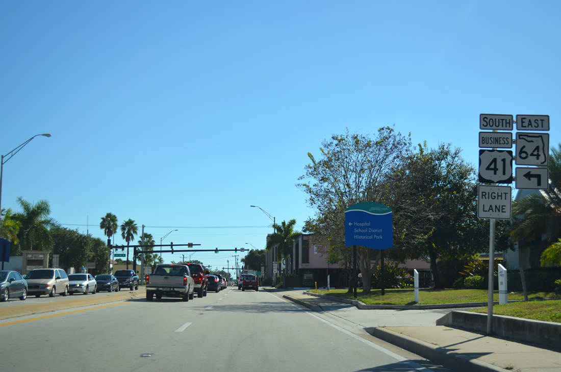
| Motorists are advised of the forthcoming turn for U.S. 41 Business at SR 64 (6th Avenue W) east. 11/03/13 |
|
| SR 64 east follows 6th Avenue West through Downtown from 15th Street West to 14th Street East. SR 64 will leave the urban Bradenton area east of Interstate 75 for Zolfo Springs which lies 49 miles away along the U.S. 17 corridor. 11/03/13 |
|
| U.S. 41 Business (9th Street West) will turn along 8th Avenue West for five blocks before turning back south on 14th Street West toward U.S. 41 and Sarasota. 11/03/13 |
|
| This reassurance marker appears after the U.S. 41 Business turn from 9th Street West onto 8th Avenue West. 11/03/13 |
|
| Tamiami Trail leaves the undivided 8th Avenue for 14th Street W in two blocks. 11/03/13 |
|
| 14th Street W takes U.S. 41 Business and Tamiami Trail through south Bradenton to U.S. 41 and SR 684. 11/03/13 |
|
| U.S. 41 Business quickly approaches 9th Avenue West (Martin Luther King Jr. Avenue West) after joining 14th Street West. Sarasota lies 11 miles ahead along U.S. 41 south. 11/03/13 |
|
| 14th Street West next meets 12th Avenue West at a signalized intersection in the south reaches of Bradenton. 11/03/13 |
|
| 17th Avenue West stems east from U.S. 41 Business to reach LECOM (formerly McKechnie Field) and U.S. 41/301. The ball field opened in 1923 is the currently the spring training facility of the Pittsburgh Pirates Major League Baseball team. The field was known as McKechnie Field from 1962 to 2017. 11/03/13 |
|
| U.S. 41 Business south next encounters 21st Avenue West. 21st Avenue West links with U.S. 41 south of the split with U.S. 301. 11/03/13 |
|
| South of 21st Avenue W, Tamiami Trail (14th Street W) presses onward toward U.S. 41 and Sarasota. 11/03/13 |
|
| 30th Avenue West provides access to 26th Street to the west and U.S. 41 (1st Street) and U.S. 301 to the east. 11/03/13 |
|
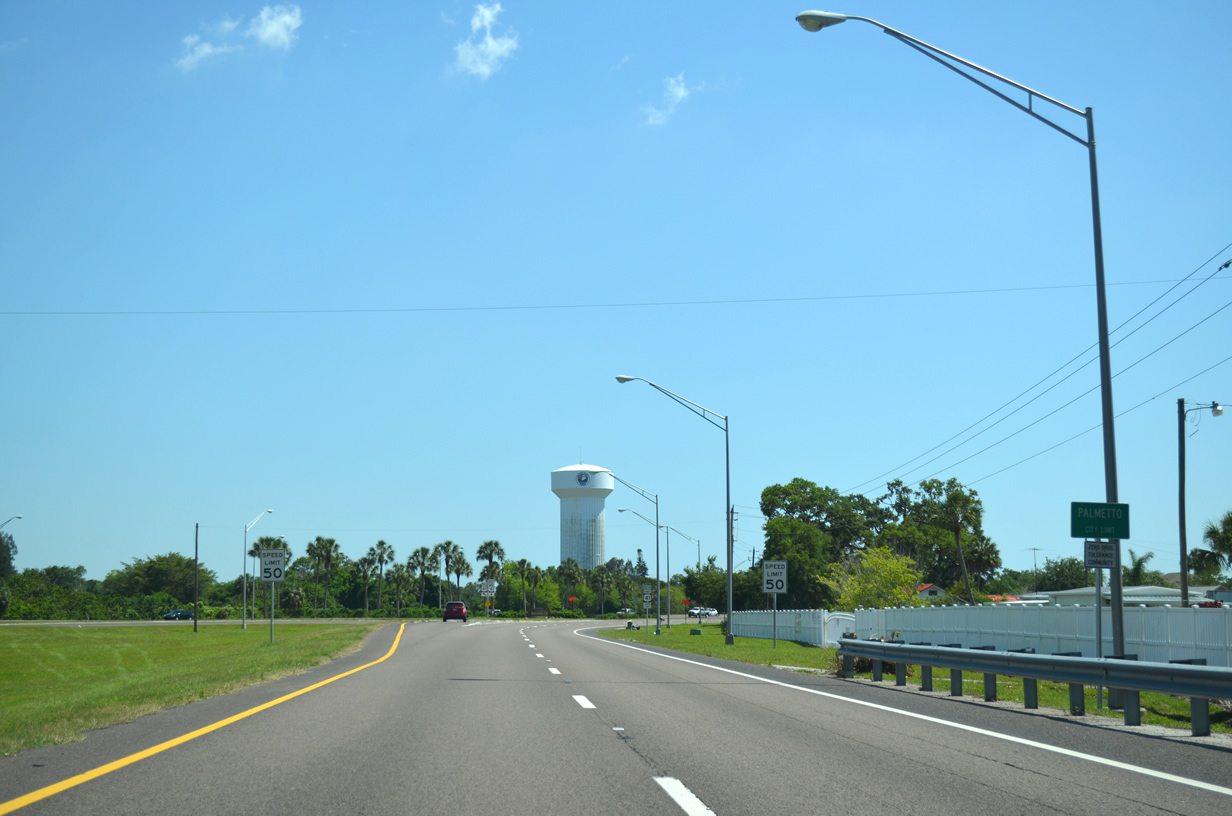
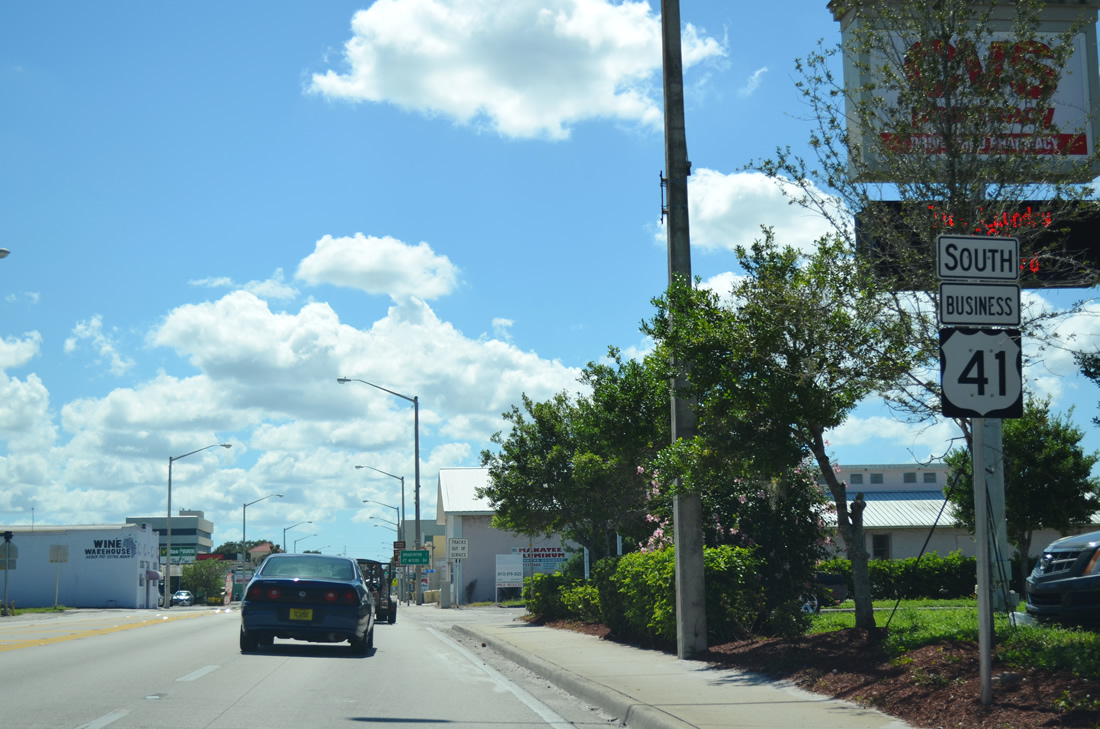
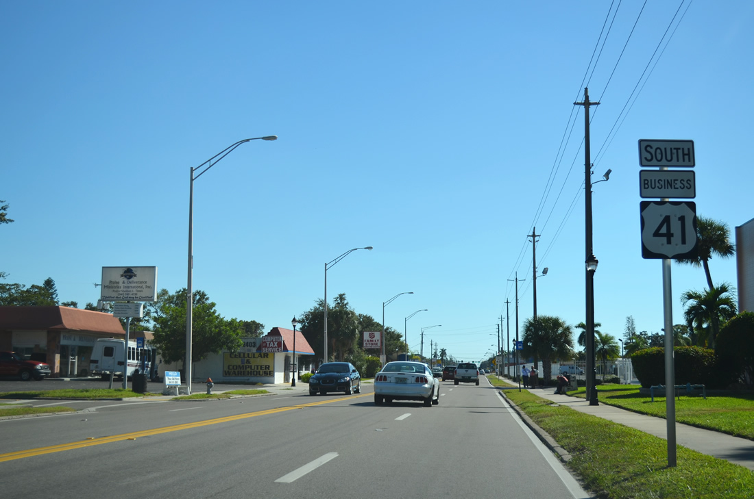
| The final signalized intersection joins U.S. 41 Business south with 39th Avenue West near the merge with U.S. 41 south. 11/03/13 |
|
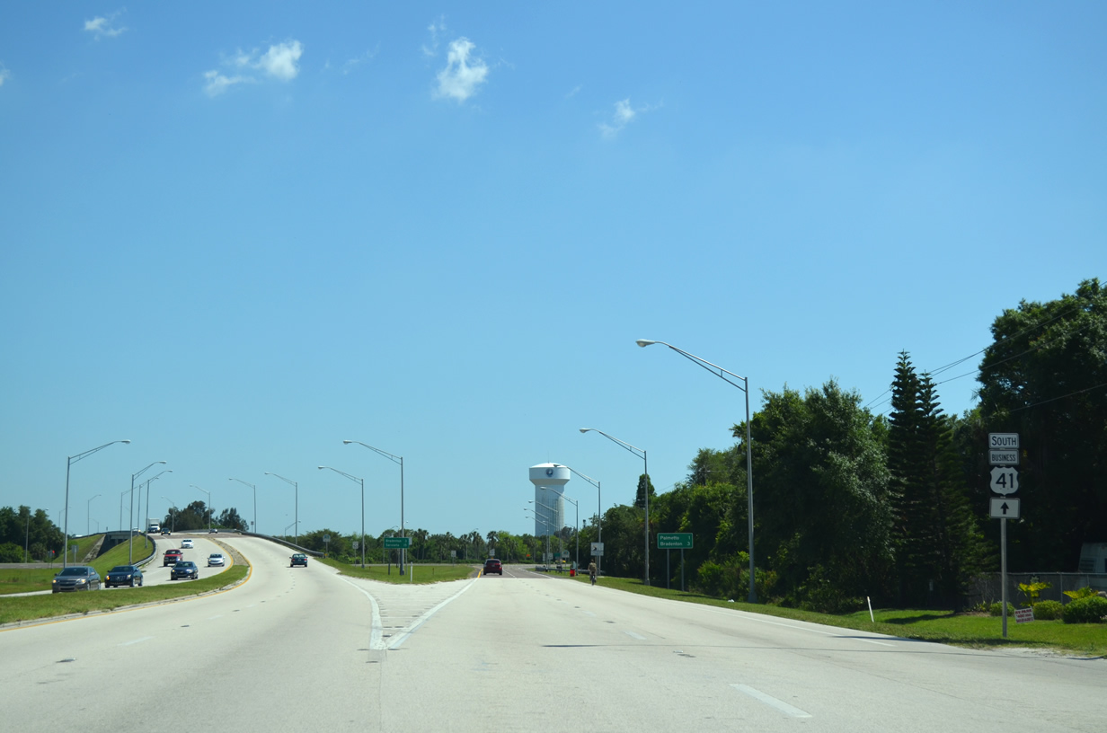
| U.S. 41 Business concludes at the forthcoming intersection with U.S. 41 and SR 684 (Cortez Road). SR 684 extends west along Cortez Road west from U.S. 41 to Bradenton Beach. 01/22/14 |
|
| Cortez Road is a heavily used commercial arterial through the west sections of Bradenton. The state route navigates a small peninsula to reach Cortez and Bradenton Beach via a drawbridge over the Intracoastal Waterway. 11/03/13 |
|
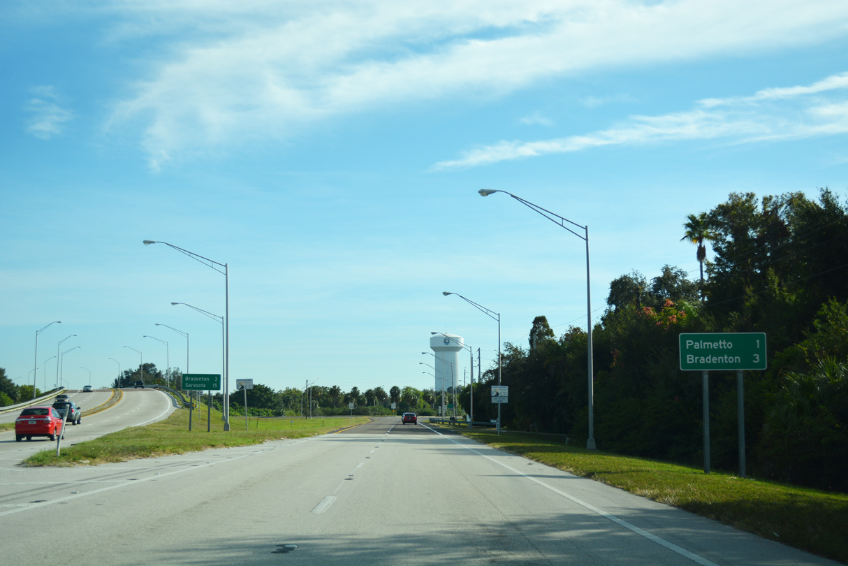
| U.S. 41 Business concludes where U.S. 41 turns south from Cortez Road toward Sarasota at a busy commercialized intersection. Tamiami Trail joins U.S. 41 for the 9.4 mile drive to Sarasota. 11/03/13 |
Page Updated 11-19-2019.


 North
North