|
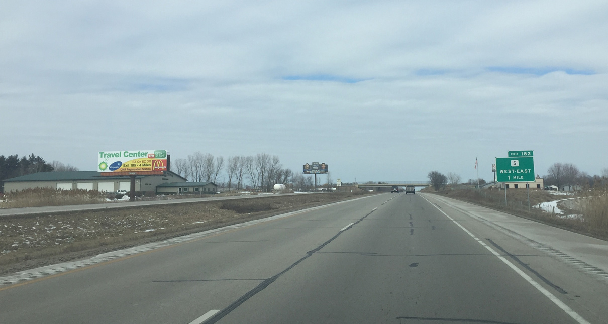
| One mile south of the diamond interchange (Exit 182) with Oconto County S on the U.S. 41/141 freeway north ahead of Allen Road. When there is not a control city or road name, WISDOT typically signs the cardinal directions in order on guide signs. 03/03/16 |
|
| Crossing under County S, trucks along U.S. 41/141 north next approach a left side weigh station. 03/03/16 |
|
| Crivitz and Iron Mountain are ahead on U.S. 141, while Marinette is 36 miles to the northeast on U.S. 41. 03/03/16 |
|
| The U.S. 41/141 weigh station operates in both directions between the north and southbound travel lanes. The facility was built during the freeway upgrade of the US routes. A previous weigh station was located at the north split near Abrams. 03/03/16 |
|
| Passing under the Geano Beach Road overpass north of the weigh station on U.S. 41/141 north. 03/03/16 |
|
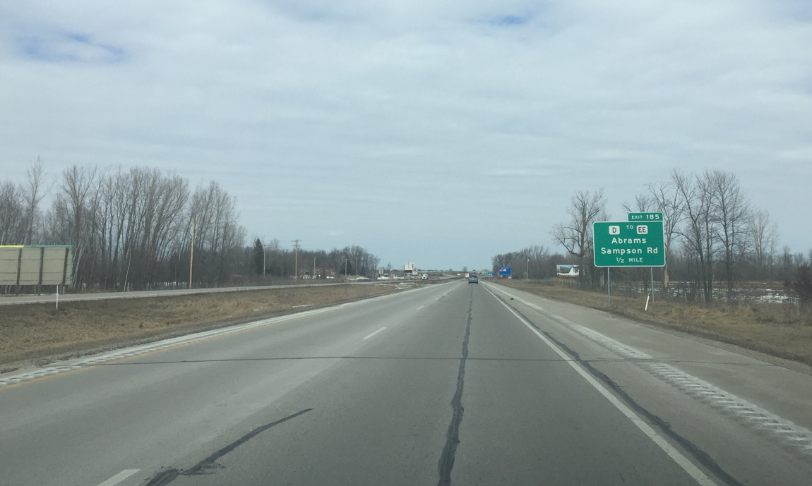
| Advancing north, U.S. 41/141 next meet County D west and Sampson Road east at Exit 185. This is the last interchange before U.S. 41-141 split. 03/03/16 |
|
| Entering the diamond interchange (Exit 185) with County D west to County EE north and Sampson and Sampson Road east to County S near Charles Pond State Natural Area. CTH-EE parallels the freeway north to Abrams. 03/03/16 |
|
| The final set of shields for U.S. 41/141 precede the Oak Orchard Road overpass by Abrams. 03/03/16 |
|
| A pair of guide signs advise motorists of the impending split of U.S. 41/141 at Exit 187. 03/03/16 |
|
| A left side ramp (Exit 187) takes motorists onto U.S. 141 north along an expressway to Stiles and Lena while the U.S. 41 mainline turns northeast toward Oconto. The freeway ends here. 03/03/16 |
|
| U.S. 141 splits from U.S. 41 at a semi directional T interchange. 03/03/16 |
Page Updated 04-19-2016.


 North
North