|
| Upon entering Jennings County, U.S. 50 West encounters the small town of Nebraska. 12/18/11 |
|
| West of Nebraska, U.S. 50 also passes through the small town of Butlerville on its way to North Vernon. 12/18/11 |
|
| West of Butlerville, U.S. 50 follows the CSX (originally Baltimore and Ohio) Railroad tracks to the south as it approaches the city of North Vernon. 12/18/11 |
|
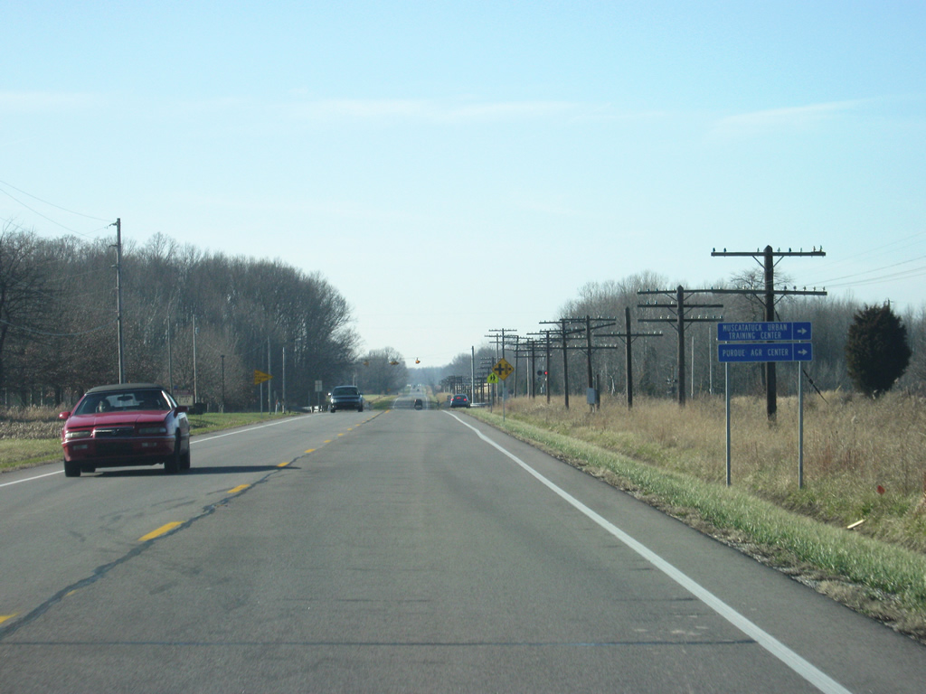
| U.S. 50 West approaches the intersection with County Road 425 East. About a mile to the north of this intersection is the Muscatatuck Urban Training Center, a unique urban-looking facility that is used to train civilian first responders and the military for urban warfare. 12/18/11 |
|
| The CSX rail line will continue to follow U.S. 50 West another 2.2 miles beyond County Road 425 before departing on its own trajectory into North Vernon. The two corridors reconvene about four miles west of the city. 12/18/11 |
|
| U.S. 50 West enters the city of North Vernon (population 6,728). As with both Martin and Jackson Counties further west along U.S. 50, North Vernon is not the county seat but is the largest population settlement for its county. The intersection of two railroads brought more people into North Vernon as opposed to the town of Vernon, the county seat, which lies to the immediate south along SR 3 & 7. 12/18/11 |
|
| U.S. 50 becomes Buckeye Street on the east side of North Vernon as it approaches the downtown area of the city. 12/18/11 |
|
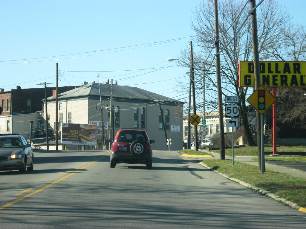
| U.S. 50 (Buckeye Street) approaches its first traffic signal in North Vernon at 5th Street, Madison Avenue, Short and Walnut Streets. As of March 2012, construction has begun on a two lane partial bypass for U.S. 50 from the west side of North Vernon to the north side, ending at SR 3. Planning is already underway on the eastern portion of the bypass, which will reconnect with U.S. 50 east of the city. Once complete, the bypass will carry the U.S. 50 designation. 12/18/11 |
|
| Another view of U.S. 50 (Buckeye Street) as it approaches the traffic light. U.S. 50 West turns at this traffic light following Walnut Street into the heart of downtown North Vernon, which is well preserved and viable despite further commercial development along SR 3 & SR 7 (State Street). The North Vernon Municipal Airport can be reached by going north on 5th Street to Base Road and north out of North Vernon. 12/18/11 |
|
| Now at the complicated intersection with U.S. 50 (Buckeye Street), 5th Street, Madison Avenue, Short and Walnut Streets. The Madison Railroad crosses the middle of the intersection with Madison Avenue lining the west side and Short Street lining the east side. 5th Street veers off to the right in a northerly direction while U.S. 50 West crosses the railroad and proceeds onto Walnut Street in a southwesterly direction. 12/18/11 |
|
| West of downtown North Vernon, U.S. 50 west continues along Walnut Street toward the intersection with SR 3 & SR 7 (State Street). SR 3 goes for 223.5 miles in two segments, between Charlestown and Markle, passing through North Vernon, Greensburg, Rushville, New Castle, Muncie, and Hartford City along the way. The second segment goes from Fort Wayne north to Brighton where it ends. Prior to 1972, SR 3 was continuous between Charleston and Brighton, but when Interstate 69 was completed through Fort Wayne, the section between Markle and Fort Wayne was decommissioned, creating the current two segments. 12/18/11 |
|
| Now at the intersection of U.S. 50 (Walnut Street) and SR 3 & SR 7 (State Street). This is the major crossroads for Jennings County and easily the busiest traffic signal within North Vernon. The town of Vernon can be reached via SR 3 & SR 7 (State Street) about two miles to the south. SR 7 exists for 41 miles from Madison, located to the south, to Columbus, located to the northwest along the U.S. 31 and Interstate 65 corridors. The two state highways share pavement for about three miles between Vernon and the north side of North Vernon. 12/18/11 |
|
| U.S. 50 (Walnut Street) turns to a more westerly direction at the intersection with Norris Avenue on the west side of North Vernon. 12/18/11 |
|
| U.S. 50 turns toward the southwest as it leaves the city of North Vernon en route to Seymour, which lies 13 miles to the west. 12/18/11 |
|
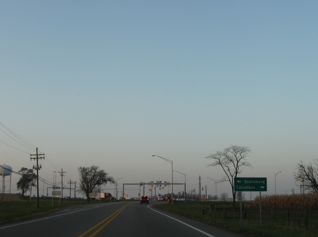
| This portion of U.S. 50 between North Vernon and Seymour carries a decent amount of traffic. Along with the proposed bypass of North Vernon, plans are also in place to improve some of the intersections along this stretch of highway. As with the stretch of U.S. 50 to the east of North Vernon, U.S. 50 here follows the CSX railroad for part of its journey toward Seymour. 12/18/11 |
|
| Approaching the intersection with County Road 700 West, serving the town of Hayden to the north of U.S. 50. 12/18/11 |
|
| Coming up to the intersection with County Road 1000 West, which serves the Muscatatuck National Wildlife Refuge area to the south of U.S. 50. Jackson County lies immediately west of the intersection. 12/18/11 |
|
| U.S. 50 crosses over into Jackson County (population 42,376) west of the intersection with Jennings County Road 1000 West. 12/18/11 |
|
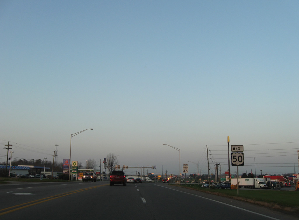
| Approaching U.S. 31 along U.S. 50 West on the outskirts of Seymour. Consisting of 1,280 miles, U.S. 31 parallels nearby Interstate 65 from near Mobile, Alabama to Indianapolis, where the U.S. highway continues north toward Kokomo, South Bend, and beyond while the interstate heads northwest toward Gary, its final destination. 12/18/11 |
|
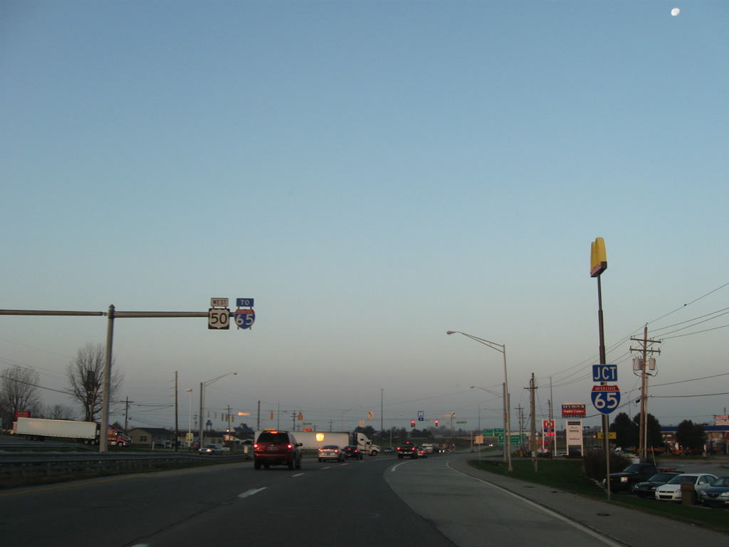
| U.S. 31 leads north 5.1 miles to Reddington and 18.3 miles into Columbus from U.S. 50. U.S. 50 West continues as short distance to a cloverleaf interchange with Interstate 65. 11/05/09 |
|
| Span wire attached shields are used in all directions of the U.S. 50 and 31 intersection. Southward, U.S. 31 remains rural through Muscatatuck National Wildlife Refuge to Uniontown. Scottsburg, 21 miles to the south, is a faster drive via parallel Interstate 65. 11/05/09 |
|
| U.S. 50 expands into a four lane commercial arterial from U.S. 31 into Seymour. 11/05/09 |
|
| Interstate 65 shield assemblies posted between U.S. 31 and Stevens Way along U.S. 50 West. Interstate 65 stays east of Seymour on the 100 mile drive between Interstate 265 at Clarksville and Interstate 465 at Indianapolis. 11/05/09 |
|
| Commerce Drive south and Stevens Way north both facilitate freeway side development east of Interstate 65 as service roads to the freeway. 11/05/09 |
|
| Nearing the northbound on-ramp of Interstate 65 to Columbus, Franklin and Indianapolis on U.S. 50 west. 11/05/09 |
|
| Motorists bound for the capital city depart U.S. 50 (Tipton Street) westbound. 11/05/09 |
|
| A loop ramp follows onto Interstate 65 south to the Falls City area of Indiana and adjacent Louisville, Kentucky. 12/18/11 |
|
| West of the Interstate 65 interchange, U.S. 50 enters the city of Seymour (population 17,503). Seymour is the largest community along U.S. 50 in between Vincennes and Cincinnati, Ohio, and is the regional hub for the surrounding area of Jackson and Jennings Counties. 09/19/10 |
|
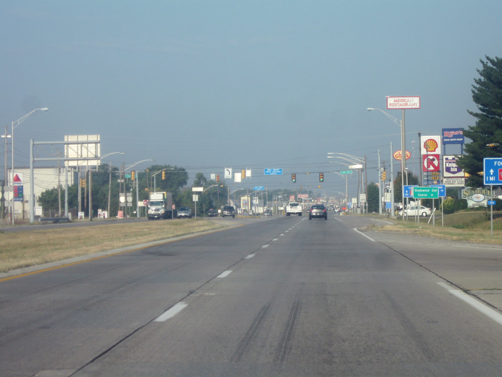
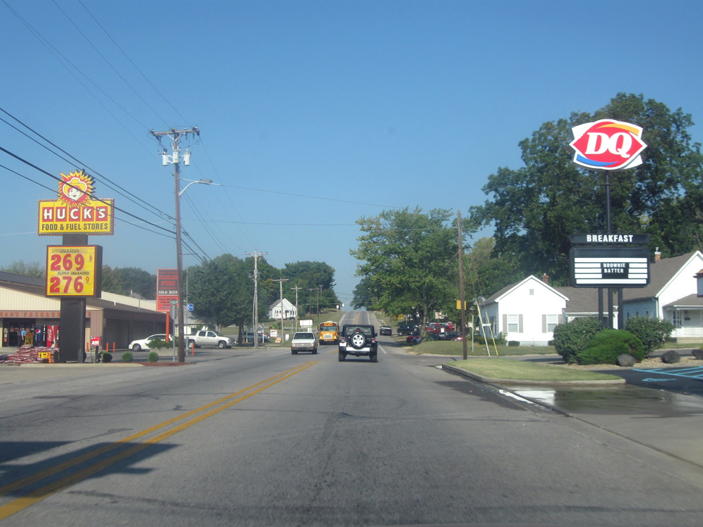
| West of Interstate 65, U.S. 50 (Tipton Street) becomes more commercialized as it approaches the long strip of retail from here to SR 11 north at Downtown Seymour. 09/19/10 |
|
| U.S. 50 (Tipton Street) comes up to the intersection with SR 11 north (Broadway Street). SR 11 exists in two segments, one in Floyd and Harrison Counties and the other in Jackson and Bartholomew Counties. The northern segment goes for 26 miles from SR 46 in Columbus to SR 250 in Dudleytown. 09/19/10 |
|
| West of the intersection with SR 11 North, U.S. 50 (Tipton Street) is multiplexed with SR 11 South for four blocks to Walnut Street, south of downtown Seymour. 09/19/10 |
|
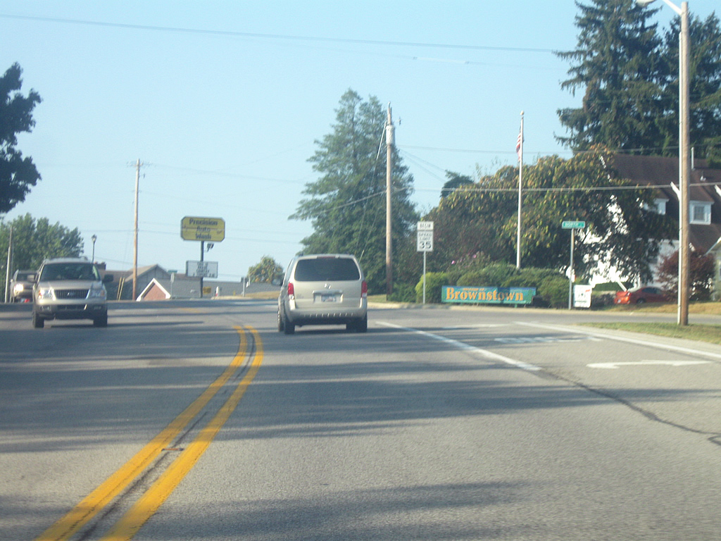
| U.S. 50 West & SR 11 South (Tipton Street) crosses the Louisville and Indiana Railroad. The junction between the Louisville and Indiana Railroad and the CSX Railroad one block to the north made Seymour a crossroads between the two lines and helped to make it into a bustling community, more so than Brownstown, the county seat of Jackson County, to the southwest. 09/19/10 |
|
| Now at the intersection where U.S. 50 (Tipton Street) splits with SR 11 South (Walnut Street). The Schneck Medical Center is located at the southwestern corner of the intersection. Downtown Seymour can be reached by taking Walnut Street to the north. 09/19/10 |
|
| Traversing more commercial and residential areas on the west side of Seymour, U.S. 50 (Tipton Street) West approaches Airport Road, which leads to the Freeman Municipal Airport (SER) and Indiana National Guard Armory. The airport was established in 1942 by the U.S. Army Air Force (USAAF) and served as the first USAAF helicopter training school. 09/19/10 |
|
| Now on the western edge of Seymour, U.S. 50 narrows to two lanes as it is now ten miles from the next community of Brownstown. 09/19/10 |
|
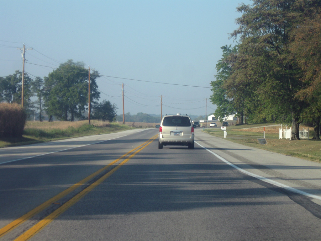
| U.S. 50 West between Seymour and Brownstown is a busy two lane highway as it connects the largest city in the county with the county seat. Passing lanes exist along this stretch as U.S. 50 traverses rolling hills. 09/19/10 |
|
| U.S. 50 West enters the town of Brownstown (population 3,000). Brownstown is the county seat for Jackson County and located in the geographic center of the county. Historically, it is the second county seat for Jackson County, succeeding Fort Vallonia. Brownstown was founded in 1816, prior to Indiana’s statehood. 09/19/10 |
|
| The first part of U.S. 50 in Brownstown follows Main Street into Downtown. The top of the Jackson County courthouse, only a few blocks away can be seen from U.S. 50 heading south. 09/19/10 |
|
| U.S. 50 (Main Street) approaches the intersection with SR 250 East (Commerce Street). U.S. 50 will continue west along Commerce Street while SR 250 heads east. SR 250 goes for 33 miles from Brownstown to the east to SR 7 in Middlefork. A second segment to the highway goes for another 30 miles from U.S. 421 to Rising Sun on the Ohio River. The Jackson-Washington State Forest is two miles away along SR 250 East. 09/19/10 |
|
| A view of U.S. 50 (Commerce Street) as it heads west across the western side of Brownstown. 09/19/10 |
|
| U.S. 50 West approaches the intersection with Ewing Street, which leads to the small neighborhood of the same name, located in the northwestern part of Brownstown. Beyond Ewing Street is the intersection with SR 135 South. 09/19/10 |
|
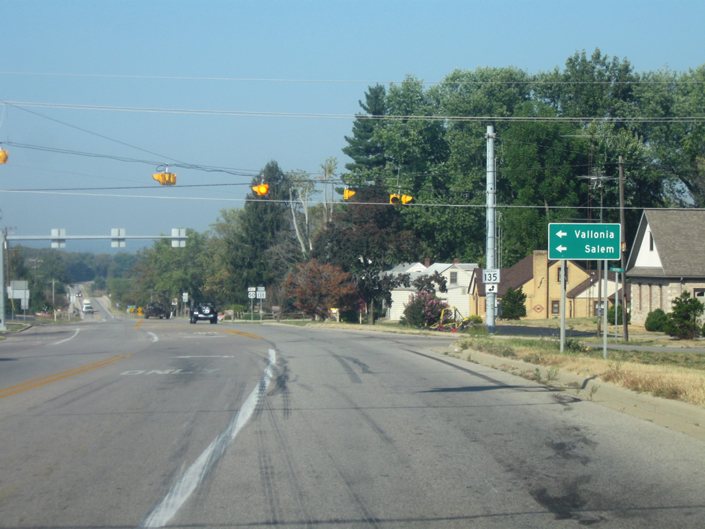
| U.S. 50 (Commerce Street) now approaches the intersection with SR 135 South. SR 135 is the longest three-digit state highway, extending for 138 miles from the south side of Indianapolis to the Ohio River in Harrison County. Originally, the highway was known as SR 35 before U.S. 35 was commissioned in Indiana. Both Vallonia and the Washington County seat of Salem can be reached via SR 135 South. SR 135 will share pavement with U.S. 50 before turning north toward Freetown and beyond. 09/19/10 |
|
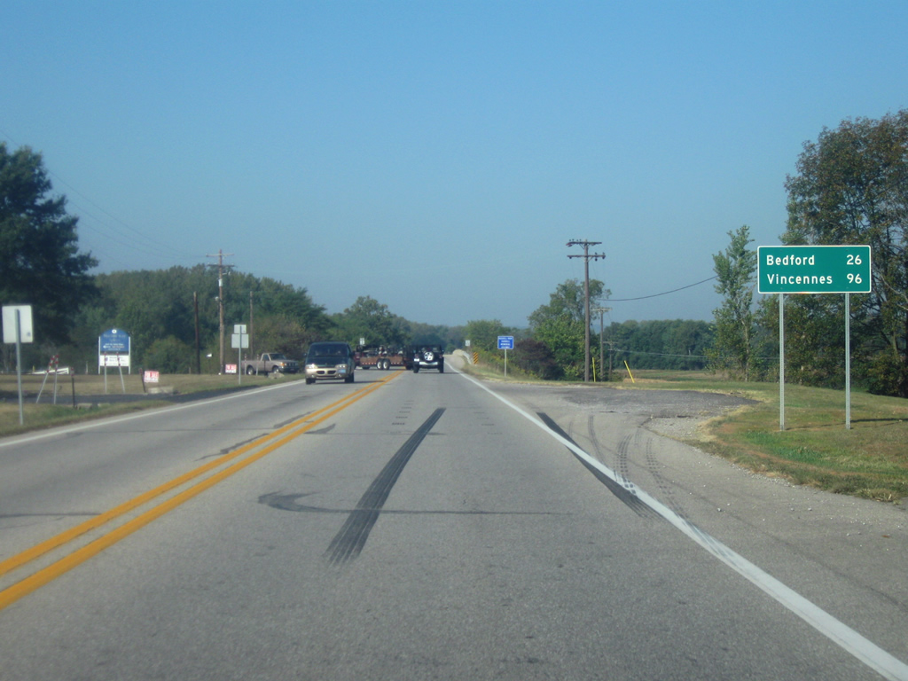
| West of the SR 135 South intersection, U.S. 50 West & SR 135 North leaves Brownstown. Bedford is the next major community at 26 miles away and Vincennes is further down at 96 miles. 09/19/10 |
|
| U.S. 50 West & SR 135 North crosses the East Fork of the White River in the middle of Jackson County. This is the first of three crossings of this river for U.S. 50. 09/19/10 |
|
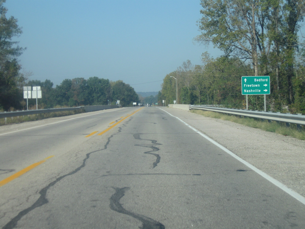
| The split between U.S. 50 and SR 135 North is near. Freetown and the Brown County seat of Nashville can be reached by taking SR 135 to the north, which goes through the heart of Indiana’s hill country across northern Jackson County and Brown County. 09/19/10 |
|
| Now at the junction between U.S. 50 and SR 135 North. 09/19/10 |
|
| West of the SR 135 North junction, U.S. 50 is now only 22 miles from Bedford in nearby Lawrence County and 92 miles from Vincennes. 09/19/10 |
|
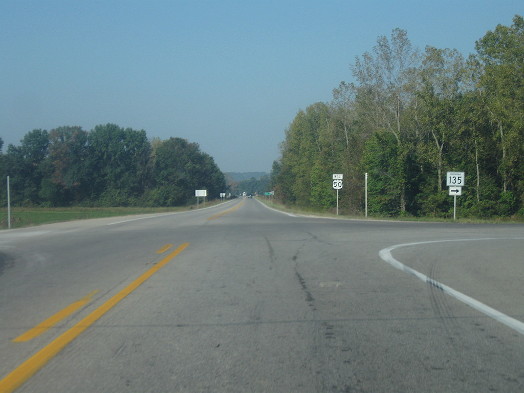
| The town of Medora can be reached from SR 235. Located about three miles to the south, Medora is best known for its covered bridge, the longest in the United States. SR 235 goes for only 7.5 miles from U.S. 50 southeast to SR 135 East of Medora. 09/19/10 |
|
| West of SR 235, the city of Bedford lies 19 miles ahead. Vincennes is now within an 89 mile reach. 09/19/10 |
|
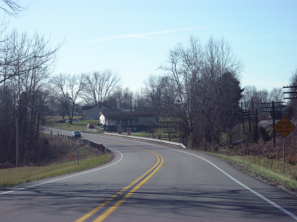
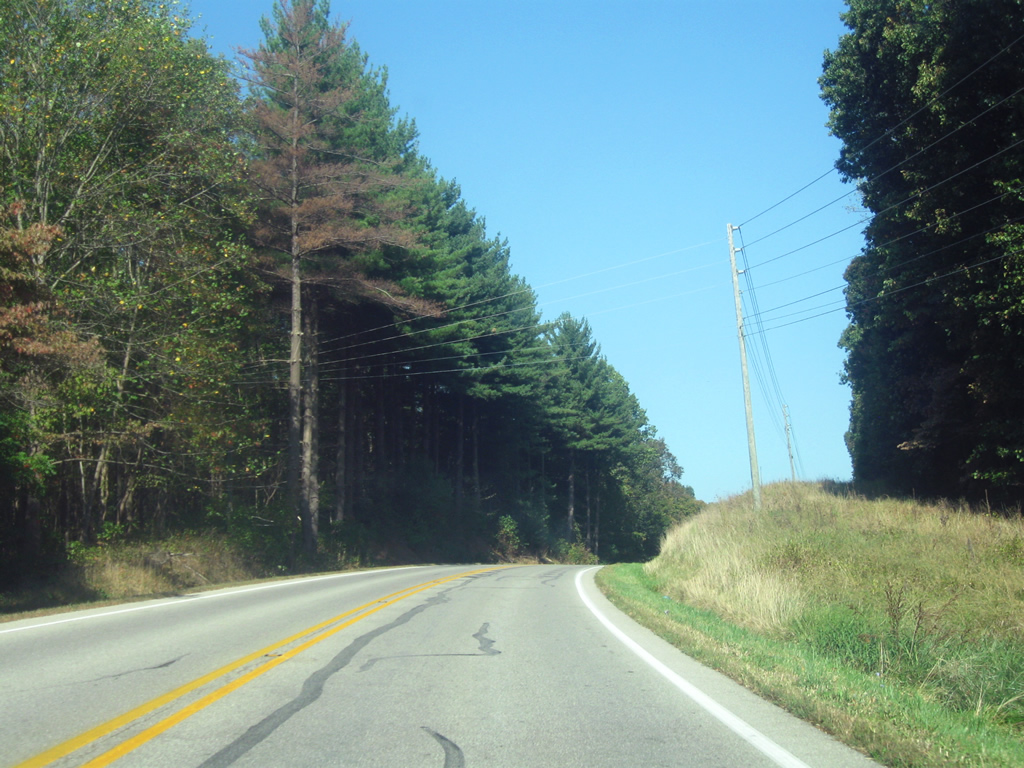
| U.S. 50 West travels through scenic terrain in western Jackson County, as it winds across the Norman Upland of Southern Indiana. The Norman Upland consists of a series of hills that begins in Brown County and stretches to the south toward the Ohio River. This section of U.S. 50 remains a well-traveled highway connecting Bedford and Seymour. 09/19/10 |
|
| U.S. 50 crosses over into Lawrence County (population 46,134). The U.S. highway will navigate 28.7 miles through Lawrence County as it makes its way west and southwest toward Martin County and beyond. 09/19/10 |
Page Updated 11-12-2012.

 west
west