Traveling across the northern counties of Alabama, U.S. 72 is a four lane corridor east from the Shoals area to Athens, Huntsville, Scottsboro and Bridgeport. An Alternate route branches east from U.S. 72 at Muscle Shoals to Courtland and Decatur. The bannered route returns to U.S. 72 by way of I-565 from Mooresville east to Madison and Huntsville.
U.S. 72 shifted west onto the Bridgeport bypass, from near the Tennessee state line, southwest nine miles to the city of Stevenson per the American Association of State Highway and Transportation Officials (AASHTO) on April 16, 1999. U.S. 72 Alternate was relocated onto a 21.70 mile long overlap with Interstate 565 west from Huntsville by action of AASHTO on June 13, 1992.
|
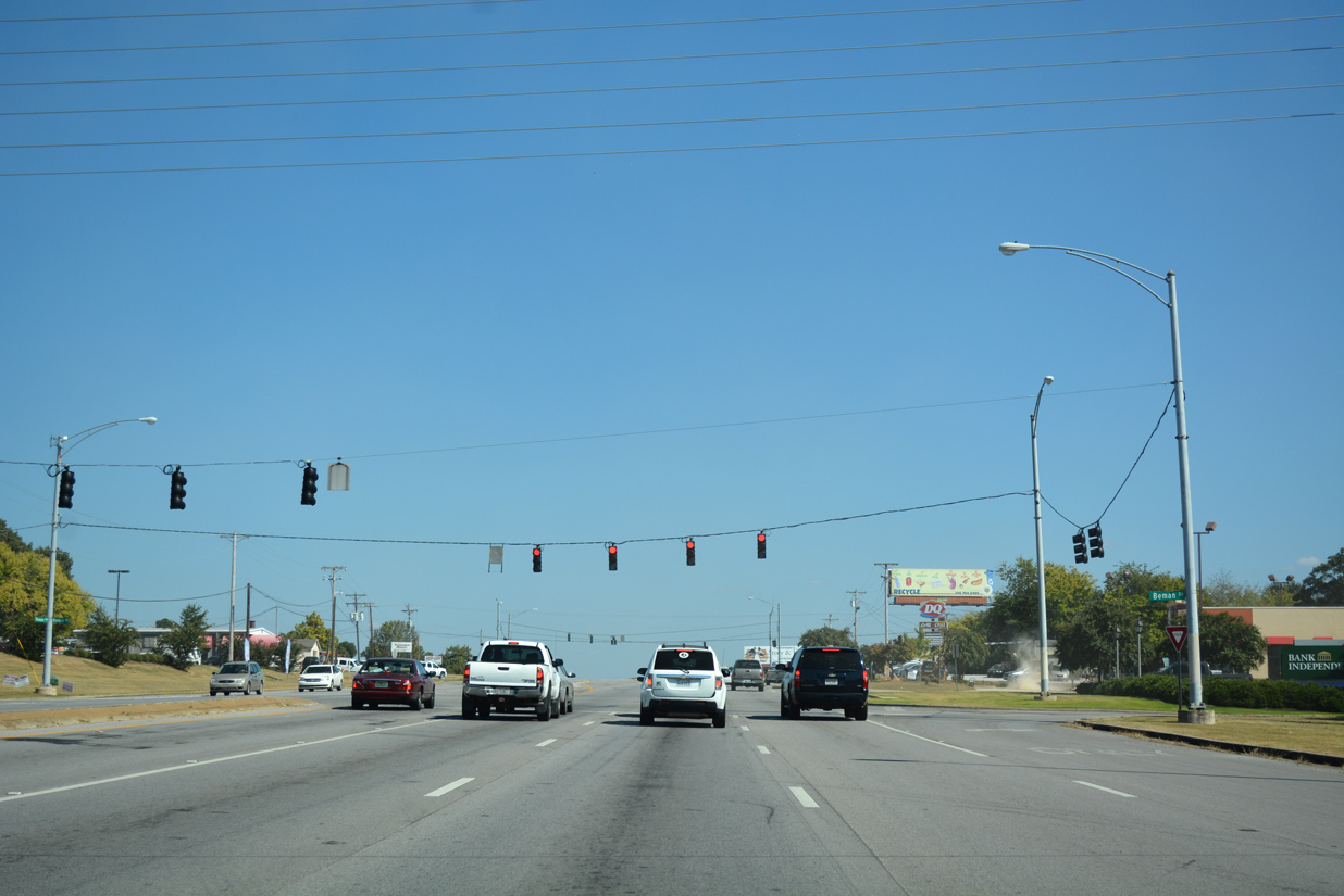
| Beman Drive serves businesses to the east of the commercialized intersection joining U.S 43/72 (Florence Boulevard) with SR 133 (Cox Creek Parkway). 10/07/16 |
|
| County Road 61 (Middle Road) stems north from adjacent CR 32 (Huntsville Road) to the town of St. Florian and the Tennessee state line. 10/07/16 |
|
| Huntsville Road (CR 32) converges with U.S. 43/72 from East Florence and Weeden Heights. The roadway is the historic alignment of U.S. 72 to the west. 10/07/16 |
|
| CR 374 ties into U.S. 43/72 (Florence Boulevard) adjacent to Huntsville Road (CR 32). 10/07/16 |
|
| Bailey Springs Road (CR 323) runs north from U.S. 43 & 72 to CR 30 along the east side of St. Florian. 10/07/16 |
|
| Confirming markers for U.S. 43 north, U.S. 72 east and SR 13 north posted after County Road 323. SR 13 is signed, despite representing the state route counterpart of U.S. 43 throughout most of the state. 10/07/16 |
|
| Lauderdale County Road 27 heads north from U.S. 43/72 to Tate Springs nd agricultural areas west of Shoal Creek. 10/07/16 |
|
| Lakeview Drive doubles as County Road 367 south from Florence Boulevard to residences along Wilson Lake. 10/07/16 |
|
| Harris Drive ties into the commercial stretch along U.S. 43/72 preceding Shoal Creek. 10/07/16 |
|
| U.S. 43/72 east span Shoal Creek across the Disabled American Veterans Memorial Bridge. Opened in 2005, the 945 foot long span1 replaced a cantilevered Warren through truss bridge at this location. 10/07/16 |
|
| Closed to traffic, the 1925-built Shoals Creek Bridge remains in place along the north side of U.S 43/72. The span carried westbound traffic along Florence Boulevard from 1959, when the former eastbound span opened, to 2005.2 10/07/16 |
|
| The 115.2 foot wide deck on the Disabled American Veterans Memorial Bridge accommodates six overall lanes of traffic.1 10/07/16 |
|
| Robbins Beach Road north and Lake Drive south come together at U.S. 43/72 from neighborhoods alongside Shoal Creek. 10/07/16 |
|
| U.S. 43 shifts northward from U.S. 72 east at the town of Killen. U.S. 43/SR 13 extend 10.86 miles north to Upper Green Hill and Lawrence County, Tennessee. 10/07/16 |
|
| U.S. 72 (Lee Highway) continues east from U.S. 43/SR 13 through Killen 5.86 miles to Center Star and 9.69 miles to Elgin. 10/07/16 |
|
| Continuing beyond the split with U.S. 43, U.S. 72 travels 36 miles to the city of Athens. 10/07/16 |
|
| U.S. 72 intersects Epworth Drive beyond the end of Interstate 565 on Chapman Mountain. Epworth Drive runs along the south side of U.S. 72 from the exchange with I-565 by adjacent residential areas. 12/28/09 |
|
| U.S. 72 crosses Chapman Mountain at Certain Gap beyond Epworth Drive. 12/28/09 |
|
| Appalachian Regional Development Corridor V overlays U.S. 72 east from U.S. 72 Alternate and the city of Huntsville. Blue and white markers, including this assembly at Paint Rock near Keel Mountain, mark this stretch of highway. 09/26/03 |
|
| U.S. 72 passes through Certain Gap ahead of the left turn for Epworth Drive on Chapman Mountain. 12/28/09 |
|
| U.S. 72 splits with Interstate 565 and U.S. 72 Alternate west at a folded diamond interchange (Exit 21). 12/28/09 |
|
| U.S. 72 transitions to a controlled access highway (I-565) after the at-grade intersection with Epworth Drive. 12/28/09 |
|
| The first shield for Interstate 565 precedes the departure of U.S. 72 westbound at Exit 21. 12/28/09 |
|
| Exit 21 also provides local access to Maysville Road south from U.S. 72 east to the Chapman Heights and Darwin Downs neighborhoods of east Huntsville. 12/28/09 |
|
| Interstate 565 provides a direct route to Downtown Huntsville, Madison and Decatur via U.S. 72 Alternate west. U.S. 72 lowers from Chapman Mountain to connect with U.S. 231/431 (Memorial Parkway) nearby. 12/28/09 |
|
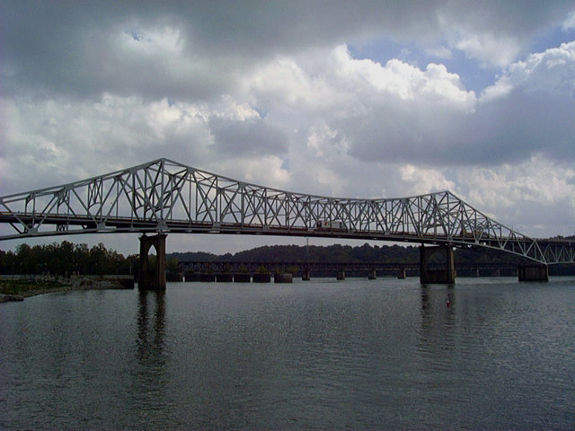
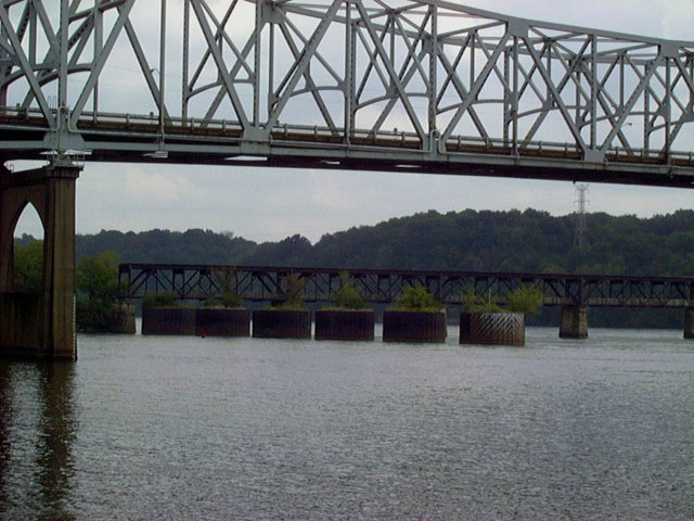
| U.S. 43, U.S. 72 and SR 13, 17, 20 and 157 cross the Tennessee River over the O'Neal Bridge west of Wilson Dam. The cantilevered Warren through truss bridge links the cities of Florence and Muscle Schoals. 09/26/03 |
|
| U.S. 43/72 east crossed Shoal Creek on cantilevered Warren through truss bridge until 2005. The 806 foot long span carried two lanes of eastbound traffic across a 28.2 foot wide deck. It was demolished by 2007.2 09/26/03 |
Page Updated 01-09-2019.

 North
North  East
East