Beginning near Flagstaff and continuing north past the Grand Canyon and Glen Canyon, U.S. 89 provides a scenic route into the national parks of Northern Arizona and Southern Utah. U.S. 89 previously extended south of Flagstaff, continuing to Wickenburg, Phoenix and Tucson before ending at the Mexican Border in Nogales. That portion was eliminated at the American Association of State Highway and Transportation Officials (AASHTO) Route Numbering Committee meeting held June 14, 1992.1
Former U.S. 89 between Flagstaff and Mexico was supplanted by I-40 (Flagstaff to Ash Fork), SR 89 (Ash Fork to Wickenburg), U.S. 93 (Wickenburg), U.S. 60 (Wickenburg to Florence Junction), SR 79 (Florence Junction to Oracle Junction), SR 77 (Oracle Junction to Tucson), Business Loop I-19 (Tucson to Green Valley), and I-19 (Green Valley to Nogales).
|
| Northbound SR 89 at SR 69 in Prescott. SR 69 is a multi lane divided highway that leads from Prescott southeast to Interstate 17 near Agua Fria National Monument. 05/23/03 |
|
| US 89 commences north from Business Loop I-40/U.S. 180, where they turn south across Historic U.S. 66 to I-40 at Country Club Drive. Completed in 2008, construction replaced the trumpet interchange joining the three routes here with a signalized intersection. 04/26/17 |
|
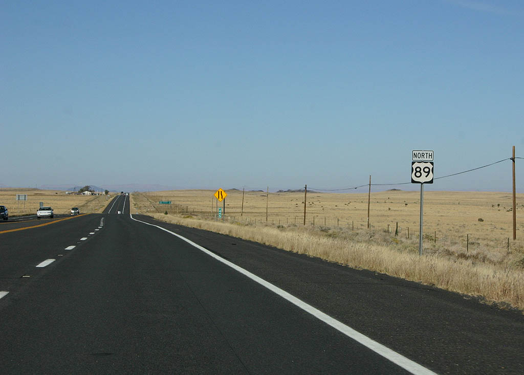
| The first confirming marker for U.S. 89 north. 04/26/17 |
|
| U.S. 89 provides part of a route from Flagstaff to both the South and North Rim of the Grand Canyon. 10/25/08 |
|
| U.S. 89 north intersects Cummings Street at the entrance to Flagstaff Mall. 04/26/17 |
|
| U.S. 89 advances north from Townsend-Winona Road, the original alignment U.S. 66 east from the Flagstaff area, to Doney Park. Gray Mountain follows in 36 miles. 10/25/08 |
|
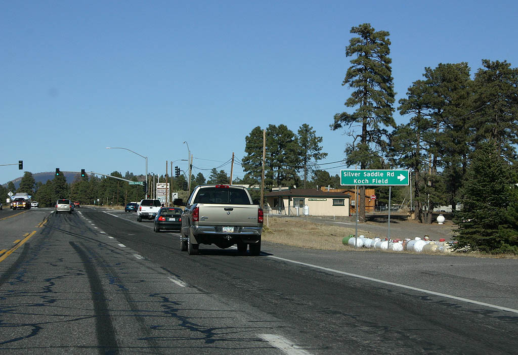
| Silver Saddle Road stems east from U.S. 89 into the community of Doney Park, where it connects with Koch Field Road south. 10/25/08 |
|
| U.S. 89 north at Kevins Way and Black Bill Park. 10/25/08 |
|
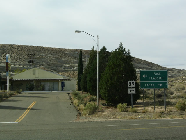
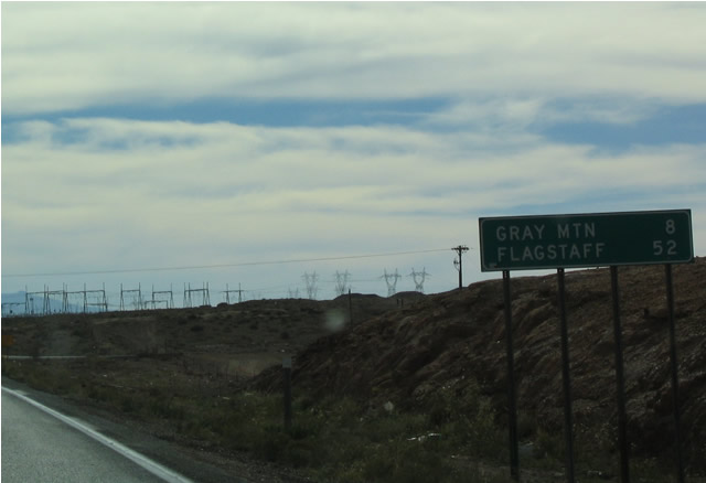
| Distance sign to Gray Mountain and Page. US 89 is starting to climb to the saddle between Sunset Crater and Mount Humphries. 10/25/08 |
|
| Advance signage for Sunset Crater National Monument, one mile. 10/25/08 |
|
| Turn right for Sunset Crater. The crater was added to the National Park system in 1930 after Hollywood planned to blow the crater up for a movie. 10/25/08 |
|
| This is the highest point along US 89 in Arizona, at the top of the ridge between Humphries and Sunset Crater. 10/25/08 |
|
| US 89 now enters a long descent into the Antelope Hills. 10/25/08 |
|
| Distance sign to Gray Mountain and Page. US 89 now passes through the CO Bar Ranch, owned by the Babbitt Brothers. 10/25/08 |
|
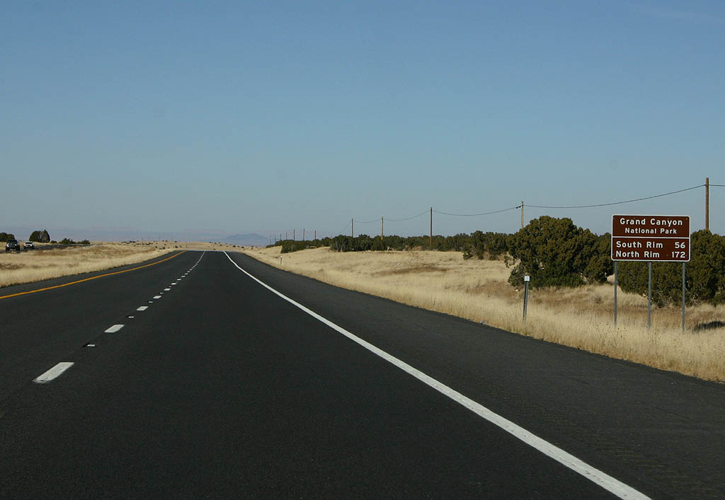
| Distance sign to the Grand Canyon, both South Rim (56 miles) and North Rim (172 miles). 10/25/08 |
|
| US 89 reverts to an undivided highway ahead. 10/25/08 |
|
| Advance signage for Wupatki National Monument, 1 mile. Wupatki preserves the remains of a Sinaguan dwelling. 10/25/08 |
|
| Reassurance marker for US 89 northbound. 10/25/08 |
|
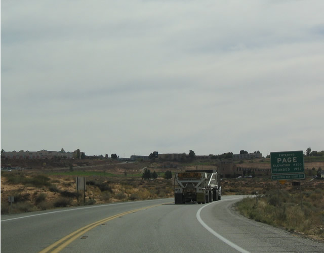
| Distance sign to Gray Mountain and Page. 10/25/08 |
|
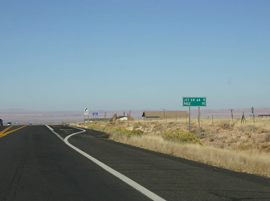
| Leaving Gray Mountain, the next major junction is SR 64. 10/25/08 |
|
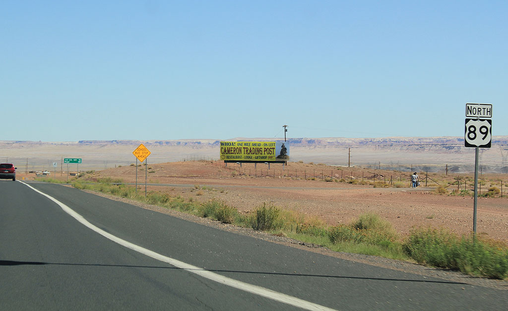
| US 89 enters the small town of Cameron at this point, just before SR 64. 10/25/08 |
|
| Advance signage for SR 64, 1/2 mile. 10/25/08 |
|
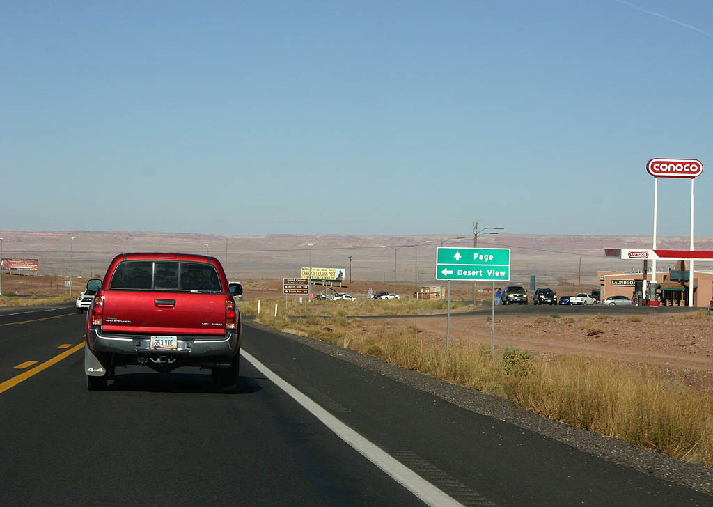
| Continue ahead for Page, or turn on SR 64 to reach Grand Canyon National Park. 10/25/08 |
|
| Continue ahead for the North Rim of the Grand Canyon, or turn left for the South Rim. 10/25/08 |
|
| Turn left for SR 64 here. 10/25/08 |
|
| US 89 enters the town of Cameron. The Cameron trading post dates back to the early 20th century. Cameron itself is named for former State Senator Ralph Cameron, who built the Bright Angel Trail in the Grand Canyon. 09/25/11 |
|
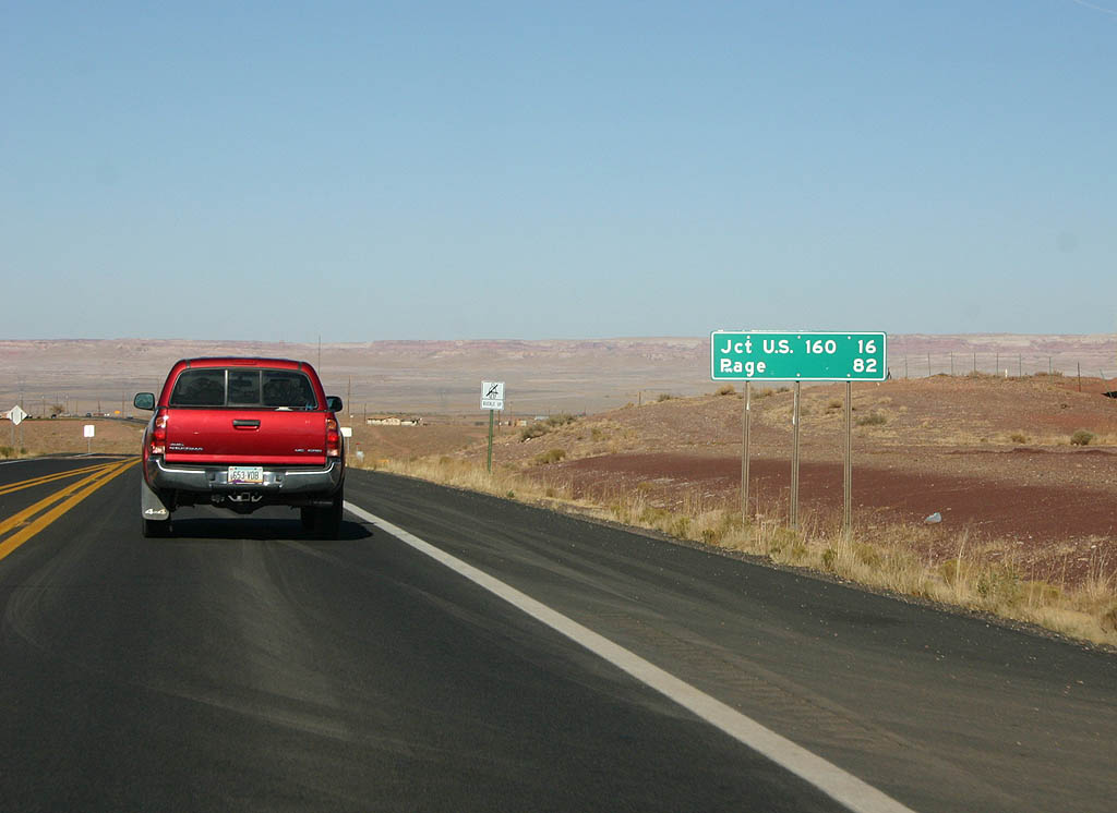
| Distance sign to US 160 and Page, as seen in Cameron. 10/25/08 |
|
| Distance sign for US 160 and Page. 09/25/11 |
|
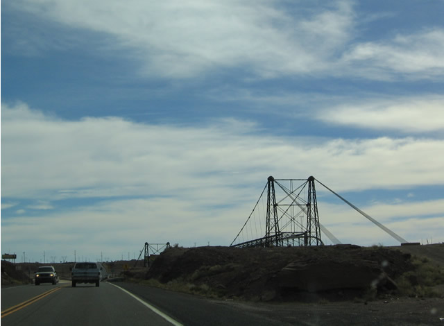
| US 89 approaches the Little Colorado River here. The bridge to the left dates back to 1912, as the first suspension bridge across the River. It is now used for pipelines. 10/25/08 |
|
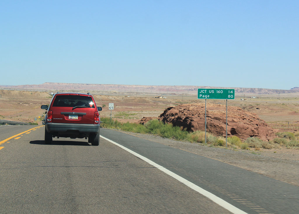
| Distance sign to US 160 and Page, as seen when leaving Cameron. 09/25/11 |
|
| US 89 crosses Moenkopi Wash. 10/25/08 |
|
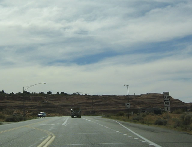
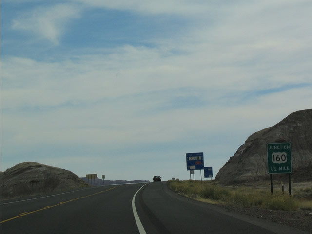
| Advance signage for US 160, 1/2 mile. 09/25/11 |
|
| US 160 travels to Tuba City and Kayenta, through the Navajo Nation. 09/25/11 |
|
| Turn right for Tuba City, or continue ahead for Page. The majority of the traffic on US 89 turns onto US 160 at this point. 09/25/11 |
|
| Distance sign to Gap (17 miles) and Page (66 miles). 09/25/11 |
|
| Headlight use is required all times of the day on US 89 between Cameron and Page. 09/25/11 |
|
| US 89 enters The Gap here. The Gap is a small settlement centered around a gap in the Echo Cliffs. Limited copper mining happened here in the early 20th century. 09/25/11 |
|
| US 89 meets Indian Route 20. Indian Route 20 is the original dirt road up to Page, and was used during the early days of construction of Glen Canyon Dam. 09/25/11 |
|
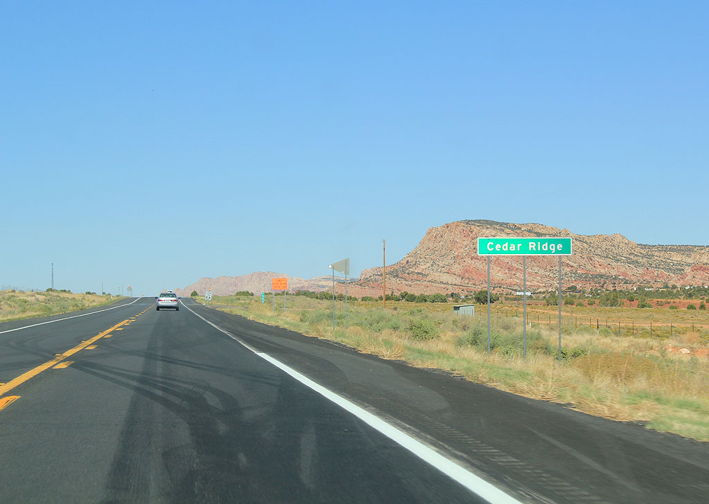
| US 89 enters the small settlement of Cedar Ridge, named for the nearby ridge. 09/25/11 |
|
| Distance sign to US 89A and Page, north of Cedar Ridge. 09/25/11 |
|
| Distance sign to US 89A and Page. US 89 is approaching Tanner Wash, named for a Mormon settler. 09/25/11 |
|
| The Echo Cliffs can be seen in the distance. The Echo Cliffs are a barrier to travel, which is why the old Honeymoon Trail/US 89 went around them until 1959. 09/25/11 |
|
| Bitter Springs is a Navajo settlement. Supposedly the water is not bitter here... 09/25/11 |
|
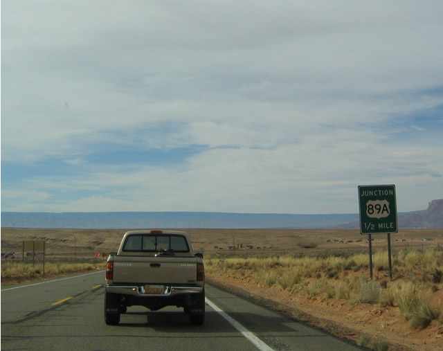
| Advance signage for US 89A, 1/2 mile. 09/25/11 |
|
| US 89A is the former mainline of US 89, renumbered in 1959. The road travels through Jacob Lake and meets up with US 89 in Kanab. 09/25/11 |
|
| Turn left for US 89A, or continue ahead on US 89 to Page. 09/25/11 |
|
| View of Antelope Pass (just north of Bitter Springs) along U.S. 89 north as seen from the pull out. 10/26/03 |
|
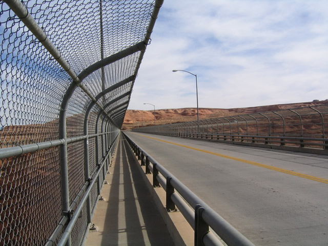
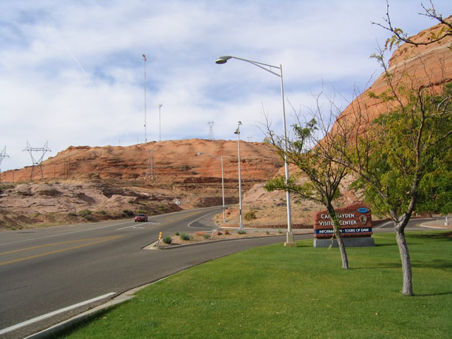
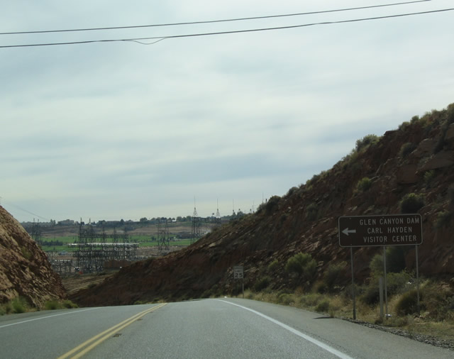
| Northbound U.S. 89 at the Glen Canyon Dam/Carl Hayden visitors Center. The free parking lot is the staging area for dam tours as well as a walk on the sidewalk over the Colorado River bridge adjacent to Glen Canyon Dam. 10/26/03 |
|
| After traveling east since leaving Kanab 60 miles ago, U.S. 89 finally turns south to leave the Beehive State of Utah and enter the Grand Canyon State of Arizona. U.S. 89 is already within the Lake Mead National Recreation Area as it crosses the state line. This picture shows the first U.S. 89 shield along southbound. 10/26/03 |
|
| Brown information sign for Glen Canyon National Recreation Area along southbound immediately after passing the state line. 10/26/03 |
|
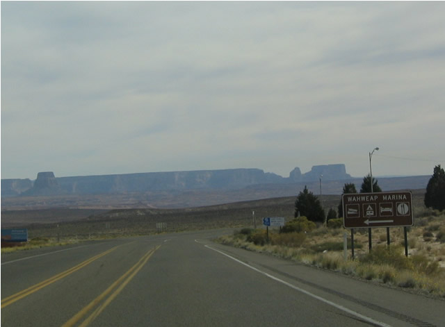
| The first intersection along southbound leads southeast to the Wahweap Marina, which includes a boat ramp to Lake Powell, which is held back by the Glen Canyon Dam. 10/26/03 |
|
| Distance sign along southbound for Glen Canyon Dam and Page. The power plant smokestacks visible in the background are located east of Page off SR 98. 10/26/03 |
|
| This view of U.S. 89 approaching Glen Canyon Dam is somewhat deceptive. The dam is actually located to the left of the red-brown hill in the canyon. The city of Page is located where the green areas are on the hillside. 10/26/03 |
|
| The Wahweap Marina Loop Road returns to U.S. 89 just north of Glen Canyon Dam. The marina is approximately five miles north of this intersection. 10/26/03 |
|
| Southbound U.S. 89 approaching the Carl Hayden Visitors
Center on the northwest approach to the bridge over the
Colorado River. 10/26/03 |
|
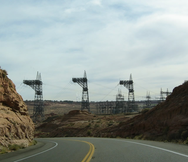
| View of power line towers that carry power lines from
the turbines situated at the base of the dam on the floor
of the canyon to the top of the canyon. The Glen Canyon
Dam, just like the Hoover Dam to the southwest, provides
power to people all across the west. 10/26/03 |
|
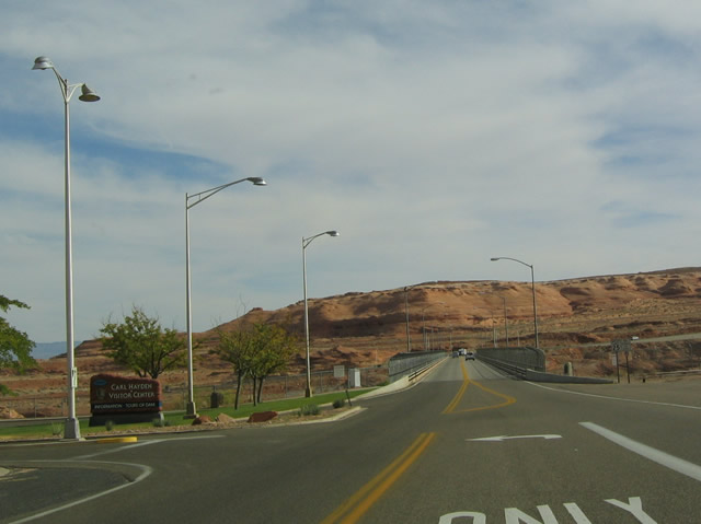
| Southbound U.S. 89 at the entrance to the Carl Hayden
Visitors Center. Free parking for the free, hour-long
dam tours is available at this turnoff. In addition, motorists
may park for stellar views of the bridge, dam, lake, and
canyon. 10/26/03 |
|
| After crossing the Colorado River, U.S. 89 south enters
the city of Page. 10/26/03 |
|
| While the mainline remains to the west of downtown Page,
a business route connects U.S. 89 to the city center to
the east. 10/26/03 |
|
| The business loop promptly returns to U.S. 89 only a
mile or two southern of its northern terminus. Note that
the business loop is not signed as a bannered business
route; this is because it is not state maintained. 10/26/03 |
|
| After leaving Page, U.S. 89 passes several power lines
that connects with the power generation station at the
dam and the fossil fuel plants to the northeast. The next
town is Bitter Springs, where U.S. 89 rejoins Alternate
U.S. 89. U.S. 89 is now within the Navajo Indian Reservation
(sometimes referred to as the Navajo Nation). U.S. 89
passes through the western edge of the Navajo Indian Reservation;
most of the reservation occupies the northeastern corner
of Arizona and northwestern portion of New Mexico (including
the towns of Kayenta, Teec Nos Pos, Mexican Water, and
Four Corners). 10/26/03 |
|
| The next major intersection is with SR 98. Arizona
98 begins just south of Page and heads southeast to meet
U.S. 160 in the Hopi Indian Reservation. U.S. 160 continues
northeast to the Four Corners, where the states of Utah,
Colorado, New Mexico, and Arizona meet at one common point.
In addition, U.S. 160 meets the western terminus of U.S.
64 in Teec Nos Pos, which is one of the longest U.S. routes. 10/26/03 |
|
| SR 98 does not enter any cities along its route,
so it is signed for Kayenta, a town located at the junction
of U.S. 160 and U.S. 163 in northeastern Arizona, some
99 miles east of here. While much of this land is Indian
Reservation, there are not many cities along the way. 10/26/03 |
|
| Southbound U.S. 89 at SR 98. There are
no facilities at this intersection. U.S. 89 continues
south toward the southern entrance of Grand Canyon National
Park and Flagstaff. 10/26/03 |
|
| View of U.S. 89 southbound as it passes along the Kabito
Plateau before reaching Antelope Pass. 10/26/03 |
|
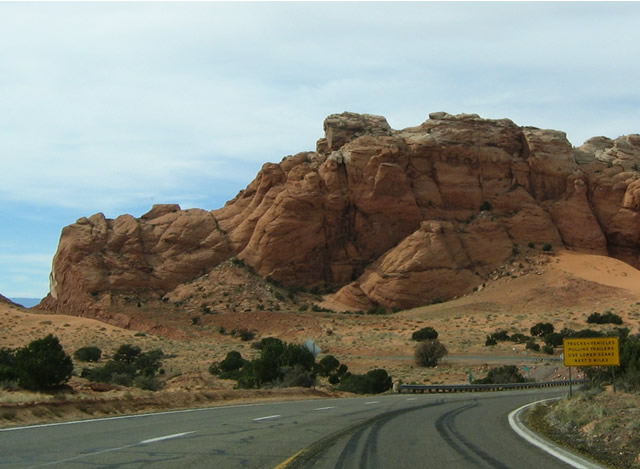
| U.S. 89 reaches Antelope Pass approximately 20 miles
south of Page. These signs warn motorists to slow down
as they pass into the first curves in the road since leaving
Page. 10/26/03 |
|
| Antelope Pass rises to an elevation of 6,533 feet, and
U.S. 89 crosses the pass through this narrow cut before
beginning its descent to Bitter Springs. 10/26/03 |
|
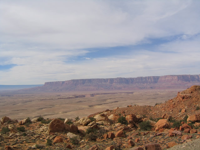
| This stunning view is afforded from a pullout on the
downgrade from Antelope Pass along southbound. The Vermillion
Cliffs National Monument is visible as well as the canyons
of the Colorado River and Kaibab National Forest. 10/26/03 |
|
| View of southbound U.S. 89 as seen from the pullout
on the downgrade from Antelope Pass. 10/26/03 |
|
| Distance sign along southbound for Bitter Springs/U.S. 89 ALT, with Flagstaff as the control city (still another 112 miles south of here). 10/26/03 |
|
| As U.S. 89 continues down from Antelope Pass, it approaches
a runaway truck ramp. 10/26/03 |
|
| Now at the bottom of the hill, U.S. 89 approaches Alternate
U.S. 89 (U.S. 89A). U.S. 89A follows the original alignment
of U.S. 89 between Kanab, Utah, and Bitter Springs, Arizona,
before the current alignment of U.S. 89 was constructed
through Page in the late 1950s. U.S. 89A leads north from
here to cross the Colorado River at Marble Canyon, then
continues west to Jacob Lake (SR 67) and
northwest to Fredonia (SR 389). Alternate
U.S. 89 returns to U.S. 89 via Utah 11 in Kanab. 10/26/03 |
|
| U.S. 89 south at U.S. 89A. For travelers headed to Flagstaff, it is worth the detour to take U.S. 89A north to Marble Canyon to see the bridge over the Colorado River. That bridge is one of a handful of bridges (and driveable dams) that span the Colorado River in Arizona; the crossings include from south to north: I-8, Business Loop I-8 (Old U.S. 80), Imperial County Route S-24, I-10, SR 62/SR 95 Spur, I-40, SR 95, SR 163/SR 68, I-11/U.S. 93, U.S. 89A and U.S. 89. 10/26/03 |
|
| At the time this photo was taken, lane markings were stripped away from the pavement in preparation for a repaving project. 10/26/03 |
|
| The next town of significance along southbound is The
Gap, six miles south of the U.S. 89A intersection. 10/26/03 |
|
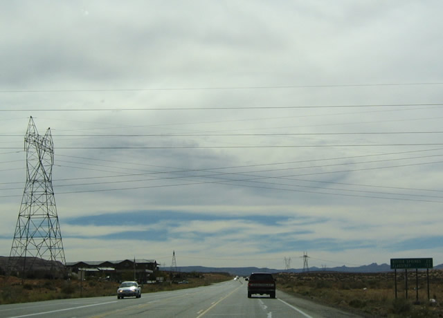
| Due to the abundance of power generation facilities
in northeast Arizona, many power pylons criss-cross the
area traversed by U.S. 89. This mileage indicates that
the next intersection of significance is U.S. 160, which
is 17 miles. 10/26/03 |
|
| Another set of power pylons carry electricity from the
fossil fuel generation facilities of northeast Arizona/northwest
New Mexico. 10/26/03 |
|
| Southbound U.S. 89 approaching U.S. 160, one half mile. 10/26/03 |
|
| Eastbound U.S. 160 leads to Tuba City, which is located ten miles east of here. Like SR 98, U.S. 160 heads to Kayenta and Monument Valley via U.S. 163. U.S. 160 meets U.S. 191 in Mexican Water and U.S. 64 in Teec Nos Pos before exiting Arizona. 10/26/03 |
|
| U.S. 160 is a very long U.S. route that crosses the
Rocky Mountains via southern Colorado, then continues
east across the Great Plains state of Kansas en route
to southern Missouri. U.S. 160 ends just shy of the Mississippi
River in Poplar Bluff. Its western terminus is here at
U.S. 89; the Grand Canyon essentially ends its southwesterly
trajectory. 10/26/03 |
|
| Distance sign along southbound for the next town of significance,
which is Cameron. Cameron is located just north of the
intersection between U.S. 89 and SR 64, which leads
west to the South Rim of the Grand Canyon. While traversing
this stretch, look east of the modern highway to spot
the original alignment of U.S. 89 as well as some old
bridges and culverts. 10/26/03 |
|
| An old bridge that used to carry U.S. 89 over the Little
Colorado River is visible on the west side of modern U.S.
89. 10/26/03 |
|
| The new bridge carrying U.S. 89 over the Little Colorado
River closely parallels the old bridge that used to carry
U.S. 89. The old suspension bridge dates back to 1938,
and is now used to carry pipelines. 10/26/03 |
|
| Southbound U.S. 89 approaching SR 64 in
Cameron. 10/26/03 |
|
| SR 64 is an odd state route; beginning here in
Cameron, it heads west to the Grand Canyon National Park,
passing by the Tusayan Ruin and Museum before reaching
the South Rim of the Grand Canyon. Turning south, Arizona
64 picks up U.S. 180 at the southern entrance to the Grand
Canyon National Park and Valle (the duplex is only signed
on westbound SR 64/Southbound U.S. 180; in the opposite
direction, the northern terminus of U.S. 180 is at its
junction with SR 64). After U.S. 180 splits off to
the southeast at Valle, SR 64 continues due south
to meet Interstate 40/Business Loop I-40 at Williams (Exit
165). 10/26/03 |
|
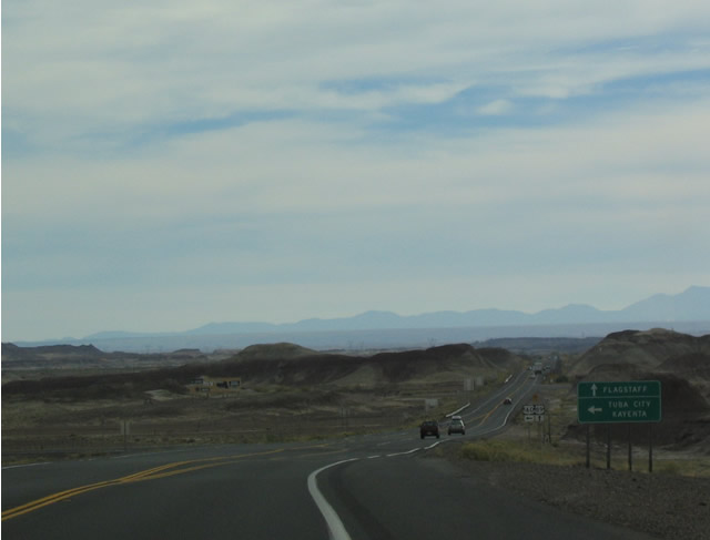
| The next town of significance along southbound U.S.
89 is Gary Mountain, which is the first town after leaving
the Navajo Indian Reservation. 10/26/03 |
|
| Now south of both the Navajo Indian Reservation and
Gray Mountain, U.S. 89 meets Indian Road 395, which provides
a scenic loop from U.S. 89 east into Wupatki National
Monument then southwest to Sunset Crater Volcano National
Monument. Indian Road 395 rejoins U.S. 89 in the Coconino
National Forest ten miles north of Flagstaff. This loop
tour is well worth the trip, as it passes through old
lava flows, forest, and Indian ruins. Note that U.S. 89
has widened out to four lanes; it will remain at least
this wide for the remainder of its route to Flagstaff. 10/26/03 |
|
| As it ascends into the Coconino National Forest, U.S.
89 becomes a divided highway with four lanes. The Sunset
Crater Volcano is visible on the horizon to the southeast
(to the left in this picture). 10/26/03 |
|
| The other mountain that dominates the view of U.S. 89
along this stretch is Humphreys Peak, which at 12,633
feet is the highest point in Arizona. Skiing and hiking
are available seasonally on this mountain, which sits
in the heart of Coconino National Forest and is accessible
via U.S. 180 north of Flagstaff. 10/26/03 |
|
| Southbound U.S. 89 enters the Coconino National Forest
almost as soon as U.S. 89 passes by its first tree as
it continues to gain elevation en route to its summit. 10/26/03 |
|
| This magnificent vista is afforded on U.S. 89 south
as it enters the national forest. 10/26/03 |
|
| Southbound U.S. 89 reassurance shield within the national
forest. 10/26/03 |
|
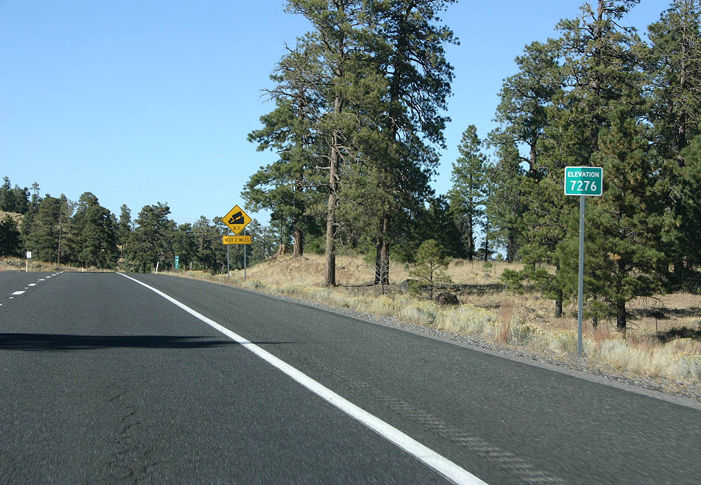
| Now reaching its summit of 7,276 feet, U.S. 89 descends
slightly and turns southwest to reach its final destination,
Flagstaff. 10/26/03 |
|
| The Wupatki/Sunset Crater Scenic Loop (Indian Road 395)
rejoins U.S. 89 at this intersection. 10/26/03 |
|
| In this scene after Indian Road 395, U.S. 89 gains a
turn lane in the center. The rural sense of this highway
is changing to suburban. 10/26/03 |
|
| U.S. 89 concludes south at Business Loop I-40/U.S. 180, 0.32 miles north of Interstate 40. Prior to 2007/08 construction, a trumpet interchange joined the three routes here. 04/26/17 |
|
| Business Loop I-40/U.S. 180 overtake the arterial route beyond the end sign for U.S. 89 en route to Downtown Flagstaff. 04/26/17 |
|
| SR 89 south at Yavapai County Route 70 between Chino Valley and Prescott. 05/23/03 |
|
| SR 89 south at SR 69 south in Prescott. 05/23/03 |
|
| U.S. 89 Business north at U.S. 89, just west of the Page city center and southeast of the dam. U.S. 89 Business through Page is not state maintained and is therefore not signed as a state facility. 10/26/03 |
|
| View of the bridge, dam and power substation from the northbound business loop. 10/26/03 |
|
| U.S. 89 Business concludes at U.S. 89 west of Downtown Page and southeast of Glen Canyon Dam. 10/26/03 |
|
| U.S. 89 north leads to the dam and Utah. U.S. 89 south leads to U.S. 160, Grand Canyon National Park and Flagstaff. 10/26/03 |
|
| While the main intersection for SR 98 and U.S. 89 is the most direct route, the business route also connects to SR 89. 10/26/03 |
|
| Southbound U.S. 89 Business at Coppermine Road in Page. 10/26/03 |
|
| The southbound beginning of SR 89 from the diamond interchange joining the east end of Business Loop I-40 from Ash Fork with Interstate 40. 04/27/17 |
|
| Wahweap Marina Road west where it meets U.S. 89. 10/26/03 |
|
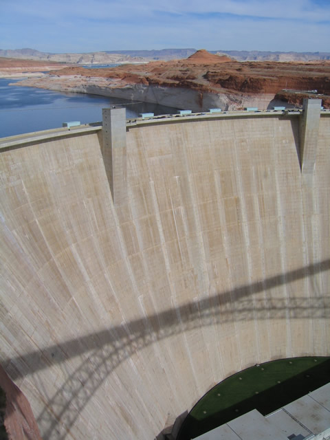
| U.S. 89 spans Glen Canyon adjacent to Glen Canyon Dam, just outside the city of Page in Coconino County. 10/26/03 |
|
| Located on the deck of the Glen Canyon Dam, the bridge plaque indicates the span was constructed in phases between 1957 and 1959. Once completed, U.S. 89 was rerouted from its old alignment via U.S. 89A and moved onto this route through Page. 10/26/03 |
|
| The Colorado River below Glen Canyon Dam. 10/26/03 |
|
| Operated by the Bureau of Reclamation, Glen Canyon Dam was built between 1960 and 1963. 10/26/03 |
Page Updated 04-02-2022.

 North
North


 scenes