|
| East of Paradis, U.S. 90 advances to meet I-310/LA 3127 north in St. Charles Parish. 11/20/08 |
|
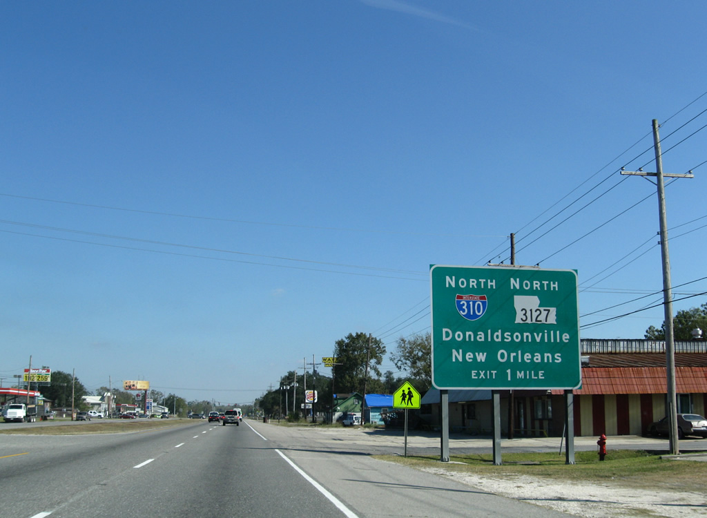
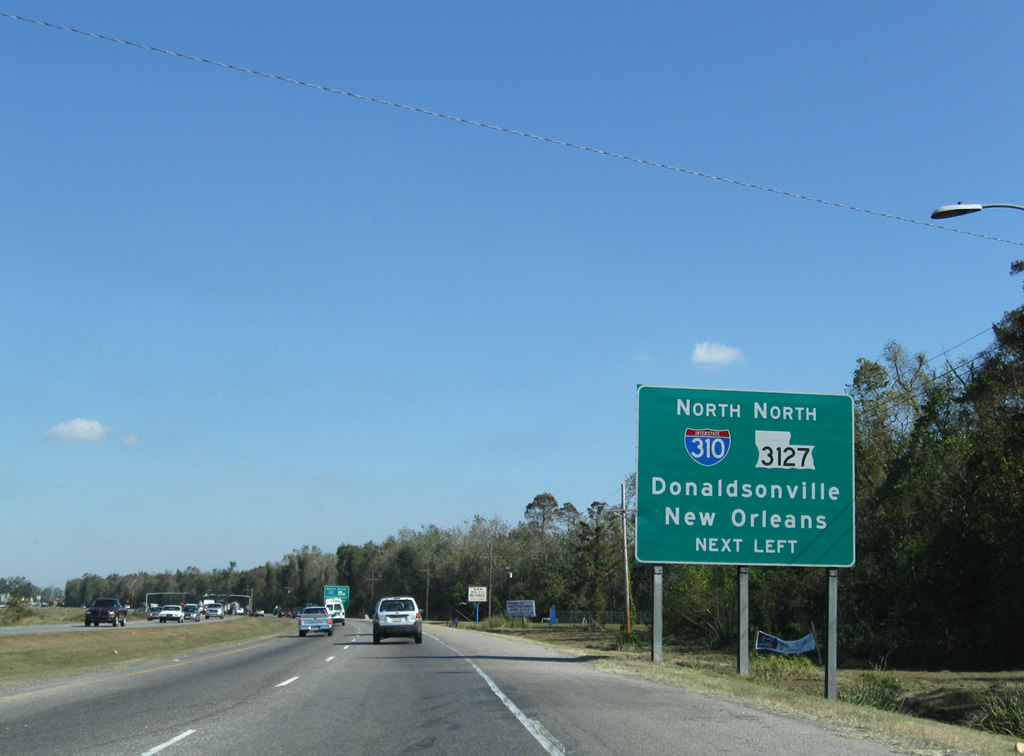
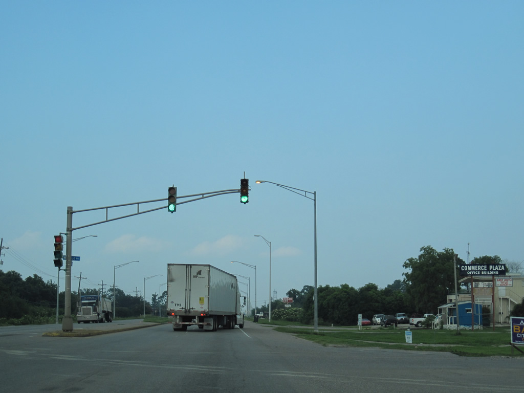
| A half diamond interchange links U.S. 90 with I-310/LA 3127 at the community of Boutte. I-310 connects the Houma and Morgan City area with I-10 near Louis Armstrong New Orleans International Airport (MSY). LA 3127 overlaps with I-310 briefly before turning northwest to Donaldsonville along River Parishes Highway. 11/23/08 |
|
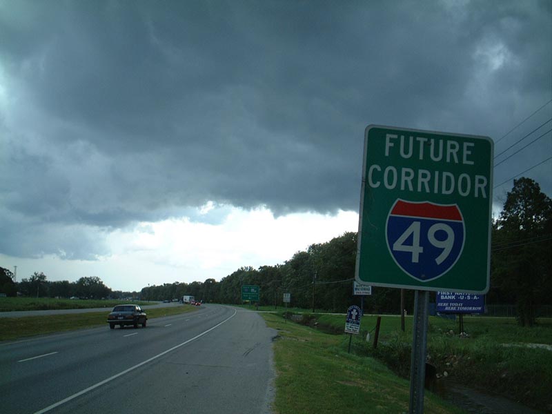
| Many I-49 future corridor signs were posted along U.S. 90 in the late 1990s from Lafayette to Greater New Orleans. East from Boutte, I-49 was initially proposed to follow U.S. 90 onto the Westbank Expressway. This assembly was removed by 2006. 06/15/01 |
|
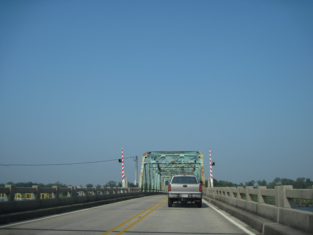
| U.S. 90 east at the northbound entrance ramp for I-310/LA 3127 to Destrehan, Kenner and New Orleans. Ramp stubs from the adjacent viaduct allude to a possible extension of I-310 south to proposed Interstate 49. 11/23/08 |
|
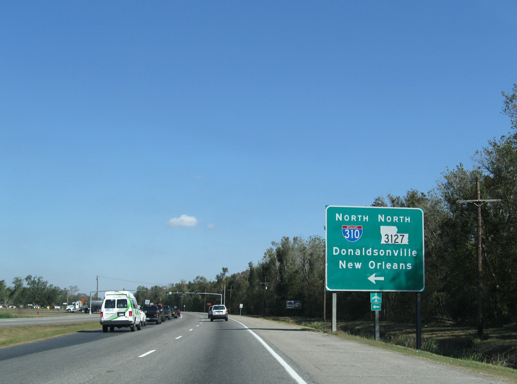
| U.S. 90 leaves Interstate 310 and continues to Boutte, Waggaman and Avondale. 11/23/08 |
|
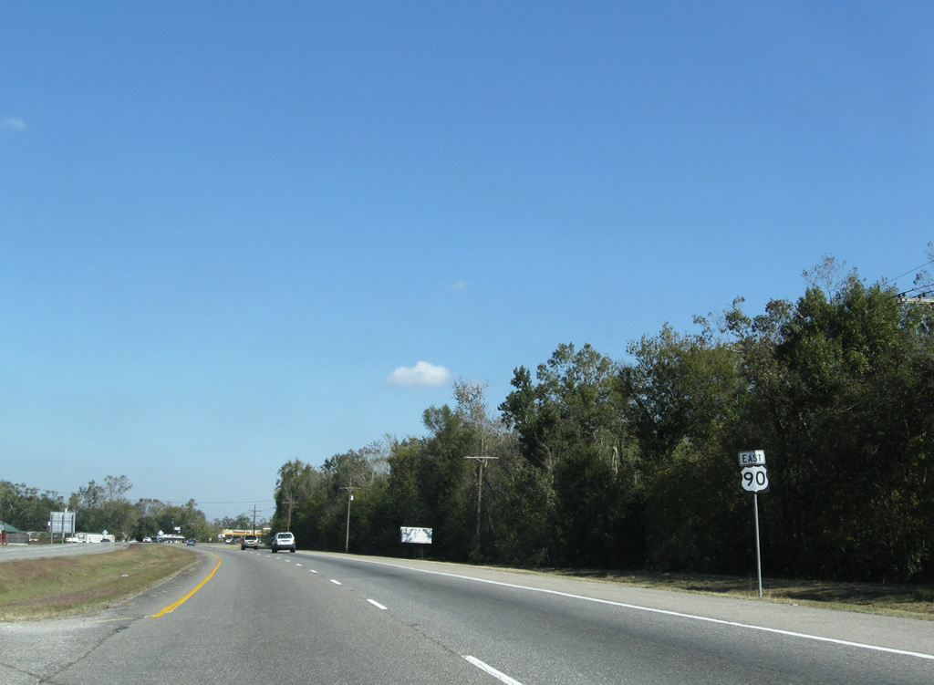
| LA 52 (Paul Mailard Road) south and LA 633 (Magnolia Ridge Road) north conclude at U.S. 90 in Boutte. LA 52 connects Boutte with Luling and LA 18 while LA 633 meanders south to a dead end. 11/23/08 |
|
| East of Avondale, U.S. 90 nears the split with U.S. 90 Business (Westbank Expressway). 08/02/02 |
|
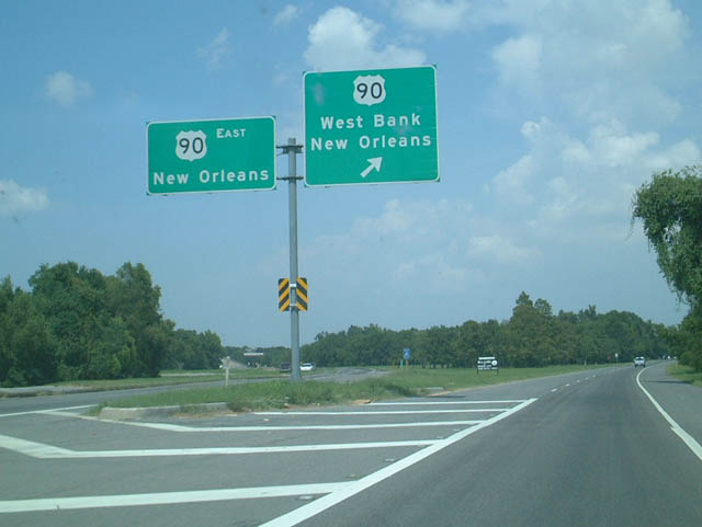
| U.S. 90 eastbound at the beginning of the Westbank Expressway (U.S. 90 Business). U.S. 90 Business arcs eastward through the Westbank communities of Westwago, Marrero, Harvey and Gretna before reaching the Crescent City Connection bridge at Algiers, New Orleans.
The overhead assembly pictured here was replaced with ground level shields. 08/02/02 |
|
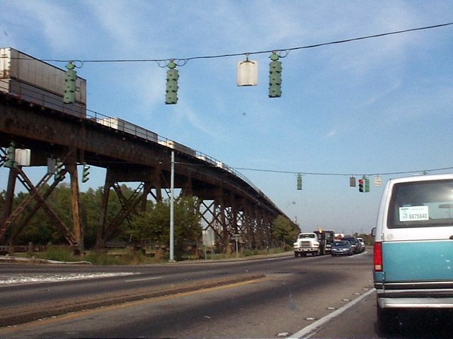
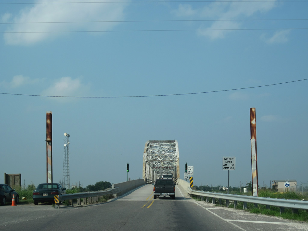
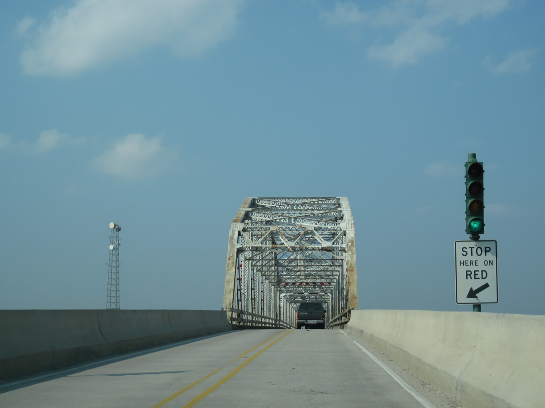
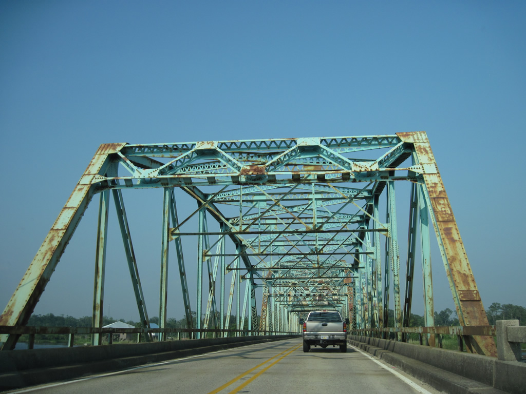
| A historical look at U.S. 90 eastbound at the merge with LA 18 (River Road) near Bridge City. The railroad portion (New Orleans Public Belt Railroad) of the Huey P. Long Bridge climbs toward the crossing of the Mississippi River between what is now the split roadway of U.S. 90. LA 18 enters U.S. 90 via River Road from the communities of Avondale and Waggaman. 11/12/99 |
|
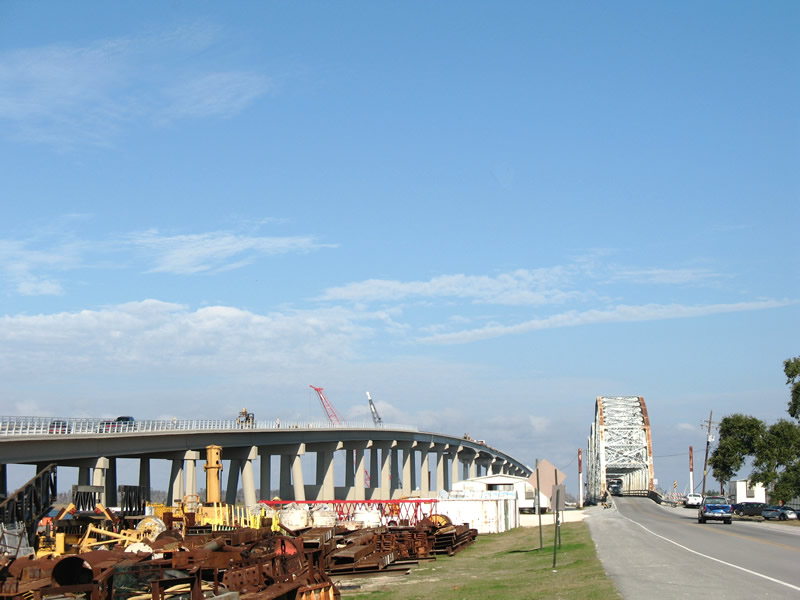
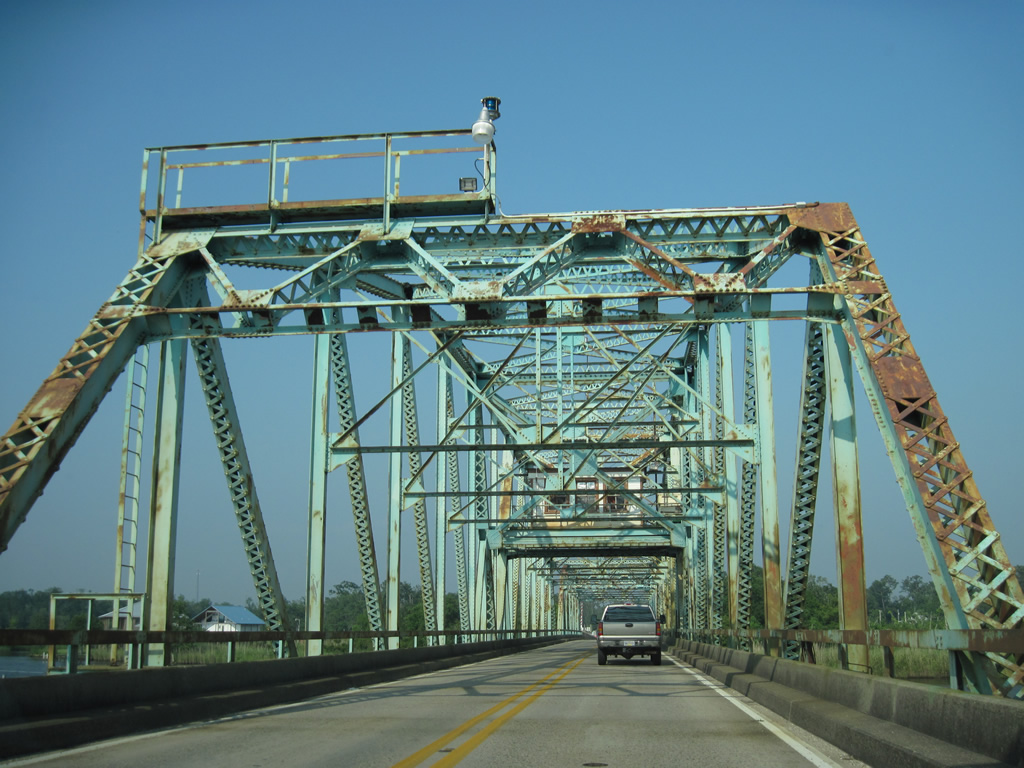
| A $1.2 billion project commenced in 2006 to expand the capacity of the 1935-built Huey P. Long Bridge from four to six overall lanes. The original deck was narrow with nine foot wide lanes and no shoulders. Completed in 2013, the expanded bridge accommodates three eleven foot lanes with two foot inside shoulders and eight foot outside shoulders between Bridge City and Jefferson. 11/12/99 |
|
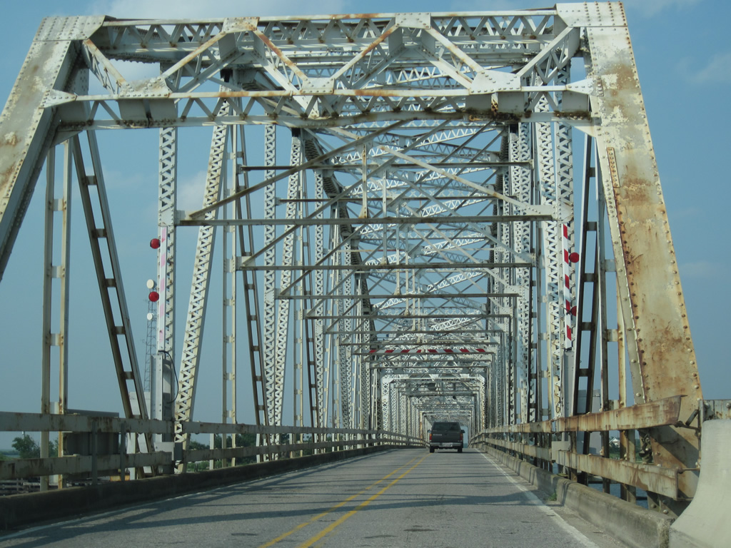
| The Huey P. Long Bridge opened to traffic December 16, 1935. The bridge was struck by a ship and had to be repaired in 1979. The lack of shoulders and extremely narrow travel lanes led to a ban on trucks passing. 11/12/99 |
|
| Descending towards Jefferson on U.S. 90 eastbound. The New Orleans Public Belt Railroad gradually sweeps to the northeast, eventually paralleling the Earhart Expressway into New Orleans. The Huey P. Long Bridge comprises the longest and highest steel railroad bridge in the United States at 4.35 miles in length with a 135 foot vertical clearance. 11/12/99 |
|
| U.S. 90 turned eastward with LA 48 along the Jefferson Highway at the northern end of the Huey P. Long Bridge. Traffic heading north joined Clearview Parkway toward Interstate 10.
LA 48 continues the Jefferson Highway west from Jefferson to the city of Kenner and St. Charles Parish. U.S. 90/LA 48 previously shared a half mile overlap east to Central Avenue, but the stretch along Central Avenue was decommissioned by 2011. 11/12/99 |
|
| U.S. 90 winds through Central City and emerges at the Claiborne Avenue viaduct by the Superdome. The viaduct carries the US highway mainline through the directional interchange with Interstate 10. 11/23/08 |
|
| A service road travels alongside the elevated lanes of U.S. 90 to Earhart Boulevard for the ramp to U.S. 90 Business west to Algiers. 11/23/08 |
|
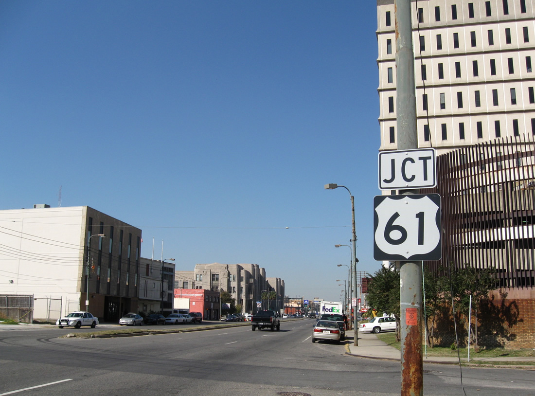
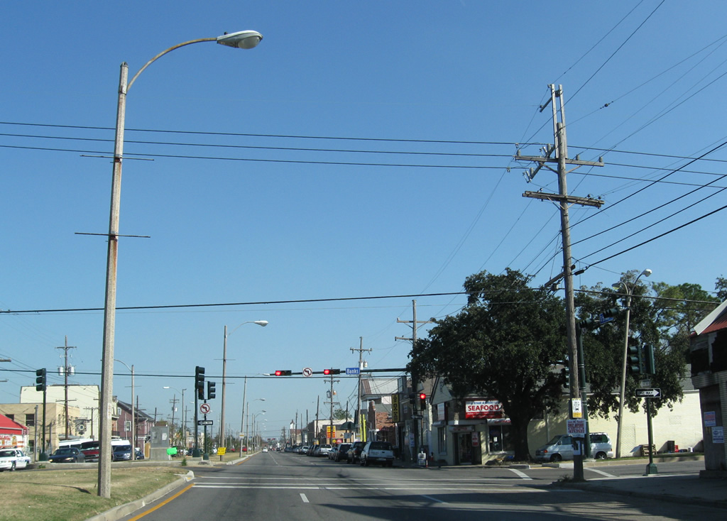
| U.S. 90 follows Canal Street northwest from Claiborne Avenue to U.S. 61. U.S. 61 begins at the U.S. 90 turn onto Broad Avenue and continues Tulane Avenue northwest to Mid City and Airline Drive. The US highway travels north from the Gulf Coast to Jackson, Mississippi, Memphis, Tennessee, Quad Cities, and St. Paul on a 1,400 mile trek to Wyoming, Minnesota. 11/23/08 |
|
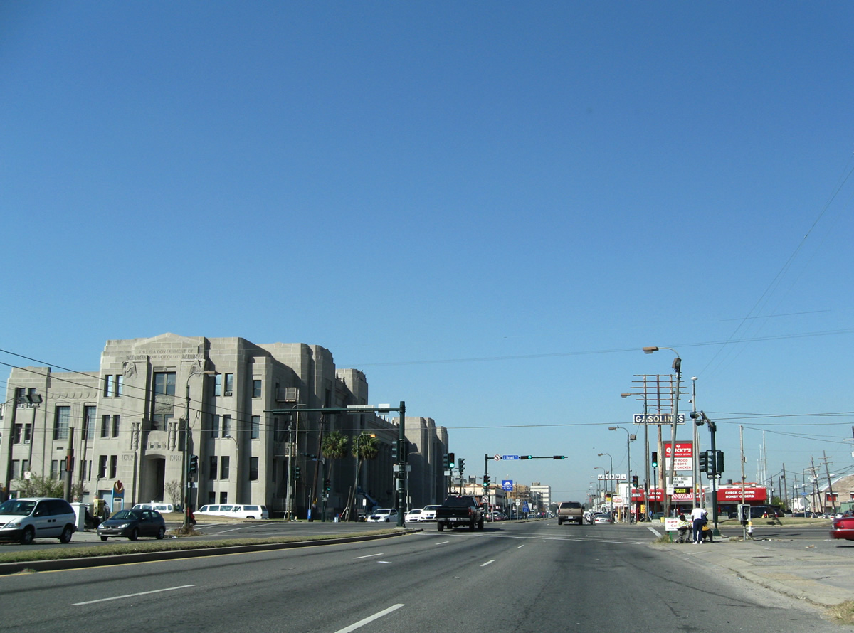
| Broad Avenue swings east from Napolean Avenue and Broadmoor to become U.S. 90 east of U.S. 61 (Tulane Avenue) to Allen Street and Interstate 610. The movement of U.S. 90 east and the beginning of U.S. 61 north are not posted at the intersection of Tulane and Broad. 11/23/08 |
|
| One block removed from Tulane Avenue along U.S. 90 (Broad Avenue) at Banks Street. 11/23/08 |
|
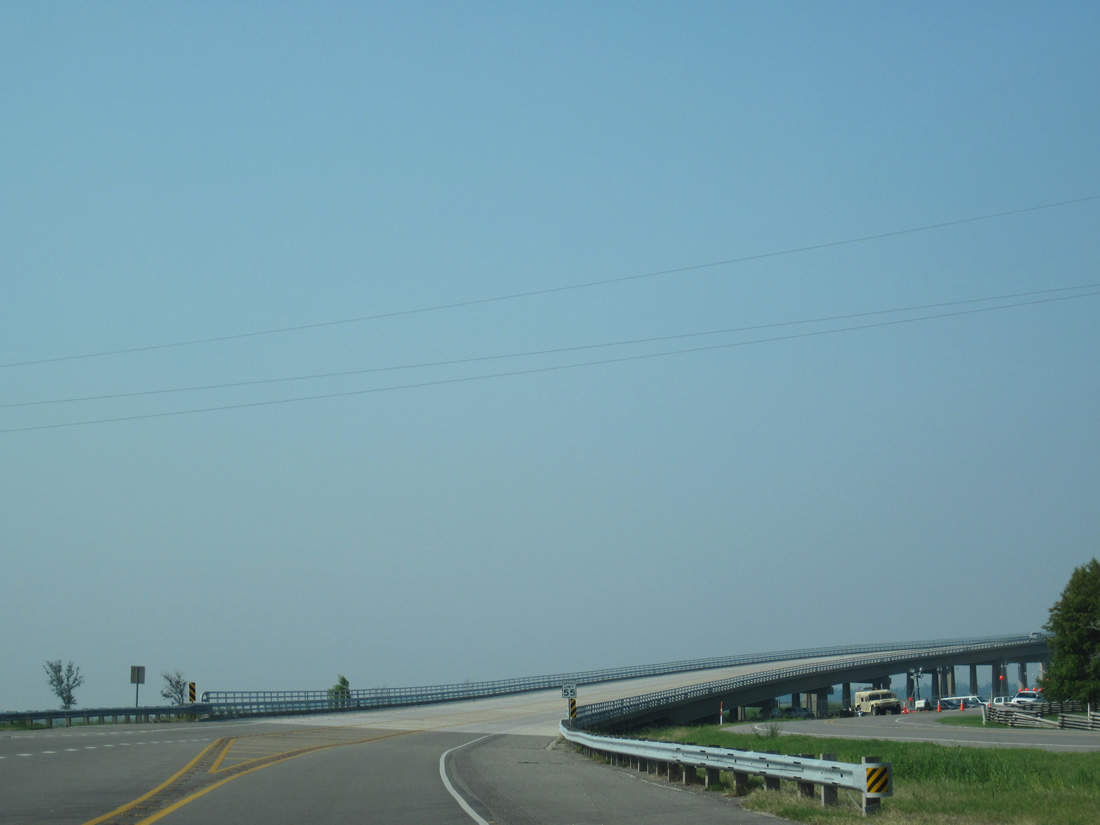
| The on-ramp from France Road adds a fourth eastbound lane to U.S. 90 across the main span of the Danziger Bridge. 05/09/15 |
|
| The Danziger Bridge crosses the Industrial Canal between the Gentilly Woods and Pines Village neighborhoods of New Orleans. A barrier lowers during bridge openings. 05/09/15 |
|
| Drivers lower from the vertical lift bridge above an industrial area preceding Downman Road. 05/09/15 |
|
| Directional ramps connect forthcoming Downman Road with the High Rise Bridge west and from Interstate 10 east. The inbound ramp is closed during the morning peak hours to offset congestion due to a limited merge area on the freeway. 05/09/15 |
|
| Interstate 10 leads back to the southwest through the Desire neighborhood en route to Downtown New Orleans. Downman Road north parallels the Industrial Canal north to New Orleans Lakefront Airport (NEW). 05/09/15 |
|
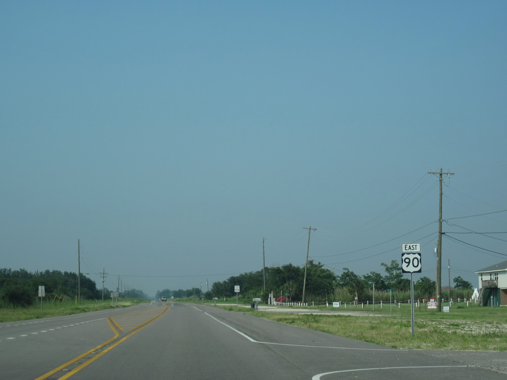
| Traveling through New Orleans East, U.S. 90 (Chef Menteur Highway) meets Interstate 510 & LA 47 at a six-ramp parclo interchange. The southbound ramp travels to Intracoastal Waterway bridge to Chalmette in St. Bernard Parish.
Sign changes made since this photo was taken remove the northbound set of shields. 11/06/99 |
|
| A left turn takes drivers from U.S. 90 east onto Interstate 510 & LA 47 north to Interstate 10 and Little Woods. 06/09/10 |
|
| A hodgepodge of industrial type businesses line U.S. 90 (Chef Mentuer Highway) east through Michoud. Michoud Boulevard crosses the four lane divided highway from Old Gentilly Road near the NASA Michoud Assembly facility northward to Village de L'Est. 06/09/10 |
|
| Alcee Fortier Boulevard spurs north from a traffic light with U.S. 90 to a residential area and Dwyer Boulevard. 06/09/10 |
|
| Industrial Parkway spurs south from U.S. 90 to a number of businesses alongside Michoud Canal. 06/09/10 |
|
| U.S. 90 trailblazer posted along the Chef Menteur Highway after Industrial Highway. 06/09/10 |
|
| U.S. 90 curves northward along the periphery of Bayou Sauvage to meet the south end of U.S. 11 at Powers Junction. 06/09/10 |
|
| Due to the low traffic volumes of the area, a simple set of flashers govern the movements at the southern terminus of U.S. 11 in eastern New Orleans. 12/10/07 |
|
| U.S. 11 departs U.S. 90 (Chef Menteur Highway) on its ten-state, 1,645 mile journey northward to Canada at Rouses Point, New York. While much of the route shadows an Interstate highway, portions of the route still play a pivotal role, such as the bridge across Lake Pontchartrain, which was the first span to reopen following the aftermath of Hurricane Katrina in 2005. 12/10/07 |
|
| The replacement shield assembly for U.S. 11 north on U.S. 90 east. U.S. 11 parallels Irish Bayou Canal northward to Interstate 10 at Pointe aux Herbes and the 5-Mile Bridge to Slidell. Originally the highway shared pavement with U.S. 90 west into central New Orleans. 06/09/10 |
|
| Leading away from U.S. 11, U.S. 90 continues along Bayou Sauvage to Venetian Isles. 06/09/10 |
|
| U.S. 90 spans Chef Menteur Pass along the Chef Pass Bridge, still within the New Orleans city limits. Now far removed from the hustle and bustle of the Big Easy central business district, U.S. 90 sleepily crosses this waterway that links Lakes Borgne and Pontchartrain. 06/09/10 |
|
| The Chef Menteur Pass Bridge opened to traffic in September of 1929. Storm surge from Hurricane Katrina in 2005 scoured away soil through the pass, shifting the bridge support columns. Hurricane Rita continued the process almost a month later and normal tidal scouring eventually led to the eastern bank of the bridge to begin sliding into the pass. The bridge was closed from August 29, 2005 to August 11, 2006 for repair work.3 06/09/10 |
|
| The 1,174-foot-long bridge3 was closed in early 2008 as construction crews worked to stabilize the bridge and fix its locking mechanism.1 A cement barge struck the bridge on October 26, 2011, resulting in $100,000 in damages.2 06/09/10 |
|
| Side profiles of the Chef Pass Bridge, with some local fishermen enjoying the waters. 11/12/99 |
|
| A pond lines the east side of U.S. 90 (Chef Menteur Highway) near the former Brazillier Island Road. Marquez Canal parallels the rural highway to the southeast, linking Chef Menteur Pass with Lake St. Catherine. 06/09/10 |
|
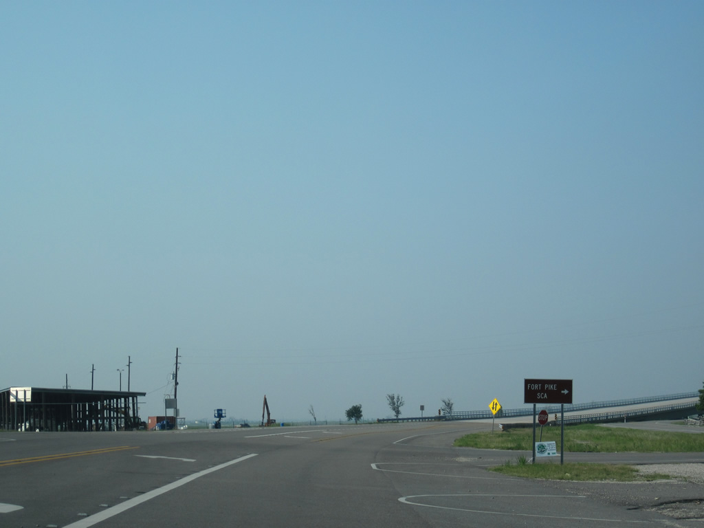
| Fort Pike State Historic Site lies along The Rigolets along U.S. 90, just east of Lake Pontchartrain. Fort Pike was commissioned in 1826 to defend coastal areas in conjunction with five other masonry forts at the time. It remained in service until 1890, serving as a staging area or depot during the Seminole Wars, the Mexican War and the Civil War. 06/09/10 |
|
| A comparison look at work on the new high-level Rigolets Bridge alongside the 1930-steel truss Fort Pike Bridge. Opened on January 15, 2008 at a cost of $50 million, the new bridge supports two 12 foot travel lanes with 8 foot shoulders in each direction. This is a major upgrade when compared to the original Ft. Pike Bridge with its 10 foot travel lanes and lack of shoulders. Additionally the new bridge's 72 foot clearance allows the largest of marine craft unimpeded passage on the Rigolets below, a change from the moveable Ft. Pike Bridge. 12/07/07, 12/10/07 |
|
| Work on the new Rigolets Bridge began in October 2004 at a projected cost of $20 million (1997 dollars). The landfall of Hurricane Katrina delayed the project another eight months, increasing construction costs to $50 million.1 The new bridge increases U.S. 90's effectiveness as an evacuation route for future hurricanes.
Concrete from the 1930 Fort Pike Bridge was used for a breakwater near Fort Pike. The Rigolets crossing was the first toll free connection between New Orleans and Mississippi. Public Service Commission member Huey P. Long (who later became Louisiana Governor) spearheaded the drive to build the bridge.1 06/09/10 |
|
| Historical look at the eastbound beginning of the 1930-built Rigolets Bridge. This narrow passageway divides Lake Pontchartrain with Lake Borgne and the open waters of the Gulf of Mexico. Its defense was imperative during the War of 1812, as the waterway allowed passage to Lake Pontchartrain and the northern edge of the city of New Orleans. During the war, the British Fleet, which drastically outnumbered the American navy at New Orleans, considered passing through the Rigolets to enter Lake Pontchartrain for an attack on New Orleans from their base in Jamaica. However, a capture of five American gunboats on Lake Borgne in the first battle near New Orleans during December of 1814 threw a curve ball in General Andrew Jackson&aposs plans of defense. This skirmish ultimately led the British Fleet to choose an approach to the city from the east by way of Lake Borgne and Bayou Bienvenu, which ultimately took them within a mile of the Mississippi River. The change in approach spared the city the full brunt of the navy, and weakened the overall assault by the British. 06/15/01 |
|
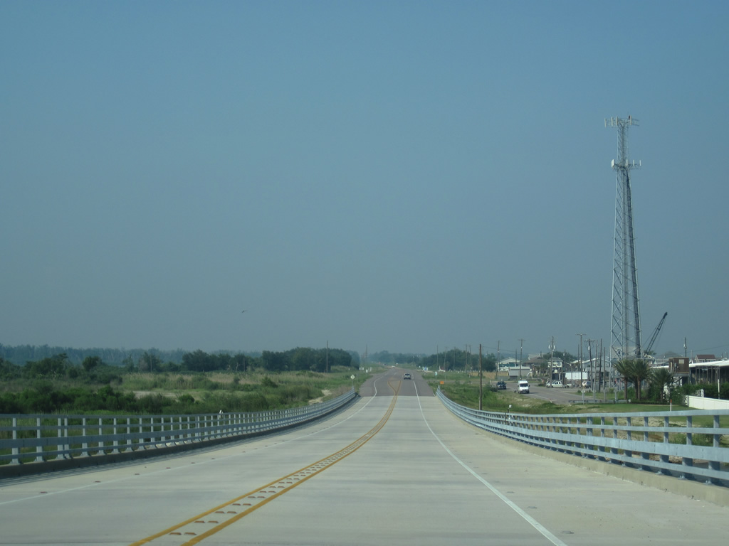
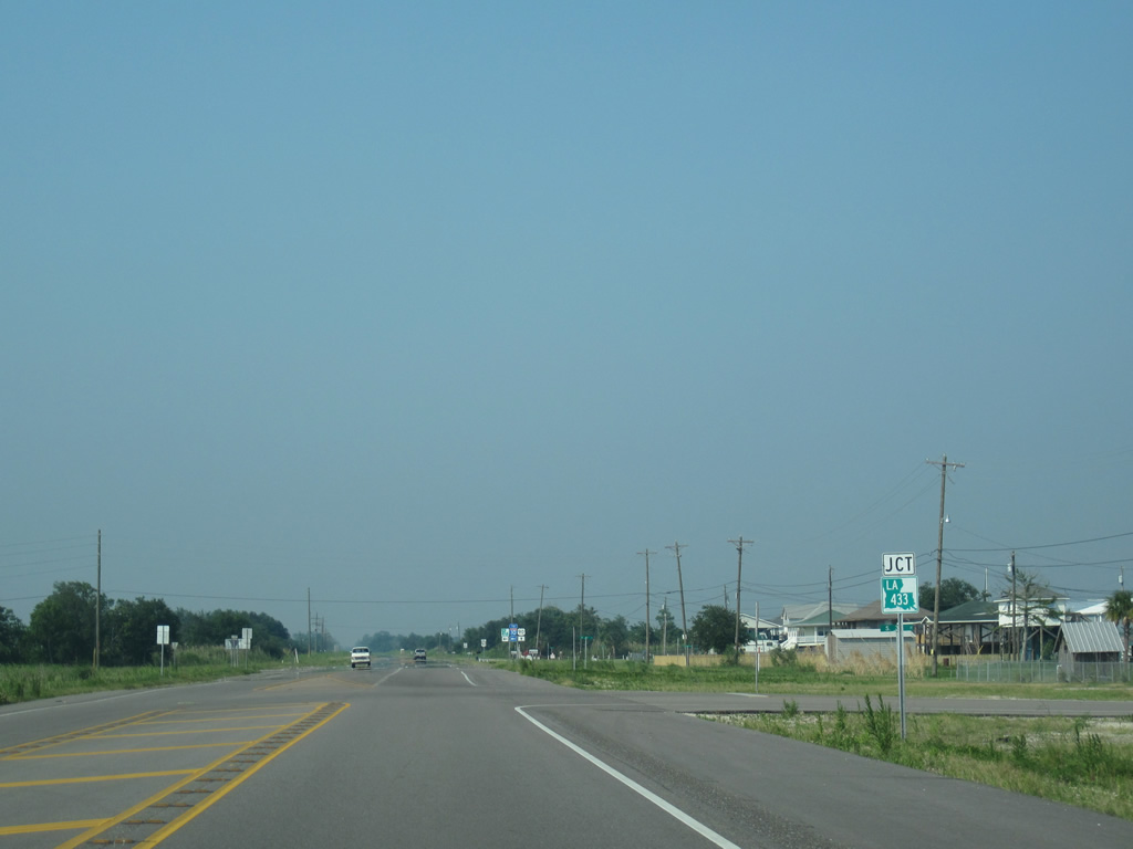
| U.S. 90 enters St. Tammany Parish midway across The Rigolets. Beyond the span, the US highway intersects the south end of LA 433 at the community of Snug Harbor. Construction realigned the end of LA 433 from a two-leg wye intersection to a conventional one. 06/09/10 |
|
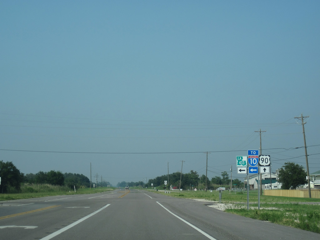
| Louisian 433 winds northwest from U.S. 90 to Slidell and Interstate 10 (Exit 263). The state highway totals 14.9 miles overall through Slidell, Bayou Liberty, Bonfounca and U.S. 190 at Colt. 06/09/10 |
|
| U.S. 90 continues northeast along Geoghegan Canal toward Prevost Island from LA 433. 06/09/10 |
|
| Traveling alongside Big Branch Marsh National Wildlife Refuge, U.S. 90 sees two lanes of concrete to Apple Pie Ridge and White Kitchen. 06/09/10 |
|
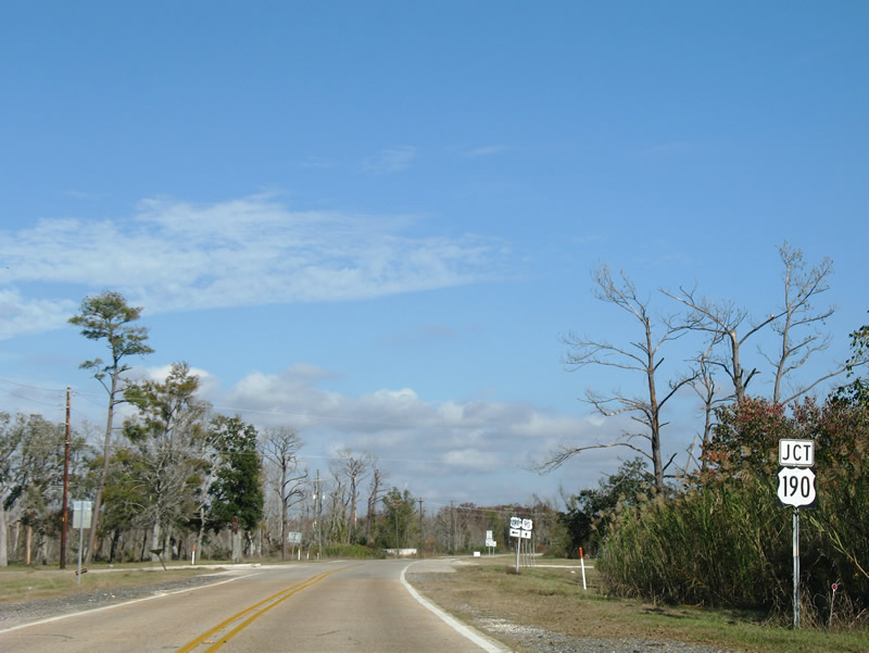
| U.S. 90 curves eastward and reaches the terminus of U.S. 190 at White Kitchen. 12/10/07 |
|
| An older shield and guide sign assembly at the east end of U.S. 190 that was posted on U.S. 90 east. The intersection was devoid of signs for a period of time after Hurricane Katrina.
U.S. 190 travels west 7.7 miles to the city of Slidell and I-10. The US route follows a 875 mile course to west Texas, where it concludes at Interstate 10 (Exit 307). 06/15/01 |
|
| Replacement signs for U.S. 90 east at the westbound beginning of U.S. 190. U.S. 190 meanders northwest 3.8 miles to U.S. 190 Business at Military Road. There U.S. 190 heads north to LA 1090 and Gause Boulevard into the heart of Slidell. U.S. 190 Business (Fremaux Avenue) provides a direct connection to Downtown Slidell and a 2008-opened interchange with I-10. 06/09/10 |
|
| The final shield of U.S. 90 posted along the 304.8 mile trek across southern Louisiana. 06/09/10 |
|
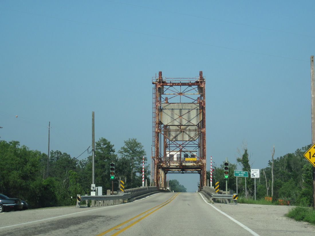
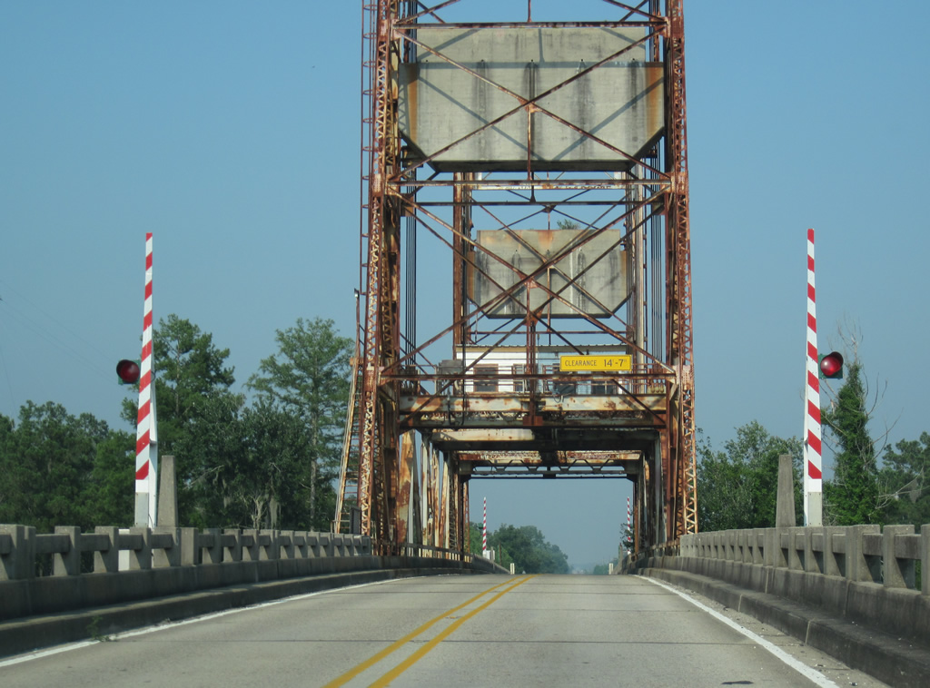
| A 1933-lift bridge spans the West Pearl River along U.S. 90 east of White Kitchen. 06/09/10 |
|
| U.S. 90 enters the Pearl River Wildlife Management Area from the West Pearl River to Honey Island. 06/09/10 |
|
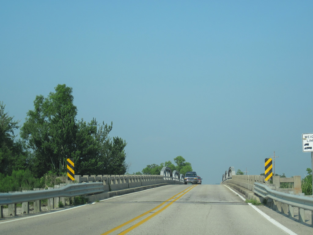
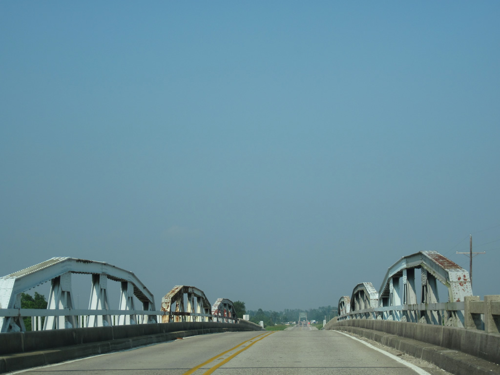
| The first in a series of 1933 pony truss bridges carries U.S. 90 across the West Middle River onto Deer Island. 06/09/10 |
|
| The second pony truss bridge of U.S. 90 east crosses Middle River onto Desert Island. 06/09/10 |
|
| U.S. 90 leaves Desert Island for Honey Island at the East Pearl River. The highway leaves the Pearl River Wildlife Management Area nearby. 06/09/10 |
|
| A movable truss bridge spans the Pearl River into Hancock County, Mississippi. Activity located in this scene was related to the BP oil clean-up of summer 2010. 06/09/10 |
|
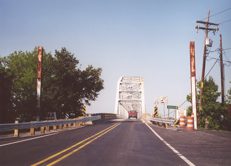
| Exiting St. Tammany Parish, Louisiana along U.S. 90 across the Pearl River. The bridge was built in 1926, but was not a part of U.S. 90 until June 21, 1937 when Louisiana requested an alignment change with AASHO to relocate the route from its alignment across the Watson-Williams Bridge at Slidell.4 06/09/10 |
Page Updated 10-04-2016.


 East
East