|
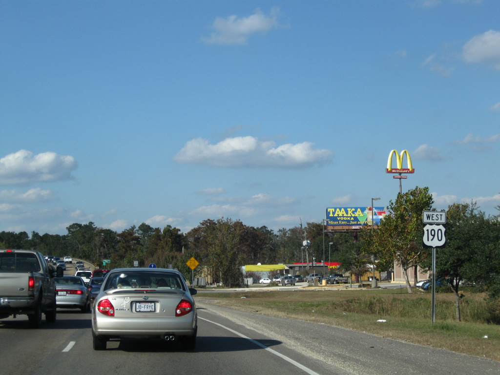
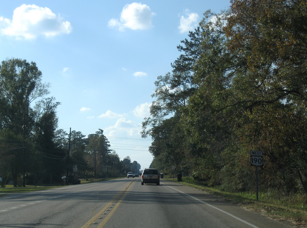
| What was the first westbound shield of U.S. 190, affixed to a utility pole at the White Kitchen wayside park. U.S. 190 was unsigned from after Hurricane Katrina until at least December 10, 2007. The adjacent park was closed and demolished since the storm as well. 11/06/99 |
|
| The replacement first marker of U.S. 190 west at White Kitchen. U.S. 190 begins 3.9 miles west the Mississippi state line from U.S. 90, six miles outside Slidell. 10/24/09 |
|
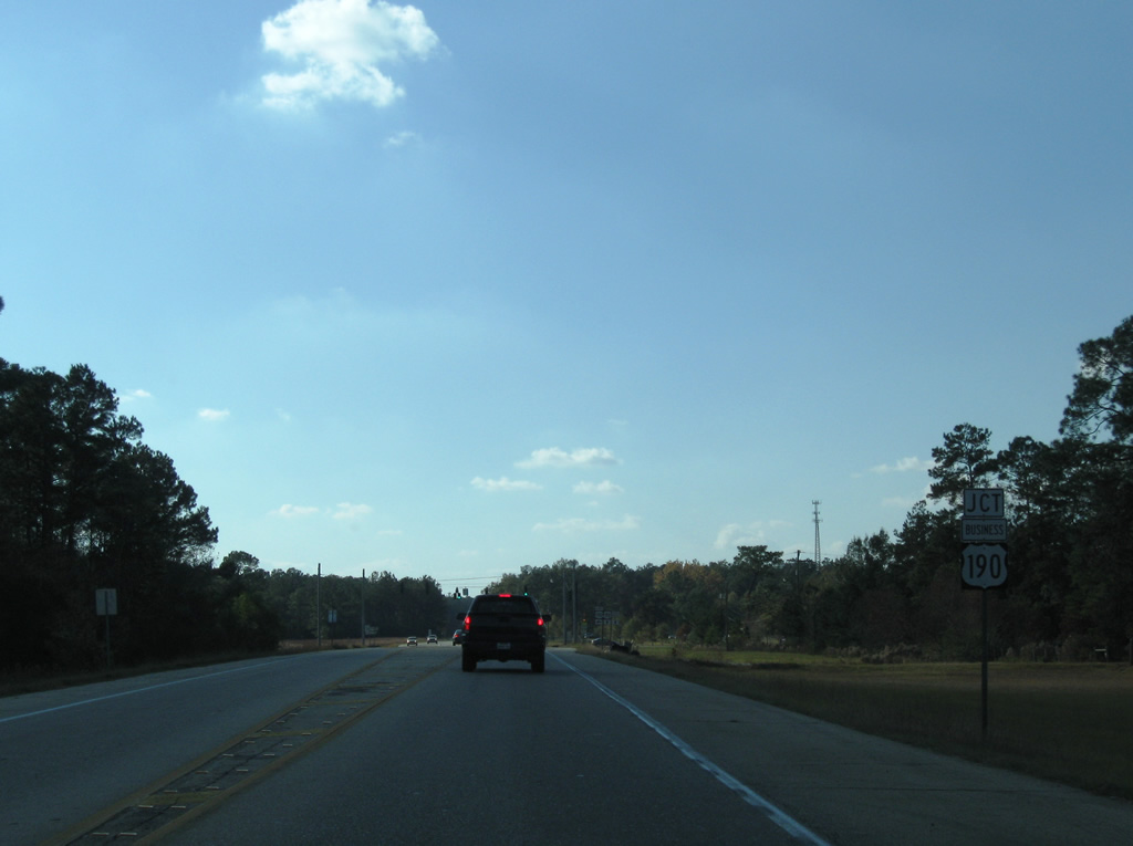
| 3.8 miles west of its beginning is the U.S. 190 split with U.S. 190 Business (Shortcut Highway). U.S. 190 Business follows the original route of U.S. 190 west to downtown Slidell while U.S. 190 turns northward onto Military Road. 10/24/09 |
|
| U.S. 190 Business (Shortcut Highway) travels two miles west to a 2008-opened diamond interchange with Interstate 10. The route concludes at U.S. 11 (Front Street), 0.6 miles south of U.S. 190 (Gause Boulevard). 10/24/09 |
|
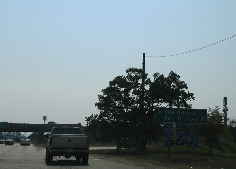
| Entering the busy diamond interchange with Interstate 10 on U.S. 190 (Gause Boulevard) westbound. Interstate 10 meets Interstate 12 west to Hammond and Interstate 59 north to Picayune nearby. 06/10/06 |
|
| Nearing the intersection with U.S. 11 (Front Street) along U.S. 190 (Gause Boulevard) west. An older overhead assembly hosts a more modern guide sign directing traffic to downtown Slidell via U.S. 11 south. 06/21/01 |
|
| U.S. 11 parallels a Norfolk Southern Railroad line southward through downtown Slidell and north to the town of Pearl River. The route generally serves local traffic as a busy arterial connecting Slidell with Interstate 12 (Exit 83). U.S. 190 continues along Gause Boulevard west from a pair of shopping centers to the suburban outskirts of Slidell and Northshore Squall Mall. 06/21/01 |
|
| U.S. 190 turns northward at Mandeville and overtakes Causeway Boulevard as a freeway to Interstate 12 at Covington. A diamond interchange follows with Fairway Drive west and Judge Tanner Boulevard east. 10/03/01 |
|
| U.S. 190 crosses Ponchitalawa Creek and enters a directional cloverleaf interchange with Interstate 12. All traffic to I-12 departs in unison for Hammond to the west and Slidell to the east. 10/03/01 |
|
| U.S. 190 leaves Interstate 12 and transitions into a busy commercial route north to Covington. 11/20/08 |
|
| A pair of frontage roads radiate outward from U.S. 190 at the north end of the interchange with Interstate 12. These roads spur west and east along I-12 to an assortment of businesses. 11/20/08 |
|
| Holiday Boulevard stems west from U.S. 190 by a number of lodging businesses to Avenue Palais Royal at the Versailles subdivision. 11/20/08 |
|
| Several additional signals await westbound drivers along the stretch north of Interstate 12, including this set at Lake Drive and an entrance to Walmart. Lake Drive acts as a short service road along the eastbound side. 11/20/08 |
|
| Crestwood Drive stems east from U.S. 190 at another traffic light to Falconer Drive and the Crestwood Estates subdivision. 11/20/08 |
|
| Three Rivers Road east and 9th Avenue west come together at the next westbound signal. 11/20/08 |
|
| Harrison Avenue leads east by the Ingram Estates residential street grid and connects U.S. 190 with LA 59 at Abita Springs. 11/20/08 |
|
| Spanning the Abita River along U.S. 190 westbound. 11/20/08 |
|
| U.S. 190 next splits with the Covington business loop by St. Tammany Square Shopping Center. U.S. 190 Business travels west along Boston Street to the historic district. 11/20/08 |
|
| A five lane connector road links with LA 21 (Boston Street) as U.S. 190 elevates to cross Bogue Falaya River. LA 21 combines with U.S. 190 Business to the intersection of W 21st Avenue and Tyler Street. The 51.8 mile long route travels southwest to Mandeville and northward to Waldheim, Sun, Bogalusa and Walthall County, Mississippi. 11/20/08 |
|
| U.S. 190 quickly narrows to two lanes as it passes over LA 21 (Boston Street) and the Bogue Falaya River. 11/20/08 |
|
| Crossing Bogue Falaya River, U.S. 190 enters Covington and travels Collins Boulevard. The waterway flows 28 miles southward into the Tchefuncte River. 11/20/08 |
|
| U.S. 190 (Collins Boulevard) gains a center turn lane north of the Bogue Falaya River. A grassy right of way along the westbound lane alludes to a potential future widening. 11/20/08 |
|
| LA 437 crosses paths with U.S. 190 (Collins Boulevard) at the intersection with 30th Avenue west and Lee Road north. 11/20/08 |
|
| LA 437 travels 20.7 miles north from Covington to LA 16 at Enon in Washington Parish. The state highway travels 30th Avenue west from U.S. 190 to Columbia Street south to end at U.S. 190 Business (Boston Street) as an a vastly unsigned route. 11/20/08 |
|
| Continuing north from LA 437, drivers pass by a U.S. 190 reassurance shield and hurricane evacuation route marker. 11/20/08 |
|
| 32nd Avenue links U.S. 190 (Collins Boulevard) with Columbia (LA 437 Spur) and Tyler Streets within the Covington street grid to the west and LA 437 (North Lee Road) to the east. 11/20/08 |
|
| U.S. 190 passes by the St. Tammany Parish Fairgrounds and approaches the north end of LA 437 Spur (Columbia Street). 11/20/08 |
|
| LA 437 Spur (Columbia Street) travels 1.04 miles south from U.S. 190 (Collins Boulevard) to 30th Avenue (LA 437) in Covington. 11/20/08 |
|
| U.S. 190 (Collins Boulevard) expands into a four lane divided highway ahead of the intersection with LA 25 north. LA 25 begins and travels north 30 miles to Folsom, Franklinton and the Mississippi state line north of Warnerton. 11/20/08 |
|
| U.S. 190 resumes a westward orientation beyond the split with LA 25 north. 11/20/08 |
|
| A classic style guide sign directed U.S. 190 westbound motorists to the left at LA 25. U.S. 190 was the main route between Covington and Hammond before Interstate 12 was completed in the 1970s. 11/20/08 |
|
| LA 25 quickly exits the city of Covington for an industrial park and the settlement of Ramsey. U.S. 190 lines the north side of Covington to the River Forest community. 11/20/08 |
|
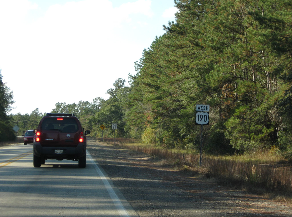
| U.S. 190 continues west from LA 25 with a grassy right of way allocated for a potential four-laning in the future. 11/20/08 |
|
| U.S. 190 Business returns to U.S. 190 west by way of West 21st Avenue at the next traffic light. 11/20/08 |
|
| U.S. 190 Business bends southeast by a number of subdivisions before entering the Covington street grid and merging with LA 21 north at Tyler Street. 11/20/08 |
|
| U.S. 190 passes by Covington High School beyond the merge with 21st Avenue. The highway remains within Covington's city limits to the Tchefuncte River. 11/20/08 |
|
| Speed limits increase to 55 miles per hour west of U.S. 190 Business. A 1968 bridge carries motorists across the Tchefuncte River next. 11/20/08 |
|
| LA 1077 and U.S. 190 come together at the settlement of Goodbee in western St. Tammany Parish. 11/20/08 |
|
| LA 1077 constitutes a 20.8 mile "L" shaped route between a boat ramp at the mouth of the Tchefuncte River on Lake Pontchartrain to LA 25 north of Ramsey. The state highway connects U.S. 190 with Interstate 12 (Exit 57) and Madisonville to the southeast. 11/20/08 |
|
| U.S. 190 ventures west through a relatively uninterrupted stretch of forest from Goodbee to the Tangipahoa Parish line. 11/20/08 |
|
| U.S. 190 bends southward slightly at the Tangipahoa Parish line east of Lorraine. 11/20/08 |
|
| Almost six miles west of the parish line, U.S. 190 meets LA 445 at the community of Robert. 11/20/08 |
|
| LA 445 leads 1.7 miles south from U.S. 190 and Robert to Exit 47 of Interstate 12. The nearly 25 mile route ends at LA 22, west of Bedico, to the south and at Holton (LA 16) to the north. 11/20/08 |
|
| West from Robert and LA 445, U.S. 190 heads another seven miles to Hammond. 11/20/08 |
|
| U.S. 190 crosses the Tangipahoa River on a bridge built in 1969. 11/20/08 |
|
| A reassurance marker follows the U.S. 190 intersection with Old Covington Highway south. Old Covington Highway used to be LA 1067 west toward Hammond. 11/20/08 |
|
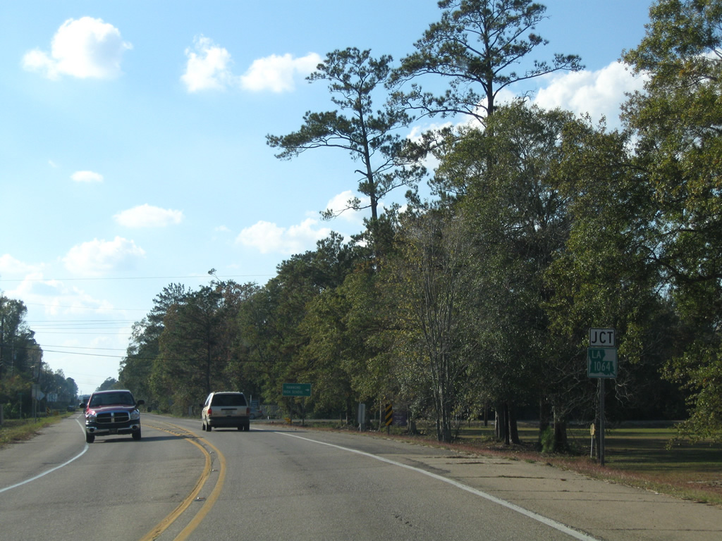
| LA 1064 begins from U.S. 190 west and follows River Road north to a merge with LA 443 (Morris Road). 11/20/08 |
|
| LA 1064 comprises a 15.5 mile loop around the north side of Hammond between U.S. 190 and U.S. 51 at Natalbany and west from there to LA 43 in Livingston Parish. 11/20/08 |
|
| U.S. 190 leaves the intersection with LA 1064 and continues west to Coburn and the outer suburbs of Hammond. 11/20/08 |
|
| U.S. 190 west enters the Hammond city limits at the intersection with Industrial Park Road. Hammond Municipal Airport (HDC) appears on the north side of the US route. 11/20/08 |
|
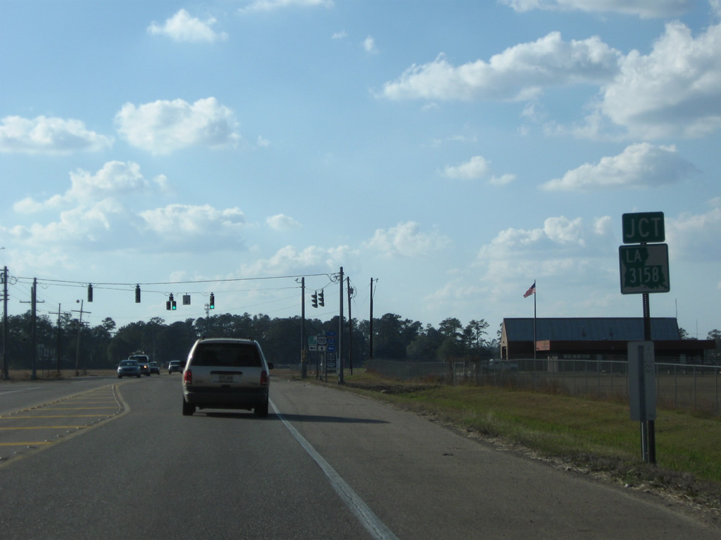
| LA 3158 (Airport Road) intersects U.S. 190 on the south side of the airport. 11/20/08 |
|
| LA 3158 connects U.S. 190 and Hammond Municipal Airport (HDC) with Interstate 12 at Exit 42. The state highway totals 2.3 miles. 11/20/08 |
|
| U.S. 190 prepares to split into a one way street couplet as it meets the south end of LA 443 (Morris Road). 11/20/08 |
|
| LA 443 leads 8.3 miles northeast from Hammond to LA 40 south of Loranger. 11/20/08 |
|
| U.S. 190 splits with westbound following Thomas Street to downtown Hammond. Eastbound traffic utilizes Morris Avenue one block to the south. 11/20/08 |
|
| LA 1065 follows Cherry Street south to end at U.S. 190 in downtown Hammond. Signs for the U.S. 190 and LA 1065 intersection were replaced by August 2010. 11/20/08 |
|
| LA 1065 constitutes a 11 mile loop north from U.S. 190 in Hammond to U.S. 51 south of Independence.
The error shield for U.S. 190 referencing Cherry Street south as well as Thomas Street west was corrected by 2010. 11/20/08 |
|
| U.S. 190 west at Cypress Street. Traffic lights operate at most intersections along U.S. 190 (Thomas Street) through Downtown Hammond. 11/20/08 |
|
| A Canadian National Illinois Central Railroad line bisects downtown Hammond. Cate Street parallels the east side of the tracks. 11/20/08 |
|
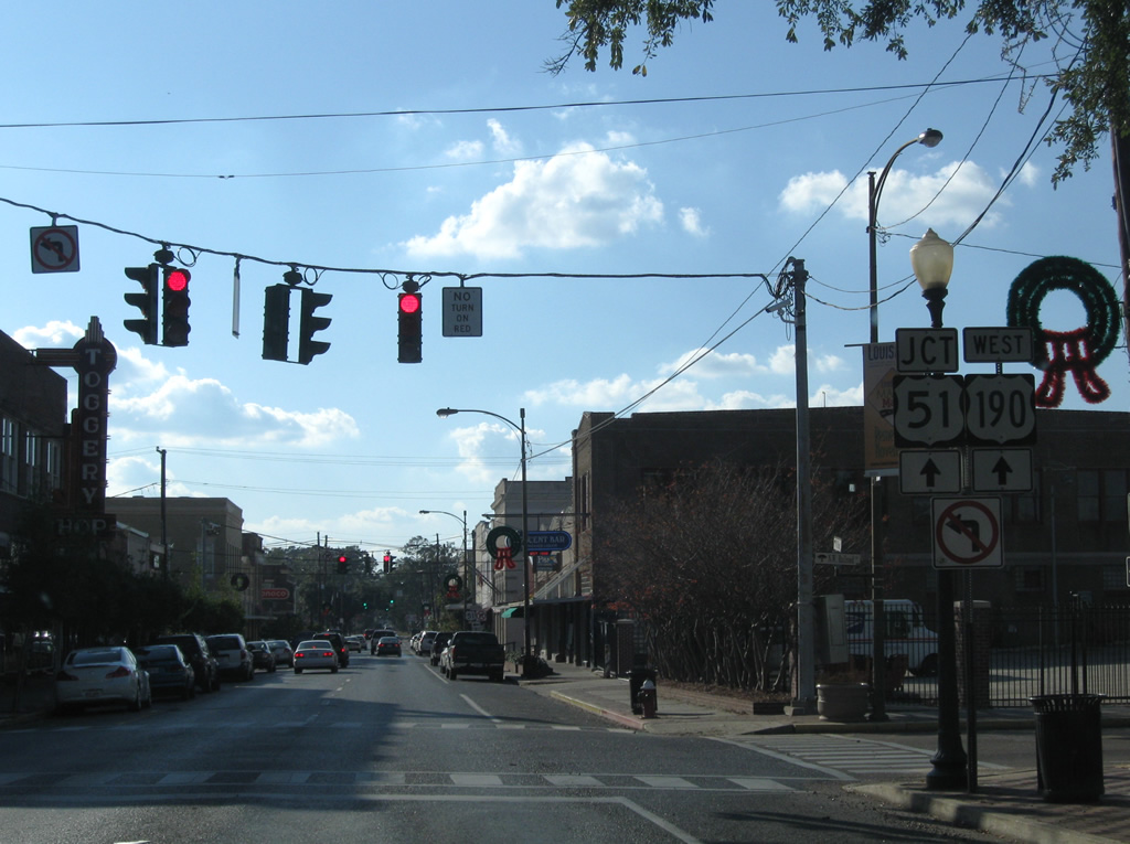
| U.S. 190 intersects Railroad Avenue, the north end of U.S. 51 Business. U.S. 51 Business southbound follows Oak Street a few blocks before combining with northbound along Railroad Avenue en route to Hammond Squre Mall and Interstate 12 (Exit 40). Signs for U.S. 51 along U.S. 190 west erroneously reference the parent route. 11/20/08 |
|
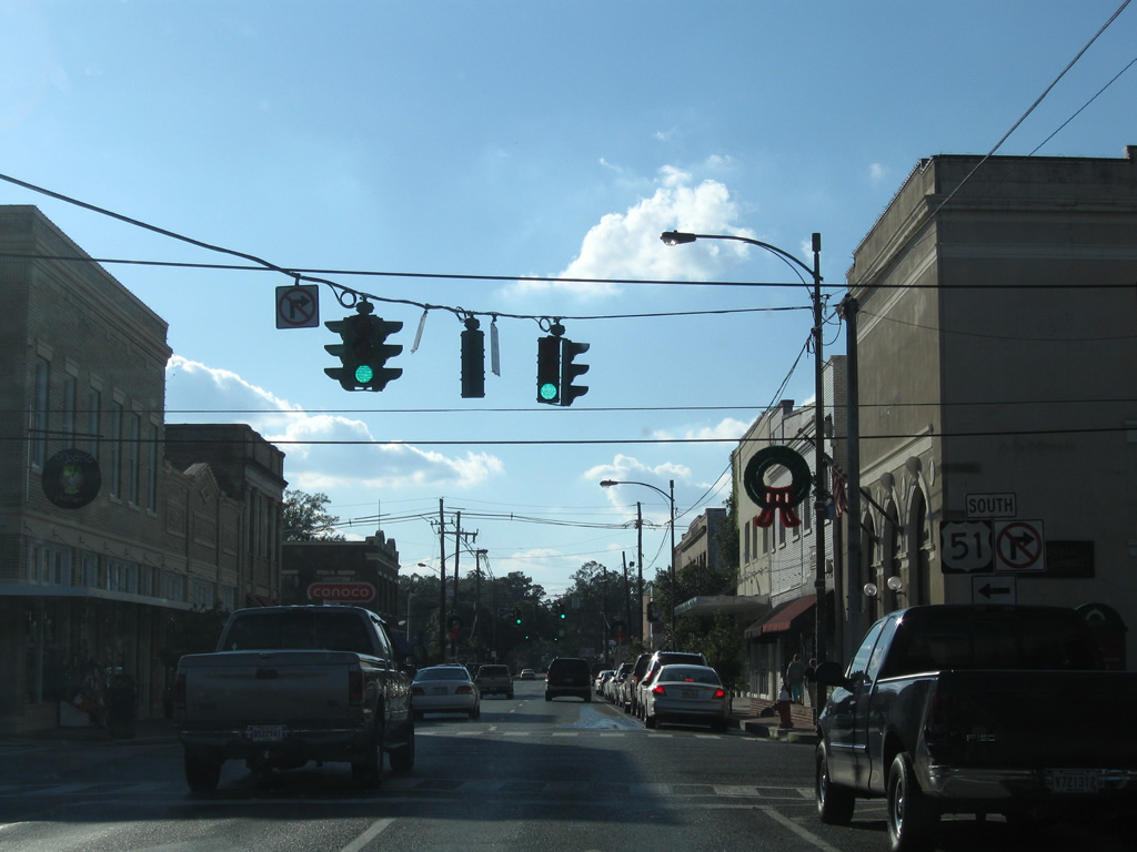
| U.S. 190 (Thomas Street) west at the southbound beginning of U.S. 51 Business (Oak Street) south. U.S. 51 Business follows old U.S. 51 between Hammond, Ponchatoula and Exit 23 of Interstate 55 for a distance of 8.6 miles. 11/20/08 |
|
| Magnolia Street intersects U.S. 190 west at this traffic light. 11/20/08 |
Page Updated 09-25-2012.

 West
West