U.S. 271 extends just 3.2 miles into Arkansas, connecting Sprio, Oklahoma with Fort Smith. Originating in Tyler, Texas, U.S. 271 travels 299 miles overall through the Lone Star state and Oklahoma before entering the Natural State.
Originally ending in Downtown Fort Smith at Towson and Garrison Avenues (U.S. 64/U.S. 71 Business), U.S. 271 was relocated twice. The second end point was located two miles south of Downtown along Towson Avenue (former U.S. 71), as U.S. 271 followed Oklahoma State Highway 9A from Arkoma into Arkansas via Y Street. The subsequent realignment shifted U.S. 271 onto a freeway from Oklahoma and then along an arterial north to meet U.S. 71 Business (former U.S. 71) in the south neighborhoods of Fort Smith.
|
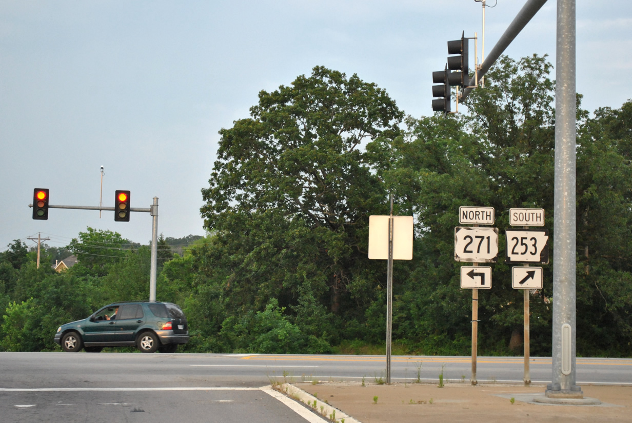
| Crossing into Arkansas and Sebastian County from Oklahoma, U.S. 271 north prepares to depart ahead. Interstate 540 will begin its 14.1 mile stint to I-40 at the diamond interchange it shares with U.S. 271 and Arkansas 253 south (Exit 14). U.S. 271 continues another 2.54 miles north to its terminus at U.S. 71 Business. Arkansas 253 stems south 2.1 miles to Arkansas 45 and Enterprise. Use Exit 14 to reach both the Port of Fort Smith and Sparks Regional Medical Center. 05/06/12 |
|
| Reaching the end of the departure ramp for Exit 14, U.S. 271 turns north toward U.S. 71 Business and Fort Smith as Arkansas 253 begins its 2.1 mile trip to Arkansas 45 at Enterprise. 05/06/12 |
|
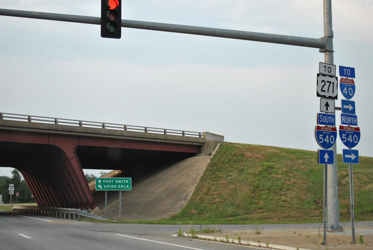
| Interstate 540 continues northeast 14.1 miles from U.S. 271 through the east side of Fort Smith and Van Buren before ending at a trumpet interchange with Interstate 40. Though signed at this interchange, Interstate 540 does not continue south as only U.S. 271 enters Oklahoma for Spiro, 12.1 miles to the southwest. 05/06/12 |
|
| North of Interstate 540, U.S. 271 consists of an undivided multi-lane arterial to its end in 2.5 miles. 05/06/12 |
|
| Harvard Avenue connects U.S. 271 with Southfield Heights subdivision to the west and Colony Woods subdivision to the east. 05/06/12 |
|
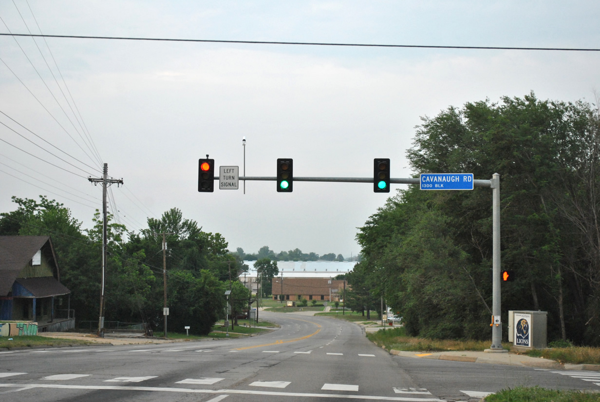
| A signal governs movements between U.S. 271 north and Cavanaugh Road. Cavanaugh Road extends west to State Line Road and east to U.S. 71 Business immediately north of Interstate 540. 05/06/12 |
|
| U.S. 271 north nears Arkansas 255 (Zero Street) to the Port of Fort Smith. Arkansas 255 represents a 17.2 mile route linking Barling with Fort Smith. 05/06/12 |
|
| Commercial trucks bound for the Port of Fort Smith should follow Arkansas 255 north along Zero Street to Wheeler Avenue. Arkansas 255 south runs tandem with U.S. 271 to its end at nearby U.S. 71 Business, where the state highway turns east to follow the bannered route towards I-540 and Barling. 05/06/12 |
|
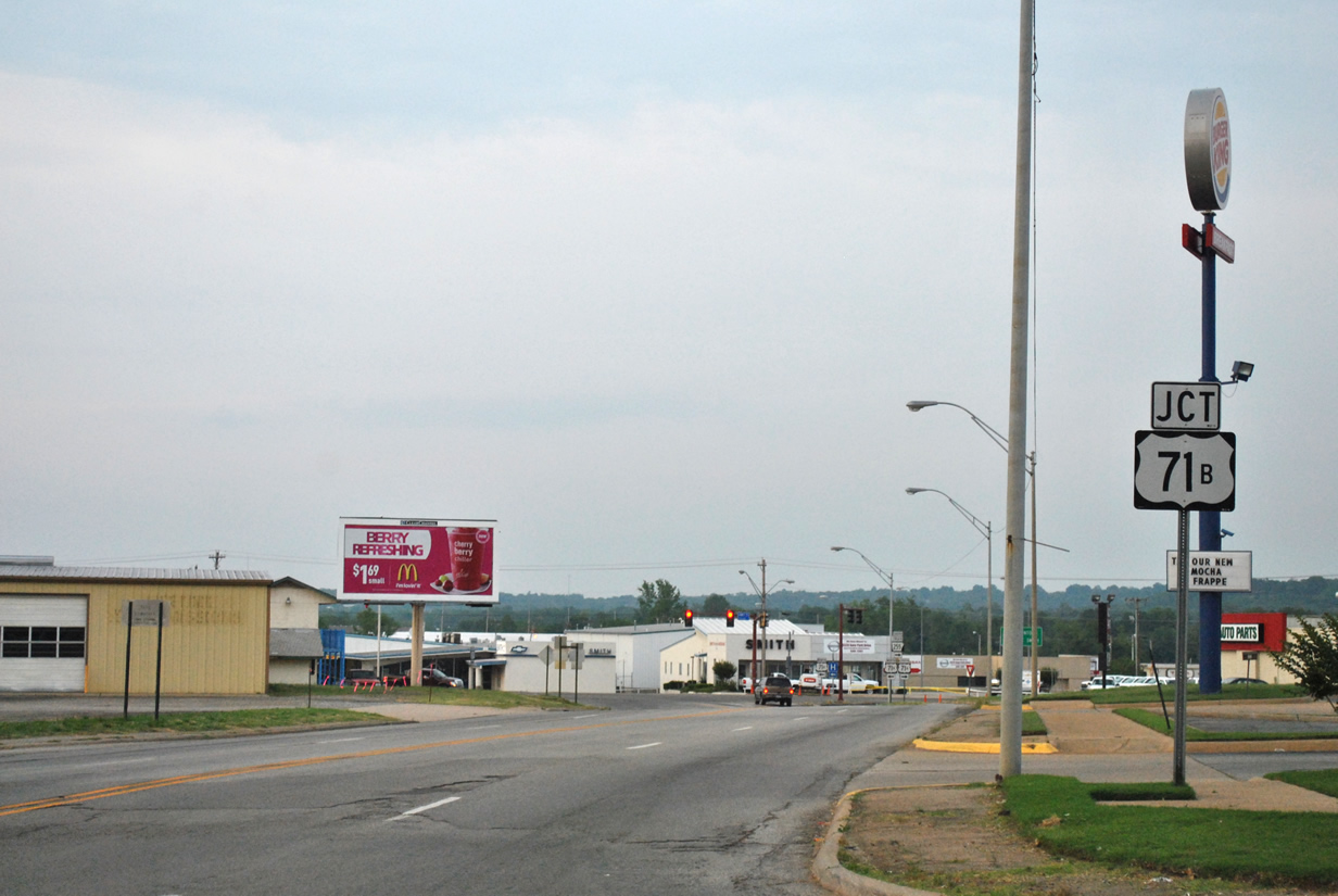
| Leaving Zero Street U.S. 271 north approaches its end at U.S. 71 Business in south Fort Smith. 05/06/12 |
|
| U.S. 71 Business runs along the former alignment of U.S. 71 through both Downtown Fort Smith and Van Buren as the parent highway follows Interstate 540 to Interstate 40 east. Arkansas 255 follows U.S. 71 Business south 0.6 miles before the bannered route spokes southeast. 05/06/12 |
|
| Traveling a total of 299 miles from Texas, U.S. 271 quietly comes to an end. Motorists heading to Downtown Fort Smith should use U.S. 71 Business north (Towson Avenue). Also use U.S. 71 Business north to reach Sparks Regional Medical Center. 05/06/12 |
|
| U.S. 271 south leaves Fort Smith and Interstate 540 for Oklahoma and Spiro. The freeway segment will end following the upcoming interchange with Oklahoma 112. 05/06/12 |
|
| Oklahoma 112 south will join U.S. 271 in one half mile for a 2.3 mile overlap. Oklahoma 112 north continues another five miles to the town of Arkoma and the Arkansas state line. 05/06/12 |
|
| U.S. 271 reaches the Oklahoma state line on its final approach to the interchange with OK 112. The U.S. highway will travel 159.6 miles through the Sooner state, entering Spiro, Poteau, Clayton and Antlers en route to Hugo near the Texas border. 05/06/12 |
Page Updated 06-20-2014.

 North
North