|
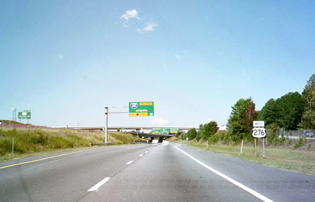
| U.S. 276 splits with I-385 north and extends the freeway from I-26 outside Clinton to the Mauldin city center. This stretch provides access from I-385 north to both Standing Springs Road (Exit 30) and I-185 north along the Southern Connector. 10/15/01 |
|
| Two lanes depart the left side of U.S. 276 west for Interstate 185 north. The Southern Connector opened on February 27, 2001 west from Mauldin and I-85 near Gantt. The toll road provides an alternate route to I-85 south for Atlanta and U.S. 29 south for Anderson. 10/15/01 |
|
| Leaving Interstate 85, U.S. 276 rises to the signalized intersection with Duvall Drive west. Duvall Drive extends west from Laurens Road as a frontage road to I-85. 08/07/13 |
|
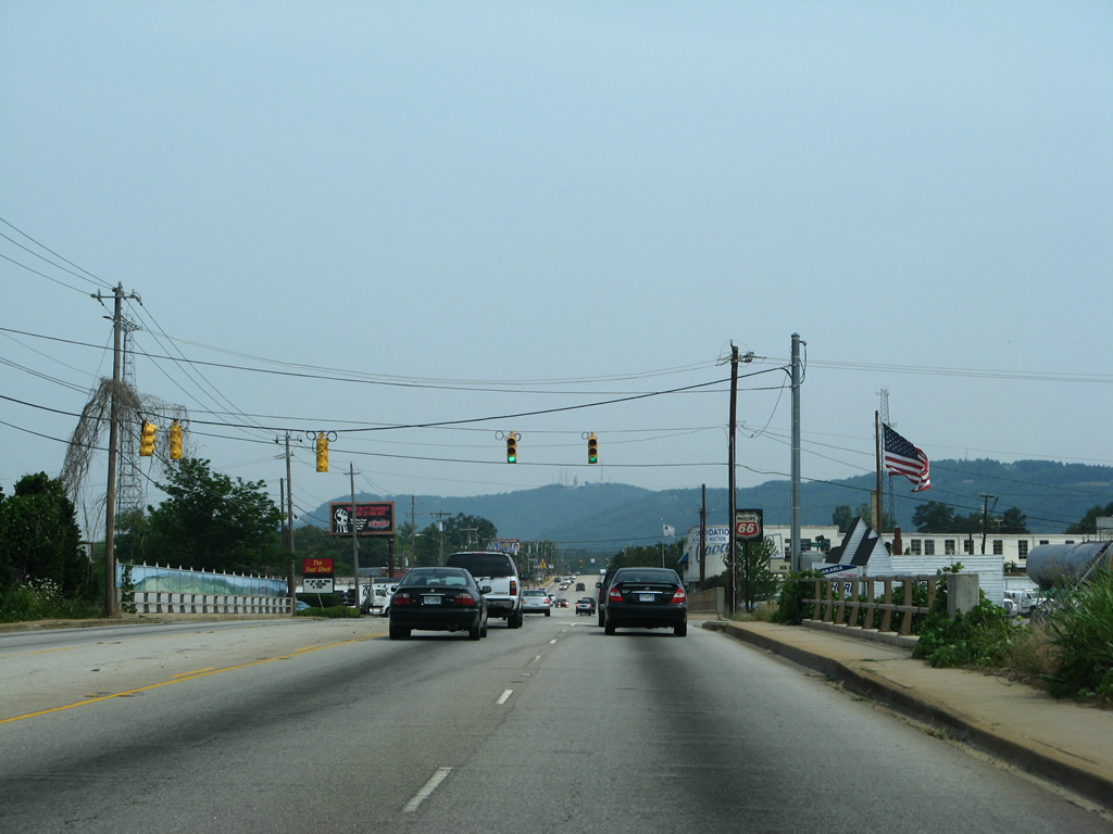
| U.S. 276 travels along Laurens Road in Greenville to the Nicholtown neighborhood and diamond interchange with Interstate 385. This trailblazer preceded the former on-ramp to I-385 south opposite Richland Way. 2001-04 widening of I-385 realigned the southbound entrance ramp slightly north across Richland Creek. 10/15/01 |
|
| Business Spur I-385 was acknowledged at the previous entrance ramp to I-385 south for Mauldin and Columbia. The unmarked business route extends 0.447 miles west from the exchange with U.S. 276 along E North Street to U.S. 29 (Church Street) at Downtown. All references to the business route were removed during construction in Fall 2003. 10/15/01 |
|
| Button copy signs along U.S. 276 (Laurens Road) at the north end of I-385. U.S. 123 (Academy Street) begins from North Street nearby and loops around Downtown en route to Easley. All guide signs at the exchange with I-385 were removed during 2001-04 road work. 10/15/01 |
|
| Curving westward along Stone Avenue from the Greenline-Spartanburg neighborhood, U.S. 276 meets U.S. 29 (Church Street) at a grade separated intersection. Column Street (U.S. 29 Connector) links the two highways. Church Street leads U.S. 29 southwest through the business district. U.S. 29 overtakes Wade Hampton Boulevard a short distance northward en route to Taylors and Greer. 07/23/04 |
|
| U.S. 276 turns northward onto Rutherford Street from Stone Avenue at the Viola Street neighborhood of Greenville. Rutherford Street takes U.S. 276 north to Shaw Street west and Poinsett Highway. Rutherford Road branches northeast to Brutontown. 05/31/07 |
|
| Paris Mountain lines the northern horizon on U.S. 276 (Poinsett Highway. 05/31/07 |
|
| Passing by the Park Place community along U.S. 276 (Poinsett Highway) west at Hammett and Henry Streets. 05/31/07 |
|
| The frontage becomes more industrial as U.S. 276 nears a Norfolk Southern Railroad underpass. 05/31/07 |
|
| Loop Street spurs east from U.S. 276 (Poinsett Highway) at the NS Railroad bridge. 05/31/07 |
|
| Furman Hall Road branches northeast from U.S. 276 at Toledo Street to S.C. 291 (Pleasantburg Drive). 05/31/07 |
|
| Crossing a CSX Railroad, U.S. 276 (Poinsett Highway) approaches the signalized entrance to Cherrydale Point shopping center opposite Furman Road south. 05/31/07 |
|
| S.C. 291 concludes its 11.4 mile route via State Park Road west from Pleasantburg Drive and S.C. 253 to U.S. 276 (Poinsett Highway). 05/31/07 |
|
| Blue Ridge Drive ties into U.S. 276 at State Park Road (S.C. 291) from the west. The arterial route doubles as S.C. 253, which is unsigned here, to Riverside and S.C. 124 west to Easley. 05/31/07 |
|
| Continuing north along U.S. 276 (Poinsett Highway) west at Perry Road. 05/31/07 |
|
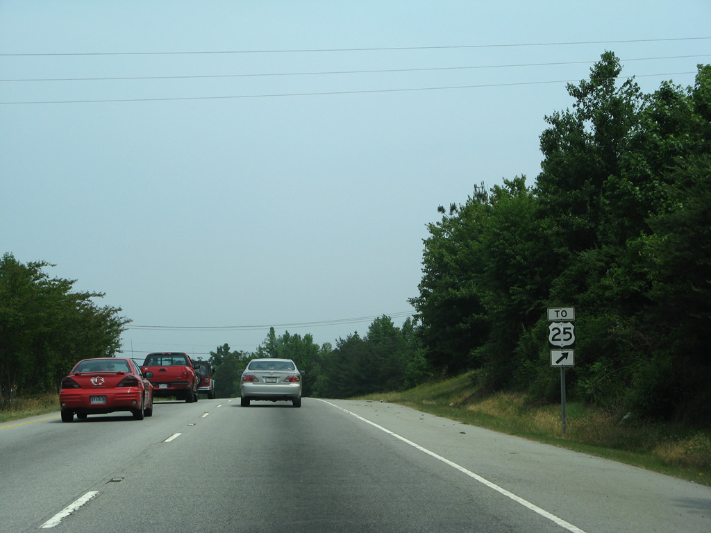
| McMakin Drive leads west from U.S. 276 opposite a Lowe's entrance to an adjacent neighborhood and Tindall Road. A distance sign posted at McMakin Drive includes the distance to Asheville for U.S. 25 north. U.S. 25 Business used to overlap with U.S. 276 from north of Downtown to Travelers Rest. 05/31/07 |
|
| U.S. 276 is a five lane commercial boulevard north to Bruce Lake. 05/31/07 |
|
| Galloway Drive and a shopping center entrance precede the modified diamond interchange with Old Buncombe Road along U.S. 276 west. 05/31/07 |
|
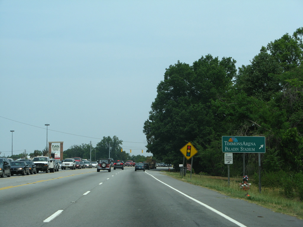
| Old Buncombe Road links U.S. 276 with Duncan Chapel Road west to Timmons Arena and Paladin Stadium at Furman University. The former alignment of U.S. 276, Old Buncombe Road parallels U.S. 276 to the north and heads south to Sans Souci. 05/31/07 |
|
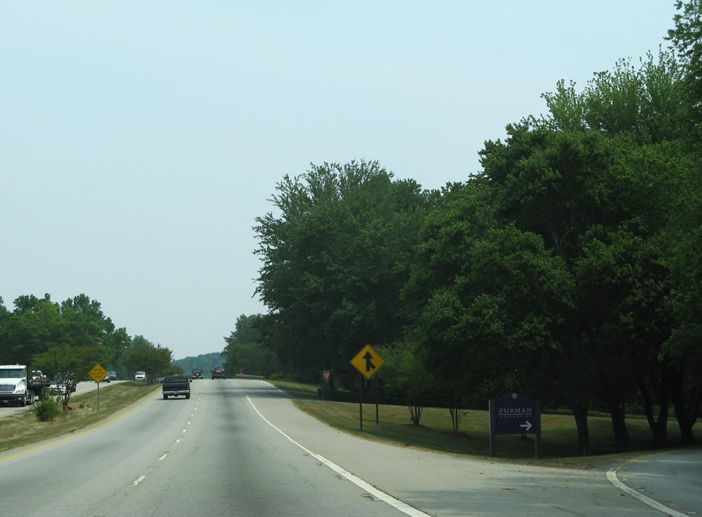
| U.S. 276 (Old Poinsett Highway) travels along the east side of Furman University along an expressway, connecting with the campus via a trumpet interchange and access road. 05/31/07 |
|
| Old Buncombe Road returns to U.S. 276 at Roe Ford Road south of Travelers Rest. A frontage road extends north from the former U.S. 276 to Altamont Road onto nearby Paris Mountain. 05/31/07 |
|
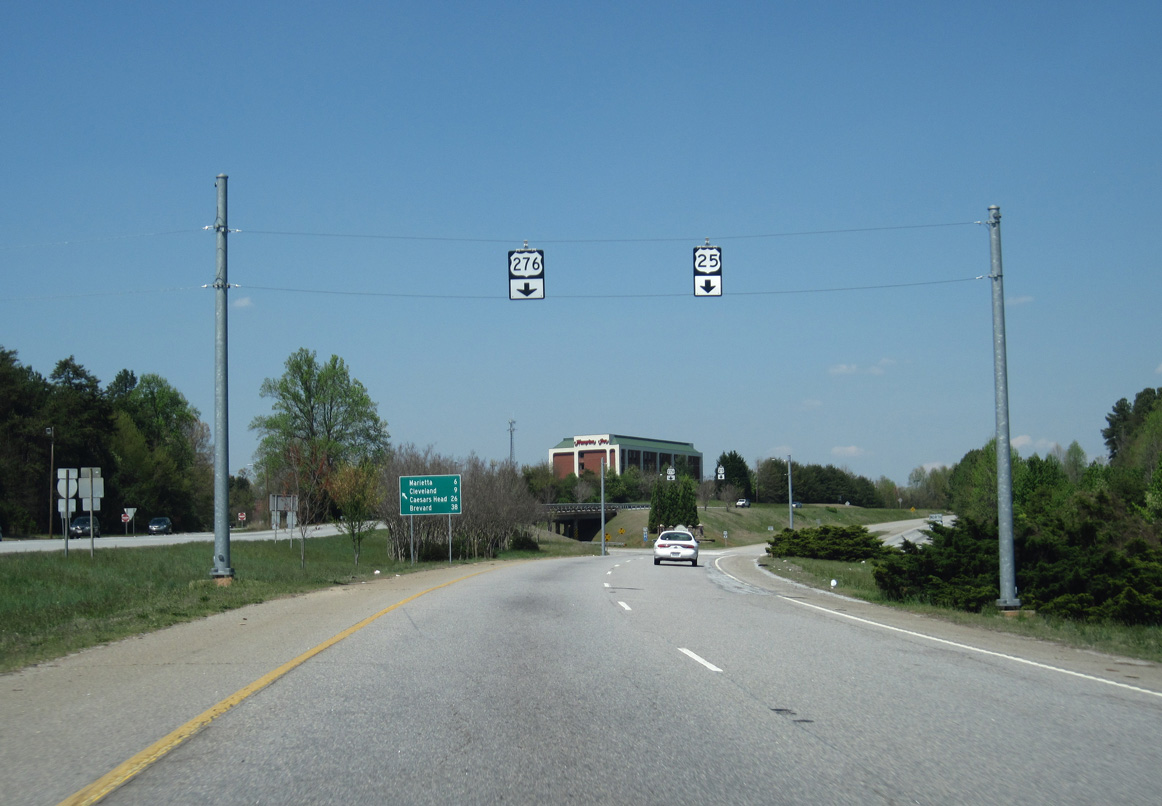
| U.S. 276 overtakes Old Buncombe Road northward to the merge with U.S. 25 at Travelers Rest. 05/31/07 |
|
| U.S. 276 west and U.S. 25 north combine at a wye interchange just outside the Travelers Rest city limits. 05/31/07 |
|
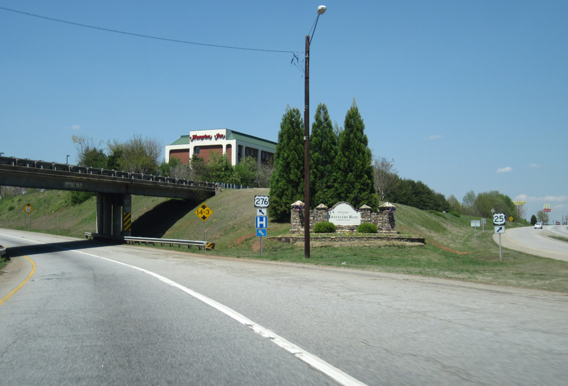
| U.S. 25 north and U.S. 276 west parallel one another on separate roadways into Travelers Rest. 04/12/14 |
|
| U.S. 276 continues nine miles from U.S. 25 at Travelers Rest to Cleveland and 26 miles to Caesars Head, the highest point in the state. 04/12/14 |
|
| U.S. 25 takes over Poinsett Highway from U.S. 276 and leads northward from Travelers Rest to Lima and the North Carolina state line south of Flat Rock. 04/12/14 |
|
| U.S. 25 travels partly as an expressway from U.S. 276 to North Carolina and as a full freeway from the state line to Interstate 26 at East Flat Rock. U.S. 276 proceeds north into Downtown Travelers Rest. 04/12/14 |
|
| U.S. 276 transitions onto a three-lane boulevard with on-street parking along Main Street through the city of Travelers Rest. The succeeding traffic light is with Roe Road. 04/12/14 |
|
| U.S. 276 (Main Street) west at McElhaney Road west and Center Street east in Travelers Rest. 04/12/14 |
|
| Succeeding traffic lights operate along U.S. 276 (N Main Street) at Henderson Drive / Gateway Park and Travelers Rest High School. 04/12/14 |
|
| Leaving Travelers Rest, U.S. 276 follows Geer Highway from Renfrew to the west end of S.C. 414. S.C. 414 (Bates Crossing Road) meanders nine miles east to Tigerville and 17.26 miles overall to S.C. 14. 04/12/14 |
|
| Crossing the North Saluda River, U.S. 276 (Geer Highway) enters the community of Marietta. 04/12/14 |
|
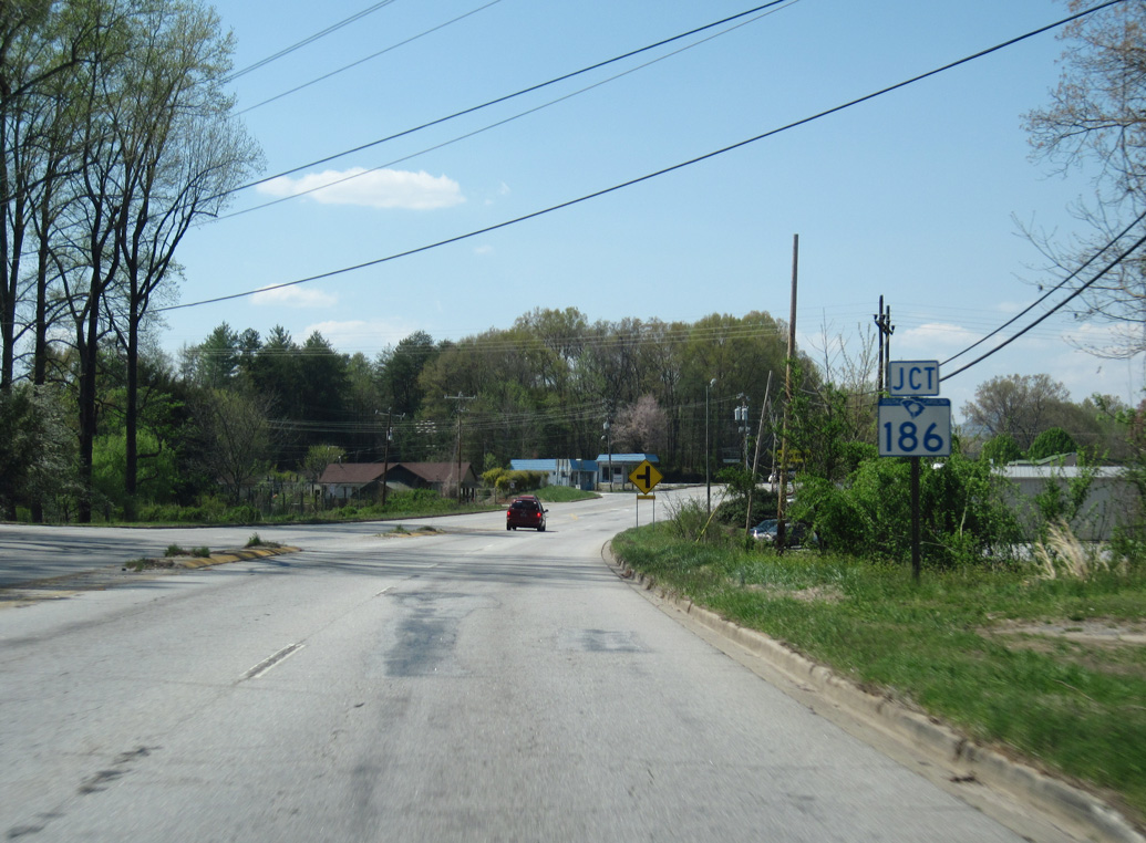
| S.C. 186 (Dacusville Road) is the second of three state highways intersecting U.S. 276 along a 1.5 mile stretch. S.C. 186 provides one of two routes between Marietta and Pickens. 04/12/14 |
|
| S.C. 186 (Dacusville Road) winds 4.36 miles southwest from U.S. 276 to the Pickens County line. The state highway travels 14.96 miles overall to S.C. 8, west of Dacusville. 04/12/14 |
|
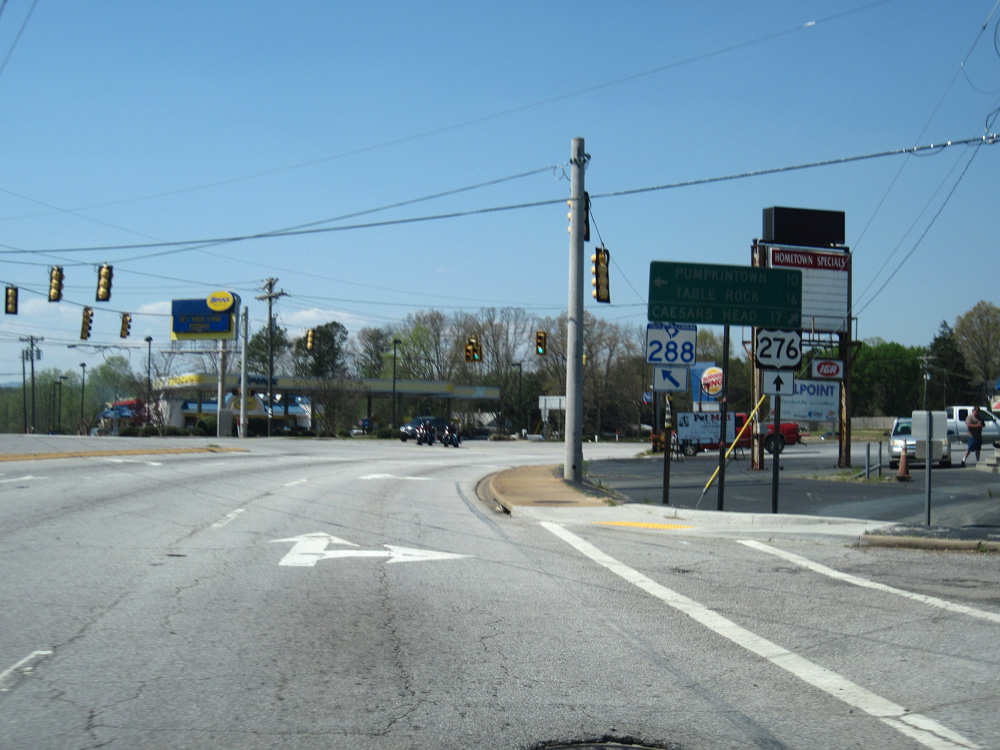
| S.C. 288 (Pumpkintown Road) branches west from U.S. 276 (Geer Highway) at Marietta ten miles to Pumpkintown. 04/12/14 |
|
| Traffic lights were added at the east end of S.C. 288 after 2004. The state highway runs 15.07 miles west to U.S. 178 near Table Rock. 04/12/14 |
Page Updated 08-26-2019.

 West
West