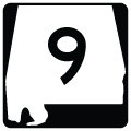
Alabama State Route 9 travels 273.07 miles north from the Florida state line at Florala to Georgia state line east of Cedar Bluff and Farill. The southern 100.47 miles of SR 9 constitutes the unsigned counterpart of U.S. 331. U.S. 331 extends north from DeFuniak Springs, Florida to Opp, Luverne and U.S. 80/82-SR 21 (South Boulevard) in Montgomery.
Alabama State Route 9 Guides
SR 9 encircles Montgomery along an unmarked overlap with U.S. 80-82/SR 21 (South Boulevard) east for 3.90 miles to U.S. 231. U.S. 82 turns east toward Union Springs while U.S. 231 joins U.S. 80-SR 9/21 north along Eastern Boulevard. Unsigned SR 9/53 overlap with U.S. 231/SR 21 north for 11.47 miles to the Elmore County seat of Wetumpka.
Measuring 149.59 miles in length, the signed portion of SR 9 emerges from U.S. 231/SR 21-53 along Central Plank Road on the north side of Wetumpka. SR 9 heads northward to Goodwater in Coosa County and northeast to the Clay County seat of Ashland. Traversing areas of Talladega National Forest east of Horseblock Mountain, SR 9 meets U.S. 431 at Hollis Crossroads in Cleburne County.
Entering the Cleburne County seat of Heflin, SR 9 connects with Interstate 20 at Exit 199 before combining with U.S. 78 south of Downtown. U.S. 78/SR 9 overlap 4.27 miles west to Old Davisville in Calhoun County. Resuming a northward course, SR 9 parallels the Choccolocco Mountains to White Plains and Piedmont. Continuing north into Cherokee County, SR 9 crosses Coloma Mountain to Ellisville en route to the county seat of Centre.
SR 9/68 overlap 5.23 miles northeast from Centre across Weiss Lake to the town of Cedar Bluff. Beyond their separation, SR 9 heads 9.30 miles east to Farill south of Bogan Mountain and to the state border where Georgia State Route 20 takes over en route to Rome.
Connect with:
Interstate 20
U.S. 78
U.S. 231
U.S. 280
U.S. 411
U.S. 431
State Route 21
State Route 22
Page Updated 08-24-2022.
