Baldwin County Road 112 (Old Pensacola Road) traverses large swaths of pine forest along a 32 mile course between U.S. 31 near Bay Minette and the Florida state line west of Muscogee. The east end of CR 112 transitions to Escambia County Road 184 east to Cantonment.
Plans announced in May 2004 extended Alabama State Route 181 southward 16 miles from U.S. 90 at Malbis to U.S. 98 near Weeks Bay. SR 181 overtook Baldwin County Road 27 (Belforest Road), a rural two lane highway. Four-laning of the Belforest Road to arterial standards commenced in Fall 2009. Expansion accommodated growing commuter traffic on SR 181 between Interstate 10 and County Road 64.
The state of Alabama took over maintenance of CR 27 between U.S. 90 and the CR 27 eastern turn north of Turkey Branch in a mileage swap with Baldwin County. Baldwin County accepted responsibility for maintenance of the entire route of SR 112 in exchange.1 As of early 2006, shields for SR 112 at U.S. 31 were replaced with County Road 112 markers.
|
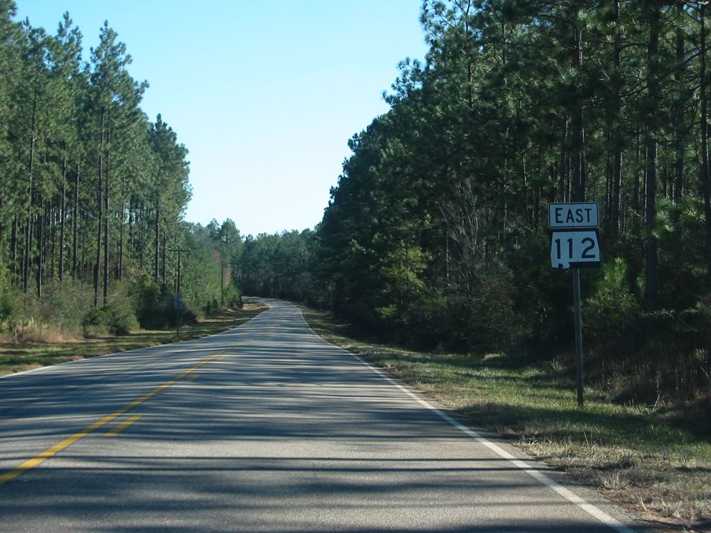
| CR 112 begins and heads east from U.S. 31 (East 2nd Street) near the Bay Minette city line. The first shield for SR 112 was replaced by CR 112 by early 2006. 02/08/06, 06/14/04 |
|
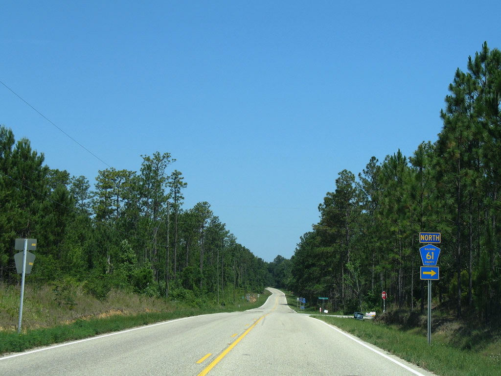
| Nearing the west of Phillipsville Road Extension (CR 61) east of Bay Minette. CR 61 loops east then north through Phillipsville before ending at U.S. 31 near Perdido. 03/20/09 |
|
| Eastbound CR 112 at the northbound beginning of CR 61. CR 61 follows Phillipsville Road north from the Dyas Creek crossing to U.S. 31. The county road resumes north from Perdido to Lottie, Redtown, and Blacksher. 03/20/09 |
|
| Continuing southeast from CR 61 (Phillipsville Road Extension) through undeveloped pine forest land near Hollinger Creek. 03/20/09 |
|
| The next intersection of importance along CR 112 is with CR 64 west of Gateswood. CR 64 leads south to Exit 53 of Interstate 10 near Rosinton. 03/20/09 |
|
| CR 64 travels along Wilcox Road across Interstate 10 before turning west along Rosinton Road to Loxley. 03/20/09 |
|
| A look at the same intersection and the previous set of shields posted for CR 64 and Interstate 10. 03/23/02 |
|
| CR 112 marker, and the SR 112 shield it replaced, posted after the junction with CR 64. 14 miles separate the intersection with the Escambia County line. 06/07/06, 12/20/03 |
|
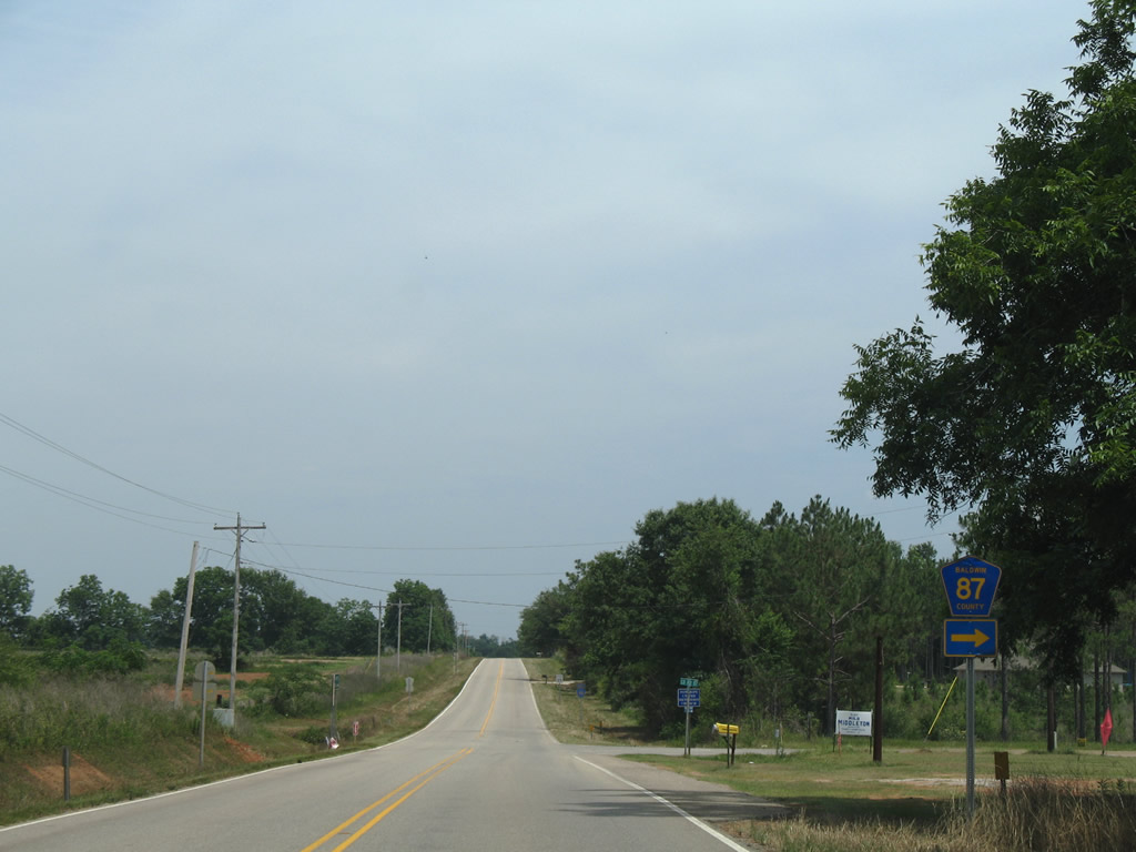
| East of Gateswood, CR 112 eastbound motorists approach the north end of CR 87. 06/07/06 |
|
| CR 87 leads south through pine forest land to meet U.S. 90 at Elsanor. 06/07/06 |
|
| Leaving CR 87, CR 112 continues toward the Magnolia Farms community and Pensacola, Florida. 06/07/06 |
|
| CR 112 crosses the Perdido River into the state of Florida, transitioning to Escambia County 184 eastbound en route to Muscogee. 03/20/09 |
|
| Escambia County 184 transitions into CR 112 at the Perdido River border between Alabama and Florida across a 1960-built concrete bridge. 06/05/06 |
|
| What was left of a Welcome to Alabama sign posted along CR 112 beyond the Perdido River crossing. 06/05/06 |
|
| CR 112 westbound reassurance marker posted between the river and Champion Paper Road. The first 26 miles of the county road are vastly undeveloped, with just a handful of homes and churches along the forested highway. 06/05/06 |
|
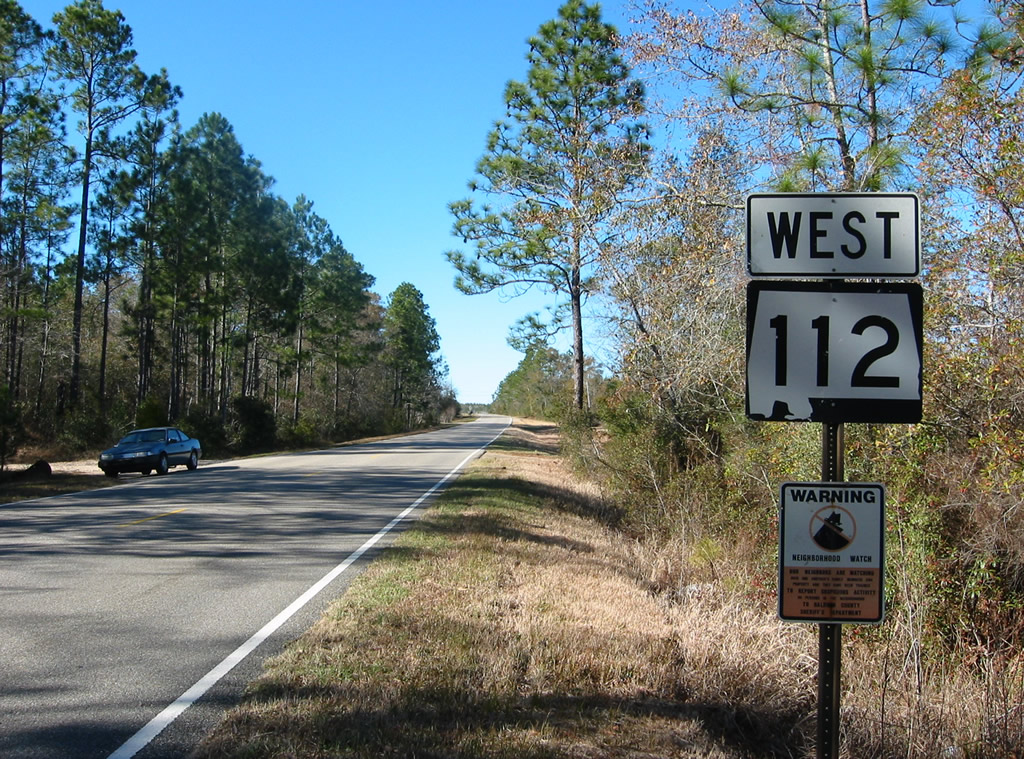
| A look at the former SR 112 westbound shield posted west of the Perdido River. 12/20/03 |
|
| Nearing the north end of CR 87 on CR 112 westbound. 06/05/06 |
|
| CR 87 travels southward through pine forest land to U.S. 90 at Elsanor. The county highway eventually reaches the eastern outskirts of Elberta and U.S. 98 before ending at CR 20 north of Hammock Bay. 06/05/06 |
|
| Continuing northwest along CR 112 toward the rural settlement of Gateswood. 06/05/06 |
|
| The next connection between CR 112 and the rest of the county highway network is with CR 64. 06/05/06 |
|
| CR 64 begins and heads south to Exit 53 of Interstate 10 and west from there to Rosinton and Loxley. Truck Route 17 stems west from the county highway nearby to Steelwood Lake in northern Loxley. 06/05/06 |
|
| Westbound reassurance shields for SR 112 and CR 112 posted after CR 64. 06/05/06, 03/23/02 |
|
| Much of the forest land situated along CR 112 is maintained by paper companies. Drivers pass by a dozen or so local or forest roads on the otherwise empty stretch between Gateswood and CR 61 (Phillipsville Road Extension). 06/05/06 |
|
| Still several miles out from Bay Minette, CR 112 meets CR 61 (Phillipsville Road Extension) north. CR 61 initially heads east and crosses Dyas Creek near the Florida state line before turning north to Phillipsville. 06/05/06 |
|
| CR 61 parallels the Perdido River along Phillipsville Road from Dyas Creek to U.S. 31. Multiple branches of the county road exist north of U.S. 31 at Perdido as well. 06/05/06 |
|
| Approaching the western terminus of Baldwin 112 (Old Pensacola Road) within eastern reaches of Bay Minette. 02/08/06 |
|
| U.S. 31 mirrors the course of Interstate 65 to the east between Bay Minette and Atmore. The US route carries light traffic over rolling hills northeast from Baldwin County Road 112. Westward, U.S. 31 travels 1.4 miles along 2nd Street to Courthouse Square in Downtown Bay Minette. 02/08/06 |
Page Updated 01-22-2010.