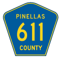
County Road 611 represents one of the three main routes connecting St. Petersburg with Clearwater in Pinellas County. Through St. Petersburg, CR 611 follows 49th Street, a four lane boulevard through residential neighborhoods north from Gulfport to unincorporated Lealman. 49th Street N widens to a six lane, divided arterial north of 38th Avenue N (CR 138). Through the city of Pinellas Park, CR 611 becomes more commercial and meets U.S. 19 at a six-ramp parclo interchange near Freedom Lake. An array of industrial parks spread northward along 49th Street N from U.S. 19 to High Point and the vicinity of St. Petersburg-Clearwater International Airport (PIE).
The tolled Gateway Expressway (SR 686A) ties into CR 611 (49th Street N) from Roosevelt Boulevard (SR 686) by PIE Aiport. CR 611 transitions onto the Bayside Bridge from there and continues across western reaches of Old Tampa Bay as an expressway to SR 60 (Gulf to Bay Boulevard). Beyond the single point interchange with Gulf to Bay Boulevard, CR 611 resumes as a six lane, at-grade arterial along McMullen Booth Road north through east Clearwater to Dellwood and Safety Harbor.
North across Lake Tarpon Canal, CR 611 meets Tampa Road (CR 572) at a grade separated interchange then shifts onto East Lake Road. Lake Road continues as a four lane, divided arterial by John Chestnut Senoir Park on Lake Tarpon and a number of golf course communities to CR 582 (Keystone Road). East Lake Road intersects Trinity Boulevard (CR 996) before crossing into Pasco County, where CR 611 becomes CR 77 (Seven Springs Boulevard) north to New Port Richey.
Pinellas County Road 611 Guides
A low bid of $1,079,024 from Brinson Construction Company of Tampa was received by the Florida State Road Department, predecessor to the Florida Department of Transportation (FDOT) for the construction of 9.3 miles of the Gulf Coast Highway from Clearwater to Pinellas Park on October 31, 1950. The alignment extended south from Gulf to Bay Boulevard (SR 60) in Clearwater to Park Boulevard in Pinellas Park. It included bridges across the south of Allen's Creek and another over Cross Bayou Canal. The project included grading and drainage for an eventual four lane highway, but paving only for a 24 foot wide, two lane highway.1
Historically, the alignment of County Road 611 on Haines Road and McMullen-Booth Road was designated as State Road 593 between SR 60 (Gulf to Bay Boulevard) and SR 580. This segment was deleted from the State Primary Road System and turned over to Pinellas County in 1973.2 49th Street through Pinellas Park and High Point was Florida State Secondary 691 by 1959. SR 691 connected U.S. 19 with SR 686 by St. Pete-Clearwater International Airport (PIE). The State Secondary designation was extended south along 49th Street to 22nd Avenue S / Gulfport Boulevard in St. Petersburg by 1973. SR 691 to the south was subsequently renamed County Road 691 by 1980. The 1989 Florida official highway map shows East Lake Boulevard as County Road 77 south from CR 582 (Keystone Road).
Bayside Bridge
Approved by Pinellas County Commissioners on February 10, 1987, the Bayside Bridge is a 2.7 mile long set of twin spans linking Pinellas Park with Clearwater over Old Tampa Bay. Costing $110 million overall, with $71 million for just the bridge, design work on the crossing commenced on January 1, 1988. Construction followed on January 30, 1991 and the Bayside Bridge opened to traffic on June 2, 1993. Funding for the span was derived from Pinellas County gasoline and sale taxes instead of state or federal transportation sources. Subsequent work expanded 49th Street North from the bridge's south end. Widening of McMullen Booth to the north however dragged on for another two years.2
The Bayside Bridge was previously incorporated in mid 1970s plans for Pinellas Parkway. The tolled expressway was envisioned north from U.S. 19 at Cross Bayou Canal to SR 586 (Curlew Road). It was rejected by voters.3 The Bayside Bridge was later proposed as the tolled 49th Street Bridge in 1979. Tolling concepts were dropped by county officials, citing potential traffic disruptions and air pollution concerns with idling vehicles at toll collection points.4
- "Tampa Firm Low Bidder on New 9.3-Mile Gulf Coast Link." St. Petersburg Times (FL), November 1, 1950.
- "Notice of Public Hearing." St. Petersburg Times (FL) Legal Notices, March 16, 1973.
- "New day dawns on Bayside Bridge." Tampa Bay Times (FL), June 2, 1993.
- "Bayside Bridge finally opens - The new span will provide long-awaited relief for thousands of commuters." Tampa Tribune, The (FL), June 2, 1993.
Connect with:
U.S. 19
State Road 60
State Road 580
State Road 686 - East Bay Drive / Roosevelt Boulevard
State Road 688 - Ulmerton Road
State Road 694 / County Road 694
Pasco County Road 77
Pinellas County Road 202 - 54th Avenue N
Pinellas County Road 216 - 62nd Avenue N
County Road 296 - Bryan Dairy Road
Page Updated 02-28-2022.
