SR 82 meanders west from SR 52 (Kennett Pike) across hilly terrain associated with the Appalachian Piedmont to Mt. Cuba, Ashland and Yorklyn in northern New Castle County. Campbell Road leads the state route west from Kennett Pike and Kirk Road to a causeway across Hoopes Reservoir and New London Road. SR 82 then arcs southward along New London Road to Pyles Ford Road and Mt. Cuba.
Paralleling Red Clay Creek and the Wilmington & Western Railroad, the rest of SR 82 lines Creek Road to the Ashland Nature Center, Yorklyn and Auburn Heights Preserve. SR 82 becomes PA 82 en route to Southridge and the borough of Kennett Square.
Established by 1936, together with PA 82, the multi state route travels 37.14 miles overall to PA 23 in Elverson. Construction in 2000-01 made small geometric improvements and added small shoulders to improve the safety of the scenic state route.
SR 82 was incorporated into the Red Clay Valley Scenic Byway in 2004. The Red Clay Valley Scenic Byway Alliance completed a corridor management plan in 2008 to help preserve attributes of the byway. One of the recommendations under consideration was the delisting of State Route 82 in order to help protect the intrinsic qualities of the byway. A 30-day Virtual Public Workshop, underway on March 4, 2010, collected public comment on the proposal to declassify SR 82. Of the 120 responses, 75% indicated opposition to the removal of the state route designation. Opponents cited the value of the designation when giving directions to area visitors.1
The high accident rate at SR 52 (Kennett Pike) and SR 82 (Campbell Road) placed the intersection within the Highway Safety Improvement Program (HSIP). An intersection improvement project added a separate left turn lane and shared right turn and through lane along both directions of SR 52 at SR 82 north and Kirk Road east. Work started in spring 2013 and was completed in 2014.
Delaware State Route 82 - 2015 Annual Average Daily Traffic (AADT)
- 2,582 - SR 52 to Owls Nest Road
- 1,849 - Pyles Ford Road to Mt. Cuba Road
- 2,521 - Mt. Cuba Road to Yorklyn Road
- 1,177 - Yorklyn Road to Pennsylvania state line
|
| Kirk Road leads 0.77 miles west from SR 100 (Montchanin Road) by Wilmington Country Club golf course to SR 52 (Kennett Pike) and SR 82 (Campbell Road). 12/18/17 |
|
| Northbound SR 82 begins across SR 52 (Kennett Pike) from Kirk Road. 12/18/17 |
|
| Kirk Road west at the intersection of SR 52 (Kennett Pike) and SR 82 (Campbell Road) prior to the SR 52 & SR 82 Intersection Improvements project. 12/22/12 |
|
| A begin shield was added for SR 82 at Campbell Road and SR 52 (Kennett Pike) in 2017. 12/18/17 |
|
| SR 82 (Campbell Road) runs along the north side of Valley Garden Park beyond this reassurance marker. 12/18/17 |
|
| West from Valley Garden Park, SR 82 lowers to intersect Centerville Road and cross Hoopes Reservoir along a causeway. 12/18/17 |
|
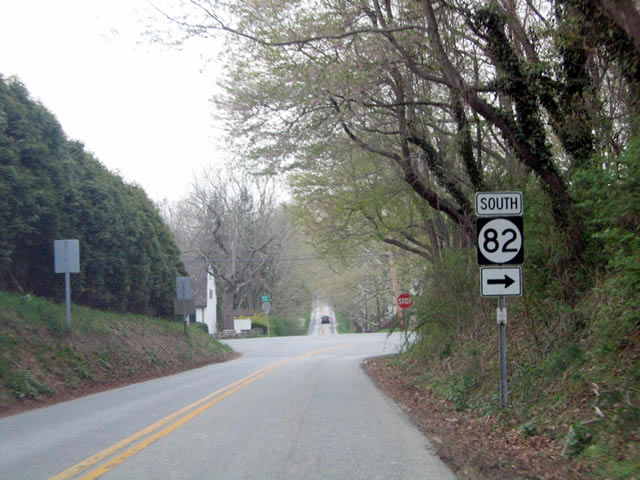
| PA 82 (Creek Road) extends SR 82 north 2.8 miles to South Street at the borough of Kennett Square. 12/19/01 |
|
| SR 82 (Creek Road) enters northern Delaware alongside Red Mill Creek. Leaving Auburn Heights Preserve, the state route enters the community of Yorklyn. Yorklyn Road stems southwest to SR 41 at Hockessin. 12/19/17 |
|
| Resuming a course alongside Red Mill Creek, SR 82 (Creek Road) continues from Yorklyn to Snuff Mill Road. 12/19/17 |
|
| A split intersection with Way Road joins SR 82 (Creek Road) beyond Ashland and ahead of this trailblazer. 12/19/17 |
|
| SR 82 (Creek Road) emerges from alongside Red Clay Creek and turns east at Mt. Cuba Road toward Hoopes Reservoir. 04/24/04 |
|
| Creek Road curves east to become Pyles Ford Road a short distance from Mt. Cuba Road. A reassurance marker for SR 82 was posted on this stretch until 2007. 04/24/04 |
|
| New London Road curves north to intersect Walnut Green Road west, Owls Nest Road north and Campbell Road east. SR 82 turns east for its final 1.2 miles here. 04/24/04 |
|
| SR 82 lowers from New London Road to cross Edgar M. Hoopes Reservoir along a two lane causeway. 04/24/04 |
|
| Crossing over Hoopes Reservoir, the municipal water supply for Wilmington, along Campbell Road east. Valley Garden Park lines the east side of the reservoir along Centerville Road. The public park was once a part of the DuPont family estate. 04/24/04 |
|
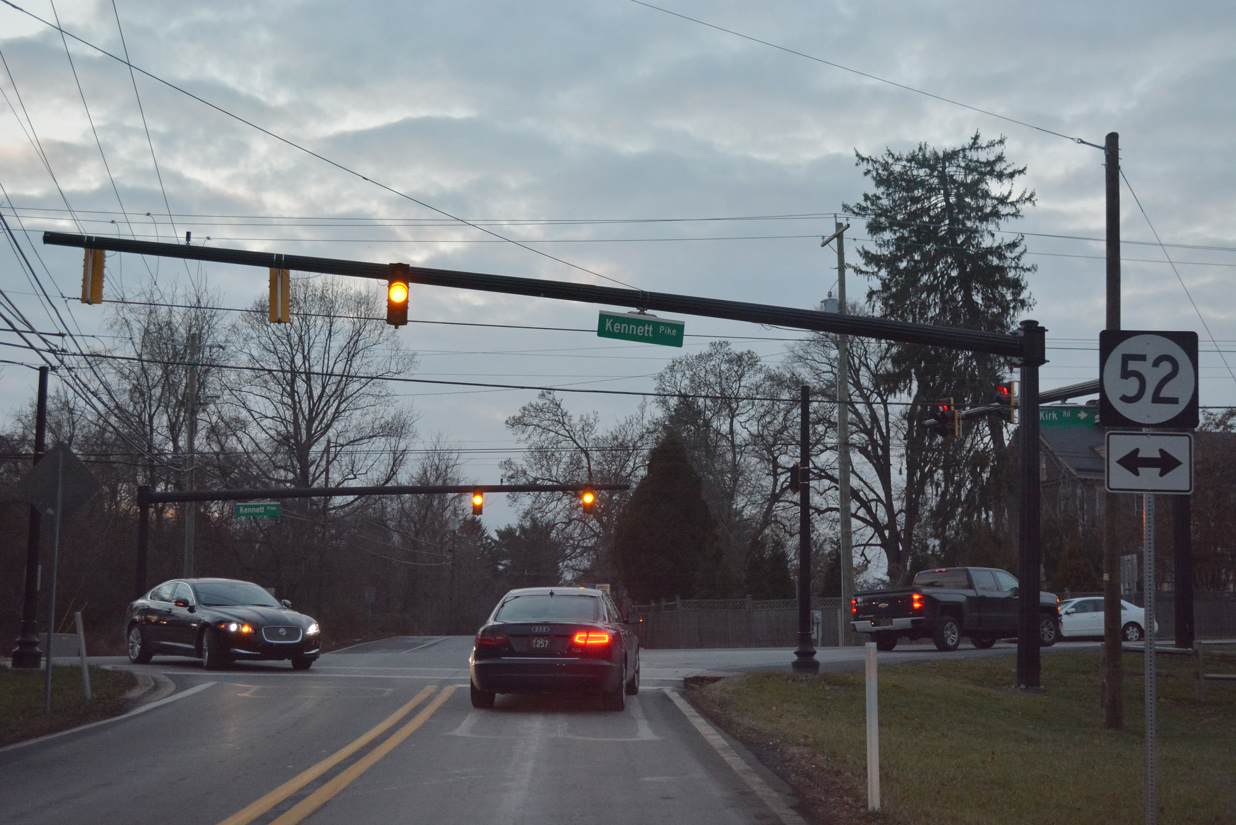
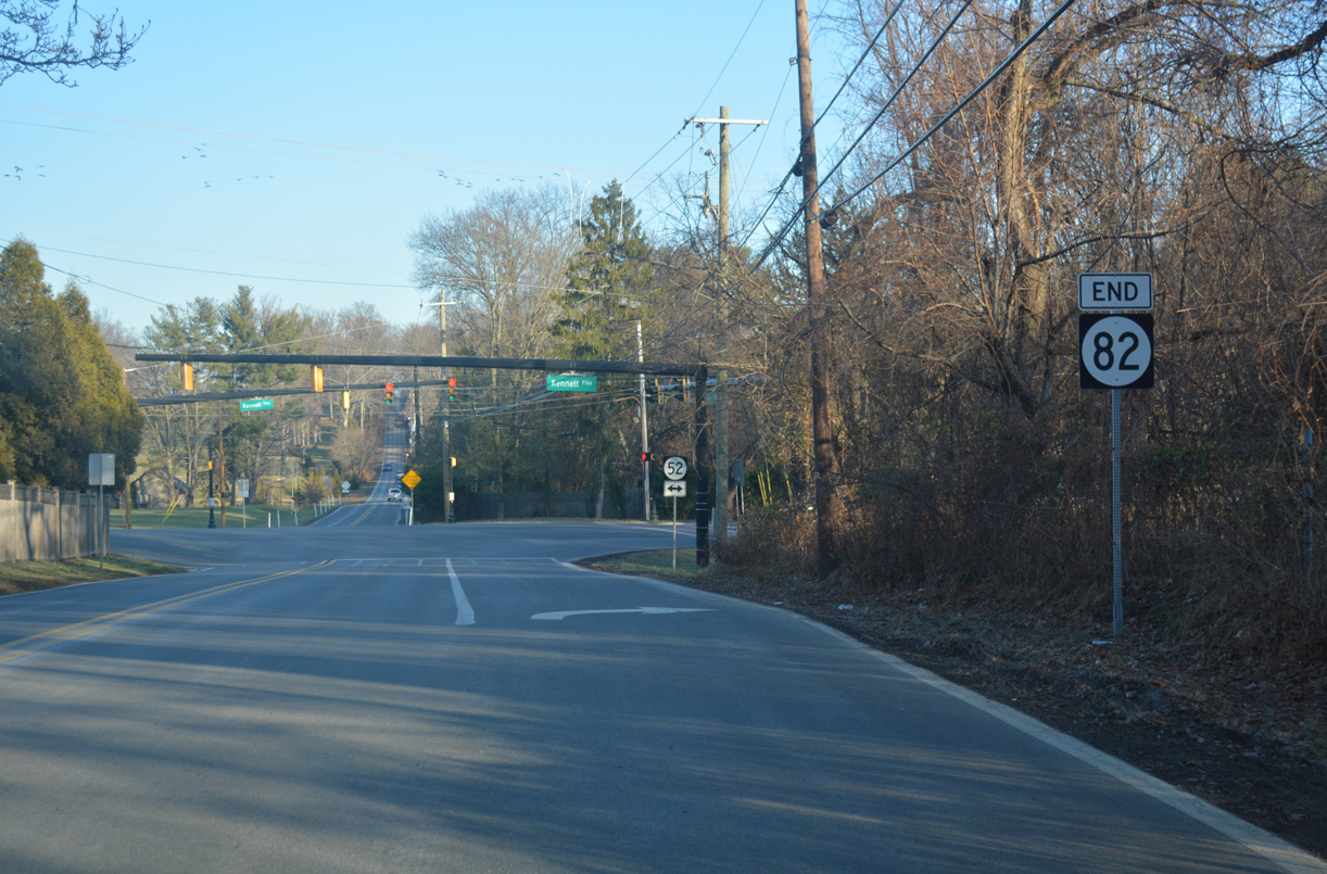
| SR 82 (Campbell Road) ends at SR 52 (Kennett Pike) and Kirk Road. 12/21/17 |
|
| SR 52 ventures north to Centerville and south to Greenville. Kirk Road links SR 82 with SR 100 at Montchanin. 12/21/17 |
|
| Centerville Road extends north from Prices Corner to Hoopes Reservoir and SR 82 (Campbell Road) by Valley Garden Park. 12/21/17 |
Sources:
- "DelDOT Responds to Public Feedback." Delaware Department of Transportation, press release. April 26, 2010.
12/19/01, 04/24/04, 12/22/12, 12/18/17, 12/19/17, 12/21/17 by AARoads
Connect with:
State Route 52
Route 82
Page Updated 12-04-2018.

 North
North