|
| SR 50 remains through Withlacoochee State Forest for another 1.3 miles north from Hernando County. 05/02/21 |
|
| County Road 478A forms a 6.40 mile rural loop west and north from SR 50 to Big Gant Lake and SR 471 at Webster. 05/02/21 |
|
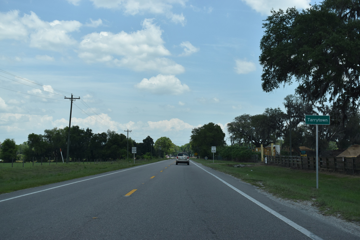
| SR 50 bee lines 1.8 miles east from Wilson Corner and CR 478A to Tarrytown. 05/02/21 |
|
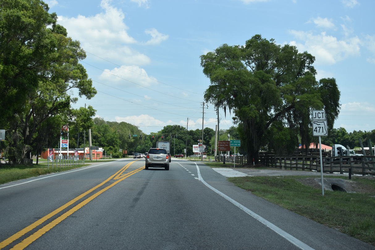
| Tarrytown lies at the crossroads of SR 50 and 471. SR 471 is a linear route leading south 21.2 miles to U.S. 98 in Polk County. 05/02/21 |
|
| SR 471 provides a truck route south to Lakeland via U.S. 98 and north to U.S. 301 at Sumterville. The state road follows Market Boulevard through the city of Webster, 3.25 miles to the north. 05/02/21 |
|
| Confirming marker posted east of SR 471. 05/02/21 |
|
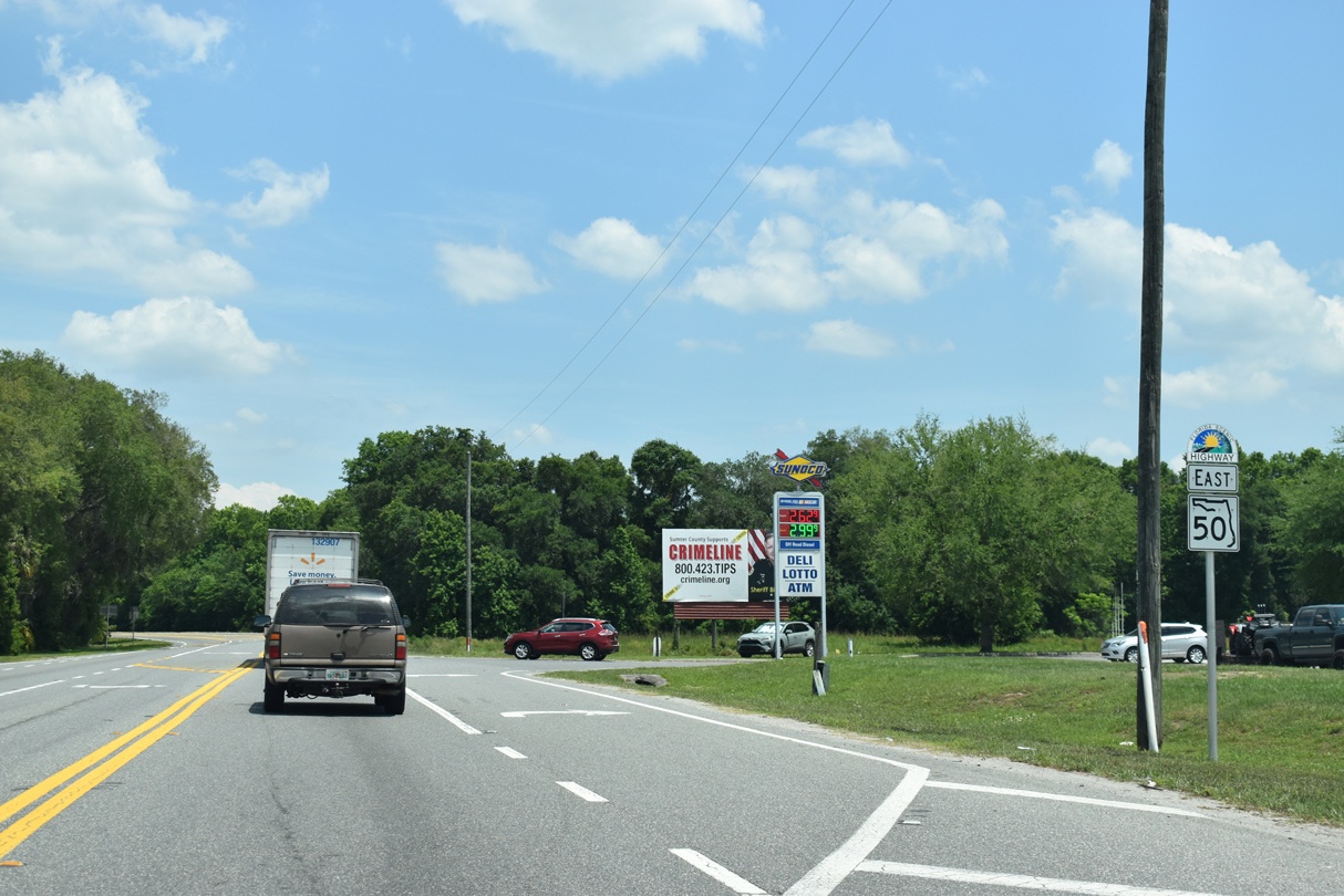
| Distance sign posted 13 miles ahead of Groveland. The figure for Clermont references the SR 50 junction with U.S. 27, located two miles further than the city center. 05/02/21 |
|
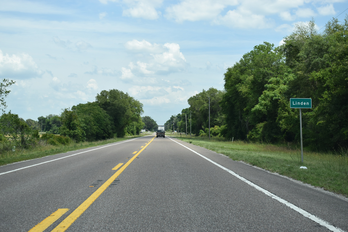
| Eastbound SR 50 at the rural settlement of Linden. 05/02/21 |
|
| Continuing east through portions of Withlacoochee State Forest, SR 50 emerges ahead of Mabel. 05/02/21 |
|
| The official scenic highway section of SR 50 concludes at General James A. Van Fleet State Trail. 05/02/21 |
|
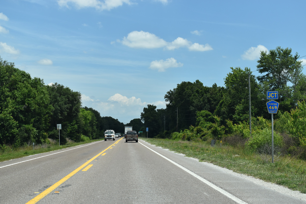
| County Road 469 stems north from SR 50 to CR 48 at the forthcoming intersection. 05/02/21 |
|
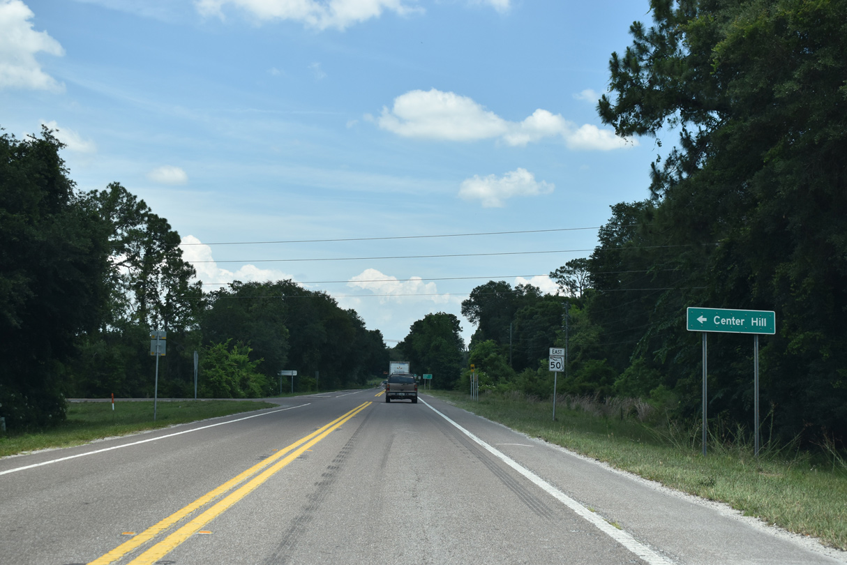
| 5.46 miles in length, Sumter County Road 469 comprises a rural route connecting SR 50 with the city of Center Hill. 05/02/21 |
|
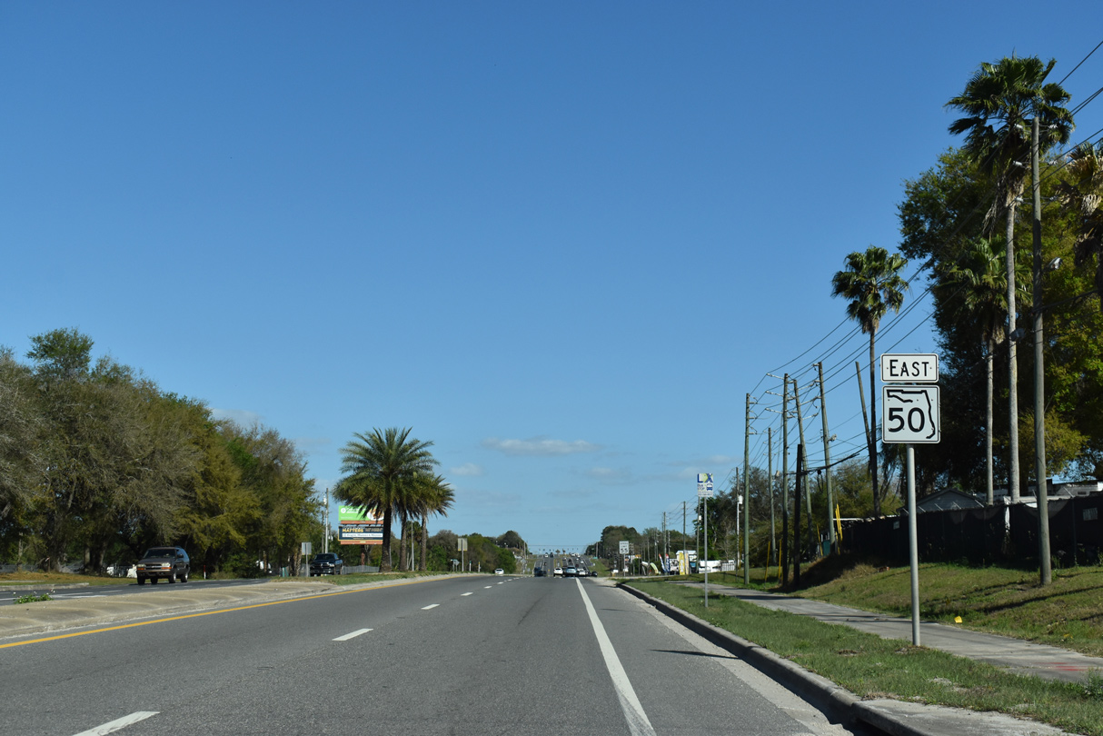
| This SR 50 reassurance marker posted at CR 469 replaced an assembly removed by 2017 that was located just to the east. 05/02/21 |
|
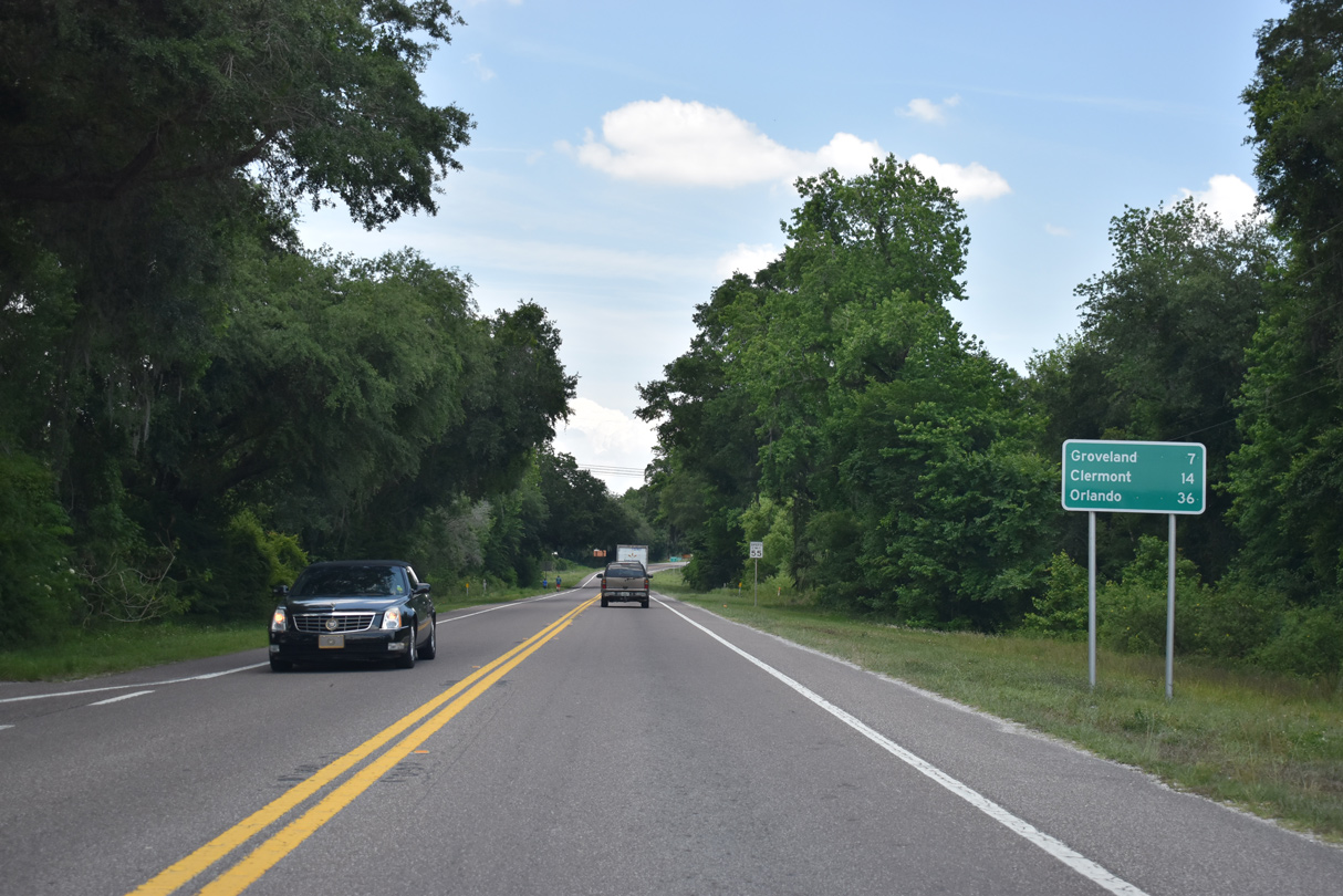
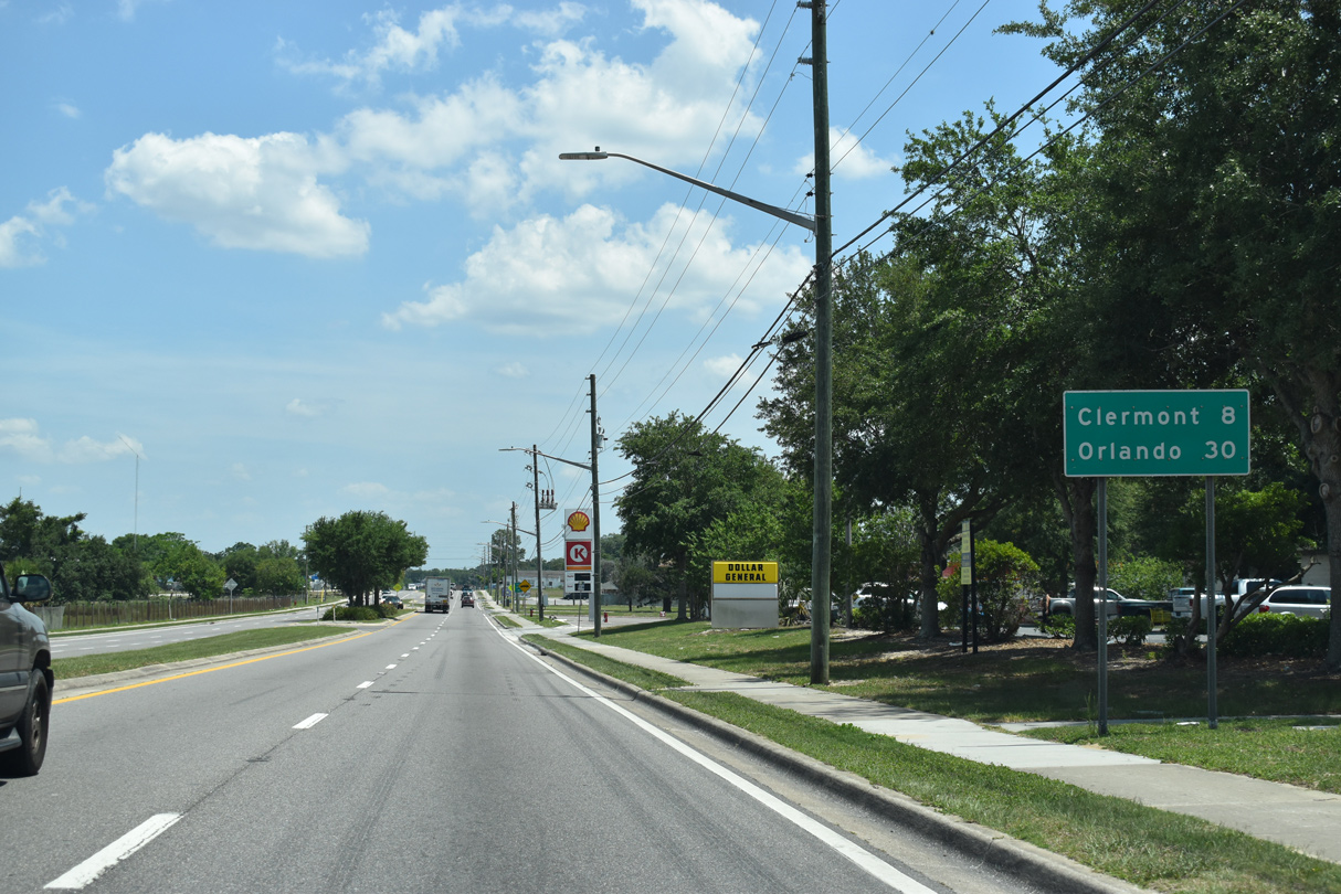
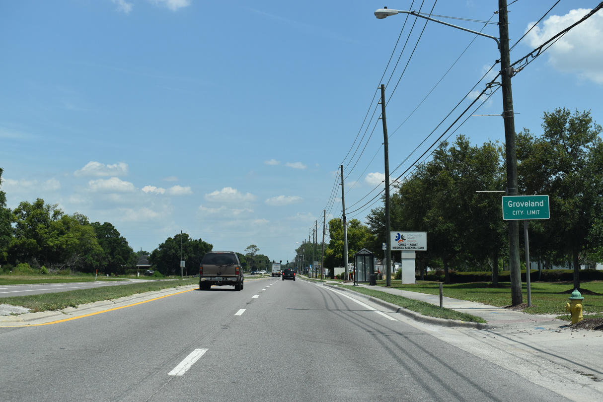
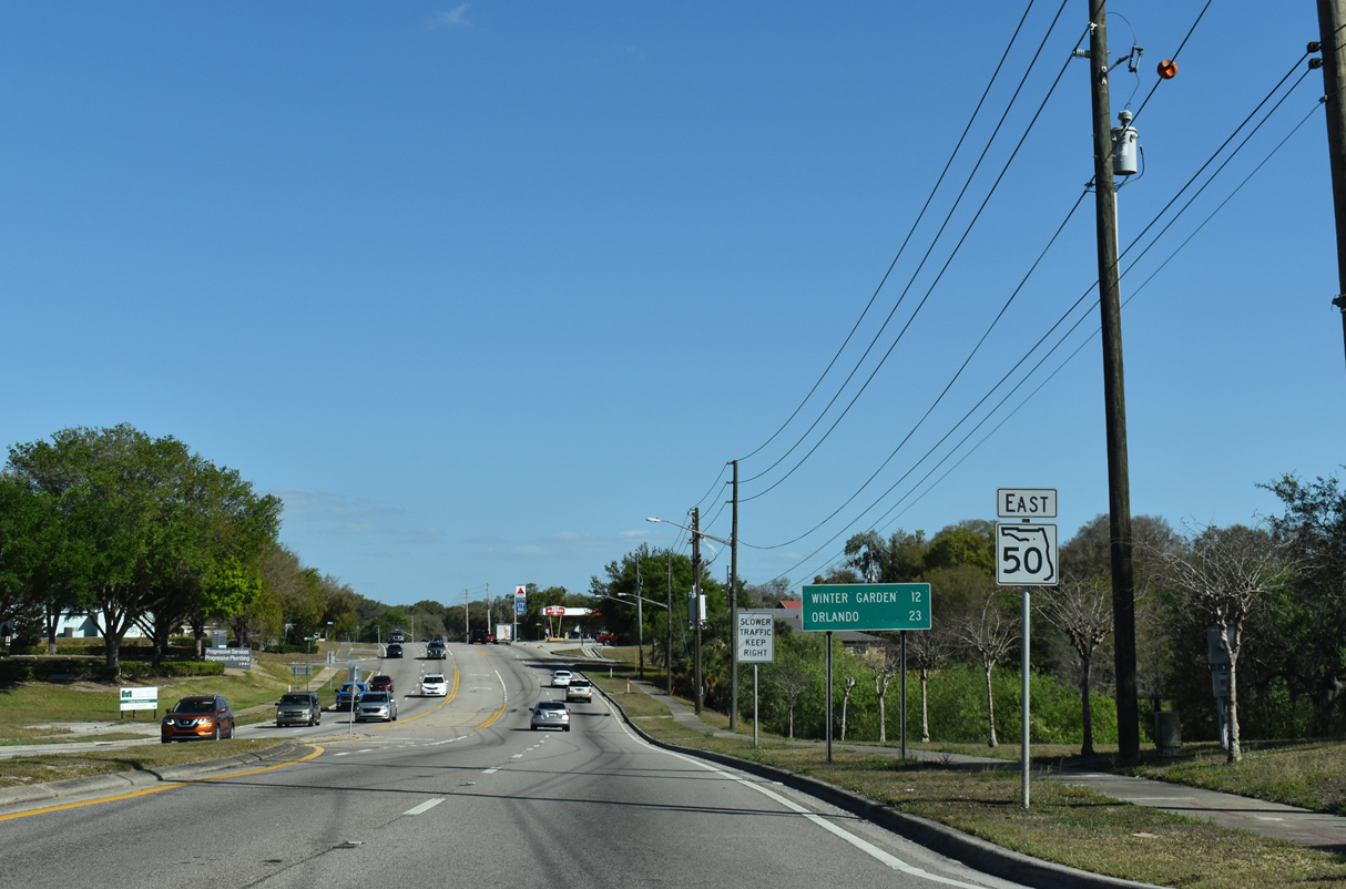
| The fast growing city of Groveland lies seven miles ahead. Downtown Clermont is 12 miles away, but again referenced two miles further on SR 50 distance signs. 05/02/21 |
|
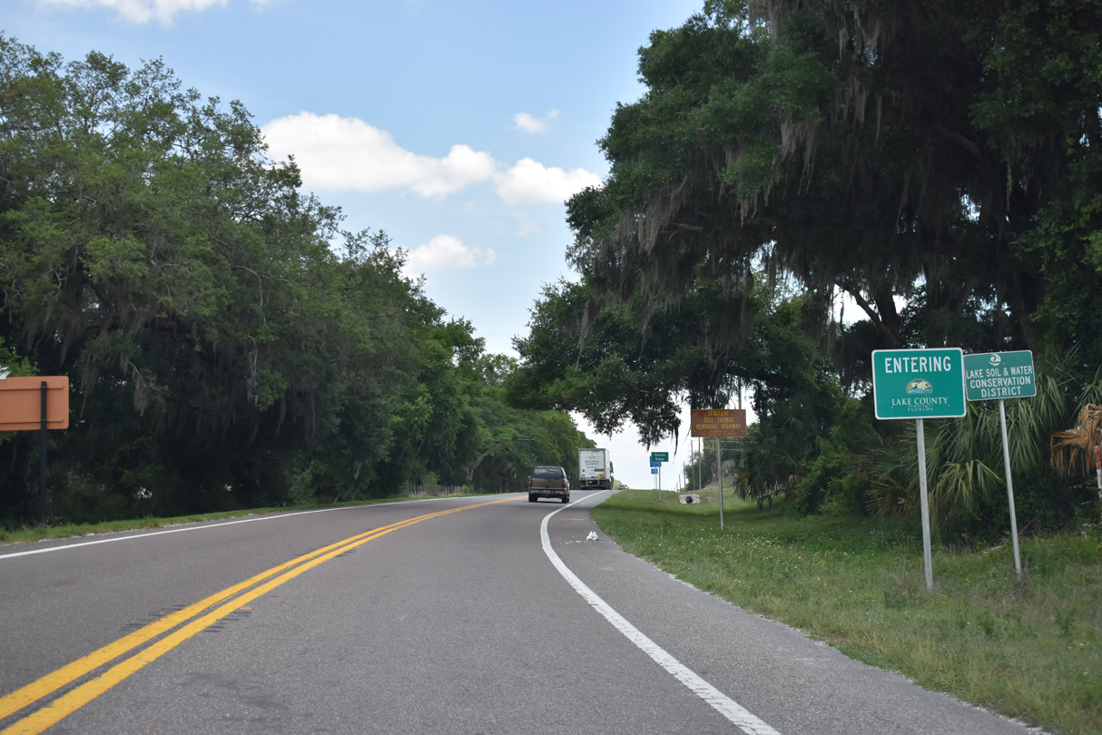
| SR 50 crosses into rural western Lake County south of Big Prairie. 05/02/21 |
|
| The rural settlement of Slones Ridge lies just inside Lake County along SR 50. 05/02/21 |
|
| SR 50 makes a series of subtle s-curves east to the rural community of Stuckey. 05/02/21 |
|
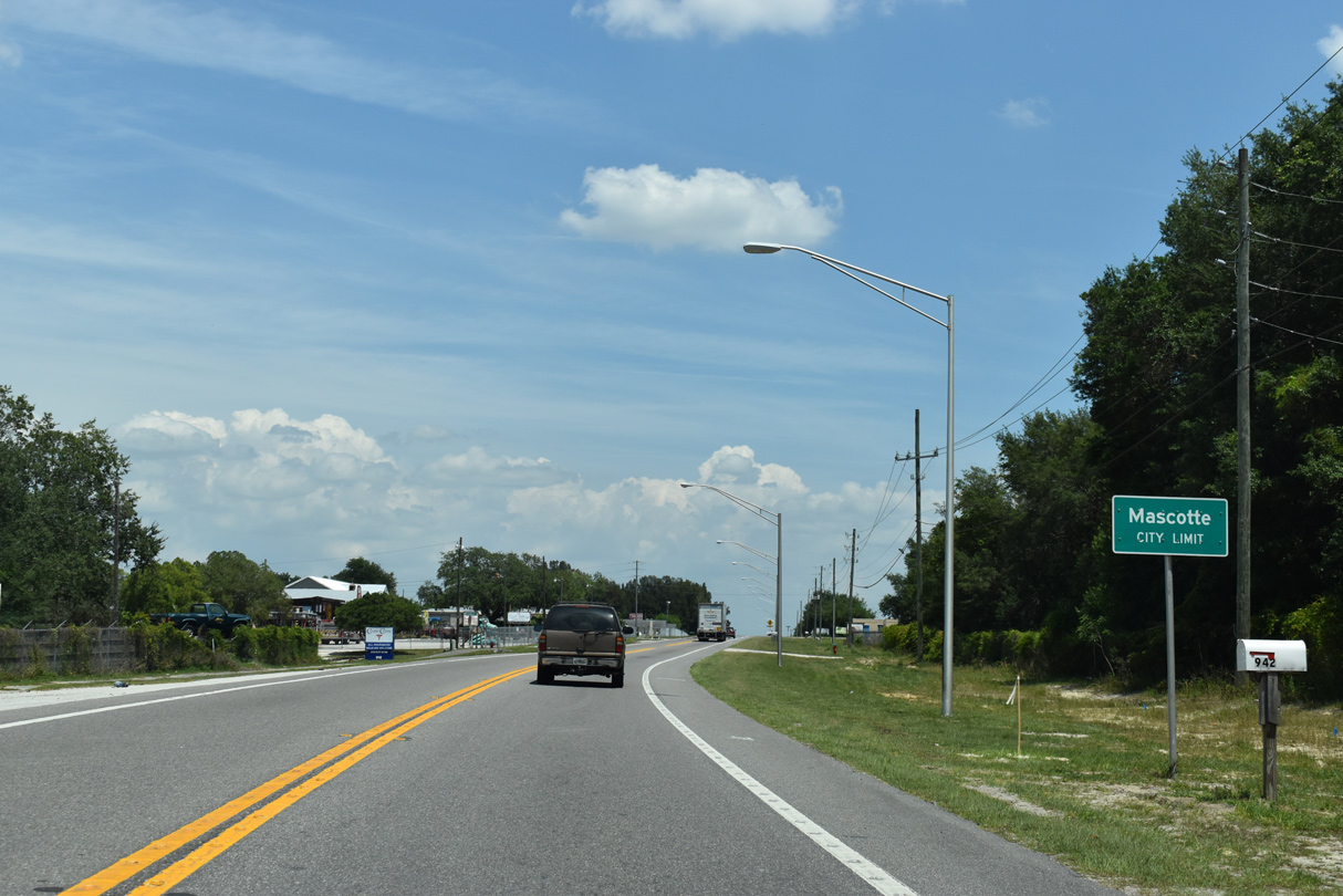
| A city of over 7,000, SR 50 enters Mascotte. With annexations and suburban development to the north, the city doubled in population from 2000 to 2013. 05/02/21 |
|
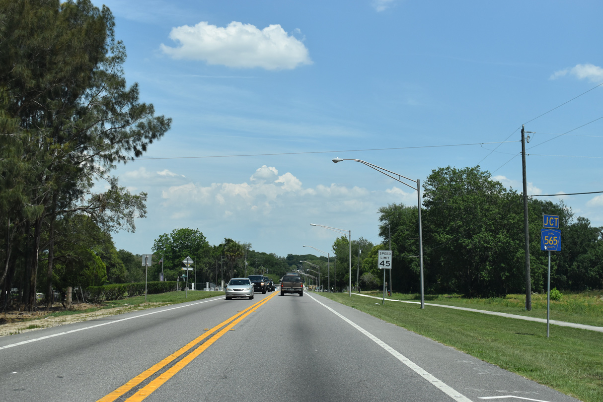
| The south branch of Lake County Road 565 (Bay Lake Road) intersects SR 50 (Myers Boulevard) near Lake Jackson. 05/02/21 |
|
| County Road 565 (South Bay Lake Road) spurs 9.5 miles south from SR 50 to Bay Lake and a trailhead for the General James A. Van Fleet State Trail. This shield assembly was removed by 2021. 02/25/17 |
|
| East from CR 565 (Bay Lake Road) south and Bay Lake Avenue north, SR 50 (Myers Boulevard) expands into a three lane boulevard. 05/02/21 |
|
| Sunset Avenue provides a cut off to CR 33 (Bluff Lake Road) north from SR 50 (Myers Boulevard) east. The 0.7 mile street doubles as unsigned CR 50. 10/19/17 |
|
| Upcoming Lake County Road 33 arcs northward around Big Bluff Lake through the suburban north side of Mascotte. 05/02/21 |
|
| County Road 33 travels 13.4 miles north from SR 50 to Okahumpka and U.S. 27 in south Leesburg. 05/02/21 |
|
| An implied overlap takes CR 33 south alongside SR 50 east to Groveland. 05/02/21 |
|
| Historic Downtown Clermont lies eight miles ahead. Beyond there, SR 50 transitions into a heavily traveled arterial leading east to Orange County. 05/02/21 |
|
| Angling southeast, SR 50 enters the city of Groveland south of Dukes Lake. The four lane arterial follows Broad Street to Downtown. 05/02/21 |
|
| The north branch of County Road 565 lines Villa City Road from SR 50 (Broad Street) at Mount Pleasant Road. Traffic lights were added at CR 565 in 2012. 05/02/21 |
|
| CR 565 (Villa City Road) extends 7.4 miles north around Lake Lucy to Villa City and U.S. 27 near Florida's Turnpike. 03/06/22 |
|
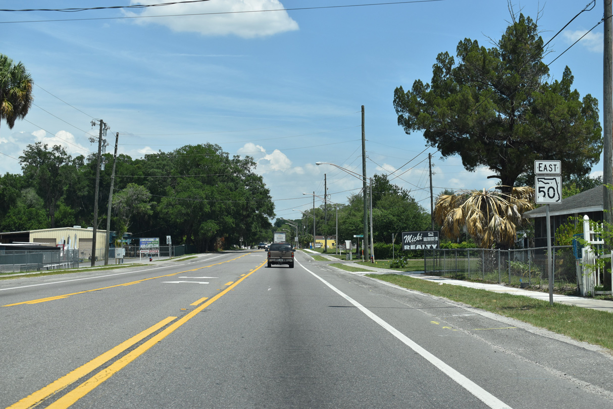
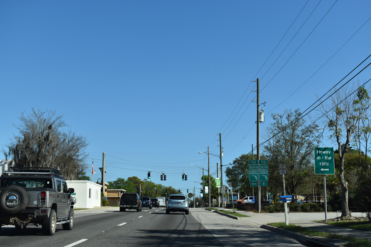
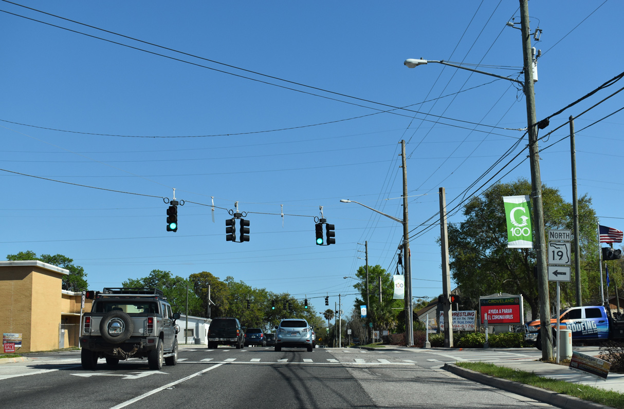
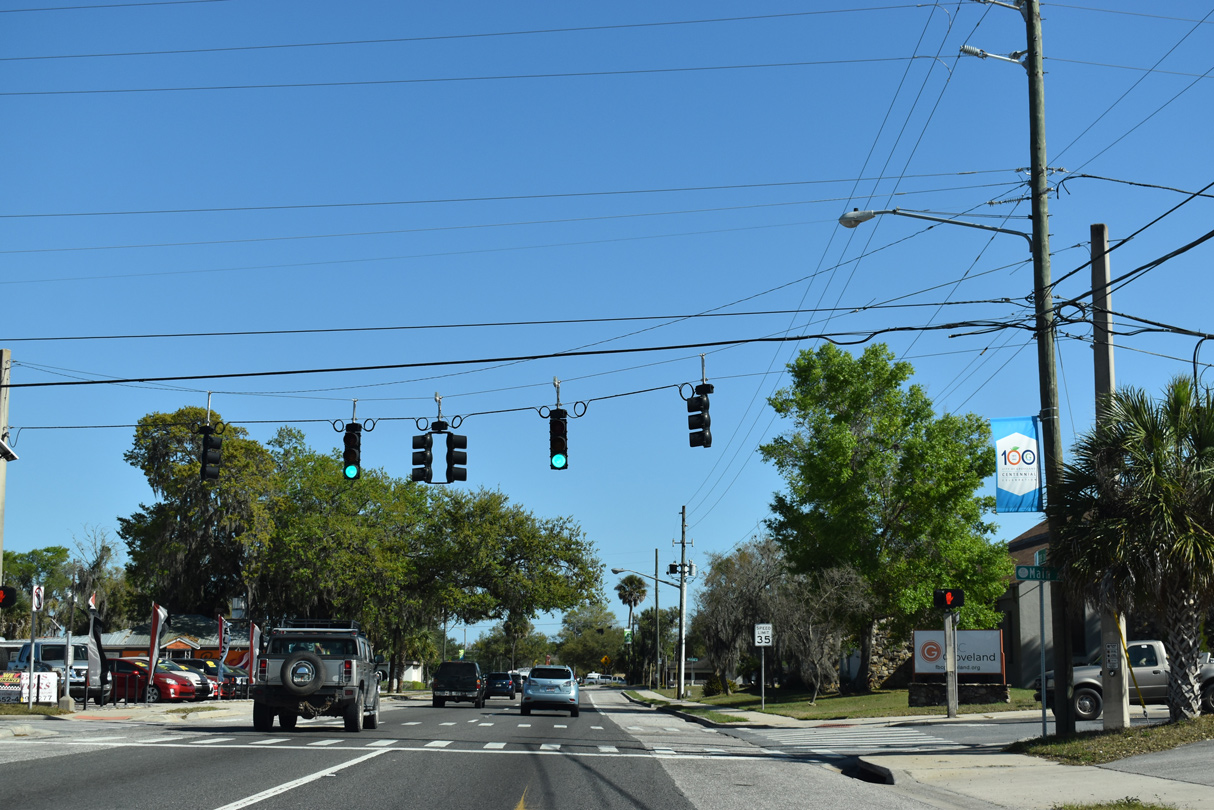
| Broad Street partitions into a one way couplet through Downtown Groveland. Meeting SR 50 next is the south end of SR 19. 03/06/22 |
|
| SR 19 travels 12 miles north to the city of Howey-in-the-Hills and 20 miles to U.S. 441 in Tavares. 03/06/22 |
|
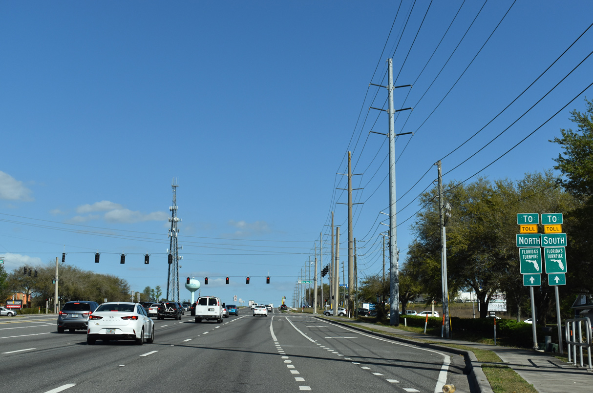
| SR 19 and U.S. 27 meet 6.7 miles north by the Leesburg and Tavaras interchange along Florida's Turnpike. The exchange provides access to the Turnpike southbound, with the northbound ramps relocated four miles further along U.S. 27. SR 50 meets the Turnpike directly in 14 miles. 03/06/22 |
|
| Overall SR 19 travels 89 miles from Groveland to Eustis, Umatilla and U.S. 17 in Palatka. 03/06/22 |
|
| One block east from SR 19 (Lake Avenue), SR 50 (Broad Street) intersects Orange Avenue. 03/06/22 |
|
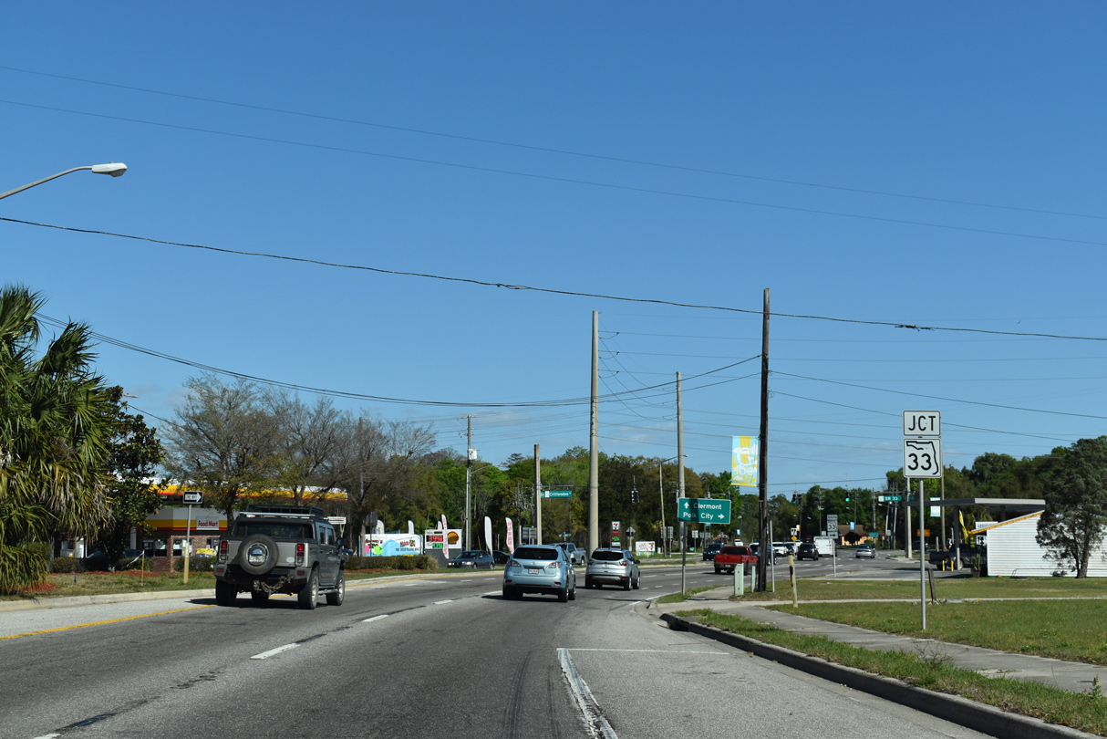
| The split directions of SR 50 along Broad Street converge ahead of SR 33 south and Crittenden Street north. 03/06/22 |
|
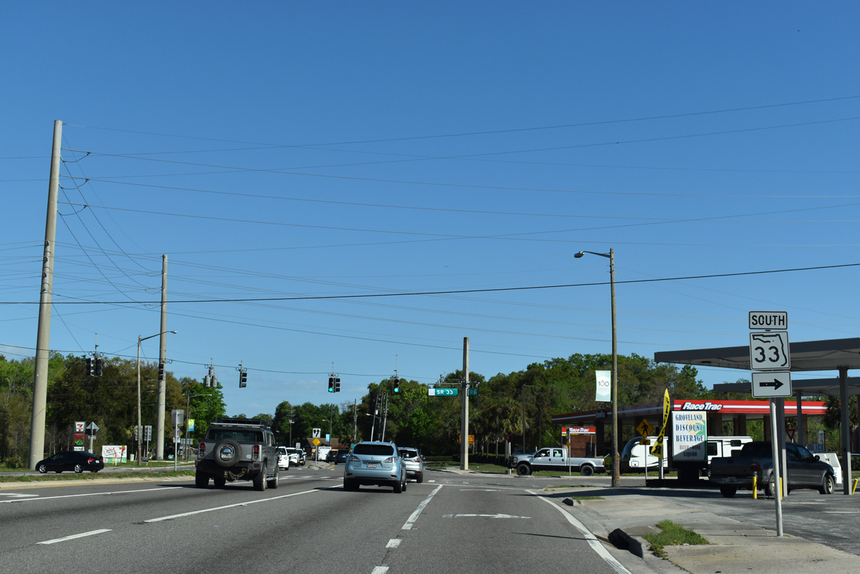
| SR 33 commences a 40.4 mile route south to U.S. 92 (Memorial Boulevard) in Lakeland from SR 50 in Groveland. 03/06/22 |
|
| SR 33 stays east of the Green Swamp along a mostly rural course to SR 559 in Polk City. 03/06/22 |
|
| FDOT recorded 30,000 vehicles per day (vpd) along SR 50 east of SR 33 in 2019. 03/06/22 |
|
| Downtown Clermont lies 5.3 miles east from SR 33 via SR 50. Downtown Orlando is 28.8 miles away along SR 50 and Colonial Drive. 03/06/22 |
|
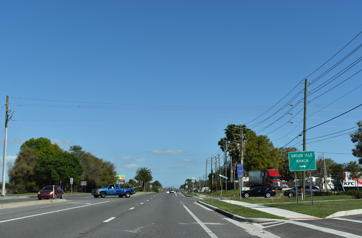
| The southern branch of CR 565A follows Montevista Road 4.59 miles southeast from SR 50 to Green Isle Ranch and CR 565B (Pine Island Road) near Lake Arlene. 03/06/22 |
|
| SR 50 advances through eastern reaches of the Groveland to the Waterside Pointe development. 03/06/22 |
|
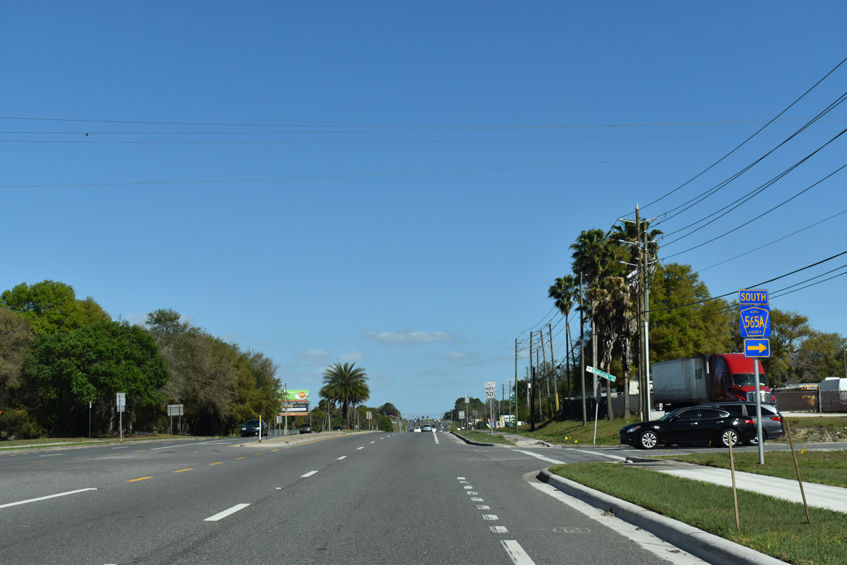
| The northern leg of CR 565A comprises a 2.67 mile long loop east from SR 50 to CR 561 around Green Valley Country Club golf course and Lake Hiawatha. 03/06/22 |
|
| SR 50 east lowers from an elevation of 182 feet above sea level north of Sumner Lake to 100 feet at Lake Palatlakaha. 03/06/22 |
|
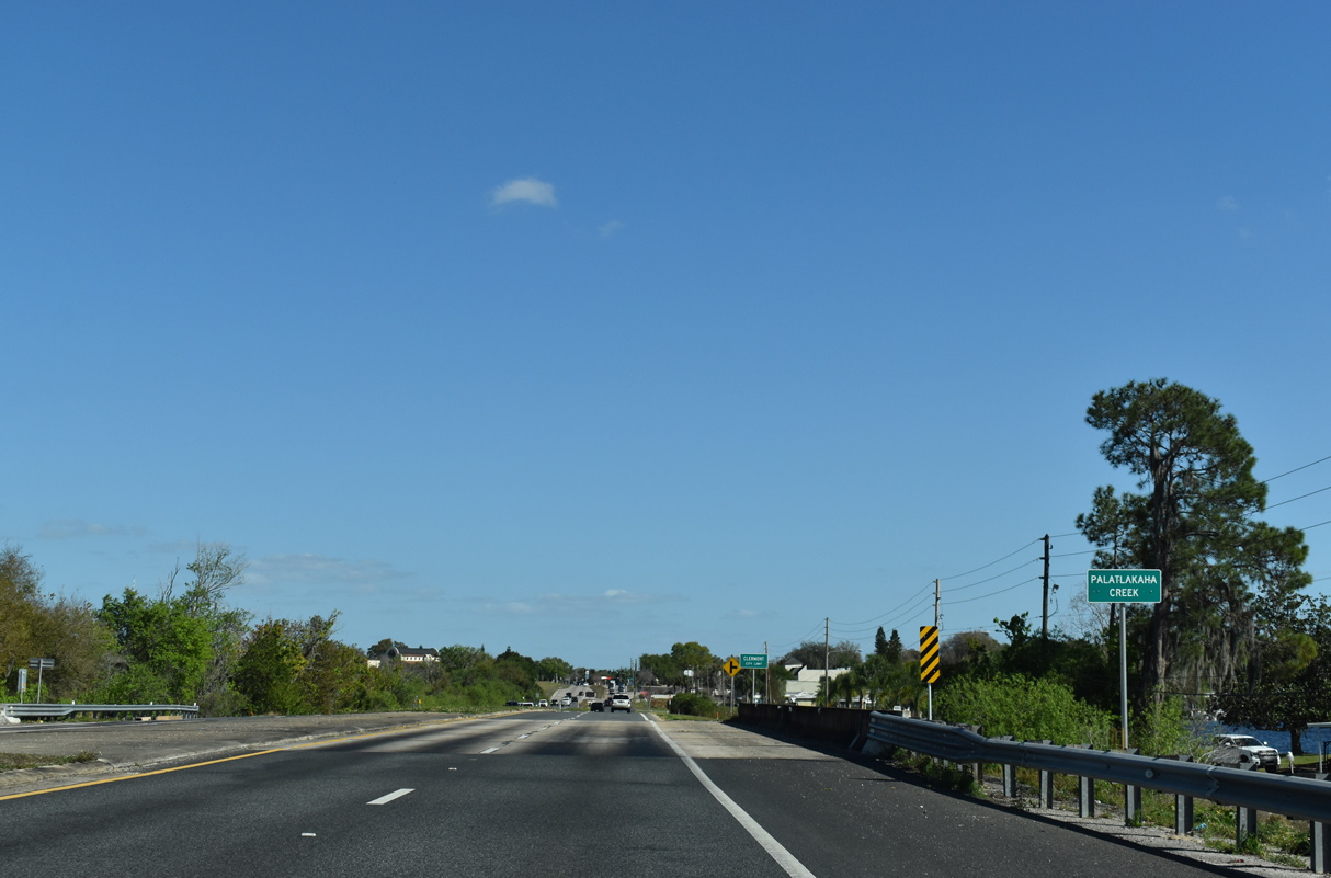
| Palatlakaha Creek flows between Lake Minnehaha and Lake Minneola 03/06/22 |
|
| SR 50 proceeds east into the city of Clermont from Palatlakaha Creek. 03/06/22 |
|
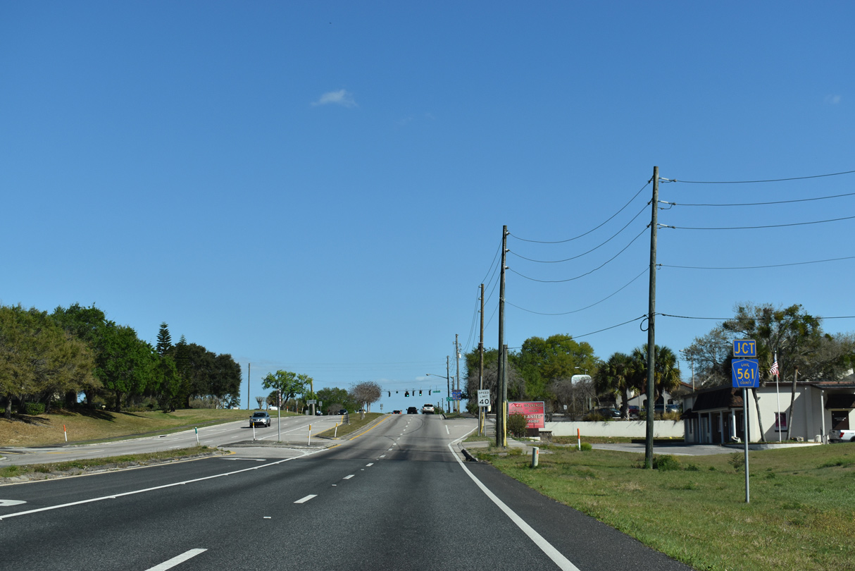
| Gaining 29 feet in elevation, SR 50 next meets CR 561 (12th Street) on the west side of the Clermont street grid. 03/06/22 |
|
| CR 561 runs south from Clermont and Lake Minnehaha to Lake Nellie and SR 33 south of Kirkland Lake. 03/06/22 |
|
| CR 561 passes west of Downtown Clermont along 12th Street en route to Lake Minneola Shores encircling Lake Minneola north and east to the city of Minneola. 03/06/22 |
|
| Winter Garden is the next city referenced on distance signs east from Clermont along SR 50. 03/06/22 |
|
| 8th Street encircles Center Lake north from SR 50 into historic Downtown Clermont. 03/06/22 |
|
| The succeeding traffic light along SR 50 east is with 5th Street, which passes between Lake Winona and Crystal Lake. 03/06/22 |
|
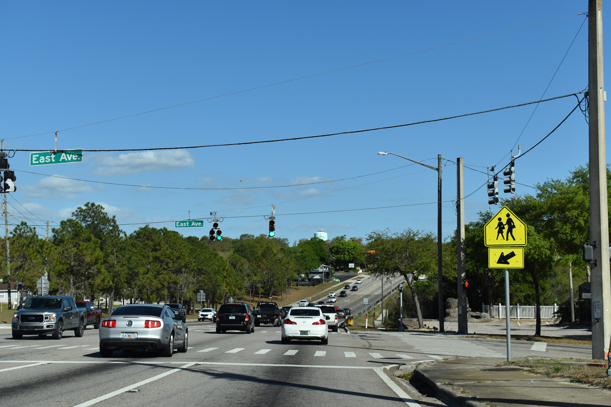
| East Avenue heads south to neighborhoods along Lake Sunnyside and Minnehaha and north from SR 50 to a pair of schools and Waterfront Park. 03/06/22 |
|
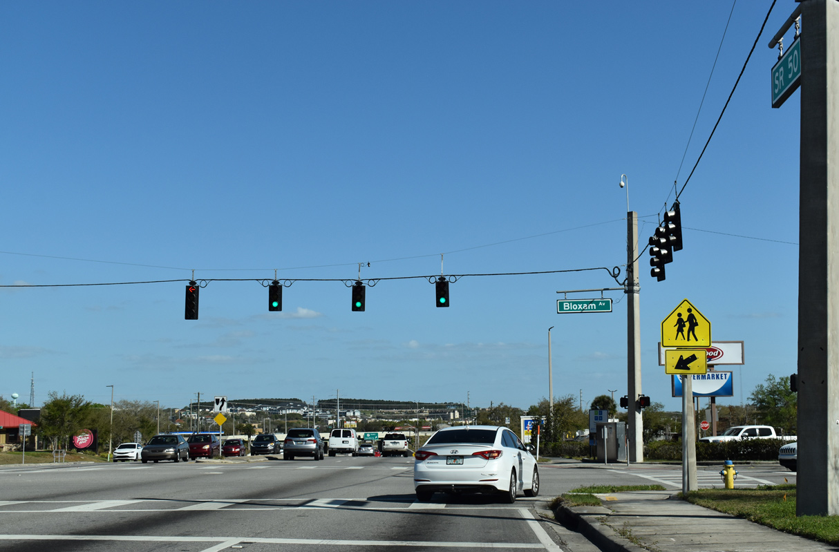
| Bloxam Avenue parallels U.S. 27 to the west. 03/06/22 |
|
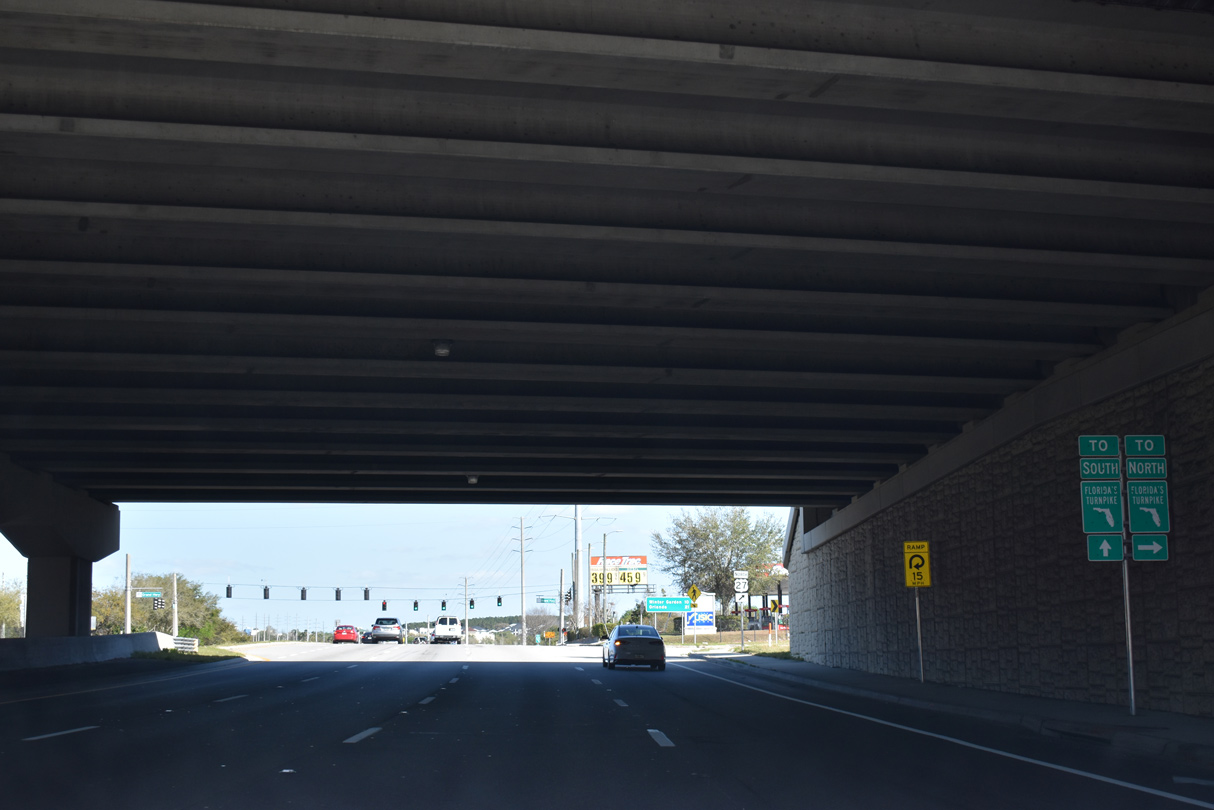
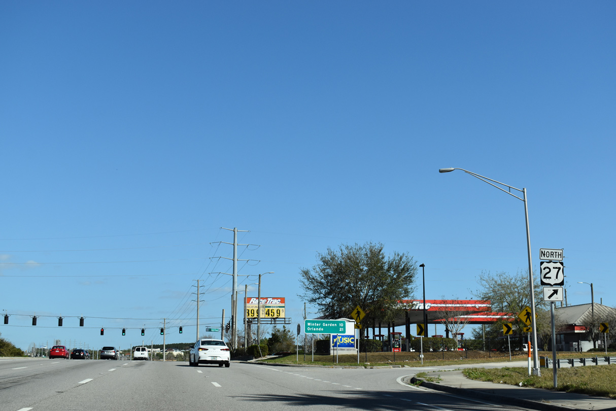
| East of Bloxam Avenue, SR 50 enters a cloverleaf interchange with U.S. 27. 03/06/22 |
|
| U.S. 27 travels south from Clermont along a heavily developed suburban corridor to Four Corners and Haines City. 03/06/22 |
|
| North from Clermont, U.S. 27 continues through adjacent Minneola before turning westward to Lesburg, The Villages and Ocala. 03/06/22 |
|
| U.S. 27 parallels Florida's Turnpike northwest to the exchange with SR 19. SR 50 east meets the Turnpike at Oakland. 03/06/22 |
|
| Work completed in Fall 2013 converted the diamond interchange joining SR 50/U.S. 27 into a cloverleaf. U.S. 27 in Florida leads south to Miami and northwest to Tallahassee. 03/06/22 |
|
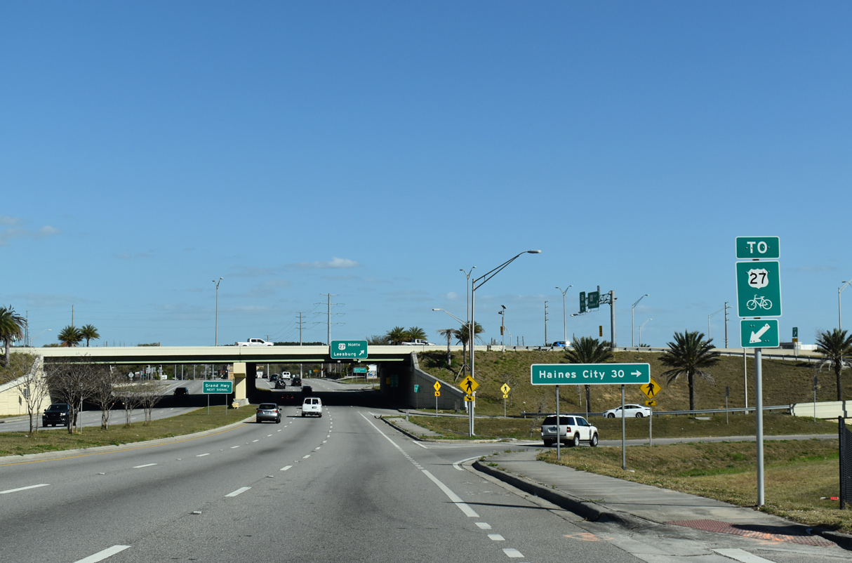
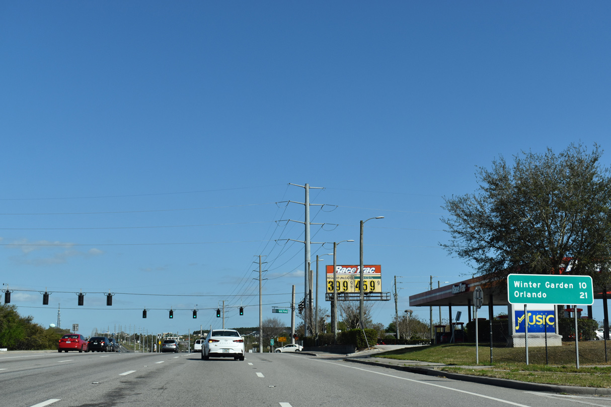
| SR 50 travels 10 miles east from U.S. 27 to Winter Garden and 21 miles to Orlando. The arterial intersects Grand Highway at the adjacent traffic light. 03/06/22 |
|
| SR 50 dips east of Grand Highway between retail areas south of Jacks Lake and north of Wilma Lake. 03/06/22 |
|
| Confirming marker posted east between Grand Highway and Oakley Seaver Drive. 03/06/22 |
|
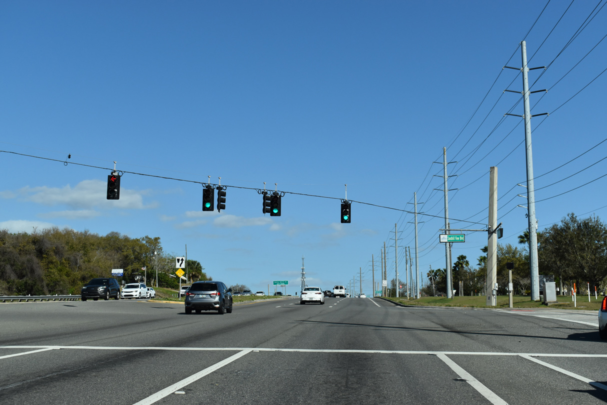
| Six lane expansion of SR 50 through east Clermont included the addition of traffic lights at Sandhill View Boulevard south to adjacent big box retail and Hooks Street. 03/06/22 |
|
| Oakley Seaver Drive arcs north from parallel Hooks Street and SR 50 to residential areas between Citrus Tower Boulevard and Hancock Road. 03/06/22 |
|
| Citrus Tower Boulevard forms an arterial loop east around Clermont while also connecting U.S. 27 north with SR 50 east. 03/06/22 |
|
| Eastbound SR 50 descends from a bluff toward Orange County and the Lake Apopka and Johns Lake area. 03/06/22 |
|
| Hancock Road is a major collector north 4.21 miles to Florida's Turnpike. Hancock Road was extended to the Turnpike in 2017, where a new parclo interchange (Exit 278) opened to traffic on June 10. 03/06/22 |
|
| Hancock Road leads south from SR 50 to a bevy of subdivisions and north to the nearby South Lake Campus of Lake - Sumter State College. 03/06/22 |
|
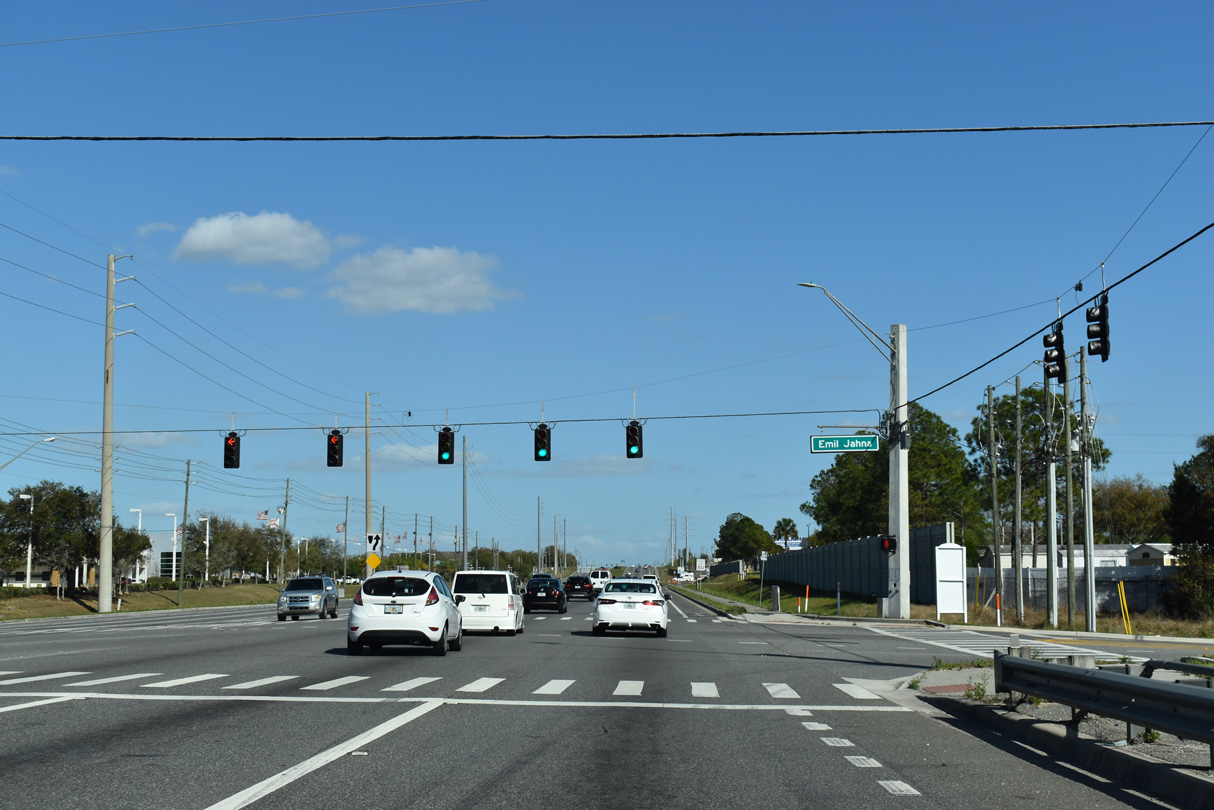
| Greater Hills Boulevard south from the Hidden Hills development and Emil Jahna Road north come together at the ensuing traffic light along SR 50 east. 03/06/22 |
|
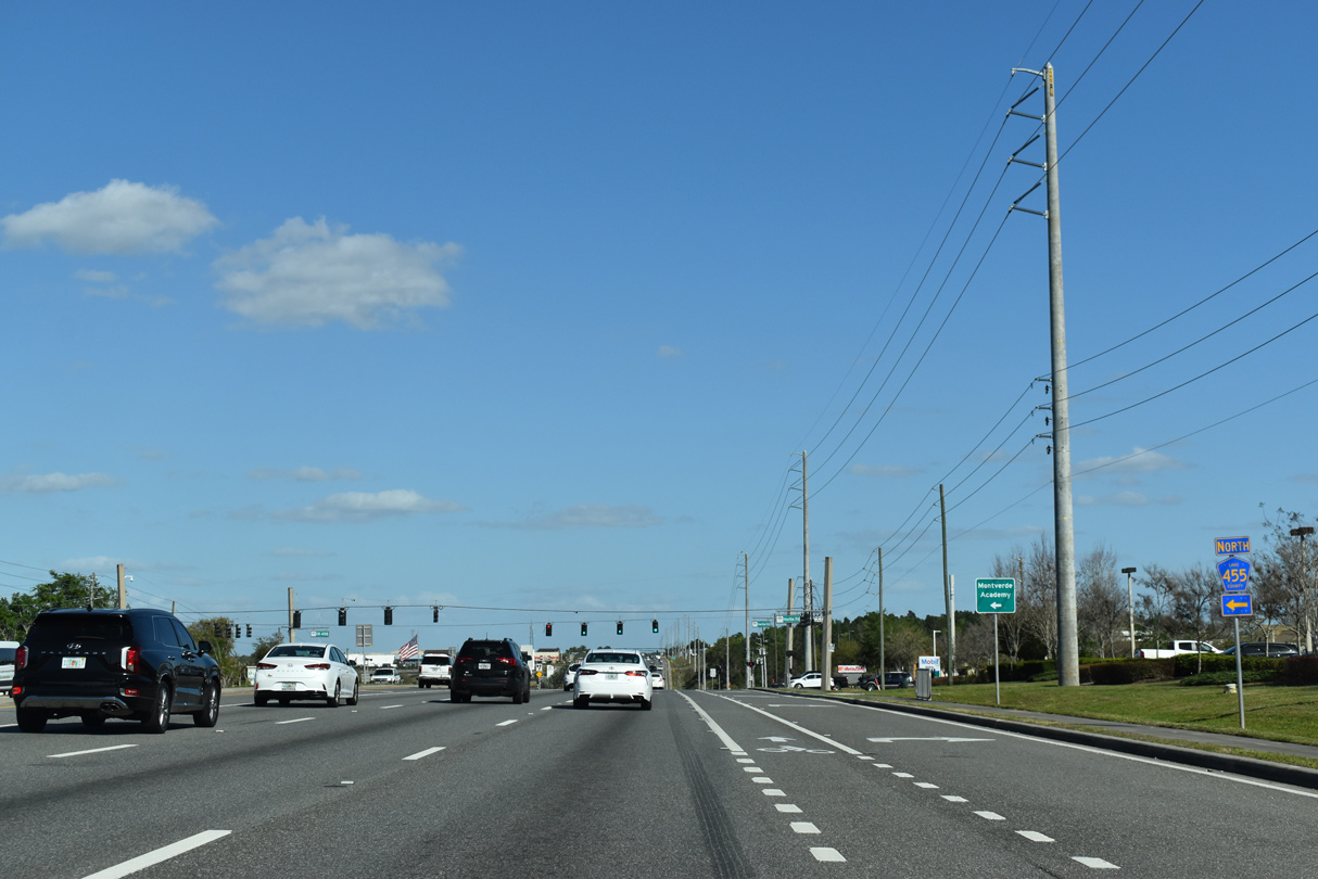
| County Road 455 north begins from SR 50 at the forthcoming intersection with Hartle Road. 03/06/22 |
|
| CR 455 meanders northward by Lake Apopka to the town of Montverde and community of Ferndale. 03/06/22 |
|
| CR 455 constitutes a 14.27 mile long loop northwest from SR 50 in Clermont to SR 19 south of Howey-in-the-Hills. 03/06/22 |
|
| SR 50 east to Oakland in Orange County was widened from four to six lanes in 2010-11. 03/06/22 |
|
| Magnolia Pointe Boulevard spurs south to subdivisions of Johns Lake from SR 50 at an area of car dealerships. 03/06/22 |
|
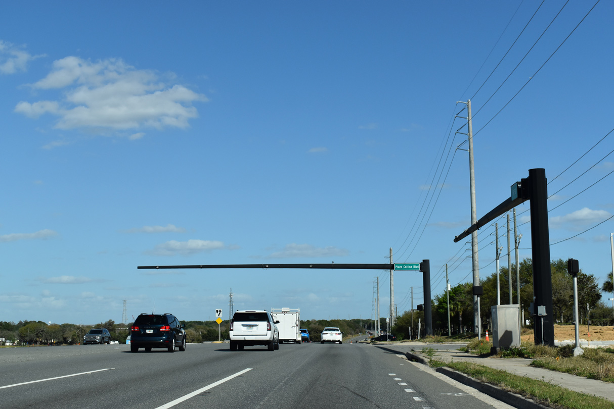
| Mast arms were installed in anticipation of development along SR 50 at Plaza Collina Boulevard. 03/06/22 |
|
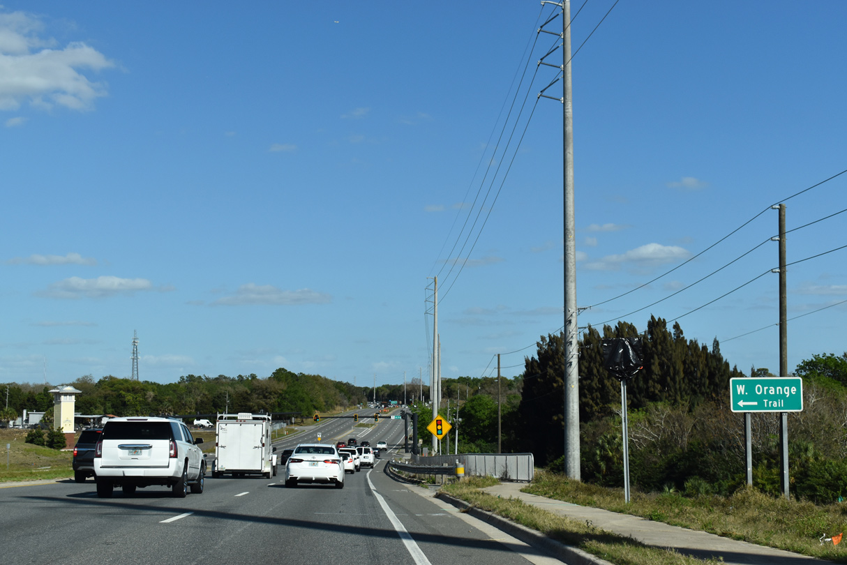
| Lake Boulevard links SR 50 with adjacent Old County Road 50 west at West Orange trail Killarney Station park. 03/06/22 |
|
| Old CR 50 runs 1.92 miles west from Lake Boulevard to CR 455 at Montverde Junction. Paralleling SR 50 to the north, CR 438 extends east from Old CR 50 into Oakland. 03/06/22 |
|
| Passing by northern reaches of Johns Lake, SR 50 enters both the town of Oakland and Orange County. 03/06/22 |
Page Updated 03-08-2022.

 East
East