
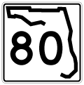
Florida State Road 80 stretches 123.80 miles across the Florida peninsula connecting Fort Myers on the Gulf coast with La Belle, Clewiston, Belle Glade and West Palm Beach on the Atlantic coast. The state road is one of three major corridors linking the two sides of the southern peninsula, following U.S. 41 (Tamiami Trail) and Interstate 75 (Alligator Alley). On its course across the state SR 80 follows near the Caloosahatchee River and canal system as well as around the southern edge of Lake Okeechobee.
Florida State Road 80 Guides
East
SR 80 begins in Downtown Fort Myers at a grade separated interchange with U.S. 41 (Cleveland Avenue). A 0.316 mile section of Main and Monroe Streets remains state maintained, while the remainder of SR 80 east to SR 739 (Fowler Street) was decommissioned through Downtown along First Street (westbound) and Second Street (eastbound). Second Street takes State Road 80 east a short distance before merging onto Seaboard Street while SR 80 west follows First Street from Billy Creek toward Downtown. The two one way segments reconvene opposite East Riverside Drive, then head northeast along Palm Beach Boulevard into East Fort Myers and Tice. East of I-75, Palm Beach Boulevard and State Road 80 continue northeastward through Fort Myers Shores before arcing east toward Hendry County and La Belle. SR 80 maintains four to six lanes throughout its course in Lee County.
Entering Hendry County near the community of Charleston Park, State Road 80 remains a four-lane divided highway as it turns northeast once more toward the county seat. Once in La Belle SR 80 briefly shares pavement with SR 29, which enters the county seat from Immokalee and Everglades City, proceeding north to Palmdale. The state road continues east from La Belle and the Port La Belle development south of the Caloosahatchee River and Canal system as it straddles the Hendry and Glades county lines. Improvement projects are underway to four lane the segment between Port La Belle and CR 833, which will complete SR 80 as a multi-lane road throughout the state.
SR 80 joins U.S. 27 west of Clewiston at a diamond interchange opened in 2014. The two travel east through Clewiston before turning southeast into Palm Beach County, running adjacent to the 143 mile Herbert Hoover Dike system around Lake Okeechobee. The dike system was built in stages between the 1930s and 1960s as a deterrent to storm surges on the lake. SR 80 departs east for West Palm Beach 25 miles after joining with U.S. 27 in South Bay. U.S. 27 continues southward to the Everglades and Miami while SR 80 travels east and north through Belle Glade.
State Road 80 joins U.S. 98/441 north of Belle Glade, and beelines east through sugar cane fields toward the West Palm Beach metro area. Beyond SR 700 (Connors Highway), the three routes curve southeast to Twentymile Bend before recurving east toward Wellington. Passing south of Lion Country Safari adventure park, U.S. 98/441 and SR 80 travel along Southern Boulevard into the village of Wellington. A planned urban development that began in 1971 and incorporated by 1995, portions of what is now Wellington was once home to the world's largest strawberry patch.1 Canal C-51 of the South Florida Water Management District canal system parallels Southern Boulevard to the south.
Entering the metro West Palm Beach area, SR 80 and U.S. 98/441 expands to an eight lane urban arterial. U.S. 441 leaves U.S. 98 and SR 80 for Fort Lauderdale and Miami at an interchange with SR 7. SR 7 follows U.S 441 south and continues north to SR 704 and Loxahatchee. Beyond Florida's Turnpike, SR 80 and U.S. 98 (Southern Boulevard) becomes a controlled-access expressway to I-95. Interchanges are located at Jog Road, Haverhill Road, SR 809 (Military Trail), and SR 807 (Congress Avenue) with at-grade crossings in between.
East of I-95 U.S. 98/SR 80 (Southern Boulevard) continues into central West Palm Beach as an undivided arterial. Southern Boulevard crosses U.S. 1 (Dixie Highway) and Lake Worth Lagoon via a low span draw bridge. A $93 million improvement project through 2021 will replace both bridges spanning Lake Worth Lagoon.2 Both SR 80 and U.S. 98 conclude at a roundabout with SR A1A a block from the Atlantic Ocean in Palm Beach.
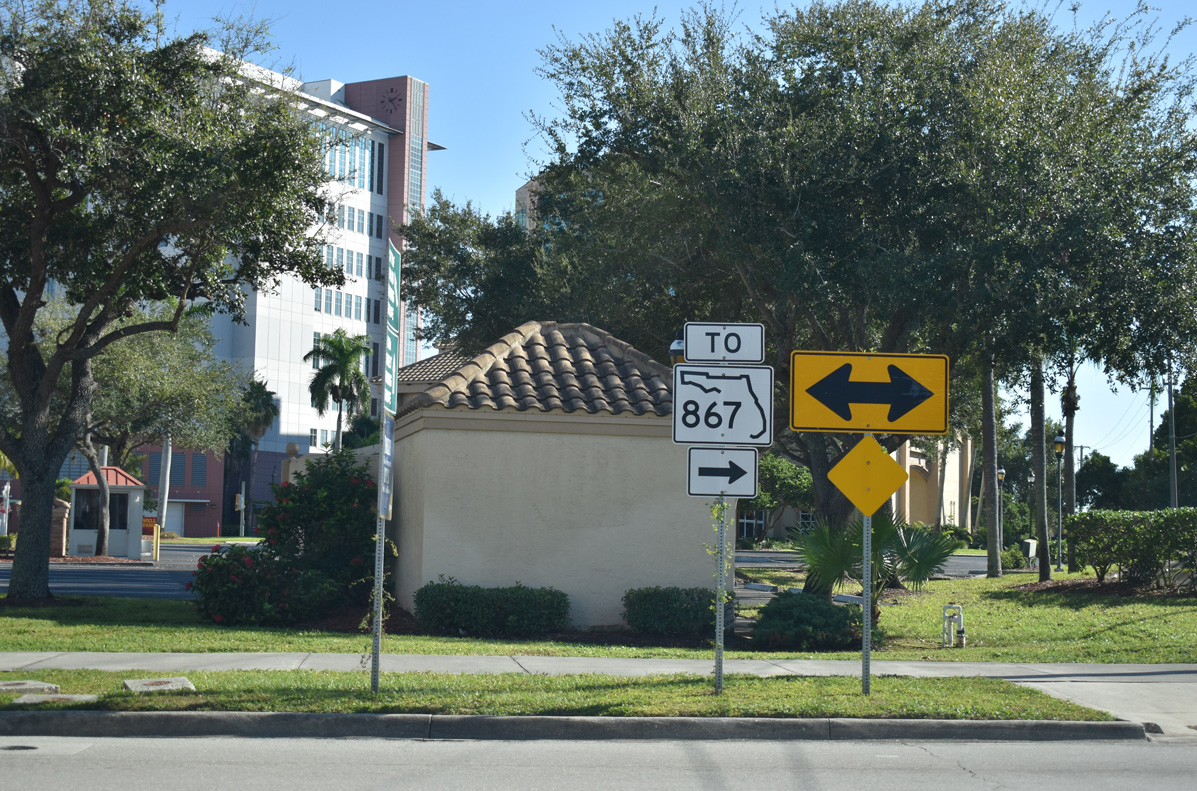 | A SR 867 trailblazer directs traffic from Bay and Heitman Streets south to First Street (old SR 80) west for the nearby Carson Street ramp to McGregor Boulevard. SR 867 was decommissioned north of Colonial Parkway, yet this assembly replaced a previous installation by 2016. 11/30/19 |
- The Village of Wellington, official website. https://www.wellingtonfl.gov/
- SR 80 (Southern Boulevard) Bridge Replacement Project (D4), official website.
Photo Credits:
11/30/19 by AARoads
Connect with:
Interstate 75
Interstate 95
U.S. 27
U.S. 41
U.S. 98
U.S. 441
U.S. 41 Business - Fort Myers / North Fort Myers
Page Updated 12-02-2019.