Known as Blue Angel Parkway, Florida State Road 173 is an 11.93 mile long route connecting Pensacola Naval Air Station with SR 297 (Pine Forest Road) south of Interstate 10. SR 173 encircles Bellview south and passes west of Myrtle Grove across a mixture of suburban development and wetlands. SR 292 (Sorrento Road) west and CR 292A (Gulf Beach Highway) at the south end of SR 173 lead travelers west to Perdido Key. Blue Angel Parkway (unsigned CR 173) spurs 0.195 miles south from SR 173/CR 292A to the West Gate of Pensacola N.A.S.
SR 173 originally tied into U.S. 90 (Mobile Highway) by way of Millview Road to northwest of Bellview. This segment was replaced by Blue Angel Parkway east to SR 297 at Longleaf Drive.
Florida Department of Transportation (FDOT) project 421012-1 will eventually expand a 3.239 mile section of SR 173 (Blue Angel Parkway) northeast from SR 292 (Sorrento Road) to just beyond U.S. 98 near Myrtle Grove. Construction will widen SR 173 to four overall lanes with a 30 foot wide median and add sidewalks, bike lanes and a shared use path on the east side of Blue Angel Parkway. Construction was not funded in the FDOT Five-Year Work Progam as of 2021.
|
| Continuing from SR 292 (Sorrento Road), SR 173 (Blue Angel Parkway) passes between big box retail. The ensuing stretch reduces to two lanes en route to the Coral Creek neighborhood. 05/15/14 |
|
| The southern branch of CR 297 follows Dog Track Road 3.26 miles north from SR 292 (Sorrento Road) to U.S. 98 (Lillian Highway) and SR 298 at Millview. Pensacola Greyhound Track was located to the northwest along CR 297 near Heron Bayou. 05/15/14 |
|
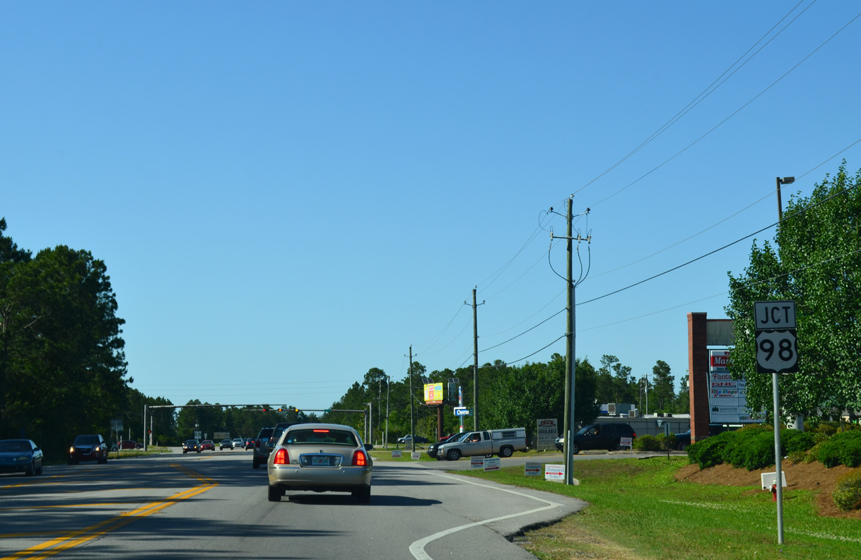
| SR 173 (Blue Angel parkway) meets U.S. 98 west of the Myrtle Grove community. 05/15/14 |
|
| U.S. 98 travels west to Lillian, Elberta and Foley in Baldwin County, Alabama. U.S. 98 east expands to four lanes from just west of SR 173 to Naval Hospital Pensacola, Warrington and Pensacola. 05/15/14 |
|
| Curving northeast, SR 173 (Blue Angel Parkway) advances 1.5 miles from U.S. 98 to SR 298 (Lillian Highway) west of Myrtle Grove. 10/01/09 |
|
| SR 298 (Lillian Highway) loops from U.S. 98 at Millview east 6.84 miels to SR 295 at West Pensacola. Historically Lillian Highway was the original alignment of U.S. 98 east to U.S. 90 (Mobile Highway). 05/16/14 |
|
| North from SR 298, SR 173 (Blue Angel Parkway) arcs westward from the Southwoods subdivision across Marcus Bayou. 05/17/14 |
|
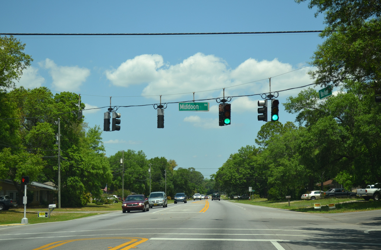
| Muldoon Road branches east from Blue Angel Parkway into the community of Bellview. 05/17/14 |
|
| SR 173 parallels Muldoon Road to the west into Bellview. 05/17/14 |
|
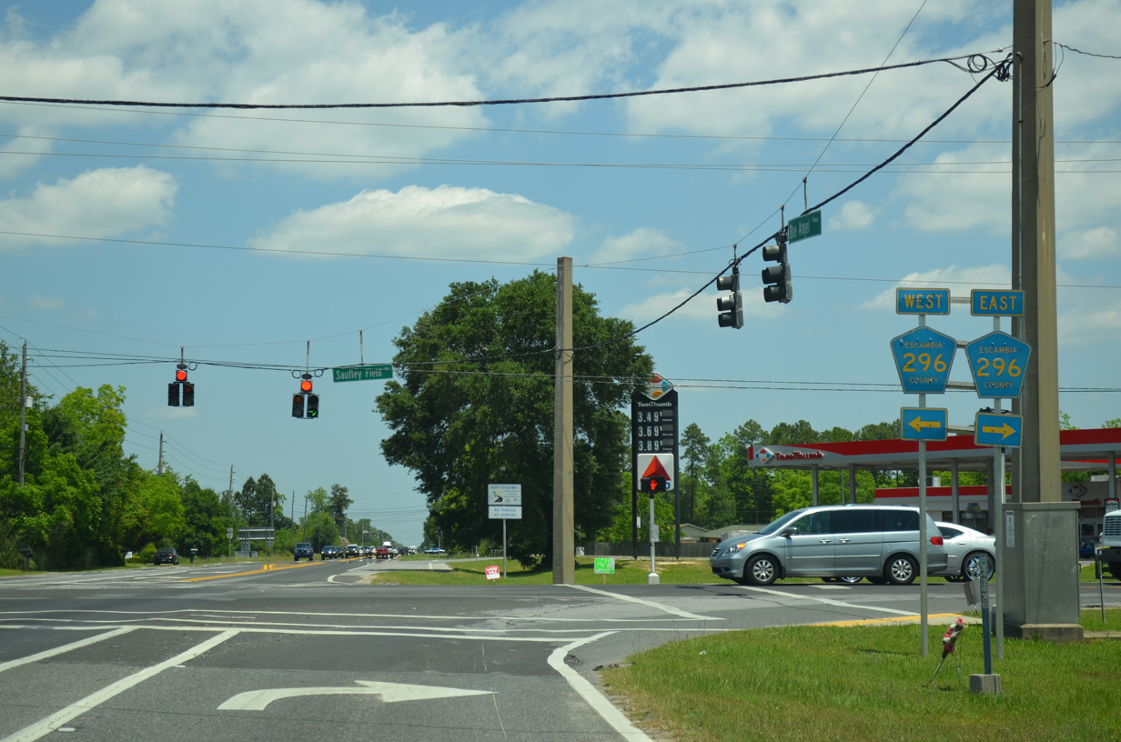
| CR 296 (Saufley Field Road) spurs west from SR 173 (Blue Angel Parkway) to the Naval Education Training Professional Development Technology Center at Saufley Field. East at U.S. 90 (Mobile Highway), CR 296 becomes SR 296 (Michigan Avenue) en route to Brent. 05/17/14 |
|
| SR 173 (Blue Angel Parkway) continues north from CR 296 (Saufley Field Road) through Belleview. 05/17/14 |
|
| SR 173 curves east from Millview Road, a former segment of SR 297 linking Blue Angel Parkway with U.S. 90 (Mobile Highway) to the north. 05/17/14 |
|
| Blue Angel Parkway proceeds 0.6 miles east from U.S. 90 (Mobile Highway) to SR 297 (Pine Forest Road). 05/17/14 |
|
| SR 173 and SR 297 (Pine Forest Road) provide the most direct route between the West Gate of Pensacola Naval Air Station and Interstate 10. 11/17/12 |
|
| SR 297 is a 4.29 mile long arterial route connecting U.S. 90 at Bellview with U.S. 90 Alternate (Nine Mile Road) at Pine Forest. 05/17/14 |
|
| Longleaf Drive extends east from the end of SR 173 (Blue Angel Parkway) and SR 297 to Pine Forest High School and Kemp Road. SR 297 heads 1.1 miles north to Five Flags Speedway and 2.5 miles to I-10 at Exit 7. 11/17/12 |
|
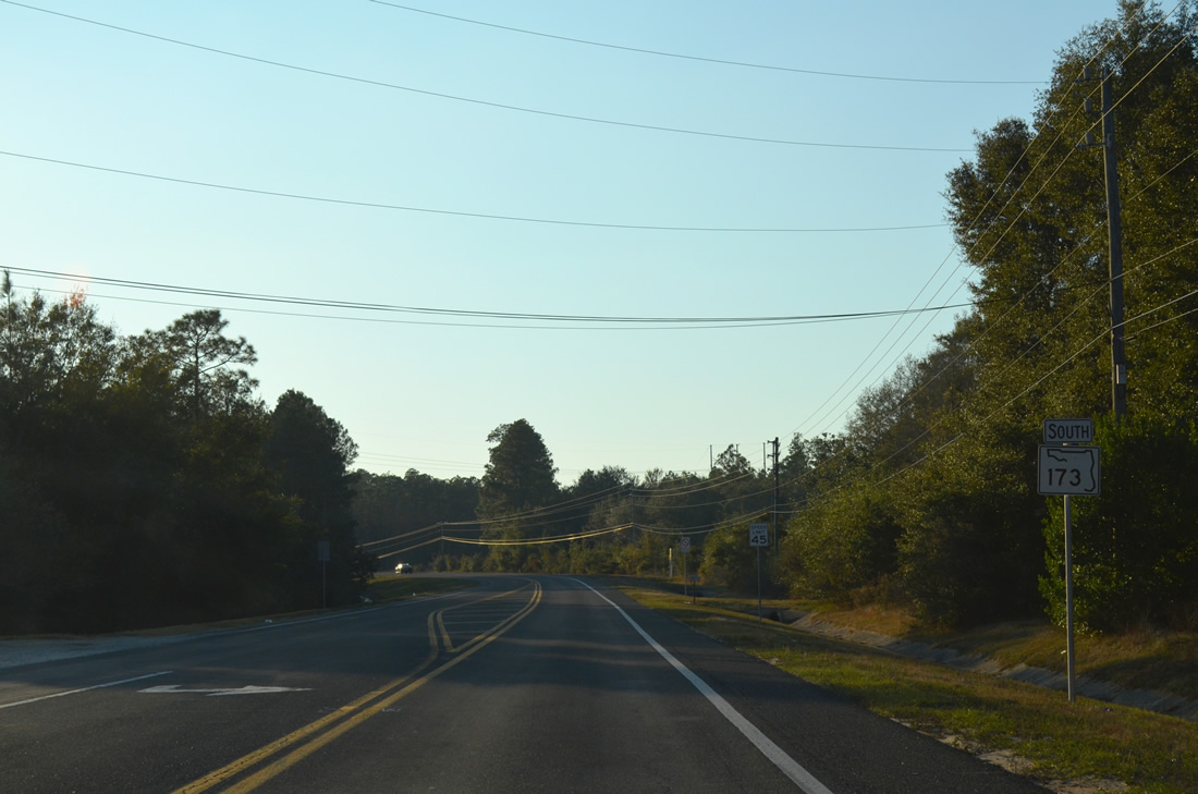
| The first confirming marker for SR 173 south stands west of SR 297 (Pine Forest Road) and Longleaf Drive. 12/21/03 |
|
| U.S. 90 (Mobile Highway) travels northwest from Bellview to meet SR 173 (Blue Angel Parkway) at the succeeding traffic light. U.S. 90 continues from the Pensacola area at Beulah to Seminole, Alabama. 05/17/14 |
|
| SR 173 bypasses Bellview, Myrtle Grove and Warrington south from U.S. 90 to Pensacola N.A.S. U.S. 90 (Mobile Highway) angles southeast to West Pensacola Brownsville and the city of Pensacola. 05/17/14 |
|
| SR 173 (Blue Angel Parkway) arcs southward from U.S. 90 (Mobile Highway) and Millview Road (old SR 297). 11/17/12 |
|
| 0.51 miles long, Millview Road provides a cutoff from U.S. 90 (Mobile Highway) east to Blue Angel Parkway south. 11/17/12 |
|
| Continuing south from Saufley Field Road (CR 296) on SR 173 (Blue Angel Parkway) in Bellview. 02/01/06 |
|
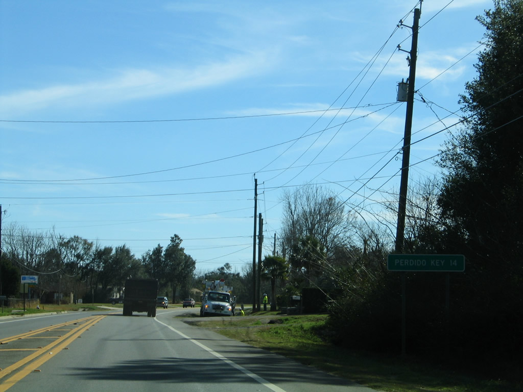
| Perdido Key lies 14 miles to the southwest along the Gulf of Mexico via SR 173 and SR 292 (Sorrenton Road). 02/01/06 |
|
| This reassurance marker was formerly posted south of Cerny Road. Cerny Road (unsigned CR 296A) stems 1.46 miles east from SR 173 to Marlane Drive at Cerny Heights. 02/01/06 |
|
| Muldoon Road and SR 173 (Blue Angel Parkway) come together south of Cerny Road and Bellview. 02/01/06 |
|
| Progressing south from Bayou Marcus and the Southwoods development, SR 173 (Blue Angel Parkway) next meets SR 298 (Lillian Highway). 05/17/14 |
|
| SR 298 (Lillian Highway) runs west to U.S. 98 and CR 297 (Dog Track Road) at Millview and east to SR 295 (New Warrington Road) at West Pensacola. 05/17/14 |
|
| SR 173 stays west of Myrtle Grove from SR 298 southward to U.S. 98. 01/31/06 |
|
| U.S. 98 heads west from Warrington and Myrtle Grove to SR 173 (Blue Angel Parkway) en route to Millview, Paradise Beach and Lillian, Alabama. 01/31/06 |
|
| U.S. 98 is one of four routes joining Pensacola with Baldwin County, Alabama. U.S. 98 travels west to Foley and east toward Downtown Pensacola. 01/31/06 |
|
| Future road work will expand a 3.239 mile section of SR 173 (Blue Angel Parkway) from a point just north of U.S. 98 southwest to SR 292 (Sorrento Road). 01/31/06 |
|
| Unmarked on SR 173 south, CR 297 (Dog Track Road) crosses Blue Angel Parkway southeast from Millview to SR 292 (Sorrento Road) at Pleasant Grove. 01/31/06 |
|
| SR 173 (Blue Angel Parkway) extends 1.5 miles south from SR 292 (Sorrento Road) along a controlled access arterial to CR 292A (Gulf Beach Highway). 05/05/14 |
|
| SR 173 (Blue Angel Parkway) converges with CR 292A (Gulf Beach Highway) along the western perimeter of Pensacola Naval Air Station. 05/15/14 |
|
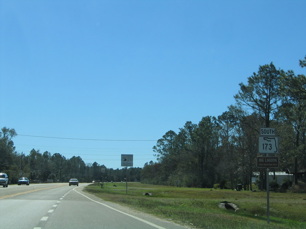
| Gulf Beach Highway (CR 292A) arcs northeast to SR 292 at Pleasant Grove and runs west to Big Lagoon State Park and SR 292 at Innerarity Point Road. 05/15/14 |
|
| Blue Angel Parkway (unsigned CR 173) extends 0.195 miles south from CR 292A (Gulf Beach Highway) to the West Gate of Pensacola N.A.S. The base is home to the National Museum of Naval Aviation. 05/15/14 |
Photo Credits:12/21/03, 01/31/06, 02/01/06, 10/01/09, 11/17/12, 05/05/14, 05/15/14, 05/16/14, 05/17/14 by AARoads
Connect with:
U.S. 90
U.S. 98
State Road 292
State Road 297 - Pine Forest Road
State Road 298 - Lillian Highway
County Road 292A - Gulf Beach Highway / Innerarity Point Road
Page Updated 04-02-2021.

 North
North