|
| Gulf Boulevard northbound at the Don Cesar Resort, just ahead of the intersection with SR 682 (Pinellas Bayway) east and SR 699 north. An overpass connects the historic hotel with an adjacent parking lot. 05/12/14 |
|
| Gulf Boulevard northward doubles as SR 699 as SR 682 begins and ventures east across the Pinellas Bayway, a toll facility linking St. Pete Beach with St. Petersburg and U.S. 19 and Interstate 275. 05/12/14 |
|
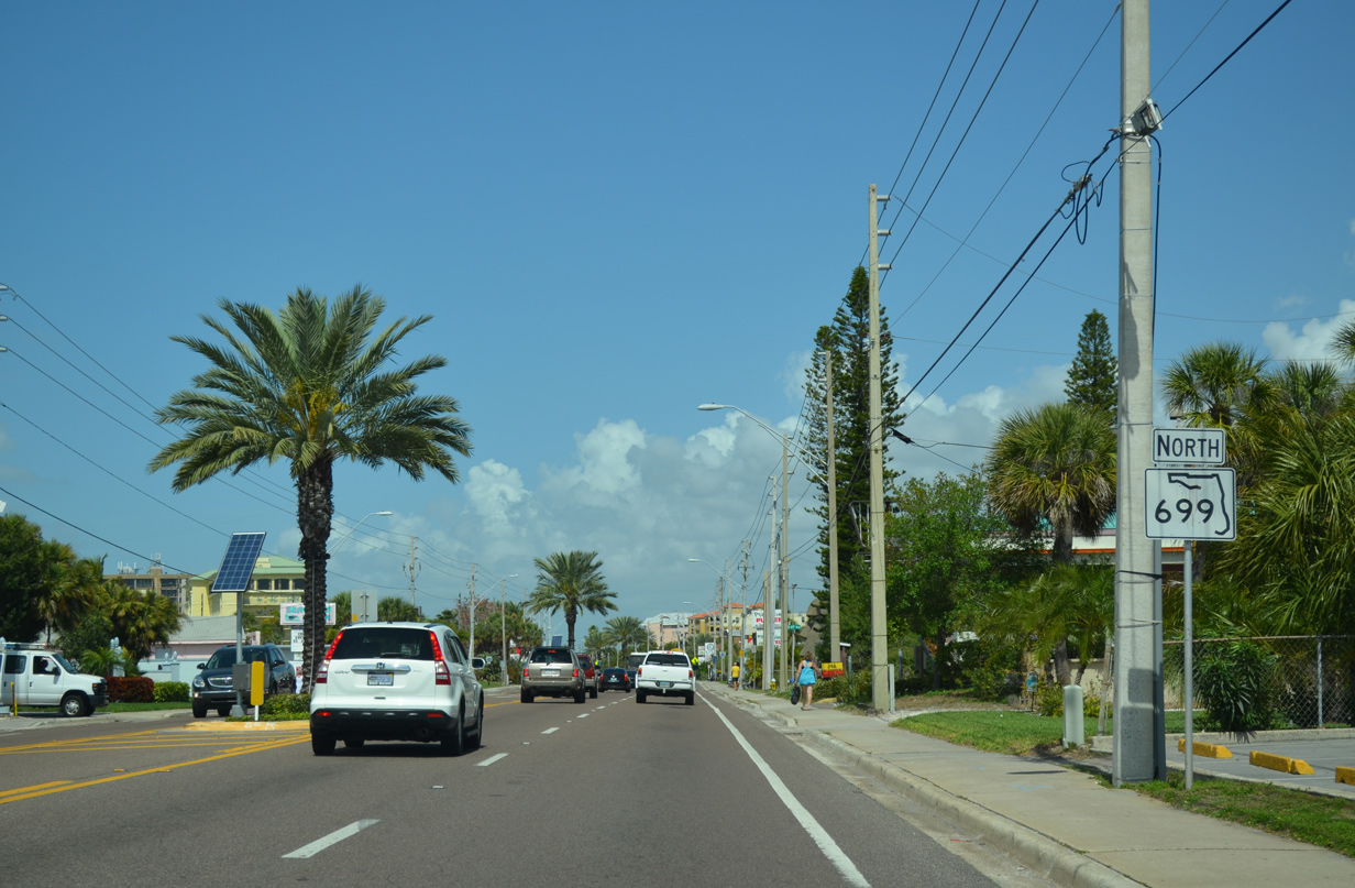
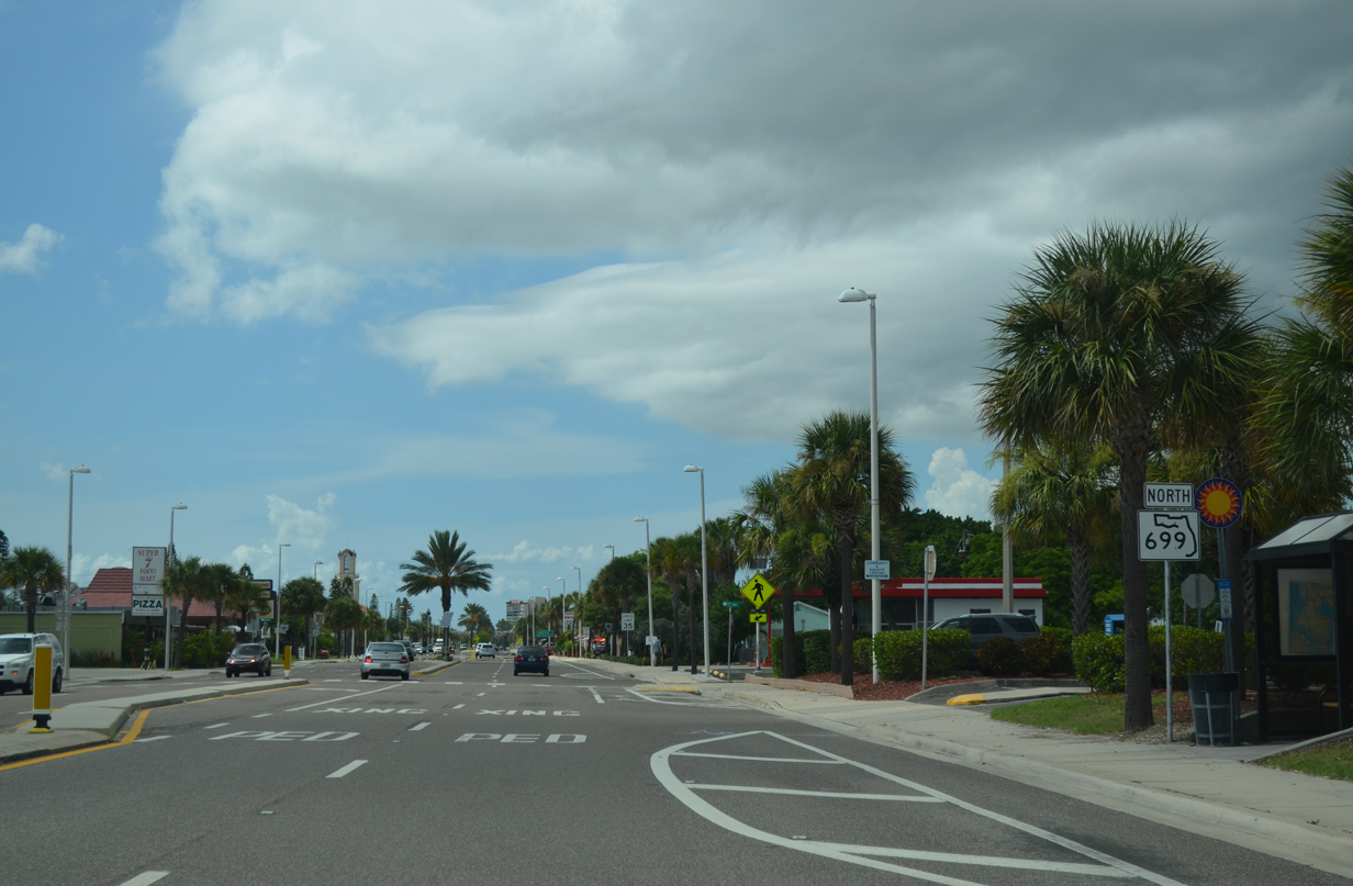
| SR 699 (Gulf Boulevard) begins its northward journey along a narrow strip of land between the Gulf of Mexico and McPherson Bayou in St. Pete Beach. 03/11/15 |
|
| The city of Treasure Island follows St. Pete Beach in three miles. SR 699 ends in Indian Rocks Beach in 15 miles. 03/11/15 |
|
| 44th Avenue leads east from SR 699 (Gulf Boulevard) to Lido Beach. 03/11/15 |
|
| The St. Pete Beach Access Park lies across from Dolphin Village Shopping Center near 46th Avenue. 03/11/15 |
|
| A northbound reassurance marker for SR 699 appears after the public beach and before 49th Avenue. 03/11/15 |
|
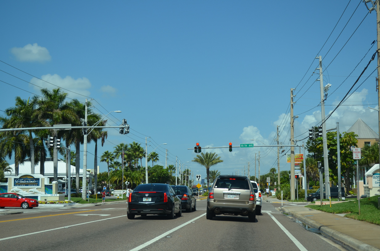
| Gulf Boulevard north near 55th Avenue, a spur to Brightwater Beach. 03/11/15 |
|
| A traffic signal governs the movements along Gulf Boulevard at 55th Avenue and the TradeWinds Resort complex. 03/11/15 |
|
| Gulf Winds Drive branches away from SR 699 (Gulf Boulevard) north after 59th Avenue. The street in conjunction with Boca Ciega Drive provides an alternate route to Downtown St. Pete Beach and SR 693 (75th Avenue). 03/11/15 |
|
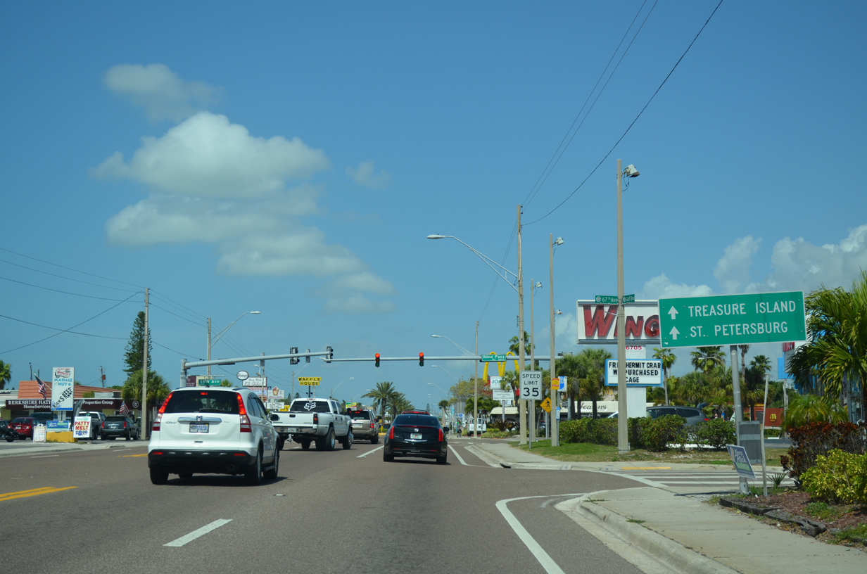
| Nearing Downtown St. Pete Beach, a guide sign directs motorists to St. Petersburg and Treasure Island to remain along SR 699 north through 75th Avenue. 67th Avenue here connects SR 699 with parallel Sunset Way, a road straddling Blind Pass, and Boca Ciega Drive.
Blind Pass Road splits with Gulf Boulevard north at the ensuing signal through the St. Pete Beach business district. 03/11/15 |
|
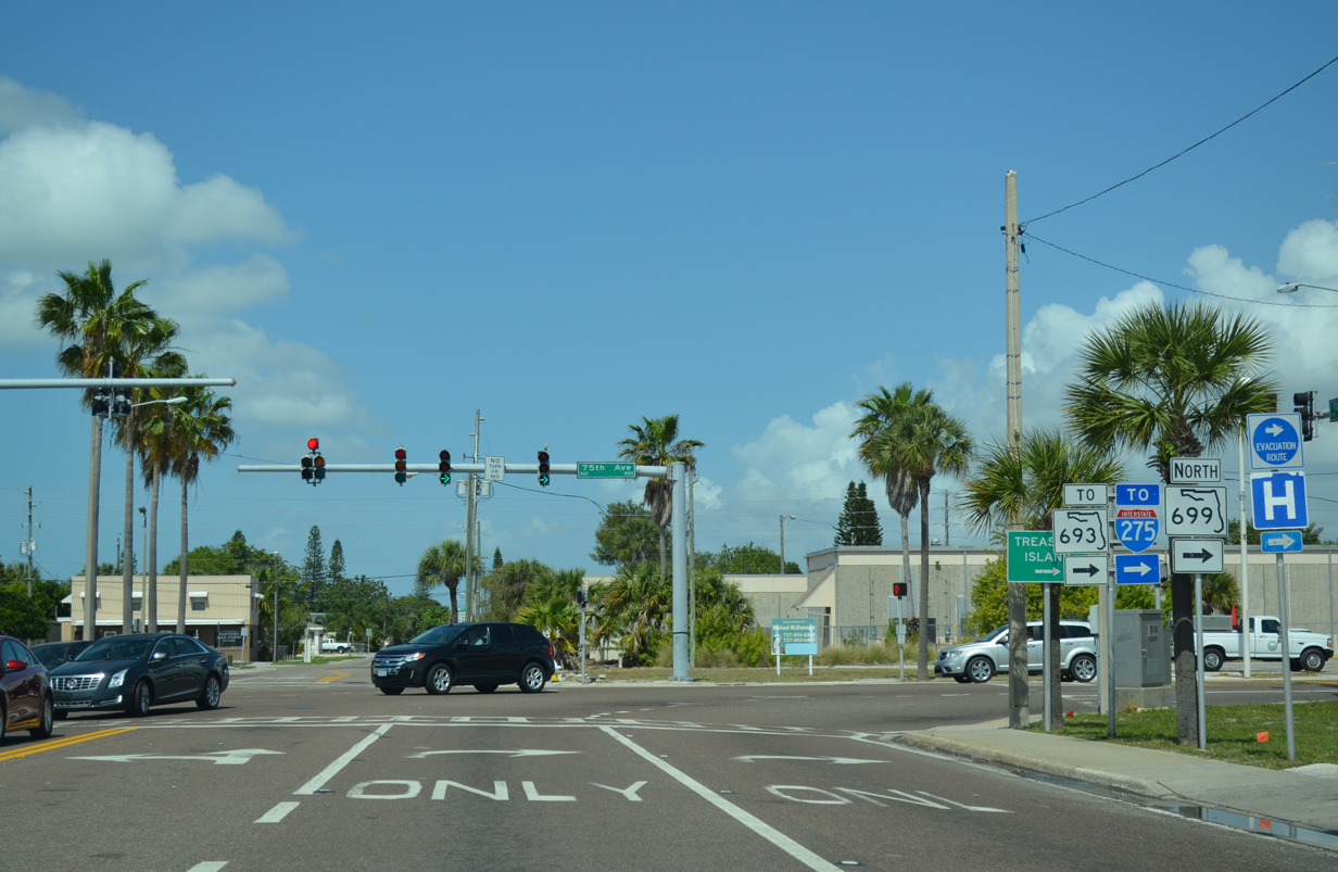
| An assembly for SR 693 and 699 provides motorists with advance notice of the upcoming turn of SR 699 onto 75th Avenue. SR 693 continues 75th Avenue to Corey Causeway and South Pasadena. 03/11/15 |
|
| A set of fire signals hang above SR 699 (Gulf Boulevard) north at 73rd Avenue by Downtown St. Pete Beach. The two northbound lanes of Gulf Boulevard turn east onto 75th Avenue in two blocks. 03/11/15 |
|
| Corey Avenue crosses paths at the next intersection, serving the business district of St. Pete Beach. 03/11/15 |
|
| SR 699 turns east from Gulf Boulevard for a one block drive on 75th Avenue. 03/11/15 |
|
| 75th Avenue west joins the state road with Sunset Way two blocks westward at Blind Pass. 03/11/15 |
|
| SR 693 begins at the SR 699 turn from 75th Avenue onto Blind Pass Road. The state road follows Corey Causeway to South Pasadena, the first toll free crossing to the Pinellas County mainland from the south. SR 693 overall joins the coast with Pinellas Park and U.S. 19. 05/12/14 |
|
| Connections from SR 693 (Pasadena Avenue / 66th Street North) via Gulfport Boulevard and 5th Avenue North in St. Petersburg lead drivers east to Interstate 275. 03/11/15 |
|
| SR 699 resumes its northerly course along Blind Pass Road from SR 693 (75th Avenue) to the Blind Pass bridge into Treasure Island. 08/15/15 |
|
| The city of Treasure Island lies one mile ahead, with SR 699 traveling another 11 miles to Indian Rocks Beach. 08/15/15 |
|
| Blind Pass Road bisects a grid of streets between Gulf Boulevard and Boca Ciega Drive to 87th Avenue. A pedestrian signal serves a school at 85th Avenue. 08/15/15 |
|
| An S-curve takes SR 699 westward to the bridge across Blind Pass. 08/15/15 |
|
| A four lane low level fixed bridge carries SR 699 across Blind Pass between north St. Pete Beach and Treasure Island. 03/11/15 |
|
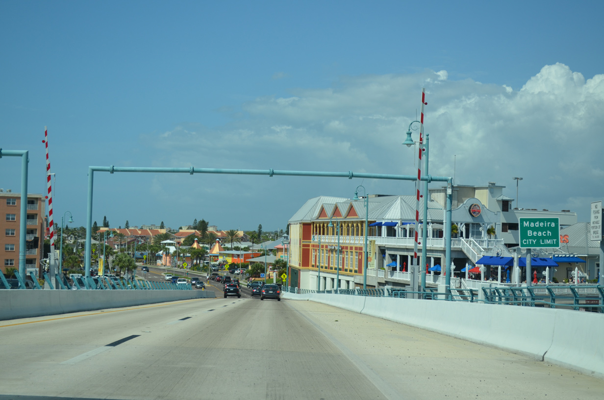
| SR 699 enters the city of Treasure Island and once again follows Gulf Boulevard. 03/11/15 |
|
| Gulf Boulevard intersects West Gulf Boulevard, a spur leading south to the Sunset Beach peninsula of Treasure Island. Their intersection ties into 1st Street East. 03/11/15 |
|
| SR 699 reassurance marker posted along Gulf Boulevard north beyond West Gulf Boulevard. The road carries four overall lanes through Treasure Island. 08/15/15 |
|
| 104th Avenue loops east from SR 699 (Gulf Boulevard) at Treasure Island Gulf Front Park to 107th Avenue around the Treasure Island business district. 08/15/15 |
|
| Upcoming 107th Avenue (CR 150) joins SR 699 (Gulf Boulevard) with Treasure Island Causeway. The causeway includes a draw bridge across the Intracoastal Waterway that was rebuilt in 2006-07. The new span replaced a 1938-built bridge. It opened on August 25, 2007 to coincide with the removal of tolls along the causeway. The new bridge travels 21 feet above water. 03/24/07 |
|
| 107th Avenue east leads to Treasure Island Causeway across both Paradise Island and Causeway Isles to the Pinellas County mainland. The former toll bridge connects with Central Avenue (County Road 150) through the city of St. Petersburg. 05/12/14 |
|
| A new reassurance marker was posted for SR 699 north after 107th Avenue by summer 2015. 08/15/15 |
|
| 112th Avenue spurs east from SR 699 (Gulf Boulevard) onto the Isle of Palms. 08/15/15 |
|
| 117th Avenue follows from SR 699 (Gulf Boulevard) onto the Isle of Capri. 08/15/15 |
|
| SR 699 north crosses Johns Pass between Treasure Island and the south end of Sand Key. 08/15/15 |
|
| Johns Pass was formed by a hurricane in 1848. It was named after John Levique, an area homesteader who discovered the pass on the morning of September 27, 1848 after sailing from New Orleans to Boca Ciega Bay.1 03/11/15 |
|
| The new four lane Johns Pass Bridge was completed in September 2010 after five years of work. The $76.9 million project replaced twin bascule bridges on the same alignment. The new spans provide a greater horizontal clearance to vessels below at a height of 27 feet.2 08/15/15 |
|
| Lowering into the city of Maderia Beach on SR 699 (Gulf Boulevard) northbound. The Johns Pass Bridge accommodates two 12-foot travel lanes and an eight foot sidewalk in each direction. 03/11/15 |
|
| Johns Pass Village rises along the east side of Gulf Boulevard as SR 699 touches down from the Johns Pass Bridge at 129th Avenue. The retail complex includes a number of eateries and shops and options for boat and jet ski rentals. 08/15/15 |
|
| A number of Rapid Rectangular Flashing Beacons were installed at crosswalks along Gulf Boulevard through Madeira Beach by FDOT in 2014-15. 03/11/15 |
|
| The next traffic light along SR 699 (Gulf Boulevard) north is at 140th Avenue. 140th Avenue joins Gulf Boulevard with Crystal Island and other islands in Boca Ciega Bay. 03/11/15 |
|
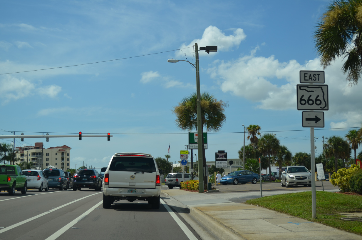
| SR 666 shield posted ahead of the intersection with 150th Avenue on SR 699 north. SR 666 joins Gulf Boulevard with U.S. 19 Alternate (Seminole Boulevard north / Bay Pines Boulevard east) as a four lane divided arterial. 06/14/14, 08/15/15 |
|
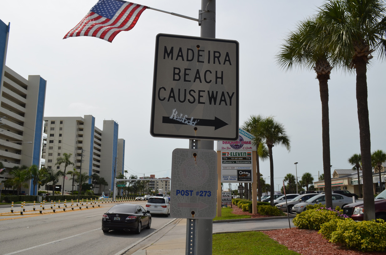
| This repurposed sign referenced SR 666 as Madeira Beach Causeway, its common name. It was removed by 2015. Tom Stuart Causeway is the fourth crossing from the south between the barrier islands and the Pinellas County mainland. 06/14/14 |
|
| State Road 666 totals just 1.39 miles between SR 699 (Gulf Boulevard) and a three-wye interchange with U.S. 19 Alternate near Bay Pines. The causeway was previously designated as an east-west branch of SR 699. 06/14/14, 08/15/15 |
|
| Madeira Way angles west from SR 666 (150th Avenue) through the Madeira Beach business district to intersect SR 699 (Gulf Boulevard) opposite Archibald Memorial Beach Park. 06/14/14 |
|
| A fire signal operates on SR 699 at 153rd Avenue for Fire Rescue Station Number 25. 153rd Avenue joins SR 699 (Gulf Boulevard) with Madeira Beach City Hall, Gulf Beaches Library and the Madeira Beach Recreation Complex. 03/11/15 |
|
| SR 699 (Gulf Boulevard) crosses the Redington Beach city line at 155th Avenue. 03/11/15 |
|
| 161st Avenue spurs northeast from Gulf Boulevard onto a man made peninsula jutting out into Boca Ciega Bay. 03/11/15 |
|
| This reassurance marker stands within the town limits of North Redington Beach. The incorporated community stretches along SR 699 between 164th and 173rd Avenues. 03/11/15 |
|
| Redington Shores is a 1.2 square mile town along SR 699 at the north end of Boca Ciega Bay. 03/11/15 |
|
| An overhead sign appears one half mile south of the intersection with Pinellas County Road 694 (Park Boulevard) east on SR 699 (Gulf Boulevard) north. CR 694 provides the next crossing over the Intracoastal Waterway between Indian Shores and Seminole. 03/11/15 |
|
| Drivers along Gulf Boulevard north enter the Indian Shores city limit at 183rd Terrace. 03/11/15 |
|
| A split intersection joins SR 699 with CR 694 by the Park Boulevard Boat Ramp. A two lane ramp angles northeast from Gulf Boulevard to join a four lane draw bridge across The Narrows, the Intracoastal Waterway linking Boca Ciega Bay with Clearwater Harbor. Pinellas County Road 694 upgrades to State Road 694 east of SR 693 (66th Street North) in Pinellas Park. 03/11/15 |
|
| SR 694 becomes Gandy Boulevard east of a SPUI with U.S. 19 while en route to Interstate 275 and U.S. 92 in north St. Petersburg. 03/11/15 |
|
| A signalized intersection governs the movements of the ending Pinellas County Road 694 west at SR 699 (Gulf Boulevard). SR 699 reduces to two lanes northward. 03/11/15 |
|
| Continuing north through Indian Shores, SR 699 sees a pedestrian signal at 196th Avenue and Tiki Gardens County Park. 03/11/15 |
|
| The waters of the Intracoastal (The Narrows) appear alongside Gulf Boulevard north as Sand Key narrows to Indian Rocks Beach. 03/11/15 |
|
| Welcome to Indian Rocks Beach sign posted along SR 699 north. 03/11/15 |
|
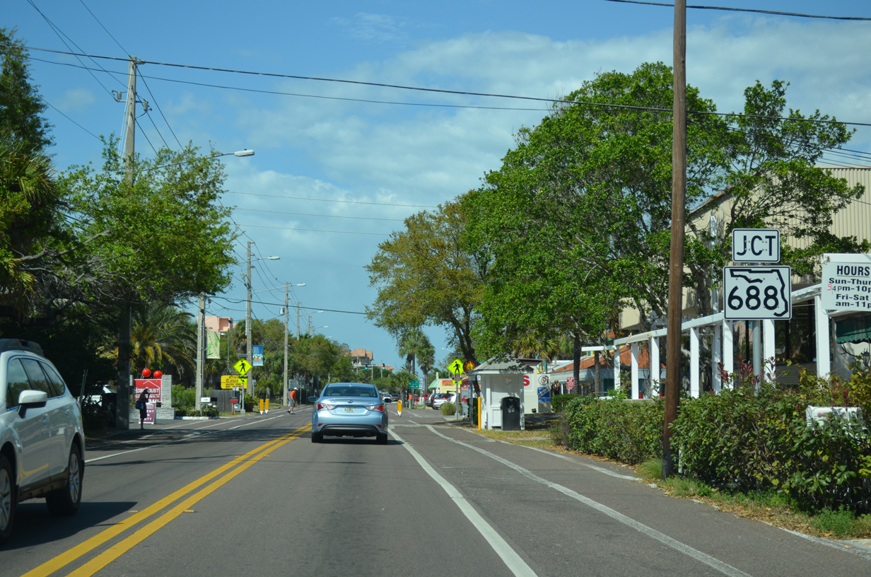
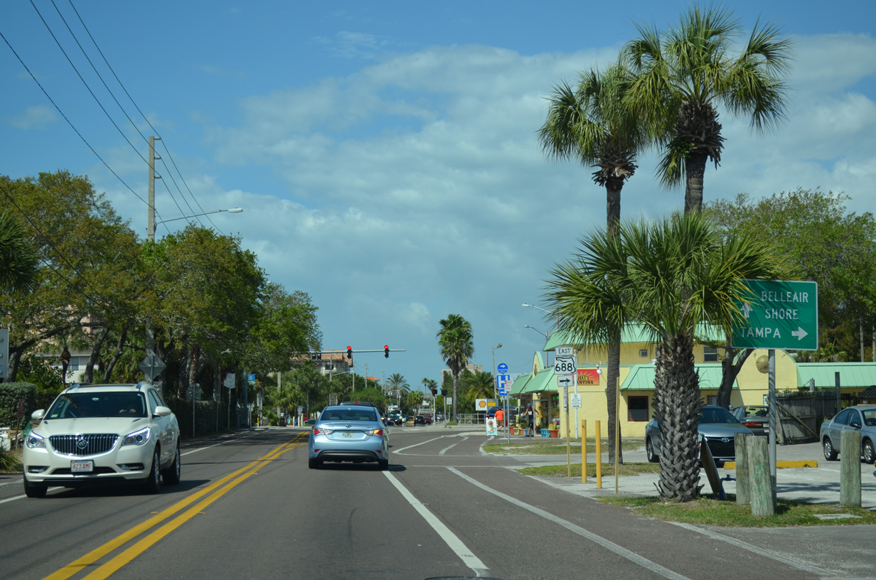
| Gulf Boulevard advances northward to 5th Avenue, the joint terminus of both SR 688 and 699. 03/11/15 |
|
| SR 688 travels the width of Pinellas County east from Indian Rocks Beach to Interstate 275 at the Howard Frankland Bridge approach to Tampa. 03/11/15 |
|
| A 12.91 mile route, SR 688 crosses the Indian Rocks Beach Drawbridge toward unincorporated Anona on the Pinellas County mainland. East from the Intracoastal, SR 688 travels Walsingham and Ulmerton Roads as a varying four to eight lane arterial to Largo, St. Pete-Clearwater International Airport (PIE), Pinellas Park and St. Petersburg. 03/11/15 |
|
| Gulf Boulevard expands to three lanes in width and becomes County Road 183 north from SR 688 (5th Avenue). 03/11/15 |
|
| County Road 416 (Causeway Boulevard) stems east from Gulf Boulevard (CR 183) in the city of Belleair Beach to Belleair Bluffs and along West Bay Drive into Largo. 03/11/15 |
|
| Belleair Causeway spans an inlet and the Intracoastal Waterway east from Gulf Boulevard to Indian Rocks Road (CR 233). The two lane roadway was rebuilt between 2007-10, with the construction of a new 74 foot high fixed span opened in 2009. 03/11/15 |
|
| Motorists along Gulf Boulevard cross the Clearwater city line near this collection of condominium north of Harrison Avenue. 03/11/15 |
|
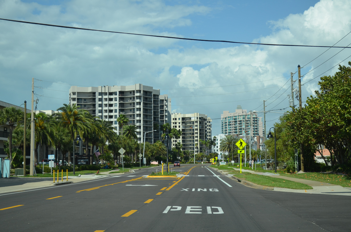
| Condo towers line the west side of Gulf Boulevard (CR 183) through northern reaches of Sand Key. 03/11/15 |
|
| Gulf Boulevard kinks eastward matching the shoreline of Sand Key in this scene near milepost 21. 03/11/15 |
|
| The northern tip of Sand Key doubles as a county park with public beach access and walking trails. 03/11/15 |
|
| Gulf Boulevard passes by Fire & Rescue Station Number 44 ahead of the Clearwater Pass Bridge. 03/11/15 |
|
| The lone northbound reassurance marker for Pinellas County Road 183 appears at the Clearwater Pass Bridge. 03/11/15 |
|
| The fixed Clearwater Pass Bridge ascends to a height of 65 feet above the waters below. The span was opened in 1994 to replace a tolled draw bridge operated by the city of Clearwater.3 03/11/15 |
|
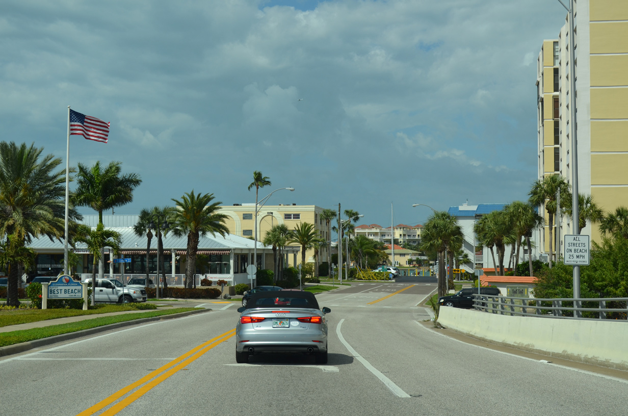
| Lowering into Clearwater Beach, a popular tourist and spring break destination, along CR 183 north. 03/11/15 |
|
| County Road 183 ends as Gulf Boulevard intersects Gulfview Boulevard. Gulfview Boulevard swings northward to complete the route between Sand Key and SR 60 east back to the Pinellas County mainland. 03/11/15 |
|
| Gulfview Boulevard arcs northwest from Gulf Boulevard to intersect Hampden Drive. Hampden Drive runs along the east side of Clearwater Beach while Gulfview Boulevard stays west by the public beach. 03/11/15 |
|
| Gulfview Boulevard ends at Coronado Drive, which travels a commercial strip between it and Hampden Drive. 03/11/15 |
|
| Coronado Drive comprises a four lane palm tree lined boulevard north from Gulfview Boulevard and the traffic circle with Causeway Boulevard. 03/11/15 |
|
| Coronado Drive ends at the rotary with Causeway Boulevard east, a driveway to Clearwater Municipal Marina, Poinsettia Avenue north and Mandalay Avenue north. Causeway Boulevard becomes Memorial Causeway and State Road 60 across the Intracoastal Waterway to Downtown Clearwater. 03/11/15 |
Page Updated 08-20-2015.