
 North
North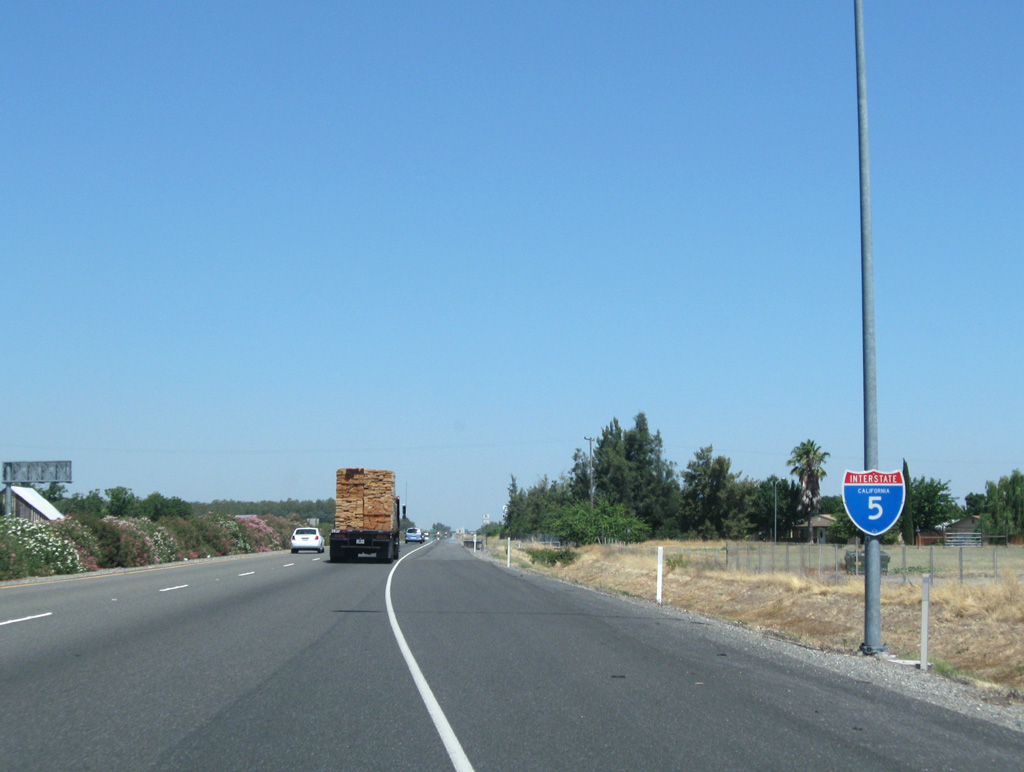
08/02/11
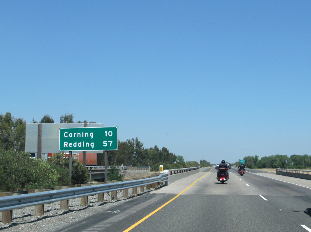
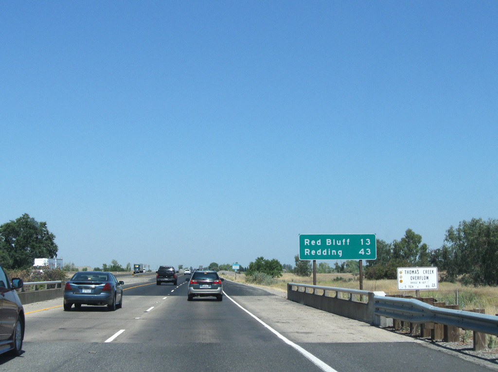
Interstate 5 advances 10 miles north to Corning and 57 miles to Redding in Shasta County.
08/02/11
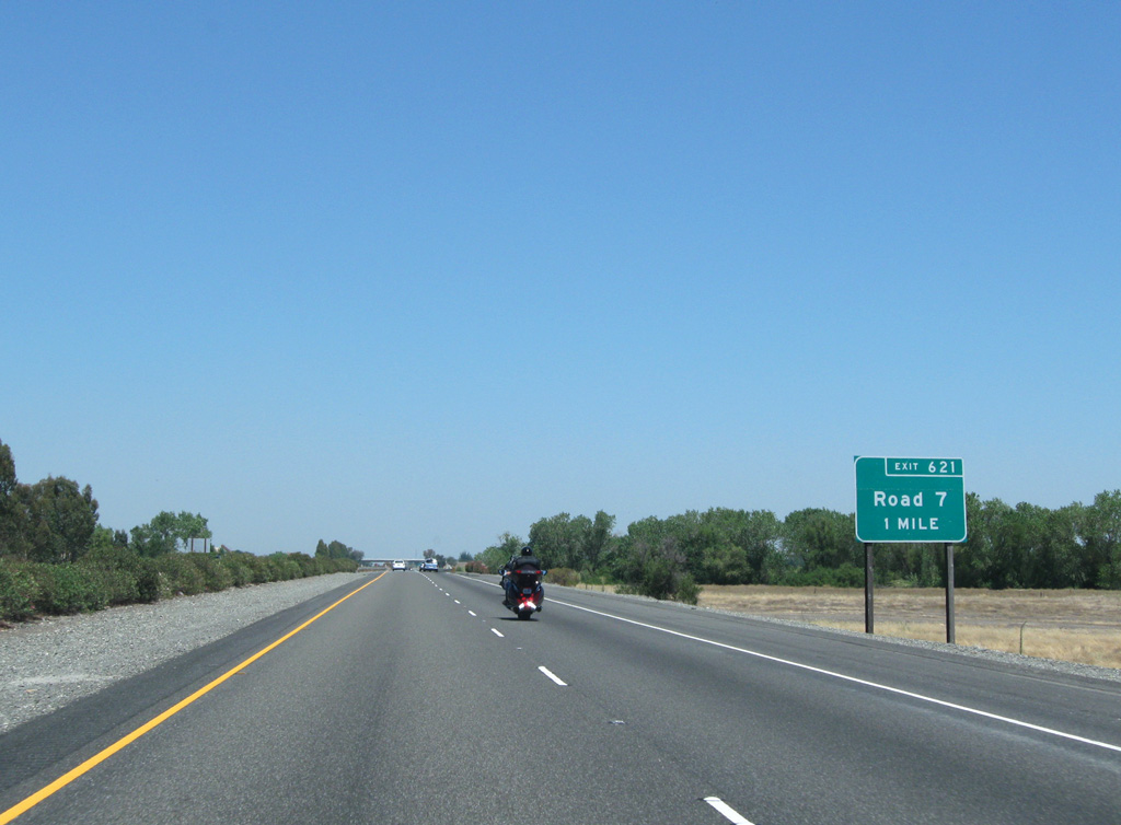
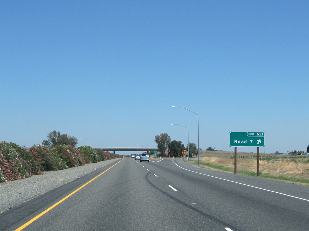
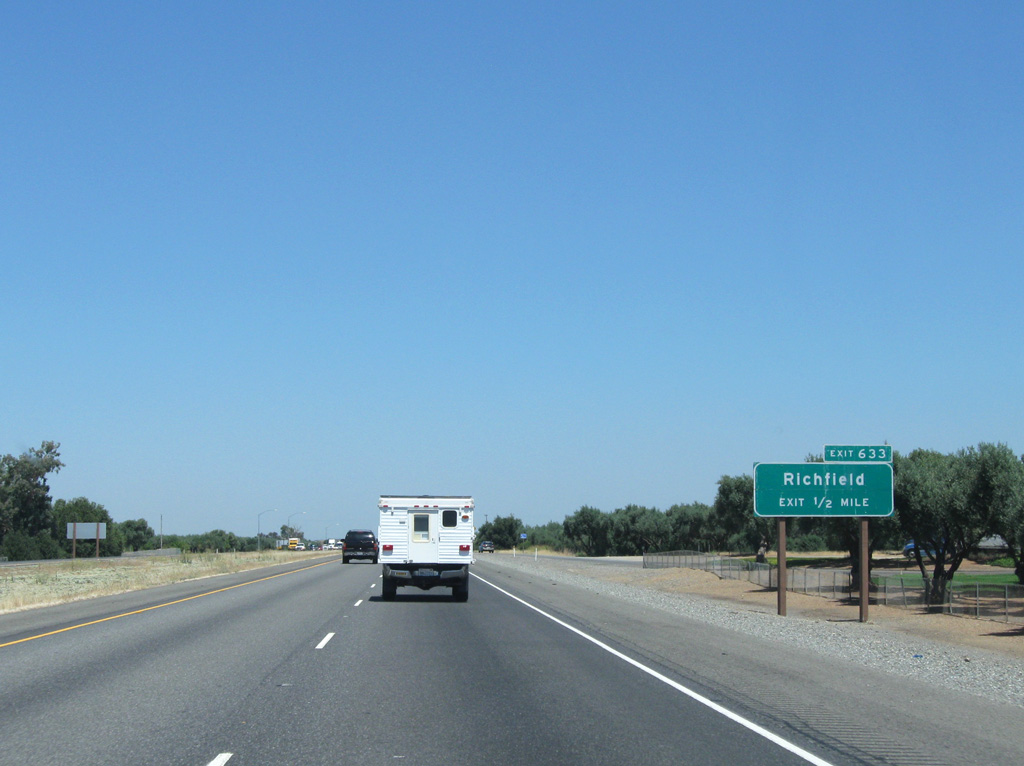
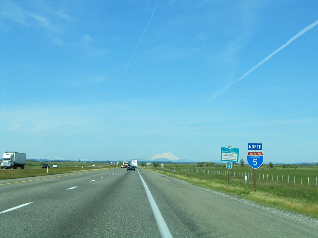
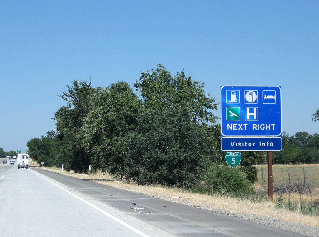
I-5 meets the northern end of Business Loop I-5 one mile ahead. The 20.4 mile long business route originated in Willow to the south.
08/02/11
08/02/11
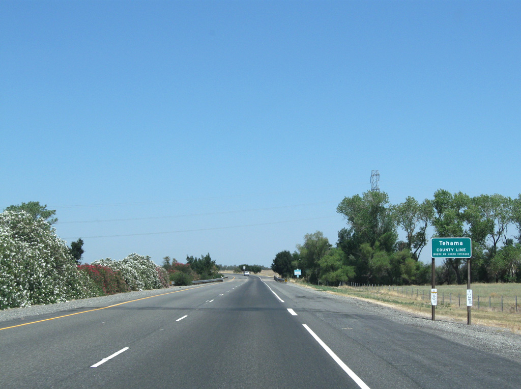
I-5 north crosses into Tehama County ahead of Gay Creek and a 230kV Pacific Gas and Electric (PG&E) transmission line.
08/02/11
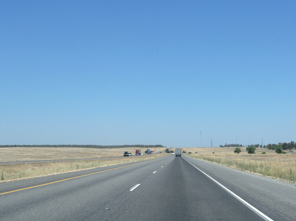
The ensuing stretch of Interstate 5 to Exit 631 (Corning Road) was constructed in 1966.
08/02/11
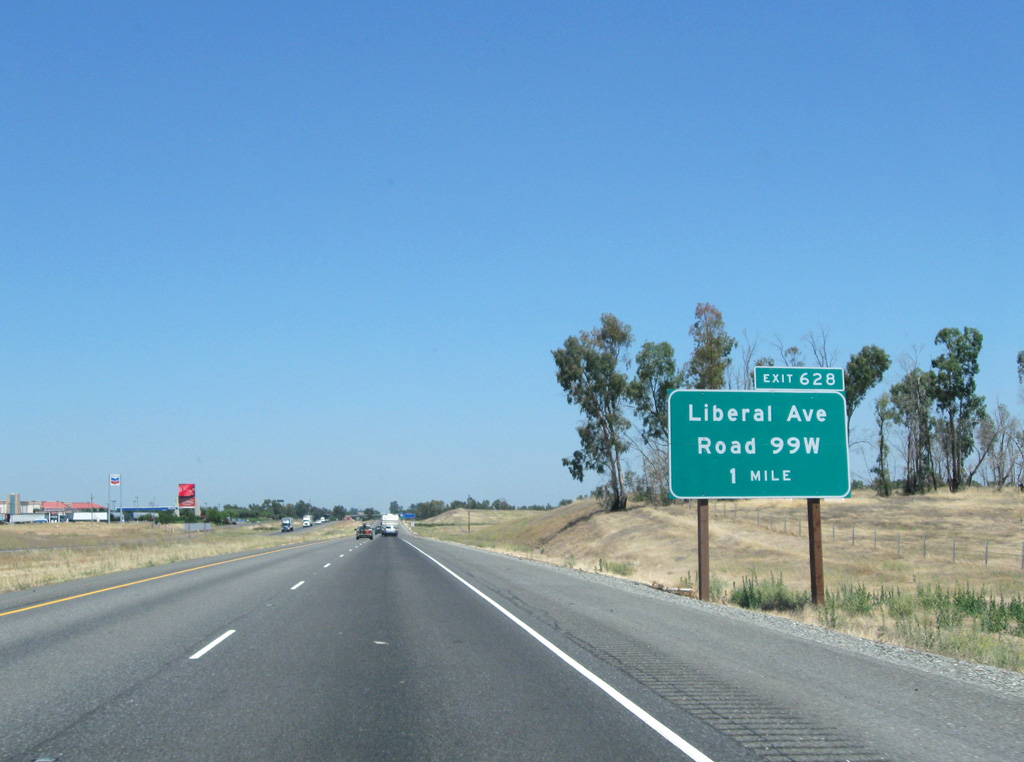
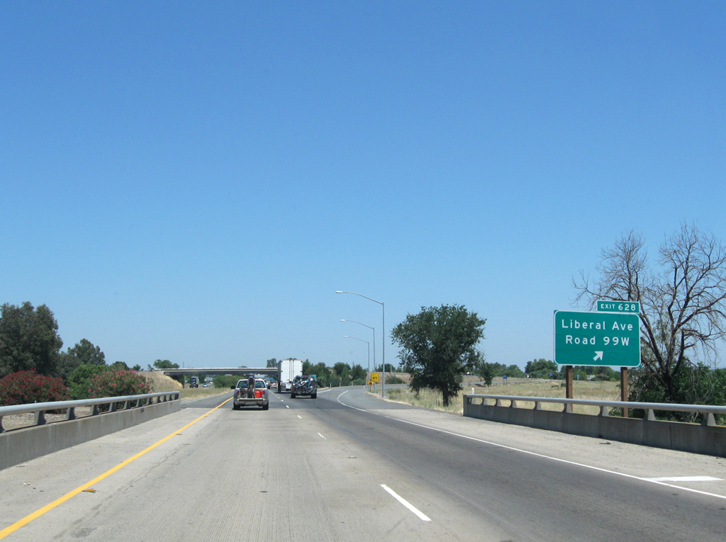
Liberal Avenue joins Interstate 5 with South 99W (old U.S. 99W) in one mile at a diamond interchange (Exit 628).
08/02/11
08/02/11
03/31/05
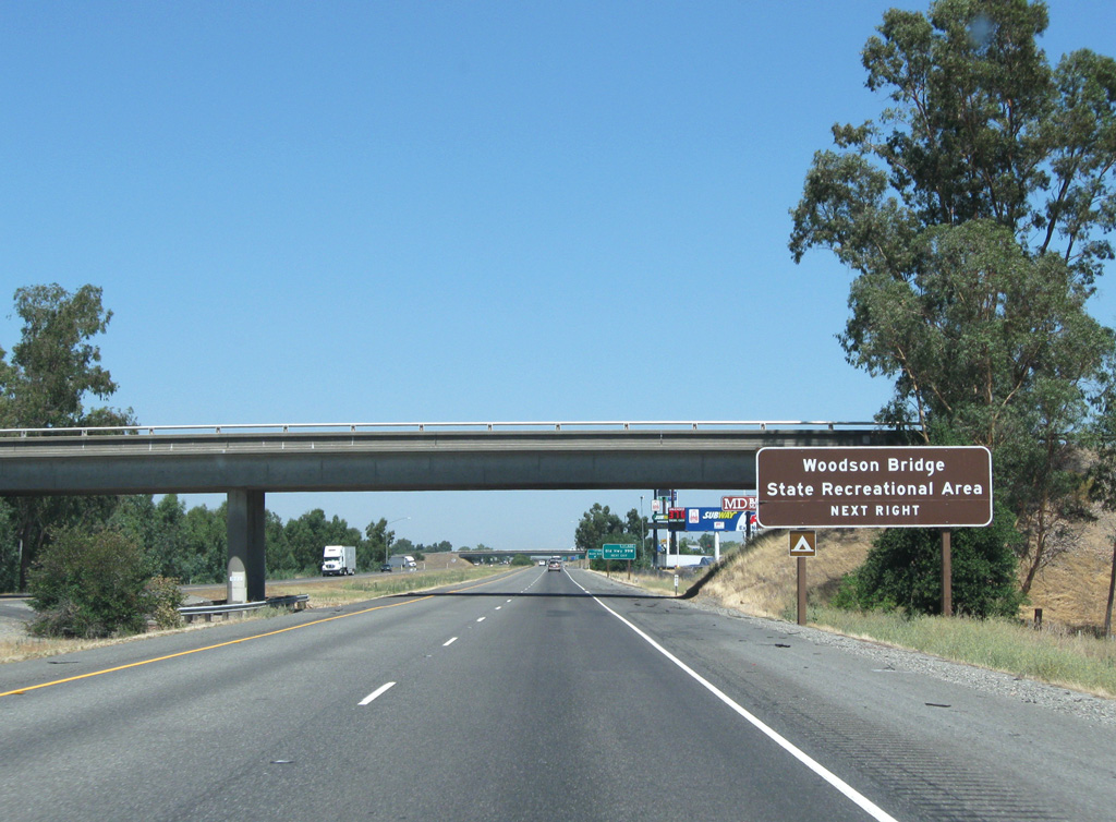
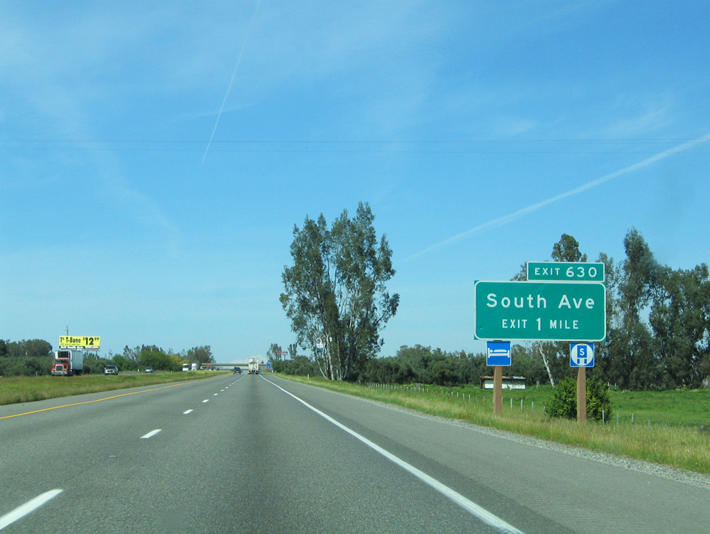
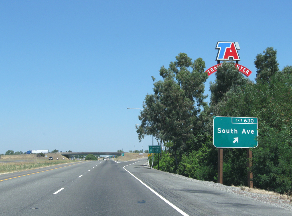
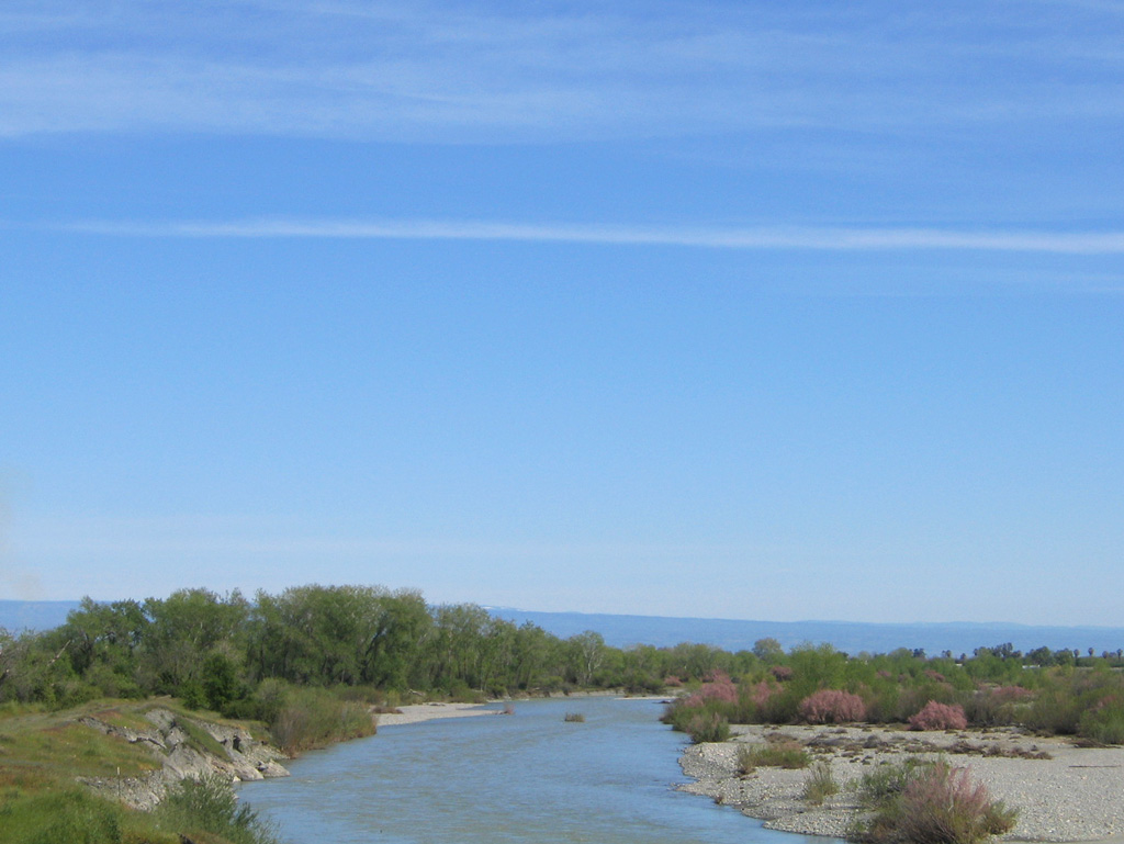
South Avenue leads east from I-5 to the Woodson Bridge State Recreation Area along the Sacramento River.
08/02/11
08/02/11
08/02/11
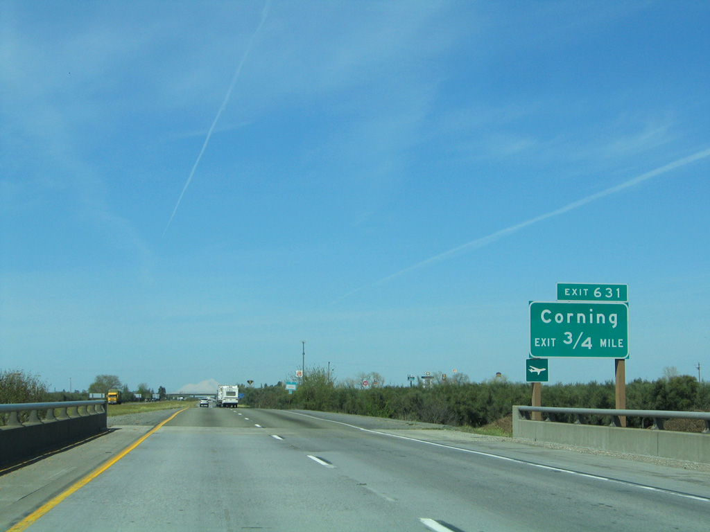
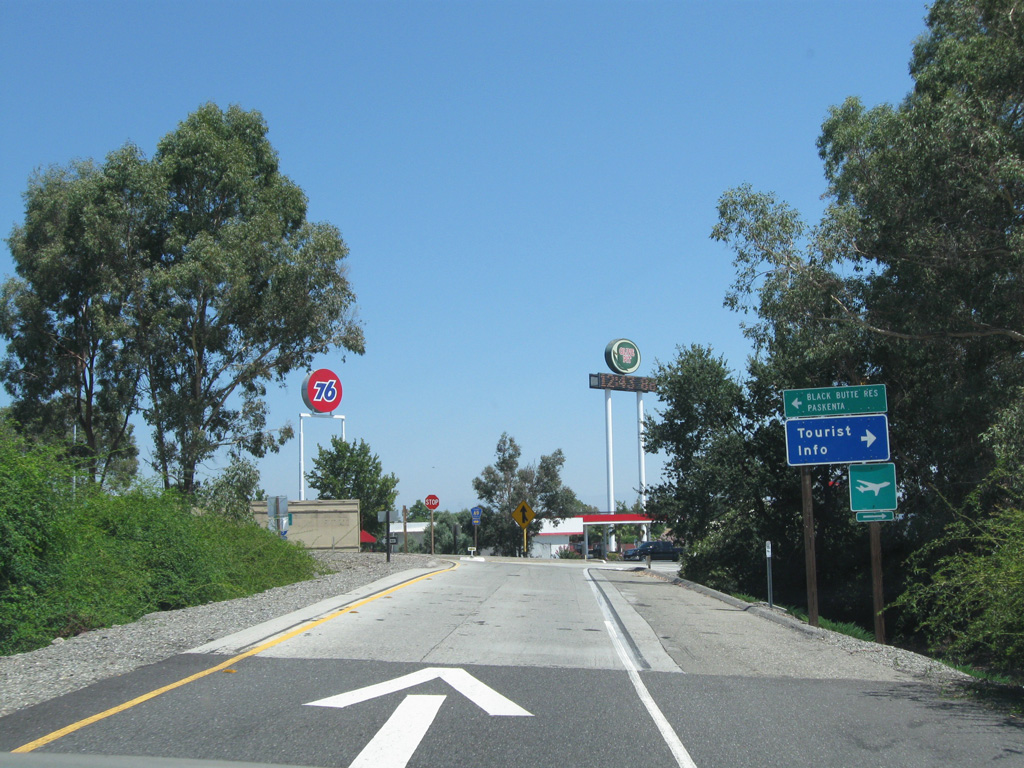
Crossing Burch Creek, Interstate 5 meets Solano Street (Tehama County Route A9) to Corning 0.75 miles ahead.
03/31/05
03/31/05
Corning was established as a city August 6, 1907 and is known as the "Olive City".
08/02/11
08/02/11
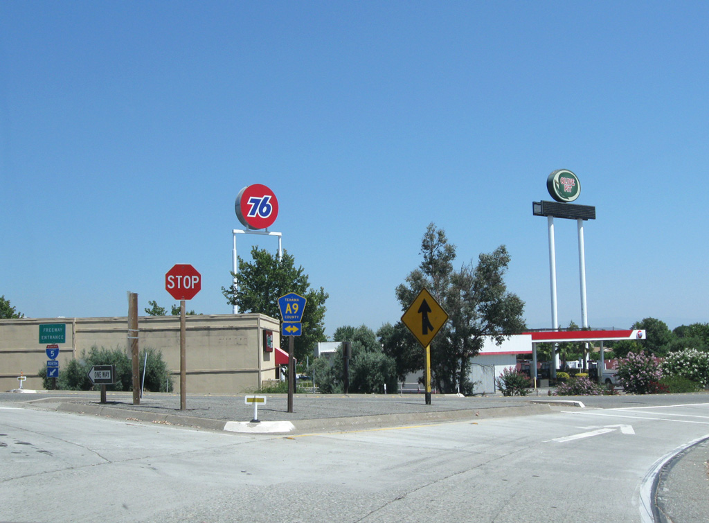
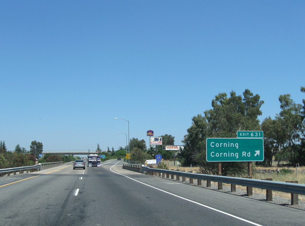
Corning Road extends CR A9 west to Flournoy and Paskenta while Solano Street travels east into central Corning.
08/02/11
03/31/05
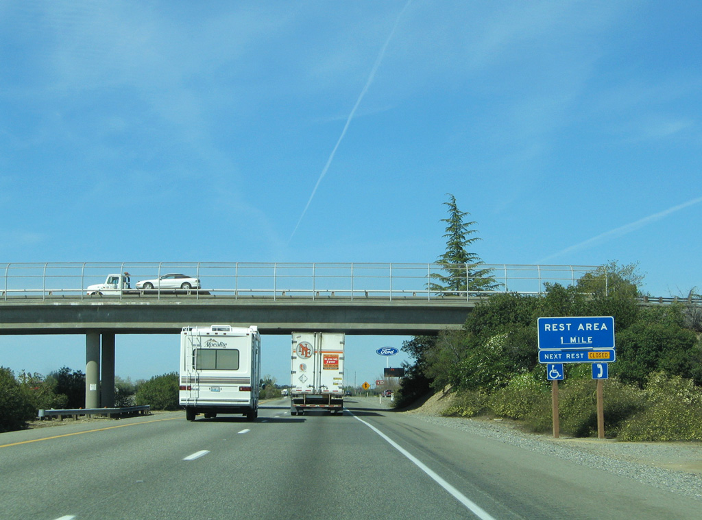
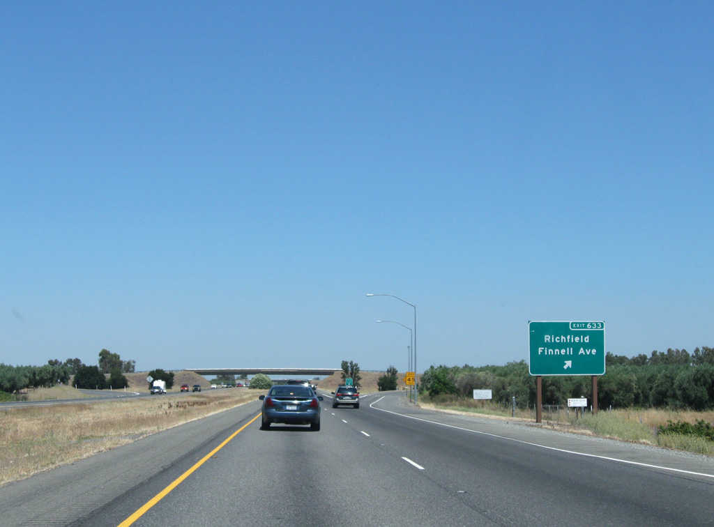
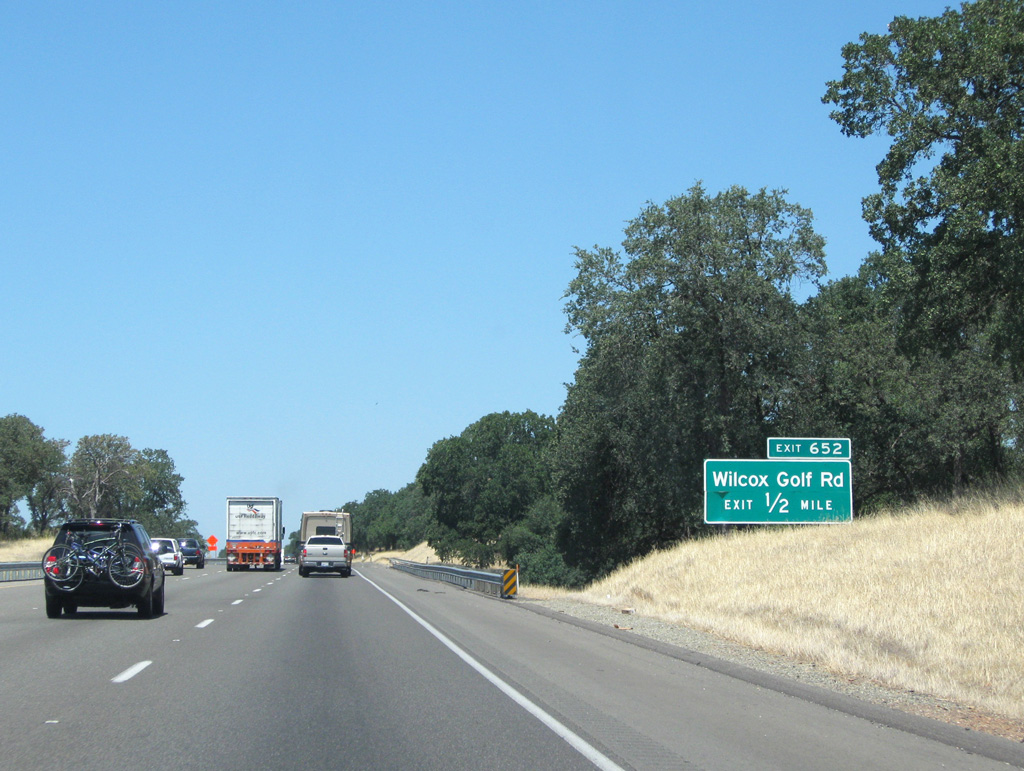
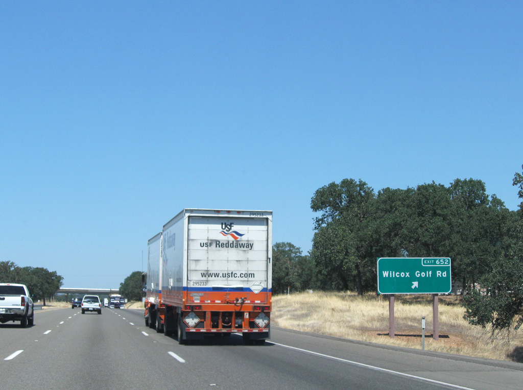
The Lieutenant John C Helmick Rest Areas line Interstate 5 between Exit 631 (Solano Street) and Exit 633 (Finnell Avenue).
08/02/11
08/02/11
08/02/11
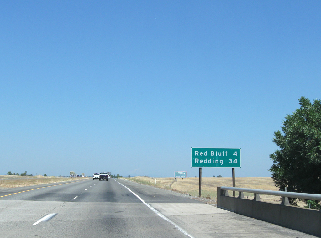
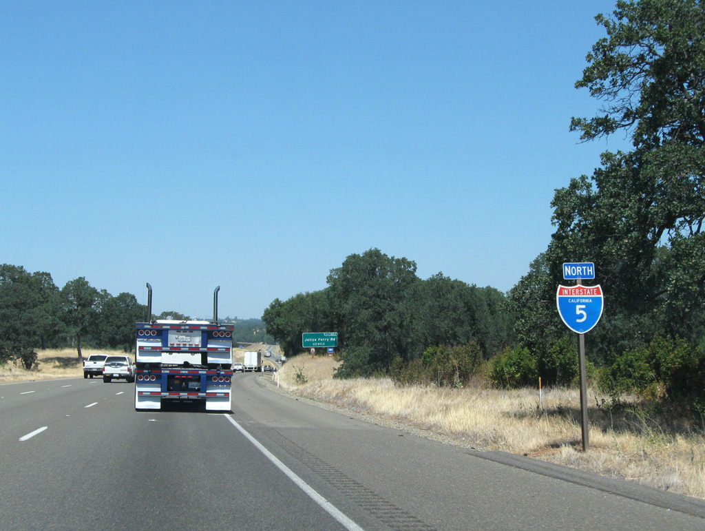
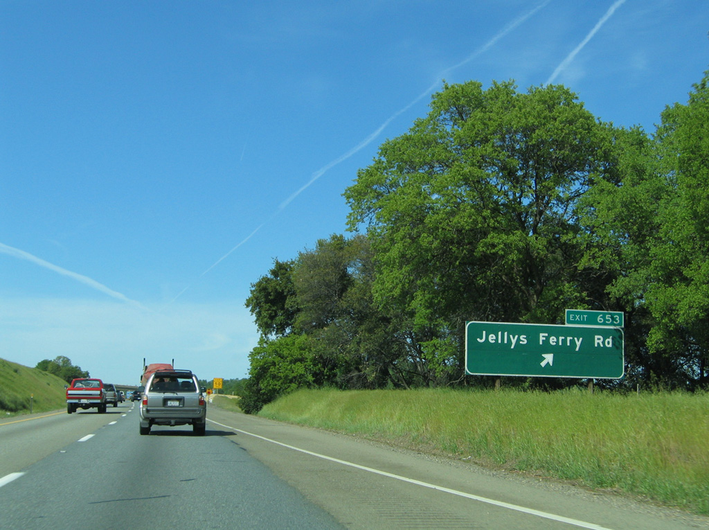
The seat of Tehama County lies 13 miles ahead.
08/02/11
08/02/11
03/31/05
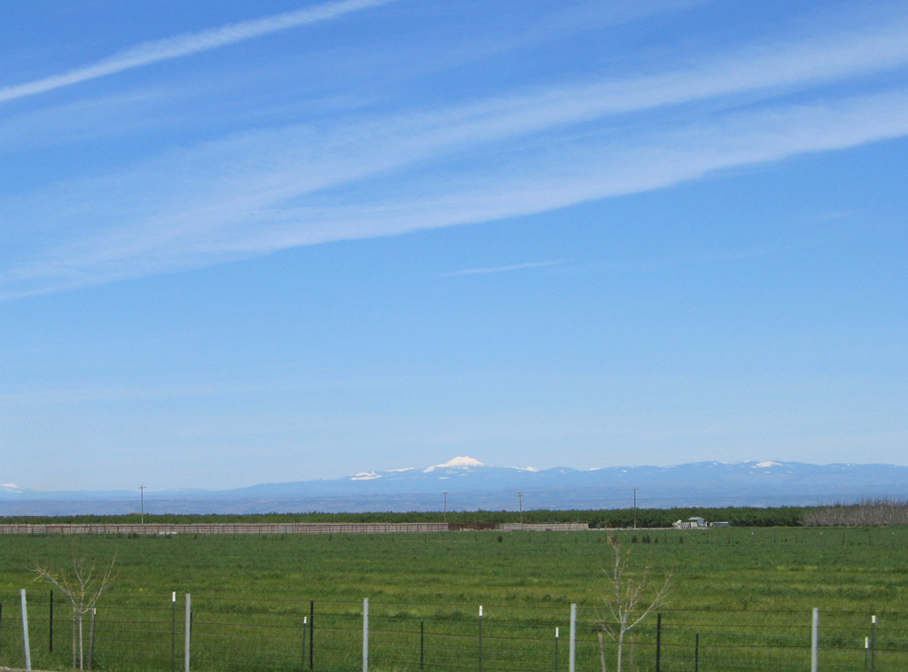
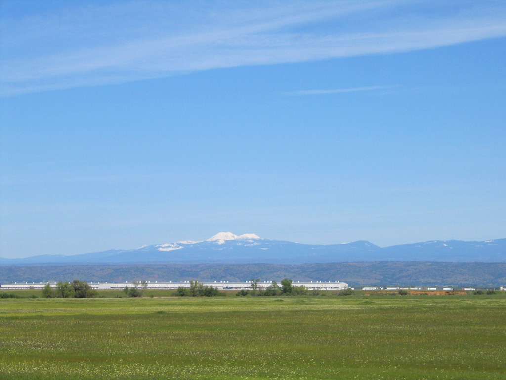
Located in Lassen Volcanic National Park, Mount Conarg and Lassen Peak rise in the distance along I-5 north. Lassen Peak was dormant for nearly 27,000 years until eruptions in May 1914 and 1915.1
03/31/05
08/02/11
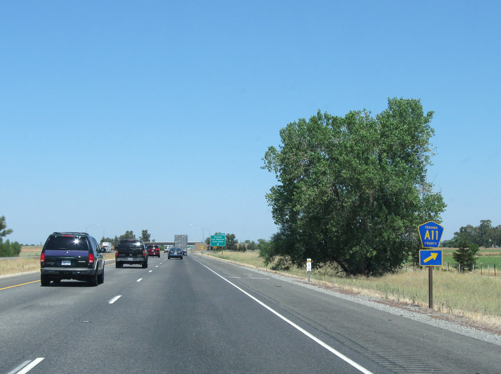
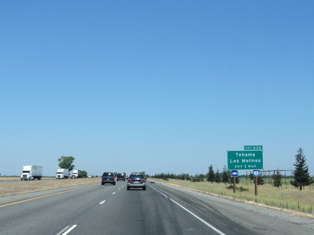
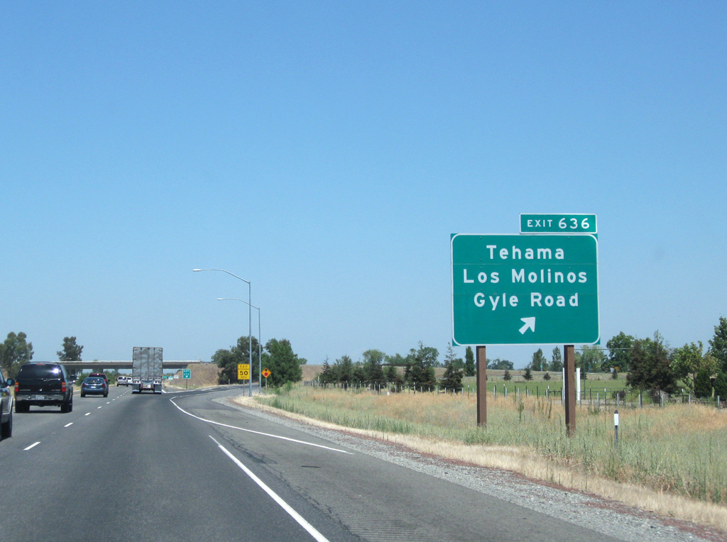
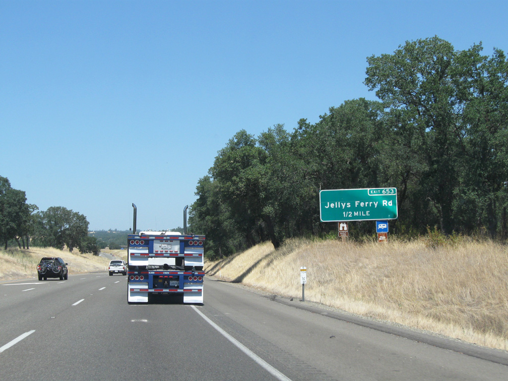
CR A11 overlays Gyle Road east from I-5 to Tehama and Los Molinos, both located along the Sacramento River.
08/02/11
08/02/11

08/02/11
08/02/11
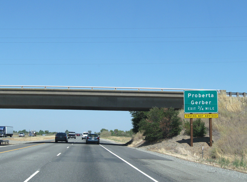
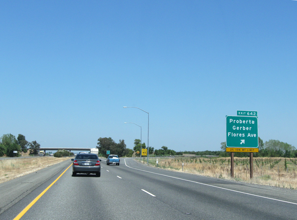
Chard Avenue spans Interstate 5 ahead of a parclo interchange (Exit 642) with Flores Avenue to Proberta.
08/02/11
08/02/11
On clear days Mount Shasta is visible along northbound I-5 leading toward Red Bluff.
03/31/05
03/31/05
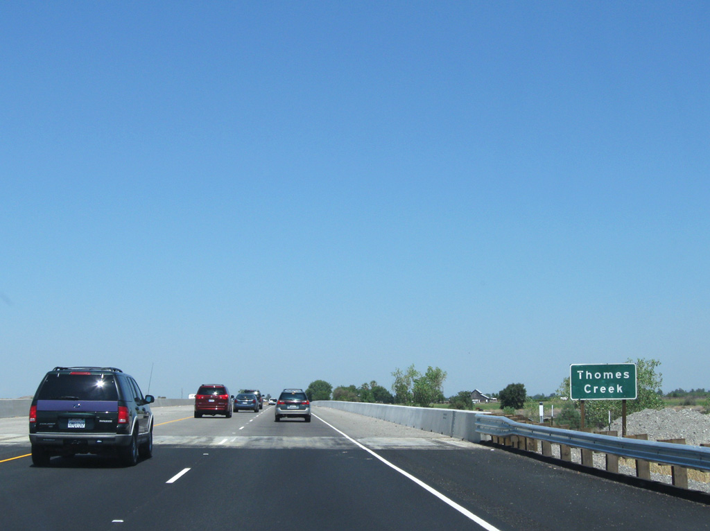
Crossing Coyote Creek 34 miles out from Redding along Interstate 5 north.
08/02/11
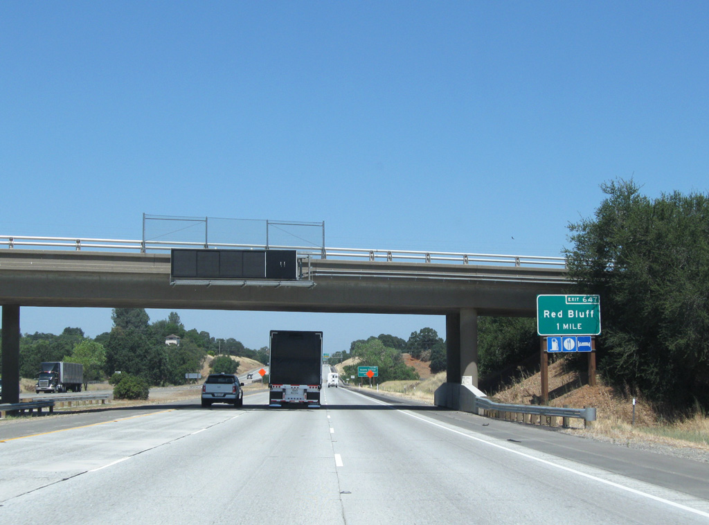
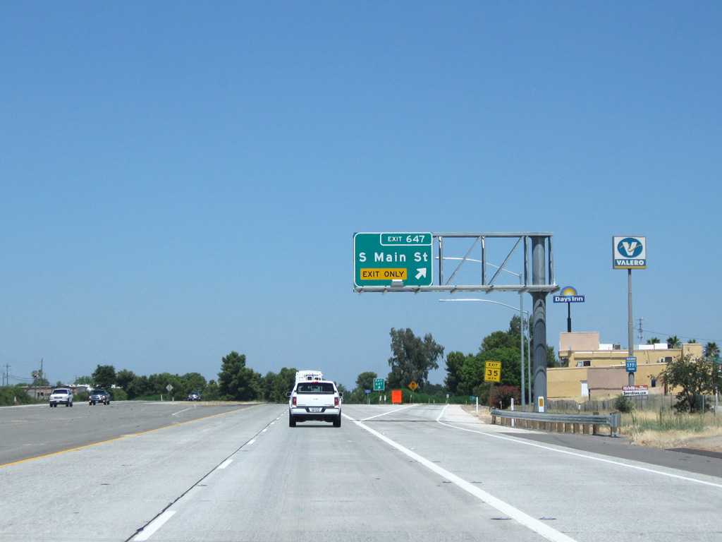
The first of three interchanges for Red Bluff is one mile ahead at Exit 647 (Business Loop I-5). This sign near the Riverside Avenue overpass was removed by Summer 2015 and never replaced.
08/02/11
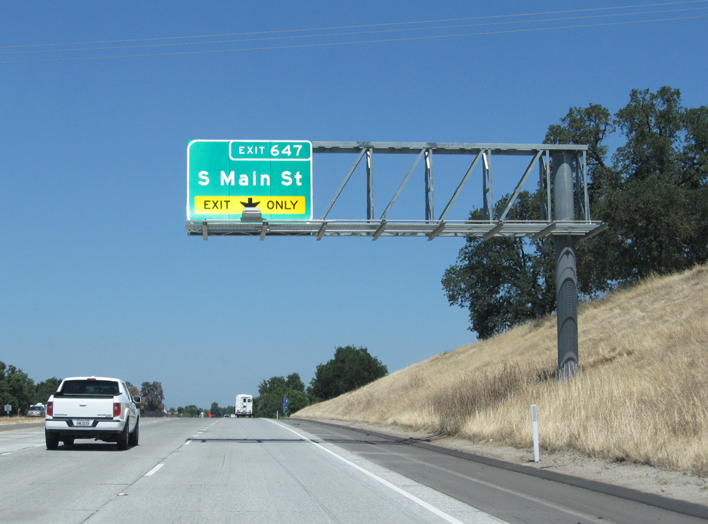
Business Loop I-5 follows S Main Street (historic U.S. 99W) northwest into central Red Bluff.
08/02/11
Overall, the business route travels 4.20 miles through the Tehama County seat.
08/02/11
08/02/11
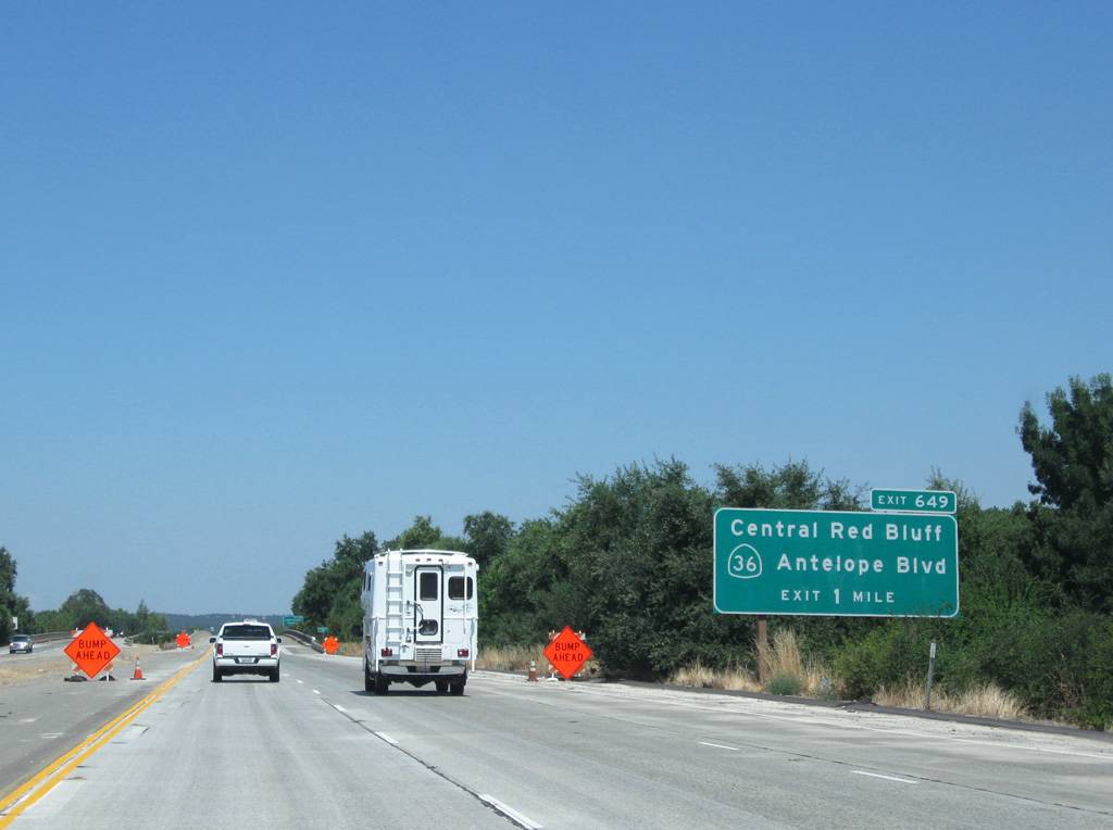
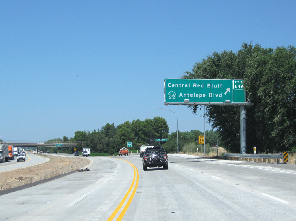
I-5 advances under S Main Street, a Union Pacific railroad, and Diamond Avenue one mile ahead of a parclo interchange (Exit 649) with SR 36.
08/02/11
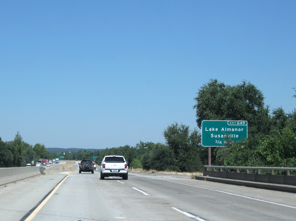
The first of two crossings of the Sacramento River is ahead of Exit 649 to SR 36 (Antelope Boulevard). SR 36 joins I-5 with Lake Almanor located 70 miles to the east of Red Bluff.
08/02/11
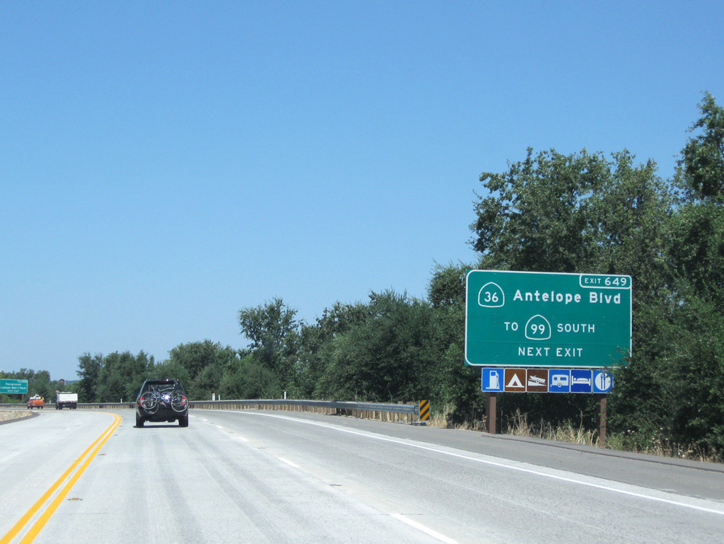
SR 99 begins its run southeast to Sacramento 2.2 miles to the east of Exit 649. Historically, U.S. 99E followed SR 36 from Los Molinos and Chico into Red Bluff, ending at former U.S. 99W (S Main Street) in downtown.
08/02/11
08/02/11
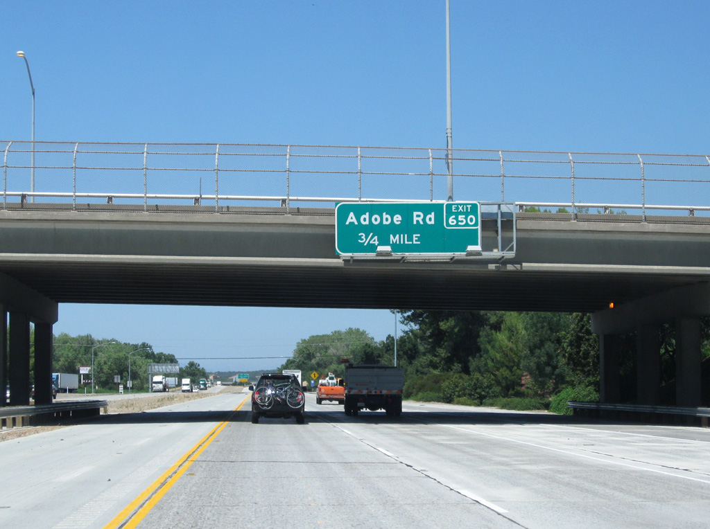
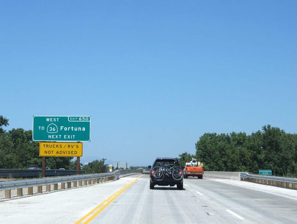
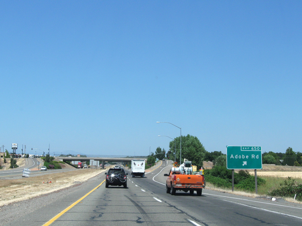
Adobe Road (Exit 650) joins Interstate 5 with SR 36 west to Fortuna along the Pacific coast next.
08/02/11
08/02/11
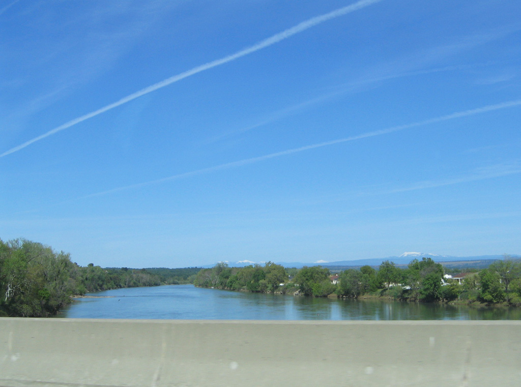
Looking north along the Sacramento River on the second crossing on Interstate 5.
03/31/05
08/02/11
This confirming marker stands beyond the return of the Red Bluff business route (I-5) at a wye interchange for southbound (Exit 651).
08/02/11
08/02/11
08/02/11
08/02/11
08/02/11
03/31/05
08/02/11
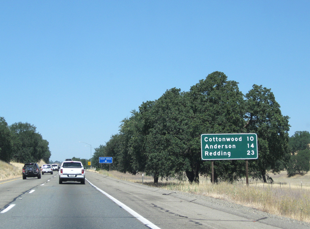
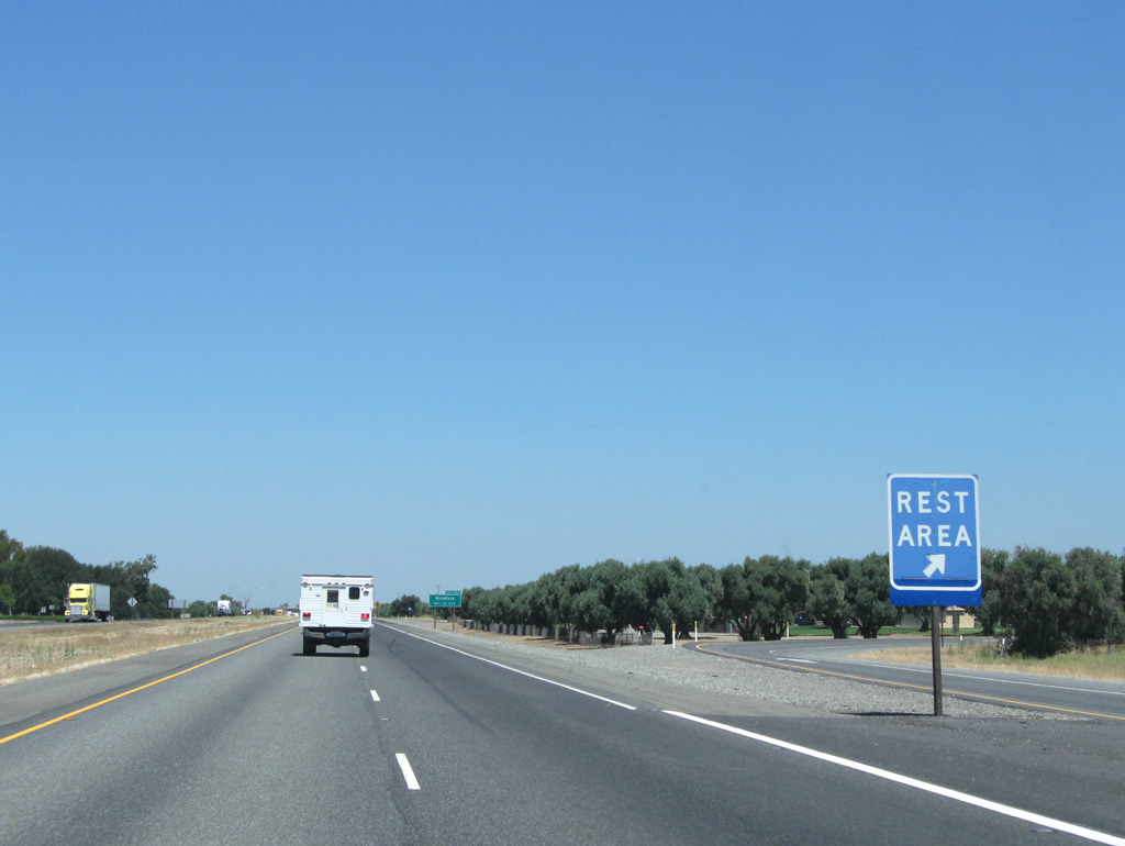
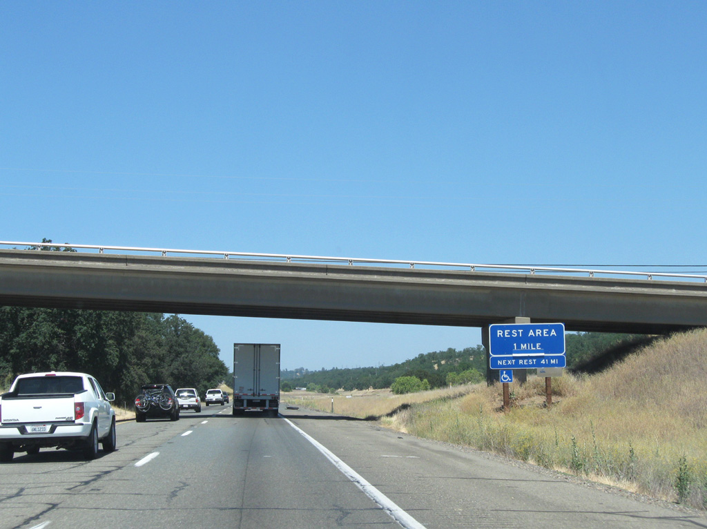
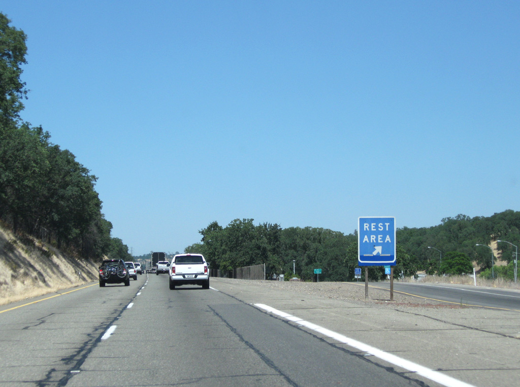
This distance sign precedes the Herbert S Miles Rest Area on Interstate 5 north. Cottonwood is located 10 miles ahead in Shasta County.
08/02/11
08/02/11
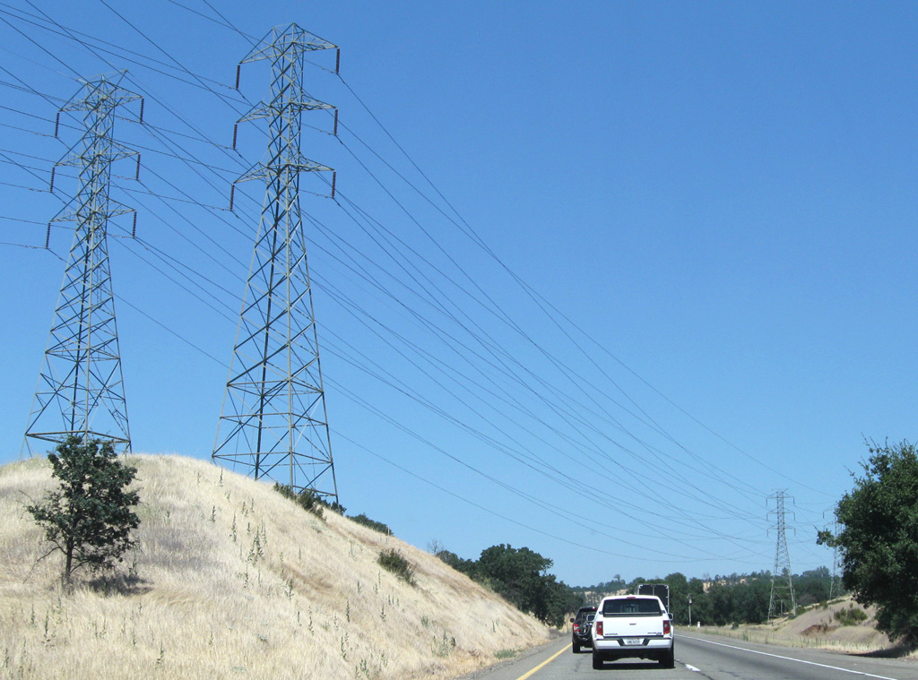
Leaving the PG&E Path 66 transmission lines, a pair of 230kV and one 138kv PG&E lines span I-5 near a southbound rest area and ahead of Exit 657.
08/02/11

These 230kV transmission lines continue north to the Cottonwood Substation, interconnecting with other regional lines before angling northeast to rejoin the Path 66 line toward Oregon.
08/02/11
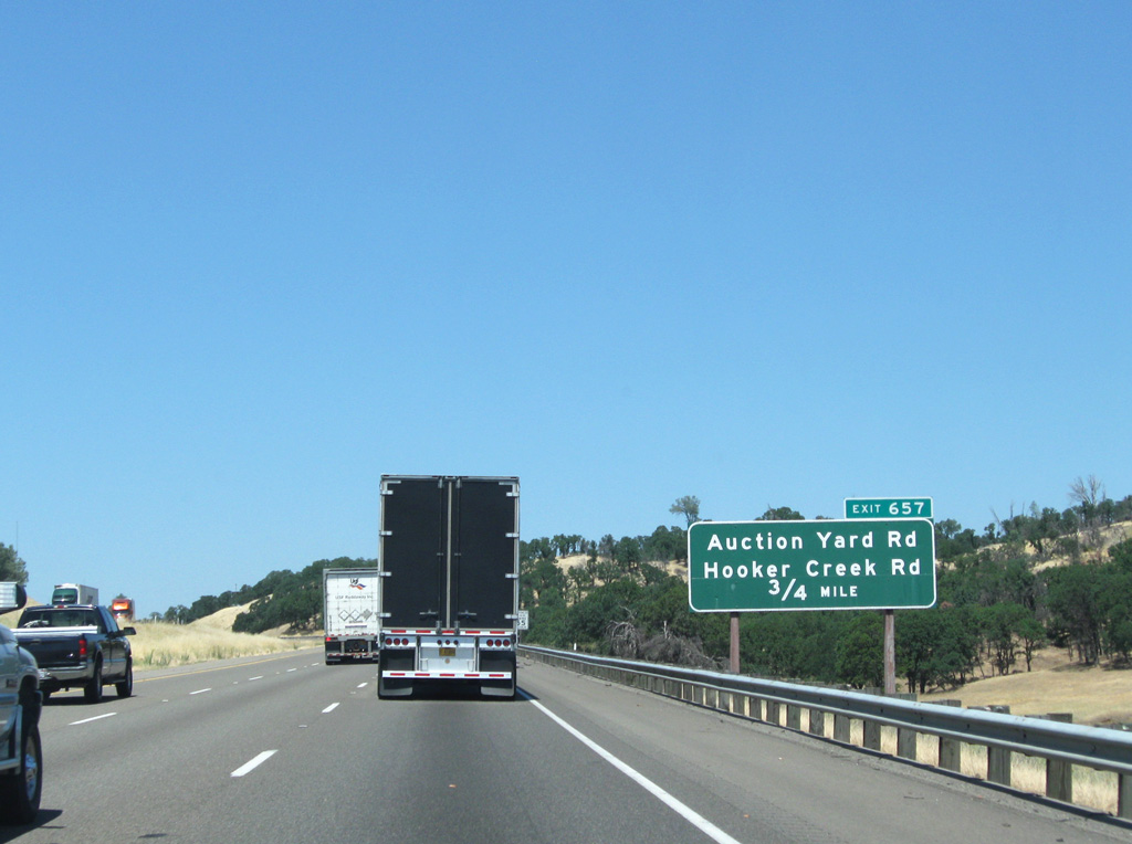
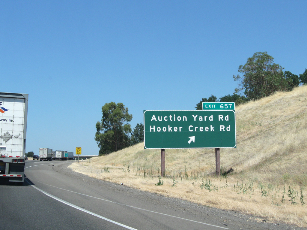
I-5 briefly gains a third lane ahead of a diamond interchange (Exit 657) to Hooker Creek Road.
08/02/11
08/02/11
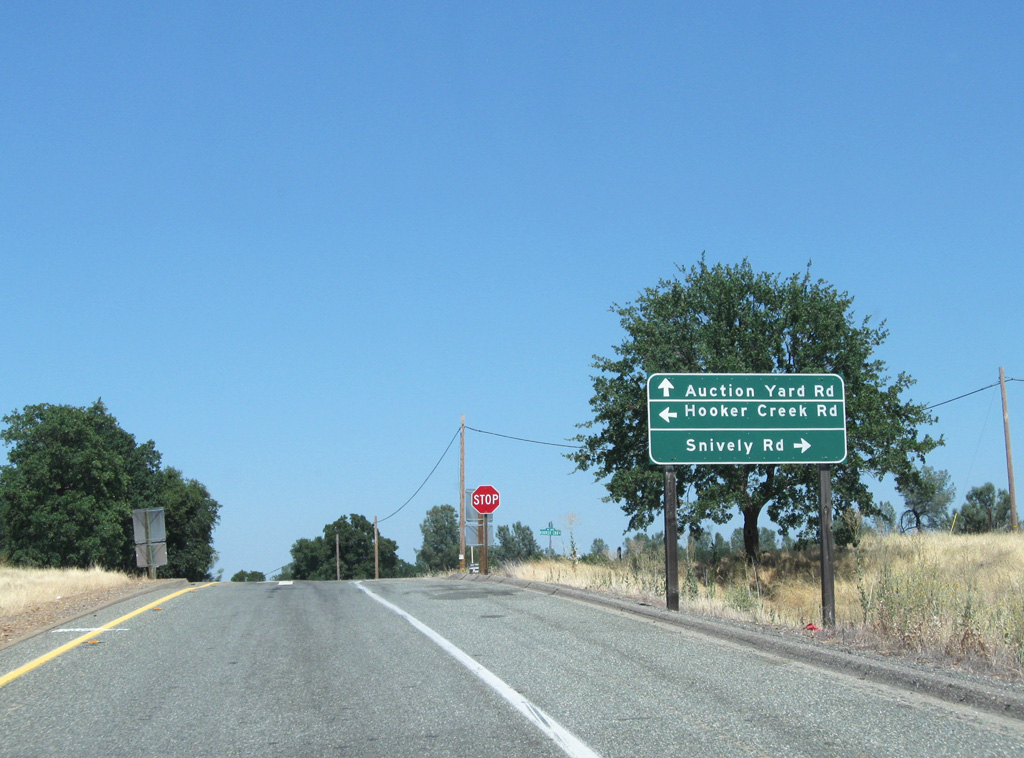
Auction Yard Road stems north from the off ramp at Exit 657 while Hooker Creek Road east connects with Snively Road.
08/02/11
08/02/11
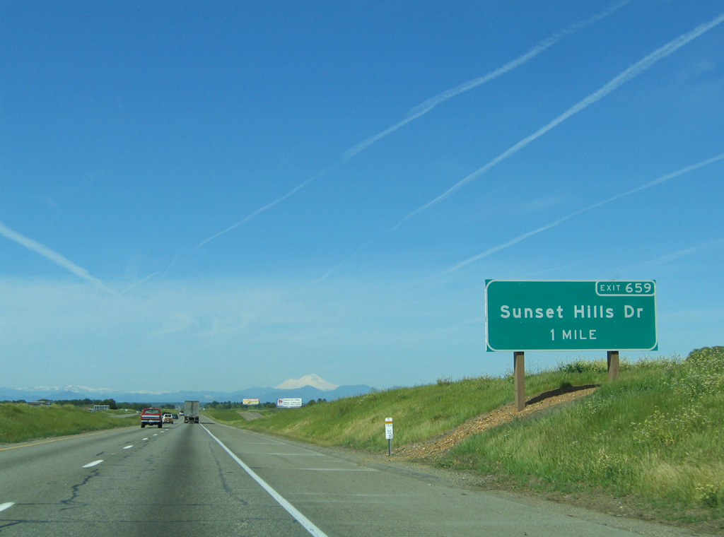
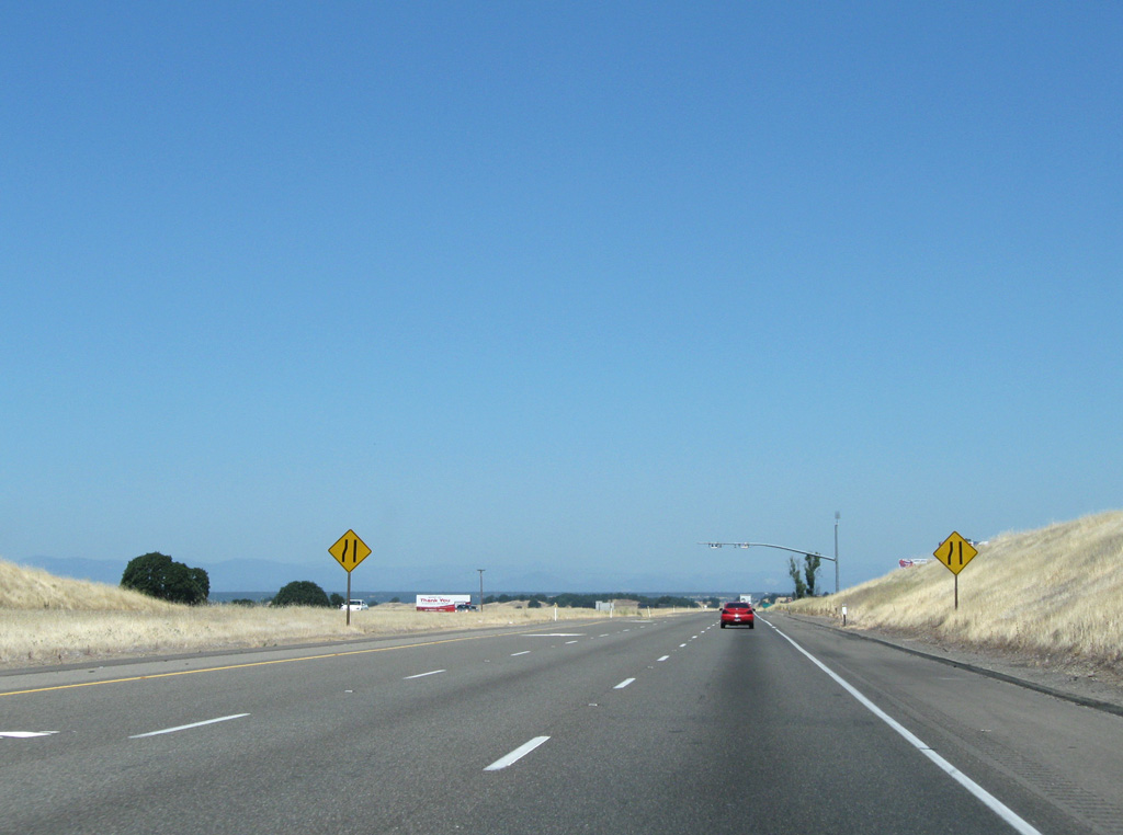
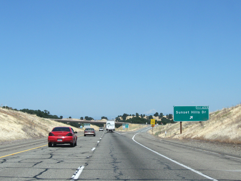
One mile out from Sunset Hills Drive (Exit 659). Auction Yard Road parallels the east side of I-5 to the upcoming diamond interchange.
03/31/05
08/02/11
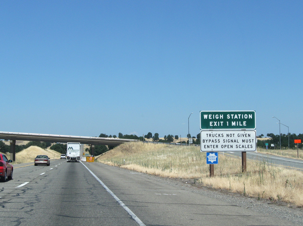
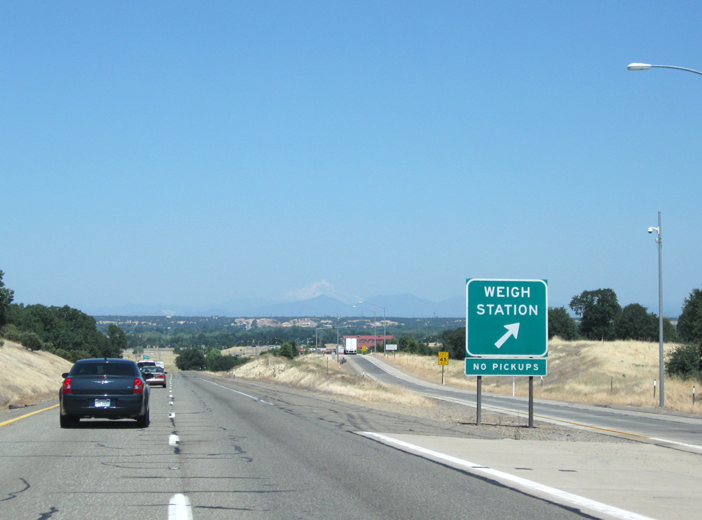
The Cottonwood weigh station lines northbound Interstate 5 one mile north of Exit 659.
08/02/11
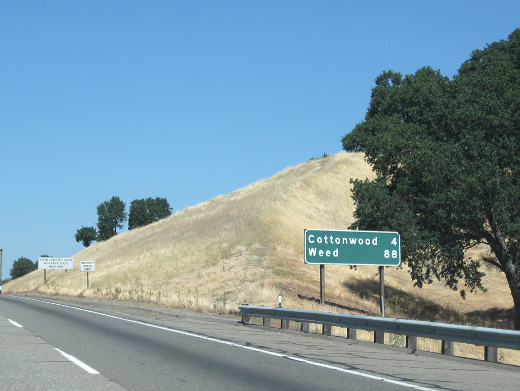
The first instance of Weed (88 miles) is posted on this distance sign ahead of the Cottonwood weigh station.
08/02/11
08/02/11
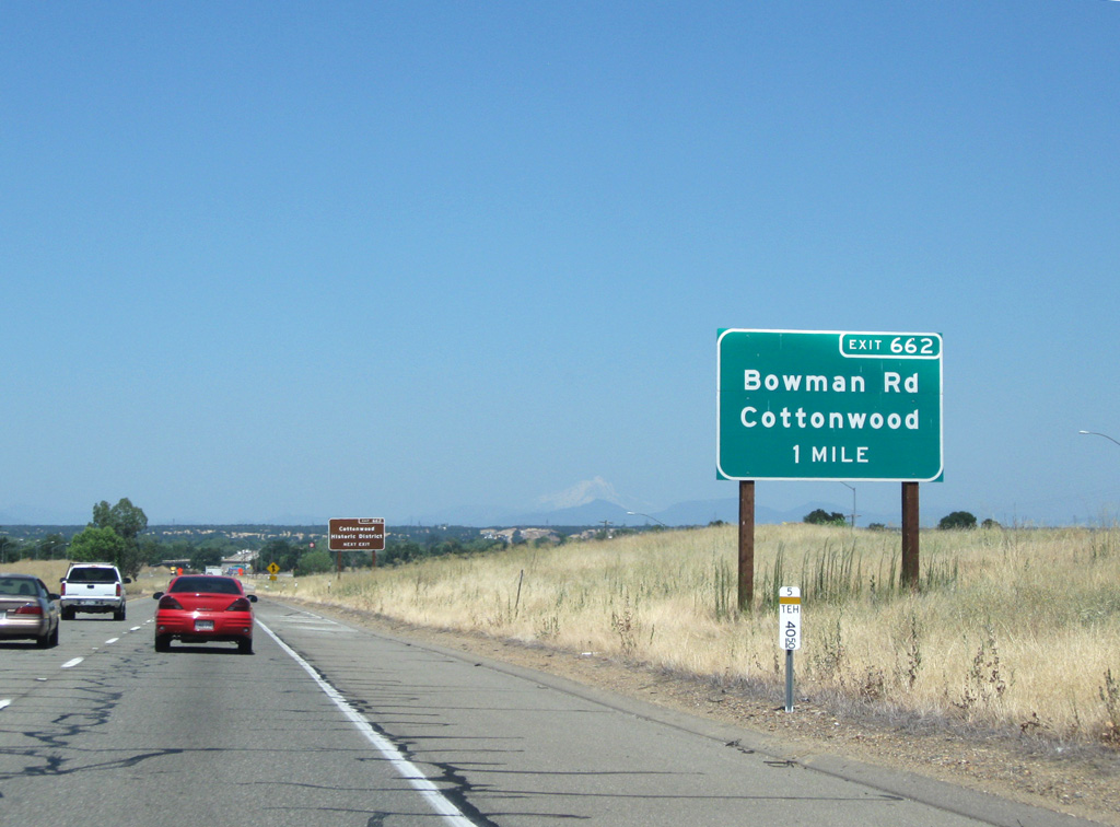
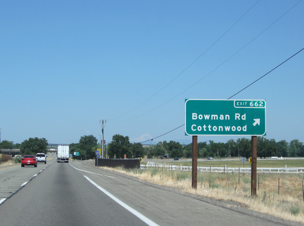
Located one mile ahead, Exit 662 for Bowman Road / Main Street is first of two exits for Cottonwood.
08/02/11
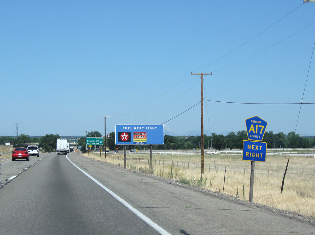
Tehama County Route A17 follows Main Street (Historic U.S. 99) north into Cottonwood while CR A5 overlays Bowman Road southwest to SR 36.
08/02/11
08/02/11
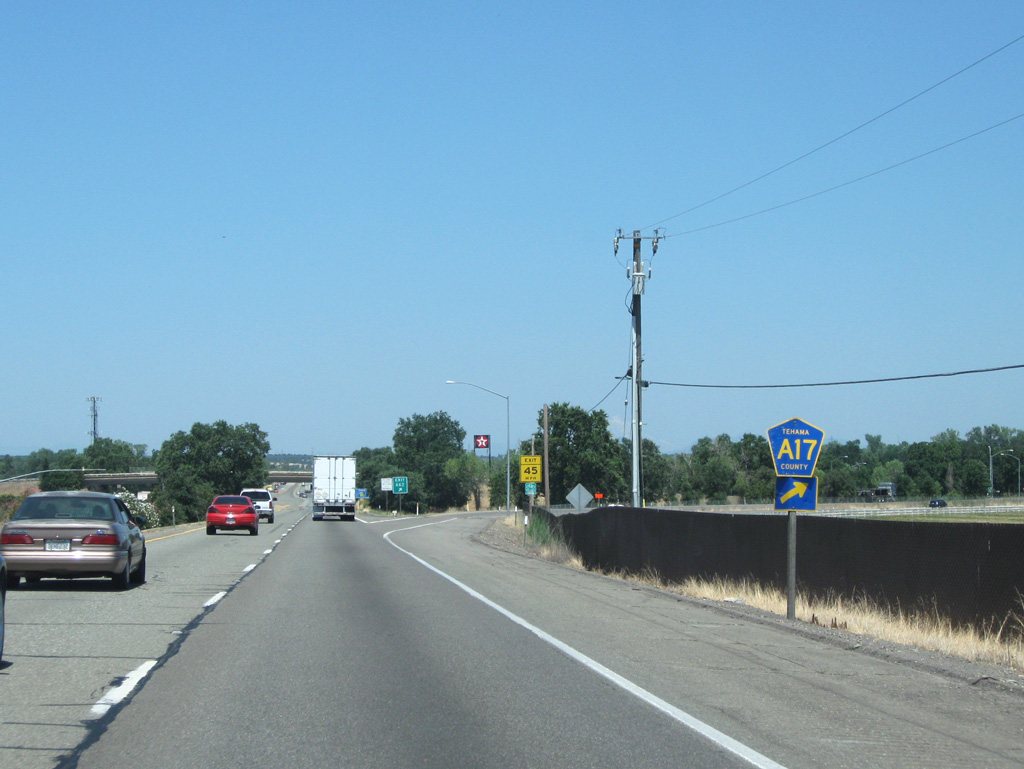
CR A17 initially overlays Main Street into Cottonwood, turning east onto Front Street in the historic district. The county route eventually angles northeast along Balls Ferry Road into rural Shasta County en route to SR 44.
08/02/11
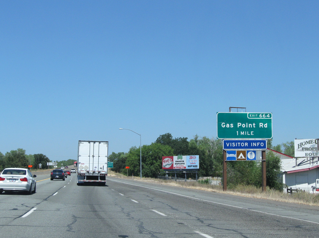
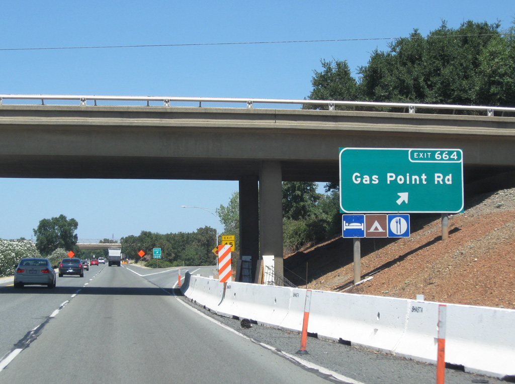
I-5 meets Gas Point Road / 4th Street at the first diamond interchange (Exit 664) within Shasta County in one mile.
08/02/11
I-5 north spans Cottonwood Creek and a Union Pacific railroad line into Shasta County ahead of Exit 664 (Gas Point Road). The bridge was originally replaced in 1998.
03/31/05
08/02/11

Sources:
- A Guide to California's Volcanoes (https://www.california.com/guide-californias-volcanoes/). Retrieved January, 27, 2023.
Photo Credits:
03/31/05, 08/02/11 by AARoads
Page Updated 01-27-2023.