|
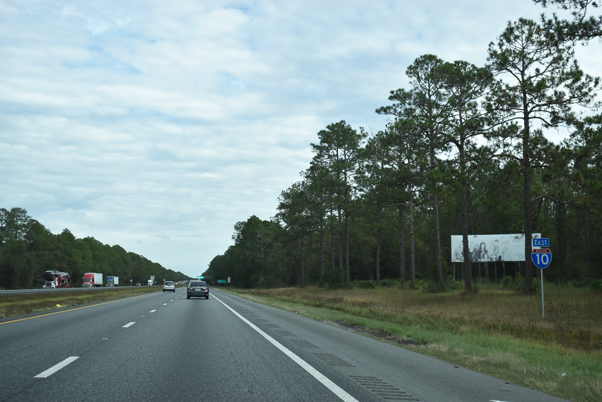
| Like the state of California, the state of Florida operates agricultural inspection stations. Stations are located along I-10, I-75 and I-95 near the state line and along highways that cross the Suwannee River. 11/24/15 |
|
| All commercial trucks, rented trucks, and other delivery vehicles are required to enter the agricultural inspection station. Passenger cars however are exempt unlike in California. 11/24/15 |
|
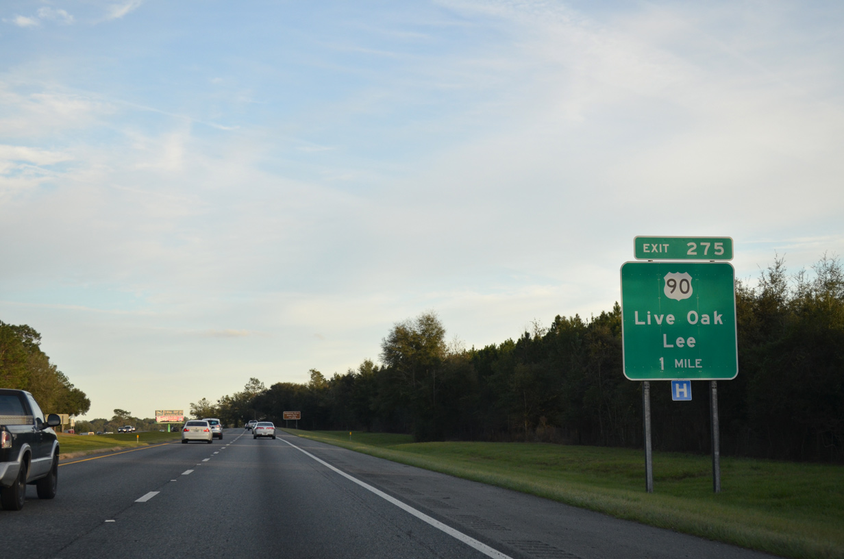
| U.S. 90 travels 17 miles east from Lee to meet Interstate 10 at a folded diamond interchange (Exit 275) near Falmouth. 11/24/15 |
|
| Exit 275 parts ways with Interstate 10 east for U.S. 90 near the railroad siding of Dickert. U.S. 90 parallels a CSX Railroad line closely on the 24 mile drive between Lee and Live Oak. 11/24/15 |
|
| U.S. 90 spans the Suwannee River at Suwannee River State Park and Ellaville. 11/24/15 |
|
| Interstate 10 arcs northward around Live Oak between between Exit 275 and U.S. 129 at Exit 283. 07/22/04 |
|
| U.S. 129 enters the state of Florida from Statenville, Georgia, 15 miles to the north of Jasper and 28 miles north of Interstate 10. 05/12/15 |
|
| Entering the diamond interchange (Exit 283) with U.S. 129 on I-10 east. U.S. 129 (Dr. Martin Luther King, Jr. Avenue) widens to four lanes from Interstate 10 southward into Live Oak. 05/12/15 |
|
| U.S. 129 meets Interstate 75 eight miles north of Exit 283 and combines with U.S. 41 for 3.36 miles through Jasper beyond there. 05/12/15 |
|
| Beyond Live Oak, U.S. 129 continues south 25 miles to Branford and 63 miles to U.S. 19/98 at Chiefland. 05/12/15 |
|
| Leaving the Live Oak area, Interstate 10 continues through timberland and agricultural areas to Lake City and Osceola National Forest. 07/02/11 |
|
| Interstate 10 progresses eight miles east to Suwannee County Road 137 near Tiger Bay. 07/02/11 |
|
| CR 137 travels four miles north from U.S. 90 and Wellborn to a folded diamond interchange (Exit 292) with Interstate 10. CR 137 continues another 2.5 miles north to CR 136 at Pouchers Corner. 07/02/11 |
|
| Interstate 75 converges with I-10 at a directional cloverleaf interchange (Exit 296) southeast from SR 136 near Pouchers Corner. 07/02/11 |
|
| Routed wholly within Suwannee County, CR 137 extends 26.23 miles south from CR 136 at Pouchers Corner to U.S. 27 at Hildreth. CR 136 east to SR 136 leads to White Springs. 07/02/11 |
|
| The succeeding rest area along I-10 east precedes the Columbia County line by Tiger Bay. 03/13/10, 07/02/11 |
|
| Adams Road crosses Interstate 10 at the Columbia County line. 03/13/10 |
|
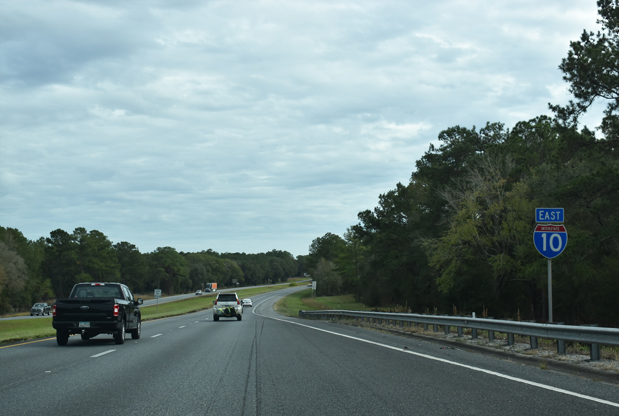
| Interstate 75 travels 46 miles southeast from Valdosta, Georgia to I-10 at Exit 296 outside Lake City. 07/02/11 |
|
| All of Interstate 75 is at least six lanes wide from Alligator Alley in Collier County north to Macon, Georgia. The Georgia portion was expanded from 2005 to 2011. 07/02/11 |
|
| This ground level sign for Exit 296 was installed in 2008. A supplemental sign follows for St. Petersburg via I-75 south. I-275 branches southeast from I-75 to Tampa and St. Peterburg in 160 miles. 07/02/11 |
|
| Exit 296A leaves I-10 east for I-75 south to Gainesville, Ocala and Tampa. I-75 to Florida's Turnpike joins points north with Orlando, West Palm Beach and Miami. 07/02/11 |
|
| Interstate 75 continues northwest from Exit 296B to Jasper and Jennings en route to Macon and Atlanta, Georgia. 03/13/10 |
|
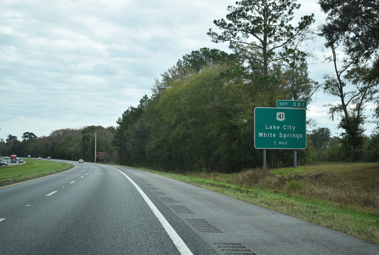
| Heading 65 miles east to Jacksonville, Interstate 10 passes north of Lake City over the ensuing eight miles. The Columbia County seat lies at the crossroads of U.S. 41, U.S. 441 and U.S. 90. 12/04/20 |
|
| U.S. 41 angles southeast from Jennings, Jasper and White Springs to a folded diamond interchange (Exit 301) with Interstate 10. 12/04/20 |
|
| 3.4 miles south from Exit 301, U.S. 41 (Main Boulevard) combines with U.S. 441 west of Downtown Lake City, and again 27 miles south from near Alligator Lake to I-75 at Ellisville and U.S. 27 at High Springs. 12/04/20 |
|
| White Springs lies along the Suwannee River 8.5 miles northwest across the Hamilton County line. Traveling southeast, U.S. 41 overlays Louisiana Street into Lake City. 12/04/20 |
|
| Confirming marker posted east of the U.S. 41 and Norfolk Southern Railroad under crossing. 12/04/20 |
|
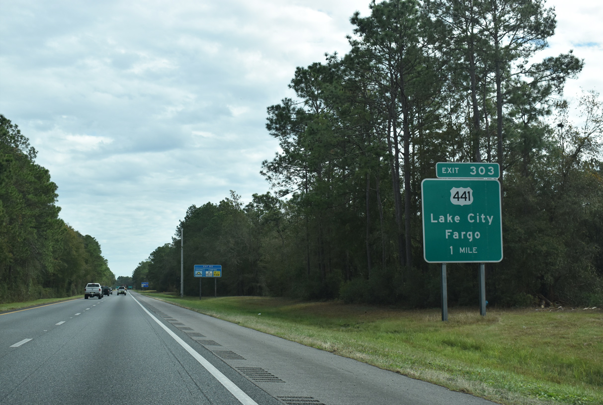
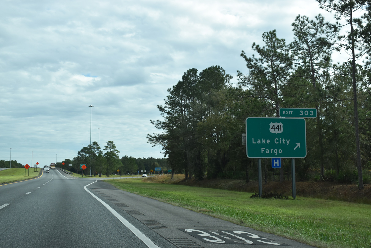
| U.S. 441 (Marion Avenue) travels due north through Five Points from Bascom Norris Drive (SR 100A) in Lake City to a diamond interchange (Exit 303) with I-10. CR 100A (Bascom Norris Drive) loops 2.61 miles east from Marion Avenue to Watertown and U.S. 90 while U.S. 441 was realigned in 2019 to bypass Downtown Lake City to the west. 12/04/20 |
|
| North from Exit 303 and Lake City, U.S. 441 (Marion Avenue) travels 38 miles to Fargo, Georgia. U.S. 441 generally runs midway between the I-75 and I-95 corridors through east central Georgia to Homerville and Athens. 12/04/20 |
|
| The 21 mile stretch between Lake City and Sanderson is the longest along Interstate 10 without an exit in Florida. 12/04/20 |
|
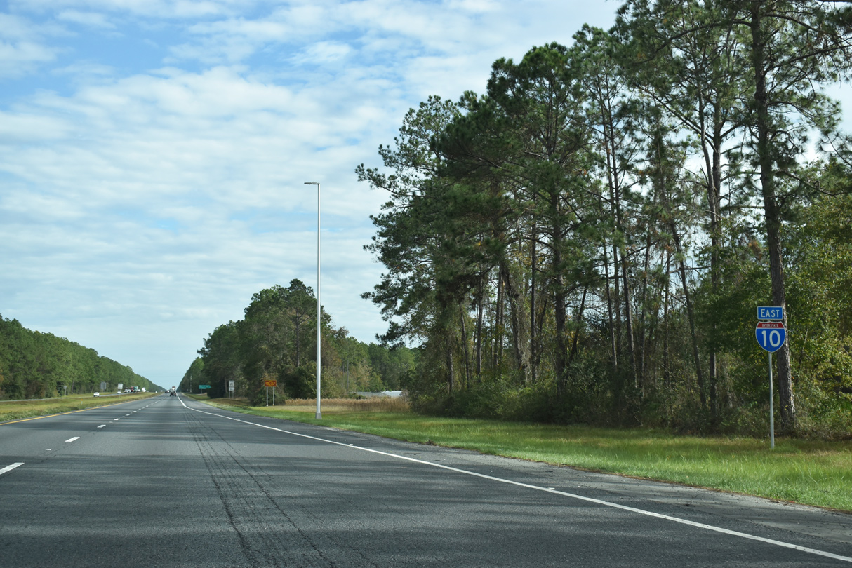
| I-10 traverses Osceola National Forest east between Exit 303 and U.S. 90 near Sanderson. This is also the longest exit less stretch for I-10 east of Hudspeth County in West Texas, where a 22 mile section is located. 12/04/20 |
|
| I-10 enters Osceola National Forest and Osceola Wildlife Management Area 1.75 miles east of U.S. 441 (Marion Avenue). 12/04/20 |
|
| Interstate 10 travels 20.69 miles east across Columbia County to the Baker County line near Ocean Pond and CR 250A. 12/04/20 |
|
| The final rest area for eastbound Interstate 10 lies within Osceola National forest, six miles west of U.S. 90 (Exit 324). 12/04/20 |
|
| Leaving Osceola National Forest and Osceola Wildlife Management Area, Interstate 10 turns southeast to cross U.S. 90. 12/04/20 |
|
| U.S. 90 parallels Interstate 10 to the south from Lake City, Watertown, Olustee Battlefield and Olustee to Exit 324. This is the fifth meeting between the two routes in Florida. 12/04/20 |
|
| A folded diamond interchange (Exit 324) joins U.S. 90 opposite a CSX Railroad line. U.S. 90 continues east two miles to the unincorporated community of Sanderson. 12/04/20 |
|
| Work completed by 2018 modified the loop ramp joining I-10 east with U.S. 90, requiring westbound traffic to U-turn at the east end of the interchange. U.S. 90 stays north of Interstate 10 between Exit 324 and Downtown Jacksonville. 12/04/20 |
|
| Interstate 10 bypasses Sanderson to the south between U.S. 90 and Baker County Road 229. 12/04/20 |
|
| CR 229 meets Interstate 10 at a parclo B2 interchange (Exit 327), 1.3 miles south of Sanderson and U.S. 90. 14 miles separate I-10 and Raiford via the county road. 12/04/20 |
|
| CR 229 south links I-10 with CR 238 for the Union County seat of Lake Butler. CR 229 continues 8.53 miles north of Sanderson to Osceola National Forest and CR 250 south of Taylor. 12/04/20 |
|
| Interstate 10 and U.S. 90 progress six miles east from the Sanderson area to Glen Saint Mary in eastern Baker County. 12/04/20 |
|
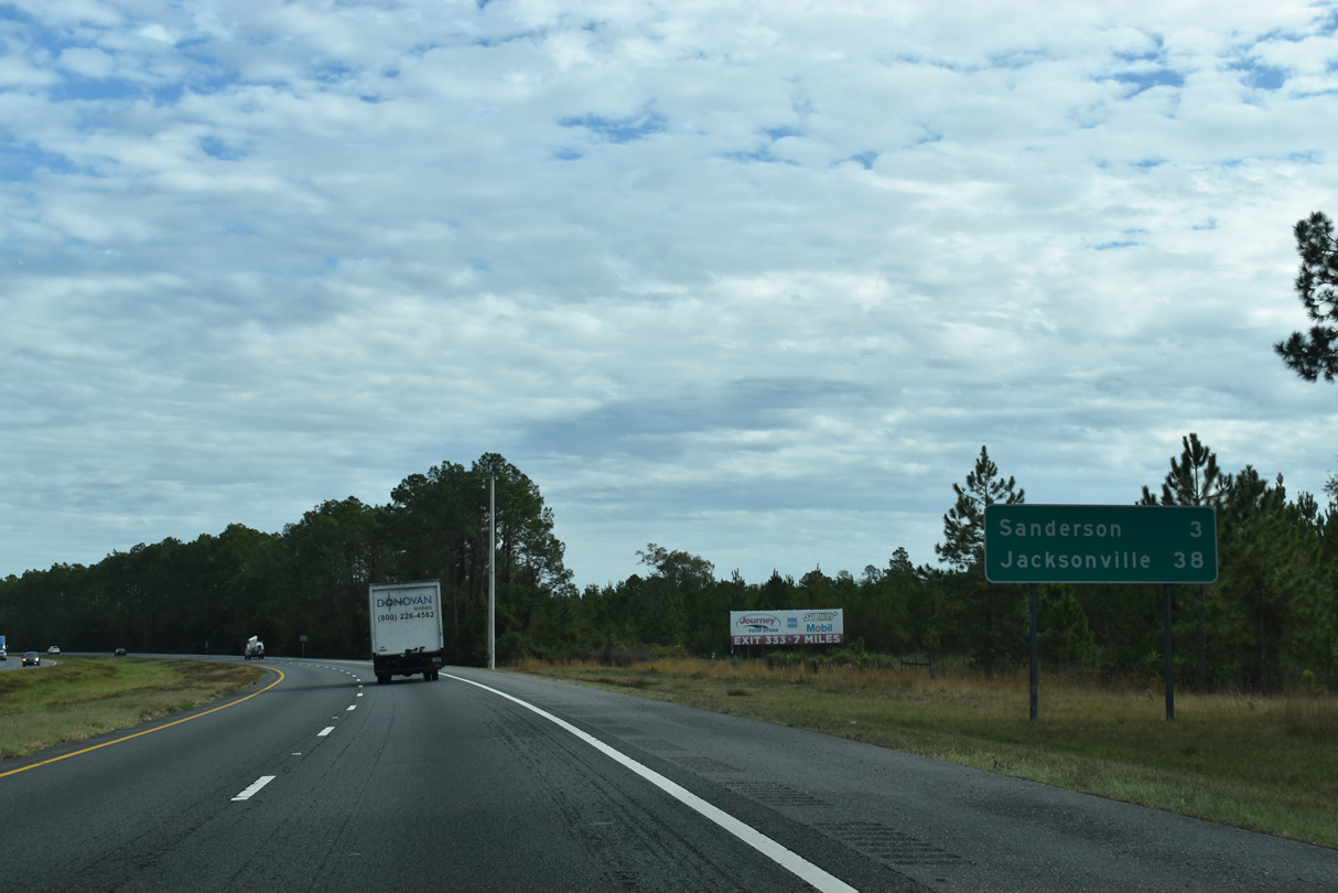
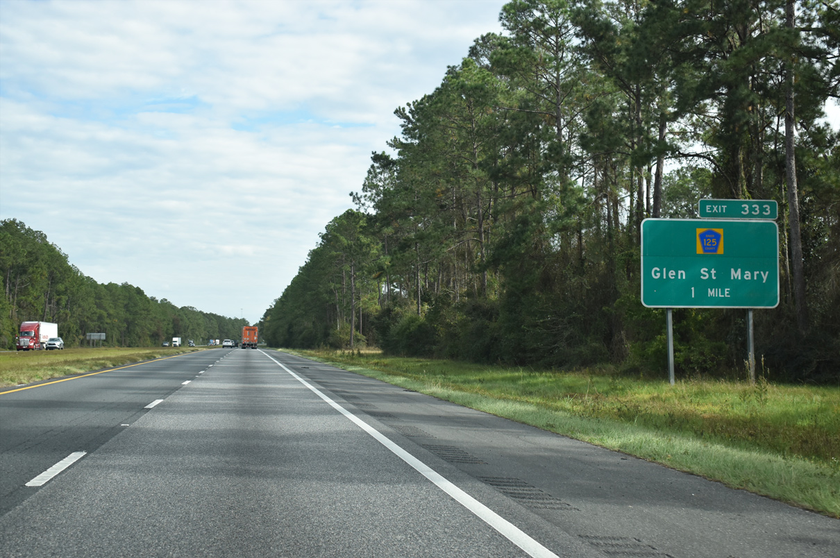
| Interstate 10 advances one mile to a diamond interchange (Exit 333) with CR 125 (Glenn Avenue). 12/04/20 |
|
| Glen Saint Mary lies just north of Interstate 10 along U.S. 90. CR 125 follows Glenn Avenue across the town en route to Taylor and John M. Bethea State Forest in northern Baker County. 12/04/20 |
|
| CR 125 provides a cutoff to SR 121 south for Raiford and Lake Butler from Interstate 10 east. 12/19/13 |
|
| CR 125 travels 5.78 miles between U.S. 90 (Mt. Vernon Street) in Glen St. Mary and SR 121 north of Manning. Measuring 27.92 miles overall, CR 125 extends northward to SR 2 near Eddy. 12/19/13 |
|
| Interstate 10 crosses the South Prong of the St. Marys River just east of CR 125 by this reassurance marker. 12/04/20 |
|
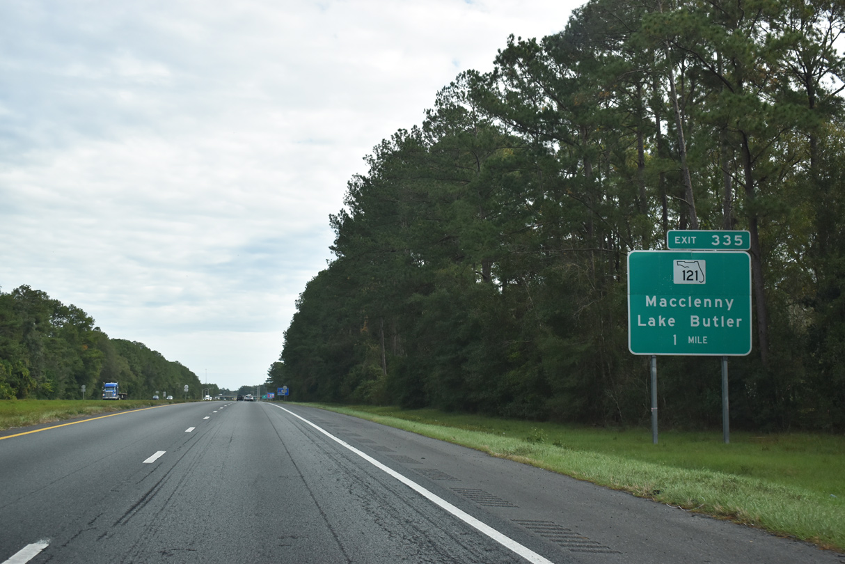
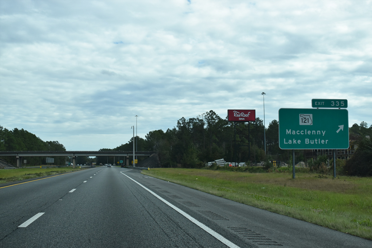
| SR 121 (S 6th Street) meets Interstate 10 at the succeeding exit eastbound. The multi state route extends northward to Georgia and Rock Hill, South Carolina. Locally SR 121 links I-10 with Downtown Macclenny. 12/04/20 |
|
| A parclo B2 interchange (Exit 335) joins I-10 and SR 121 (6th Street) in south Macclenny. SR 121 travels 17 miles southwest from Exit 335 to Raiford and 23 miles to SR 100 at Lake Butler. SR 121 north enters the southern tip of Georgia in six miles. 12/04/20 |
|
| Interstate 10 briefly passes through the Macclenny city limits within the exchange at Exit 335. The freeway bends northward from SR 121 to cross Turkey Creek beyond this eastbound shield. 12/04/20 |
|
| The western leg of SR 228 at Macclenny concludes at Exit 336. The 1.93 mile long state road follows S 5th Street northwest to U.S. 90 (Macclenny Avenue) at CR 228 (N Fifth Street). 12/04/20 |
|
| CR 228 (Maxville-Macclenny Road) loops southeast from Exit 336, 5.7 miles to the Duval County line and 7.72 miles to U.S. 301 at Maxville. A second branch of SR 228 runs across Southwest Jacksonville. 12/04/20 |
|
| 38,000 vehicles per day (vpd) were recorded by FDOT along I-10 east from SR 228 in 2019. This stretch peaked at 44,000 vpd in 2006. 12/04/20 |
|
| Downtown Jacksonville lies 25 miles to the east. Interstate 10 enters the city limits in four miles at the Duval County line. 12/04/20 |
|
| Leading east from Macclenny, I-10 crosses Trail Ridge at nearly 175 feet above sea level before sinking 100 feet across wetland areas along Deep Creek in western Duval County. 12/19/13 |
|
| Interstate 10 spans a former Seaboard Coast Line railroad east into the southwestern corner of Nassau County. 12/04/20 |
|
| Interstate 10 passes through Nassau County for just 0.68 miles east to the Duval County and the Jacksonville city line. 12/04/20 |
Page Updated 12-05-2020.

 East
East