|
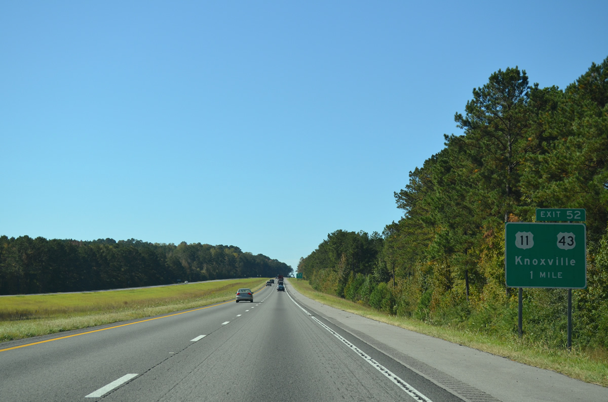
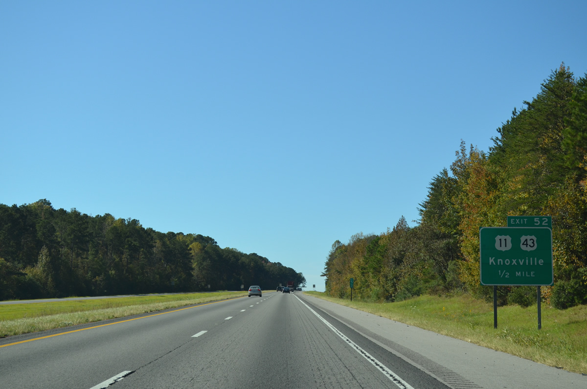
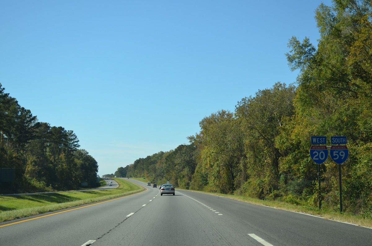
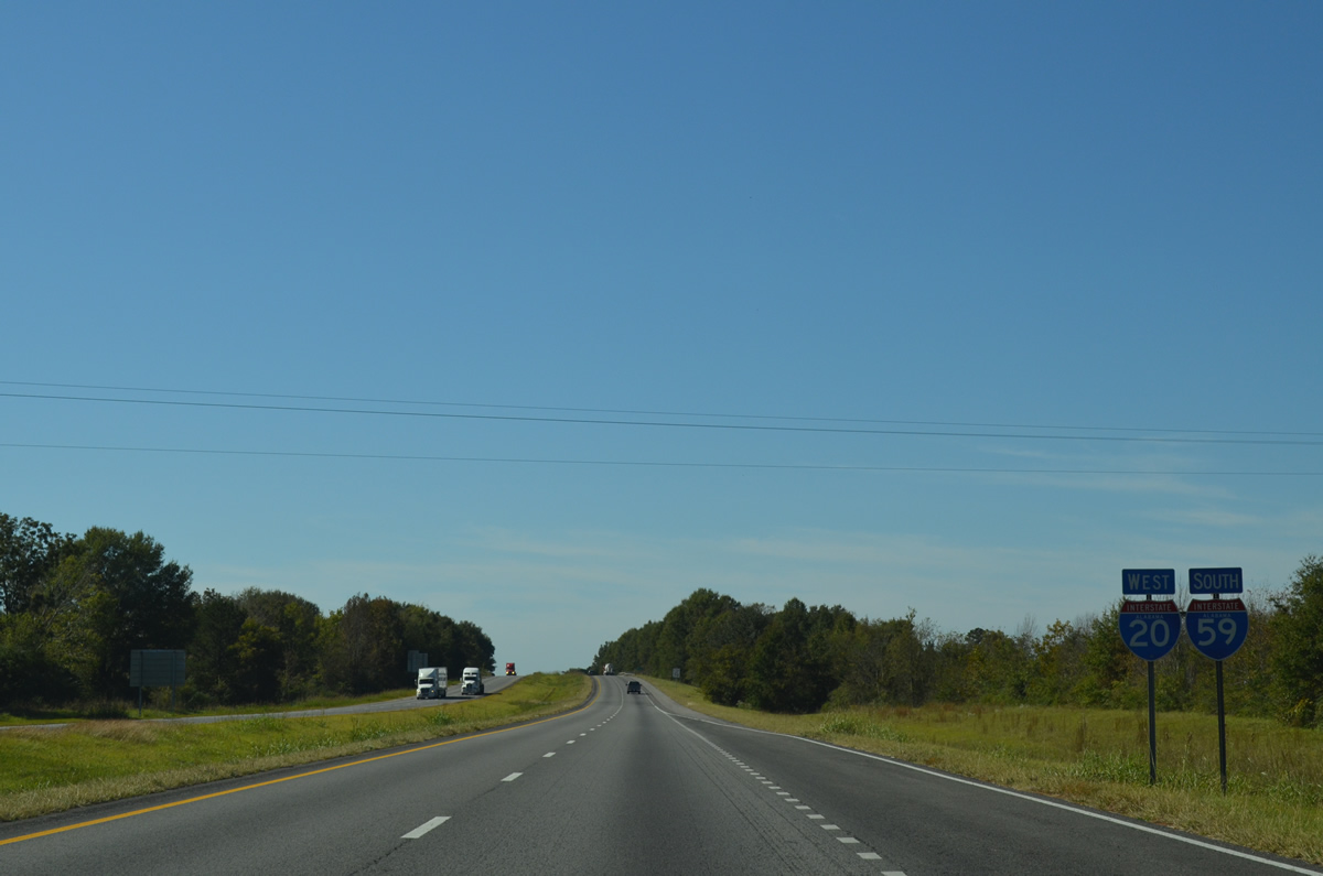
| U.S. 11/43 and I-20/59 converge south at Knoxville and Exit 52 in one mile. 10/21/12 |
|
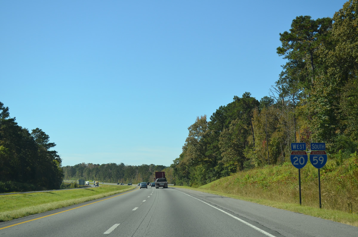
| South from Exit 52, U.S. 11/43 continue another 12.68 miles to Eutaw. 10/21/12 |
|
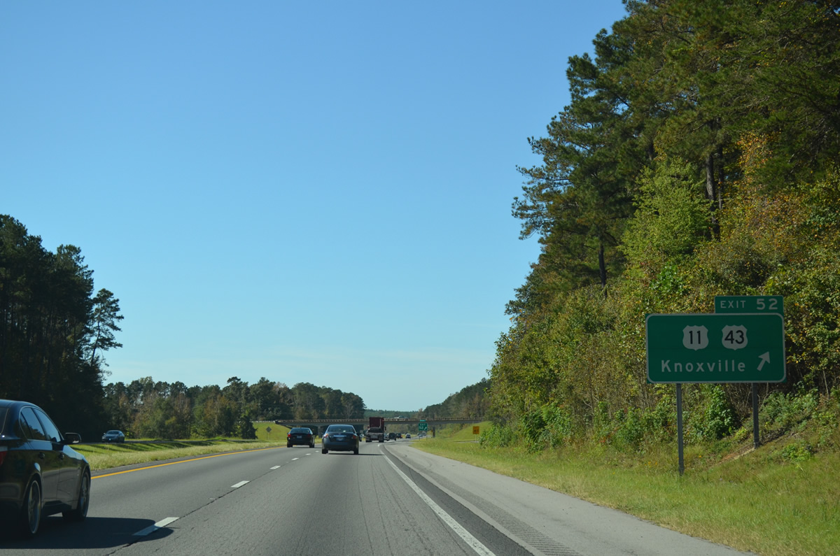
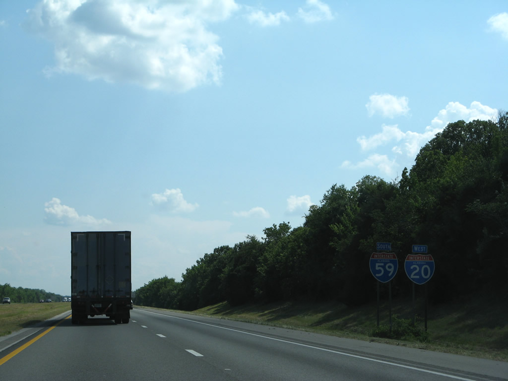
| A diamond interchange connects I-20/59 with U.S. 11/43 at Exit 52. U.S. 43 leaves the I-20/59 corridor at Eutaw for Demopolis, Linden, Grove Hill and Mobile. 10/21/12 |
|
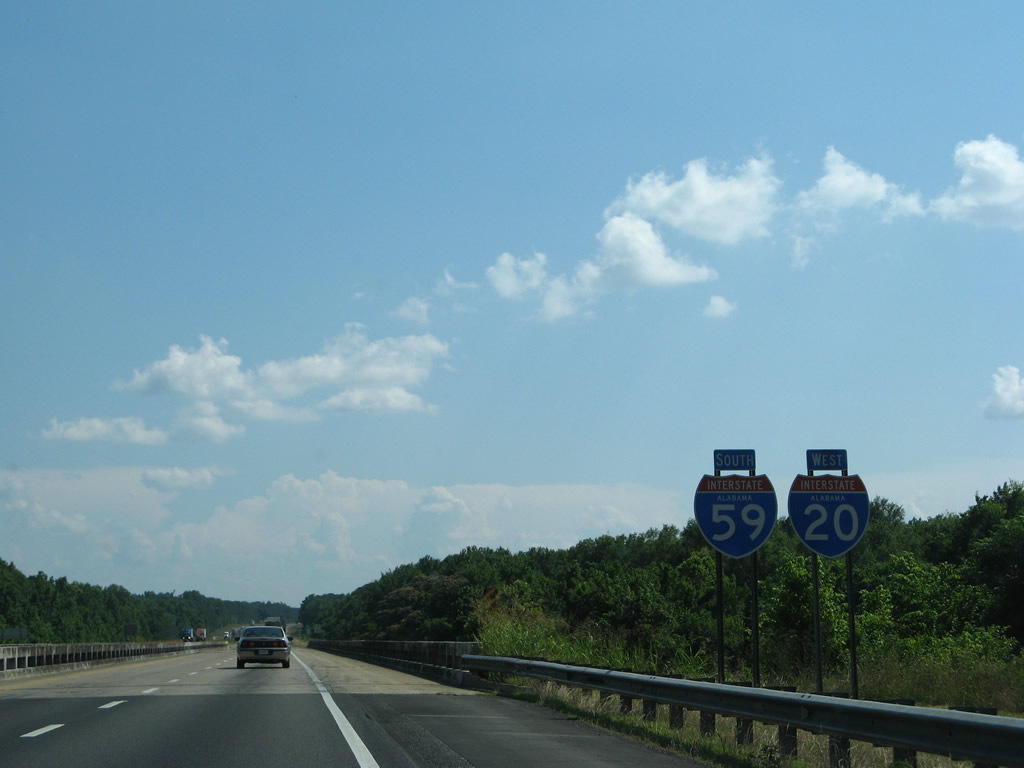
| Greene County is the least populous county in the state of Alabama.1 10/21/12 |
|
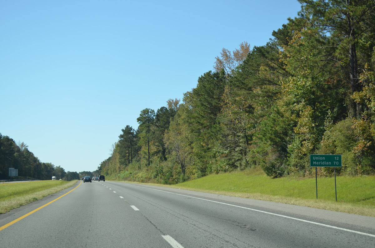
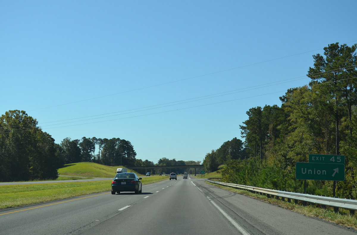
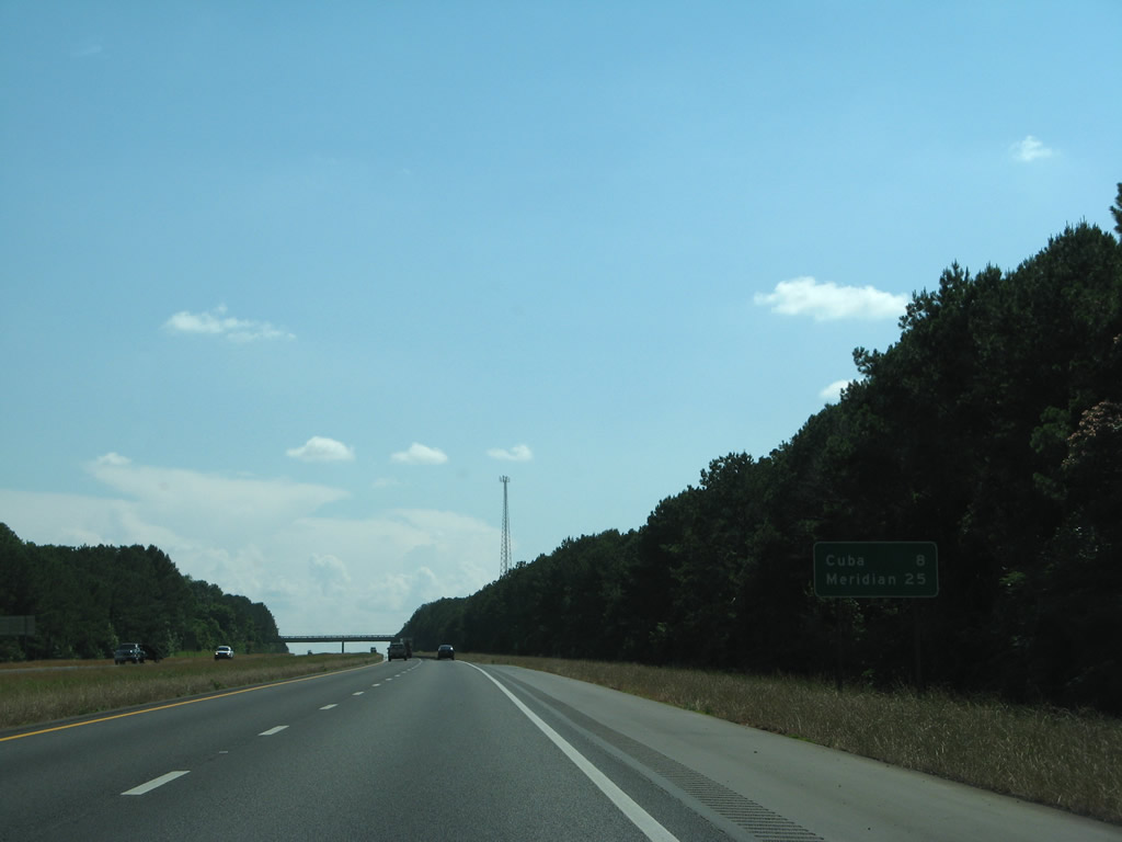
| Union, 5.5 miles to the north of Exit 45, is the succeeding exit on I-59/20 southbound. Meridian is an hour drive away.
Several distance signs in Greene County were replaced with Clearview font based signs by 2012. 10/21/12 |
|
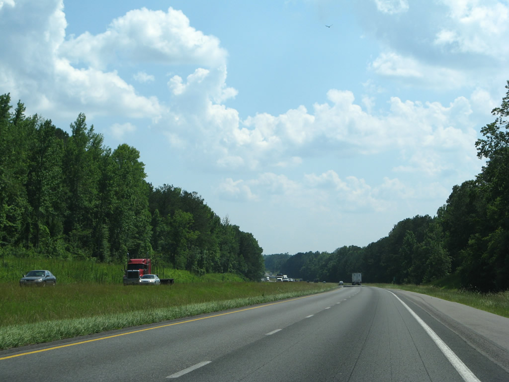
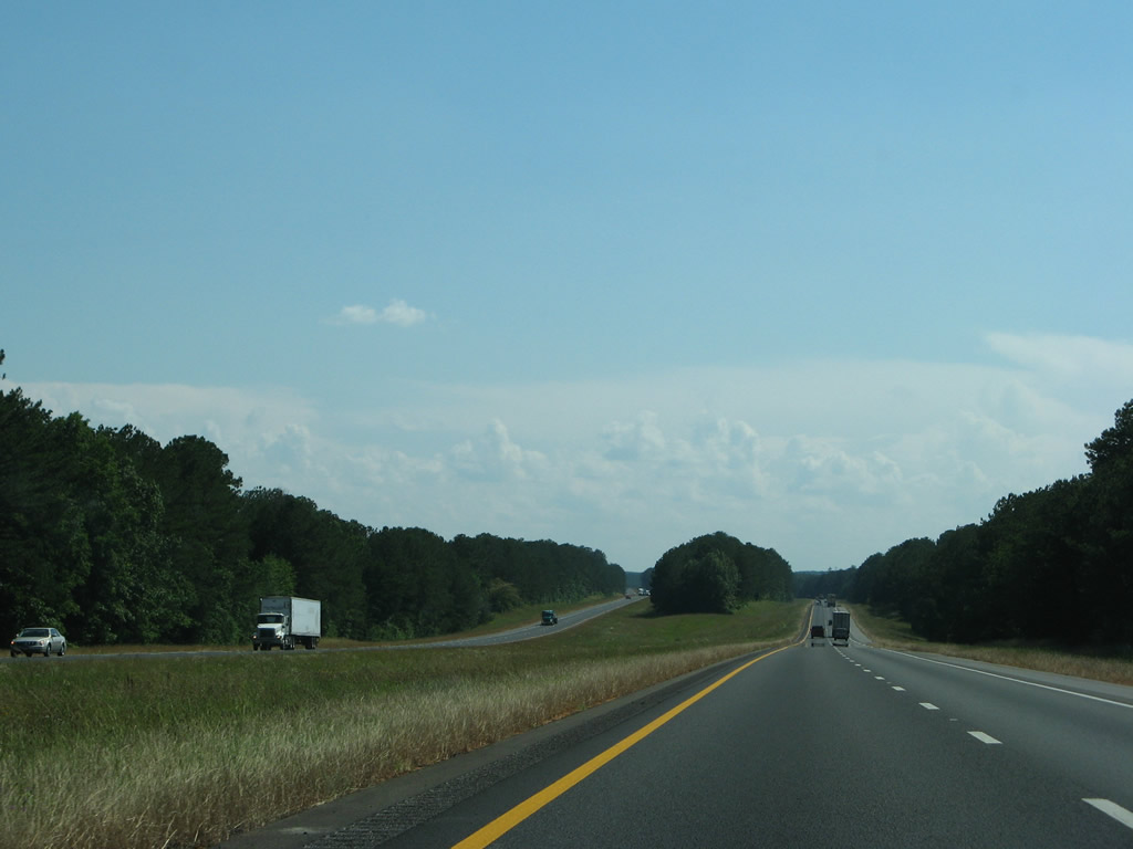
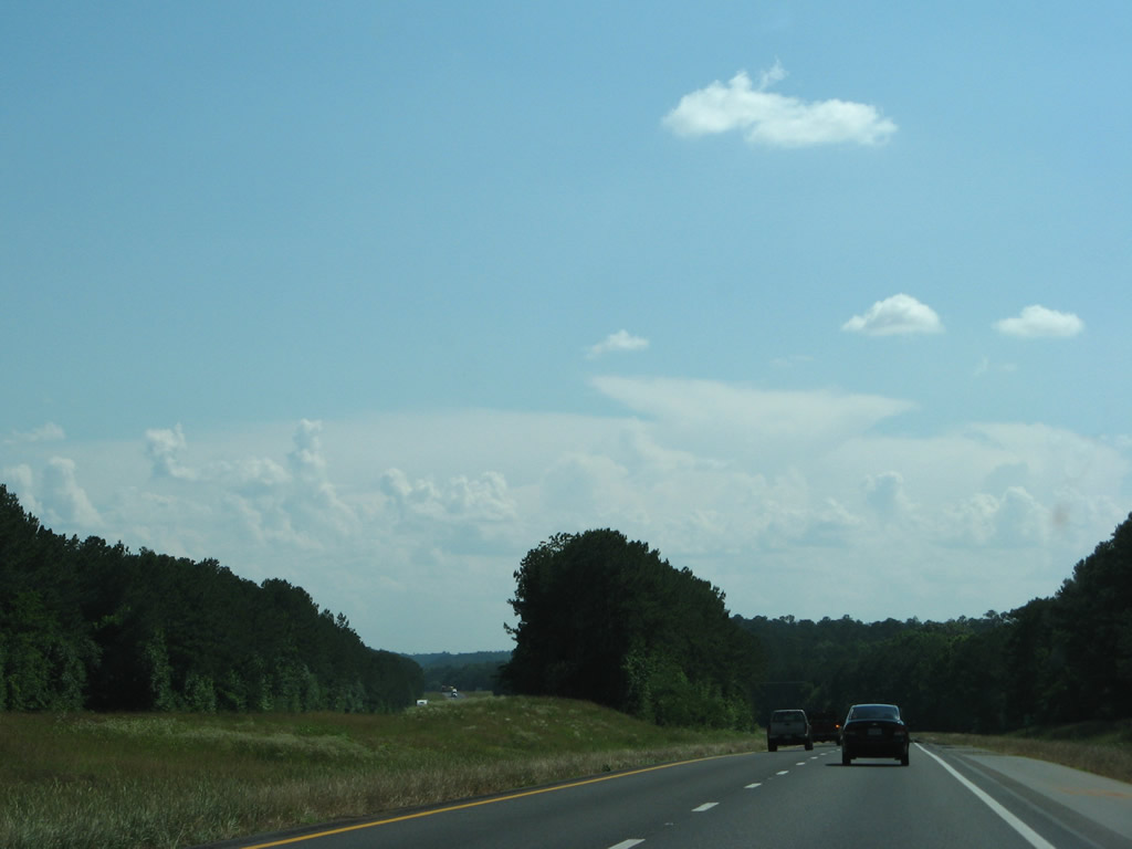
| Forested hills are representative of the rural landscape along I-20/59 throughout Greene County. 06/12/08 |
|
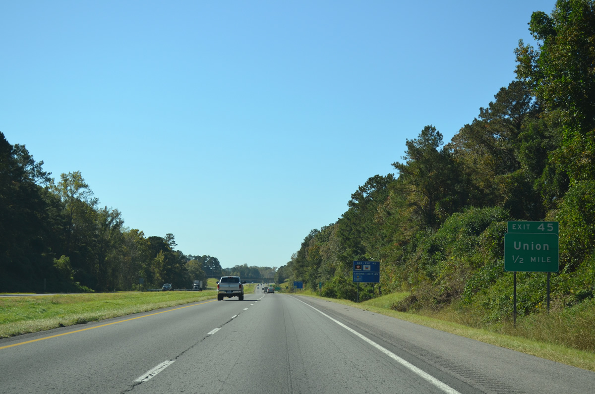
| Greene County Route 208 (M.L. King Highway) crosses paths with I-20/59 south at Exit 45 in one mile. 10/21/12 |
|
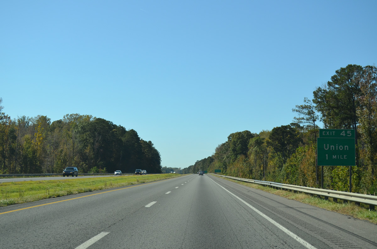
| Exit 45 serves Union to the north and the Greenetrack Entertainment Center to the south. Providing an alternate route to Eutaw from I-20/59, CR 208 connects with U.S. 11/43 in 1.3 miles. 10/21/12 |
|
| Entering the diamond interchange (Exit 45) with CR 208 on I-20 west / I-59 south. CR 208 continues north from Union to Mantua and CR 156 near the Pickens County line. 10/21/12 |
|
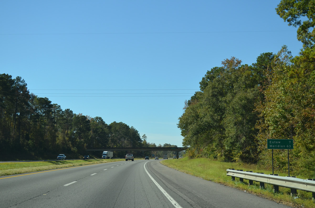
| The Greene County seat is seven miles to the southwest. I-20/59 reach Meridian in 63 miles. 10/21/12 |
|
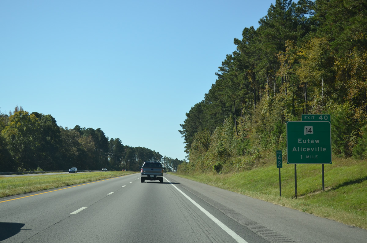
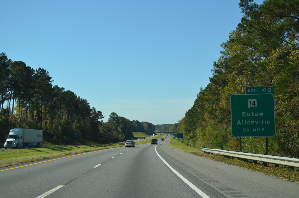
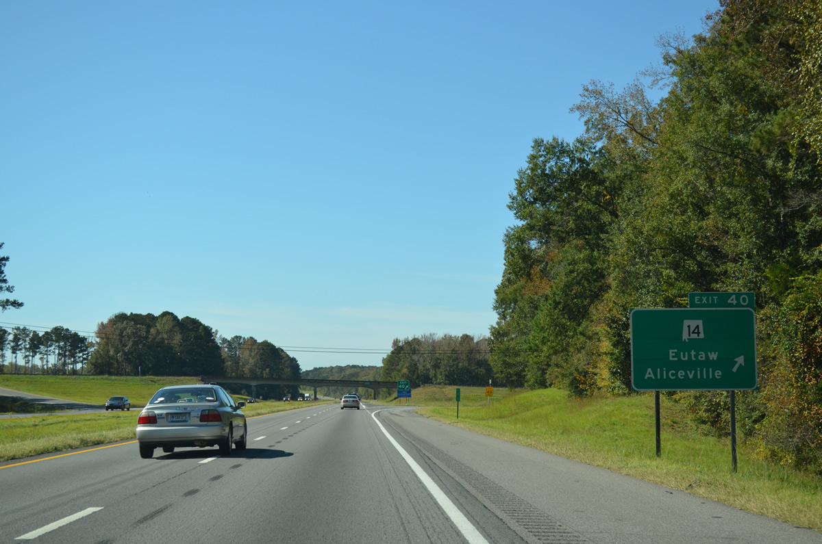
| SR 14 runs three miles northwest from Downtown Eutaw to the diamond interchange at Exit 40. 10/21/12 |
|
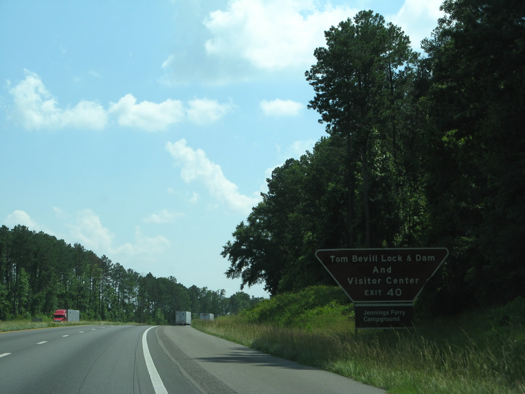
| SR 14 travels 34 miles northwest to Pickensville and Aliceville Lake. The lake was formed by Aliceville Lock and Dam, which bears the name of Tom Bevill, a proponent of the Tenn-Tom Waterway.2 Southeast to the Black Warrior River, amenities for outdoor enthusiasts there include the Jennings Ferry Campground. 06/12/08 |
|
| Measuring 218.29 miles in length, SR 14 travels across the state from Mississippi Highway 69, southeast of Columbus, east to Eutaw, Greenville, Marion, Selma, Prattville, Wetumpka and Auburn. 10/21/12 |
|
| SR 14 continues 5.15 miles west from Exit 40 to SR 39 at Clinton and 24 miles to Aliceville. The state route spans the Black Warrior River east of a short overlap with U.S. 43 at Eutaw en route to Wedgeworth. 10/21/12 |
|
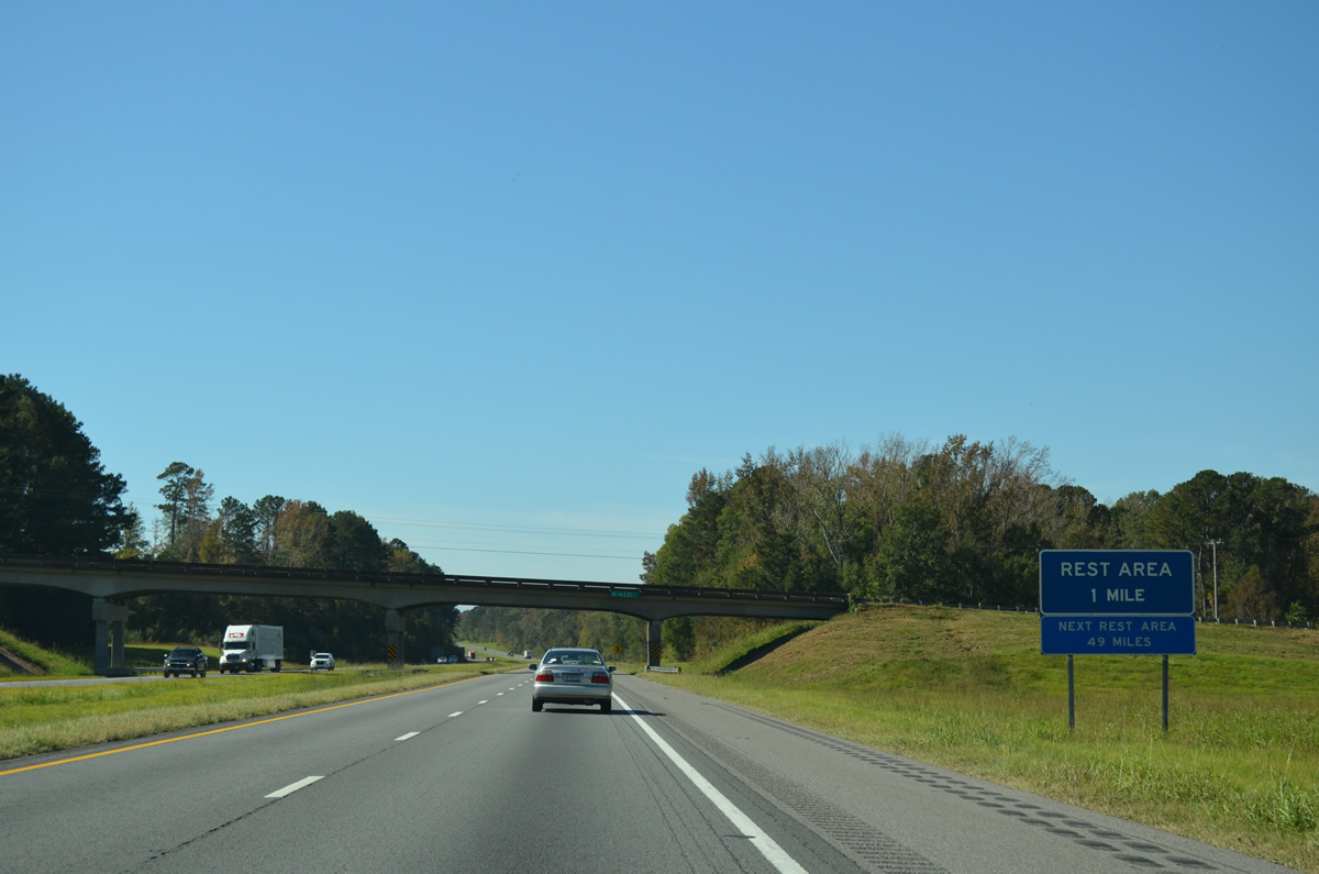
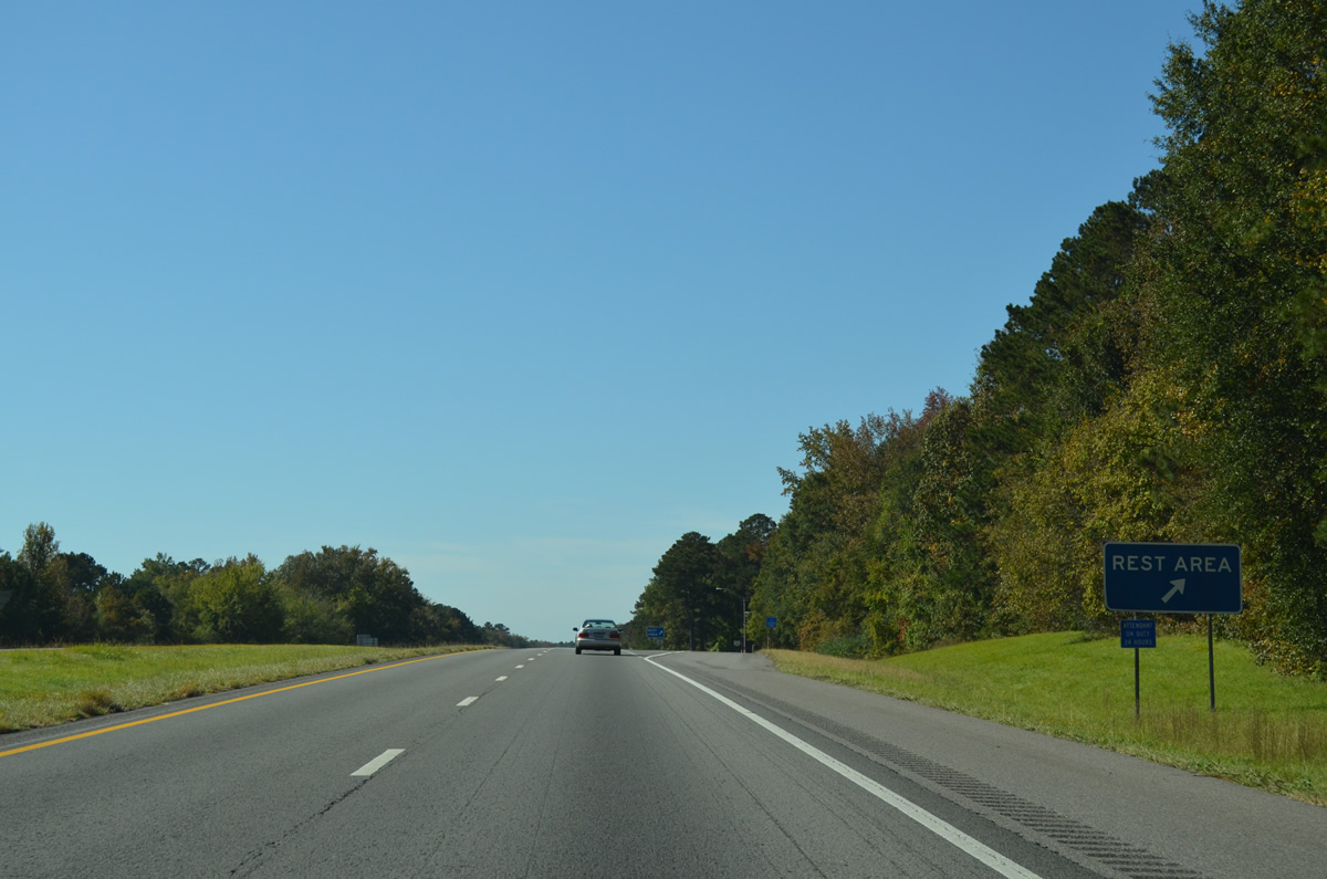
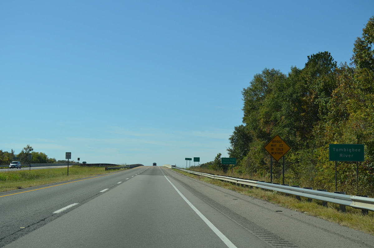
| The last rest area on I-59/20 south in Alabama follows the entrance ramp from SR 14 near Eutaw. 10/21/12 |
|
| Reassurance shields posted between SR 14 and the southbound area. A northbound facility lies further south beyond the County Route 131 overpass. 10/21/12 |
|
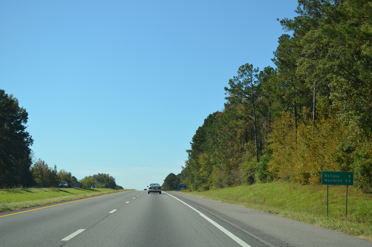
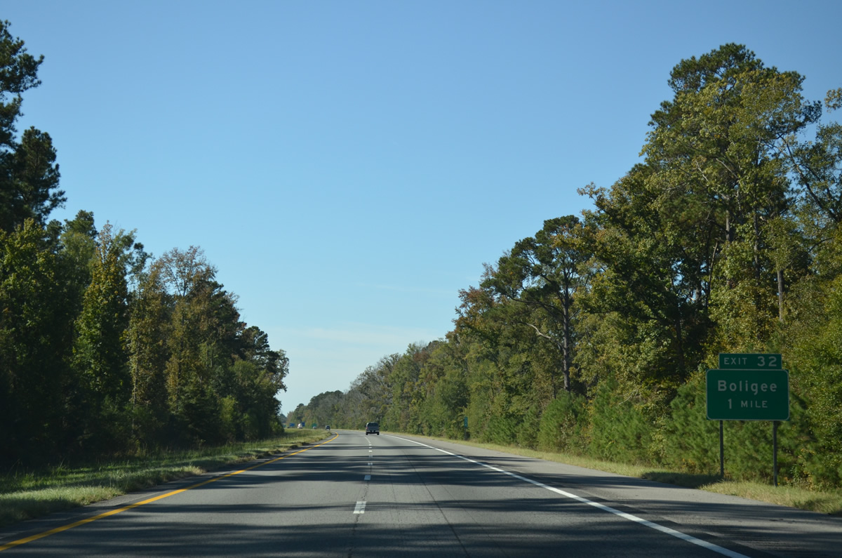
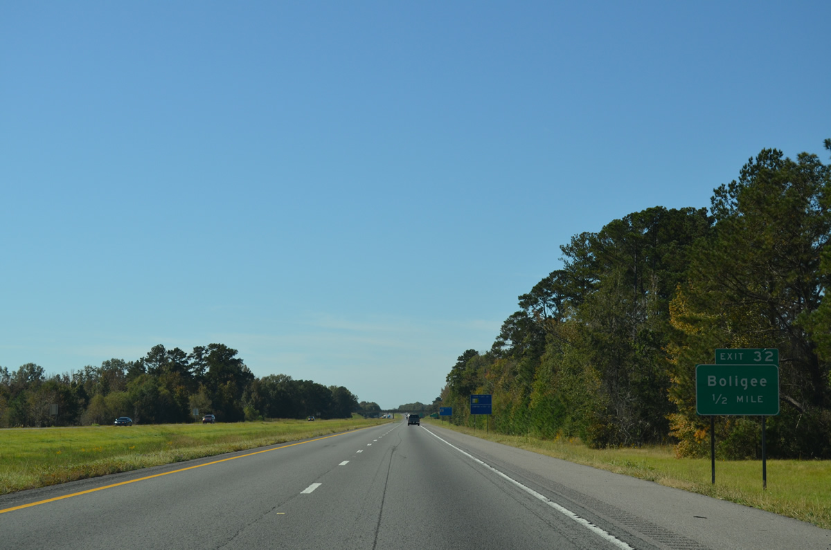
| The town of Boligee is nine miles to the southwest. 10/21/12 |
|
| The next rest area along I-20/59 beyond Greene County is outside Meridian, Mississippi. 10/21/12 |
|
| Greene County Route 20 and I-20/59 converge at Lizzieville on the north side of Boligee. 10/21/12 |
|
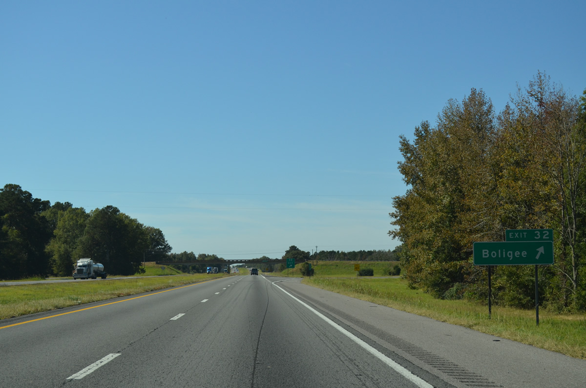
| One half mile out from the diamond interchange (Exit 32) with County Route 20 on I-20/59 south. 10/21/12 |
|
| CR 20 connects Boligee with Forkland to the south. North from Exit 32, CR 20 leads to New Mt. Hebron and SR 39. 10/21/12 |
|
| I-20/59 south span the Alabama and Gulf Coast Railway and leave Boligee on the 11 miles to Epes. 10/21/12 |
|
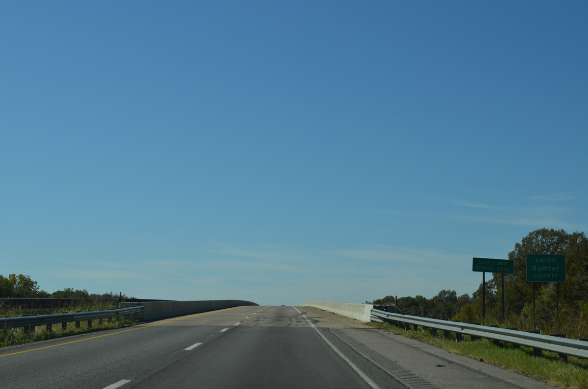
| A number of flood relief bridges precede the Sally S. Minus Memorial Bridge across the Tombigbee River along I-20/59 south. The freeway elevates to cross the Tenn-Tom Waterway into Sumter County on a pair of bridges constructed by 1976. 10/21/12 |
|
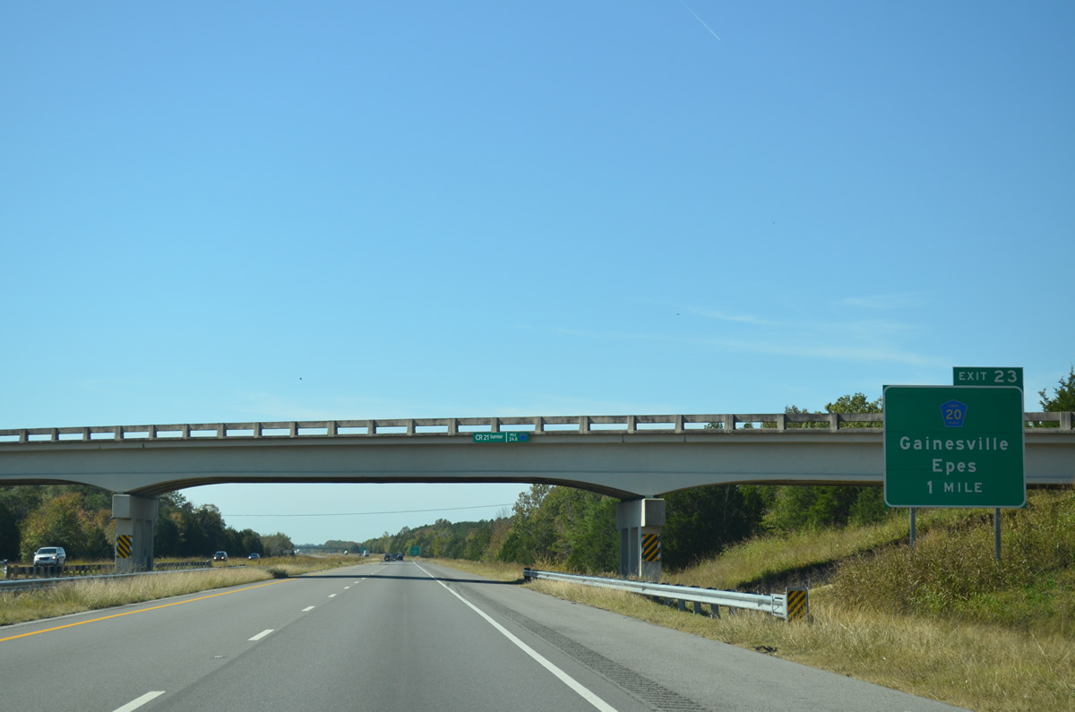
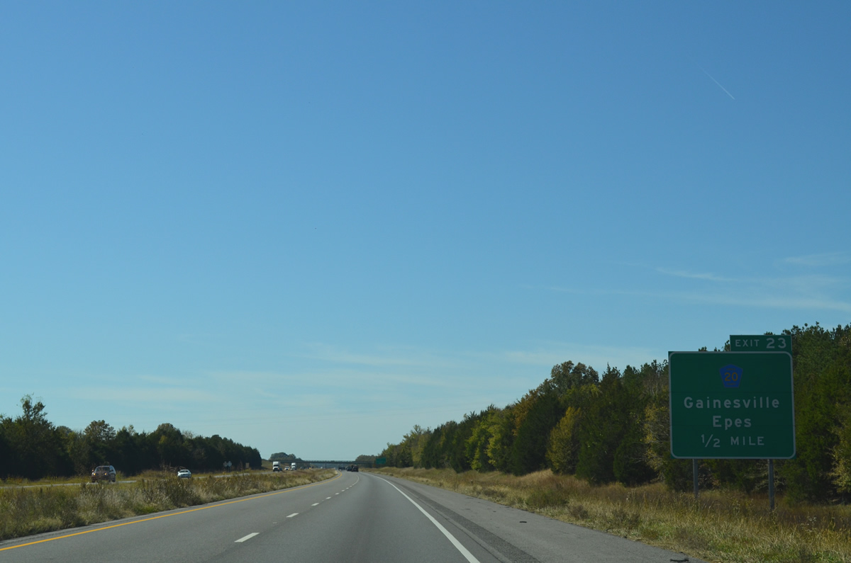
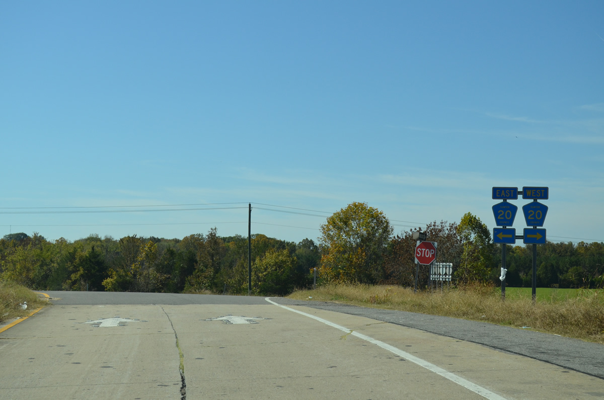
| Sumter County Route 20 spurs west along Main Street from CR 21 (Cedar Hill Drive) in Epes to I-20/59 at Exit 23. 10/21/12 |
|
| West from Exit 23, CR 20 continues to SR 39 nearby, Sumterville, Sledge and Kemper County, Mississippi. SR 39 is an 11.03 mile long highway between Gainesville and U.S. 11 near Parker. There is no direct access between the state route and freeway. 10/21/12 |
|
| Exit 23 parts ways from I-20/59 south for County Route 20 and Epes. 10/21/12 |
|
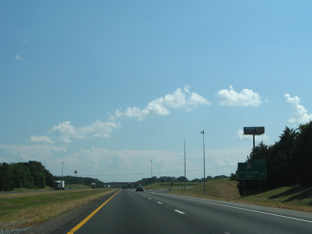
| Livingston, the seat of Sumter County and home of the University of West Alabama, lies ten miles to the southwest of Epes via I-20/59. Meridian is 41 miles away. 06/12/08 |
|
| SR 28 and I-20/59 come together on the northwest side of Livingston at a diamond interchange (Exit 17). 06/12/08 |
|
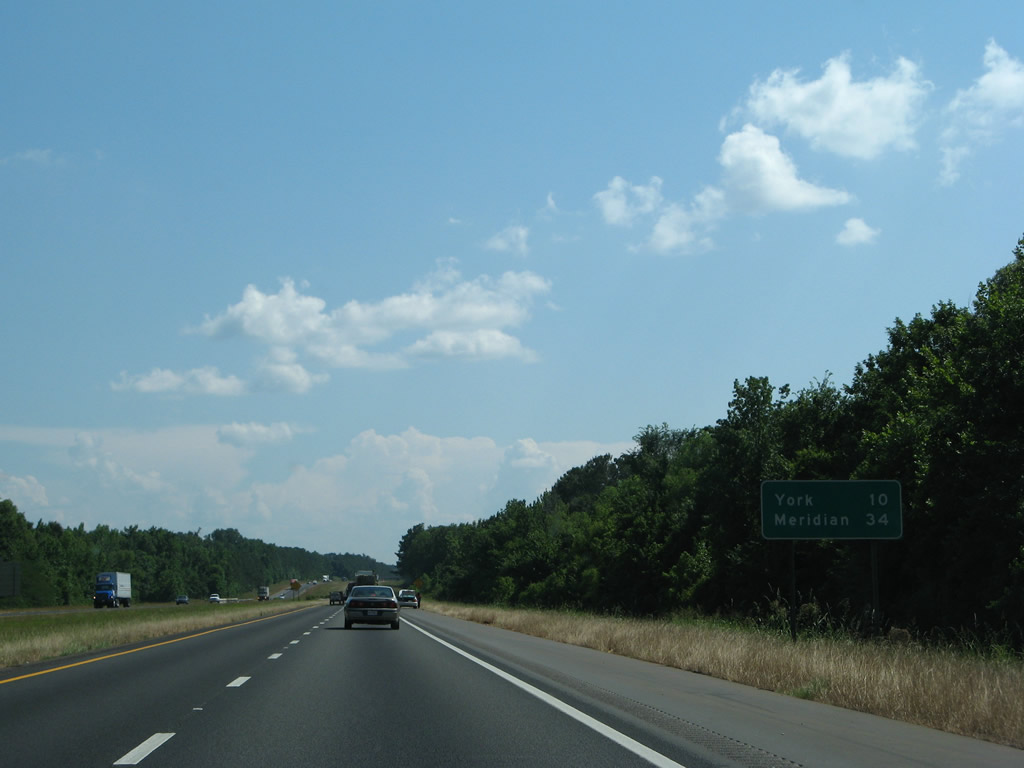
| SR 28 concludes 5.90 miles to the west of Exit 17 at SR 17 near Boyd. 06/12/08 |
|
| SR 28 combines with U.S. 11 (Washington Street) south from I-59/20 for 2.06 miles through Livingston before resuming eastward to Coatopa and U.S. 80 west of Demopolis. 06/12/08 |
|
| This set of shields for I-20/59 stands at the crossing of the Sucarnoochee River. 06/12/08 |
|
| The city of York is the next population center along I-20/59 in Sumter County in ten miles. 06/12/08 |
|
| The freeway separates twice with a forested median along the 9.04 mile long stretch between Livingston and York. 06/12/08 |
|
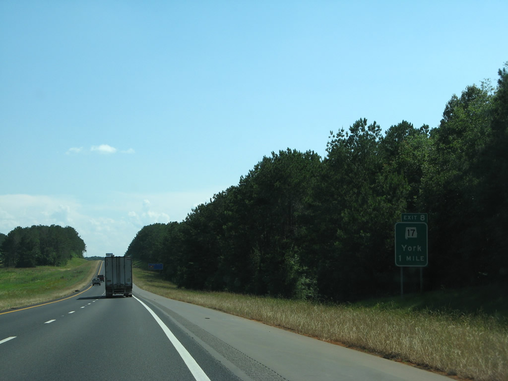
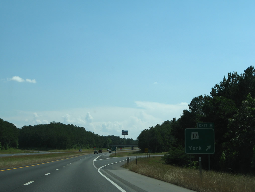
| SR 17, a 346.67 mile long highway between Tennessee, north of Florence, and Mobile meets I-59/20 at diamond interchange (Exit 8) on the north side of York. 06/12/08 |
|
| Broad Street leads SR 17 south to the York city center. Northward the state route advances 6.63 miles to Boyd. 06/12/08 |
|
| SR 17 is the hidden counterpart of U.S. 43 and U.S. 45 for significant distances through the state. The stand alone section of SR 17 connects Hamilton with Washington County. 06/12/08 |
|
| CR 19 branches northwest from U.S. 11 in York across I-20/59 en route to Millville beyond this set of reassurance markers. 06/12/08 |
|
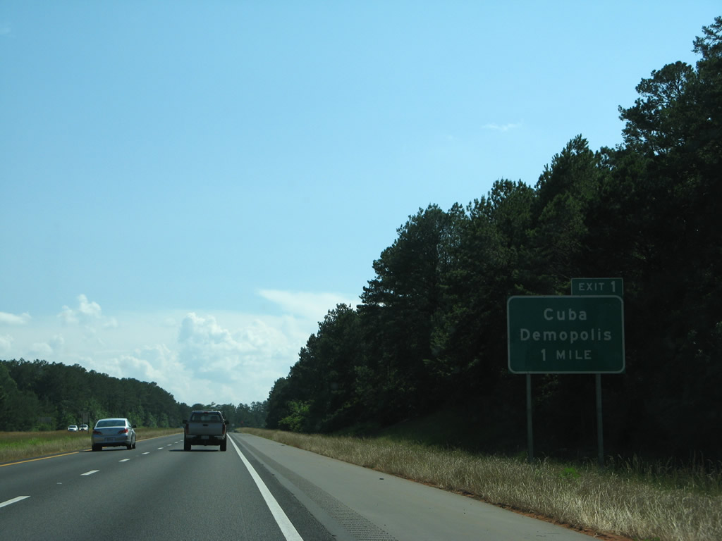
| The town of Cuba is the last destination along I-20 west / I-59 south in Alabama. 06/12/08 |
|
| Pine forest continues to line the sides of I-20/59, including the median between CR 19 and CR 2. 06/12/08 |
|
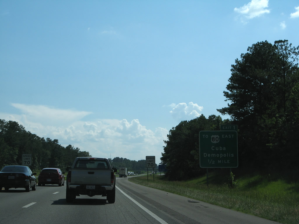
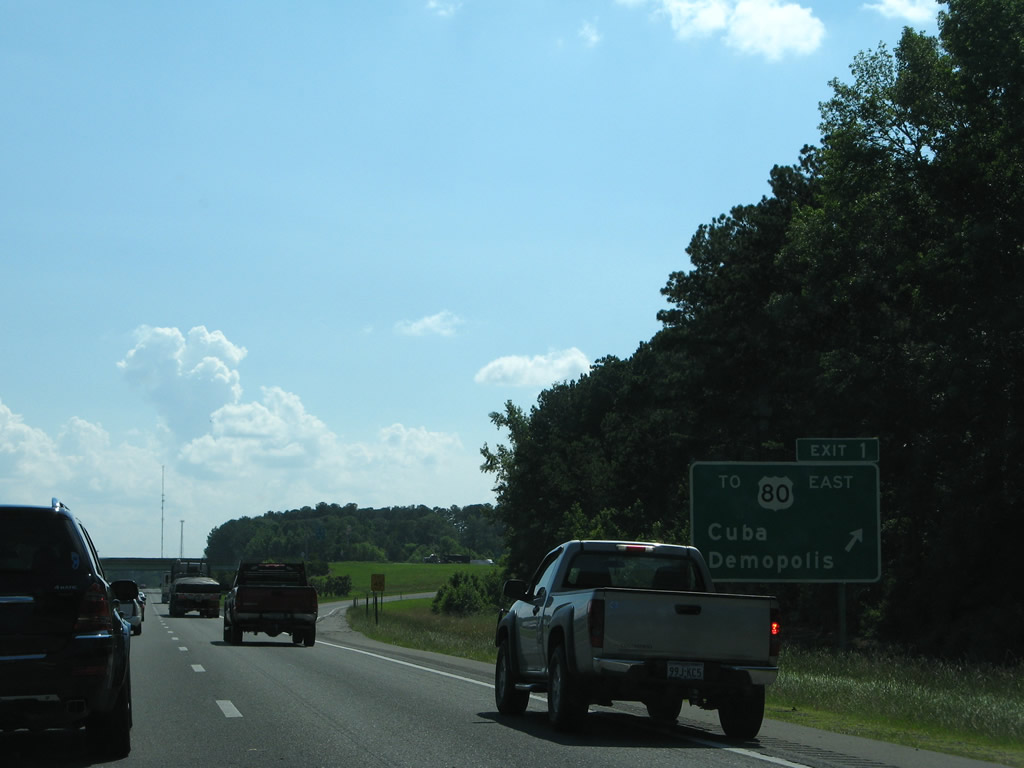
| SR 8, the hidden counterpart for all of U.S. 80 between Cuba and Phenix City, emerges as an unsigned route to connect I-20/59 with U.S. 11/80. 06/12/08 |
|
| One half mile north of the diamond interchange (Exit 1) with SR 8. SR 8 heads 1.91 miles east to join U.S. 80 at the north split with U.S. 11. U.S. 11/80 combine west though Cuba to Meridian, Mississippi. 06/12/08 |
|
| Exit 1 departs southbound I-59/20 for SR 8 east to U.S. 80 at Cuba. U.S. 80 doubles as High Priority Corridor 6 east from Cuba to Demopolis, Montgomery and ultimately Savannah, Georgia. The corridor east to Columbus, Georgia is proposed as part of Interstate 14. 06/12/08 |
|
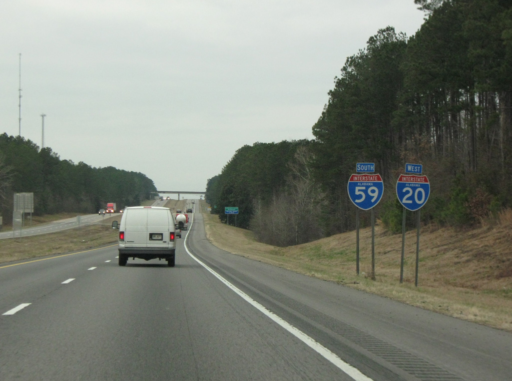
| The final set of shields for I-20/59 south posted in Alabama. 02/06/10 |
|
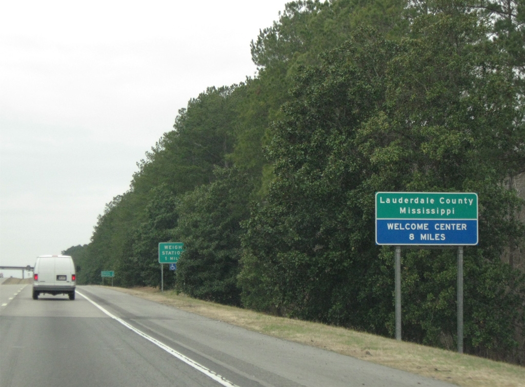
| I-59/20 south enters Mississippi and Lauderdale County. The county is home to Meridian and Meridian Naval Air Station. 02/06/10 |
Page Updated 10-24-2012.


 West
West  South
South