|
| Westbound IH 20 at the diamond interchange (Exit 410) with Bankhead Drive in Weatherford. Bankhead Drive is the old route of US 80. It continues east to Fort Worth as the Bankhead Highway. Originally running from Washington DC to San Diego, the Bankhead is one of America's old auto trails. Today few segments remain, but one of the longest connects this area with Fort Worth. 04/18/08 |
|
| A half diamond interchange (Exit 409) connects IH 20 west with FM 2552 (Santa Fe Drive) north and Clear Lake Drive) in one mile. 04/18/08 |
|
| Exit 409 marks the southern end of FM 2552, which winds 2.68 miles northwest into Downtown Weatherford. Many Parker County offices are located along the FM road, which is mostly four lanes. 04/18/08 |
|
| The succeeding westbound exit with SH 171 to FM 51 and FM 1884 is the last to serve Downtown Weatherford. SH 171 (Cleburne Highway) ventures across hills south and east to Cleburne in Johnson County. FM 51 is an important state highway that goes both north and south to cities like Granbury and Gainesville at IH 35. 04/18/08 |
|
| The freeway becomes noticeably less cramped after the SH 171 exit, and widens out to reveal farms and hills on the southern horizon. 04/18/08 |
|
| Old Dennis Road and Bowie Drive run southwest from Weatherford to connect some of the city's suburban areas and farms with IH 20. This marks the end of the DFW area; from here on west it is strictly rural. 04/18/08 |
|
| IH 20 westbound reassurance marker in southwest Weatherford. Texas covers their interstate medians with wildflower seeds each year, and this spring scene revealed the beginnings of some Indian paintbrush blooms. 06/14/08 |
|
| Ric Williamson Memorial Highway (RWMH) forms a belt route encircling the city of Weatherford north from IH 20 at Exit 405. A ground breaking ceremony for the RWMH Bridge and new interchange with IH 20 east of Sanchez Creek took place on May 14, 2013.1 06/14/08 |
|
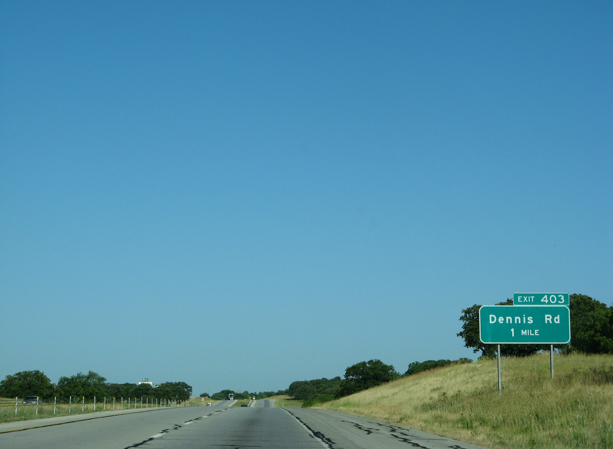
| West of Weatherford, IH 20 converges with Spur 312, the old route of U.S. 80, at a wye-interchange. Exit 403 joins the freeway westbound with Spur 312 via Dennis Road. 06/14/08 |
|
| IH 20 crosses Patrick Creek beyond this confirming marker after the merge with old U.S. 80 at Exit 402. 06/14/08 |
|
| The land-to-sky ratio climbs ever higher, as the road enters the Brazos Valley. 06/14/08 |
|
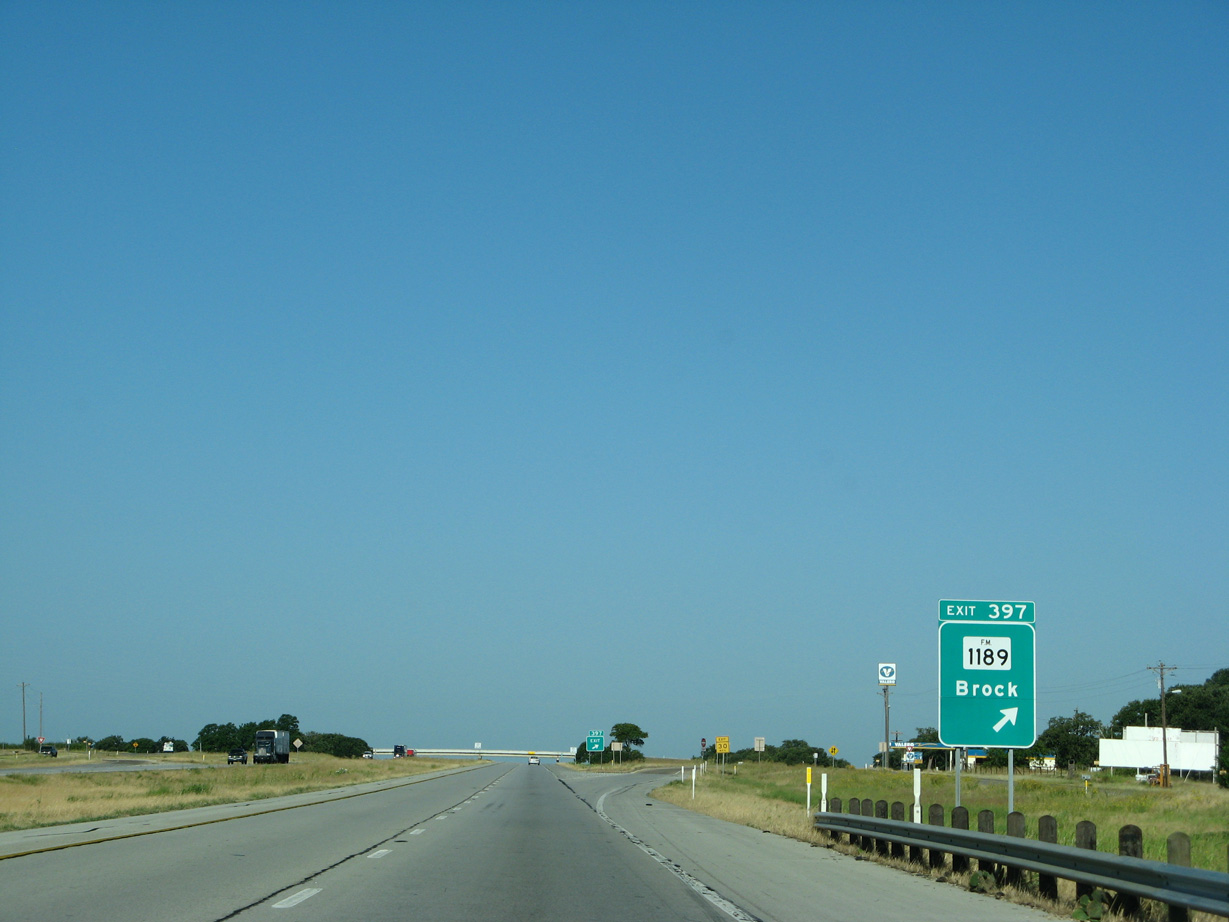
| The next westbound exit is for FM 1189 south and Fairview Road, which connects IH 10 with the town of Millsap to the north. 06/14/08 |
|
| FM 1189 travels 20.21 miles south from IH 10 to FM 4 at Lipan through the city of Brock and town of Dennis on the east bank of the Brazos. 06/14/08 |
|
| FM 113, a 17.71 mile long highway north to FM 1185 by Lake Mineral Wells State Park, begins at forthcoming Exit 394. 06/14/08 |
|
| FM 113 runs north to FM 3028 in Millsap from Exit 394. Millsap started in the 1870s as a stagecoach stop on the jaunt from Weatherford to Palo Pinto. 06/14/08 |
|
| As IH 20 continues to drop into the Brazos valley, views of the road ahead are more sweeping. TxDot repaved the interstate with new concrete on this stretch in 2008. 04/18/08 |
|
| As it leaves Parker County, IH 20 crosses over the Brazos River. This is one of Texas' most important rivers, along with Colorado, as it drains much of the central part of the state. The Brazos is often mentioned in old prison songs, because it tends to run past most of the prisons in Texas. 04/18/08 |
|
| The last exit in Parker County is Gilbert Pit Road, a short local route named for an old quarry. 04/18/08 |
|
| IH 20's next entry is into Palo Pinto County. The county was established in 1856 and was known for Indian brutality to settlers until the Texas Rangers rounded them all up and put them on reservations in the 1870s. Today Palo Pinto County is a good place to relax, with a lot of lazy river tubing and hiking opportunities. 04/18/08 |
|
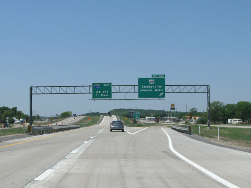
| U.S. 281 crosses paths with IH 20 three miles west into Palo Pinto County. US 281 is a true cross country route, running from the International Peace Garden at the Canadian Border to the Mexican border at Brownsville. 04/18/08 |
|
| This looks westbound at an IH 20 reassurance marker in Palo Pinto County. 04/18/08 |
|
| IH 20 westbound at US 281. El Paso debuts as a control point, even though IH 20 never gets that far (Midland would be a more appropriate choice). US 281 runs north into Mineral Wells, the largest city in the area. The town used to be known for its mineral baths and is home to a multi-story abandoned hotel built in the 1920s called the Baker. 04/18/08 |
|
| Eastland and El Paso are featured here on the distance sign west of US 281, although it is likely that the majority of travelers along the interstate will be going to neither of those places! 04/18/08 |
|
| FM 4 marks the subsequent exit for Palo Pinto, which is the county seat. While only a blip in the road, it is the county seat by virtue of an old Texas law that states that the county seat must be placed within a certain number of miles from the geographical center of the county. Never mind that the population center of the county might be some 20 miles away. 04/18/08 |
|
| IH 20 westbound at FM 4. This exit also connects the towns of Lipan and Santo to the interstate. Santo used to be called Cresco, but a train dispatcher's confusing Cresco with Cosco caused a terrible rail accident and the town was renamed. 04/18/08 |
|
| Interstate 20 spends some 10 miles running through the southern end of the Palo Pinto Hills. The hills are the eroded eastern end of the great plains. The area is popular with DFW residents for its many recreational opportunities, but historically has been known as the last holdout of the area's Native American tribes. 04/18/08 |
|
| Gordon is the last city encountered along IH 20 west in Palo Pinto County. The rural town used to be known as the site of a large train robbery executed by the famous outlaw Rube Burrow. Today it is a sleepy community in the hills. 04/18/08 |
|
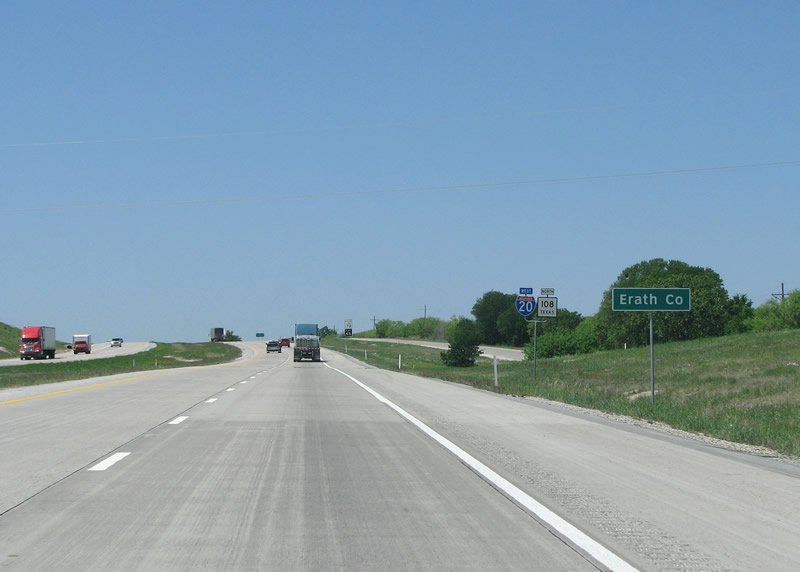
| IH 20 and SH 108 share an overlap west from Exit 370 as the freeway enters Erath County. The county was named for George B. Erath, a surveyor. It is very important to pronounce the county's name correctly - it is "E'-rath" with a long and emphasized E, instead of "erruth". 04/18/08 |
|
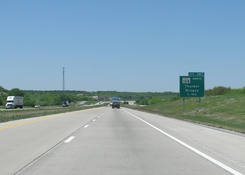
| SH 108 parts ways with the freeway in one mile and continues north to Thurber and Mingus. Thurber is perhaps Texas' most famous ghost town. Its population once stood at 10,000 but the 2000 census put the number of citizens there at 8. The coal mining town was bypassed by the railroad and the coal eventually ran out. The history of Thurber is fascinating and many old buildings still remain and are visible from IH 20. 04/18/08 |
|
| SH 108 arcs northwest 7.68 miles from the diamond interchange (Exit 367) with IH 20 to end at SH 16 in Strawn. 04/18/08 |
|
| West of Thurber, IH 20 travelers see the first views of the great plains beyond. The plains, which are not eroded, sit a few hundred feet higher than this vantage point. 04/18/08 |
|
| An IH 20 reassurance marker just west of Tudor Road. 04/18/08 |
|
| The succeeding exit is for SH 16, one of the state's most important state highways, and the longest. The 541 mile long road runs throughout the central portion of the state, but only serves one major city - San Antonio. 04/18/08 |
|
| H 20 westbound enters the diamond interchange (Exit 361) with SH 16. There are no services at this exit, but Strawn is only three miles to the north. The rural city, which is in Palo Pinto County, has been home to coal mines, natural gas wells, and three oil fields. 04/18/08 |
|
| Ranger is the next major city along the route. This distance sign is much more useful to most drivers here than the others that frequently reference El Paso. 06/14/08 |
|
| IH 20 enters a broad valley fed by Bear Creek as it crosses into Eastland County. 06/14/08, 04/18/08 |
Page Updated 07-19-2019.


 West
West