The lone business loop posted in Kentucky travels 11.4 miles between Exits 4 and 11 on Interstate 24 to Downtown Paducah in McCracken County. The west end of Business Loop I-24 lies near Kentucky Oaks Mall along U.S. 60 (Hinkleville Road). U.S. 60 and Business Loop I-24 overlap eastward onto Park Avenue to Noble Park, where U.S. 60 splits for Joe Clifton Drive. U.S. 60 Business begins and follows Park Avenue along the business route through the Paducah residential street grid. A one-way couplet separates eastbound along Martin Luther King, Jr. Drive and westbound along Park Avenue to the couplet of 3rd and 4th Streets through the central business district. U.S. 45 Business joins the one-way pairs between 8th Street and Kentucky Avenue.
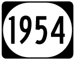
Leaving Downtown, Business Loop I-24 and U.S. 60 Business combine as solely 3rd Street from Ohio Street eastward through an industrial area alongside the Tennessee River. Crossing Island Creek, the pair transition to Wayne Sullivan Drive, which angles the pair southward to U.S. 60/62 (Clarks River Road) and John L. Puryear Drive. U.S. 60 Business ends as Business Loop I-24 joins Kentucky 1954 along John Puryear Drive south back to Interstate 24.
The Downtown Paducah couplet system of Business Loop I-24/U.S. 60 Business along 3rd and 4th Streets was constructed in the mid 1970s.1 The establishment of the Paducah business loop was supported by then-Governor Julian Carroll (1974-79), who added funding for the Downtown Loop during his time in office.2
Before the completion of John Puryear Drive in 1999, which relocated KY 1954 east from Husband Road, Business Loop I-24 continued east along U.S. 60/62 to their partition at Riverview. U.S. 62 and Business Loop I-24 proceeded south from there to U.S. 68, which returned the business route to Interstate 24 at Exit 16. Historically U.S. 68 followed U.S. 60/62 northwest to Tyler and along Business U.S. 60/62 to U.S. 45 Business (Kentucky Avenue) in Downtown Paducah.
|
| Business Loop I-24 begins at a diamond interchange (Exit 11) between Interstate 24 and KY 1954 (Husband Road). KY 1954 follows Husband Road 3.7 miles south to KY 348 near Hardmoney. 04/05/13 |
|
| Business Loop I-24/KY 1954 follow a five lane arterial north from Interstate 24 to U.S. 60/62 (Clarks River Road) at Woodlawn. 04/05/13 |
|
| KY 1954 was relocated from Husband Road north to KY 284 (Bridge Street) onto John L. Puryear Drive when it was completed in 1999. The former two lane alignment was renumbered as KY 2187. 04/05/13 |
|
| Passing over a ditch where an abandoned railroad once traveled along Business Loop I-24 west / KY 1954 north ahead of Eich Road. Speed limits are set at 55 miles per hour along this stretch of John Puryear Drive. 04/05/13 |
|
| KY 450 (Oaks Road) was realigned by construction of the John Puryear Drive overpass above the Paducah and Louisville Railroad line at Woodlawn. KY 450 currently runs 8.6 miles north from KY 348, west of Symosonia, to Oaks, Oakdale and KY 284 (Benton Road) at Woodlawn. 04/05/13 |
|
| Speed limits lower to 35 miles per hour as Business Loop I-24 elevates to cross over KY 284, the aforementioned railroad line and an old stretch of Clarks River Road. 04/05/13 |
|
| Descending from the overpass, Business Loop I-24/KY 1954 (John Puryear Drive) intersect U.S. 60/62 opposite Wayne Sullivan Drive (U.S. 60 Business). KY 1954 ends as U.S. 60 Business begins and follows Business Loop I-24 northwest to Downtown Paducah. U.S. 60/62 combine along Clarks River Road east to their split in 1.8 miles and along commercialized Irvin Cobb Drive west to Tyler and Littleville. 04/05/13 |
|
| Curving westward, Business Loop I-24/U.S. 60 Business enter an industrial area east of Tyler and south of the Tennessee River. A set of signals hang above the intersection with Bethel Street in this scene. 04/05/13 |
|
| A set of reassurance markers posted along each direction of Wayne Sullivan Drive reside between Bethel and Tully Streets at the south side of Paducah. 04/05/13 |
|
| Locust Drive leads north from KY 284 (Bridge Street) to become 4th Street north of a traffic light with Business Loop I-24/U.S. 60 Business (Wayne Sullivan Drive). 04/05/13 |
|
| Wayne Sullivan Drive transitions into 3rd Street beyond Island Creek and this set of reassurance shields posted between Broad and Elizabeth Streets. 04/05/13 |
|
| Business Loop I-24/U.S. 60 Business partition into a one way couplet at Ohio Street. 3rd Street carries westbound traffic, one block from eastbound traffic along 4th Street. 04/05/13 |
|
| 3rd Street west at Kentucky Avenue in Downtown Paducah. Kentucky Avenue ends two blocks to the east by the mouth of the Tennessee River. Southwest from Business Loop I-24, the avenue carries U.S. 45 Business (and former alignments of U.S. 60 Business and U.S. 62 Business) to South 28th Street (U.S. 45/60). U.S. 68 ended at 6th Street and Kentucky Avenue until its eastward truncation to I-24 at Exit 16. 04/05/13 |
|
| Business Loop I-24/U.S. 45-60 Business (3rd Street) west at Broadway. 04/05/13 |
|
| Business Loop I-24/U.S. 45-60 Business branch westward from 3rd Street onto North Loop Road to make the transition into Park Avenue west. 04/05/13 |
|
| Executive Boulevard west and 4th Street south come together at this traffic light next to the eastbound transition of Business Loop I-24 from Martin Luther King, Jr. Drive onto North 4th Street. 04/05/13 |
|
| Now along Park Avenue, drivers approach the split with U.S. 45 Business, which follows 8th Street west back to U.S. 45. 04/05/13 |
|
| U.S. 45 Business concludes a 4.4 mile route westward along 8th Street through an industrial area to U.S. 45 (H.C. Mathis Drive). U.S. 45 proceeds north from there onto the Irvin S. Cobb Bridge (Brookport Bridge) to Brookport, Illinois. 04/05/13 |
|
| Five blocks further west, Business Loop I-24/U.S. 60 Business (Park Avenue) approach KY 305 (13th Street). 04/05/13 |
|
| KY 305 ventures west from Business Loop I-24 (Park Avenue / Martin Luther King, Jr. Drive) along 13th Street to Cairo Road, Cecil and Exit 3 of Interstate 24. The state route concludes 12.5 miles to the west at Camelia and U.S. 62. 04/05/13 |
|
| U.S. 60 Business reassurance marker posted by Burnett Street, just two blocks west of KY 305. 04/05/13 |
|
| Business Loop I-24 nears a curve to travel alongside Oak Grove Cemetery from 16th Street to the merge of Park Avenue and Martin Luther King, Jr. Drive. 04/05/13 |
|
| The U.S. 45 mainline follows H.C. Mathis Drive south from the Bridgeport Bridge to intersect Business Loop I-24/U.S. 60 Business (Park Avenue) at Bob Noble Park. 04/05/13 |
|
| U.S. 45 proceeds southward to combine with U.S. 60 (Joe Clifton Drive) by Carson Park to Jackson Street (U.S. 62) west. The 1,297 mile route between Mobile, Alabama and Ontonagon, Michigan joins Paducah with Mayfield to the south and Metropolis, Illinois to the northwest. 04/05/13 |
|
| Park Avenue lines the south side of Bob Noble Park as the route becomes more commercialized west from U.S. 45 (H.C. Mathis Drive). This set of shields refers to the route as U.S. 60 west, despite U.S. 60 having yet to overtake Park Avenue from its Business Loop. 04/05/13 |
|
| U.S. 60 Business ends as U.S. 60 combines with Business Loop I-24 from Joe Clifton Drive north opposite the main entrance to Bob Noble Park. 04/05/13 |
|
| Bob Noble Park is a 135-acre park dating back to 1921. A concrete wall and ornamental entrance welcomes visitors to the park at the intersection of U.S. 60 (Joe Clifton Drive) and Park Avenue (Business Loop I-24). The gateway was constructed in 1926.3 04/05/13 |
|
| U.S. 60 overlaps with Business Loop I-24 for the remaining 2.5 mile drive back to Interstate 24. 04/05/13 |
|
| KY 731 (32nd Street) begins and heads south from Business Loop I-24/U.S. 60 (Park Avenue) toward the Avondale Heights area of west Paducah. 04/05/13 |
|
| A 1.6 mile unsigned state route, KY 731 follows 32nd Street south to a dogleg along Broadway Street to Lone Oak Road south. Lone Oak Road leads directly to the south split of U.S. 45 and U.S. 62 (Allen Barkley Drive). 04/05/13 |
|
| Allen Lane north and Country Park Road south come together at Business Loop I-24/U.S. 60 (Park Avenue) ahead of the Paducah and Louisville Railroad underpass. 04/05/13 |
|
| Park Avenue becomes Hinkleville Road as Business Loop I-24/U.S. 60 continue west from the railroad bridge. Pictured here is the north end of Friedman Road which is surrounded by a number of traveler services serving I-24 traffic. 04/05/13 |
|
| Business Loop I-24/U.S. 60 Business (Hinkleville Road) cross Perkins Creek ahead of the signalized intersection with Coleman Road and the diamond interchange with Interstate 24. 04/05/13 |
|
| Business Loop I-24 ends as motorists depart U.S. 60 (Hinkleville Road) west for Interstate 24 west to Metropolis, Vienna and Goreville, Illinois. 04/05/13 |
Sources:
- Paducah-McCracken County Transportation Study - March 2002.
http://paducahky.gov/paducah/files/u3/TranspStudy2002.pdf
- "West Kentucky losing influence in Frankfort." The Paducah Sun (KY), January 12, 2009.
- Noble Park history,
http://paducahky.gov/paducah/noble-park-history Paducah government web site.
04/05/13 by AARoads
Connect with:
Interstate 24
Page Updated 10-28-2013.

 West
West  North
North


 West
West


