Interstate 26 north and Ephraim Knob north of the scenic overlook located west of California. 05/31/07
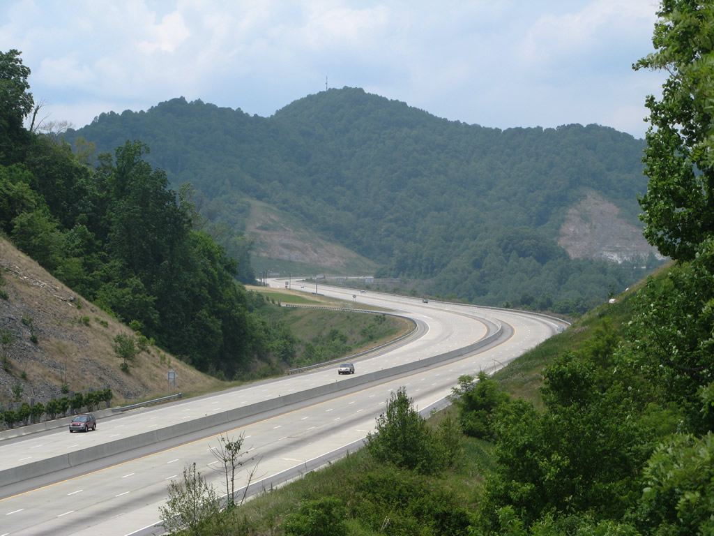
Generally traveling from south to north, Interstate 26 in North Carolina connects Hendersonville, Asheville and the Tri-Cities region in Tennessee. Prior to 2003, I-26 began at the western exchange joining I-40/240 outside Asheville. It was extended northward to I-81 along portions of U.S. 23 and Interstate 181, and a new terrain alignment across Sams Gap. The freeway carries tourist traffic bound for the mountains year round and freight traffic circumventing I-40 across the Great Smoky Mountains.
Interstate 26 North Carolina Guides
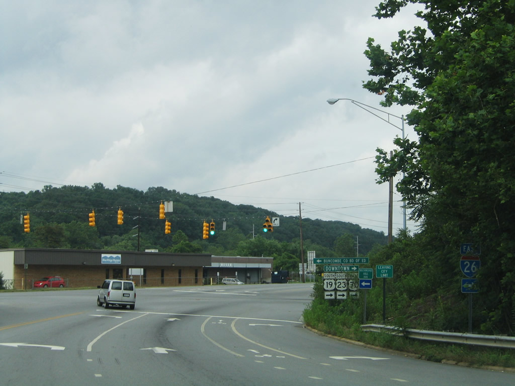
I-26 leading north from I-240 in Asheville along U.S. 19/23 is designated a Future Route due to substandard design of the freeway. A new alignment, Section B of the $950 million Asheville I-26 Connector project, will be constructed bypassing this section and the exchange with I-240. Construction for the new alignment for I-26 starts in 2021. Work upgrading I-26/240 follows beginning in 2022.
Major construction started on October 15, 2019 widens 16.9 miles of Interstate 26 from U.S. 64 at Hendersonville to NC 191 (Brevard Road) in Asheville. Section I-4400 covers 9.1 miles of the freeway from U.S. 64 at Exit 49 to NC 280 at Exit 40. Section I-4700 is the 7.8 miles extending north from Exit 40 to the exchange with I-40/240. Costing $531 million overall, construction runs through 2024.
Interstate 26 will be expanded to six overall lanes along the concurrent section with U.S. 25 from Exit 54 to Exit 44, and eight lanes from the north split with U.S. 25 to I-40/240. The cloverleaf interchange with U.S. 64 will be modified into a six-ramp parclo interchange with two signalized intersections added. The exchange at the north split with U.S. 25 at Asheville Highway will be rebuilt as a DDI. The diamond interchange with NC 280 was previously rebuilt as a DDI during construction from May 2014 to November 2016.
$19 million construction at Columbus reconfigured the exchanges joining Interstate 26 with U.S. 74 east and NC 108 (Mill Street). Previously a shared ramp system linked the two interchanges, requiring motorists from westbound I-26 to intersect Mill Street before merging onto the freeway along U.S. 74 east. U.S. 74 west to I-26 utilized turns along NC 108 to make the connection. Work started in October 2017 constructed two new bridges on direct ramps joining I-26 west with U.S. 74 east and U.S. 74 west with I-26 east. All ramps were open to traffic the week of June 3, 2019.1
When Interstate 26 was extended in 2003, exits were renumbered from I-40/240 southeast to the South Carolina line. New exit numbered were noted by Carter Buchanan on January 27, 2004:
- Exit 33 (old 2) - NC 191
- Exit 39 (old 6) - NC 146 Skyland
- Exit 40 (old 9) - NC 280 Brevard / Arden / Asheville Regional Airport (AVL)
- Exit 44 (old 13) - U.S. 25 Fletcher / Mountain Home
- Exit 49A/B (old 18A/B) - U.S. 64 Hendersonville / Bat Cave
- Exit 53 (old 22) - Upward Road / Hendersonville
- Exit 54 (old 23) - NC 225 to U.S. 25 / U.S. 176 Greenville
- Exit 59 (old 28) - Saluda
- Exit 67 (old 36) - U.S. 74 / NC 108 Columbus / Rutherfordton / Shelby
- Milepost 71 - NC/SC state line
|
| NC 191 (Brevard Road) north meets Interstate 26 for the first time by Asheville Outlets shopping center at the community of Venable. 12/31/13 |
|
| Spanning I-26, drivers turn onto I-26/U.S. 74 west from NC 191 (Brevard Road) north. NC 191 meets I-40 east directly, with I-26 providing the connection to westbound. 12/31/13 |
|
| NC 251 begins at the Broadway Street interchange with Interstate 26 and U.S. 19-23-70 in north Asheville. 07/16/05 |
|
| NC 251 joins Riverside Drive north at the eastbound entrance ramp for Interstate 26. The state highway follows the French Broad River toward Woodfin. 07/16/05 |
|
| Riverside Drive northbound at NC 251 (Broadway Street) and the parclo interchange with I-26/U.S. 19-23-70. Riverside Drive used to carry NC 251 southward toward I-240. 07/16/05 |
|
| Looking southwest from the scenic overlook along Interstate 26 westbound near milepost seven. Bailey Ridge, Sevenmile Ridge, and the Spring Creek Mountains are among some of the peaks rising along the horizon. 05/31/07 |
|
| I-26/U.S. 23 continue northward by Hooker Knob. This view looks from the path at the westbound side scenic overlook. 05/31/07 |
|
| Southward view from the scenic overlook path, showing the entire westbound side facility and an eastbound runaway truck ramp. This site is around 2,600 feet above sea level. 05/31/07 |
|
| Big Laurel Road travels west parallel to the Big Laurel Creek from Old U.S. 23 near I-26/U.S. 23 at Exit 3. A high-level bridge takes I-26 above both the local road and waterway. 05/31/07 |
Sources:
- "All Ramps Open on New Interstate Interchange." North Carolina Department of Transportation (NCDOT), press release. June 6, 2019.
- 07/16/05 by AARoads.
- 05/31/07 by AARoads and Carter Buchanan.
- 12/31/13 by AARoads and Carter Buchanan.
Connect with:
Interstate 40
Interstate 240
U.S. 19
U.S. 23
U.S. 25
U.S. 64
U.S. 70
U.S. 74
Page Updated 01-27-2023.

 scenes