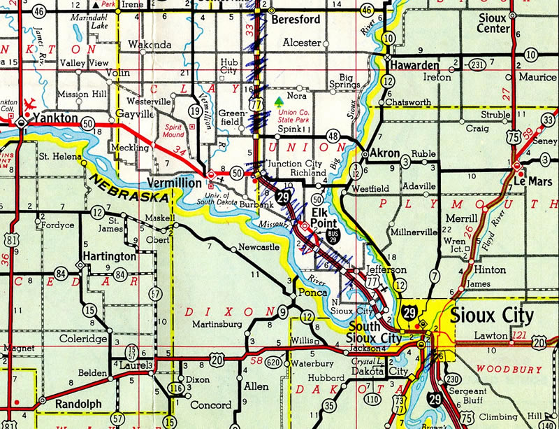
The Elk Point Business Loop for Interstate 29 appears on this 1965 Gousha map of South Dakota. U.S. 77 was already replaced by I-29 northward to U.S. 18 east in Lincoln County. The route however remained through North Sioux City and Lincoln, which later became a part of SD 105.
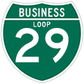
Elk Point is a small city with over 1,800 residents in Union County. The community lies 16 miles north of Sioux City, Iowa and is the main population and service center along I-29 between North Sioux City and Beresford. Business Loop I-29 travels along 477th Avenue and Main Street along a 2.679 mile route between Exits 15 and 18.
|
| Union County Road 6 (477th Avenue) ties into the Elk Point business loop south end at Exit 15. 04/20/07 |
|
| Business Loop I-29 shield posted along 477th Avenue north between I-29 and the Country Club Estates subdivision. 04/20/07 |
|
| Main Street north reaches the southbound on-ramp for Interstate 29 leading back to Sioux City, Iowa. 06/17/15 |
|
| CR 10 takes over for the ending Business Loop I-29 along Burbank Road north to Clay County. 06/17/15 |
|
| Business Loop I-29 overtakes Main Street from CR 10 at a parclo interchange (Exit 18) on the west side of Elk Point. 06/17/15 |
|
| Beresford is the northbound control point in place of Sioux Falls from Elk Point. The overpasses carrying I-29 above Main Street were built in 1993 for southbound and 1994 for northbound. 06/17/15 |
|
| Beresford, a city of around 2,000, is the lone population center along I-29 north between Elk Point and Sioux Falls. 06/17/15 |
|
| The first confirming marker for Business Loop I-29 stands along Main Street southbound at Corydon Drive. 06/17/15 |
|
| A second shield for Business Loop I-29 appears as Main Street enters the Elk Point street grid at Scott Street. 06/17/15 |
|
| Main Street expands to include on-street parking as Business Loop I-29 reaches the Elk Point business district at Jackson Street. 06/17/15 |
|
| Business Loop I-29 (Main Street) south at Franklin Street. Franklin Street leads three blocks north to Rose Street and the northbound beginning of SD 11. SD 11 follows old U.S. 77 north 5.1 miles to SD 50 near Richland. 06/17/15 |
|
| Main Street transitions into residential areas of Elk Point southeast of Grant Street and the Union County Court House. 06/17/15 |
|
| A final reassurance marker for Business Loop I-29 stands at the Main Street intersection with Green Street. Old U.S. 77 remains north of here along Rose Street and CR 1B. 06/17/15 |
|
| County Road 9 links Business Loop I-29 with old U.S. 77 (CR 1B) across the adjacent BNSF Railroad line. CR 1B continues southeast to Jefferson while CR 9 loops through agricultural areas. Main Street becomes 477th Avenue at this intersection as well. 06/17/15 |
|
| Business Loop I-29 (477th Avenue) turns southward and returns to Interstate 29. 06/17/15 |
|
| Interstate 29 bypasses the west side of Elk Point on the 31.5 mile drive to Beresford. 06/17/15 |
|
| CR 6 extends south from I-29 along 477th Avenue through agricultural areas for four miles to 330th Street. 06/17/15 |
Page Updated 07-20-2016.

 North
North


