|
| Interstate 43 leads north one mile from the Manitowoc County line to the diamond interchange (Exit 171) with Wis 96 west and County KB (De Pere Road) at the village of Denmark. 08/12/09 |
|
| Wis 96 begins and leads west 15 miles to Greenleaf. CTH-KB extends the route east through Denmark to southern Kewaunee County and CTH-AB (old Wis 163). County KB is the former eastern alignment of Wis 96. 08/12/09 |
|
| Leaving the village limits of Denmark, drivers along I-43 pass by this confirming shield at the North Avenue overpass. 08/12/09 |
|
| Langes Corner Road crosses over I-43 west of old U.S. 141 (CTH-R) and the settlement of Langes Corner. 08/12/09 |
|
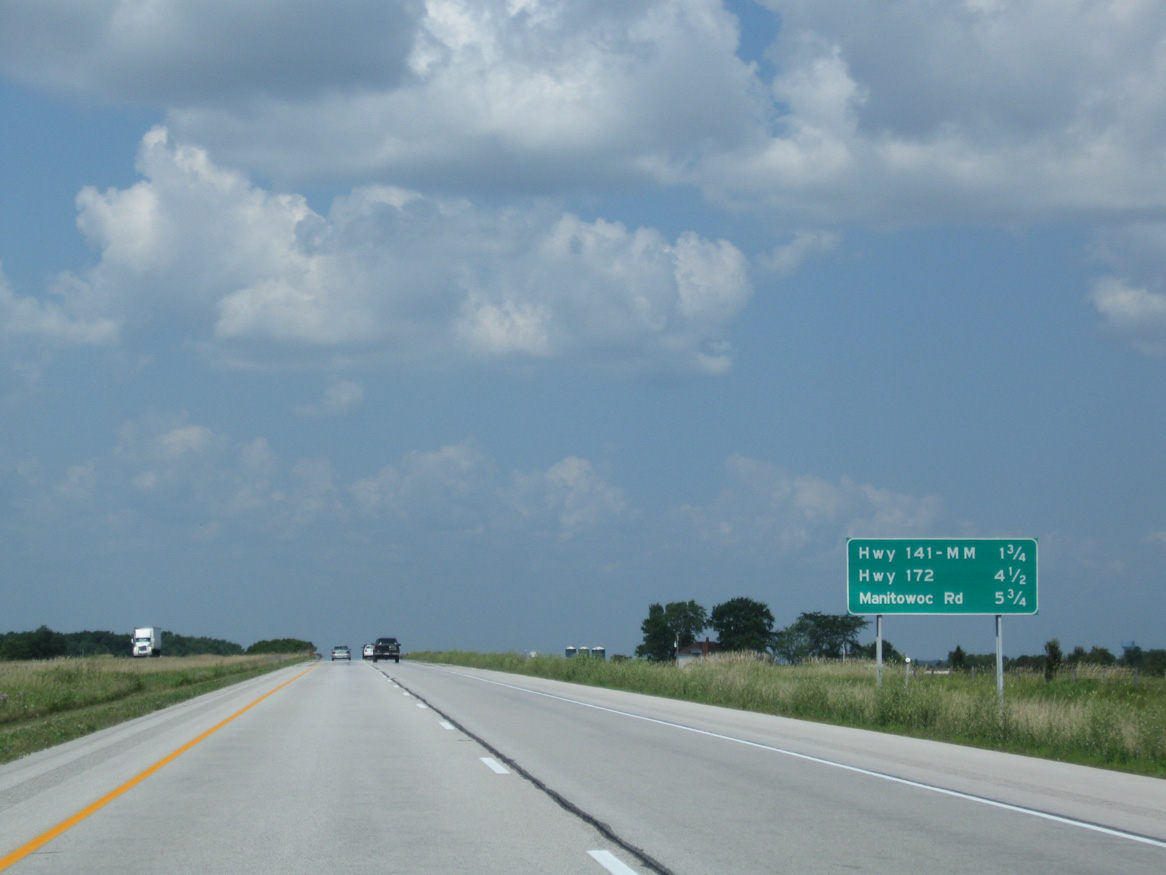
| The first of eight exits serving the city of Green Bay lies 1.75 miles ahead with U.S. 141 north and Brown County MM (Dutchman Road) west. 08/12/09 |
|
| U.S. 141 begins in one mile at the diamond interchange (Exit 178) with County MM (Dutchman Road). The two-state route combines with Wis 29 nearby through the village of Bellevue. Wis 29 ties into the highway from Kewaunee off Lake Michigan. 08/12/09 |
|
| Exit 178 departs Interstate 43 north for County MM west to Kolbs Corner in Ledgeview. U.S. 141 runs northwest through Bellevue to Downtown Green Bay, meeting I-43 again at the northern terminus. The remainder of the highway in Wisconsin totals 116.7 miles to Niagara outside Iron Mountain, Michigan. 08/12/09 |
|
| Interstate 43 angles northwest to enter the village limits of Bellevue. 05/30/11 |
|
| The final rural stretch of Interstate 43 concludes at the three wye interchange with Wis 172 in 1.5 miles. Exit 181 with Manitowoc Road (CTH-JJ) follows for east Bellevue. 05/30/11 |
|
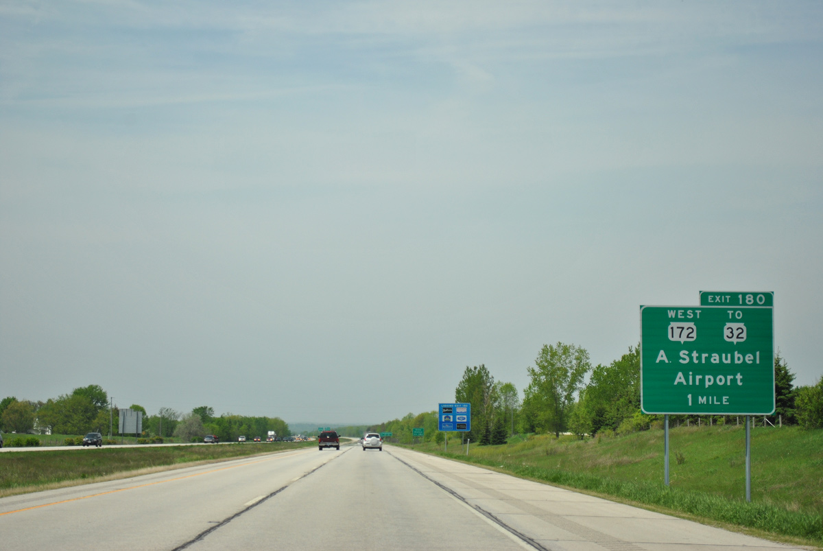
| Wis 172 leads west from Exit 180 to Interstate 41 as a freeway. The route transitions into an expressway there en route to Austin Straubel International Airport (GRB). 05/30/11 |
|
| Button copy sign for Ashwaubenon predating the extension of I-43 south along the Rock Freeway. Wis 172 spans the Fox River into the village at Wis 32 (Ashland Avenue). 05/30/11 |
|
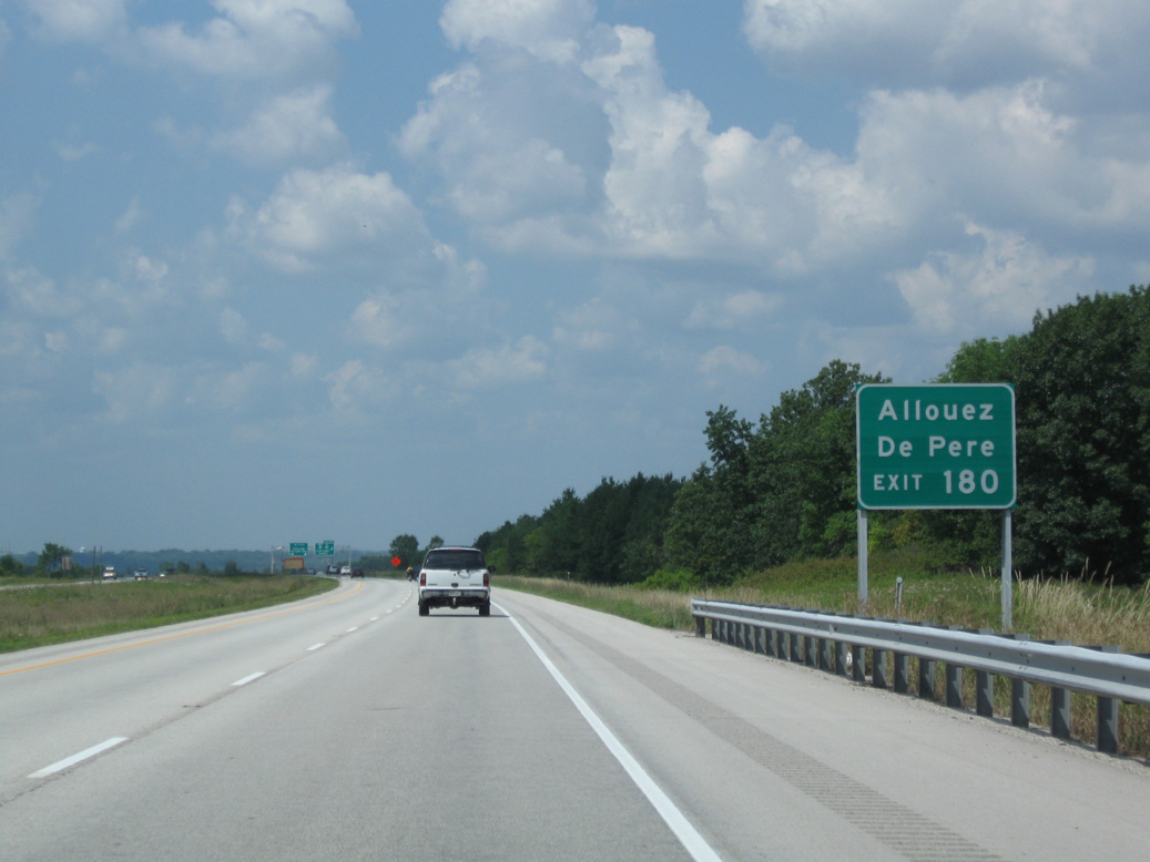
| STH-172 constitutes a commuter route for Green Bay. The freeway passes through the village of Allouez west of Bellevue and serves interests to De Pere via Wis 32 (Ashland Avenue) south. 08/12/09 |
|
| Interstate 43 encircles Green Bay northward to Wis 57 for Sturgeon Bay and the U.S. 41 freeway leading north from Howard toward Marinette. Wis 172 west extends beyond GRB Airport as a two lane route to Oneida within the village of Hobart. 01/21/16 |
|
| Curving back to the northeast, I-43 bisects suburban areas through the ensuing two exits for Manitowoc Road (CTH-JJ) and Mason Street (CTH-V). 08/12/09 |
|
| Brown County JJ travels a series of roads 11.1 miles west from County P to Bellevue Street in Bellevue. 08/12/09 |
|
| U.S. 141/Wis 29 (Main Street) pass over Interstate 43 beyond the on-ramp from Wis 172 east. County JJ connects I-43 (Exit 181) with U.S. 141 via Verlin Road. 08/12/09 |
|
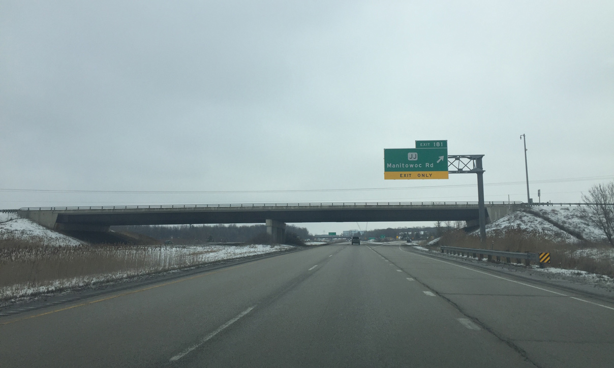
| A folded diamond interchange joins Interstate 43 with County JJ (Manitowoc Road) by an assortment of big box stores, fast food franchises and other retail. A lane from Wis 172 was extended past this sign bridge to reduce congestion in the merge area. 03/05/16 |
|
| Exit 181 loops away from I-43 north to Brown County JJ. Manitowoc Road serves a number of Bellevue subdivisions southeast back to Wis 29 and northwest through the Wilder Park neighborhood of Green Bay. 03/05/16 |
|
| All remaining exits along Interstate 43 fall within the city of Green Bay. 08/12/09 |
|
| Northbound confirming marker for I-43 posted ahead of the Greenbrier Road overpass and Green Bay city limits. 08/12/09 |
|
| Mason Street, an east-west arterial, crosses paths with Interstate 43 at a diamond interchange (Exit 183) in one half mile. County V follows Mason Street east by the I-43 Business Center to Finger Road and rural areas within the town of Humboldt. 08/12/09 |
|
| Mason Street takes CTH-V west to East Town Mall and U.S. 141/Wis 29 (Main Street) at the Lake Largo community. Beyond there, Mason Street crosses the Fox River as both a freeway and Wis 54/57. 08/12/09 |
|
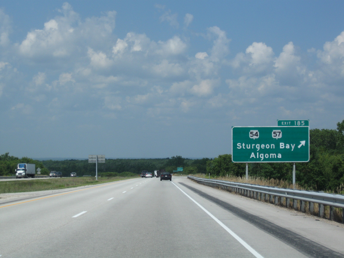
| Interchange sequence sign posted 1.75 miles ahead of the directional cloverleaf interchange (Exit 185) with Wis 54/57 on I-43 north. 08/12/09 |
|
| Interstate 43 curves northwest beyond Baird Creek and the McAuliffe Park community toward Exit 185 by Schmitt Park. 08/12/09 |
|
| Wis 54 comprises a cross-state route from Winona, Minnesota to Algoma off Lake Michigan. Wis 54 overlaps with Wis 57 for 8.2 miles from Downtown Green Bay east to the University of Wisconsin-Green Bay and County I. 08/12/09 |
|
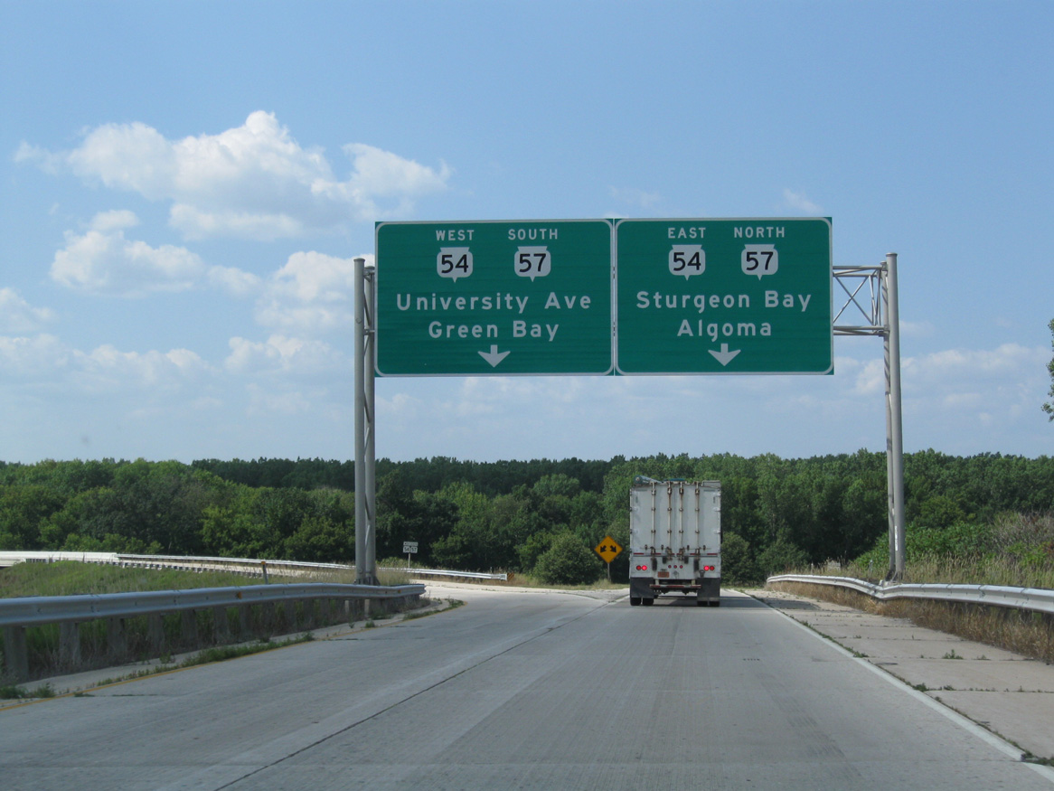
| Exit 185 carries all traffic in unison from Interstate 43 north to STH-54/57. Wis 57 previously overlapped with I-43 through Ozaukee County. The state trunk highway runs 192 miles from Milwaukee to Sister Bay. 08/12/09 |
|
| STH-57 runs northeast along an expressway to Dyckesville, Brussells and STH-42 on the Door County peninsula. University Avenue carries the trunk highway west to Three Corners in Green Bay. 08/12/09 |
|
| The final 5.25 miles of I-43 take the freeway west along the periphery of Green Bay to I-41/U.S. 41-141. 08/12/09 |
|
| East Shore Drive stems west from County A (Nicolet Drive) along Bay Beach Wildlife Sanctuary to meet Interstate 43 at a parclo interchange (Exit 187). Webster Avenue extends southwest from Exit 187 into the Green Bay street grid. 08/12/09 |
|
| The last mainline exit lies opposite of the forthcoming Leo Frigo Bridge in two miles. 08/12/09 |
|
| Industrial areas lie both east and west of the Fox River between Exits 187 and 189. 08/12/09 |
|
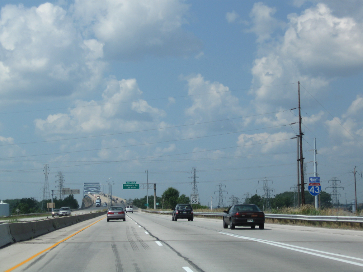
| Atkinson Drive spurs north from U.S. 141 (Velp Avenue) to a parclo interchange (Exit 189) with Interstate 43 in 1.75 miles. 08/30/16 |
|
| The overhead sign for Atkinson Drive was replaced by a ground level sign in 2016 to include "To Velp Avenue" since access between I-43 and Velp Avenue was eliminated with the new I-41/I-43 interchange. 08/12/09 |
|
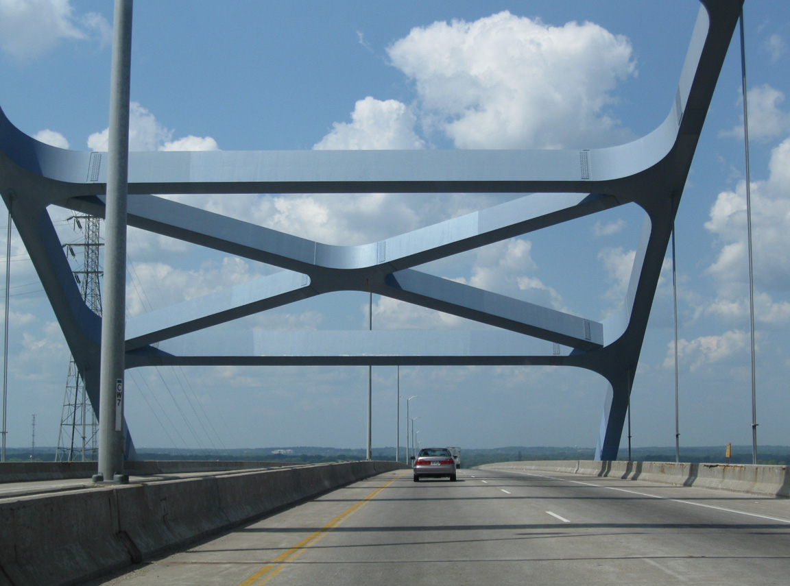
| The Leo Frigo Bridge opened in 1981 in conjunction with Interstate 43 through Green Bay. The 1.51 mile long tied arch bridge travels 203 feet above the Fox River.1 08/12/09 |
|
| Underground steel supports for five of the Leo Frigo Bridge piers were corroded by industrial byproducts found within the soil below the east approach. This resulted in one pier failing and a 400 foot section of the bridge deck sagging by approximately 2 feet. The event on September 25, 2013 led to an emergency closure of the span.2 08/12/09 |
|
| Cresting over the Fox River along Interstate 43 north. The Leo Frigo Bridge reopened to traffic on January 5, 2014. 08/12/09 |
|
| Atkinson Drive links I-43 with Hurlbut Street, a north side frontage road leading west to Ken Euers Nature Area and Military Avenue. Velp Avenue (U.S. 141) parallels the freeway to the south through the Mather Heights and Perkins Park Area of north Green Bay. 08/12/09 |
|
| Northbound I-43 reaches the loop ramp (Exit 189) for Atkinson Drive and the Port of Green Bay. 08/30/16 |
|
| The last northbound shield for Interstate 43. 08/12/09 |
|
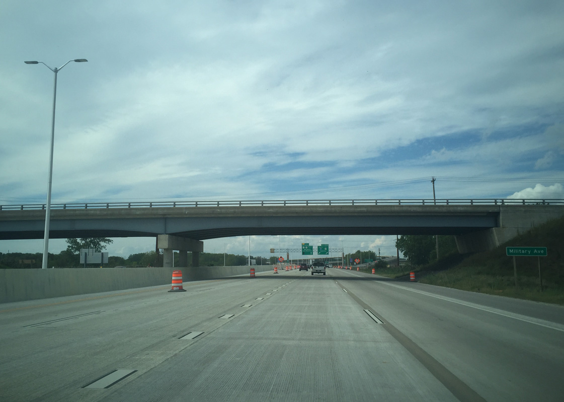
| Military Avenue is the final overpass before the I-41 interchange. The existing span is one of the few bridges that was not rebuilt as part of the 2016-completed I-41 project. 08/30/16 |
|
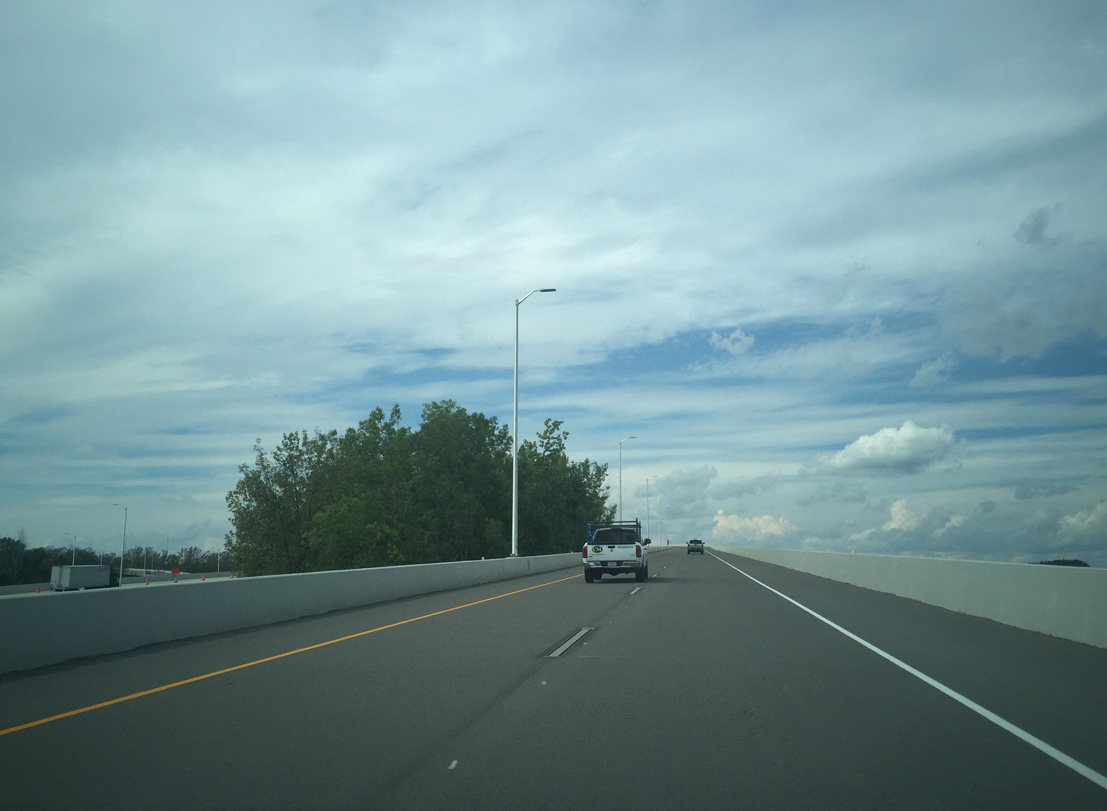
| A high speed flyover takes drivers from the left side of Interstate 43 north to I-41 south back into Green Bay. 08/30/16 |
|
| Traffic merges onto Interstate 41 south from the high flyover as the freeway crosses over U.S. 141 (Velp Avenue). 08/30/16 |
Page Updated 09-09-2016.

 North
North