
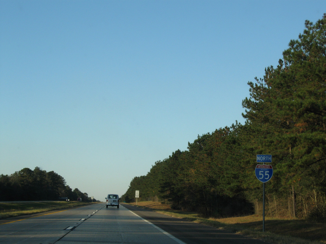
 North
North
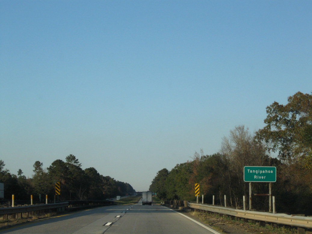
Interstate 55 enters the Magnolia state north from Tangipahoa Parish, Louisiana.
11/20/08

The first of nine exits from I-55 in Pike County, the diamond interchange at Exit 1 links with MS 584.
11/20/08

MS 584 leads 1.82 miles east from Exit 1 to U.S. 51 (Second Street) in the town of Osyka.
11/20/08

MS 584 runs 25.34 miles northwest from Osyka to MS 24/48 in the Amite County seat of Liberty.
11/20/08

11/20/08

11/20/08

11/20/08

11/20/08

11/20/08

The diamond interchange at Exit 4 joins Interstate 55 with Chatawa Road 0.69 miles west from parallel U.S. 51.
11/20/08

Chatawa Road heads 1.62 miles west from Exit 4 to Cutrer Drive near Terrys Creek. The CN Railroad siding of Chatawa lies east of U.S. 51 along St. Mary Drive.
11/20/08

11/20/08

11/20/08

MS 568 meets Interstate 55 at the first of two exits north for the Pike County seat of Magnolia.
11/20/08

MS 568 constitutes a 16.77 mile long highway from adjacent U.S. 51 to LA 43 southwest of the unincorporated community of Gillsburg.
11/20/08

11/20/08
11/20/08
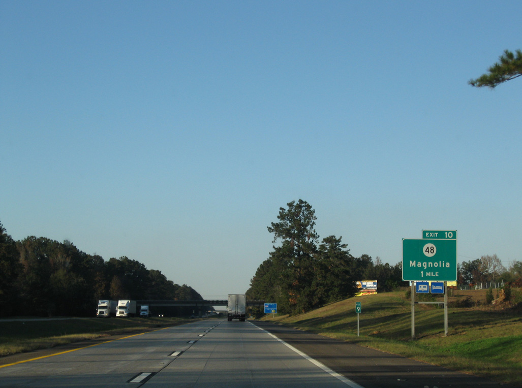
MS 48 (W Bay Street) runs 1.04 miles west from U.S. 51 (Clark Avenue) in Downtown Magnolia to the parclo interchange at Exit 10.
11/20/08

East from Magnolia, MS 48 travels 20.9 miles to the Walthall County seat of Tylertown. The state highway turns 5.2 miles north from Exit 10 to combine with MS 24 west of McComb.
11/20/08

11/20/08

Airport Fernwood Road meets Interstate 55 at Exit 13 west of Mc Comb/ Pike County Airport (MCB).
11/20/08
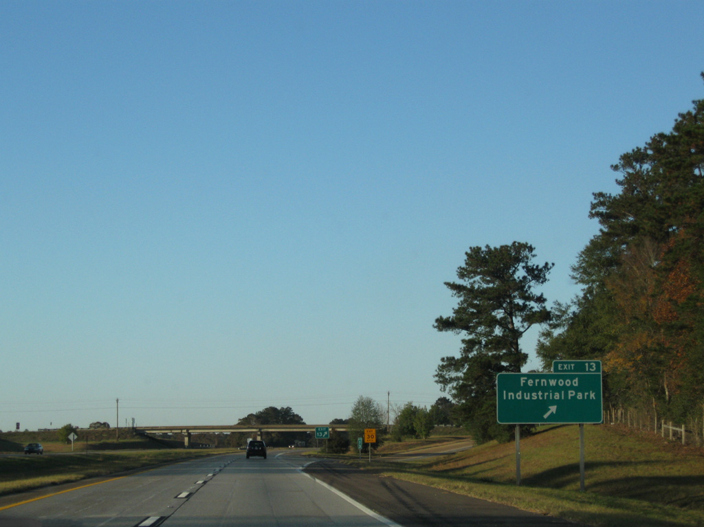
Airport Fernwood Road stems 2.67 miles east from parallel MS 48 near Percy Quin State Park to U.S. 51 at the community of Fernwood.
11/20/08
11/20/08
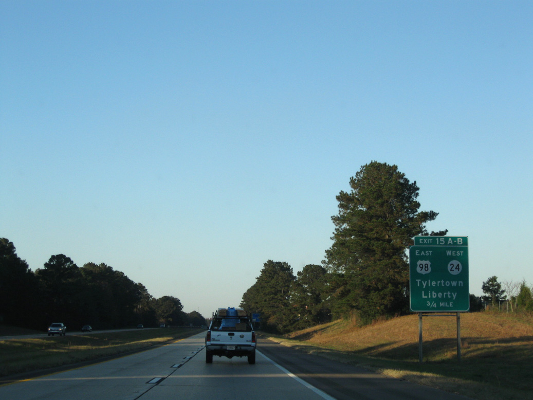
Interstate 55 advances north into the city of McComb at forthcoming Exit 15 with U.S. 98/MS 24 (Presley Boulevard).
11/20/08

U.S. 98/MS 24 (Presley Boulevard) runs along a commercial strip across south McComb 1.97 miles east to U.S. 51 (Broadway Street).
11/20/08

U.S. 98 is a four lane highway joining McComb east with Tylertown, Columbia and Interstate 59 at Hattiesburg.
11/20/08
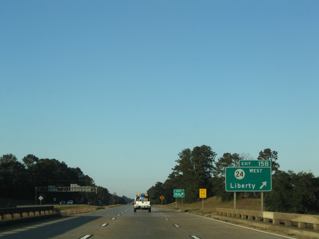
The loop ramps at the cloverleaf interchange with U.S. 98/MS 24 were removed after 2011. MS 24 overlaps with MS 48 west 18.6 miles to Liberty.
11/20/08
North  West
West
U.S. 98 combines with I-55 north from the entrance ramp at Exit 15, 4.43 miles to Exit 20 B. Historically U.S. 98 overlapped with U.S. 51 north through McComb to Lawrence Street (MS 198) west in Summit.
11/20/08

Delaware Avenue connects I-55/U.S. 98 with U.S. 51 in Downtown McComb, 1.59 miles to the east of Exit 17.
11/20/08

Delaware Avenue angles 1.41 miles northwest from the diamond interchange at Exit 17 to MS 570.
11/20/08

MS 570 (Veterans Boulevard) converges with I-55/U.S. 98 at Exit 18 adjacent to the Uptown McComb retail complex in north McComb.
11/20/08

Measuring 17.29 miles in length, MS 570 heads northwest from U.S. 51 (Northwest Street) in McComb to Mars Hill, Smithdale and U.S. 98 near Mount Olive.
11/20/08

11/20/08
The town of Summit lies just north of McComb along U.S. 51 (Laurel Street) to the east of the cloverleaf interchange at Exit 20.
11/20/08

11/20/08

Exit 20 A departs next for Lawrence Street, unsigned MS 198 east 0.60 miles to U.S. 51 (Laurel Street) at Hershal L. Grady Memorial Highway (MS 908).
11/20/08

11/20/08

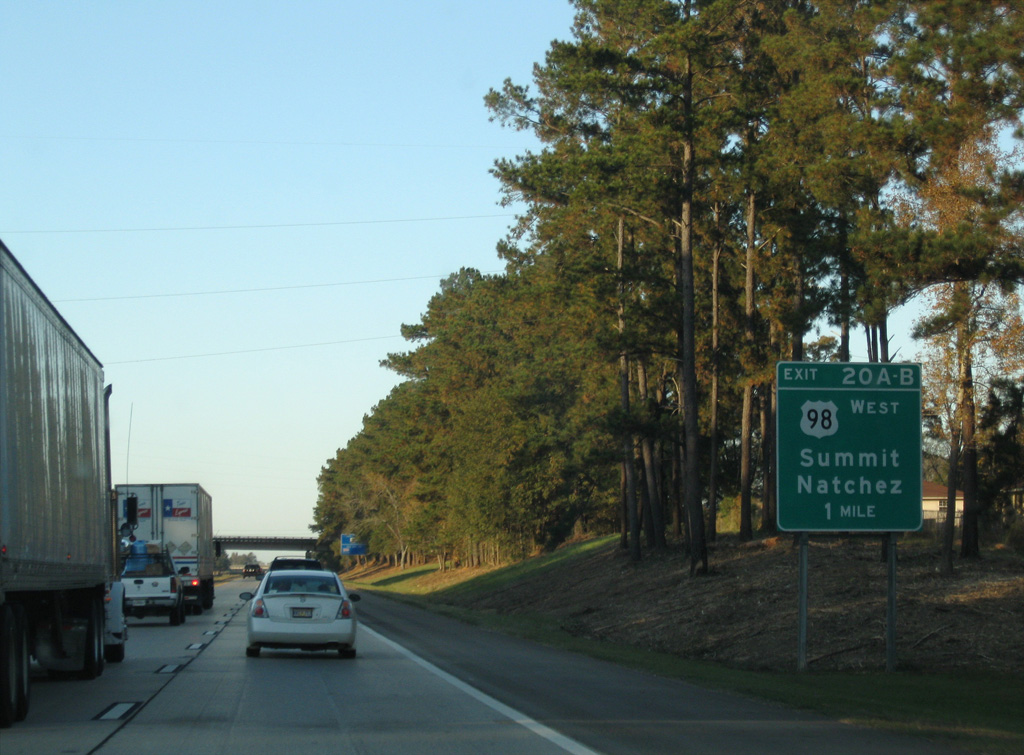
U.S. 98 travels 29.8 miles northwest from Interstate 55 to U.S. 84 at Bude. U.S. 84 continues 28.6 miles west from there to U.S. 65 outside Natchez.
11/20/08
North
11/20/08
11/20/08
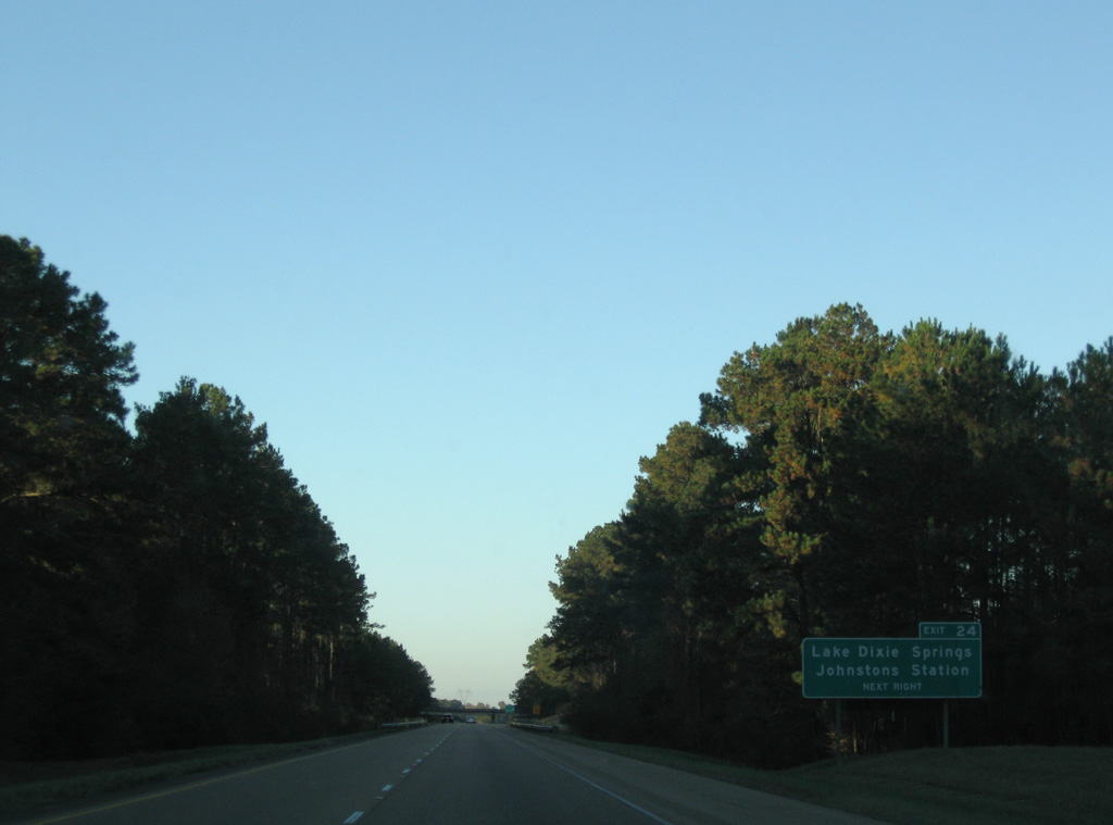
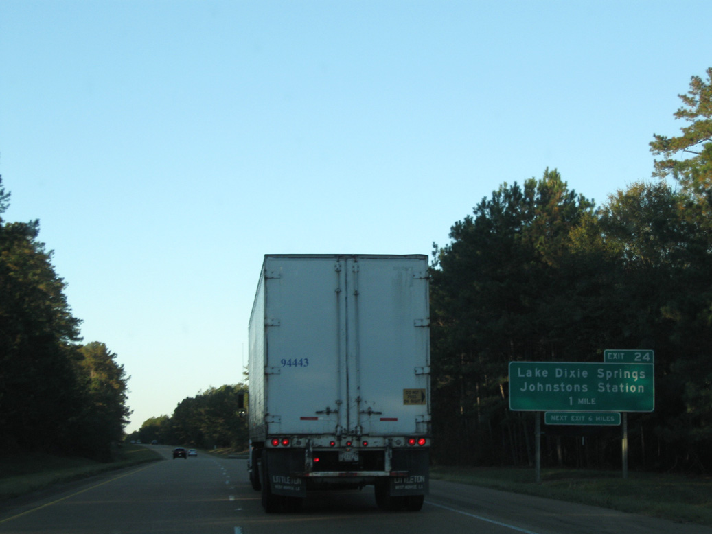
County Line Road links Interstate 55 at Exit 24 with U.S. 51 north of Dixie Springs Lake.
11/20/08

The diamond interchange at Exit 24 straddles the Pike / Lincoln County line.
11/20/08

Interstate 55 crossing Dickerson Creek northbound.
11/20/08

An abandoned rest area was located north of the Montgomery Road overpass.
10/23/03

A forested median separates the roadways along Interstate 55 north to Alibritton Creek and Mount Pleasant Creek.
10/23/03

The succeeding exit along Interstate 55 north is for the unincorporated community of Bogue Chitto.
11/20/08
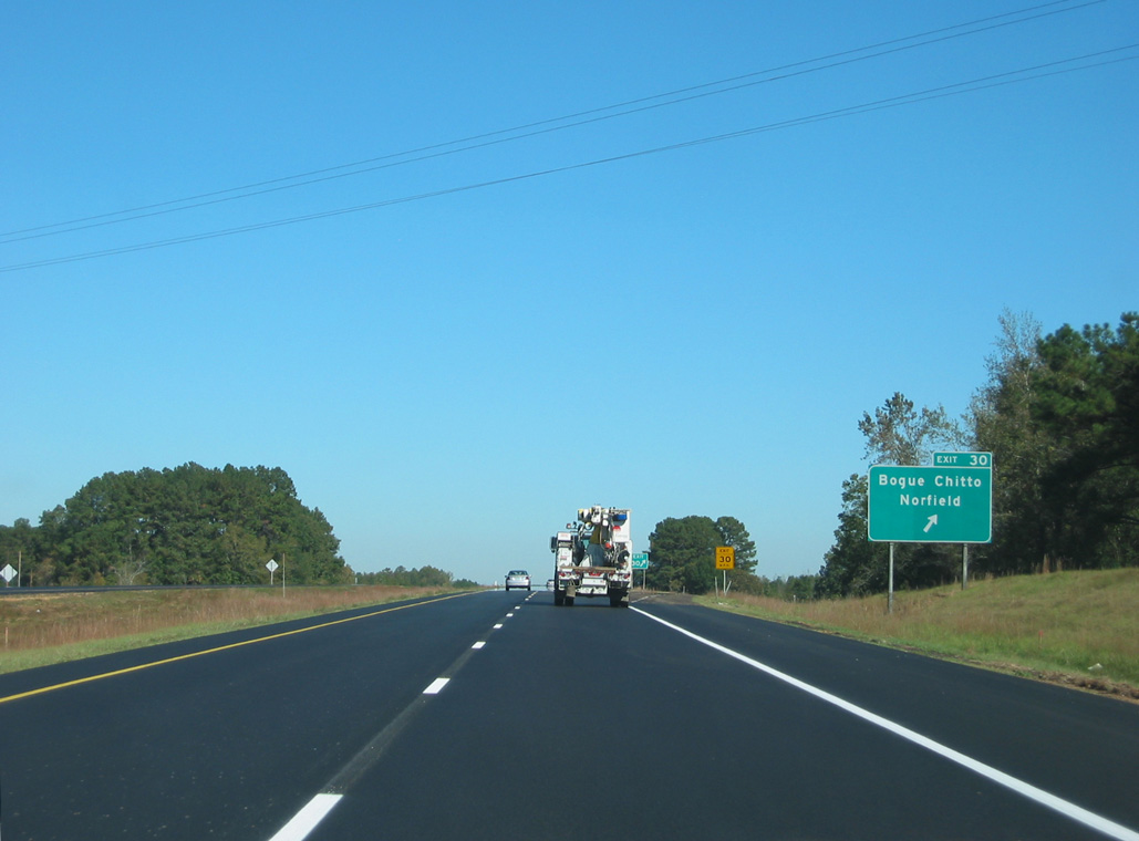
Bogue Chitto Road angles 1.68 miles northeast from the diamond interchange at Exit 30 to U.S. 51 in Bogue Chitto.
10/23/03

11/20/08

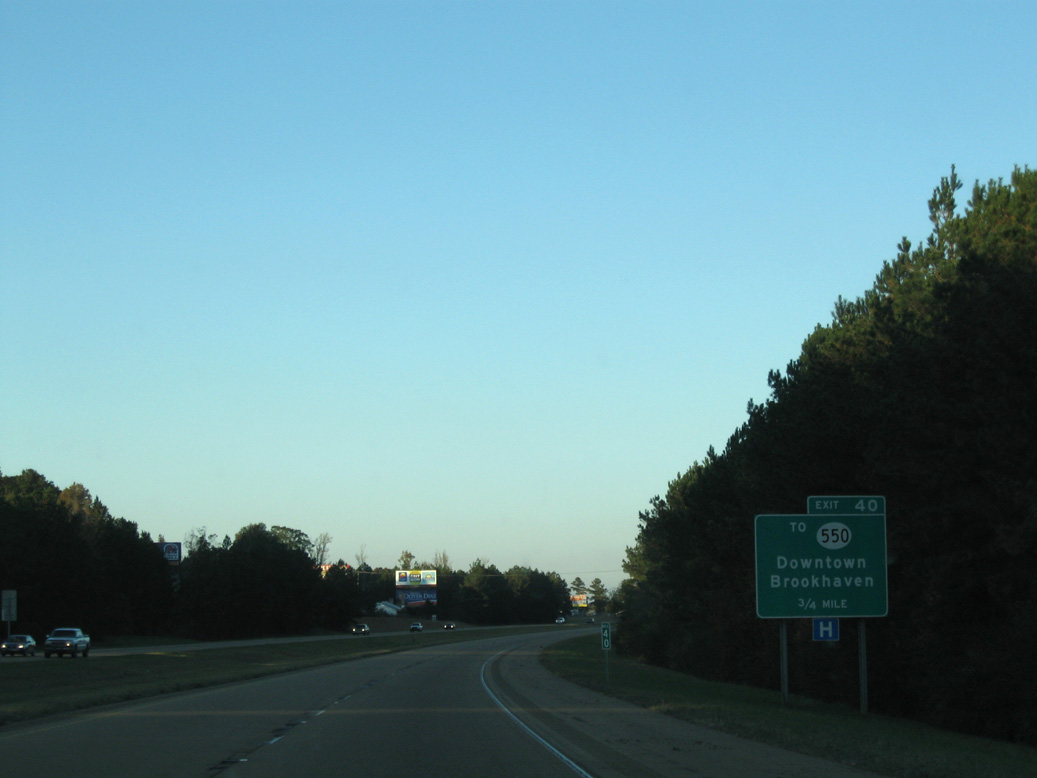
U.S. 84 converges with Interstate 55 at Exit 38 to the southwest of the city of Brookhaven.
11/20/08

The Franklin County seat of Meadville is 25 miles to the west off U.S. 84. Monticello, seat of Lawrence County, is 22 miles to the east from Interstate 55.
11/20/08

U.S. 84 constitutes a four lane corridor across southern Mississippi west to Natchez and east to Laurel and Waynesboro.
11/20/08

11/20/08
11/20/08

11/20/08

11/20/08

11/20/08

11/20/08

11/20/08

11/20/08

Photo Credits:
10/23/03, 11/20/08 by AARoads
Page Updated 04-30-2023.